Jual MobileMapper Spectra MM10, MM20 Call Budi 082119953499

HUBUNGI KAMI : PT.MINDS INDO SURVEY, DISTRIBUTOR ALAT UKUR SURVEY DAN PEMETAAN, KOMP/RUKO. MEGA KALIMALANG KAV. 8 JLN KH NOER ALI NO. 11,PEKAYON JAYA BEKASI, TLP : 02195099644/ HP : 082119953499 / 087886144398 PIN BB : 237FC845, Klik Web : www.mindsindosurvey.com PENGIRIMAN GRATIS UNTUK WILAYAH DKI Menjual Alat-Alat Untuk Survey Pemetaan, Infrastruktur, Kontraktor, Telekomunikasi, Pertambangan, Geologist, Exploration, Mining, Dirling, Kelautan, Militer, Migas, Pembangunan Pembangunan, Pengelolahan Lahan Lahan Perhutanan Dan Perkebunan Kelapa Sawit. RUANG LINGKUP KEGIATAN PENJUALAN, SERVICE / PERBAIKAN DAN PENYEWAAN ALAT-ALAT UKUR PENJUALAN : • Alat Ukur - Total Station - Altimeter - Theodolite - Digital Planimeter - Levels - Walking Measure - GPS Geodetic - Digital Level / Smart Tool - Compass - Phantograph - Clinometer - Tandem / Clino - Compass • Accessories : - Tripod - Prisma - Rambu Ukur - Meteran - Jalon - Binocular PENYEWAAN : - Total Station - Automatic Level - Theodolite MEREK ALAT UKUR YANG TERSEDIA : - MINDS - SPECTRA - NIKON - SUUNTO - GARMIN - LEICA - HORIZON SERVICE / PERBAIKAN DAN KALIBRASI MACAM-MACAM ALAT UKUR HARGA MENARIK / COMPETITIVE Catatan : Price List akan dikirim sesuai permintaan

Recommended
Recommended
More Related Content
More from Budi anto
More from Budi anto (20)
Recently uploaded
Recently uploaded (20)
Jual MobileMapper Spectra MM10, MM20 Call Budi 082119953499
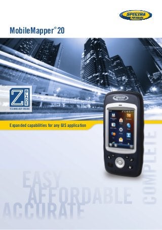
- 1. Expanded capabilities for any GIS application MobileMapper ® 20
- 2. MobileMapper20 MobileMapper 20 Geographical Information Systems and Location Based Services are now being used in a wide range of applications and organizations. The growing need for geo-localization is naturally boosting the demand for efficient and affordable data collection solutions. Spectra Precision is leading the democratization of GNSS, enabling wider access to professional mapping. With MobileMapper 20, Spectra Precision makes it possible to deploy a professional accurate GIS receiver to any field work force. Powerful and complete, MobileMapper 20 is the ideal enabling tool for a huge range of positioning applications. With MobileMapper 20, organizations will improve the quality of their georeferenced information and their field productivity, yielding reduced operational costs. Secure Your Field Work ■■ A wide range of capabilities in a compact, lightweight design ■■ Several days of battery life ■■ Rugged and reliable Unpack and Start Logging ■■ Ready-to-use complete mapping solution for field and office ■■ User friendly Windows® Embedded Handheld 6.5 ■■ Easy-to-use software for short learning curve and quick logging operations Ideal for Data Maintenance or Inspection ■■ Log your assets in real-time with 1 to 2 meter accuracy ■■ Connect field and office work force for maximum productivity ■■ Achieve half meter accuracy with post-processing
- 3. MobileMapper Field and Office Software A complete solution The Spectra Precision MobileMapper software suite includes all the GIS features that professionals really need, without the burden of complicated and rarely used functions. Running on MobileMapper receivers, MobileMapper Field is the perfect solution for GIS data collection, asset management, area measurement, map creation and update. The software is very intuitive and easy-to-use, requiring minimum training. It also provides a direct interface to external sensors for a complete field solution. The Spectra Precision MobileMapper Office tool can be used to differentially post-process raw GPS data collected with the MobileMapper Field software. Through an Internet connection, MobileMapper Office can automatically find and download the base data files that will match the collected raw data; it then computes corrected positions automatically. Tune MobileMapper 20 To Your Applications With Windows Embedded Handheld 6.5 you may upload necessary utilities or software on your MobileMapper 20, to suit your next job. You can collect GIS/GPS points and maps via the GIS application of your choice, either third-party software such as ESRI® ArcPad® or a purpose-built Spectra Precision application.
- 4. GNSS Characteristics ■■ Internal antenna: 20 channels - GPS L1 C/A - SBAS: WAAS/EGNOS/MSAS/GAGAN ■■ External antenna connector ■■ NMEA output Accuracy Specifications (Horizontal RMS)1 ■■ Real-time SBAS: < 2 m typical ■■ Post-processed: < 50 cm typical Processor ■■ ARM9™ ■■ Clock frequency: 600 MHz Operating System ■■ Microsoft® Windows Embedded Handheld 6.5 ■■ Languages available: English, French, German, Italian, Japanese, Korean, Portuguese, Spanish, Simplified Chinese ■■ Software package includes: - Internet Explorer® - Office Mobile - ActiveSync® - Transcriber (handwriting recognition) Communications Cellular ■■ Built in GSM/GPRS/HSPA (3.5G) Modem Versions ■■ P/N 802168-00: 3.5 G: 900/2100 MHz; 2G: 850/900 /1800 MHz ■■ P/N 802168-10: 3.5G: 850/900 MHz; 2G: 850/900/1800/1900 MHz Bluetooth ■■ Bluetooth 2.1 with EDR WiFi ■■ Integrated Interface ■■ USB Physical Characteristics Size ■■ 169x88x25 mm Weight ■■ 380g with battery (310g without) User Interface Keyboard ■■ 4-way navigation, menu, contextual keys ■■ Illuminated keyboard with touch screen ■■ Virtual keyboard Display ■■ VGA Color TFT High resolution display sunlight readable with touch screen, LED backlight. ■■ Size: 3.5” ■■ Colours: 262k Memory ■■ 256 MB SDRAM ■■ Storage: 512 MB NAND Flash (non volatile) ■■ MicroSDHC™ memory card (up to 32GB, SanDisk® , Kingston® recommended) Environmental Characteristics ■■ Operating temperature: -10° to +60°C (14 to 140°F) ■■ Storage temperature: -30° to +70°C without battery (-13 to 158°F) ■■ Humidity: 95% non condensing ■■ Waterproof: IP54 ■■ Free drop: 1.2 m on concrete Power Characteristics ■■ Battery life: > 20 hrs @ 20 ºC with GPS on2 ■■ Charging time: 4 hours ■■ Removable battery Multimedia & Sensors ■■ Camera 5M Pixels ■■ E-Compass ■■ G-Sensor ■■ Speaker ■■ Microphone Software Options ■■ Spectra Precision MobileMapper Field and Office software ■■ Post-processing ■■ ESRI ArcPad software bundle (USA only) Standard Accessories ■■ Stylus ■■ Hand-strap ■■ A/C charger ■■ USB cable Optional Accessories: ■■ External magnetic GPS antenna ■■ Pole bracket 1 Handheld accuracy performance achieved in good conditions (open sky) with PDOP <3 and more than seven satellites in view. 2 GPS on, no Bluetooth or WiFi are used, backlight used 20% of the time at minimal settings. * Including available options. MobileMapper 20 Technical Specifications* SCAN THIS CODE FOR MORE INFORMATION ©2014 Trimble Navigation Limited. All rights reserved. Spectra Precision is a Division of Trimble Navigation Limited. Spectra Precision and the Spectra Precision logo are trademarks of Trimble Navigation Limited or its subsidiaries. All other trademarks are the property of their respective owners. Contact Information: AMERICAS Spectra Precision Division 10368 Westmoor Drive Westminster, CO 80021, USA +1-720-587-4700 Phone 888-477-7516 (Toll Free in USA) EUROPE, MIDDLE EAST AND AFRICA Spectra Precision Division Rue Thomas Edison ZAC de la Fleuriaye 44474 Carquefou (Nantes), France +33 (0)2 28 09 38 00 Phone ASIA-PACIFIC Spectra Precision Division 80 Marine Parade Road #22-06, Parkway Parade Singapore 449269 +65-6348-2212 Phone www.spectraprecision.com