1. NRCS Geospatial Strategy
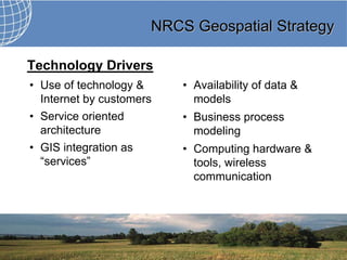
Technology Drivers
• Use of technology & • Availability of data &
Internet by customers models
• Service oriented • Business process
architecture modeling
• GIS integration as • Computing hardware &
“services” tools, wireless
communication
2. NRCS Geospatial Strategy
Business Drivers Geospatial Challenges
• Resource limitations • Infrastructure
• Progress Reporting • Planning & Investment
• Conservation Planning • Human Capital
• Federal Enterprise
Architecture
• Data Management
3. NRCS Geospatial Strategy
NRCS Geospatial Data Assets
More than 300 terabytes of data worth in excess of
$5.9 billion.
Replacement
Data Category Only Source Replicated
Value $
NRI Data YES 500 million
Elevation data No 400 million
Soils YES Yes 5 billion
Other vector data No Yes 1 million
Other imagery No 10 million
Failover data No Yes 2 million
Other data No 20 million
300 Tb 5.9 billion
5. NRCS Geospatial Strategy
Risks to NRCS
• Duplication of geospatial information and databases
• Poor quality or inadequate geospatial information
• Inability to access and use geospatial information
across NRCS business lines
• Ineffective and unleveraged geospatial investments
6. NRCS Geospatial Strategy
Benefits to NRCS
• Supports real world decision making and problem
solving
• Supports daily business
• Facilitates local, regional and National analyses
• Revitalizes mapping products and services
• Provides a place-based context for scientific studies
• Display and share geographic resources
8. NRCS Geospatial Strategy
OUTCOME 1
Optimize & Standardize Geospatial Data,
Technology, and Services
1. Establish Authoritative Data Sources and Data
Stewards
2. Add value to authoritative data
3. Establish data life cycle management, policy, and
services practices
4. Optimize the geospatial infrastructure, products, and
services
9. NRCS Geospatial Strategy
OUTCOME 1
5. Build and implement agile geo-enabled corporate
data
6. Establish geospatial standards and corporate
solutions
7. Standardize high quality cartographic products
10. NRCS Geospatial Strategy
Outcome 2
Enhance Geospatial Governance
1. Establish geospatial business requirements
planning process
2. Manage the Geospatial Portfolio through
Governance
3. Implement geospatial management
11. NRCS Geospatial Strategy
OUTCOME 3
Enhance Geospatial Planning and Investment
1. Identify NRCS geospatial investment priorities
2. Framing investments in the NRCS Geospatial Portfolio
3. Geospatial return on investments
12. NRCS Geospatial Strategy
What does this mean to NRCS??
• Geospatial data and services will be fully integrated into
NRCS’s business processes
• A Conservation Desktop Concept will be implemented to
manage workflow and access data and tools
• The use of mobile computing will be institutionalized for
conducting resource inventory, analysis, and decision
support steps for conservation planning
13. NRCS Geospatial Strategy
This new
conservation delivery
system will be
implemented by five
cross-cutting
initiatives that span
organizational lines
of responsibility.
The foundation of this
will be mobile
computing with
access to data
anywhere and all the
time.
15. NRCS Geospatial Strategy
So, how does this impact WLIA and NRCS,
and other feds, in Wisconsin??
• Institutionalized contracting mechanism for moving funds
when partnering with local and state agencies
• A benefit of WLIA to federal agencies would be a method
of acquiring statewide datasets such as parcel data
• The fact that the internet infra-structure does not meet
the performance needs of data movement and web
mapping applications needs to be addressed.
• “Lobbying” to change the sharing policy for certain
federal datasets that are not in the public domain.
Specifically the CLU.
16. NRCS Geospatial Strategy
• How WLIA could change to benefit federal agencies
– less emphasis on the county land info system. WLIA
needs to integrate the views of municipalities, town, feds,
and others more instead of being county-centric.
• Find ways to work better with WIGICC. Both groups
have the same fundamental goal of delivering better
service to the citizens of Wisconsin at less cost. WLIA as
an organization and WLIA membership were critical in
identifying the need and establishing the structure for
WIGICC. Find better ways to make both organizations
successful and assure that we are working together
without duplication and waste. There is plenty of work to
be done.