
Recommended
Recommended
More Related Content
More from Tom Pert
More from Tom Pert (17)
Recently uploaded
Recently uploaded (20)
DEVELOPING APPROACH TO NATIONAL MAPPING
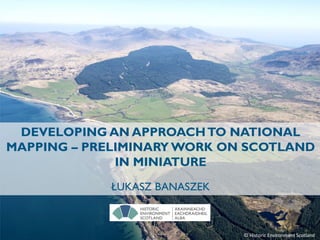
- 1. DEVELOPING AN APPROACHTO NATIONAL MAPPING – PRELIMINARY WORK ON SCOTLAND IN MINIATURE ŁUKASZ BANASZEK © Historic Environment Scotland
- 2. Historic Environment Scotland is the lead public body set up in 2014 to investigate, care for and promote Scotland’s historic environment.
- 4. 1908 Date: 1908 Entry date: Like "*1988*“ County: <>"NOT APPLICABLE“ District: <>"maritime” RCAHMS Caithness (fw) RCAHMS Berwick (fw) Kernel Density Output cell size 1000m Search Radius 5000m Units Km square
- 5. 1909 RCAHMS Caithness (fw) RCAHMS Galloway, I & 2 (fw)
- 7. 1911 RCAHMS Galloway, I & 2 (fw) RCAHMS Caithness Publication Beveridge
- 10. 1914 RCAHMS Galloway, II RCAHMS Outer Hebrides, Skye and the Small Isles (fw) Publication Craw
- 11. 1915 RCAHMS Berwick RCAHMS Outer Hebrides, Skye and the Small Isles (fw)
- 12. 1916
- 13. 1917
- 14. 1918
- 15. 1919
- 17. 1921
- 18. 1922
- 20. 1924 RCAHMS East Lothian Ordnance Survey update Ordnance Survey update Publication Mackintosh
- 22. 1926 RCAHMS Midlothian and West Lothian (fw)
- 23. 1927 RCAHMS Orkney and Shetland (fw)
- 24. 1928 RCAHMS Orkney and Shetland (fw) RCAHMS Outer Hebrides, Skye and the Small Isles Publication Mathieson
- 25. 1929 RCAHMS Orkney and Shetland (fw) RCAHMS Midlothian and West Lothian Publication Cruickshank and Gunn
- 26. 1930 RCAHMS Orkney and Shetland (fw)
- 27. 1931 RCAHMS Orkney and Shetland (fw) Publication Ogston
- 28. 1932
- 32. 1936
- 36. 1940
- 37. 1941
- 42. 1946 RCAHMS Roxburghshire (fw) RCAHMS Orkney and Shetland
- 59. 1963 RCAHMS Peeblesshire (fw) Ordnance Survey updates RCAHMS Stirlingshire
- 67. 1971 RCAHMS Argyll (fw) Ordnance Survey updates
- 71. 1975 RCAHMS Argyll (fw) Ordnance Survey updates
- 72. 1976 Ordnance Survey updates RCAHMS Aerial Survey updates (Nationwide)
- 73. 1977 RCAHMS Easter Ross, Ross and Cromarty District, Highland Region Ordnance Survey RCAHMS North Kyle, Kyle and Carrick, Strathclyde Region Ordnance Survey RCAHMS Stirling District, Central Region Ordnance Survey RCAHMS Aerial Survey updates (Nationwide)
- 74. 1978 RCAHMS Stirling District, Central Region RCAHMS Easter Ross, Ross and Cromarty District, Highland Region RCAHMS Dumbarton District, Clydebank District, Bearsden and Milngavie District, Strathclyde Region RCAHMS Lanarkshire Ordnance Survey Ordnance Survey RCAHMS Aerial Survey updates (Nationwide) Ordnance Survey RCAHMS Lunan Valley, Montrose Basin, Angus District, Tayside Region Publication McWilliam
- 75. 1979 RCAHMS Orkney RCAHMS Berwickshire District, Borders Region RCAHMS Argyll RCAHMS Stirling District, Central Region RCAHMS Easter Ross, Ross and Cromarty District, Highland Region RCAHMS Ewesdale and Lower Eskdale, Annandale and Eskdale District, Dumfries and Galloway Region RCAHMS Aerial Survey updates (Nationwide)
- 76. 1980 RCAHMS Orkney RCAHMS North Kyle, Kyle and Carrick, Strathclyde Region RCAHMS Argyll Ordnance Survey RCAHMS Berwickshire District, Borders Region RCAHMS Ewesdale and Lower Eskdale, Annandale and Eskdale District, Dumfries and Galloway Region RCAHMS Aerial Survey updates (Nationwide) Publication Coastal Survey Ordnance Survey
- 77. 1981 RCAHMS Argyll RCAHMS Orkney RCAHMS Ewesdale and Lower Eskdale, Annandale and Eskdale District, Dumfries and Galloway Region RCAHMS North Kyle, Kyle and Carrick, Strathclyde Region Ordnance Survey RCAHMS Aerial Survey updates (Nationwide)
- 78. 1982 RCAHMS Argyll RCAHMS Orkney RCAHMS North Kyle, Kyle and Carrick, Strathclyde Region Ordnance Survey Strathclyde RCAHMS South Kincardine, Kincardine and Deeside District, Grampian Region Ordnance Survey Caithness RCAHMS Aerial Survey updates (Nationwide)
- 79. 1983 RCAHMS Argyll RCAHMS Orkney RCAHMS North Kincardine, Kincardine and Deeside District, Grampian Region RCAHMS Angus District, Tayside Region RCAHMS Rhum, Lochaber District, Highland Region RCAHMS North Kyle, Kyle and Carrick, Strathclyde RegionRCAHMS Aerial Survey updates (Nationwide)
- 80. 1984 RCAHMS West Rhins, Wigtown District, Dumfries and Galloway Region RCAHMS Argyll RCAHMS Orkney RCAHMS North Kincardine, Kincardine and Deeside District, Grampian Region RCAHMS Angus District, Tayside Region RCAHMS Aerial Survey updates (Nationwide) Publication Hunter
- 81. 1985 RCAHMS Argyll RCAHMS North Kyle, Kyle and Carrick, Strathclyde Region RCAHMS West Rhins, Wigtown District, Dumfries and Galloway Region RCAHMS Orkney RCAHMS Aerial Survey updates (Nationwide) Publication Edinburgh University
- 82. 1986 RCAHMS Orkney RCAHMS Argyll RCAHMS West Rhins, Wigtown District, Dumfries and Galloway Region RCAHMS Aerial Survey updates (Nationwide) Publication Edinburgh University
- 83. 1987 RCAHMS North Perthshire RCAHMS Argyll RCAHMS West Rhins, Wigtown District, Dumfries and Galloway Region RCAHMS Orkney RCAHMS Aerial Survey updates (Nationwide) Publication Edinburgh University
- 84. 1988 RCAHMS North Perthshire RCAHMS Argyll RCAHMS Aerial Survey updates (Nationwide) Publication Edinburgh University RCAHMS Midlothian
- 85. 1989 Date: 1989 Entry date: Not Like "*1988*“ County: <>"NOT APPLICABLE“ District: <>"maritime” RCAHMS OS Revision RCAHMS Strath Rusdale RCAHMS Catertuns RCAHMS Stanhope RCAHMS OS Revision RCAHMS South Perthshire RCAHMS Aerial Survey updates (Nationwide) Publication Miket and Wildgoose Publication NOSAS Publication Van Hoek
- 86. 1990 RCAHMS Gatehouse of Fleet RCAHMS Huntly Dufftown RCAHMS Waternish RCAHMS North Perthshire RCAHMS South Perthshire RCAHMS East Dumfries RCAHMS Aerial Survey updates (Nationwide) Archaeology Scotland Discovery and Excavation Scotland (Nationwide) Publication Miket and Wildgoose
- 87. 1991 RCAHMS Muirkirk RCAHMS Cleish RCAHMS Forres RCAHMS Strath of Kildonan RCAHMS Knoydart RCAHMS East Dumfries RCAHMS Aerial Survey updates (Nationwide) Archaeology Scotland Discovery and Excavation Scotland (Nationwide) Publication Miket and Wildgoose Publication Bute Natural History Society RCAHMS Glenesslin
- 88. 1992 RCAHMS Braes of Doune RCAHMS Central Scottish Woodland s RCAHMS Glenesslin RCAHMS Southdean RCAHMS South Perthshire RCAHMS East Dumfries RCAHMS Aerial Survey updates (Nationwide) Archaeology Scotland Discovery and Excavation Scotland (Nationwide)
- 89. 1993 RCAHMS Den of Boddam RCAHMS Mar Lodge RCAHMS Upper Strathnairn RCAHMS Strathbraa n RCAHMS OS Revision RCAHMS Finlaggan RCAHMS East Dumfries RCAHMS OS Revision RCAHMS Aerial Survey updates (Nationwide) Archaeology Scotland Discovery and Excavation Scotland (Nationwide) Publication Hood
- 90. 1994 RCAHMS Achiltibuie RCAHMS Kingussie RCAHMS Inverewe RCAHMS Canna RCAHMS Craigievar RCAHMS Central Scottish Woodland s RCAHMS Creetown RCAHMS East Dumfries RCAHMS Aerial Survey updates (Nationwide) Archaeology Scotland Discovery and Excavation Scotland (Nationwide) RCAHMS FESP pilot
- 91. 1995 RCAHMS First Edition Survey Project (Nationwide) RCAHMS Rogart RCAHMS Kingussie RCAHMS Upper Strathearn RCAHMS OS revision RCAHMS Lake of Menteith RCAHMS East Dumfries RCAHMS Aerial Survey updates (Nationwide) Archaeology Scotland Discovery and Excavation Scotland (Nationwide) Publication Wildgoose RCAHMS Publication Kirby Publication Hannah and Proudfoot
- 92. 1996 RCAHMS First Edition Survey Project (Nationwide) RCAHMS Strathdon RCAHMS Liddwsdale RCAHMS Plateau of Lorn RCAHMS East Dumfries RCAHMS Aerial Survey updates (Nationwide) Archaeology Scotland Discovery and Excavation Scotland (Nationwide) Publication Hannah and Proudfoot
- 93. 1997 RCAHMS First Edition Survey Project (Nationwide) RCAHMS Strathdon RCAHMS Glen Urquhart RCAHMS Menstrie Glen RCAHMS East Dumfries RCAHMS Aerial Survey updates (Nationwide) Archaeology Scotland Discovery and Excavation Scotland (Nationwide) Publication Barrowman Publication Cullen and Tompsett
- 94. 1998 RCAHMS First Edition Survey Project (Nationwide) RCAHMS Strathdon RCAHMS Sheriff Muir RCAHMS Holyrood RCAHMS Aerial Survey updates (Nationwide) Archaeology Scotland Discovery and Excavation Scotland (Nationwide)
- 95. 1999 RCAHMS First Edition Survey Project (Nationwide) RCAHMS Strathdon RCAHMS Kale Water RCAHMS Glen Clova RCAHMS Aerial Survey updates (Nationwide) SCRAN Hume project (Nationwide) RCAHMS Dick, Peddie & Mackay (Nationwide) Archaeology Scotland Discovery and Excavation Scotland (Nationwide) Publication Hannah and Proudfoot
- 96. 2000 RCAHMS First Edition Survey Project (Nationwide) RCAHMS Strathdon RCAHMS Ben Laws RCAHMS East Dumfries RCAHMS Aerial Survey updates (Nationwide) SCRAN Hume project (Nationwide) RCAHMS Scottish Architects Preservation Project (Nationwide) RCAHMS Dick, Peddie & Mackay (Nationwide) Archaeology Scotland Discovery and Excavation Scotland (Nationwide) Publication Hannah and Proudfoot
- 97. 2001 RCAHMS First Edition Survey Project (Nationwide) RCAHMS Strathdon RCAHMS Ben Lawers RCAHMS Aerial Survey updates (Nationwide) SCRAN Hume project (Nationwide) RCAHMS Cropmark tagging (Nationwide) RCAHMS Scottish Architects Preservation Project (Nationwide) RCAHMS Dick, Peddie & Mackay (Nationwide) Archaeology Scotland Discovery and Excavation Scotland (Nationwide)
- 98. 2002 RCAHM S Muck RCAHMS Kirkudbright Training Area RCAHMS White Hill RCAHMS Strathdon RCAHMS First Edition Survey Project (Nationwide) RCAHMS Aerial Survey updates (Nationwide) SCRAN Hume project (Nationwide) RCAHMS Cropmark tagging (Nationwide) RCAHMS Scottish Architects Preservation Project (Nationwide) RCAHMS Dick, Peddie & Mackay (Nationwide) RCAHMS Mactaggart and Nicol (Nationwide) Archaeology Scotland Discovery and Excavation Scotland (Nationwide)
- 99. 2003 RCAHMS Mingulay RCAHMS Strathdon RCAHMS Aerial Survey updates (Nationwide) RCAHMS Arial Photograph Backlog (Nationwide) SCRAN Hume project (Nationwide) RCAHMS Scottish Architects Preservation Project (Nationwide) RCAHMS Mactaggart and Nicol (Nationwide) Archaeology Scotland Discovery and Excavation Scotland (Nationwide) RCAHMS Ben Lawers
- 100. 2004 RCAHMS Yarrows RCAHMS Binn Hill RCAHMS Mulberry Harbour Rigg Bay RCAHMS Aerial Survey updates (Nationwide) Publication Greig RCAHMS Arial Photograph Backlog (Nationwide) RCAHMS Mactaggart and Nicol (Nationwide) RCAHMS Basil Spence (Nationwide) Archaeology Scotland Discovery and Excavation Scotland (Nationwide) RCAHMS Ben Lawers
- 101. 2005 RCAHMS Pentland Range RCAHMS Croy Hill RCAHMS Aerial Survey updates (Nationwide) Publication Coastal Assessment Survey Publication Currie Publication Coastal Assessment Survey RCAHMS Arial Photograph Backlog (Nationwide) RCAHMS Basil Spence (Nationwide) Archaeology Scotland Discovery and Excavation Scotland (Nationwide) RCAHMS Ben Lawers
- 102. 2006 RCAHMS Brae of Abernethy RCAHMS ST KILDA Survey Loch Katrine Waterworks RCAHMS The Waverley Line RCAHMS Aerial Survey updates (Nationwide) RCAHMS Arial Photograph Backlog (Nationwide) RCAHMS Basil Spence (Nationwide) Archaeology Scotland Discovery and Excavation Scotland (Nationwide)
- 103. 2007 RCAHMS East Renfrewshire RCAHMS ST KILDA RCAHMS Architecture (Nationwide) Publication NOSAS RCAHM S Muck RCAHMS Aerial Survey updates (Nationwide) Archaeology Scotland Discovery and Excavation Scotland (Nationwide) SRP update RCAHMS Ben Lawers
- 104. 2008 RCAHMS Cape Wrath RCAHMS ST KILDA SRP update RCAHMS Architecture (Nationwide) Publication Coastal Assessment Survey RCAHMS Aerial Survey updates (Nationwide) Archaeology Scotland Discovery and Excavation Scotland (Nationwide) Publication Currie SRP update RCAHMS Cambo RCAHMS Ben Lawers
- 105. 2009 RCAHMS ST KILDA RCAHMS North Rona RCAHMS Bute RCAHMS Architecture (Nationwide) SRP update RCAHMS Aerial Survey updates (Nationwide) Archaeology Scotland Discovery and Excavation Scotland (Nationwide) Publication Currie
- 106. 2010 RCAHMS-HER Orkney concordance RCAHMS Walls RCAHMS ST KILDA RCAHMS-HER Scottish Borders concordance RCAHMS Bute RCAHMS Architecture (Nationwide) RCAHMS North Rona RCAHMS Aerial Survey updates (Nationwide) Archaeology Scotland Discovery and Excavation Scotland (Nationwide) RCAHMS Buildings at Risk concordance (Nationwide)
- 107. 2011 RCAHMS Walls RCAHMS ST KILDA RCAHMS Threatened Building Survey Programme (Nationwide) SRP update SRP update RCAHMS-HER East & Mid-Lothian concordance RCAHMS-HS Listed Building concordance (Nationwide) RCAHMS Aerial Survey updates (Nationwide) Archaeology Scotland Discovery and Excavation Scotland (Nationwide) RCAHMS Bute
- 108. 2012 RCAHMS Walls RCAHMS ST KILDA RCAHMS Kale Water RCAHMS Threatened Building Survey Programme (Nationwide) NTS update RCAHMS Uists RCAHMS Aerial Survey updates (Nationwide) Archaeology Scotland Discovery and Excavation Scotland (Nationwide) NTS update RCAHMS North Rona Publication Crawford Publication Shepherd
- 109. 2013 RCAHMS Walls RCAHMS First World War (Nationwide) RCAHMS ST KILDA RCAHMS Uists RCAHMS Kale Water Publication Watson NTS update RCAHMS Aerial Survey updates (Nationwide) Archaeology Scotland Discovery and Excavation Scotland (Nationwide) NTS update NTS update Scottish Canals update NTS update NTS update NTS update Publication Bradford University
- 110. 2014 (May) RCAHMS-HER Western Isles concordance RCAHMS War memorials (Nationwide) NTS update NTS update RCAHMS Aerial Survey updates (Nationwide) NTS update Scottish Canals update NTS update NTS update NTS update
- 112. BACKGROUND 8,264 km² = 25 years Scotland = 80,077 km² Systematic survey routinely increases numbers of known monuments by 50-200%
- 113. REMOTE SENSING DATA Airborne Laser Scanning coverage Orthophotograph coverage
- 114. CONTEXT • Much of Scotland’s archaeology is not on record • Majority of RS data is not exploited for archaeological purposes • RS data is proliferating • Use of RS data is largely constrained within traditional methods of prospection & object identification developed in the 20th century • Implications of digital/3D? Can we play a lead role?
- 115. Our response? Develop an approach to national rapid mapping
- 116. NATIONAL SCALE ARCHAEOLOGICAL SURVEY: SOME ISSUES • Is ‘national coverage’ necessary? • Balance between extent of coverage and level of recording detail • How comprehensive? (i.e. what sources are consulted?) • What comprises a minimum level of record? • How far can RS data can be relied on as the primary source? • What is the role of field observation? • How do we define ‘quality’? • How can we ‘speed up’ archaeological survey?
- 117. 432 km² Scotland in miniature – Isle of Arran Eilean Arainn © Historic Environment Scotland
- 118. © Historic Environment Scotland
- 119. LEVELS OF SURVEY Where we are at the moment... • Level 0 - Preliminary, desk-based survey and record • Level 1 - Basic record: Field visit to produce an accurate location at basic mapping scale, brief description and classification • Level 2 - Landscape mapping: detailed landscape mapping by EDM/GPS 1:2500, 1:5000; 1:10,000) allowing features to be seen in context • Level 3 - Groups of monuments: group of sites or structures planned by SRA at 1:250 and 1:500 • Level 4 - Individual detailed survey and record using plane table Where does Arran survey and proposed national mapping fit in?
- 120. DO BASIC RECORDS FIT MULTIPLE PURPOSES? • Where, what, when and how – when do we need more? • Relationships with ‘deeper’ (sometimes) records in HERs • How often do users find information exactly the way they want it? • Is NRHE ‘best’ as an index? • Would readily available ALS visualisations change what we do?
- 121. Level of confidence Is a field visit required?
- 124. ARE THERE ISSUESWITH A PRIMARY RELIANCE ON RS DATA FOR THE NATIONAL SURVEY? • Are we happy to use RS data alone for site creation/upgrade? • How do we develop our confidence in using ALS data? • How do we assess RS data reliability? • Do we believe in ‘ground truth’? • How do we use ground observation selectively? • What is the role(s) of field visits?
- 125. NR83SE 26 8908 3026 NR 8908 3026. A heather-covered hut circle was found during field investigation situated on gently sloping moorland at approximately 300ft OD. The earth and stone bank, spread to 3.0m and up to 0.8m high, encloses a level interior 5.5m in diameter. There is a 1.0m wide entrance in the south-east with a single orthostat on its east side. Approximately 100.0m south of the hut circle is an 80.0m long bank. Comprising earth and large stones, it is 2.0m wide and 0.4m high and is probably a field bank associated with the hut. Lying between the hut circle and the bank is a group of 15 heather-covered stony mounds similar to other probable clearance heaps in this area (see NR83SE 11). Visited by OS (TRG), 20 October 1977
- 126. A heather-covered probable hut circle was found during field investigation situated on a gentle slope in open moorland. The earth and stone bank, spread to 2.5m and up to 0.8m high, encloses a level interior 5.0m in diameter. In the south-west the bank is 5.0m wide and 1.8m high, possibly the result of dumping from nearby peat cutting. There is a 1.5m wide entrance in the south- east; a small gap in the north-west appears to be a modern mutilation. Visited by OS (TRG) 20 October 1977
- 129. A basic record Where NR 92193 38348 What Shieling hut(s) Shieling mound(s) When Post Medieval Event ‘An archaeological survey of Arran was conducted between ** and ** by HES, Survey and Recording .... ALS data ..., extent and Level of Survey...’
- 130. A more detailed record Where NR 92193 38348 What Shieling hut(s) Shieling mound(s) When Post Medieval Event ‘An archaeological survey of Arran was conducted between ** and ** by HES, Survey and Recording .... ALS data ..., extent and Level of Survey...’ A scatter of at least 25 shieling mounds have been identified from Airborne Laser Scanning data derived visualisations beside the Allt Airigh na Cuiseig in Glen Iorsa. The majority of the mounds lie to the S of the stream, and are formed as distinct grassy mounds, with a depression, sometimes subrectangular, or dimple on the summit. The largest of the mounds measures about 6m in diameter and up to 0.8m in height. Information from HES Survey and Recording (DCC) 24 October 2017
- 131. WHAT ARRAN SURVEY PROJECT LOOKS LIKE? Maximise use of RS data • Prospection/reconnaissance • Level of confidence • Site/record creation to minimum standard Where (coordinate/polygon) What When Event • Identify sites/areas for field visits (anomalies, gaps, poor ALS data) Strategic field work • Visit anomalies • Targeted field reconnaissance in ‘gaps’ • Some more intensive RS-based mapping and field investigation Develop digital documentation/interpretation experience/skills
- 132. SOURCES: Old and current OS maps First Edition Settlement Project Aerial Photographs Historic Land Use Assessment (HLA) ALS visualisations FROM POINTTO POLYGON
- 133. Oblique photograph PREHISTORIC ROUND HOUSE FOOTINGS Hillshading Sky View Factor Local Dominance Slope
- 134. Known Site Extent Discovery Area New Discoveries Shieling huts Round houses Cultivation RAPID DESK-BASED PROSPECTION
- 135. 8 INTERPRETERS 3 WORKING DAYS EACH UP TO 30KM2 PER PERSON/DAY FOR BASIC POLYGONISATION
- 136. TAKING THIS AS A MOMENT TO REFLECT ON THE KNOWLEDGE PRODUCTION PROCESS • Role of expertise • How we think about observation • Black boxes and explanation • Descriptions of reliability / probability • When are we data driven and pattern seeking? When are we fitting to conceptual models?
- 137. TO BETTER DEFINETHE ESSENCE OF WHAT COMPRISESTHE ARCHAEOLOGICAL IN LANDSCAPE SURVEY What we see is dependent on: • our expectations • our experience • our questions • our acuity
- 138. Accountability? Observation – interpretation – depiction Interpretation: ‘Because I say so...’?
- 139. Give half a dozen people the same information and you get half a dozen different interpretations, all equally valid and probably not even mutually contradictory in any significant way, but each of them will bear the style of the individual interpreter Reginald Hill, 2008.The Roar of the Butterflies
- 140. Archaeology and deep learning
- 141. PRE-HISTORY OF AUTOMATION Object Based Image Analysis Custom algorithms Adaptive template matching Zingman et al. 2015 Template matching with morphometric derivatives Schneider et al. 2015
- 142. Deep Learning STEP CHANGE INTHE LAST 5YEARS
- 143. RAPID DEVELOPMENT ACROSS MANY FIELDS Medical imaging Cell detection & Classification 3D Histopathology Surveillance Automated Video Surveillance Systems Target detection Social media Face recognition Automated tagging How variable and complex are archaeological remains compared to: • Puppies • Human Faces • Medical images
- 144. Trier (2016) and Zingman (2016) • Pre-training on ImageNet • Then train (learn) on a relatively small target set of images • Can use Matlab toolbox Mat-ConvNet Automatic charcoal kiln detection for a 3×3 km test area. Convolutional Neural Networks (Machine Learning) Underpinned by field observation Image courtesy of Ø. Trier
- 145. AUTOMATED OBJECT DETECTION: PROOF OF CONCEPT • Norwegian Computing Center • Height data • Learning sets for hut-circles, small cairns and shieling huts • Development for national mapping, crucial for big data • Contribute to understanding better how we see sites • No threat to archaeological interpretation & expertise, but a tool
- 146. AUTOMATION ON ARRAN Manual mapping • Up to 30km2 per person/day for basic polygonisation only • Single data source CNN on Arran • Learning sets (hut-circles, small cairns, shieling huts) • Work in progress
- 147. Neural network implemented using pyTorch (http://pytorch.org/). Øivind Due Trier Preliminary results
- 148. Procedures for rapid assessment of ALS/RS data as it becomes available within a strategy for national mapping RS data at the forefront, multiple scales of survey Methods to express varying confidence in outputs from RS Review what constitutes an adequate archaeological record Assessment of the potential representativity of data Creation of a ‘learning set’ for automated object detection routines for ALS data Developing an approach to national mapping
- 149. ACKNOWLEDGEMENTS • ALS data: Fugro and Scottish Government • Adara López-López • Žiga Kokalj Thank you for your attention!