SlideShare a Scribd company logo
1 of 5
Download to read offline
The International Journal of Engineering And Science (IJES)
||Volume|| 2 ||Issue|| 1 ||Pages|| 76-80 ||2013||
ISSN: 2319 – 1813 ISBN: 2319 – 1805
  Impact of Natural Resource on Socio-economic Status of Sagar
                    Island. West Bengal, India
                                     1
                                         Manas mondal, 2Satyabrata Mandal
                                    1, 2
                                           (Asst Teacher in Geography & Research Scholar)

-----------------------------------------------------------Abstract-----------------------------------------------------
This paper deals with impact of natural resources on socio-economic status of Sagar Island, West Bengal, India
. It conceived through the integration of various factors like available land & water resources, existing
agricultural production, soil fertility & climatic factors influence socio-economic status of the inhabitants in our
study area. Here we have tried to discuss major parameters, which directly or indirectly controlled socio-
economic condition of this island. In rural area maximum no of peoples are depends on existing natural
resources. This area is also dependent on natural resources. Agriculture, Soil & Water resources are the prime
indicators of socio-economic condition of our study area. The growing population has been exerting tremendous
pressure as well between 2002 to 2011, the land available for aman agriculture had sunk from 14700 to 14170
hectares with the rise in population settlements have also increased from 28398 to 42382 (Census of India 2001
& 2011).Therefore total population are also increasing in rapid way. In 2001 total population was 180408.It
converted to 206801 in 2011.The average land holding is 0.82 hectare per family & about 0.084 hectare per
capita. The national average of operational land holding is 1.33 hec per capita. Naturally agriculture is no
longer a prefer livelihood option for the younger generation. The assets created by the father has little value for
the son, who has to start his struggle all over again. For this he either has to migrate or get trained in a skill
that will help him earn a livelihood. They have little freedom to choose from available career options. The range
of soil PH belongs to 6.3 to 8.2 in normal temperature (22 ºc). EC varies from 0.34 to 1.75 (dsm-1).Therefore
org.c (%) varies from 3 to 12.2. However soil fertility is also discussed here to understand the productivity of
soil. In entire region range of clay belongs to 32.1 -48.3. N varies from 156 to 292 (Kg ha -1 ). P2O5 varies from
22 to 79. k2o goes through 442 to 936.Available potassium (kg ha -1) range is 8.5 to 32.2. Available sulphur (mg
kg-1 ) varies from 5.5 to 37.2.Available zinc (mg kg -1) range is 2.5 to 10.2. . Ponds & internal canals are only
variable source of irrigation in this island, which cover 7.51% & 14.25% of total cultivable upland & midland
respectively. Studies of quality of irrigation water indicate that saline irrigation water is the major problem in
this study area. Lowest EC value ( 0.43-0.91 dsm-1) is obtained for pond water followed by internal canal water
(EC 12.24 to 19.36 dsm-1) and river water (EC 16.09 to 21.96 dsm -1). The higher EC value of river water might
be due to its close connection with the sea. Low EC value of pond water (≤0.92 dsm-1) indicates that it would not
lead to soil salinization if used for irrigation purposes.
-------------------------------------------------------------------------------------------------------------------------- --------------
Date of Submission: 19, December, 2012                                              Date of Publication: 05, January 2013
----------------------------------------------------------------------------------------------------------------------------- -----------

                                                      I.     Introduction:
         Etymologically „resource refers to two separate words „re‟ and „source‟ that indicate any thing or
substance that may occur unhindered many more times. The term „resource‟ had no special significance till the
early part of the twentieth century. After the use of various resources in various fields, it is very popular term in
economic geography. Resource popularly signifies: a) A source or possibility of assistance b) An expedient c)
Means of support d) Means to attain given end. e) Capacity to take advantage of opportunities.
         Resource can be subjective as well as objective. Subjective resource denotes internal resource, objective
resource is external resource. According to Prof Zimmermann: “The word resource dose not refer to thing or a
substance but to a function which a things or a substance may perform or to an operation in which it may take
part namely the function or operation of attaining a given end such as satisfying a want‟‟.

         Sagar Island such an area which despite its tremendous economic potentiality is lagging behind in
comparison with many other areas which are in geo-economic, geo-environmental and geo-hydrological in same
region. This study is emphasize on finding out the utilizatation of natural resources & their impact on present
people as well as upcoming people & the reasons behind the backwardness , identifying the areas of potentials
and highlighting the prospects therein.


www.theijes.com                                                The IJES                                                      Page 76
Impact of Natural Resource on Socio-economic Status of Sagar Island. West Bengal, India

Study area:
         Sagar Island lies on the continental shelf of Bay of Bengal having the island area of about 251.59 sq km
with 43 villages and with population of over 180408 with population density of 717 / sq km (2001). The study
area extended from 21o 37/ N to 21052/ N and 88002/ E to 88011/E. The Island has scattered Mangrove swamp,
waterways and small rivers. Low laying rice production system is pre dominated. Tidal ingression, inundation of
cropped land, cyclonic storm often hamper the kharif-rabi production system of Sagar Island, Severe
meteorological drought and extreme rainfall event frequently disrupt the crop production. In the last 30 years
population increased rapidly in this study area. Majority of them infiltrate from neighboring districts. In 1991
census the total population and the population density were 149222 and 593/Km2, which increase to 180408 and
717/Km2 respectively in 2001.In the 2011 census total population was 203074. Total area of the island is 251.59
Km2 of which 116.83 Km2 is not available for cultivation. 134.76 Km2 has been considered as agricultural land
of which 114.47 Km2 areas is un-irrigated. Only 13.31% land is benefited by irrigation.

Objectives:
.The objectives for this thesis are drawn to address the study rationale listed below as:

1. To analyze the existing socio-economic and environmental status of Sagar island in order to identify
environmental issues and problems.
2. To evaluate the existing schemes and their appropriateness with the utilization of present natural resources in
the socio-economic settings.

Data Base & Research Methodology:
 The present study is based upon primary field data which are mainly collected at the time of field survey. Here
10 % household data are collected in random sampling method to the total house hold. Soil sampling at one
kilometer grid interval has been done for our study area. The analysis of macro & micro nutrients of this area has
been completed. Therefore secondary data are also collected to fulfill this work. For effective discussion various
government reports, national & international journals & books have been followed. Therefore we have also
collected 321 GCP (Ground control point) by GPS.

Findings & Analysis:
          Topographically this island has no significant variation. In socio economic status this study area has
been considered as backward region. It has some major problems, which are adversely affecting the socio
economic condition of the inhabited people. The present area of study is characterized by several physical and
non-physical constrains which reduce the use of natural resource as well as economic status of the inhabitants.
To build up a strategic framework of natural resource management some basic research questions are herein
reported.

Agricultural Resources:
         Agriculture is one of the most human activities. It is still one of the main sources of income. The
traditional Agricultural system has been found in this study area. Most of the people (more than 70%) are Corley
depend on agriculture. Maximum area is considered as monocarp. Rice- rice crop sequence is principally
followed in the area with vegetables & oilseeds in some pockets of upland & medium land. Marginal farmers
owned the major share of total cropped area in comparison to small farmers. For both the categories maximum
yield was obtained from upland (2.90 – 10.65 tonha) while the minimum yield was recorded from lowland (1.82-
2.14 ton ha). Cropping intensity was maximum in midland area followed by upland & lowland areas. Upland &
midland areas are considered as double crop in some pockets of this study area. Lowland areas are mostly
monocrop except few patches remained fallow during the rabi season. Aman is cultivated in monsoon season.
The total area is 12803 hectors covering for Aman cultivation. Total production is 24.302 thousand metric ton,
and yield is 1898.12 Kg/hectors (District Statistical Handbook, 2008). Boro is mainly cultivated in post monsoon
season. 73 hectors is covering for Boro cultivation. Total production is 0.250 thousand metric ton and yield is
3429.07 Kg/hectors (source- census of India 2001).The production of aman paddy is very low and fails to offer
decent returns to the farmer 1.5 to 2 tones per hectare against a national average of 3.28 tones per hectare. The
income is to the tune of Rs 6000 per acre against an investment of Rs 4000 per acre in monsoon season. There
are three dominant reasons why agriculture will remain subsistence in this study area. Firstly the land holdings
are small. There is also land loss to deal with. Finally there is a limited potential to develop irrigation facilities ,
which means multi-cropping cannot be practiced extensively. The growing population has been exerting
tremendous pressure as well between 2002 to 2011, the land available for aman agriculture had sunk from 14700
to 14170 hectares with the rise in population settlements have also increased from 28398 to 42382 (Census of
India 2001 & 2011).Therefore total population are also increasing in rapid way. In 2001 total population was

www.theijes.com                                        The IJES                                              Page 77
Impact of Natural Resource on Socio-economic Status of Sagar Island. West Bengal, India
180408.It converted to 206801 in 2011.The average land holding is 0.82 hectare per family & about 0.084
hectare per capita. The national average of operational land holding is 1.33 hec per capita. Apart from all this
there are governance deficits and institutional shortcomings that do not allow farmers of our study area to get a
better price for whatever little they produce. Development of rural infrastructure with proper marketing and
storage facilities are the necessary pre-requisite for successful rural agro based industries. Ease of transportation
is an integral part of proper infrastructure. In the entire study area this infrastructure is minimal.
This lack sometimes leads to huge losses for the cultivators. Sagar is famous for the production of watermelon.
With no proper storage, transport, credit & marketing facilities their producers do not get any opportunity to sell
these non- food grain crops in distant places at competitive prices. There is no cold storage in entire area.
Naturally agriculture is no longer a prefer livelihood option for the younger generation. The asset created by the
father has little value for the son, who has to start his struggle all over again. For this he either has to migrate or
get trained in a skill that will help him earn a livelihood. They have little freedom to choose from available career
options.

          During hot summer season the average temperature is 35 0C and 65% to 70% average humidity is the
major problem for summer cultivation. In this study area agricultural system is totally depend on monsoon
rainfall. To analyze variability of monsoon 30 years rainfall data have been collected. Pre –monsoon & monsoon
rainfall graph have been drawn to show actual variability of rainfall. Rainfall is primarily controller of
production of aman paddy.
                        2600


                        2400


                        2200
       Rainfall in mm


                        2000


                        1800


                        1600


                        1400


                        1200
                               1980                             1985          1990             1995               2000       2005      2010          2015

                                                                                                         Year


                                                                                            1742.4              mu = 1736

                           Annual distribution of monsoon rainfall


                                                       600


                                                       500


                                                       400
                                      Rainfall in mm


                                                       300


                                                       200


                                                       100


                                                         0
                                                             1980      1985          1990             1995            2000   2005   2010      2015

                                                                                                             Year
                                                                                                              116.8


                           Annual distribution of pre-monsoon rainfall

Water Resources:
          Irrigation system is very poor in this study area. Most of the canals and creeks are full of brackish or
saline water. This type of water has no utility for irrigation. Ponds & internal canals are only variable source of
irrigation in this island, which cover 7.51% & 14.25% of total cultivable upland & midland respectively. Studies
of quality of irrigation water indicate that saline irrigation water is the major problem in this study area. Lowest
EC value ( 0.43-0.91 dsm-1) is obtained for pond water followed by internal canal water (EC 12.24 to 19.36 dsm -

www.theijes.com                                                                                  The IJES                                                   Page 78
Impact of Natural Resource on Socio-economic Status of Sagar Island. West Bengal, India
1
 ) and river water (EC 16.09 to 21.96 dsm-1). The higher EC value of river water might be due to its close
connection with the sea. Low EC value of pond water (≤0.92 dsm-1) indicates that it would not lead to soil
salinization if used for irrigation purposes. Shallow pump system is totally absent in this area. P.H.E. pump
stations are also situated for domestic purpose. But they do not supply adequate water. As a result especially
summer agriculture system is hampered due to proper irrigation system. No ground water irrigation scheme yet
been implemented for Rabi crop production.

         The fresh drinking water is totally depends on ground water. The dipper aquifers are located in between
180 to 330 meters below ground level (Das. 91) and the fresh water tapped by means of small diameter tube well
fitted with hand pump. Dug well produced saline water. Deep tube well set up is very costly. The existing
numbers of tube wells are insufficient for the inhabitants. The scarcity between water demand and availability is
one of the prime problems of the study area.

Soil Resources:
           Soil sampling at one kilometer grid interval has been done for our study area. Here 296 soil samples
have been collected. The analyses of macro & micro nutrients of this area have been completed. In this area
physio-chemical property of soil has been analyzed. The range of soil PH belongs to 6.3 to 8.2 in normal
temperature (22 ºc). EC varies from 0.34 to 1.75 (dsm-1).Therefore org.c (%) varies from 3 to 12.2. However soil
fertility is also discussed here to understand the productivity of soil. In entire region range of clay belongs to 32.1
-48.3. N varies from 156 to 292 (Kg ha -1 ). P2O5 varies from 22 to 79. k2o goes through 442 to 936.Available
potassium (kg ha-1) range is 8.5 to 32.2. Available sulphur (mg kg-1 ) varies from 5.5 to 37.2.Available zinc (mg
kg-1) range is 2.5 to 10.2. Basically physiochemical properties & fertility of soil are totally controlled the
productivity of soil. Paddy is the principle crop of this entire area. Battle is cultivated for the economic supports
of the inhabitants. Other vegetable crops are also cultivated to fulfill the local demand. In winter season Green
chilly & Watermelon were the main commercial crops in few years ago. But now they are totally ignored for
poor production. The study area is considered as a coastal zone. So the soil of that area is clayey in nature,
enclosed with saline type sandy-clay soil that spread mostly in the inward side of the boundary walls. This belt of
soil remains uncultivated throughout the year.

Present Socio-economic conditions:
           In the last 30 years population increased rapidly in this study area. Maximum no. of peoples are
infiltrate from neighboring districts. In 1991 census the total population and the population density were 149222
and 593/Km2, which increase to 180408 and 717/Km2 respectively in 2001. In 2011 total population &
population density are 206801 and 821.98 /km2. The total area of the island is 251.59 Km2 of which 116.83 Km2
is not available for cultivation. 134.76 Km2 has been considered as agricultural land of which 114.47 Km2 areas
is un-irrigated. Only 13.31% land is benefited by irrigation. Thus a huge amount of lands are still un-irrigated.
For a long time this area demands immediate implementation of sustainable irrigation system to fulfill the target
production of crop.

          Only 38% of the area covering a population of 40% of Sagar Island are developed indicating that more
than 60% of the area and population are backward. In this backward area maximum no. of inhabitants belongs
below poverty line. As a result multi-dimensional poverty is the major problem in this area. The poor suffer
deprivation in multiple ways, low level of income, illiteracy, relatively high level of mortality, poor
infrastructure, lack of voice, and poor access to resources such as credit, land, water and forests. The H.D.I.
index of this study area is 0.55.

          Poor health facilities have been found in this study area. Only one rural hospital is situated in this
Island. Therefore 3 primary health centers and 1 Nursing home is available here. Only 87 beds are present for the
patient. A huge number of patients do not get proper treatment. As a result mortality rate is also greater than
other islands. Therefore poor people do not take sufficient nutrient. Immunity power is very poor. So they do not
resist severe disease. A great number of peoples are suffering from various chronic diseases.

         Transport system is still poor in the study area. Only a terminating bus route (30 Km North-South
directions) is considered as the lifeline of the island. Recently few metalled roads also developed under Rajiv
Gandhi Gram Sadak Yojona. 8 ferry services also available in this area. Un-metalled road is the main
communication network for the villagers. There is no railway line in this area. Government of West Bengal is
planning to connect Sagar Island with the main land with a 3.3 k. m bridge costing around R.S- 6000 million.
West Bengal Government is also planning to build a deep sea port in the south western coast of the island.


www.theijes.com                                       The IJES                                              Page 79
Impact of Natural Resource on Socio-economic Status of Sagar Island. West Bengal, India

Recommendations:
          Sufficient natural resources are present in this island. But lacks of proper utilization knowledge, most of
the resources are not in position for use. So proper planning & guideline is very necessary for actual utilization of
resources.
 Agricultural activity is not satisfactory in summer & winter season in still now. Poor irrigation facility is the
     main problem for these seasons. So better irrigation facility should be arranged by government for more
     production.
 To mitigate the climatic change effects on agricultural production & productivity, a range of adaptive
     strategies need to be considered. Changing cropping calendars & pattern will be the immediate best
     available option with available crop varieties to mitigate the climate change impact.
     The role of P.H.E should be more active to serve fresh drinking water to all inhabitants of the island.
 More health stations should be build up to get adequate medical facility.
 100 % electrification is very necessary for the socio-economic development of this island.
     At present natural beauty in the name of “Tourism industry” & tourists as people who “travel & stay in
     places outside their usual environment & enjoy your environment & pay for it”. This island has ample scope
     to attract people & earn money from her natural beauty of ocean. More hotels & resorts are to be set up for
     this ecotourism industry.

Conclusion:
         Different researchers have been assessed the Natural Resources of Sagar Island. With all these previous
studies carried out in the area natural resource potential questions still persists with the needed for the better
description of different natural resources for the inhabitants of Sagar Island. As the inhabitants solely depend
upon the available natural resources for their life subsistence the utilization and consumption pattern of natural
resources and their impact on the island‟s socio-economic environment has great importance for the analysis and
assessment. Therefore this journal arise the core question – How natural resource can be properly utilized for the
development of Socio-economic condition of this study area?

References:
  [1].    A.K.Ghosh (2008): Status of Environment in West Bengal –A citizen‟s Report, Society for Environment and
          development; Kolkata, pp 46- 50.
  [2].    Seal & R.Bera(2008).-Appraisal of Natural Resource database for alternative agricultural land use at village level
          under saline environment-A case study from Sagar island, India .pp 1-10.
  [3].    Catley, A. (1999): Participatory approaches to veterinary epidemiology IIED, Sustainable Agriculture & Rural
          livelihoods, London.pp 7-12.
  [4].    Chambers R (1994): Participatory rural appraisal (PRA): Analysis of experience World Development 22, pp 1253-
          1268.
  [5].    Delta C Calcuttan & Joseph Tanui (year2008)-Engaging stakeholders in Integrated Natural Resource Management ;
          approaches and guidelines from land care. pp 4-9.
  [6].    District Human Development Report( South 24 Paraganas 2009) Development & Planning Department,
          Government of West Bengal. pp 13-22.
  [7].    District statistical handbook 2008.(South 24 paraganas) Bureau of Applied Economics and Statistics, Government
          of West Bengal.
  [8].    Gardian Meijerink & Pim Roza (April 2007)-The role of agriculture in economic development. U.K , pp 5-38.
  [9].    H.R. Betal, Indian Cartographer (2003), Cartography of Sustainable Development: A case study of Sagar Island,
          West Bengal, pp 1-5.
  [10].   IPCC Response Strategies working group reports, (1989), pp 166-202.
  [11].   Michael K McCall and Pettier A Minang-Assessing participatory GIS for community-based natural resource
          management; claiming community forests in Cameroon.
  [12].   Report on the status of environment in West Bengal, September, 1998; Department of Environment, Government of
          West Bengal, pp 3-60.
  [13].   S. Bandyopadhyaya (1997): Natural Environmental Hazards and their Management: A Case study of Sagar Island,
          India, Singapore Journal of Tropical Geography,18(1)pp 20-45.
  [14].   Science & Technology and socio-economic development, annual report, 2010-2011. Pp 141-187.
  [15].   Soil Annual Report, 2011. NBSS & LUP, pp 14-19.
  [16].   Statistical Abstract of West Bengal, (2008) Bureau of Applied Economics and Statics, Government of West Bengal.
  [17].   Water resource: A remote sensing and GIS approach, J. Indian Soc. Remote Sens, vol 37, pp 483-491.


www.theijes.com                                          The IJES                                                Page 80

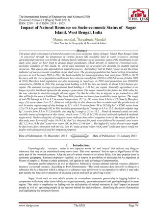
More Related Content

What's hot

Study on Impact of Land Fragmentation in Agriculture-A Case of Rajshahi Distr...
Study on Impact of Land Fragmentation in Agriculture-A Case of Rajshahi Distr...Study on Impact of Land Fragmentation in Agriculture-A Case of Rajshahi Distr...
Study on Impact of Land Fragmentation in Agriculture-A Case of Rajshahi Distr...paperpublications3
 
Towards Climate Change Resilient of Hail Haor, Sylhet: Reviewing the Role of ...
Towards Climate Change Resilient of Hail Haor, Sylhet: Reviewing the Role of ...Towards Climate Change Resilient of Hail Haor, Sylhet: Reviewing the Role of ...
Towards Climate Change Resilient of Hail Haor, Sylhet: Reviewing the Role of ...IOSR Journals
 
F03406035040
F03406035040F03406035040
F03406035040theijes
 
GIS-based watershed management of Kurianad- Maniyakupara watershed near Kozha...
GIS-based watershed management of Kurianad- Maniyakupara watershed near Kozha...GIS-based watershed management of Kurianad- Maniyakupara watershed near Kozha...
GIS-based watershed management of Kurianad- Maniyakupara watershed near Kozha...Jean joy
 
19 sustainability of wrm mym
19   sustainability of wrm mym19   sustainability of wrm mym
19 sustainability of wrm mymMahbubul Hassan
 
THE OPPORTUNITIES AND CHALLENGES FOR MITIGATING CLIMATE CHANGE THROUGH DROUGH...
THE OPPORTUNITIES AND CHALLENGES FOR MITIGATING CLIMATE CHANGE THROUGH DROUGH...THE OPPORTUNITIES AND CHALLENGES FOR MITIGATING CLIMATE CHANGE THROUGH DROUGH...
THE OPPORTUNITIES AND CHALLENGES FOR MITIGATING CLIMATE CHANGE THROUGH DROUGH...Julius Huho
 
Planning and sustainable development in indian context
Planning and sustainable development in indian contextPlanning and sustainable development in indian context
Planning and sustainable development in indian contextsavitanarayan29
 
Perceptions of climate change in africa
Perceptions of climate change in africaPerceptions of climate change in africa
Perceptions of climate change in africaAlexander Decker
 
Economics of exhaustible resources
Economics of exhaustible resourcesEconomics of exhaustible resources
Economics of exhaustible resourcesDocumentStory
 
Flood Vulnerability Study in Parts of Oyo Township Using GIS and Remote Sensing
Flood Vulnerability Study in Parts of Oyo Township Using GIS and Remote SensingFlood Vulnerability Study in Parts of Oyo Township Using GIS and Remote Sensing
Flood Vulnerability Study in Parts of Oyo Township Using GIS and Remote Sensingpaperpublications3
 
Land Use And Regulation
Land Use And RegulationLand Use And Regulation
Land Use And RegulationKetan Wadodkar
 
Climate change and economic adaptability of indian sunderban
Climate change and economic adaptability of indian sunderbanClimate change and economic adaptability of indian sunderban
Climate change and economic adaptability of indian sunderbanAlexander Decker
 
Hill area Development programme-NILGIRIS district
Hill area Development programme-NILGIRIS districtHill area Development programme-NILGIRIS district
Hill area Development programme-NILGIRIS districtRavi Varma reddy
 
Effect of Climate Change on Maize (Zea-mays) and Cassava (Manihot-esculenta) ...
Effect of Climate Change on Maize (Zea-mays) and Cassava (Manihot-esculenta) ...Effect of Climate Change on Maize (Zea-mays) and Cassava (Manihot-esculenta) ...
Effect of Climate Change on Maize (Zea-mays) and Cassava (Manihot-esculenta) ...Journal of Agriculture and Crops
 

What's hot (19)

Rural land use of bangladesh
Rural land use of bangladeshRural land use of bangladesh
Rural land use of bangladesh
 
Study on Impact of Land Fragmentation in Agriculture-A Case of Rajshahi Distr...
Study on Impact of Land Fragmentation in Agriculture-A Case of Rajshahi Distr...Study on Impact of Land Fragmentation in Agriculture-A Case of Rajshahi Distr...
Study on Impact of Land Fragmentation in Agriculture-A Case of Rajshahi Distr...
 
Towards Climate Change Resilient of Hail Haor, Sylhet: Reviewing the Role of ...
Towards Climate Change Resilient of Hail Haor, Sylhet: Reviewing the Role of ...Towards Climate Change Resilient of Hail Haor, Sylhet: Reviewing the Role of ...
Towards Climate Change Resilient of Hail Haor, Sylhet: Reviewing the Role of ...
 
F03406035040
F03406035040F03406035040
F03406035040
 
GIS-based watershed management of Kurianad- Maniyakupara watershed near Kozha...
GIS-based watershed management of Kurianad- Maniyakupara watershed near Kozha...GIS-based watershed management of Kurianad- Maniyakupara watershed near Kozha...
GIS-based watershed management of Kurianad- Maniyakupara watershed near Kozha...
 
hydrology-03-00002
hydrology-03-00002hydrology-03-00002
hydrology-03-00002
 
19 sustainability of wrm mym
19   sustainability of wrm mym19   sustainability of wrm mym
19 sustainability of wrm mym
 
THE OPPORTUNITIES AND CHALLENGES FOR MITIGATING CLIMATE CHANGE THROUGH DROUGH...
THE OPPORTUNITIES AND CHALLENGES FOR MITIGATING CLIMATE CHANGE THROUGH DROUGH...THE OPPORTUNITIES AND CHALLENGES FOR MITIGATING CLIMATE CHANGE THROUGH DROUGH...
THE OPPORTUNITIES AND CHALLENGES FOR MITIGATING CLIMATE CHANGE THROUGH DROUGH...
 
Planning and sustainable development in indian context
Planning and sustainable development in indian contextPlanning and sustainable development in indian context
Planning and sustainable development in indian context
 
Perceptions of climate change in africa
Perceptions of climate change in africaPerceptions of climate change in africa
Perceptions of climate change in africa
 
Economics of exhaustible resources
Economics of exhaustible resourcesEconomics of exhaustible resources
Economics of exhaustible resources
 
Landuse in India
Landuse in IndiaLanduse in India
Landuse in India
 
Flood Vulnerability Study in Parts of Oyo Township Using GIS and Remote Sensing
Flood Vulnerability Study in Parts of Oyo Township Using GIS and Remote SensingFlood Vulnerability Study in Parts of Oyo Township Using GIS and Remote Sensing
Flood Vulnerability Study in Parts of Oyo Township Using GIS and Remote Sensing
 
Land Use And Regulation
Land Use And RegulationLand Use And Regulation
Land Use And Regulation
 
Climate change and economic adaptability of indian sunderban
Climate change and economic adaptability of indian sunderbanClimate change and economic adaptability of indian sunderban
Climate change and economic adaptability of indian sunderban
 
salisu
salisusalisu
salisu
 
Hill area Development programme-NILGIRIS district
Hill area Development programme-NILGIRIS districtHill area Development programme-NILGIRIS district
Hill area Development programme-NILGIRIS district
 
Resouces
ResoucesResouces
Resouces
 
Effect of Climate Change on Maize (Zea-mays) and Cassava (Manihot-esculenta) ...
Effect of Climate Change on Maize (Zea-mays) and Cassava (Manihot-esculenta) ...Effect of Climate Change on Maize (Zea-mays) and Cassava (Manihot-esculenta) ...
Effect of Climate Change on Maize (Zea-mays) and Cassava (Manihot-esculenta) ...
 

Viewers also liked

The International Journal of Engineering and Science (The IJES)
The International Journal of Engineering and Science (The IJES)The International Journal of Engineering and Science (The IJES)
The International Journal of Engineering and Science (The IJES)theijes
 
The International Journal of Engineering and Science (The IJES)
The International Journal of Engineering and Science (The IJES)The International Journal of Engineering and Science (The IJES)
The International Journal of Engineering and Science (The IJES)theijes
 
The International Journal of Engineering and Science (The IJES)
The International Journal of Engineering and Science (The IJES)The International Journal of Engineering and Science (The IJES)
The International Journal of Engineering and Science (The IJES)theijes
 
The International Journal of Engineering and Science (The IJES)
The International Journal of Engineering and Science (The IJES)The International Journal of Engineering and Science (The IJES)
The International Journal of Engineering and Science (The IJES)theijes
 
The International Journal of Engineering and Science (The IJES)
The International Journal of Engineering and Science (The IJES)The International Journal of Engineering and Science (The IJES)
The International Journal of Engineering and Science (The IJES)theijes
 
The International Journal of Engineering and Science (IJES)
The International Journal of Engineering and Science (IJES)The International Journal of Engineering and Science (IJES)
The International Journal of Engineering and Science (IJES)theijes
 
The International Journal of Engineering and Science (The IJES)
The International Journal of Engineering and Science (The IJES)The International Journal of Engineering and Science (The IJES)
The International Journal of Engineering and Science (The IJES)theijes
 
The International Journal of Engineering and Science (The IJES)
The International Journal of Engineering and Science (The IJES)The International Journal of Engineering and Science (The IJES)
The International Journal of Engineering and Science (The IJES)theijes
 
The International Journal of Engineering and Science (The IJES)
The International Journal of Engineering and Science (The IJES)The International Journal of Engineering and Science (The IJES)
The International Journal of Engineering and Science (The IJES)theijes
 
The International Journal of Engineering and Science (The IJES)
The International Journal of Engineering and Science (The IJES)The International Journal of Engineering and Science (The IJES)
The International Journal of Engineering and Science (The IJES)theijes
 
The International Journal of Engineering and Science (The IJES)
The International Journal of Engineering and Science (The IJES)The International Journal of Engineering and Science (The IJES)
The International Journal of Engineering and Science (The IJES)theijes
 
The International Journal of Engineering and Science (IJES)
The International Journal of Engineering and Science (IJES)The International Journal of Engineering and Science (IJES)
The International Journal of Engineering and Science (IJES)theijes
 
The International Journal of Engineering and Science (The IJES)
The International Journal of Engineering and Science (The IJES)The International Journal of Engineering and Science (The IJES)
The International Journal of Engineering and Science (The IJES)theijes
 
The International Journal of Engineering and Science (The IJES)
The International Journal of Engineering and Science (The IJES)The International Journal of Engineering and Science (The IJES)
The International Journal of Engineering and Science (The IJES)theijes
 
The International Journal of Engineering and Science
The International Journal of Engineering and ScienceThe International Journal of Engineering and Science
The International Journal of Engineering and Sciencetheijes
 
The International Journal of Engineering and Science (The IJES)
The International Journal of Engineering and Science (The IJES)The International Journal of Engineering and Science (The IJES)
The International Journal of Engineering and Science (The IJES)theijes
 
The International Journal of Engineering and Science (The IJES)
The International Journal of Engineering and Science (The IJES)The International Journal of Engineering and Science (The IJES)
The International Journal of Engineering and Science (The IJES)theijes
 
The International Journal of Engineering and Science (The IJES)
The International Journal of Engineering and Science (The IJES)The International Journal of Engineering and Science (The IJES)
The International Journal of Engineering and Science (The IJES)theijes
 
The International Journal of Engineering and Science (The IJES)
The International Journal of Engineering and Science (The IJES)The International Journal of Engineering and Science (The IJES)
The International Journal of Engineering and Science (The IJES)theijes
 

Viewers also liked (19)

The International Journal of Engineering and Science (The IJES)
The International Journal of Engineering and Science (The IJES)The International Journal of Engineering and Science (The IJES)
The International Journal of Engineering and Science (The IJES)
 
The International Journal of Engineering and Science (The IJES)
The International Journal of Engineering and Science (The IJES)The International Journal of Engineering and Science (The IJES)
The International Journal of Engineering and Science (The IJES)
 
The International Journal of Engineering and Science (The IJES)
The International Journal of Engineering and Science (The IJES)The International Journal of Engineering and Science (The IJES)
The International Journal of Engineering and Science (The IJES)
 
The International Journal of Engineering and Science (The IJES)
The International Journal of Engineering and Science (The IJES)The International Journal of Engineering and Science (The IJES)
The International Journal of Engineering and Science (The IJES)
 
The International Journal of Engineering and Science (The IJES)
The International Journal of Engineering and Science (The IJES)The International Journal of Engineering and Science (The IJES)
The International Journal of Engineering and Science (The IJES)
 
The International Journal of Engineering and Science (IJES)
The International Journal of Engineering and Science (IJES)The International Journal of Engineering and Science (IJES)
The International Journal of Engineering and Science (IJES)
 
The International Journal of Engineering and Science (The IJES)
The International Journal of Engineering and Science (The IJES)The International Journal of Engineering and Science (The IJES)
The International Journal of Engineering and Science (The IJES)
 
The International Journal of Engineering and Science (The IJES)
The International Journal of Engineering and Science (The IJES)The International Journal of Engineering and Science (The IJES)
The International Journal of Engineering and Science (The IJES)
 
The International Journal of Engineering and Science (The IJES)
The International Journal of Engineering and Science (The IJES)The International Journal of Engineering and Science (The IJES)
The International Journal of Engineering and Science (The IJES)
 
The International Journal of Engineering and Science (The IJES)
The International Journal of Engineering and Science (The IJES)The International Journal of Engineering and Science (The IJES)
The International Journal of Engineering and Science (The IJES)
 
The International Journal of Engineering and Science (The IJES)
The International Journal of Engineering and Science (The IJES)The International Journal of Engineering and Science (The IJES)
The International Journal of Engineering and Science (The IJES)
 
The International Journal of Engineering and Science (IJES)
The International Journal of Engineering and Science (IJES)The International Journal of Engineering and Science (IJES)
The International Journal of Engineering and Science (IJES)
 
The International Journal of Engineering and Science (The IJES)
The International Journal of Engineering and Science (The IJES)The International Journal of Engineering and Science (The IJES)
The International Journal of Engineering and Science (The IJES)
 
The International Journal of Engineering and Science (The IJES)
The International Journal of Engineering and Science (The IJES)The International Journal of Engineering and Science (The IJES)
The International Journal of Engineering and Science (The IJES)
 
The International Journal of Engineering and Science
The International Journal of Engineering and ScienceThe International Journal of Engineering and Science
The International Journal of Engineering and Science
 
The International Journal of Engineering and Science (The IJES)
The International Journal of Engineering and Science (The IJES)The International Journal of Engineering and Science (The IJES)
The International Journal of Engineering and Science (The IJES)
 
The International Journal of Engineering and Science (The IJES)
The International Journal of Engineering and Science (The IJES)The International Journal of Engineering and Science (The IJES)
The International Journal of Engineering and Science (The IJES)
 
The International Journal of Engineering and Science (The IJES)
The International Journal of Engineering and Science (The IJES)The International Journal of Engineering and Science (The IJES)
The International Journal of Engineering and Science (The IJES)
 
The International Journal of Engineering and Science (The IJES)
The International Journal of Engineering and Science (The IJES)The International Journal of Engineering and Science (The IJES)
The International Journal of Engineering and Science (The IJES)
 

Similar to The International Journal of Engineering and Science (The IJES)

Studies on Tribal Farming in Nicobar Islands, India
Studies on Tribal Farming in Nicobar Islands, IndiaStudies on Tribal Farming in Nicobar Islands, India
Studies on Tribal Farming in Nicobar Islands, Indiaiosrjce
 
Significance of Solomon four group pretest-posttest method in True Experiment...
Significance of Solomon four group pretest-posttest method in True Experiment...Significance of Solomon four group pretest-posttest method in True Experiment...
Significance of Solomon four group pretest-posttest method in True Experiment...IOSR Journals
 
Bhatinda - Geology And Hydrology
Bhatinda - Geology And Hydrology Bhatinda - Geology And Hydrology
Bhatinda - Geology And Hydrology Abhishek Kanwar
 
Assessment of Field Conditions and Soil Losses from Arable Lands of Wanke Dis...
Assessment of Field Conditions and Soil Losses from Arable Lands of Wanke Dis...Assessment of Field Conditions and Soil Losses from Arable Lands of Wanke Dis...
Assessment of Field Conditions and Soil Losses from Arable Lands of Wanke Dis...IJSRED
 
Rate of gully expansion on major land uses, the case of huluka watershed, cen...
Rate of gully expansion on major land uses, the case of huluka watershed, cen...Rate of gully expansion on major land uses, the case of huluka watershed, cen...
Rate of gully expansion on major land uses, the case of huluka watershed, cen...Alexander Decker
 
An agro ecological approach for sustainable farming in langge sub-watershed, ...
An agro ecological approach for sustainable farming in langge sub-watershed, ...An agro ecological approach for sustainable farming in langge sub-watershed, ...
An agro ecological approach for sustainable farming in langge sub-watershed, ...Alexander Decker
 
Hydrochemical characterization, classification and evaluation of groundwater ...
Hydrochemical characterization, classification and evaluation of groundwater ...Hydrochemical characterization, classification and evaluation of groundwater ...
Hydrochemical characterization, classification and evaluation of groundwater ...Alexander Decker
 
Fighting through community participation based on vegetative conservation app...
Fighting through community participation based on vegetative conservation app...Fighting through community participation based on vegetative conservation app...
Fighting through community participation based on vegetative conservation app...Alexander Decker
 
International Journal of Engineering Research and Development
International Journal of Engineering Research and DevelopmentInternational Journal of Engineering Research and Development
International Journal of Engineering Research and DevelopmentIJERD Editor
 
IRJET- Hydrogeochemistry and Environmental Implication of Periyar River S...
IRJET-  	  Hydrogeochemistry and Environmental Implication of Periyar River S...IRJET-  	  Hydrogeochemistry and Environmental Implication of Periyar River S...
IRJET- Hydrogeochemistry and Environmental Implication of Periyar River S...IRJET Journal
 
Environmental impact assessment
Environmental impact assessmentEnvironmental impact assessment
Environmental impact assessmentendw
 
Impacts of Climate Change in Coastal Aquaculture in Bangladesh : A Seminar Paper
Impacts of Climate Change in Coastal Aquaculture in Bangladesh : A Seminar PaperImpacts of Climate Change in Coastal Aquaculture in Bangladesh : A Seminar Paper
Impacts of Climate Change in Coastal Aquaculture in Bangladesh : A Seminar Paperihn FreeStyle Corp.
 
Water Quality Guidelines For Agriculture
Water Quality Guidelines For AgricultureWater Quality Guidelines For Agriculture
Water Quality Guidelines For AgricultureTiffany Surratt
 
Contribution of aquaculture on livelihood development of fish farmer at Noakh...
Contribution of aquaculture on livelihood development of fish farmer at Noakh...Contribution of aquaculture on livelihood development of fish farmer at Noakh...
Contribution of aquaculture on livelihood development of fish farmer at Noakh...AbdullaAlAsif1
 
Natural_Resource_Management_and_Food_Sec (1).pdf
Natural_Resource_Management_and_Food_Sec (1).pdfNatural_Resource_Management_and_Food_Sec (1).pdf
Natural_Resource_Management_and_Food_Sec (1).pdfSantoshKumarGatadi
 

Similar to The International Journal of Engineering and Science (The IJES) (20)

Studies on Tribal Farming in Nicobar Islands, India
Studies on Tribal Farming in Nicobar Islands, IndiaStudies on Tribal Farming in Nicobar Islands, India
Studies on Tribal Farming in Nicobar Islands, India
 
Ash1514054 m
Ash1514054 mAsh1514054 m
Ash1514054 m
 
Environmental sustainability for better livelihood and Ecology in Sundarban: ...
Environmental sustainability for better livelihood and Ecology in Sundarban: ...Environmental sustainability for better livelihood and Ecology in Sundarban: ...
Environmental sustainability for better livelihood and Ecology in Sundarban: ...
 
Geography
GeographyGeography
Geography
 
Significance of Solomon four group pretest-posttest method in True Experiment...
Significance of Solomon four group pretest-posttest method in True Experiment...Significance of Solomon four group pretest-posttest method in True Experiment...
Significance of Solomon four group pretest-posttest method in True Experiment...
 
Bhatinda - Geology And Hydrology
Bhatinda - Geology And Hydrology Bhatinda - Geology And Hydrology
Bhatinda - Geology And Hydrology
 
Assessment of Field Conditions and Soil Losses from Arable Lands of Wanke Dis...
Assessment of Field Conditions and Soil Losses from Arable Lands of Wanke Dis...Assessment of Field Conditions and Soil Losses from Arable Lands of Wanke Dis...
Assessment of Field Conditions and Soil Losses from Arable Lands of Wanke Dis...
 
Rate of gully expansion on major land uses, the case of huluka watershed, cen...
Rate of gully expansion on major land uses, the case of huluka watershed, cen...Rate of gully expansion on major land uses, the case of huluka watershed, cen...
Rate of gully expansion on major land uses, the case of huluka watershed, cen...
 
An agro ecological approach for sustainable farming in langge sub-watershed, ...
An agro ecological approach for sustainable farming in langge sub-watershed, ...An agro ecological approach for sustainable farming in langge sub-watershed, ...
An agro ecological approach for sustainable farming in langge sub-watershed, ...
 
Hydrochemical characterization, classification and evaluation of groundwater ...
Hydrochemical characterization, classification and evaluation of groundwater ...Hydrochemical characterization, classification and evaluation of groundwater ...
Hydrochemical characterization, classification and evaluation of groundwater ...
 
Fighting through community participation based on vegetative conservation app...
Fighting through community participation based on vegetative conservation app...Fighting through community participation based on vegetative conservation app...
Fighting through community participation based on vegetative conservation app...
 
International Journal of Engineering Research and Development
International Journal of Engineering Research and DevelopmentInternational Journal of Engineering Research and Development
International Journal of Engineering Research and Development
 
IRJET- Hydrogeochemistry and Environmental Implication of Periyar River S...
IRJET-  	  Hydrogeochemistry and Environmental Implication of Periyar River S...IRJET-  	  Hydrogeochemistry and Environmental Implication of Periyar River S...
IRJET- Hydrogeochemistry and Environmental Implication of Periyar River S...
 
H0372042047
H0372042047H0372042047
H0372042047
 
Environmental impact assessment
Environmental impact assessmentEnvironmental impact assessment
Environmental impact assessment
 
Impacts of Climate Change in Coastal Aquaculture in Bangladesh : A Seminar Paper
Impacts of Climate Change in Coastal Aquaculture in Bangladesh : A Seminar PaperImpacts of Climate Change in Coastal Aquaculture in Bangladesh : A Seminar Paper
Impacts of Climate Change in Coastal Aquaculture in Bangladesh : A Seminar Paper
 
Water Quality Guidelines For Agriculture
Water Quality Guidelines For AgricultureWater Quality Guidelines For Agriculture
Water Quality Guidelines For Agriculture
 
Contribution of aquaculture on livelihood development of fish farmer at Noakh...
Contribution of aquaculture on livelihood development of fish farmer at Noakh...Contribution of aquaculture on livelihood development of fish farmer at Noakh...
Contribution of aquaculture on livelihood development of fish farmer at Noakh...
 
Natural_Resource_Management_and_Food_Sec (1).pdf
Natural_Resource_Management_and_Food_Sec (1).pdfNatural_Resource_Management_and_Food_Sec (1).pdf
Natural_Resource_Management_and_Food_Sec (1).pdf
 
F0144153
F0144153F0144153
F0144153
 

The International Journal of Engineering and Science (The IJES)

  • 1. The International Journal of Engineering And Science (IJES) ||Volume|| 2 ||Issue|| 1 ||Pages|| 76-80 ||2013|| ISSN: 2319 – 1813 ISBN: 2319 – 1805 Impact of Natural Resource on Socio-economic Status of Sagar Island. West Bengal, India 1 Manas mondal, 2Satyabrata Mandal 1, 2 (Asst Teacher in Geography & Research Scholar) -----------------------------------------------------------Abstract----------------------------------------------------- This paper deals with impact of natural resources on socio-economic status of Sagar Island, West Bengal, India . It conceived through the integration of various factors like available land & water resources, existing agricultural production, soil fertility & climatic factors influence socio-economic status of the inhabitants in our study area. Here we have tried to discuss major parameters, which directly or indirectly controlled socio- economic condition of this island. In rural area maximum no of peoples are depends on existing natural resources. This area is also dependent on natural resources. Agriculture, Soil & Water resources are the prime indicators of socio-economic condition of our study area. The growing population has been exerting tremendous pressure as well between 2002 to 2011, the land available for aman agriculture had sunk from 14700 to 14170 hectares with the rise in population settlements have also increased from 28398 to 42382 (Census of India 2001 & 2011).Therefore total population are also increasing in rapid way. In 2001 total population was 180408.It converted to 206801 in 2011.The average land holding is 0.82 hectare per family & about 0.084 hectare per capita. The national average of operational land holding is 1.33 hec per capita. Naturally agriculture is no longer a prefer livelihood option for the younger generation. The assets created by the father has little value for the son, who has to start his struggle all over again. For this he either has to migrate or get trained in a skill that will help him earn a livelihood. They have little freedom to choose from available career options. The range of soil PH belongs to 6.3 to 8.2 in normal temperature (22 ºc). EC varies from 0.34 to 1.75 (dsm-1).Therefore org.c (%) varies from 3 to 12.2. However soil fertility is also discussed here to understand the productivity of soil. In entire region range of clay belongs to 32.1 -48.3. N varies from 156 to 292 (Kg ha -1 ). P2O5 varies from 22 to 79. k2o goes through 442 to 936.Available potassium (kg ha -1) range is 8.5 to 32.2. Available sulphur (mg kg-1 ) varies from 5.5 to 37.2.Available zinc (mg kg -1) range is 2.5 to 10.2. . Ponds & internal canals are only variable source of irrigation in this island, which cover 7.51% & 14.25% of total cultivable upland & midland respectively. Studies of quality of irrigation water indicate that saline irrigation water is the major problem in this study area. Lowest EC value ( 0.43-0.91 dsm-1) is obtained for pond water followed by internal canal water (EC 12.24 to 19.36 dsm-1) and river water (EC 16.09 to 21.96 dsm -1). The higher EC value of river water might be due to its close connection with the sea. Low EC value of pond water (≤0.92 dsm-1) indicates that it would not lead to soil salinization if used for irrigation purposes. -------------------------------------------------------------------------------------------------------------------------- -------------- Date of Submission: 19, December, 2012 Date of Publication: 05, January 2013 ----------------------------------------------------------------------------------------------------------------------------- ----------- I. Introduction: Etymologically „resource refers to two separate words „re‟ and „source‟ that indicate any thing or substance that may occur unhindered many more times. The term „resource‟ had no special significance till the early part of the twentieth century. After the use of various resources in various fields, it is very popular term in economic geography. Resource popularly signifies: a) A source or possibility of assistance b) An expedient c) Means of support d) Means to attain given end. e) Capacity to take advantage of opportunities. Resource can be subjective as well as objective. Subjective resource denotes internal resource, objective resource is external resource. According to Prof Zimmermann: “The word resource dose not refer to thing or a substance but to a function which a things or a substance may perform or to an operation in which it may take part namely the function or operation of attaining a given end such as satisfying a want‟‟. Sagar Island such an area which despite its tremendous economic potentiality is lagging behind in comparison with many other areas which are in geo-economic, geo-environmental and geo-hydrological in same region. This study is emphasize on finding out the utilizatation of natural resources & their impact on present people as well as upcoming people & the reasons behind the backwardness , identifying the areas of potentials and highlighting the prospects therein. www.theijes.com The IJES Page 76
  • 2. Impact of Natural Resource on Socio-economic Status of Sagar Island. West Bengal, India Study area: Sagar Island lies on the continental shelf of Bay of Bengal having the island area of about 251.59 sq km with 43 villages and with population of over 180408 with population density of 717 / sq km (2001). The study area extended from 21o 37/ N to 21052/ N and 88002/ E to 88011/E. The Island has scattered Mangrove swamp, waterways and small rivers. Low laying rice production system is pre dominated. Tidal ingression, inundation of cropped land, cyclonic storm often hamper the kharif-rabi production system of Sagar Island, Severe meteorological drought and extreme rainfall event frequently disrupt the crop production. In the last 30 years population increased rapidly in this study area. Majority of them infiltrate from neighboring districts. In 1991 census the total population and the population density were 149222 and 593/Km2, which increase to 180408 and 717/Km2 respectively in 2001.In the 2011 census total population was 203074. Total area of the island is 251.59 Km2 of which 116.83 Km2 is not available for cultivation. 134.76 Km2 has been considered as agricultural land of which 114.47 Km2 areas is un-irrigated. Only 13.31% land is benefited by irrigation. Objectives: .The objectives for this thesis are drawn to address the study rationale listed below as: 1. To analyze the existing socio-economic and environmental status of Sagar island in order to identify environmental issues and problems. 2. To evaluate the existing schemes and their appropriateness with the utilization of present natural resources in the socio-economic settings. Data Base & Research Methodology: The present study is based upon primary field data which are mainly collected at the time of field survey. Here 10 % household data are collected in random sampling method to the total house hold. Soil sampling at one kilometer grid interval has been done for our study area. The analysis of macro & micro nutrients of this area has been completed. Therefore secondary data are also collected to fulfill this work. For effective discussion various government reports, national & international journals & books have been followed. Therefore we have also collected 321 GCP (Ground control point) by GPS. Findings & Analysis: Topographically this island has no significant variation. In socio economic status this study area has been considered as backward region. It has some major problems, which are adversely affecting the socio economic condition of the inhabited people. The present area of study is characterized by several physical and non-physical constrains which reduce the use of natural resource as well as economic status of the inhabitants. To build up a strategic framework of natural resource management some basic research questions are herein reported. Agricultural Resources: Agriculture is one of the most human activities. It is still one of the main sources of income. The traditional Agricultural system has been found in this study area. Most of the people (more than 70%) are Corley depend on agriculture. Maximum area is considered as monocarp. Rice- rice crop sequence is principally followed in the area with vegetables & oilseeds in some pockets of upland & medium land. Marginal farmers owned the major share of total cropped area in comparison to small farmers. For both the categories maximum yield was obtained from upland (2.90 – 10.65 tonha) while the minimum yield was recorded from lowland (1.82- 2.14 ton ha). Cropping intensity was maximum in midland area followed by upland & lowland areas. Upland & midland areas are considered as double crop in some pockets of this study area. Lowland areas are mostly monocrop except few patches remained fallow during the rabi season. Aman is cultivated in monsoon season. The total area is 12803 hectors covering for Aman cultivation. Total production is 24.302 thousand metric ton, and yield is 1898.12 Kg/hectors (District Statistical Handbook, 2008). Boro is mainly cultivated in post monsoon season. 73 hectors is covering for Boro cultivation. Total production is 0.250 thousand metric ton and yield is 3429.07 Kg/hectors (source- census of India 2001).The production of aman paddy is very low and fails to offer decent returns to the farmer 1.5 to 2 tones per hectare against a national average of 3.28 tones per hectare. The income is to the tune of Rs 6000 per acre against an investment of Rs 4000 per acre in monsoon season. There are three dominant reasons why agriculture will remain subsistence in this study area. Firstly the land holdings are small. There is also land loss to deal with. Finally there is a limited potential to develop irrigation facilities , which means multi-cropping cannot be practiced extensively. The growing population has been exerting tremendous pressure as well between 2002 to 2011, the land available for aman agriculture had sunk from 14700 to 14170 hectares with the rise in population settlements have also increased from 28398 to 42382 (Census of India 2001 & 2011).Therefore total population are also increasing in rapid way. In 2001 total population was www.theijes.com The IJES Page 77
  • 3. Impact of Natural Resource on Socio-economic Status of Sagar Island. West Bengal, India 180408.It converted to 206801 in 2011.The average land holding is 0.82 hectare per family & about 0.084 hectare per capita. The national average of operational land holding is 1.33 hec per capita. Apart from all this there are governance deficits and institutional shortcomings that do not allow farmers of our study area to get a better price for whatever little they produce. Development of rural infrastructure with proper marketing and storage facilities are the necessary pre-requisite for successful rural agro based industries. Ease of transportation is an integral part of proper infrastructure. In the entire study area this infrastructure is minimal. This lack sometimes leads to huge losses for the cultivators. Sagar is famous for the production of watermelon. With no proper storage, transport, credit & marketing facilities their producers do not get any opportunity to sell these non- food grain crops in distant places at competitive prices. There is no cold storage in entire area. Naturally agriculture is no longer a prefer livelihood option for the younger generation. The asset created by the father has little value for the son, who has to start his struggle all over again. For this he either has to migrate or get trained in a skill that will help him earn a livelihood. They have little freedom to choose from available career options. During hot summer season the average temperature is 35 0C and 65% to 70% average humidity is the major problem for summer cultivation. In this study area agricultural system is totally depend on monsoon rainfall. To analyze variability of monsoon 30 years rainfall data have been collected. Pre –monsoon & monsoon rainfall graph have been drawn to show actual variability of rainfall. Rainfall is primarily controller of production of aman paddy. 2600 2400 2200 Rainfall in mm 2000 1800 1600 1400 1200 1980 1985 1990 1995 2000 2005 2010 2015 Year 1742.4 mu = 1736 Annual distribution of monsoon rainfall 600 500 400 Rainfall in mm 300 200 100 0 1980 1985 1990 1995 2000 2005 2010 2015 Year 116.8 Annual distribution of pre-monsoon rainfall Water Resources: Irrigation system is very poor in this study area. Most of the canals and creeks are full of brackish or saline water. This type of water has no utility for irrigation. Ponds & internal canals are only variable source of irrigation in this island, which cover 7.51% & 14.25% of total cultivable upland & midland respectively. Studies of quality of irrigation water indicate that saline irrigation water is the major problem in this study area. Lowest EC value ( 0.43-0.91 dsm-1) is obtained for pond water followed by internal canal water (EC 12.24 to 19.36 dsm - www.theijes.com The IJES Page 78
  • 4. Impact of Natural Resource on Socio-economic Status of Sagar Island. West Bengal, India 1 ) and river water (EC 16.09 to 21.96 dsm-1). The higher EC value of river water might be due to its close connection with the sea. Low EC value of pond water (≤0.92 dsm-1) indicates that it would not lead to soil salinization if used for irrigation purposes. Shallow pump system is totally absent in this area. P.H.E. pump stations are also situated for domestic purpose. But they do not supply adequate water. As a result especially summer agriculture system is hampered due to proper irrigation system. No ground water irrigation scheme yet been implemented for Rabi crop production. The fresh drinking water is totally depends on ground water. The dipper aquifers are located in between 180 to 330 meters below ground level (Das. 91) and the fresh water tapped by means of small diameter tube well fitted with hand pump. Dug well produced saline water. Deep tube well set up is very costly. The existing numbers of tube wells are insufficient for the inhabitants. The scarcity between water demand and availability is one of the prime problems of the study area. Soil Resources: Soil sampling at one kilometer grid interval has been done for our study area. Here 296 soil samples have been collected. The analyses of macro & micro nutrients of this area have been completed. In this area physio-chemical property of soil has been analyzed. The range of soil PH belongs to 6.3 to 8.2 in normal temperature (22 ºc). EC varies from 0.34 to 1.75 (dsm-1).Therefore org.c (%) varies from 3 to 12.2. However soil fertility is also discussed here to understand the productivity of soil. In entire region range of clay belongs to 32.1 -48.3. N varies from 156 to 292 (Kg ha -1 ). P2O5 varies from 22 to 79. k2o goes through 442 to 936.Available potassium (kg ha-1) range is 8.5 to 32.2. Available sulphur (mg kg-1 ) varies from 5.5 to 37.2.Available zinc (mg kg-1) range is 2.5 to 10.2. Basically physiochemical properties & fertility of soil are totally controlled the productivity of soil. Paddy is the principle crop of this entire area. Battle is cultivated for the economic supports of the inhabitants. Other vegetable crops are also cultivated to fulfill the local demand. In winter season Green chilly & Watermelon were the main commercial crops in few years ago. But now they are totally ignored for poor production. The study area is considered as a coastal zone. So the soil of that area is clayey in nature, enclosed with saline type sandy-clay soil that spread mostly in the inward side of the boundary walls. This belt of soil remains uncultivated throughout the year. Present Socio-economic conditions: In the last 30 years population increased rapidly in this study area. Maximum no. of peoples are infiltrate from neighboring districts. In 1991 census the total population and the population density were 149222 and 593/Km2, which increase to 180408 and 717/Km2 respectively in 2001. In 2011 total population & population density are 206801 and 821.98 /km2. The total area of the island is 251.59 Km2 of which 116.83 Km2 is not available for cultivation. 134.76 Km2 has been considered as agricultural land of which 114.47 Km2 areas is un-irrigated. Only 13.31% land is benefited by irrigation. Thus a huge amount of lands are still un-irrigated. For a long time this area demands immediate implementation of sustainable irrigation system to fulfill the target production of crop. Only 38% of the area covering a population of 40% of Sagar Island are developed indicating that more than 60% of the area and population are backward. In this backward area maximum no. of inhabitants belongs below poverty line. As a result multi-dimensional poverty is the major problem in this area. The poor suffer deprivation in multiple ways, low level of income, illiteracy, relatively high level of mortality, poor infrastructure, lack of voice, and poor access to resources such as credit, land, water and forests. The H.D.I. index of this study area is 0.55. Poor health facilities have been found in this study area. Only one rural hospital is situated in this Island. Therefore 3 primary health centers and 1 Nursing home is available here. Only 87 beds are present for the patient. A huge number of patients do not get proper treatment. As a result mortality rate is also greater than other islands. Therefore poor people do not take sufficient nutrient. Immunity power is very poor. So they do not resist severe disease. A great number of peoples are suffering from various chronic diseases. Transport system is still poor in the study area. Only a terminating bus route (30 Km North-South directions) is considered as the lifeline of the island. Recently few metalled roads also developed under Rajiv Gandhi Gram Sadak Yojona. 8 ferry services also available in this area. Un-metalled road is the main communication network for the villagers. There is no railway line in this area. Government of West Bengal is planning to connect Sagar Island with the main land with a 3.3 k. m bridge costing around R.S- 6000 million. West Bengal Government is also planning to build a deep sea port in the south western coast of the island. www.theijes.com The IJES Page 79
  • 5. Impact of Natural Resource on Socio-economic Status of Sagar Island. West Bengal, India Recommendations: Sufficient natural resources are present in this island. But lacks of proper utilization knowledge, most of the resources are not in position for use. So proper planning & guideline is very necessary for actual utilization of resources.  Agricultural activity is not satisfactory in summer & winter season in still now. Poor irrigation facility is the main problem for these seasons. So better irrigation facility should be arranged by government for more production.  To mitigate the climatic change effects on agricultural production & productivity, a range of adaptive strategies need to be considered. Changing cropping calendars & pattern will be the immediate best available option with available crop varieties to mitigate the climate change impact.  The role of P.H.E should be more active to serve fresh drinking water to all inhabitants of the island.  More health stations should be build up to get adequate medical facility.  100 % electrification is very necessary for the socio-economic development of this island.  At present natural beauty in the name of “Tourism industry” & tourists as people who “travel & stay in places outside their usual environment & enjoy your environment & pay for it”. This island has ample scope to attract people & earn money from her natural beauty of ocean. More hotels & resorts are to be set up for this ecotourism industry. Conclusion: Different researchers have been assessed the Natural Resources of Sagar Island. With all these previous studies carried out in the area natural resource potential questions still persists with the needed for the better description of different natural resources for the inhabitants of Sagar Island. As the inhabitants solely depend upon the available natural resources for their life subsistence the utilization and consumption pattern of natural resources and their impact on the island‟s socio-economic environment has great importance for the analysis and assessment. Therefore this journal arise the core question – How natural resource can be properly utilized for the development of Socio-economic condition of this study area? References: [1]. A.K.Ghosh (2008): Status of Environment in West Bengal –A citizen‟s Report, Society for Environment and development; Kolkata, pp 46- 50. [2]. Seal & R.Bera(2008).-Appraisal of Natural Resource database for alternative agricultural land use at village level under saline environment-A case study from Sagar island, India .pp 1-10. [3]. Catley, A. (1999): Participatory approaches to veterinary epidemiology IIED, Sustainable Agriculture & Rural livelihoods, London.pp 7-12. [4]. Chambers R (1994): Participatory rural appraisal (PRA): Analysis of experience World Development 22, pp 1253- 1268. [5]. Delta C Calcuttan & Joseph Tanui (year2008)-Engaging stakeholders in Integrated Natural Resource Management ; approaches and guidelines from land care. pp 4-9. [6]. District Human Development Report( South 24 Paraganas 2009) Development & Planning Department, Government of West Bengal. pp 13-22. [7]. District statistical handbook 2008.(South 24 paraganas) Bureau of Applied Economics and Statistics, Government of West Bengal. [8]. Gardian Meijerink & Pim Roza (April 2007)-The role of agriculture in economic development. U.K , pp 5-38. [9]. H.R. Betal, Indian Cartographer (2003), Cartography of Sustainable Development: A case study of Sagar Island, West Bengal, pp 1-5. [10]. IPCC Response Strategies working group reports, (1989), pp 166-202. [11]. Michael K McCall and Pettier A Minang-Assessing participatory GIS for community-based natural resource management; claiming community forests in Cameroon. [12]. Report on the status of environment in West Bengal, September, 1998; Department of Environment, Government of West Bengal, pp 3-60. [13]. S. Bandyopadhyaya (1997): Natural Environmental Hazards and their Management: A Case study of Sagar Island, India, Singapore Journal of Tropical Geography,18(1)pp 20-45. [14]. Science & Technology and socio-economic development, annual report, 2010-2011. Pp 141-187. [15]. Soil Annual Report, 2011. NBSS & LUP, pp 14-19. [16]. Statistical Abstract of West Bengal, (2008) Bureau of Applied Economics and Statics, Government of West Bengal. [17]. Water resource: A remote sensing and GIS approach, J. Indian Soc. Remote Sens, vol 37, pp 483-491. www.theijes.com The IJES Page 80