
Recommended
Recommended
More Related Content
Similar to Exploring the role of aquaculture in our marine space
Similar to Exploring the role of aquaculture in our marine space (20)
More from McGuinness Institute
More from McGuinness Institute (20)
Recently uploaded
Recently uploaded (20)
Exploring the role of aquaculture in our marine space
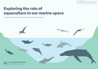
- 1. Final draft 20230704, Version 1 Disclaimer: Please do not use this information for investment decisions. Red text indicates we are awaiting points of clarification from third parties. Feedback: Please email suggestions to enquiries@mcguinnessinstitute.org Exploring the role of aquaculture in our marine space Infographics relating to McGuinness Institute’s OneOceanNZ project as at 4 July 2023
- 2. Final draft 20230704, Version 1 Disclaimer: Please do not use this information for investment decisions. Red text indicates we are awaiting points of clarification from third parties. Feedback: Please email suggestions to enquiries@mcguinnessinstitute.org Preface The McGuinness Institute continues to explore ocean management under our OneOceanNZ project. Given the size and variety of New Zealand’s ocean territory, we decided early in the project to focus on the Marlborough Sounds, with a particular emphasis on the impacts of salmon farming. The only company that undertakes salmon farming in the Marlborough Sounds is New Zealand King Salmon (NZKS). A recent application by New Zealand King Salmon (NZKS), the Blue Endeavour (open ocean) farm application, received a consent to operate in the external waters of Cook Strait (beyond the internal waters of the Marlborough Sounds). That decision has since been appealed by the Department of Conservation (DOC) and the Institute (it is currently subject to resolution of consent appeal). The Institute is primarily a public-good research Institute and to this end we have prepared seven infographics to illustrate the current state of our ocean management in the Marlborough Sounds and Cook Strait. When we initially heard of the Blue Endeavour application, we hoped this would mean moving the internal water farms in the Sounds to Cook Strait. However, this has proved not to be the case. In practice, the internal farms will be used more, in order to support the Cook Strait farms. Further, our assumption that the internal waters were more important to protect than Cook Strait is not correct – both appear to be critically important. As you will learn in the infographics, Cook Strait is not only considered the seabird capital of the world, but is also probably the marine mammal capital of the world. Recent research indicates the importance of the passage way for megafauna, such as whales, and smaller marine mammals, such as dolphins. What has been shocking is the lack of scientific research into ocean flora and fauna. ‘You cannot manage what you do not measure’ illustrates the challenges we face. There is no adequate baseline data for the Marlborough Sounds or Cook Strait and no defined boundary for internal waters versus external waters (although LINZ is hoping to provide this in 2024). The Institute has observed that the ocean management process tends to split into two – policy to protect the ocean and policy to utilise the ocean for commercial benefit. The objective of each ‘prong’ undermines the other, resulting in a question of which one should trump the other. Given the existing failure to collect and report baseline information on flora and fauna, policy to utilise the ocean for commercial benefit will continue to trump policy to protect marine flora and fauna. What makes this so alarming is that New Zealand has the world’s fifth-largest territorial waters to protect, and is responsible for global ecological spots, such as the Marlborough Sounds and Cook Strait. New Zealand is a signatory to the Convention on Biological Diversity, which commits us to protecting 30% of our land, our internal waters and territorial sea by 2030. As we venture further into using our ocean, we need to ensure our public policy and compliance is fit for purpose. In this series we draw strongly on the insights from New Zealand King Salmon’s use of water space in order to improve governance systems and decision-making for New Zealand’s long term. Each infographic aims to form part of the wider picture of New Zealand’s management of the ocean, to help conceptualise the scale and significance of aquaculture management. Infographic 1: Conservation status of selected seabirds, marine mammals and sharks that inhabit Cook Strait and the Marlborough Sounds This infographic shows a range of seabirds, marine mammals and sharks that may be found in Cook Strait and their conservation status. All species listed are protected under either the Mammals Protection Act 1978 (dolphins and whales) or the Wildlife Act 1953 (seabirds and some species of shark). Infographic 2: Marine space and protected areas This infographic provides an overview of our ocean space, highlighting coastal regions and the marine protection zones. Infographic 3: Marine aquaculture legislative history This infographic provides a timeline of marine aquaculture policy in New Zealand, with a focus on salmon. It shows how salmon farming in New Zealand is relatively recent (from the 1980s) and how environmental protection policy has responded to salmon farming, rather than preceded it. Infographic 4: NZKS salmon farms This infographic is a timeline of the lifetimes of each of NZKS’s farms, showing the significant time period permits were granted for. Table 1: NZKS salmon farms – By the numbers provides more detail on each farm (see the second page of this infographic). Infographic 5: A carbon assessment and life-cycle analysis of NZKS’s business model Increasingly businesses need to think about their impact on carbon, both from the perspective of how the climate impacts their business and how their business impacts the climate. Infographic 6: A brief analysis of NZKS – By the numbers An increase in water temperature has significantly impacted NZKS’s profitability and led to high levels of mortality (i.e. salmon become stressed when water temperatures rise above 21°C, see Infographic 7). The graphs illustrate the impact of climate change on NZKS’s business model. Infographic 7: Future of salmon farming – strategic options This infographic illustrates the strategic options for salmon farming in the foreseeable future. Observations from following NZKS applications • Many of the original consents are old, outdated and complex, and do not align with best practice. If a coastal permit has not been surrendered, expired or cancelled, it remains active. • As impacts on the natural environment from salmon farming are complex and often difficult to define, commercial benefits often receive a higher weighting. This is particularly heightened as economic benefits are likely to occur in the short term whereas environmental impacts are long-term. • NZKS has noted in its 2023 annual report (p. 19) that ‘preparations have also commenced on renewal applications for sea farm consents due to expire in 2024. This work will continue into FY24 and beyond.’ Six of the 12 NZKS sites expire in 2024. This includes the only two sites in Queen Charlotte Sound: Otanerau (site 8396) and Ruakaka (site 8274), and three in Pelorus Sound: Crail Bay (sites 8513, and 8515, currently fallowed), Forsyth Bay (site 8110, currently fallowed) and Waihinau Bay (site 8085, currently fallowed). • NZKS farms are permitted to discharge 87,000 tonnes of feed; about 20% of the dry matter consumed is excreted as faeces, see Infographic 6 (Graph 1). This means about 13,500 tonnes of faeces is permitted to be released into the Marlborough Sounds and, if Blue Endeavour proceeds, an additional 4000 tonnes of faeces is permitted to be released into Cook Strait. • There are serious concerns about the poor quality of baseline data and NZKS is not responsible for collecting baseline data in the Marlborough Sounds or Cook Strait. A lack of data collection means farms are more likely to be approved. • Cooler temperatures are critical for salmon farming. But other species have not been researched. Other marine life is also challenged by small changes in temperature. At the same time, the extent of salmon mortality is increasing, arguably making ocean farming unethical as well as inefficient. 2000 tonnes of dead salmon were dumped at the Blenheim landfill in the 2022 calendar year, see Infographic 6 (Graph 6). There is a point at which this should be stopped. • Salmon farming is carbon-intensive. All feed is imported and 59% of salmon is exported (FY2023, p. 11). See Infographic 5. • The current legal system is failing to take account of climate and biodiversity when making decisions. It is not actively seeking or ranking the importance of climate or biodiversity. The precautionary principle is easily ignored and there is a failure to seek out effective baseline and ongoing reporting. • Open ocean farming is expensive (i.e. $150m for 10,000 t p.a). Land-based salmon farming is increasingly a viable option globally and other players are looking to build land-based farms, using a circular economy model (see for example the Mt Cook Alpine Salmon proposal). See Infographic 7. Recommendations Marlborough District Council (MDC) 1. Require all grandfathered marine farms that are active solely due to s10 of the Aquaculture Reform (Repeals and Transitional Provisions) Act 2004 (ARA) and expire in 2024 to be reapplied for, not extended. This includes two Queen Charlotte Sound farms and four Pelorus Sound farms. This is so the sites can revert to a clean and natural environment, with remediation where necessary. Notably, the more recent resource consents are over 100 pages whereas the older expiring consents are between 13 and 51 pages, indicating the older consents (including considerations and conditions) are very basic. It seems timely to let all the old consents expire and start afresh. See Infographic 4, Table 1. 2. Review existing, aged controls on farms to reassess their fitness for purpose based on more modern understandings of the marine environment, as older farms tend to have lower compliance. Build compliance capability and train marine compliance officers specialised in marine management. 3. Lead a citizen-scientist reporting mechanism with DOC and NGOs, where the community shares sightings of nationally critical, nationally endangered and nationally vulnerable seabirds, marine mammals and sharks. Ministry for Primary Industries 4. Help develop a salmon feed industry in New Zealand. 5. Invest in and support land-based farming in preference to ocean farming where possible. In all cases, independently assess environmental risks, costs and benefits. Minister for Oceans and Fisheries 6. Require all grandfathered marine farms throughout New Zealand that are active solely due to s10 of the Aquaculture Reform (Repeals and Transitional Provisions) Act 2004 (ARA) to be reapplied for, not extended. 7. Make Queen Charlotte Sound a marine mammal sanctuary (Type 3 of the Marine Protection Area network) in 2024 (when NZKS farm consents expire, see Infographic 4). Internal waterways are important due to their role in breeding and feeding fish, marine mammals and seabirds – they are the kindergarten of the sea. There is at least one pod of Hector’s dolphins that live in Queen Charlotte Sound, and provided commercial and recreational set net fishing is prohibited, marine mammals gain some form of protection. 8. Develop a coastal occupancy charge or resource rent tax regime (as in Norway) for all marine farmers. See Infographic 7. 9. Review the success of the 2008 Marine Protected Areas: Classification, Protection Standard and Implementation Guidelines. How could they be improved? See Infographic 3. 10. Revisit the Marine Reserves Bill. Progress has stalled. See Infographic 7. 11. Develop a strategy for meeting the Convention on Biological Diversity requirements – protection of 30% of internal waters and 30% of our territorial sea by 2030 (less than seven years away). See Infographic 2. Department of Conservation/Ministry for the Environment 12. Research into marine baseline data of flora and fauna is beyond the current funding model of councils (e.g. MDC and Cook Strait). This could be funded from a national coastal charge or resource rent tax regime, providing funds either directly for councils or to DOC/MfE to undertake research, see 7 above). Species need to be understood in terms of their temperature limits, and how the loss of some species might impact the wider ecosystem. Megafauna and seabirds are critically important, particularly given our global responsibility as one of the seabird and marine mammal capitals of the world. Cook Strait is much more special and unique than we originally thought. 13. MDC should be required to send compliance reports on ocean and internal salmon farming to DOC as well as MPI. LINZ/MFAT 14. Provide public access to a detailed map that clearly delineates internal waters from territorial waters, identifying both boundaries and spatial areas. See Infographic 2. The combination of climate change and global tensions is putting pressure on companies to move from a global efficiency business model to a national self-sufficient business model. For the salmon industry that is likely to mean land-based farms located close to water, either using saltwater or freshwater. Open ocean farming is very expensive and risky. Risks include impacts of rogue waves and storms on infrastructure, impacts on wildlife (such as entangled marine mammals) and the potential negative impact of ocean farming on a company’s social licence to operate. Wendy McGuinness Chief Executive
- 3. Final draft 20230704, Version 1 Disclaimer: Please do not use this information for investment decisions. Red text indicates we are awaiting points of clarification from third parties. Feedback: Please email suggestions to enquiries@mcguinnessinstitute.org Infographic 1: Conservation status of selected seabirds, marine mammals and sharks that inhabit Cook Strait and the Marlborough Sounds Bottlenose dolphin Dusky dolphin Pilot whale (both long and short-finned) Orca/killer whale Common dolphin Hector’s dolphin Māui dolphin This infographic forms part of the McGuinness Institute’s OneOceanNZ project. For references see www.mcguinnessinstitute.org/publications/infographics Key Conservation status1 Nationally critical Nationally endangered Nationally vulnerable Nationally increasing Declining Recovering Relict (small population stabilised after declining) Naturally uncommon Not threatened Data deficient Migrant (non-resident native) Threatened At risk Notes: 1. Sizes are not accurate and are for illustrative purposes only. 2. There are many other endangered fauna that inhabit Cook Strait and the Marlborough Sounds. For example, see other seabirds in Table 5. There are also no fish in this infographic other than the great white and basking sharks, which have been included because they are likely to interact with the Blue Endeavour farms. Great white shark Basking shark Infographic 1, page 1 Humpback whale Blue whale (both pygmy and Antarctic) Southern right whale New Zealand king shag* (only inhabiting the Marlborough Sounds)4 Fairy prion Fluttering shearwater Sooty shearwater Australasian gannet Black-billed gull Black-fronted tern Westland petrel Antipodean albatross Northern royal albatross White-capped albatross Salvin’s albatross White-chinned petrel Buller’s shearwater Hutton’s shearwater ‘New Zealand is a very special place for seabirds. Nearly one-quarter of the world’s seabird species breed in New Zealand – more than anywhere else on earth.’2 Marine Important Bird Areas Important Bird Areas (IBAs) are sites that are recognised as internationally important for bird conservation and known to support key bird species and other biodiversity. The IBA Programme is global in scale and more than 12,000 IBAs have already been identified worldwide, using standard, internationally recognised criteria for selection.3 New Zealand king shag *The New Zealand king shag is not an IBA trigger species for Cook Strait, but has been included as it is still considered a species of significance within the Marlborough Sounds. ‘More than half the world’s whale and dolphin species are found in New Zealand waters, yet very little is known about their migration paths, their behaviour and where they go.’5
- 4. Final draft 20230704, Version 1 Disclaimer: Please do not use this information for investment decisions. Red text indicates we are awaiting points of clarification from third parties. Feedback: Please email suggestions to enquiries@mcguinnessinstitute.org 44 marine reserves As at 2014 (est. 1,726,007 ha) 2 marine parks As at 2014 (est. 1,202,000 ha) 3b, 3c 3 marine protected areas As at 2014 – Fiordland/Te Moana o Atawhenua) (not found) – Kaikōura/Te Tai ō Marokura (not found) – Ngā Motu/Sugar Loaf Islands (749 ha) Eastern North Island Infographic 2: Marine space and protected areas West Coast South Island Fiordland East Coast South Island Southern South Island South Cook Strait North Cook Strait North Eastern Eastern North Island Western North Island 1. 2. 3. 4. 5. 8. 7. 9. 6. West Coast North Island Marine Mammal Sanctuary7 Came into force 2008 2,057,400 ha (as at 18 May 2023) Clifford and Cloudy Bay Marine Mammal Sanctuary8 Came into force 2008 142,716 ha (as at 18 May 2023) Banks Peninsula Marine Mammal Sanctuary10 Came into force 1988 1,431,000 ha (as at 18 May 2023) Catlins Coast Marine Mammal Sanctuary11 Came into force 2008 65,967 ha (as at 18 May 2023) Te Waewae Bay Marine Mammal Sanctuary12 Came into force 2008 35,906 ha (as at 18 May 2023) Auckland Islands – Motu Maha Marine Reserve/Marine Mammal Sanctuary13 Came into force 1993 484,000 ha (as at 18 May 2023) Te Pēwhairangi (Bay of Islands) Marine Mammal Sanctuary6 Came into force 15 December 2021 27,978 ha (as at 22 May 2023) Under the Kaikōura (Te Tai o Marokura) Marine Management Act 2014 two sanctuaries exist to provide special protection for marine mammals:9 Te Rohe o Te Whānau Puha Whale Sanctuary and Ōhau New Zealand Fur Seal Sanctuary 1. 2. 3. 4. 5. 6. 7. 8. II: 9 coastal marine biogeographic regions2 I: Marine area1 VI: Maritime boundary definitions illustrated23, 24, 25, 26 IV: 8 marine mammal sanctuaries4, 5 III: Marine protected areas (MPAs) network3 Exclusive Economic Zone (EEZ) Continental Shelf (CS) High Seas Continental Shelf Shoreline Continental Slope Contiguous Zone (CZ) Continental Rise Deep Seabed Territorial Sea (TS) Internal Waters (IW) Territorial Sea Baseline (TSB)Territorial Waters 12 nm 24 nm 200 nm This infographic forms part of the McGuinness Institute’s OneOceanNZ project. For references see www.mcguinnessinstitute.org/publications/infographics. V: About ‘New Zealand has the fifth largest EEZ (roughly 430 million hectares) in the world, about 15 times the size of our land mass’, which means ‘[u]nder international law we have “sovereign rights” over this area’. ‘New Zealand’s marine ecosystems and species are highly diverse. This is due to a combination of factors, including our geological history and isolation, the range and complexity of habitats, and the influence of major ocean currents. The result is a wide variety, if patchy distribution, of marine plants and animals.’ ‘Marine scientists estimate that perhaps as much as 80% of New Zealand’s indigenous biodiversity is found in the sea. While many of our marine fish also occur in other countries’ seas, many of our benthic (bottom-dwelling) marine species are found only in New Zealand waters. Evaluating the state of New Zealand’s marine biodiversity is difficult due to the very limited information we have about deep-sea species.’14 Convention on Biological Diversity ‘Ensure and enable that by 2030 at least 30 per cent of ... inland water, and coastal and marine areas, especially areas of particular importance for biodiversity and ecosystem functions and services, are effectively conserved and managed through ecologically representative, well- connected and equitably governed systems ...’15 ‘On March 4, 2023, and after nearly two decades of negotiations, UN member states, including Aotearoa New Zealand, reached the successful conclusion of negotiations for a new global treaty on conservation and sustainable use of marine biological diversity of areas beyond national jurisdiction, commonly known as the high seas … Nearly two-thirds of the ocean lies outside any country’s national jurisdiction or control. These areas include the sea column beyond countries’ EEZs and the seabed beyond countries’ continental shelves … The new agreement will help to protect biodiversity in these areas in two main ways: by enabling the international community to establish marine protected areas, and by setting clear procedures and requirements for assessing the environmental impacts of activities.’16 By the numbers 30% 9.5% 5th 80% Where we need to be by 2030 New Zealand has agreed to conserve and manage 30% of inland water and coastal and marine areas by 203015 Where we are now in 2023 New Zealand has the fifth-largest EEZ in the world (roughly 430 million hectares)14 80% of New Zealand’s indigenous biodiversity is in the sea14 New Zealand has protected about 9.5% of its territorial sea17 1. Biogeographic regions are areas constituting a natural ecological community with characteristic flora, fauna, and environmental conditions and bounded by natural rather than artificial borders.2 2. Illustration excludes a number of small islands. 3. Size in total is estimated as 18,109,595 ha.2 Type 1 (high-level protection for flora and fauna) Type 1 areas protected (est. 1,726,007 ha)19 To date this type of protection covers the 44 marine reserves established under the Marine Reserves Act 1971. DOC is responsible for the implementation, management and monitoring of marine reserves.20 1. A marine protected area (MPA) is protected because it is considered unique or rare and/or a function of how the area serves marine life, and therefore fishing is not allowed.3a 2. Illustration excludes a number of small islands. Type 2 (low-level protection from fishing) Type 2 areas protected (at least 1,202,749 ha) Includes 2 marine parks, 3 marine protected areas and a range of other small areas (such as submarine cable and pipeline protection zones). These areas have been established outside of the Marine Reserves Act 1971 and put in place protections against the adverse effects of fishing under the Marine Protected Areas: Classification, Protection standard and implementation guidelines (2008).21 Type 3 (anything else) Includes the 8 marine mammal sanctuaries (see IV above) and any other form of protection that might exist in the network that does not need to meet the biodiversity requirements set out in the 2008 protection standard (mentioned under Type 2).22 Note: The Fisheries Act 1996 provides for customary fisheries (e.g. mātaitai reserves). MPAs network levels of protection Protections outside the MPAs network 1. Illustration excludes a number of small islands. 2. Type 3 areas protected include marine mammal sanctuaries which cover a total est. 4,244,967 ha. See description of Type 3 areas below. Internal waters (landward of the TSB). LINZ is hoping to provide more detail in 2024, but the largest internal waterways are likely to be Marlborough Sounds, Kaipara Harbour, Hauraki Gulf and/or Thames Harbour.1a Territorial sea (12-mile limit) (est. 18,100,000 ha)1b Exclusive Economic Zone (est. 430,000,000 ha)1c Continental shelf (170,000,000 ha of seabed outside the existing EEZ) Outer limits of the extended continental shelf New Zealand-Australian 2004 delimitation treaty Infographic 2, page 1 There is a variety of legislation and protections which cover the classification and management of marine protected areas in New Zealand.18
- 5. Final draft 20230704, Version 1 Disclaimer: Please do not use this information for investment decisions. Red text indicates we are awaiting points of clarification from third parties. Feedback: Please email suggestions to enquiries@mcguinnessinstitute.org 1980 1970 1990 2000 2010 2020 2030 Infographic 3: Marine aquaculture legislative history 1981 July Policy for ocean ranching of quinnat (king) salmon approved by Minister of Fisheries Aquaculture objective: • To encourage rational development of an ocean ranching quinnat salmon fishery.1 1971 September Marine Reserves Act 1971 This Act is administered by the Department of Conservation. • In September 2000 the Department of Conservation released a discussion document on a new Bill. It had its first reading in Parliament on 7 June 2002. • A report was prepared for the Local Government and Environment select committee on 12 December 2012. The first reading was then terminated. 1983 27 September Marine Farming Amendment Act 1983 • The definition of a ‘fish’ under the Marine Farming Act 1971 extended to include salmon.2 • Permitted sea cage farming of salmon with a licence or lease from the Crown (lease or licence maximum duration of 14 years).3 1991 22 July Resource Management Act 1991 • Restated and reformed the law relating to the use of land, air and water.4 • Repealed most of the provisions of the Marine Farming Act 1971.5 • Deemed existing leases and licences to be coastal permits and allowed them to continue under the same terms and conditions.5 • Coastal permits to be a maximum duration of 35 years.6 • Removed the right of renewal on expiry.7 1993 7 July Resource Management Amendment Act 1993 • Required marine farmers to obtain both a coastal permit from local authorities to occupy coastal space and a marine farm licence from the Minister of Fisheries.8 1994 5 May New Zealand Coastal Policy Statement 1994 • Created in accordance with a requirement under the RMA 1991.9 1999 14 October Animal Welfare Act 1999 Required an owner of an animal (including any fish): • To ensure that the physical, health, and behavioural needs of the animal are met • To ensure that an ill or injured animal receives treatment that alleviates any unreasonable or unnecessary pain or distress it is suffering.10 2002 25 March Resource Management (Aquaculture Moratorium) Amendment Act 2002 • Suspended the granting of coastal permits for aquaculture activities. • Opportunity for regional coastal plans and proposed regional coastal plans to provide for aquaculture management areas where aquaculture activities can be undertaken only as a controlled or discretionary activity, and areas where aquaculture activities are prohibited. • Allowed for consequential amendments to fisheries legislation.11 2004 18 March Resource Management (Aquaculture Moratorium Extension) Amendment Act 2004 • Extended the 2002 moratorium to 31 December 2004.12 2004 21 December Aquaculture Reform (Repeals and Transitional Provisions) Act 2004 • Repealed the Marine Farming Act 1971 and parts of the Fisheries Amendment Act of 2004.13 • Amended the Resource Management Act 1991.14 • Deemed all existing leases and licences to be a ‘coastal permit’ under the RMA (s 10). 2010 3 December New Zealand Coastal Policy Statement 2010 • Replaced the NZCPS 1994.15 2011 1 October Resource Management Amendment Act (No. 2) 2011 • Designed to reduce costs, delays and uncertainty; promote investment in aquaculture development; and enable integrated decision-making.16 • Coastal permits for aquaculture are to have a minimum term of 20 years (unless a shorter term is requested by the applicant or is required to manage effects). In the absence of a date specified, coastal permits lapse after three years if they are not implemented.17 • Removed the requirement for an aquaculture management area (AMA).18 2022 15 November Natural and Built Environment Bill proposed Aquaculture objectives: • More certain and efficient space allocation and consenting processes. • Promoted investment confidence providing for new opportunities (such as open ocean aquaculture). • Enabled the aquaculture industry to adapt more readily to climate change, cumulative effects and biosecurity issues.20 2023 27 June Natural and Built Environment Report • Select Committee report due.21 See case study in Infographic 4: NZKS salmon farms This infographic forms part of the McGuinness Institute’s OneOceanNZ project. For references see www.mcguinnessinstitute.org/publications/infographics Key Legislation RMA (including secondary legislation) Marine/animal specific Natural and Built Environment Bill 2020 27 July Resource Management (National Environmental Standards for Marine Aquaculture) Regulations 2020 • These regulations only apply to the replacement of coastal permits for existing marine farms. New marine farms formed after the commencement of these regulations, such as Blue Endeavour, rely on the decision- maker to take account of all effects.19 • In March 2021, the following guides were published by Fisheries New Zealand (i) User Guide (ii) Plan Alignment Guide (iii) Consenting Guide Infographic 3, page 1
- 6. Final draft 20230704, Version 1 Disclaimer: Please do not use this information for investment decisions. Red text indicates we are awaiting points of clarification from third parties. Feedback: Please email suggestions to enquiries@mcguinnessinstitute.org Infographic 4: NZKS salmon farms 1985 1995 2005 2015 2025 June 2023 2045 2035 2055 Waihinau Bay Otanerau Te Pangu Clay Point Forsyth Bay Crail Bay* Blue Endeavour** 1985 (year established)1 19891 19901 19921 19941 20071 20111 2011 2013 2014 20151 20492 20492 20492 20572 20161 20161 Nov 2022 20242 20242 20242 20242 20242 20362 20362 Ruakaka EPA/BOI: NZKS lodges requests for two plan changes and applications for resource consents for nine farms (see 1–9 in Table 1)6 BOI denies requests for plan changes and applications for resource consents at:7 Supreme Court grants EDS Appeal denying plan change and resource consent at:8 1. Kaitapeha 2. Ruaomoko 3. Kaitira 4. Taipipi 5. White Rock Horse 6. Papatua Approved by BOI9 Approved by BOI9 Approved by BOI9 This infographic forms part of the McGuinness Institute’s OneOceanNZ project. For references see www.mcguinnessinstitute.org/publications/infographics See Table 1: NZKS salmon farms – By the numbers for more detail on each farm. 7. Ngāmāhau 9. Kopāua/Richmond 8. Waitata * Crail Bay includes two sites. One site is for a seaweed trial and the other is for salmon farming.4 ** NZKS has reported that If Blue Endeavour is to progress, the three fallowed farms in the Pelorus Sound/ Te Hoiere will be used as nursery sites for nine months of the year.5 Key Location Queen Charlotte Sound/ Tōtaranui Pelorus Sound/ Te Hoiere Tory Channel/ Kura Te Au Cook Strait Current status (as at May 2023) Permitted site – active Permitted site – fallowed3 Under appeal by DOC and McGuinness Institute (subject to resolution of consent appeal) Proposed farms rejected Farms rejected by 2013 Board of Inquiry (BOI) Farm rejected by 2014 Supreme Court Internal waters Territorial waters Cook Strait Ferry Cook Strait N Ruakaka Crail Bay Forsyth Bay Waihinau Bay Te Pangu Clay Point Otanerau Waitata Kopāua/Richmond Okiwi Bay Blue Endeavour Ngāmāhau Tory Channel is approximately 1,250m wide at this point D’Urville Island Arapawa Island Pelorus Sound Queen Charlotte Sound Tory Channel 2. Marine zones, reserves and sanctuaries key Coastal Marine Zone 1 (CMZ1) New aquaculture activity is prohibited. Coastal Marine Zone 2 (CMZ2) Aquaculture activity is permitted once consent is granted by the Marlborough District Council. Coastal Marine Zone 3 (CMZ3) A special zone that is created to allow for a non-complying activity. The Marlborough District Council can grant a coastal permit if the non-complying activity meets specific requirements set by the Council. See the 2013 BOI decision. Kokomahua (Long Island) Marine Reserve Marine Mammal Sanctuary 1. Salmon farm key A permitted NZKS salmon farm in operation or fallowed An existing NZKS salmon farm not in operation. NZKS purchased the two Crail Bay farms from Pacifica in order to purchase their salmon. NZKS has told the Board of Inquiry in 2012 that both farms are uneconomic and will not be operated except for research in the future. Skretting Limited Finfish Research Facility (Permit U160029). This consent expires 26 January 2034. Map of NZKS farms10 Infographic 4, page 1
- 7. Final draft 20230704, Version 1 Disclaimer: Please do not use this information for investment decisions. Red text indicates we are awaiting points of clarification from third parties. Feedback: Please email suggestions to enquiries@mcguinnessinstitute.org Infographic 4, Table 1: NZKS salmon farms – By the numbers Description Area (ha) Feed (t) NZKS salmon farms with resource consents Site number Resource consent Note: Date granted refers to the original consent date No of pages1 Related resource consents Note: These are surrendered, expired or cancelled Pen surface area Pen boundary area Marine farm boundary area Overall consent area Permitted feed discharge pa Internal waters (in the Marlborough Sounds) Queen Charlotte Sound/Tōtaranui 1. Otanerau (active) (one farm)2 8396 (exp. 2024) MFL446 (granted 11 July 1990, p. 17). Permitted species: a mix, p. 1 37 No copy at MI: 010127, 950653, 981011, 060822, 080726, 160039, 090002. 2.000 (p. 2) 2.000 (p. 2) 3.250 (p. 2) 3.250 (p. 2) NF U040217 (granted 22 April 2005, p. 9). Permitted species: a mix, p. 1 43 2.000 (p. 2) 2.000 (p. 2) 7.550 (p. 1) 7.550 (p. 1) 4000 (p. 34) MPE763 (granted 9 January 2006, MOF [MDC PC, 15 June 2023]). Original resource consent not found, but relied upon for activity. 15 (in part) RCNF RCNF RCNF RCNF RCNF 2. Ruakaka (active) (one farm)3 8274 (exp. 2024) U200301 (granted 15 October 2020, p. 10, replaces part of U021247 enables subsurface anchoring structures, p. 1) 13 No copy at MI: 980543, 950656, 060822, 080726, 001268, 090002. 2.000 (see MFL001, p. 6) NF 11.300 (p. 1) 11.300 (p. 1) NF U021247 (granted 19 March 2004, p. 18; exp. 7 May 2021, p. 1. See issues raised in Endnote 3 36 2.000 (p. 2) 2.000 (p. 2) 11.303 (p. 2) 11.303 (p. 2) 4000 (p. 11) MFL001 (granted 29 September 1975, p. 23). Permitted species: a mix, p. 5 48 2.000 (p. 6) 2.000 (p. 6) 4.500 (p. 6) 4.500 (p. 6) (repeats 4000 above) Pelorus Sound/Te Hoiere 3. Crail Bay (seaweed, NZKS FY23, p. 20) (one farm) 8513 (exp. 2024) U090660 (granted 9 July 2010, p. 8). Permitted species: king salmon, p. 4 (note this and U090634 below are in the same decision) 40 No related resource consents 0.391 (p. 31) 4.500 (p. 31) 4.500 (p. 14) 4.500 (p. 14) 1770 (p. 4) MFL048 (granted 27 June 1978, p. 23). This consent does not allow salmon farming, but is required for U090660 to operate, see pp. 4, 39 of U090660) 34 No related resource consents NF NF 4.500 (p. 8) 4.500 (p. 8) NF U130743 (granted 4 April 2014, p. 20) (enables a feed barge, p. 2) 48 No related resource consents NF NF NF NF NF 4. Crail Bay (fallowed) (one farm)4 8515 (exp. 2024) U090634 (NZKS) (granted 9 July 2010, p. 8). Permitted species: king salmon, p. 3. (note this and U090660 above are in the same decision) 40 No related resource consents 0.391 (p. 22) 6.400 (p. 22) 6.400 (pp. 22, 30) 6.400 (pp. 22, 30) 1440 (p. 3) MFL032 (Crail Bay Trust) (granted 18 May 1977, p. 24). This consent does not allow salmon farming, but is required for U090634 to operate, see pp. 3, 30 of U090634. Permitted species: a mix, p. 11 44 No related resource consents NF NF 6.400 (p. 10) 6.400 (p. 10) NF 5. Forsyth Bay (fallowed) (one farm)5 8110 (exp. 2024) U040412 (granted 4 May 2005, p. 3). Permitted species: a mix, p. 17 24 No copy at MI: 950523, 980454, 060822, 080726, 130789, 180278, 090002. 2.000 (p. 5) 2.000 (p. 17) 6.000 (p. 6) 6.000 (p. 6) 4000 (p. 5) MFL239 (granted 30 June 1982, p. 14). Permitted species: a mix, p. 3 46 2.000 (p. 7) 2.000 (p. 7) 6.000 (p. 7) 6.000 (p. 7) (repeats 4000 above) 6. Kopāua/Richmond (fallowed) (new, one farm) 8633 (exp. 2049) U140295 (granted 14 March 2013, p. 68). Permitted species: king salmon, p. 73 105 No copy at MI: 170579. 1.500 (p. 75) 5.000 (p. 3) 16.487 (p. 98) 16.487 (p. 98) 4000 (p. 78) 7. Waihinau Bay (fallowed) (one farm)6 8085 (exp. 2024) MFL456 (granted 24 April 1991, p.20). Permitted species: a mix, p. 3 51 Hard copy at MI: No copy at MI office: 990126, 060822, 080726, 180707, 090002. 2.000 (p. 7) 4.000 (p. 7) 8.000 (p. 6) 8.000 (p. 6) NF U000956 (granted 18 October 2000, p. 11); exp. in 2010, but High Court Judgement (9 May 2012) extended feed until December 2024 under the ARA. Re-anchoring structures is less clear. 11 No related resource consents NF NF NF NF 3000 (p. 9) 8. Waitata (active) (new, one farm) 8632 (exp. 2049) U140294 (granted 14 March 2013, p. 149). Permitted species: king salmon, p. 155 187 No copy at MI: 170579, 180735, 180778. 1.500 (p. 157) 3.500 (p. 85) 16.500 (p. 83) 16.500 (p. 83) 6000 (p. 160) Tory Channel/Kura Te Au 9. Clay Point (active) (one farm) 8407 (exp. 2036) U160675 (granted 9 November 2016, p. 20). Permitted species: king salmon, p. 17 23 Hard copy at MI: 060926. No copy at MI office: 001268, 950655, 060822, 080726, 090002, U080054 2.000 (p. 4) 3.150 (p. 4) 19.644 (p. 4) 19.644 (p. 4) 4500 (p. 6) 10. Ngāmāhau (active) (new, one farm) 8634 (exp. 2049) U140296 (granted 14 March 2013, p. 101). Permitted species: king salmon, p. 107 136 Hard copy at MI: 150355 (mentioned in Appendix 3). 1.500 (p. 109) 3.183 (p. 37) 16.500 (p. 37) 16.500 (p. 37) 4000 (p. 112) 11. Te Pangu (active) (one farm)7 8408 (exp. 2036) U150081 (granted 26 January 2016, p. 16). Permitted species: king salmon, p. 1 18 No copy at MI: 950654, 010142, 981072, 040813, 060822, 080726, 090841, 100656, 110410, 120226, 130472, 090002. 1.500 (p. 1) 9.027 (p. 1) 21.092 (p. 1) 21.092 (p. 1) 6000 (p. 1) Total (11 sites) — — — 16.782 44.760 137.226 137.226 42,710 External waters (in Cook Strait) 12. Blue Endeavour8 (two farms) Not yet designated U190438 (granted 10 November 2022, p. 120). Permitted species: king salmon, p. 1. Subject to resolution of consent appeal 199 No related resource consents 12.000 (p. 123) 2x6 pens (6 ha) 380.000 (p. 6) 2x2 areas (190 ha) 380.000 (p. 6) 2x2 areas (190 ha) 1000.000 (p. 6) 20,000 (p. 8) Total (12 sites) — — — 28.782 424.760 517.236 1137.226 62,710 This table forms part of the McGuinness Institute’s OneOceanNZ project. For references see www.mcguinnessinstitute.org/publications/infographics. Bold italics: Highlight key data relied upon in order for the site to operate as it does today. Infographic 4, Table 1, page 1 ARA: Aquaculture Reform (Repeals and Transitional Provisions) Act 2004 App.: Appendix MDC: Marlborough District Council MFL: Marine farming licence MI: McGuinness Institute Office MOF: (previous) Ministry of Fisheries MPE: Marine farming permit NF: Not found in resource consent PC: Personal correspondence PR: Planners Report RCNF: Resource consent not found by MDC or MPI U#: A resource consent application made to MDC Abbreviations: Note: There are errors in the MDC Smart Map marine farms website summary.9 These are likely to be corrected by MDC in the next few weeks. Given this, the Institute has sought the actual active resource consents, and relied solely on those documents. If using the Smart Map marine farms website summary, please note the application number is also the resource consent number (also known as a coastal permit). MDC has been able to supply all of these except MPE763. MPE763 is an historical but active resource consent that neither MDC or MPI have been able to find.10 The Institute has uploaded all other resource consents to our website. The page number where the data has been collected can be found in the table above. Interestingly, six farms are permitted to farm only king salmon, whereas six can farm other fish (such as snapper) or marine flora (such as seaweed).
- 8. Final draft 20230704, Version 1 Disclaimer: Please do not use this information for investment decisions. Red text indicates we are awaiting points of clarification from third parties. Feedback: Please email suggestions to enquiries@mcguinnessinstitute.org Scope 2 INDIRECT Scope 3 INDIRECT Scope 3 INDIRECT Scope 1 DIRECT Reporting company Upstream activities Downstream activities Indirect transportation of salmon biomass (flown/shipped/trucked around NZ) Indirect transportation of salmon biomass (flown/shipped overseas) Franchises Retail (supermarkets) Consumer use of product (cooking, cooling, etc.) Packaging (including rebranding) Pens (from Chile*) and other equipment Transportation of goods from overseas to New Zealand Purchased electricity consumed by NZKS (heating and cooling) Feed from Chile & Australia A: A carbon assessment – Exploring Scope 1, 2 and 3 for New Zealand King Salmon’s business model B: Life-cycle analysis – Exploring New Zealand King Salmon’s business model Business travel Overseas/NZ Production and transport of diesel Transportation of waste (e.g. fish mortalities to Blenheim landfill) Company facilities and equipment Direct transportation (company cars, boats and trucks) Plant and processing facilities and labs Diesel (used to run equipment to keep sea pens cold) 19,593 t FY2019 (p. 13, 85)** 2954 t (est) $17.5 m (cost) FY2019 (pp. 13, 82)*** 3919 t (est) (20% of feed)**** 9013 t (Live weight) FY2019 (p. 82) 7520 t FY2019 (p. 12) Cool water is pumped up to the surface of farm pens. FY2019 (p. 10) 4060 t (54%) FY2019 (p. 59) FEED VOLUME 18,616 t (est) FY2023 (pp. 10, 85)** MORTALITY 4381 t (est) $25.9 m (cost) FY2023 (p. 85)*** FAECES 3723 t (est) (20% of feed)**** HARVESTED BIOMASS 6834 t (Live weight) FY2023 (p. 85) SALES VOLUME 5837 t FY2023 (p. 9) SALMON FEED FY2019 (p. 42) DIESEL UPWELLING SYSTEMS Cool water is pumped up to the surface of farm pens. FY2019 (p. 10) OVERSEAS 3443 t (59%) IMPORTS Feed largely from Tasmania, Australia. FY2023 (p. 7) Transportation of waste (e.g. heads and fins) Sources: NZKS annual reports (FYxxxx) FY2019 (p. 42) Feed from Chile and Australia. Pens from Chile. FY2019 (p. 86)* Major countries include Australia, Japan and the US. FY2023 (pp. 13, 91) * Imports: See FY2019 (p. 86); FY2023 (p. 7). See also Winter, C. (8 January 2015). Chilean firm wins King Salmon contract. Stuff. Retrieved 13 June 2023 from www.stuff.co.nz/business/farming/aquaculture/64750652/chilean-firm-wins-king-salmon-contract ** Feed volume in tonnes: [Total live weight harvested + mortality (est, see ***)] x Feed conversion ratio (FCR) (FY2023, pp. 10, 85: [6834 t + 4381 t (see very estimated figure in *** below)] x 1.66 = 18616 t) (FY2019, p. 13). *** Mortality in cost and tonnes: [Feed volume p.a. divided by FCR] - harvest volume p.a. (FY2019, p. 13: [19593 t / 1.8] - 7931 t = 2954 t). 2023: We have used FY2019 figures to estimate the relationship between cost of mortality and tonnes of mortality. (FY2023: [2019 $17,465,000 cost / 2954 t = $5,912 cost of mortality per t, then 2023 $25,943,000 cost / 2019 $5,912 cost of mortality per t = 4381 t (a rough estimate)). Note: We could not find feed volume in either FY2022 or FY2023, and we could not rely on FY2021 (as it was a seven-month financial year) or FY2020 (as the financial results were significantly impacted by COVID-19). **** Faeces: NZKS BOI June 2012 Wybourne: ‘Skretting expects that about 20% of the dry matter consumed is excreted as faeces, for NZ King Salmon current salmon diet range’. Faeces estimate based on 20% of feed volume (FY2023: 18616 (pp. 10, 85) (est, see **) x 0.2 = 3723) (FY2019, p. 13: 19,593 x 0.2 = 3919) Assumptions and estimates 2019 2023 Infographic 5: A carbon assessment and life-cycle analysis of NZKS’s business model This infographic forms part of the McGuinness Institute’s OneOceanNZ project. For references see www.mcguinnessinstitute.org/publications/infographics Infographic 5, page 1
- 9. Final draft 20230704, Version 1 Disclaimer: Please do not use this information for investment decisions. Red text indicates we are awaiting points of clarification from third parties. Feedback: Please email suggestions to enquiries@mcguinnessinstitute.org Infographic 6: A brief overview of NZKS What’s going up What’s going down • Feed conversion ratio (see Graph 2) • Harvest biomass (see Graph 12) • Average gilled and gutted (G&G) harvest weight (see Graph 13) What’s staying the same • Inventories, biological and non-current biological assets (approx. from 2017, see Graph 21) 2017 185 t 845 t 952 t 661 t 974 t 1998 t 2018 2019 2020 2021 2022 Tonnes of salmon dumped in Blenheim landfill by calendar year (see Graph 5) • Cost of mortality over a financial year (see Graph 3) • Mortality as a percentage of biomass at year end (see Graph 4) • Tonnes of salmon dumped in Blenheim landfill by calendar year (see Graphs 5 and 6) • Average revenue per tonne sold (see Graphs 9 and 11) • Average cost per tonne sold (see Graphs 10 and 11) • Feed cost ($/kg of feed) (see Graph 13) • Freight costs (see Graph 15) • Auditor fees (see Graph 19) This infographic forms part of the McGuinness Institute’s OneOceanNZ project. For references see www.mcguinnessinstitute.org/publications/infographics Infographic 6, page 1
- 10. Final draft 20230704, Version 1 Disclaimer: Please do not use this information for investment decisions. Red text indicates we are awaiting points of clarification from third parties. Feedback: Please email suggestions to enquiries@mcguinnessinstitute.org Infographic 7: Future of salmon farming – strategic options Pathways used Water used Technology used Marine-based farming Adult only Salmon farming in New Zealand Internal waters For example, the 11 NZKS farms in the Marlborough Sounds. See details in Table 1: NZKS salmon farms – By the numbers, Infographic 4. Tanks using fresh and/or salt water For example, NZKS has a smolt facility on land at Tentburn, Canterbury, using freshwater to grow smolt that are later transported to farms in the Marlborough Sounds. Saltwater pens Recirculating aquaculture systems (RAS) For example, Mt Cook Alpine Salmon proposal (which also includes a part flow- through system)1 Flow-through systems (RTS)2 This can be saltwater or freshwater. Open ocean farming For example, the NZKS Blue Endeavour in the Cook Strait. See details in Table 1: NZKS salmon farms – By the numbers, Infographic 4. Land-based farming Smolt and adult 1. Higher sea surface temperatures and concerns over biodiversity. This is likely to mean that companies will need to re- establish their social licence to operate3 2. More applications for ocean farming, and land-based farming using water from the ocean4 3. More compliance costs for marine-based farming5 This infographic forms part of the McGuinness Institute’s OneOceanNZ project. For references see www.mcguinnessinstitute.org/publications/infographics 4. Coastal charges/resource rent tax applied uniformly across all marine-based farms (e.g. Norway has introduced a resource rent tax, meaning that the marginal tax rate on aquaculture will increase from 22% to 47%)6 5. Feed costs and supply issues increase, solution is to produce feed in New Zealand7 6. Cost of salmon farming infrastructure increase (e.g. MPI suggests the cost of establishing an entire value chain for an open ocean salmon farm is $150 million or more for an operation that can produce 10,000 tonnes)8 7. Increased legislation of marine space and protected areas9 8. New rules aligning all marine farms under a similar set of rules 9. More government support and incentives for land-based farming Potential changes that may emerge in the next five years Infographic 7, page 1