ii
This is version1.4.4 of this resource, released in August 2018.
Information on the latest version and updates are available on the
project homepage: http://textbooks.wmisd.org/dashboard.html
Attribution-NonCommercial-ShareAlike CC BY-NC-SA
The text of this book is licensed under a Creative Commons
NonCommercial-ShareAlike (CC-BY-NC-SA) license as part of
Michigan’s participation in the national #GoOpen movement.
4.
The Michigan OpenBook
Project
Project Manager: Dave Johnson,
Wexford-Missaukee Intermediate School
District
6th Grade Team Editor: Amy Salani,
Wexford-Missaukee Intermediate School
District
6th Grade Content Editor: Carol Egbo
6th Grade World Geography Authors
Brian Dufort, Shepherd Public Schools
Sally Erickson, Livonia Public Schools
Matt Hamilton, East Jordan Public
Schools
David Soderquist, Three Rivers Schools
Steve Zigray, Concord Public Schools
About the Authors - 6th Grade World Geography
Brian Dufort
Shepherd Public Schools
Odyssey MS/HS
Brian is originally from Midland, MI and is a graduate of Northern Michigan University.
He has spent his entire teaching career at Odyssey Middle/High School, an alternative
education program in the Shepherd Public School system. In 2001, his environmental
studies class was one of seven programs from the United States and Canada to be
chosen as a winner of the Sea World/Busch Gardens Environmental Excellence
Award. Brian is also the Northern Conference director of the Michigan Alternative Ath-
Sally Erickson
Livonia Public Schools
Cooper Upper Elementary
Sally has taught grades 3-6, as well as special education. She has served as
a district literacy leader for many years and participated in the Galileo Lead-
ership Academy in 2001-03. She is proud to be a teacher.
Matt Hamilton
East Jordan Public Schools
East Jordan Middle School
Matt grew up in Cadillac, MI. He holds a bachelor and masters degree from Michigan
State University. He currently teaches middle school History and Geography. Matt
started and advises a club at his school called the Shoe Club to inspire his students to
Dream Big. His wife and two daughters enjoy traveling and spending time in the out-
doors.
5.
David Soderquist
Three RiversPublic Schools
Three Rivers Middle School
For the Past 11 years David has taught 6-8 grade Social Studies for Three Rivers
Middle School. He serves as Department Head, School Improvement Member and
Social Studies Rep for his area. Over the past few years he has completed his Mas-
ters Degree in Curriculum and Instruction and become a state recognized Instruc-
tional Coach.
Steve Zigray
Concord Community Schools
Concord Middle School
Steve Zigray is a 6th grade teacher. He holds a Bachelor’s Degree from Central Michi-
gan University and a Masters Degree in K-12 Administration from Eastern Michigan
University. Honors Steve has been awarded are the 2001 Junior Achievement Educa-
tor of the Year and he was nominated for Jackson Magazine’s, Educator of the year in
2014. He has also coached high school and middle school sports, worked on various
school improvement committees, wrote the 6th grade Common Assessment tests for
Jackson County ISD and is an active member in the community as well as the PTO. He
lives in southeast Jackson County with his beautiful wife and three fantastic daugh-
ters.
6.
Chapter 1
Studying
Geography
QUESTIONS TOGUIDE INQUIRY
1. What is geography?
2. Why do we study geography?
3. What tools do geographers use?
4. What is geographic inquiry?
5. Why do we need to think globally?
Image source: http://upload.wikimedia.org/wikipedia/commons/0/05/Land_ocean_ice_cloud_1024.jpg
7.
This year youwill be studying the geography of the
world in which we live. Right off the bat, think about
what you already know about geography - it could be
things you have learned in other classes at other
grade levels, things you’ve heard from your parents,
or things you’ve heard from teachers. What comes to
mind? Is it maps? Latitude and longitude? What
else?
Section 1
QUESTIONS TO GUIDE INQUIRY
1. What is geography?
2. Why do we study geography?
3. What tools do geographers use?
4. What is geographic inquiry?
5. Why do we need to think
globally?
What is Geography Anyway?
6
Interactive 1.1 What is
Geography?
Take a moment to view this brief
video online and then answer the
question in the blue box to the
best of your ability
What is Geography?
8.
Quite simply, “Geography”broken down means “to study the
earth” and throughout your studies in the book, we are going to
expand on this definition.
If you were to go home and ask your parents about
geography they may have studied in school, they might say when
they were students they memorized the states and capitals, or
major countries in the world. This is only one part of what
geography really is however. To study geography is to study
where we are in the world; what the world around us is like. It is
the study of who lives there and why. It can be the study of foods
people eat, clothes they wear, cars they drive, and homes they
live in. It is the study of climate, land, economies, politics and
culture. Like many of the disciplines in the social sciences, it is a
discipline that weaves the threads of the others.
When studying geography we are going to focus on two
aspects - physical geography and human geography. When
we look at landforms, vegetation, climate, bodies of water such
as rivers, lakes, and seas, we will be studying physical geography,
the study of natural and physical characteristics. Human
geography is different but related. It is the study of how people
interact with the earth. It also includes culture, migration
patterns, and patterns of population.
The study of something often begins with a question. This
book itself is set around a series of questions, some smaller,
some larger. Over the course of this entire world geography
book, you will explore one major
question: “How are we, as members
of a global society, connected?” In
each section of this book, we will
bring you back to this idea and have
you record any new thoughts and
ideas that occur to you based on what
you have explored in this book and
through class instruction and
discussion. You will be doing this as
part of an interactive digital journal
which you can view here.
7
Interactive 1.2 Interactive
Journal
Please note: once you have
created your own copy of this
document, this widget will only
return you to the blank copy. You
will need to access yours by
opening from your own Google
Document.
9.
While the teacherswho have put this book together have
provided some questions to focus your study, you will be asked
and encouraged to come up with your own questions as well.
The process you will be guided through is known as inquiry - the
act of seeking out information.
How are the people in the picture above dressed? Why might
people in this place wear clothing like this? If you notice the fur
hoods surrounding their faces you might think it is cold where
they live. If you investigated further, you would learn that this is a
historical photo of an Inupiat family from Alaska. It might lead you
to ask more questions - are there times of the year when they
would wear lighter clothing? What is the average temperature
during winter? What is the average temperature during the
summer months? One question about why people dress the way
they do could lead to a series of new inquiries in the desire to
learn more.
View the image
gallery above -
practice asking
geographic
questions based
on the images
shown.
8
Image source: http://upload.wikimedia.org/wikipedia/commons/8/8c/
Inupiat_Family_from_Noatak,_Alaska,_1929,_Edward_S._Curtis_(restored).jpg
Image source: https://farm4.staticflickr.com/
3302/3570407917_585dd5a1e8_o.jpg
Gallery 1.1 Image Gallery
10.
As you continueto study “the basics,” this chapter serves
not just as an introduction to your studies this year, but also as a
“how to use this book” in case this is your first time using a digital
textbook to explore Social Studies. You will have an opportunity
to practice most of the things you will be asked to do in this book
during this introductory chapter. The last thing you will be asked
to do is to once again revisit the question we posed at the start of
this section. This time, you are going to write a brief response.
9
What is Geography, anyway?
11.
You might nowhave a better idea about
what geography is, but why do we study it?
There are many reasons. Take a moment to
view the video clip here about how some
people use geography in their chosen
professions.
Section 2
QUESTIONS TO GUIDE
INQUIRY
1. What is geography?
2. Why do we study
geography?
3. What tools do
geographers use?
4. What is geographic
inquiry?
5. Why do we need to
think globally?
Why Do We Study Geography?
10
Image source: http://upload.wikimedia.org/wikipedia/commons/3/32/JohannesVermeer-
TheAstronomer(1668).jpg
Interactive 1.3 What can
you do with geography?
Learn more about what
geographers do with this YouTube
clip (requires internet connection)
12.
Why we studygeography is a question many have asked.
While to some geography is viewed only as maps, in reality it has
links to science, mathematics, literacy, literature, and the other
social sciences.
Studying geography can provide you with an overview of the
planet upon which we live. People who study it are better
equipped to understand topics such as why people live where
they do, what causes people to move between places, how we
use our natural resources, why countries and locations are broken
up into geographic regions...the list goes on and on!
In addition to knowing about our planet and the people who
live there, people study geography because it helps you learn to
think critically. It provides opportunity to inquire about the world
around you and research to find answers.
Geographers study the “why of where” which can be
simplified to “why there?” or “why here?” You may have studied
the early history of the United States in other social studies
classes. Where did early settlements like Jamestown tend to
spring up and plant roots? It was generally around water
sources. A geographer would then ask and seek to explain “why
there?”
The image on this page is not an all inclusive list of why we study
geography, but it does include many of the major reasons we will
outline as you go through this book.
11
13.
Understanding the worldaround you - Why does Michigan
generally have colder temperatures in the winter than Florida?
Why is a home on the beach so expensive? Have humans had
an effect on the climate of the earth? When studying geography
you can learn the answers to questions such as these which help
you make sense of the world around you.
Becoming a global citizen - Back in the early 1900s it could take
a person coming from Europe to America over a week to make it
from one port to the next. Now, flights leave major airports and
have people at their destination within hours. When a natural
disaster happens in one part of the world, it can affect daily life on
another. A tsunami in Japan back in March of 2011 ended up
affecting more
countries than
just Japan. We
are citizens of
the United
States of
America, but no
matter where we
live, we are also
residents of this
ball of rock
floating in
space. What
does that mean?
Learning about people and societies - If you slurp your soup in
America, folks might call you rude. Burp at the table and it’s
possible your parents might send you to your room without any
dessert. In Japan however, holding a bowl of soup and noodles
up to your mouth to eat it is considered a sign to the chef that the
food is delicious. Slurping and all! In parts of China, burping
after a meal is considered a sign of appreciation. Religious
customs vary from country to country - the five major world
religions (discussed in more depth in later chapters) all help
dictate traditions and customs in parts of the world. Studying
12
Image source: http://upload.wikimedia.org/wikipedia/commons/8/8d/
2011_Tohoku_earthquake_observed_tsunami_heights_en.png
Winter sunrise at Michigan’s St. Joseph Lighthouse
Image source: John McCormick/Shutterstock
14.
geography
allows you to
learnmore than
just where a
country is
located on a
map, but what
the people and
society are like
as well.
Learning about locations - This
may be the piece of geography that
sticks in almost everyone’s mind,
but geography is the study of
locations. We do this by studying
maps, pictures, Geographic
Information Systems data, visiting
and exploring these places, among
others.
Connections -
All of these things together help us explore the idea of how the
world around us affects every day life, as well as the
connections between how we relate to all of that.
For that reason, the inquiry question we will keep coming back
to throughout the course of this book is:
“How are we, as members of a global society, connected?”
This question is not studied because there is a world
government that unifies the planet, but more to help you realize
that whatever country you are from is one of many, and that
actions in one place can have effects on other places.
Take a moment to record your thoughts to that question. In the
next section we will begin to look at
some of the tools that geographers
use.
13
http://upload.wikimedia.org/wikipedia/commons/2/23/JapaneseBosozoku.jpg
Image source: http://upload.wikimedia.org/wikipedia/commons/1/12/
World_map_2004_CIA_large_1.7m_whitespace_removed.jpg
15.
If you wereto ask 100 people what tools geographers
use to study the earth, one of the first answers you will
undoubtedly hear will be “maps.” And it is true that maps
are one of the most common tools used to answer
geographic questions. A map is a visual representation of
the earth, or parts of the Earth and can showcase a variety
of spatial scales.
What are those spatial
scales? You can represent a
very small portion of the map
with great details. Below is an
embedded map from Google. It is
set to a city in Northern Michigan
zoomed in as far as that particular
map can go to. Take a moment to
explore that map at different scales
and then complete the Google Drive
journal activity located here.
Section 3
QUESTIONS TO
GUIDE INQUIRY
1. What is geography?
2. Why do we study
geography?
3. What tools do
geographers use?
4. What is geographic
inquiry?
5. Why do we need to
think globally?
What Tools Do Geographers Use to Study the Earth?
14
Interactive 1.5 Google
Maps
Interactive 1.4 Google
Drive Journal Activity
Refer to this handout together
with the Google Maps widget.
A Note On Scale:
The map activity on this page is
set to focus on a city in Northern
Michigan at the most zoomed-in
scale. This is the smallest scale
for a map because objects like
buildings and roads are shown
at their largest size. At a more
zoomed-out scale, objects like
buildings and roads may be so
small that we cannot see them.
16.
Maps
Maps are ableto show information about geographic areas.
Every map has at least one purpose. They can represent a place
such as a neighborhood, a town, a country, or the world overall.
Sometimes they can show human features. In the very first map
you looked at in the Google Maps link above, what human
characteristics such as roads, buildings, etc. were you able to
see? When you zoomed all the way out, were you still able to see
any human characteristics?
When your parents were younger, they probably went on a
trip with their families which involved using a map of a state or
region to get to their final destination. Modern technology such
as smart phones have GPS built in which has made these two
dimensional maps obsolete for that purpose. A road trip is not
the only use for a map of a city or a state, however. Maps can
represent a variety of different features about a place. There is a
small problem with maps however…
If you were to take a balloon
and inflate it, then draw a map of
the world on it, you could, if you
were careful, get a very close
approximation of what the world
overall looks like. If you were
extremely careful you could
represent the continents of the
earth drawn to a precise scaled
size. This is because a balloon is a
round, three-dimensional object. A
map, however, is a two-dimensional
object. If you were to pop that balloon (much like peeling the
orange in the video above) what you are left with is a much less
useful representation of the earth.
In an attempt to represent a three dimensional object in two
dimensions, mapmakers, known as cartographers, have created
different ways to represent the earth. These are known as map
projections. There are hundreds of different types of projections
and each has plusses and minuses in its usage.
15
Interactive 1.7 Map
Projections Video
Learn more about map projections
with this video. (Requires internet
connection)
Interactive 1.6 The Orange
17.
Take this mapfor
example. This is known
as a Mercator projection.
A Mercator projection
would be an excellent
map for a navigator on a
ship. In fact, this kind of
map was extremely useful
in navigation. One of the
problems with this map is
the distortion of size. If
you look at Greenland on this map, it appears to be huge.
Australia, the small continent in the bottom right hand portion of
the map, looks like it is much smaller than Greenland. In actuality
however, Greenland is much smaller. Antarctica almost appears
to be as large as the rest of the continents together. So, while a
Mercator Projection is a great map for use in navigation, it does
not project the world as it is due to the distorted size of certain
areas.
Another well known map projection is known as a Gall-Peters
Projection, or more commonly, a Peters Projection. There is a
great controversy surrounding the origins of this map, which you
might want to take a few minutes to look up in the future. In a
projection such as the one above, parts of the world are
represented
closer to
their actual
scales. If,
however,
you
compare
this map to
the Mercator
projection,
what do you
notice about
the shape of land masses? There is a distinct distortion
somewhere on
the map.
The next
projection we
will take a look
at is known as
a Robinson
Projection.
Generally
speaking, a
Robinson
projection is an attempt to compromise and show the
landmasses as close to their natural size and shape as possible
16
Image source: http://upload.wikimedia.org/wikipedia/commons/3/34/Gall
%E2%80%93Peters_projection_SW.jpg
Image source: http://upload.wikimedia.org/wikipedia/commons/thumb/9/96/
Robinson_projection_SW.jpg/1280px-Robinson_projection_SW.jpg
18.
on a twodimensional representation. It too, however, suffers
from distortion. In this case, much of the world is shown as close
to scale as possible, but as you move toward the top and bottom
of the map, what do you notice happening?
Now, think back to the video you watched at the beginning about
the orange. Another projection is known as the Goode
Homolosine Projection, more commonly known as an Interrupted
Projection. In this projection type, there is very little distortion in
terms of size of continents, however it is very difficult to calculate
distances on a map such as this. If you were taking a plane ride
from New York to London, it would be difficult to figure out the
exact distance if this were the only map available to you.
Below is a gallery of many different map projections. As you flip
through the gallery, think about how each map might be useful,
and what the disadvantages of the map might be.
17
Image source: http://upload.wikimedia.org/wikipedia/commons/f/f2/Goode_homolosine_projection_SW.jpg
Gallery 1.2 More Map Projections
19.
So, yes...maps areone of the many tools that geographers use to
study the earth. But what are some of the others?
Aerial Photographs and Satellite Imagery
When you look at the image above, what do you see? This is a
satellite image captured of the United States. The “gold” on the
map represents city lights, which in turn can help someone
studying this image understand where some of the major
metropolitan areas are in the United States. You will notice that
one portion of the United States seems to have a lot of
these lights, while large portions of the Western half of the
United States are much spottier. A “why” question a
geographer might ask about this would be: “Why are there
more large urban areas on the eastern half of the United States
than the western half?” By looking at this image, geographers
might then look at maps and other aerial photographs to get an
answer to this question.
18
Image source: http://pixabay.com/p-92367/?no_redirect
Image source: http://upload.wikimedia.org/wikipedia/commons/d/da/Washington,_D.C._-
_2007_aerial_view.jpg
20.
A satellite imagehas many purposes and can be helpful at a
variety of spatial scales from large to small. An aerial photograph
is similar to this, but is generally speaking at a larger. The aerial
photograph that shows Washington, DC, shows a zoomed-in
view of a city at a larger scale in which we can see individual
buildings and streets. A picture like this one might help someone
study patterns of development for neighborhood planning. It
could be useful in surveying an area for a potential building
project. Other aerial photographs could be useful in determining
location of farmland, where irrigation systems could be created,
among many other things. Both of these tools are useful for
geographers in answering their “why” and “where” questions.
GPS (Global Positioning Systems)
Do your parents have a smartphone they sometimes use to
get directions to places they have never been? What about you?
Global Positioning
Systems (commonly
referred to as GPS)
make use of satellites in
orbit to collect
information about where
the user is on the earth.
Your GPS device, be it
a phone or a
commercially available
stand-alone unit, sends information up into the sky where it
connects with a satellite, which then determines your position on
the planet. This information is then relayed back to the user and
displayed on a map. Aside from just locating yourself on a map,
how might GPS be a useful tool for geographers?
GIS (Geographic Information System)
A geographic information system, commonly referred to as GIS
utilizes software and hardware to collect and display data. It can
help you display forms of information useful for geographers to
explore. It is a combination of map making (cartography), data
19
Image source: http://upload.wikimedia.org/wikipedia/commons/5/59/
GPS_Receivers_2007.jpg
Image source: http://upload.wikimedia.org/wikipedia/commons/3/33/GvSIG_-_GIS.jpg
21.
about places, andcomputer technology to create a
representation of places. Someone who uses a GIS is then able
to create a representation of places by layering information on top
of the map and allowing the people using them to manipulate
information in an attempt to better understand a place.
Other tools
You may not initially think of things like stories, people, charts,
tables and graphs as being things a geographer might use,
however, even with a wealth of other tools such as maps, satellite
imagery, and GPS and GIS available, more information is needed
in pursuit of the answer to the questions of “why” and “where.”
In this case, geographers use some of the same tools as
everyone else to explore and learn more, such as data in tables,
and charts and graphs which can help with numerical data about
a place. If a geographer is trying to understand why people
settled in a given area, they might look back at historical data
about when people came to a region in an attempt to understand
why. They might also look at primary source documents - first
hand accounts from people who lived during the time to get a
sense of why people came there. If movement to this region was
recent, they might even interview living people to get clues.
What has been outlined in this section is by no means a full list
that shows you every tool a geographer can use. It focused on
some of the most common ones, and you’ll et practice with these
and many more throughout the book.
Return once more to the “What Tools Do Geographers Use to
Study the Earth” note guide. There is one final question for you
to explore before moving into the next section.
20
Interactive 1.8 Google
Drive Digital Journal Activity
22.
So far youhave learned about what geography is, why you are going study it, and
what tools geographers use. One of the most important things to remember is
that just like people in every field, geographers ask questions. Geographers go
through an inquiry process every time they ask themselves a question on
something that interests us, whether we are aware of it or not. The first step is
asking the right question. From there, you go out and find the right information.
You evaluate, sometimes without knowing it,
whether the information is “good” or not, before
finally coming up with your conclusion. These
are all steps in a good inquiry process.
Geographic inquiry is no different. For the
purposes of this book the following process will
be used:
Section 4
QUESTIONS TO GUIDE INQUIRY
1. What is geography?
2. Why do we study geography?
3. What tools do geographers use?
4. What is geographic inquiry?
5. Why do we need to
think globally?
What is Geographic Inquiry?
21
23.
Ask a geographicquestion
To begin any inquiry, you need to have a question in mind. If you
are having a hard time beating a boss in a video game, you might
ask “How do I get past the level 12 boss?” This is certainly a
question you can research, but it probably is not a question a
geographer would use. Geographers are going to ask questions
about where things happen, what happened, and why it
happened. Two geographers headed to a rock concert (music,
not stones) might wonder why it costs $15 an hour to park their
car in the lot right next to the venue, the place where the concert
happens. This is one of those times where economics also
comes into play. If they drove several streets over, there might be
cheaper parking lots. In this case, they may think the answer to
this question is “convenience.” The closer you are to your
destination, the more expensive it is to park there. To be certain
however, they are going to have to do a few more things.
Acquire Geographic Information
The second step once you have your question is to go out and
gather some information. In the rock concert example above, a
geographer probably would not look at a world map to figure out
where to park, but if you think back to the geographic tools we
discussed in the previous section, you might look at aerial
photographs to see where available parking might be. You might
also use a map that is more zoomed in so you can see more
specifically how streets connect a parking lot to the concert site.
All of this information helps you as you begin the next stage of
geographic inquiry.
Organize Geographic Information
The date of the concert is approaching and the geographers’
excitement grows. They do not want to pay too much, however,
so now that the question has been asked and they have an
opportunity to collect some resources, it’s time to explore and
organize that data. As they look through aerial photographs of
the area to determine the number of parking lots in walking
22
24.
distance of theconcert venue, they also might have received
information from the city website on how much the parking costs
at various locations. At this point they may create their own
special map which showcases prices. Once this is done, they
are ready for the next step.
Analyze Geographic Information
Once their map has been assembled with the most up-to-date
data they have available, it is easy to see the available public
parking lots that are the furthest away from location A (the
concert venue) are cheaper than the ones located right near the
venue. While our example has been relatively simple, sometimes
it takes a long time to analyze the geographic information that has
been collected and organized in response to a geographic
question. And sometimes, as you get further into the inquiry
process, you might need to return to earlier steps. Perhaps it is
asking a different question. Maybe you need more information to
reach your conclusion. Inquiry can be messy, but once you have
the right question and the right data, you can move to the final
step.
Answer Geographic Questions
Finally, the day of the concert arrives and our geographers are
ready to attend with all of the best knowledge on where to park in
the city. Not only are they going to attempt to land themselves a
parking spot at points three or four on the map so they have more
money for souvenirs, but they conduct a little more geographic
inquiry to figure out how long it will take them to walk from their
parking spot to the venue. They leave secure in the knowledge
that they went through the geographic inquiry process to answer
the important question about why parking so close to the concert
venue is more expensive.
23
Image source: Andrey Yurlov, Shutterstock
25.
Chapter 2
North
America
QUESTIONS TOGUIDE INQUIRY
1. Why do people move?
2. Why would you move?
3. How do people, goods and ideas move?
4. Why do people, goods and ideas move?
Image source: https://www.flickr.com/photos/walkingsf/5912385701
26.
The movement ofpeople, the import and export of
goods, and mass communication have all played major
roles in shaping our world. People everywhere interact
through movement. They travel from place to place and
they communicate. We live in a global village and global
economy.
People interact with
each other through
movement. Because
we are social beings,
we interact with each
other through travel,
trade, information and
political events.
Section 1
QUESTIONS TO
GUIDE INQUIRY
1. Why do people
move?
2. Why would you
move?
3. How do people,
goods and ideas
move?
4. Why do people,
goods and ideas
move?
Introduction - Movement and North America
25
Image source: http://upload.wikimedia.org/wikipedia/
commons/d/d1/
Biswa_Ijtema_Dhaka_Bangladesh_24012010.JPG
What is movement?
What factors push or pull people?
Interactive 2.1 Movement
Learn more about this theme of
geography in this video (requires
internet connection)
27.
The Geography ofNorth America
The landmass of North America lies in the Western Hemisphere.
It is bordered by the Arctic to the north, the continent of South
America and the Caribbean Sea to the south, the Atlantic Ocean
to the east, and the Pacific Ocean to the west. The land is rich in
resources like coal, natural gas, oil, timber products, freshwater,
and an abundance of plant and animal species. Renewable
resources such as wind, water, biomass, geothermal and solar
are widely used as well.
26
What is an example of an idea that moves?
How do we depend on people in other places?
How do they depend on us?
What resources are where you live?
Who uses the resources?
How could people around the world use these resources?
Image source: http://upload.wikimedia.org/wikipedia/commons/2/29/
North_America_satellite_orthographic.jpg
28.
The land isvery diverse with a variety of climates, vegetation
zones and various other geographical features. Due to its latitude
and longitude, the climates range greatly. Around the Arctic
Circle, the climate is cold and is home to the Tundra region and
very barren land masses covered in snow and ice. Move closer
to the equator and the climate and vegetation change. Although
the elevation varies due to the Rocky Mountains, this region
contains the Great Plains, forested and desert regions. In other
places, the land narrows and contains a wide variety of
climates and vegetation zones for such a small area.
With an abundance of fresh water, North America is truly
blessed. The Mississippi River is one of the world’s major river
systems in size, habitat diversity and biological productivity. It
is the third longest river in North America, flowing 2,350 miles
from its source at Lake Itasca through the center of the
continental United States to the Gulf of Mexico.
27
Image source: http://upload.wikimedia.org/wikipedia/commons/5/57/Climatemapusa2.PNG
29.
The Great Lakes- Superior, Michigan, Huron, Erie and Ontario -
are a dominant part of the physical and cultural heritage of North
America. Shared with Canada and spanning more than 750 miles
from west to east, these vast inland freshwater seas provide
water for consumption, transportation, power, recreation and a
host of other uses. The Great Lakes are the largest surface
freshwater system on the earth. Only the polar ice caps contain
more fresh water.
28
Image source: http://upload.wikimedia.org/wikipedia/commons/5/57/Great_Lakes_from_space_crop_labeled.jpg
30.
As you readthis section, think about the following questions.
Over 15,000 years ago, a land bridge was exposed in
the Bering Sea. During this time groups of hunters and
gatherers crossed this barren wasteland to follow
migrating animals. Many scientists believe that this land
bridge was the gateway to early settlement in North and
South America. The area is still known today as
Beringia.
This was perhaps the first great movement to the
Americas by any group of people. Beringia became a key migration route for
Section 2
QUESTIONS TO GUIDE INQUIRY
1. Why do people move?
2. Why would you move?
3. What’s worth moving to and
from?
The First Americans
29
How do we know these people moved?
What evidence do we have that they traveled and
settled?
Learn more about how early
humans arrived in North America
here.
Image source: http://upload.wikimedia.org/wikipedia/en/c/c8/Human_migration.png
31.
humans, plants andanimals. Today, it is a preserve that lies 42
miles from the Bering Strait. This area of Northeast Alaska and
Eastern Russia is still home to the ancestors of people today.
This heritage lives on in the culture of these people and can
easily be seen in their language, traditions and way of living.
The following section is a little controversial. After reading and
discussing in class, you can form your own opinion. Is it fact or
false? Why?
Other scientists believe there were people who crossed the
Atlantic prior to the Clovis period. These people are thought to
have been outcasts or lost seal hunters from south western
Europe. Whether a result of shelf ice detachment or lost hunters
traveling by foot or kayaks, there is evidence that suggests these
people moved and settled in what is now present day Nova
Scotia, Canada.
Like the land bridge people, grasses and animals could have
enticed these ancient travelers to migrate west and then south
along the Atlantic coast of America. These people were the
Solutreans.
The Solutreans theory began when tools found in Virginia were
the same as tools found in Western Europe during the Solutrean
period. This relatively new information is highly debated due to
cultural characteristics like language and other artifacts found in
Europe.
Archaeologists have unearthed bones and tools resembling that
of ancient Europe and are believed to be older than the Bering
crossing. These tools and remains are much older because the
move would have been from east to west. These people would
have moved the shorter distance.
These theories explain the two movements from early humans.
Over time, these first Americans spread out all over North and
South America. They developed their own way of living in the
environment they chose.
30
32.
No matter whattheory is ultimately
deemed possible, these people moved.
31
Questions:
Why do people move?
Put yourself in their shoes, what would cause you to move?
Map of the three migration hypotheses
33.
The Vikings
Hope isboth the earliest and the most indispensable virtue inherent in the state of
being alive. - Leif Erickson
Leif Eriksson was the son of Erik the Red, founder of the first European settlement
on what is now called Greenland. Around A.D. 1000, Eriksson sailed to Norway,
where King Olaf I converted him to Christianity.
According to one school of thought, Eriksson
sailed off course on his way back to Greenland
and landed on the North American continent
where he explored a region he called Vinland. He
may also have sought out Vinland based on
stories of an earlier voyage by an Icelandic trader.
After spending the winter in Vinland, Leif sailed
back to Greenland, and never returned to the
North American shores. He is generally believed
to be the first European to reach the North
American continent, nearly four centuries before
Christopher Columbus arrived in 1492.
Section 3
QUESTIONS TO GUIDE INQUIRY
1. Why do people move?
2. Why would you move?
3. What’s worth moving to and from?
4. What factors push or pull people?
The Vikings
32
Think about this:
How different would North America be if Eriksson had
started a settlement in Vineland?
How would the settlement affect future explorers
such as Columbus, Cortez and others?
Interactive 2.3 The Vikings
Learn more about the Vikings
exploration of North America with
this YouTube video (requires
internet connection)
34.
The Columbian Exchangerefers to the widespread movement of animals, plants,
culture, human populations, communicable diseases, technology and ideas
between the American and Afro-Eurasian hemispheres in the 15th and 16th
centuries. This occurrence is related to European colonization and trade, including
the atlantic slave trade, following Christopher Columbus' 1492 voyage.
This process between the two regions moved a large variety of fruits, vegetables
and domesticated animals between the continents. Side effects included a
population boom in both places and an increase of disease particularly amongst
Native Americans in the Americas. Traders returned to Europe with maize,
potatoes, and tomatoes, which became very important crops in Europe. Similarly,
Europeans introduced manioc and peanut to tropical Asia and West Africa, where
they flourished in soils that otherwise would not produce large yields.
The Spanish
Christopher Columbus, in the year 1492, sailed to the new world. He was
searching for an easier path to the East Indies for trade. The lives for millions of
indigenous people would be forever changed by this event. This event opened a
Section 4
QUESTIONS TO GUIDE INQUIRY
1. Why do people move?
2. Why would you move?
3. What’s worth moving to and from?
4. What factors push or pull people?
The Europeans
33
Where are you located?
What crops and animals are grown and raised?
Did they originate there?
Who brought them to your area?
35.
flood
gate of migrationfrom Europe. Along with the Spanish, Great
Britain and France became key players in the migration of millions
of people to the Americas.
The Atlantic Slave Trade
Africans were forced onto slave ships, by European countries for
over 300 years. These people were transported across the
Atlantic Ocean in horrible conditions. Captain John Hawkins, led
the way for the British in the Transatlantic Slave Trade.
Starting in the late 1400s, Hawkins captured over 1300 Africans
and sold them in the Americas. The willing buyers were the
Spanish and Portuguese colonists. As the new world was settled
and thus more populated, these slave traders supplied British
colonies as well. The estimated number of transported slaves
34
Research:
Choose any fruit to spend a little time researching. Where did it
come from?
How have domesticated animals changed your region?
Image source: http://commons.wikimedia.org/wiki/File:Triangular_trade.png
36.
runs around
3.4 million.
Thewilling
buyers used
these slaves
to work on
farms and
plantations.
Laws were
passed
restricting the rights of the slaves. Originally, Great Britain set up
ports on the coast of West Africa and created a monopoly in the
slave trade. Only British ships could dock there and transport
slaves from these ports. Policies like this created interlopers.
Interlopers were illegal slave transporters who traded Africans at
discounted prices. This caused a loss of profits, created less
populated ports and lowered prices for the British crown.
In March of 1807, The United States and the British signed acts
that prohibited the transportation of slaves. This did not abolish
slavery by any means; it just restricted the transportation of
Africans as slaves. Over the next couple hundred years the
movement of people by illegal means posed serious international
problems. The abolition of the slave trade was not internationally
recognized until 2001.
Movement in North America Today:
People, ideas, and products move about Earth. Over the years,
people moved by foot, animal, ship and automobile. Their
products moved the same way. Their ideas moved faster and
faster. Each move connected people from place to place. All
these moves made us who we are today. From the first humans
to come to North America by land bridge to the colonists who
braved stormy seas. These people moved. Their products
moved. Their ideas moved.
Multiple factors play into why they
moved. Were they pulled by desire,
food or just the curiosity as to what
is on the other side of the horizon?
Were they pushed like the slaves on
the slave ships? Slaves were
physically forced to move
35
Image source: http://www.tablespace.net/maps2/lowres/HumanCargo.jpg
Interactive 2.4 Slavery
Today
Does slavery still exist today?
Learn more with this article from
the Washington Post
37.
Moving People
Historically speakingthere are many reasons why people move TO North America,
but what does movement IN North America look like today?
People move. You’ve already learned about push/pull factors. Sometimes people
and families move because of jobs and opportunities elsewhere. This kind of
movement could be across a town, a state, a region, a country, or in between
countries.
Movement of people can take place in a variety of ways. You’ve already read a
little bit about historical methods of bringing people from place to place. Early
migrations took place on foot. European migrations began on ships. Today
people move in many ways. They can still travel on foot and on ship, though cars,
busses, trains, and planes have all made the speed at which people can travel
much faster.
Section 5
QUESTIONS TO GUIDE INQUIRY
1. Why do people move?
2. Why would you move?
3. What’s worth moving to and from?
4. What factors push or pull people?
Movement in North America Today
36
38.
Take a momentto look at the map below.
Let’s pretend you live at
point 1 on the map and
you and your family are
moving to point 2.
Based just off of this
map, trace your finger
over the route you might
take to get there.
Do you draw a direct
line connecting the two
points? Do you travel
south first and then
move west? What
method of travel is
best?
37
39.
It is difficultto answer some of those questions without some
more information. Therefore, in practicing the skills of a
geographer, here is a second map.
You can see now that with a map scale added you can tell the
distance between the two locations. Using a ruler or other
measuring device, do the following:
1. Determine the distance of the route you decided to
travel on the previous map.
2. Calculate the number of hours this trip would take by
car by dividing by 60
3. Will this change how you move from Point 1 to Point 2?
Why?
38
Image source: http://st.hist-geo.co.uk/img/usa-48/USA-48-Etats-1.png
40.
You may chooseto drive to this location still, but doing so will
probably require that you drive anywhere between 18-24 hours
depending on the route you chose, and assuming of course that
there are actually roads that lead to this location on the route you
traced with your finger.
To make certain you can actually travel this route by car, you need
to make certain that there are actually roads that get you there.
The fastest way will be to utilize the major United States highway
system map. Using this map, are you still able to make the trip
along your original route?
What are some reasons there might be fewer highways in
certain places?
How does your answer to the previous question possibly
relate to movement?
There is still one other thing to consider in this simulation. Even
with the highway system in place, might movement from Point 1
to Point 2 be difficult at times? To get one answer to that
question, you might want to take a look at yet another map.
39
Image source: https://upload.wikimedia.org/wikipedia/commons/2/27/Interstate_Highway_System_Map.jpg
41.
This map isa map that depicts the major mountain ranges of the
United States. You can see from this map that Point 2 requires
travel through mountains. If you’re driving in an old car without
enough power (and carrying your belongings in the back seat!)
your trip might end up being a little difficult in certain places.
That isn’t to say that you couldn’t fly there. That trip would be
much shorter and probably less expensive. You might also see if
there were train or bus routes that could get you there, though
that method of travel would add length to your time.
Looking back at the maps, could you take a boat from Point 1
to Point 2?
Depending on where and how a person wants to move, the trip
could be easy or difficult. Right now a person in North America
could move almost anywhere on
the continent and to places in Latin
America by car with varying
degrees of ease. If someone
wanted to drive from New York to
London England however, they
would be unable to do so right
now. Learn more about how the
country of Russia would like to
solve that problem in the future at
this website.
40
Image source: https://upload.wikimedia.org/wikipedia/commons/c/c8/ReliefUSA_map.gif
Interactive 2.5 Road from
US To Europe
42.
Moving Products
What didyou have for breakfast this morning?
How did that breakfast make its way to your kitchen?
The short answer to the questions you were asked above might
be “food” and “my parents bought it.”
That food however came from somewhere. Sometimes it came
from multiple places. While it is true that people travel to a store
and purchase groceries, the movement of that product from the
store to their home is only one step in a longer journey.
If you had cereal for breakfast, it’s possible you used a brand that
was created in Michigan by Kelloggs, which made $14.8 billion in
revenue in 2014. Kelloggs foods has their headquarters in Battle
Creek Michigan, and their cereals are manufactured and sold
world wide. The factory in Battle Creek, as well as others around
the country and world produces many kinds of cereal which you
may have eaten this morning.
Some might be tempted to say that the journey of the product
from the store to a home begins at the factory, but that is still not
the case. All of the parts of a product, such as ingredients for
making cereal, come from places outside of the factory. It could
come from local sources, or much farther away - across a state,
the country, or even the world.
41
Image source: https://upload.wikimedia.org/wikipedia/commons/a/a3/Froot_loops_in_a_bowl.jpg
43.
Activity - Usethe internet to find the ingredients in one
breakfast cereal of your choice. Then, pick any three
ingredients (such as rice, sugar, or salt) to find out where in
the United States these materials might come from. If it
does not come from the United States, where else might it
come from? How might those ingredients “move” to the
factory in which they are processed and turned into cereal?
The journey of an ingredient for cereal could begin
hundreds or thousands of miles away from your house. If
you live in Michigan however, it is quite possible that they
made their way to Battle Creek to be made into your
breakfast this morning.
It doesn’t necessarily matter where your cereal was created.
Often times after production it is taken to centralized warehouses
which deliver the products to many regional stores. The goods
travel over land and by air depending on the distance they must
travel.
All goods and products move in this way. If your family goes to a
local farmers market and purchases apples, the journey from the
farm to you may have been a relatively short one, but the product
still moved. If your family purchases an American made car from
Ford, GM, or Chrysler, the parts came from all over the world, and
it’s possible that it wasn’t even assembled in the state that you
live in.
From apples to cars, to the breakfast you ate this morning, the
theme of movement is taking place all across your town, your
state, the country, and the world.
42
(image source: https://upload.wikimedia.org/wikipedia/commons/2/20/Warehouse_of_Grupo_Martins_in_Cama%C3%A7ari_(Brazil).jpg)
44.
Moving Ideas
People andproducts move constantly, but a third major type of
movement also exists. The third type of movement is the
movement of ideas. Prior to the 1830s, movement of ideas could
be very slow. To communicate across vast distances people
either had to travel to a place themselves or send a letter which
could take days, weeks, or months to arrive at their final
destination.
While you will learn more about the major religions of the world in
a later chapter, the spread of religion around the world can be
traced to an idea called cultural diffusion, the spread of beliefs
and activities from one group to another. In ancient times
religions such as Christianity, and Islam spread along trade
routes, with places in the world adopting the incoming religion,
and others taking pieces of it which mixed with local customs.
When people moved from one region to another to trade goods,
their customs came with them and often times spread. This was
not a process that happened overnight, rather, it took a great deal
of time. The fastest methods of communication generally
involved people traveling long distances over long periods of
time.
Fast forward a thousand years and communication became
faster. The telegraph was invented in the 1830s. People could
now send a message to someone across a large distance much
faster, though it still required people to both send and receive the
transmission, decode it, and deliver it to a recipient. The
telegraph did however make the spread of information and ideas
much faster.
Just forty years later, the telephone was invented. For the first
time people could communicate with their voice over large
distances. This also helped ideas and information spread faster.
As faster methods of travel became available, this also led to a
faster spread of information.
Today however, many people carry a phone in their pocket which
allows them to communicate with people all over the world
instantaneously. That phone isn’t just used to send your voice.
Many phones come equipped with cameras allowing easy face
to face communication. You can text a message, a picture, or a
video to friends almost anywhere in the world and they can
receive it within seconds.
43
45.
People today caneven communicate with people they have
never, and will never meet. Social media - things like Twitter,
Facebook, and YouTube allow you to broadcast yourself to the
world.
An aspiring musician might make a video on their phone of them
playing an original song in their basement or bedroom. They
upload that song to a place like YouTube and some of their
friends and family might view it and share it with their wider circle.
A few weeks later it might have been viewed in all fifty states. A
few months later, if the song was popular enough, it might make
its way outside of the country. Some musicians have been
discovered by record labels this way and offered recording
contracts. What begins as a song recorded in a basement in
Roscommon Michigan could become a hit in Tokyo Japan if the
conditions are right.
The movement of people, goods, and ideas is constantly taking
place. You’ll learn more about how people, goods, and ideas
move in later chapters of this book.
Use the infographic at this website to research a method of
communication through the ages. Explain how the method you
chose connects/connected
people during that time period.
Describe how a “tweet” on Twitter, or a Facebook status
update represents movement of an idea.
Return to your interactive journal and describe three
important things you have learned about movement in this
chapter.
44
46.
Chapter 3
Latin
America
QUESTIONS TOGUIDE INQUIRY
1. How are we, as members of a global society,
interconnected?
2. How do people’s actions impact the world?
3. How does the environment affect human behavior and
actions?
47.
Latin America
The areaknown as Latin America is
made up of the region south of the
United States, beginning at the river
that separates the U.S. from Mexico,
the Rio Grande’, and extending to the
southern tip of South America, an area
known as Cape Horn.
This region includes Mexico, Central
America, South America and the
islands of the Caribbean Sea.
Latin America is home to 23% of the
world’s forests and 31% of its freshwater. Despite a wealth of resources, the
region’s population growth and the way in which people have used the land
around them, have led to the destruction of many of these resources.
As the population continues to grow, a major challenge becomes finding safe
water and ways to maintain sanitation in towns and cities. Pollution, both in the air
and water (freshwater, oceans, and seas) is also a major problem confronting the
people of Latin America. In some areas, competition over scarce resources has
Section 1
QUESTIONS TO
GUIDE INQUIRY
1. How are we, as
members of a
global society,
interconnected?
2. How do people’s
actions impact
the world?
3. How does the
environment
affect human
behavior and
actions?
Human/Environment Interaction in Latin America
Introduction
46
Image source: http://en.wikipedia.org/wiki/Latin_America#/media/
File:Latin_America_%28orthographic_projection%29.svg
Interactive 3.1 More About
Latin America
This video created by a teacher
for his class gives an overview of
Latin America and many of the
things you’ll study about in this
section.
48.
led to socialand environmental conflicts. These then
pose a risk to the lifestyles of all who live there.
The Theme of “Human-Environment Interaction”
If you look back to the second and third questions
that guide this chapter: “How do people’s actions
impact the world?” and “How does the environment
affect human behavior and actions?” you’ll begin to
discover what the geographic theme of “Human-
Environment Interaction” means.
The theme of Human-Environment interaction is an
interesting one to explore because its roots are not
just planted in geography. It runs through all of the social studies
disciplines. It is a part of history, economics, and civics as well as
geography and the sciences. Here’s an example from early
history:
Humans have learned over time how to adapt to the environment
around them and how to modify it to suit their needs. Most early
permanent settlements sprang up around sources of water. In
some of these places humans began to modify the environment
around them so that they could settle in large regions around
water. An early form of humans interacting with the environment
was irrigation which allowed water from these major water
sources to be brought in to surrounding farms to provide food for
people.
Latin America is a great place to study this
theme. Humans interact both positively and
negatively with the environment around them.
For example, when humans dam a river, there
are consequences, both good and bad.
You will study some of these consequences
throughout this chapter.
47
Interactive 3.2 Rain Forest
Threats
This short article from National
Geographic will give you a little
background information on an
issue you might choose to study
further in this chapter.
Interactive 3.3 Interactive
Journal
Please note: once you have
created your own copy of this
document, this widget will only
return you to the blank copy. You
will need to access yours by
opening from your own Google
Document.
49.
Mexico & CentralAmerica Mexico and the nations
of Central America make up the southern portion
of the North American continent.
The Geography of Mexico
Mexico is bordered by the United States to its
north, with the Rio Grande dividing much of the
two countries. The Gulf of California and the
Pacific Ocean lie to the west of Mexico,
Guatemala and Belize are found to
the south, and the Gulf of Mexico and the Caribbean lay to its east.
Mexico is a land with a wide range of geographical features
ranging from swampy areas and tropical forests to arid deserts
and high mountain ranges.
Central Mexico is mainly a plateau which has mountain ranges on
both sides. The northern area of the plateau is very arid and makes
up nearly 40% of the total area of country. The two main mountain
ranges found in Mexico are the Sierra Madre Oriental and the
Sierra Madre Occidental. Volcanoes and smaller mountain ranges
Section 2
QUESTIONS TO GUIDE INQUIRY
1. How are we, as members of a global
society, interconnected?
2. How do people’s actions impact the world?
3. How does the environment affect human
behavior and actions?
Physical Geography - Mexico
48
Image source: http://www.earthchronicle.com/ECv1/Atlas/Images/AmericaSRTM-CentralLarge-picasa.jpg
Interactive 3.4 Google
Maps - Mexico
Use this interactive widget to
zoom in on and see the physical
characteristics of Mexico.
50.
can also befound in southern areas
of Mexico. The appearance of the
many mountains and volcanoes, as
well as earthquakes is due to
Mexico’s placement along the
western edge of the North American
tectonic plate. Actually, Mexico is
located at a place on the earth
where three different tectonic plates
come together. The movement of
these plates causes a great deal of
geographic activity in Mexico.
49
Image source: http://upload.wikimedia.org/wikipedia/commons/a/ad/
World_tectonic_plate_map_large.png
Interactive 3.5
Earthquakes in Mexico
Find the most recent data for
earthquakes in Mexico using this
website.
What characteristic of Mexico’s geography do you think is
the biggest challenge for the people living there? Use
evidence to support your claim.
51.
Central America
Central Americais often referred to as its own
region, but it is actually the southern portion of the
North American continent. There are seven
countries in this region which you can see on the
embedded Google Map: Belize, Costa Rica, El
Salvador, Guatemala, Honduras, Nicaragua,
and Panama.
Even though Central America is a relatively
small area, its physical geography is very
diverse. In some places it is very high, like
the volcanic mountains and highlands.
There are also lowlands covered in
rainforest and dry savanna areas.
Central America contains rugged
mountains and diverse amounts of
vegetation. It is located near two oceans - both the Atlantic and the
Pacific.
Section 3
QUESTIONS TO GUIDE INQUIRY
1. How are we, as members of a global
society, interconnected?
2. How do people’s actions impact the world?
3. How does the environment affect human
behavior and actions?
Physical Geography - Central America
50
Interactive 3.6 Google
Maps - Central America
Use this interactive widget to
zoom in on and see the physical
characteristics of Central America.
Image source: http://upload.wikimedia.org/wikipedia/commons/9/94/
CIA_map_of_Central_America.png
Using the Google Map and the
map on this page, describe
Central America’s location in
the world.
52.
The major landformin Central America is the Sierra Madre
mountain range. These rugged mountains extend through the
center of Central America, running from Mexico in the west
through the center of the region. Some of these mountains rise
as high as 14,000 feet, with the highest being found in
Guatemala. On each side of these highlands are coastal lowlands
that run along the Atlantic and Pacific coasts. The lowlands are
generally hot and humid, while the highlands are cool and
relatively dry. There is also an active belt of volcanic mountains
which runs along the Pacific coast from Mexico all the way down
to Costa Rica.
With natural hazards such as volcanic activity, earthquakes, and
hurricanes, Central America is the site of many natural disasters.
The volcanic activity results in eruptions and earthquakes. The
close location to the oceans make the area vulnerable to
hurricanes. In the past. Hurricanes and the floods that often
follow can have a devastating effect on the lowland areas. In
December of 1998, Hurricane Mitch struck Central America
leaving thousands dead and even more homeless.
51
Image source: http://upload.wikimedia.org/wikipedia/commons/a/ae/Sierra_Madre_Occidental.jpg
How do natural disasters often result in people in
our global society becoming interconnected?
53.
South America
South Americais the
fourth-largest continent in
the world. It can be
divided into three
physical regions:
mountains/highlands,
river basins, and coastal
plains. Because of the
variety of geographic
features on this continent,
there are a large number of biomes, regions of the world
with similar climate, animals and plants, found here.
The deserts of the coastal plains rise up to meet the
mountains of the Andes. The river basin of the Amazon
has a dense, tropical rain forest, while the basin of
another major river, the Prana, is made up of Grassland.
With this great variety, there is a large number of plant
and animal species, making South America stand out
Section 4
QUESTIONS TO
GUIDE INQUIRY
1. How are we, as
members of a
global society,
interconnected?
2. How do people’s
actions impact
the world?
3. How does the
environment
affect human
behavior and
actions?
Physical Geography - South America
52
Interactive 3.7 Google
Maps - South America
Use this interactive widget to
zoom in on and see the physical
characteristics of South America.
Image source: http://upload.wikimedia.org/wikipedia/commons/5/51/
South_America_laea_relief_location_map.jpg
54.
among the othercontinents of the world.
Mountains & Highlands
The major mountain system in South America is the Andes
Mountains, with a length of about 5,500 miles, which makes it the
world’s longest mountain range. The Andes sit on the western
side of the continent and stretch from its southern tip to its
northern coast. The highest mountain peak in the Andes is
Aconcagua, which is 22,841 feet tall, making Aconcagua the
tallest mountain outside Asia.
Highlands are also a major feature of South America. The
Altiplano (“high plain”) of Peru and Bolivia stands out at an
elevation of about 12,300 feet. Marked by cold, windy weather,
few trees survive here. The dominant vegetation is simply grass
and shrubs. The northern area receives enough rainfall to grow
crops, whereas the southern half receives relatively little rainfall.
53
Image source: http://simple.wikipedia.org/wiki/Andes#/media/File:Andes_70.30345W_42.99203S.jpg
Image source: http://commons.wikimedia.org/wiki/File:Romanceor_Altiplano_1.jpg
55.
The southern portionof South America is known as Patagonia.
This region of Argentina and Chile consists of lower-elevation
plateaus and rugged glaciers. The Argentine side features arid
steppes, grasslands and deserts, while the western side found in
Chile has glaciers in the mountains and even rainforests.
River Basins
South America has three major river basins: the Amazon,
Orinoco, and the Paraná. The Amazon River basin covers nearly 3
million square miles, making it the largest watershed in the world.
It is also the world’s second longest river, stretching nearly 4,000
miles.
It begins in the norther part of South America and includes
smaller river tributaries that come from the glaciers of the Andes.
The Amazon River is the heart of the Amazon rain forest, which is
the world’s largest tropical rainforest and makes up about half of
54
Image source: Patagonia http://en.wikipedia.org/wiki/Santa_Cruz_Province,_Argentina#/media/
File:Landschaft_von_Patagonien.jpg
Image source: http://upload.wikimedia.org/wikipedia/commons/f/f6/Amazon_rainforest.jpg
56.
the total rainforestsfound in the world . It covers about 40% of
South America and is spread over nine different countries.
The Amazon Rainforest is invaluable to the health of the planet as
it provides about 20% of the world’s oxygen and absorbs an
equal amount of carbon dioxide.
Nowhere else on Earth is there
the same kind of diversity of
animal life like there is in the
Amazon Rainforest. There are
more than 2 million species of
insects, a large variety of animals
that include many different
primates, and thousands of
native birds such as macaws,
parrots and toucans.
55
Interactive 3.8 The World
Wildlife Fund - Amazon
Rainforest
Learn even more about the
Amazon, including some of the
threats at this website from WWF.
Image source: http://upload.wikimedia.org/wikipedia/commons/6/62/
Investigation: Head to Google to investigate some of the plants that
make their home in the Amazon and find ways people have used these
plants.
57.
The Paraná Riverbasin is not as large as the Amazon, but is over
1 million square miles. It covers much of southeastern Brazil as
well as Bolivia, Paraguay, and northern Argentina. The Paraná
River basin supplies water to the large plains found in the
southern portion of South America, known as the Pampas. The
Pampas have rich, fertile soil and predictable rainfall patterns.
This makes the area important for ranching and farming.
The Orinoco River originates in the highlands of northern Brazil
and empties into the Atlantic Ocean in Venezuela. The basin
covers an area of about 366,000 square miles. There is a vast
grassland region (savanna) known as the Llanos that is found in
this area. The Llanos is a great habitat for many bird species, as
well as many different aquatic river species like the piranha,
electric eel, and the crocodile.
Coastal Plains
The coastal plains of South America are found on the
northeastern coast of Brazil on the Atlantic Ocean, and the Pacific
Ocean coast of Peru and Chile in the west. The coastal plains are
very dry, with the Brazilian Highlands blocking the sea winds
from the Atlantic, and the Andes Mountains blocking out the
moisture coming in from the Pacific. The Atacama Desert is part
of the coastal plain in the west. It is considered the driest desert
region in the world, receiving less than a half inch of rainfall a
year. While the Atacama has few plants and animals found in the
region, it is a main source of copper which is important to the
economy
of Chile.
56
Image source: http://upload.wikimedia.org/wikipedia/commons/0/08/Birds_eye_view_of_the_Chajnantor_plateau_in_Chile's_Atacama_Desert.jpg
Do you think people live in the Atacama Desert? Why or
why not?
58.
The Caribbean
The CaribbeanSea is home to over 7,000
islands, thirteen of which are independent
nations. This area is very diverse in terms of its
physical geography. Many of these islands are
primarily the result of volcanic activity. There are
however few active volcanoes today. One well
known volcano that has been active recently is
Mt. Soufriere of Montserrat. After 365 years of
lying dormant, it erupted in 1995 and has been
the site of on-going volcanic activity ever since.
Various other islands of the
Caribbean are known to
experience various forms of
volcanic activity, even the island of
Trinidad has small volcanoes. Most
of the non-volcanic island found in
this area are coral islands that
formed from the coral reefs found
throughout the Caribbean.
Section 5
QUESTIONS TO GUIDE INQUIRY
1. How are we, as members of a global
society, interconnected?
2. How do people’s actions impact the world?
3. How does the environment affect human
behavior and actions?
Physical Geography - The Caribbean
57
Interactive 3.9 Google
Maps - The Caribbean
Use this interactive widget to
zoom in on and see the physical
characteristics of the Caribbean.
Image source: http://upload.wikimedia.org/wikipedia/commons/8/85/
CIA_map_of_the_Caribbean.png
Image source: http://upload.wikimedia.org/wikipedia/commons/7/7b/
Soufriere_Hills_Volcano.jpg
59.
Hills & Mountains
Withmost of the main islands of the Caribbean being volcanic
islands, many are very hilly and mountainous. The largest
mountain ranges in the Caribbean include the Northern Range of
Trinidad and the Blue Mountains of Jamaica. Many of these
ranges in the Caribbean are covered by rainforests and provide
an extensive variety of vegetation and wildlife. Because of the
mountainous and hilly nature found in the lands of the Caribbean,
many islands have little to no flat land leading up to these
mountainous areas. This results in the formation of swamps
where runoff rainwater is collected. Trinidad is home to two major
swamps, the Nariva and the Caroni.
Rainforests & Desert
Rainforests are commonly found in South America, but they are
also found on some of the islands of the Caribbean such as
Jamaica and Puerto Rico. Rainforests add to the diversity of the
flora and fauna of these islands. In contrast to these lush areas, a
number of islands are also found to be very arid, almost desert
like. Some of these islands include Aruba, Bonaire, Curacao and
Grand Turk. Even though these islands are surrounded by water
they receive relatively little, or sporadic, rainfall. Islands such as
these have areas that are very rugged and dry. The plant life on
these islands often
include scrub
vegetation, and even
cactus.
Due to the dry
climate, cactus can
be found in many
areas on Aruba.
58
Photo credit: Brian Dufort
Arikok National Park, Aruba
Image source: http://en.wikipedia.org/wiki/Arikok_National_Park#/media/
File:Arikok_NP.jpg
60.
So far agreat deal of attention has been paid to the
Physical Geography of the region. As you go through
the next few sections of this text dealing with history,
think about how humans interacted with their
environment.
Early Civilizations
The cultivation of crops in the Americas first began
near present-day Mexico City around 5000 B.C.E.
Originally these crops were an addition to the hunting
and gathering that was done by these early people.
By 3000 B.C.E. these people began to rely more
heavily on agriculture. This development spread to
the other hunter-gatherers societies found in south
America.
Section 6
QUESTIONS TO GUIDE INQUIRY
1. How are we, as members of a global
society, interconnected?
2. How do people’s actions impact the world?
3. How does the environment affect human
behavior and actions?
History - Early Civilizations
59
Interactive 3.10 Interactive
Journal
Please note: once you have
created your own copy of this
document, this widget will only
return you to the blank copy. You
will need to access yours by
opening from your own Google
Document.
How are humans interacting with the environment when practicing agriculture?
61.
Many important earlycivilizations developed in this area,
including the Olmecs, Zapotecs, Teotihuacanos, Mayas and
Aztecs. These cultures developed complex societies, achieved
high levels of technological advancement, developed complex
architecture, and shared many cultural aspects.
With the establishment of agriculture, groups of early Americans
began to develop more advanced societies. The earliest
civilization in the Americas first developed along the coast of the
Gulf of Mexico around 1200 B.C.E. This was the Olmec
civilization which flourished around the time of the ancient Greek
civilization and the Trojan War. They were a civilization that
flourished around the time of the ancient Greek civilizations and
the Trojan War. The rise of the Olmecs marked the beginnings of
civilization in Central America. Centuries later the oldest
civilization in South America developed in what would become
Peru.
These ancient civilizations would rise and fall, eventually being
replaced by the three great civilizations of Latin America: the
Maya, the Aztecs and the Inca.
The Maya
The Mayan civilization was at its
height from approximately 250 C.E.
until 700 C.E. The Mayan civilization
developed a written language,
understood advanced mathematics
and had an extensive knowledge of
astronomy. They even developed a
calendar based on their
astronomical observations. The
Mayans were also very skilled
architects, building large stone pyramids and well developed
large cities.
60
Map of Mesoamerica, showing locations of cities and historical sites Image source: http://
www.lib.uci.edu/about/publications/exhibits/meso/images/3.jpg
Interactive 3.11 Pyramids
in Mesoamerica
Follow this link to view a
slideshow of the pyramids of
Mesoamerica:
62.
Mayan Calendar itwas most likely a combination of these events. Although the
civilization collapsed, the Mayan people still can be found living
southern Mexico and into Central America.
61
Part of the Mayan Long Count Calendar included dates written out as five hieroglyphs separated by four
periods. Photo credit: LiveScience
Starting around the year 700 C.E., the Mayan empire began to
experience a decline . Archeologists are not sure why this
happened, although some theories as to why include epidemics,
earthquakes, drought, and warfare. Many researchers believe
that
Interactive 3.12 The Fall of
the Mayans
Follow this link to read a National
Geographic article about different
possible reasons for the fall of the
Mayan civilization. Which one do
you think is correct? Record
which theory you believe, and
why, in your Interactive Journal.
63.
The Aztecs
The Aztecsappeared in
Mesoamerica sometime in the
early 13th century. Before then,
a group of people known as the
Toltecs dominated the area. The
Aztecs arrived as the Toltecs’
influence was on the decline.
Perhaps the Aztecs were
somewhat to blame for this
decline. They built their capital
city near Lake Texcoco in what
today is central Mexico. The Aztecs drained the swampy land
surrounding the lake and built artificial islands in the lake on
which they established the beginnings of their capital city. This
city, established in 1325 C.E., is known as Tenochtitlán. The city
had around 200,000 inhabitants at one point, making it the third
largest city in the world at that time.
The Aztecs developed a complex system of agriculture, which
included irrigation practices, to support their civilization. Crops
grown by the Aztecs included corn, beans, squash, and potatoes.
They also built a powerful military. These two developments
allowed them to conquer other native peoples around them,
spread their influence, and build a strong empire.
The Inca
The Inca Empire began small, as a group that lived in a village in
the Andes Mountains. When there was an attempt by another
tribe to conquer them around the year 1200 C.E., the Inca were
able to fight off their attackers and emerge victorious. From that
time on, it would be the Inca that looked to expand their territory
and grow an empire. Over the next 100 years, the Inca conquered
many different tribes throughout
South America. The Inca Empire
would grow to stretch nearly the
entire length of the western side of
South America, becoming one of
the largest empires in the world.
The Inca had a well-developed
civilization. They built a strong
central government, and had an
equally strong army. They built
roads, bridges and aqueducts to
carry water to their cities. The Incas
also kept official records with a
62
Interactive 3.13
Tenochtitlan
Learn more about Tenochtitlan at
this academic website.
In what ways did the Aztecs interact with the environment?
Interactive 3.14 The Inca
Watch this video (requires internet
connection) for an explanation of
how the Inca built their empire.
What examples of human-
environment interaction do you
see?
64.
device called thequipu, which means knot. This was a cord
which had a series of smaller colored strings attached to it on
which knots were tied. As no South American culture had any
system of writing at this time, this record keeping system was a
major development for the Inca and allowed them to save and
send information in a much easier and reliable manner than
simple word of mouth.
The Inca also developed terrace farming in order to adapt to the
sharp mountain slopes and make farming possible in the
mountains. The Inca were so organized that they had stockpiles
of food that could be distributed to the people when times of
drought occurred and crops failed. Many of the foods we eat
today were developed and grown by the Inca, such as; potatoes,
beans and peanuts. The potato was especially important as it
could easily grow in the poor mountain soil and survive the cold
temperatures.
With their well-developed society, strong
military, agricultural practices and engineering
accomplishments, the Inca continued to grow
in power and influence. The Inca maintained
their dominance in South America until the
Spanish conquistadors arrived and defeated
them in 1533.
Return to your interactive journal. Describe
ways ancient civlizations adapted to and
changed their environment?
63
Image source: http://upload.wikimedia.org/wikipedia/commons/7/71/Pisac006.jpg
Image source: http://upload.wikimedia.org/wikipedia/commons/e/eb/Machu_Picchu,_Peru.jpg
Interactive 3.15
Interactive Journal
Please note: once you
have created your own
copy of this document,
this widget will only
return you to the blank
copy. You will need to
access yours by
opening from your own
Google Document.
65.
Latin America ishome to about 525 million people who live in 33 different
countries. The region’s population includes Native Americans, Europeans,
Africans, Asians, and mixtures of these groups. It is a unique blending of cultures
that has been influenced by both the native population and by the establishment
of colonies by the European nations of Spain and Portugal. Marriages between
European colonists and native populations established what is called the Mestizo
class. Mestizos are people with a mix of both indigenous and European ancestry.
Today, mestizos make up a large portion of the population of South America.
Another factor influencing the cultural landscape of South America was the
importation of enslaved Africans. Most of these Africans were brought to Brazil,
and it is their cultural practices, mixed with native and European beliefs that
created a unique cultural landscape that can be seen in cultural traits such as
music, dance and foods. Religion remains the backbone of many South American
cultures. While Catholicism, the official religion of both Spain and Portugal at the
time of colonization, dominates the continent, there are other spiritual beliefs that
have had an influence on other social activities.
The Day of the Dead Festival, or Dia de los Muertos, is a Mexican festival
celebrating the reunion of dead relatives with their families. This festival occurs
each year on November 1st (All Saints Day) and 2nd (All Souls Day). The origins of
the festival come from the ancient native peoples who believed that the souls of
Section 7
QUESTIONS TO GUIDE INQUIRY
1. How are we, as members of a global
society, interconnected?
2. How do people’s actions impact the world?
3. How does the environment affect human
behavior and actions?
Culture
64
66.
the dead returneach year to visit with their living relatives, and
to eat, drink and be merry. With the arrival of the Spanish,
certain Christian beliefs were brought into the festival. Today’s
practice calls for all of the deceased children to be remembered
on November 1st, All Saints Day with toys and colorful balloons
adorning their graves. The next day, All Souls Day, adults who
have died are honored with displays of their favorite food and
drinks, as well as ornaments and personal belongings. Flowers
and candles are placed on the graves and are supposed to
guide the spirits home to their loved ones. Other parts of the
celebration today include; the pan de muerto (a coffee cake
decorated with candy bones), skull-shaped candies, paper
mache’ skeletons and skulls. Today, these symbols and other
items fill shops and candy counters in October. During this time,
homes are often decorated in the same manner as the graves.
The Carnival of Rio de Janeiro in Brazil is a festival that is held
every year before Easter. It is an example of a religious
celebration that has also become a popular social event. The Rio
Carnival is the largest carnival event in the world, attracting
millions of tourists.
Another distinct cultural example is the gaucho (or “cowboy”).
This cultural group was developed in the Pampas of South
America. In the 1700s, gauchos hunted the herds of wild horses
and cattle that had been roaming freely on the open grasslands.
Much like the famous cowboys of America, the gaucho was seen
as free-spirit and became the focus of many songs, stories, and
films. The gaucho culture still exists today, especially in Argentina
and Uruguay.
65
Giant Parade Float, Carnival, Brazil http://mrfoster.blog.hu/2015/02/22/a_leggyonyorubb_jelmezek_amiket_el_tud_kepzelni
67.
Political Geography
During the1900s, the nations of Latin America experienced major
political and social changes. Slowly, control by European nations
began to decline, but they were replaced by the United States as
that nation began to influence the area more. An example of this
is the creation of Panama as an independent nation. Panama won
its independence with the support of the United States, and once
it became an independent country in 1903, Panama quickly
signed a treaty with the U.S. giving it the rights to control what
would become the Panama Canal Zone.
As the growth of industries, railroads and the expansion of trade
began to bring new wealth to the upper classes, a new middle
class began to form in the newly developing cities. But a vast
majority of Latin Americans, especially those living in the rural
areas, saw little to no progress being made in the condition of
their lives. The gap between the rich and the poor grew and led to
unrest among farmers and workers. By this time, many of the
nations of Latin America were controlled by military dictators, and
it was these governments that resisted demands for reform. In
many cases, the military was used to put down these uprisings.
This trend continued well into the next century.
In 1959, a revolution in Cuba was led by Fidel Castro. The Cuban
president Fulgencio Batista was a military dictator who had the
support of the United States because of his friendly policies
towards the U.S. He was however unpopular in Cuba due to his
cruel tactics in dealing with the Cuban people. After Castro’s
victory and take-over of the island nation, he set up a communist
government. The United States feared that communism would
continue to spread throughout the region. Hoping to destroy the
communist presence, the U.S supported other various military
dictatorships throughout the region that opposed the communist
governments. Over the next few decades, Latin America would
continue to be the site of conflict between these competing
factions.
66
Image source: http://commons.wikimedia.org/wiki/File:Gaucho_in_action.jpg
68.
These dictatorships wereoften brutal, and thousands of
political prisoners were arrested. Although communism
remained in Cuba, by the 1990s many of the military
dictatorships that had been in power were replaced with
people elected through a democratic voting process. The
transition hasn’t been an easy one as the nations of Latin
America struggle to replace governments that had been run
by one man with ones elected by the people and rely on the
democratic voting process to make decisions. Today Latin
American countries are working to end corruption within their
governments and bring economic stability.
Below are political maps of the regions of Latin America
67
Image source: http://upload.wikimedia.org/wikipedia/commons/d/d8/
Map_of_Central_America.png
Image soruce: http://upload.wikimedia.org/wikipedia/commons/
7/70/%22Political_South_America
Image source: http://upload.wikimedia.org/wikipedia/commons/9/98/Caribbean_general_map.png
69.
When Hernando Cortes
cameupon Tenochtitlan, the
capital city of the Aztecs, it
was a large city sitting in the
middle of a great lake in
central Mexico. The Aztecs
had built causeways
connecting the city to the
shore. They had small island
which were used for farming,
also connected to the
causeway system. After the
Spaniards conquered the Aztecs, the city was taken
over. The Spaniards decided that they wanted to drain
the lake and use the land surrounding the city for
farming. As the city was rebuilt by the Spanish, the
forests surrounding what became Mexico City began to
shrink. This began a long process that would drastically
affect Mexico as we know it today.
Section 8
QUESTIONS TO
GUIDE INQUIRY
1. How are we, as
members of a
global society,
interconnected?
2. How do people’s
actions impact
the world?
3. How does the
environment
affect human
behavior and
actions?
Human-Environment Interaction
68
Interactive 3.16 Lake
Texcoco Area Today
Compare this map to the one on
the left. What do you think
caused the differences?
70.
The depletion ofthe forests in the area in the early 19th century
led the springs that had supplied the city with fresh water to dry
up. New fresh water wells were dug in 1857. By the twentieth
century these wells numbered in the hundreds. The amount of
water that was removed from the ground could not be replaced
naturally, and the underground aquifer that fed the wells began to
dry up.
As more water was removed from the ground, the land that the
city was built on began to sink. Parts of the city sank below what
remained of Lake Texcoco. This caused a serious threat to the
city as it posed a flood risk during the rainy season. The course of
action to prevent this was to sink wells into Lake Texcoco itself
and remove enough water from the aquifer that fed it to make the
level of the lake itself drop below the level of the city once again.
Lake Texcoco has been drained in one way or another since the
1600’s. It now occupies only a small area surrounded by salt
marshes just east of Mexico City. With the depletion of the
ground-water, the land that the city is built on has become
relatively unstable. Large fissures, or cracks, will open up from
time to time. This, along with the fact that much of Mexico City
today is built on top of the original Lake Texcoco lake bed, means
that the cities buildings are at a constant risk. As the area is prone
to earthquakes, the ground is not very solid and stable. The
instability magnifies the ground shaking effect of the earthquakes
causing greater damage than may have otherwise occurred.
69
Thinking Points - Record your responses in your Interactive Journal:
• Why do you think the Spanish settlers destroyed old Tenochtitlan and
then built a new city where the old city had been?
• What two things were done to the environment in this area that has led to
major problems today for Mexico City?
• What are these major problems?
71.
Central America -Building the
Panama Canal
Prior to 1914, a trip from New York
to San Francisco required one to
sail around the tip of South
America. This was a journey of
approximately 12,000 miles. Not
only was this a long trip, but it was
a treacherous trip as well. The
voyage around Cape Horn, the
southern tip of South America, is marked by hazardous
conditions, including strong winds, strong currents and large
waves. With this in mind, nations such as the United States, Great
Britain and France decided that an alternate route was needed. If
a canal passing through Central America was constructed, it
would cut the travel distance between New York and San
Francisco by nearly 8,000 miles, and allow ships to avoid the
dangerous conditions around Cape Horn.
The next question became where to construct this new canal.
France began work on a canal in Panama in the 1870s. The
French effort was plagued by disease and financial problems and
the project was eventually abandoned. The United States then
considered its options. It could buy the rights to finish the French
canal, or it could build one through Nicaragua. A canal there
would be closer to the U.S., the terrain was flatter and easier to
work with, and the large number of lakes could be connected,
meaning less digging. But volcanic activity in Nicaragua
prompted the United States to try to buy the territory in Panama,
which at that time was a territory of Colombia. The U.S. failed to
acquire the rights to build the canal. Just about this same time,
an independence movement began. With support from the U.S.,
Panama successfully gained its independence. The United States
was the first nation in the world to recognize the new government
70
Interactive 3.17 Panama
Learn more about Panama at this
website.
Image source: http://upload.wikimedia.org/wikipedia/commons/c/cb/PanamaCanal1913a.jpg
72.
of Panama. Withinweeks, a treaty between the U.S. and Panama
gave a 10-mile strip of land to the United States.
Construction on the canal proved difficult. Beginning in 1907,
Americans began blasting through the mountains that stood in
the way. Yellow fever and malaria also posed a constant threat to
the workers and threatened to slow the progress being made.
Walter Reed, an Army medical doctor serving in Cuba during the
Spanish American War, had discovered that these diseases were
spread by mosquitoes that had bitten an infected person. When
that mosquito bit another person, that person was then infected
as well. Using the work of Walter Reed, anti-mosquito measures
that had combated yellow fever in Cuba were put into place in
Panama. Chemicals were sprayed on pools of shallow stagnant
water where the mosquitoes bred
and laid eggs. This treatment
proved to be effective and
greatly decreased the mosquito
population, and thereby reduced
the number of cases of yellow
fever and malaria. With the
disease factor no longer a major
problem, the Panama Canal was
finished and opened in 1914,
making travel from the Atlantic
Ocean to the Pacific much
easier.
71
Interactive 3.18 Panama
Canal
Learn more about the
construction of the Panama Canal
with this video.
Thinking Points - Record your responses in your Interactive Journal:
• Describe why there was a desire to build a canal through Central America.
• What difficulties were faced by those attempting to build such a canal.
• How were these difficulties overcome?
73.
South America -Amazon Rainforest Deforestation (Global
Rainforest Deforestation)
The destruction of the Amazon rainforests is a serious concern.
According to the World Wildlife Fund, more than 20% of the
rainforest has already been destroyed. This number grows daily
as the land continues to be cleared for agriculture, livestock
ranches, mining operations and logging. In addition, some forest
areas are being purposefully burnt in order to make charcoal to
use as a source of fuel for local power plants. The effects of the
destruction of the rainforest
will have a lasting effect on
people worldwide, as well as
the planet itself. It has been
estimated that If the
deforestation continues at its
current rate, the entire Amazon
Rainforest will be depleted by
the end of the 21st century
What is at stake?
The Amazon Rainforest is known as “The Lungs of the Earth.”
The amount of oxygen produced by the vegetation of the
rainforest, as well as the amount of carbon dioxide that is
absorbed by it, cannot be replaced. The destruction of the
rainforest is believed by many to be a contributing factor to the
global warming trend. As the forests are reduced the Earth’s
ability to absorb adequate amounts of carbon dioxide are also
reduced. The increased levels of carbon dioxide contribute to
what is called “The Greenhouse Effect.” The Greenhouse Effect
occurs when elevated levels of carbon dioxide help to trap the
sun’s energy in the Earth’s atmosphere. Just as a glass
greenhouse traps the heat from the sun, the Earth’s atmosphere,
when too much carbon dioxide is present, will trap the heat from
the sun as well. As we continue to burn more and more fossil
fuels, more and more carbon dioxide is put into the atmosphere.
Without healthy rainforests worldwide, the Earth cannot re-absorb
enough carbon dioxide to lessen the impact and reduce the
greenhouse effect.
Another issue caused by the destruction of the rainforests involve
what is found in those forests. Many fruits, spices and other
useful plants come from the rainforest, including; bananas,
guavas, figs, mangos, black pepper, cayenne pepper, chocolate,
cinnamon, cloves, ginger, coffee, vanilla and cashew nuts. It is
not just the foods that we eat that are being destroyed. About
25% of our current prescription drugs that come from plants
actually come from plants found in the rainforest. These include
drugs include those that are used to fight cancer, AIDS, and
various other viruses and infections.
72
Interactive 3.19
Rainforests in Brazil
Learn more about the Brazilian
rainforests here.
74.
73
For each section,record one thing you
learned in your Interactive Journal:
• "Enter Amazonia" for general
information.
• "Water worlds" for information about
the waters and water animals
• "Life on Land" for land animals
•"The Big Top" for animals in trees
• "Powerful Plants" to find out what
plants are there and how the plants are used
•"Sacred Ground" to learn about problems in the rainforest.
Interactive 3.21 Enter
Amazonia
Interactive 3.20
Deforestation Web-quest
Conduct an investigation into
deforestation on this online web-
quest.
Thinking Points - Record your responses in your Interactive
Journal:
• What benefits do people get from the Amazon Rainforest?
• How have people changed the rainforest?
• What are the negative effects of the changes that people
have made to the rainforest?
75.
Summary
People have beenimpacting the
environment in which they live
throughout history. Human
impact on the environment can
be explained in two ways. One
is how people have adapted to
and changed their environment
to survive and make life more
comfortable, the other is the
effect that these changes and
adaptations have on the
environment. Many of these changes and adaptations have had a
positive impact on the lives of humans, but often these changes
have proven to be bad for the environment. You have read about
a few of these examples as seen in Latin America. Consider what
you have read and viewed in this chapter, and answer the Final
Journal Discussion Questions below.
Final Journal Discussion Questions
After reading this section on Latin America, think about how the
people of the earth, as members of a global society, are
connected.
Show what you have learned by answering the following
questions:
1. How has the decision to harvest trees from the
rainforest (“cutting down the rainforest”) impacted the
environment in South America? How has it impacted the world as
a whole?
2. How has the environment of Latin America affected the
behavior and actions of the people that have lived there. Site
some specific actions.
74
Interactive 3.22
Destruction of the
Rainforest
Check out this short “Before &
“After” video highlighting the
destruction of the rainforest:
Interactive 3.23 Interactive
Journal
Please note: once you have
created your own copy of this
document, this widget will only
return you to the blank copy. You
will need to access yours by
opening from your own Google
Document.
76.
Chapter 4
North Africa
andthe
Middle East
QUESTIONS TO GUIDE INQUIRY
1. How are we, as members of a global society,
interconnected?
2. Does where you live affect your viewpoint on the areas
where others live?
3. How does culture impact a person’s perspective?
77.
On the mapabove, the regions circled in green are North Africa and the Middle
East. Using only this map, try and answer one of the questions geographers
asked when studying place:
Section 1
QUESTIONS TO GUIDE INQUIRY
1. How are we, as members of a global
society, interconnected?
2. Does where you live affect your viewpoint
on the areas where others live?
3. How does culture impact a person’s
perspective?
Introduction and Physical Geography
76
Image source: https://upload.wikimedia.org/wikipedia/commons/d/d0/BlankMap-World-1ce.png
Where is it located?
78.
The map abovecontains lines of latitude and longitude which
were discussed in the introduction. These imaginary lines run up
and down, as well as across the world to give geographers the
ability to assign coordinates which describe where a place is.
Use the map above (Hint: You can click on it to make it bigger) to
try and answer the same question you were asked before.
Where is it located?
In this chapter we’ll explore another theme of geography:
Location. In order to study a place you have to know where it is.
This allows you to then look at what is around it, and what is
connected to it.
The region of North Africa and the Middle East lies at the
continental crossroads of Asia, Africa and Europe. At this
intersection of the world, all three continents meet here at the
Mediterranean Sea. The region extends from the eastern border
of Pakistan to the Atlantic coast of Morocco in the west. The
region includes many diverse landscapes. It contains rugged
mountains, vast deserts, spacious plains and is surrounded by
numerous seas. In this unit, you will learn how geography impacts
the way people live. You will also discover how culture impacts a
person’s perspective.
Think about the following question:
When looking at this region, there are some different viewpoints
on an appropriate name. The Middle East has been known by
many different names throughout history, all depending on the
viewpoint of the people referring to the area. Today Southwest
Asia and Middle East are used interchangeably. With both terms
77
Does where you live affect your viewpoint on the
areas where others live?
Image source: http://190152612307854813.weebly.com/uploads/1/2/6/8/12683649/9446804_orig.jpg
79.
being used todescribe the same region, it can be confusing at
time as to which is appropriate. Geographically, Southwest Asia
contains all of the countries of the Middle East as well as Pakistan
and Afghanistan, Using the map on the previous page, what
countries seem to make up the Middle East?
The use of the term “the Middle East” has been criticized recently
as a primarily Eurocentric view. Having a Eurocentric view means
that the worldview is centered on Western Civilization. According
to the Associated Press, the term “The Middle East” would refer
to the countries of the western part of the region and Near East
referred to the countries of the east, but now they are
interchangeable. With all this in mind, there are a number of
different ways to refer to the region, however the current
accepted terms are Southwest Asia and the Middle East. For
simplicity, the term “Middle East” will be used in this chapter.
North Africa and The Middle East are two regions often grouped
together because they have many things in common. The region
is almost entirely composed of desert. In the region, Islam is the
dominant religion and most people speak the Arabic language.
These important factors bring the two different areas into one
region. With all these things in common, there are many
differences among the people.
• Christianity and Judaism are major religions in the area
• There are a number of different ethnic groups in the area.
One example are the Kurds who live in parts of Iran, Iraq, Syria
and Turkey. The Persians are the predominant ethnic group in
Iran, connected by ethnic background and language.
As build your knowledge of North Africa and the Middle East,
keep these questions in mind:
78
Interactive 4.1 World Bank
- The Middle East
“How does where you live impact how you live?”
“How does culture impact a person’s perspective?”
80.
The region ofNorth Africa and the Middle East is a large, diverse
region. There are many different geographic and human
characteristics that make up the region. The varied landscape has
influenced the way people live their lives.
North Africa and the Middle East have rich cultures and a history
reaching far into the past. As you work through this section, you
will look at the impact religion, government, and lifestyle play in
how a person’s perspective is shaped.
The region of North Africa and the Middle East covers almost 6.6
million square miles (17 million sq. km) in area, more than twice
the size of the continental United States. North Africa consists of
the countries of Morocco, Algeria, Tunisia, Libya and Egypt. The
Middle East is made up of Israel, Jordan, Lebanon, Syria, Turkey,
Iraq, Iran, Saudi Arabia, Yemen, Oman, United Arab Emirates,
Qatar, Kuwait, Afghanistan and Pakistan.
The Middle East and North Africa have long been linked together.
For centuries camel caravans have crossed the region taking
goods and ideas back and forth. This region became a
crossroads for trade, connecting Africa, Europe, and Asia. Today
trade still makes a lasting impact, with oil being the dominate
good instead of the spices and silks of centuries ago.
79
Image source: https://en.wikipedia.org/wiki/Trans-Saharan_trade#mediaviewer/File:Caravane_hoggar1.jpg
81.
The rich historyof the people in the region extends far beyond
economics. The Middle East has long been known as the "cradle
of civilization.” This is where
farming began. This is where
the first cities developed and
this region is also the
birthplace of three major world
religions.
Use this link to examine the
area. Look at both the human
and physical characteristics of
the region. What are some of
the things you observe? Zoom
into the area, to some of the
countries. Explore some of the pictures that show up at the
bottom.
Economic Activity
Natural resources define the economic activity of North Africa and
the Middle East. Petroleum, or oil, is the most important resource
to the region due to the world’s demand for it and the region
having so much of it. Another major resource is water, which, in
contrast to oil, is important due to the lack of fresh water in the
region.
Fossil fuels are in high demand worldwide. Due to the large
demand for oil, a fossil fuel, many countries in the region have
grown very rich meeting the world's growing reliance. North Africa
and the Middle East have the largest known oil deposits in the
world. Oil is refined down and used in many different products.
Gas is one product that comes from oil and is important since it is
the fuel used by most cars, trucks, planes and ships worldwide.
80
Interactive 4.2 Google
Maps - North Africa and the
Middle East
Use this interactive widget to learn
more about the regions.
Image source: https://upload.wikimedia.org/wikipedia/commons/f/f0/Oil_Reserves_Updated.png
Describe where oil is located in North Africa and in the
Middle East.
82.
The lack ofwater limits how much agriculture areas are able to
support. Very few areas are able to have commercial farming or
livestock. In most areas there is just enough water for
subsistence farming and nomadic herding. Small areas of
commercial farming produce olives. Wheat and fruit can be
found along the Mediterranean coast. Nomadic herders move
cattle from place to place in search of both food and water to
feed their animals. Families who rely on subsistence farming live
on small plots of land and will raise just enough food to feed their
family. The people of the region have spent centuries learning
how to adapt to the challenges of surviving in this dry region.
North Africa is one of five subregions of Africa. The world’s largest
desert, The Sahara, is the main physical feature in the area.
Physical Features
The Sahara desert is a combination of large sand dunes and
rocky terrain. As you travel the region small areas of fertile plains
exist around the few rivers and the occasional oasis, giving the
region its only sources of fresh water. The Nile, the longest river in
Africa, runs through this region, emptying into the Mediterranean
Sea. To the north, the Atlas Mountains stretch across the region.
81
Image source: http://commons.wikimedia.org/wiki/File:Sahara_ecoregion.svg
Image source: https://www.flickr.com/photos/babeltravel/2762316959/in/photostream/
83.
The physical landscapeof the Middle East is defined by great
differences. The region has some of the world’s highest
mountains to the east and the world's driest areas in the deserts
covering much of the region. The region also boasts a number of
bodies of water, both fresh and salt water. The Tigris and
Euphrates rivers come together in the area once known as
Mesopotamia to create one of the most fertile river valleys in the
world.
With a vast
network of
seas and
gulfs, tin
addition to
abundant
natural
resources, this
region boasts
one of the
largest
shipping
networks in
the world. In the south is the world’s largest peninsula, the
Arabian Peninsula, which covers more than a million square miles.
To the north, the Anatolia Plateau covers much of the rugged
landscape of modern day Turkey.
Climate
Despite the many seas and rivers in the area, North Africa and the
Middle East are regions of mostly arid and semiarid climate
zones. An area with an arid climate receives less than 10 inches
82
Image source: http://commons.wikimedia.org/wiki/
File:Mesopotamia_geographic.png
Image source: http://upload.wikimedia.org/wikipedia/commons/c/c2/ClimateMapWorld.png
Critical Thinking Skill:
What other regions of the world have a climate similar to North Africa and
the Middle East?
Why would these other regions have a similar climate?
84.
of precipitation ina year. The
semiarid zone will receive slightly
more precipitation on average per
year. These two zones often are the
hottest places in the world.
Summer temperatures can be
extreme with daytime temperatures
reaching above 100°F. There is very
little vegetation or moisture in the
air to keep in heat, so temps can
drop drastically at night.
Along the coastal areas, the climate
is more moderate. Much of the area
enjoys a Mediterranean climate.
Here summers are warm with little
precipitation and winters are mild
and wet. In other areas of the
region, the climate can vary
drastically due to changes in
elevation. Generally, in the
mountain areas, as the elevation
goes up the temperatures drop.
Vegetation
The vegetation of the region is very limited due to
the arid and semiarid climates. Much of the region
is covered by desert scrub. Desert scrub is made
up of small trees and shrubs that can survive in a
region where water is scarce. Other vegetation
zones exist depending mainly on the temperature
and rainfall of an area. The river valleys are
covered with mixed forest vegetation. In these
areas, both coniferous and deciduous trees grow.
In the Nile River Valley you will find the region’s
only area of broadleaf evergreen forest. Some
small areas of temperate grassland appear in the
cooler climate found in the highland area of
Turkey. Finally, along the coast of the
Mediterranean Sea, you will find chaparral. This
area of small trees and bushes thrives in the warm
Mediterranean climate.
Image source: https://en.wikipedia.org/wiki/Nile#/media/
File:Nile_watershed_topo.png 83
85.
North Africa andthe Middle East is a large, diverse region. There are many
different geographic and human characteristics that make up the region. The
varied landscape has influenced the way people live their lives.
As you work through this section, you will look at the impact religion, government,
and lifestyle all play in how a person’s perspective is shaped.
History and Religion- How does culture impact a persons perspective?
The civilizations of Mesopotamia and Egypt had a huge impact on later
civilizations. The Middle East and North Africa is known as “the cradle of
civilization.” This is where agriculture (farming) first began. The first cities
developed here and the region is also the birthplace of three of the worlds major
religions. Around 5,000 years ago, two civilizations developed in the region. In
North Africa, Egypt grew along the banks of the Nile River. To the east,
Mesopotamia, developed on a fertile plain located between the Tigris and
Euphrates Rivers.
Ancient Egypt
Around 5,000 years ago, two civilizations developed in this region. In North Africa,
Egypt grew along the banks of the Nile River. To the east, Mesopotamia
developed on a fertile plain located between the Tigris and Euphrates Rivers.
Section 2
QUESTIONS TO GUIDE INQUIRY
1. How are we, as members of a global
society, interconnected?
2. Does where you live affect your viewpoint
on the areas where others live?
3. How does culture impact a person’s
perspective?
History and Religion
84
Interactive 4.3 The Spread
of Religion
View this animated timeline
depicting the spread of the five
world religions.
86.
These civilizations hada
huge impact on later
civilizations. This is why the
region has been called ‘the
cradle of civilization.’ This is
where agriculture, or farming,
was invented and where the
first cities developed. The
region was also the
birthplace of three of the
world’s major religions.
Religion was very important
in Egyptian society. The
belief system was
polytheistic. Polytheism is
the worship of or belief in
many gods or deities. All
levels of Egyptian society
were influenced by the
beliefs of the Egyptian
people. Egypt was a
theocracy, a form of
government where a religious leader or leaders rule. Egyptian
rulers were called pharaohs and the Egyptians believed they were
gods as well as rulers. The rest of society was broken down into
many different levels. This complex social structure was based on
the position people held in society. At the
top were the rulers and government
officials, in the middle were business and
craftspeople, and at the bottom were the
farmers and slaves.
Ancient Mesopotamia
Around 4000 B.C.E., people began to
settle and farm the area along the Tigris
and Euphrates Rivers. This area, also
known as the Fertile Crescent, is an arch
shaped area of fertile land that stretches
from the Persian Gulf to the Mediterranean
sea. Very similar to Ancient Egypt, the
people of Mesopotamia relied on yearly
floods to provide them with fertile soil and
fresh water for irrigation. To help control
the flooding, the people developed a
complex system of ditches, canals and
dams. This also provided water for
irrigation of the farms..
About 1000 years later the small farming villages began to
develop into larger cities in the area of Sumer. These large cities
included the main city, normally surrounded by tall walls, and the
85
Image source: http://commons.wikimedia.org/wiki/File:Map_of_fertile_crescent.svg
87.
farmland around it.As these Sumerian cities grew, each
developed their own form of government and came to be called
city-states. Each city-state also included a center area that had a
large temple dedicated to the god of that city. Just like in Egypt,
people in Mesopotamia practiced a polytheistic religion.
Three World Religions
Is there a church, synagogue or a mosque in your area? These
three places of worship represent three of the world’s major
monotheistic religions: Judaism, Christianity, and Islam. All three
religions were “born” in the region and continue to claim portions
of this region as holy land. While you will learn more about these
religions in later grades, a brief history is necessary to understand
this region of the world.
History of Religion
Judaism
Judaism is the oldest of the
three religions. Judaism
originated in Israel from
Israelites or Hebrews also
known as Jews. Today,
Israel is still the center of the
Jewish religion, but many
believers are spread
worldwide.
Jewish history and religion
is found in their holy book,
the Torah, or Hebrew Bible.
In the first four books of the
Torah, Judaism was founded by a man named Abraham. Around
1800 B.C.E God told Abraham to leave his home along the
Euphrates River and move his family to the land of Israel. The
Torah states that God made a covenant or agreement with
Abraham. If he moved to the land of Canaan (Israel), he and his
family would be blessed. The descendants of Abraham, known as
Israelites today, believed they would continue to be blessed as
long as they followed God’s laws.
The Jewish people believe the most important laws were given to
a prophet, or messenger of God, named Moses. According to the
Torah, Moses led the Hebrews out of slavery in Egypt. After
escaping slavery, the Hebrew people endured the long journey
86
Critical Thinking:
Explain how you think people in Ancient Egypt and Mesopotamia
felt about the floods. Was the effect positive or negative?
Image source: http://vi.wikipedia.org/wiki/Do_Th%C3%A1i_gi
%C3%A1o
88.
back to thepromised land. Along the way Moses received God’s
laws, the most important being the Ten Commandments. These
laws were very different from others of the time because they
were based on how the people should worship God.
Around 1000 B.C.E. the kingdom of Israel was created in the area
of present-day Israel by King David.
The capital city of Jerusalem was
established and a temple built. Later
on the kingdom split into two states-
Israel and Judah. In the coming
centuries, the people of Israel would
be conquered by outside invaders
and forced to leave their homeland.
This scattering of the Jews is known
as the Jewish Diaspora.
Christianity
Christianity, another monotheistic religion, began about 2,000
years ago with a Jew named Jesus. About 30 C.E. Jesus began
preaching in the present day region of Israel. The life and
teachings of Jesus are presented in the four Gospels, the first
four books of the New Testament. The New Testament is part of
the Bible, the Christian holy book. Jesus taught that God loved all
people, even those who had sinned. He explained that if people
placed their trust in God,
their sins would be
forgiven. Jesus’
followers declared he
was the son of God and
savior of all people.
Many people viewed
Jesus as a savior sent
by God to save them.
The large following that
he was building worried
many of the Roman
leaders in Israel. Jesus
was convicted of treason under Roman law and sentenced to be
crucified. According to the Gospels, Jesus rose from the dead
and appeared to his followers.
Over time, Jesus’ followers spread his message all throughout the
Mediterranean region. Churches formed in communities large and
small. Eventually the Gospels, accounts of Jesus’ life, and other
writings from early Christians came together to form the Christian
Bible. Christianity spread all over Europe and became the
dominate religion there and eventually around the world. It is
presently the world’s largest religion with about 2 billion followers.
87
Interactive 4.4 Judaism
Overview
Learn a little more about Judaism
through this YouTube video
(requires internet connectivity)
Image source: http://commons.wikimedia.org/wiki/
File:ChristianitySymbolWhite.PNG
89.
Islam
Islam is thethird monotheistic religion
developed in the region in the 600s
CE in present day Saudi Arabia.
Muslims are followers of Islam.
Muslims believe a man named
Muhammad was the last and greatest
prophet of Islam. He followed the
prophets Abraham, Moses, and Jesus.
Muhammad, born around 570 C.E., was a merchant living in the
trading city of Mecca. According to the Quran, the holy book of
Islam, Muhammad was given messages about God from an
angel. The angel told him that god wanted him to preach to the
people, telling them that there is only one God, Allah. In his
messages, Muhammad was also sent to tell people that all whom
believed in Allah were equal in his sight.
After the death of Muhammad in 632 C.E., a group of religious
leaders know as caliphs ruled the Muslim community. For the
next few centuries, Islam spread into Asia, North Africa, and parts
of Europe. Muslim control of trade in these areas helped their
cities grow. These cities became centers for trade, learning and
government in the Muslim world. Muslim scholars made many
important contributions to math, chemistry and medicine.
How does where you live impact
how you live? Living in the Middle
East exposes people to three of the
world’s major religions. How do you
think these religions influence the way
people your age live in the Middle
East?
88
Image source: http://commons.wikimedia.org/wiki/
File:PikiWiki_Israel_13177_Christianity_and_Islam.jpg
Interactive 4.5
Comparative Religions
Complete this handout with your
knowledge from this section and
any additional research you need.
90.
Cultures and Lifestyles
Cultureis the way of life shared by a group of people. It includes their ideas,
traditions, values and beliefs. All these areas are influenced by the viewpoints,
rules and institutions found among the people. There are a number of traits that
can describe a people's culture. This section will focus on six: art, language, food,
government, religion, and ethnic background. Why does this matter? The region of
North Africa and the Middle East has served
as the crossroads for the continents of Asia,
Africa, and Europe. This has resulted in a
region that has been home to many different
groups and cultures.
The people of North Africa have a long and
rich past. As the birthplace of one of the
world’s earliest civilizations, Ancient Egypt,
the region has a rich cultural heritage. Many
of the traditions and cultures of some of the
ethnic groups have changed and adapted
over time. Modernization and urbanization
have had an impact on the way of life for the
people of the region. Despite this, many still
Section 3
QUESTIONS TO GUIDE INQUIRY
1. How are we, as members of a global
society, interconnected?
2. Does where you live affect your viewpoint
on the areas where others live?
3. How does culture impact a person’s
perspective?
Cultures and Government - North Africa
89
Image source: http://commons.wikimedia.org/wiki/File:A_cameleer_with_his_traditionally_decorated_camel._Cairo,_Egypt,_North_Africa.jpg
91.
hold on totheir traditional ways.
Ethnic Background
The people of North Africa are a mix of indigenous and Arab
cultures with a strong European influence. The main indigenous
people, the Berbers, existed long before the Arab invasions. Of
the some 15 million Berbers who occupy the area, most are
farmers or pastoral nomads. These people mostly live in the Atlas
Mountains and areas of the Sahara desert.
The majority of people in the region are Arabs.
United by language, the Arabic-speaking
people migrated to the region from the
Arabian Peninsula in the 600s C.E.
Bedouin herders can still be found
raising animals in the desert where water
can be found to support vegetation.
Government
Early on, the people of North Africa were hunter-gatherers that
lived in small groups. As time passed the Egyptian civilization
developed in the Nile River Valley. This civilization had a
theocracy, government based in religious belief. The pharaoh was
not only the head of government but seen as a god as well. As
centuries passed, different groups fought for control of the region.
Finally in the 1800s a period of European colonial rule took
control. The European states took control of the governments and
separated the area into geometric boundaries, separating the
land using straight lines. These boundaries were drawn by the
colonial powers and did not take into account natural and cultural
features that existed in the area. This created conflict among the
new countries. In the mid-1900s nationalism began to take hold
and many North African countries were able to gain their
independence.
Today many different types of governments exist. European
colonization still has a great impact on the governments of the
region. Stability is difficult to obtain. Civil wars
have been common. Some countries are
beginning to develop democracy and
constitutional monarchies that look to create
some equality and stability for the people
in North Africa.
90
92.
Language, Food andArt
How does where you live impact things like your language, food
and the art or music you enjoy? In a region as culturally diverse
as North Africa, it has a large impact. Due to the high degree of
cultural diversity, the region’s food, language and arts have
developed a flavor of their own. The diet of people living in the
region is based on staple foods that can be grown and raised in
the harsh desert environment. Food like seafood, goat, lamb,
beef, dates, almonds, olives, and other fruits and vegetables
make up the staple diet of the people. Highly influenced by
Muslim culture, most dishes served in the region follow Islamic
Law for food and meal preparation.
The history and cultures
have also had a large
impact on the languages
spoken in North Africa.
Today most people speak
Arabic. This is a result of
the dominant influence of
the Islamic religion on the
area and the conquering
of the area by the Arab
Islamic armies in the 600s
C.E. In some areas the
traditional Berber
language still is spoken. With the continued growth of the world
community, in many of the larger cities English is spoken.
History and the world community have had a strong influence on
art and music. Much of the art that comes from the region has a
strong mystical feel to it. Berber and Islamic culture heavily
influence the style of the region’s art. Traditional symbols and
signs are used to draw connections to pre-Islamic times. Music is
influenced much the same way. Many of the original peoples of
the area, like the Berbers, enjoy traditional music styles. Much of
the music is Muslim influenced. Today, popular music contains
aspects of these traditional roots as well as popular music that
has been imported.
91
Image source: http://upload.wikimedia.org/wikipedia/commons/3/37/
IlkhanateSilkCircular.jpg
Interactive 4.6 Music of
Morocco
Learn more about the Music of
Morocco at this Interactive
Website
93.
Very much likeNorth Africa, the Middle East has a rich history and heritage. As the
birthplace of civilization and three major world religions, the region has had a
number of traditional, religious and ancient influences on the cultures in the region.
Modernization and urbanization have also had an impact on the way of life for the
people of this region. Despite this, many still hold on to their traditional ways.
Ethnic Background
Almost 350 million people live in the Middle East today,
more than the current population of the United States.
There is a variety of backgrounds as a result of
migration from neighboring areas. This is a result of a
long history of migration of people into the region from
neighboring areas.
Arabs make up the largest ethnic group in the region.
The term refers to people who originally inhabited the
Arabian Peninsula, but today the term connects the
people who speak the Arabic language. A number of
other ethnic groups make up the region. In Israel there
are the Palestinians and Jews, in Iran the Persians, and
Section 4
QUESTIONS TO GUIDE INQUIRY
1. How are we, as members of a global
society, interconnected?
2. Does where you live affect your viewpoint
on the areas where others live?
3. How does culture impact a person’s
perspective?
Cultures and Government - The Middle East
92
Image source: http://en.wikipedia.org/wiki/Yemen#mediaviewer/File:3_Kids_in_San%27a.jpg
94.
the Kurds spreadthroughout Iraq, Iran, Syria and Turkey.
Government
Early on, the people of the Middle East were hunter-gatherer who
lived in small groups. As time passed and civilization developed in
Mesopotamia, so did government. City-states developed within
the area. Many of these city-states had monarchies and
theocracies both supported by their religions beliefs. As centuries
past, different groups fought for control of the region.
The Ottoman Empire, centered in present day Turkey, held
political control from the early 1500s until after World War I.
Following the empires collapse, portions of the region gained
independence, however much of the region was placed under the
colonial control of a few European countries. By the 1970s, many
of the countries were able to gain their independence. These new
governments varied in style from monarchies to dictatorships.
Many would continue to see periods of unrest and war that has
extended into the present day. Since the 1990s many, but not all,
countries have slowly moved towards democracy. This push
towards a democratic system of government has been driven by
the peoples’ desire for more participation and freedom in the
political life of the countries.
Language and Food
Most people in the region speak Arabic. However, there are many
areas that speak Turkish, Farsi and other local languages and
dialects. Many areas speak unique dialects through the
combination of other languages spoken in the region. For
example, some people in Lebanon speak a blend of English and
French mixed in with the local Arabic dialect.
Middle Eastern food’s unique flavors have been influenced by
diverse populations throughout the region. Middle Eastern cuisine
is as mixed and diverse as the people who make up the region.
Even with this diversity, the food holds some common aspects
across the region. Sharing similar characteristics and staple
foods, much of the cuisine is based on food like olives, olive oil,
pita bread, honey, dates, chickpeas, mint and parsley. Staple
meats include lamb and some beef. All foods share the same
characteristic of being able to grow in the fertile valleys of the
Tigris and Euphrates rivers.
93
95.
Global Connections-”How doeshaving a valuable natural resource impacted
the people of the region?”
You've never known life without a Playstation (1994), Wifi (1999), or even the
iPhone (2007). Can you imagine what people did prior to these inventions? In a
short amount of time much can change the way people live. Other parts of the
world such as the Middle East have radically changed as well. Take Dubai for
example, by clicking on the Interactive 4.7 link you'll see what fifteen short years
did to that city. What brought about such rapid and dramatic change to this jewel
of the Middle East?
Dubai is one of a collection of seven states that make up the United Arab
Emirates. Not that long ago this was a small town where nomads raised cattle in
the nearby desert oasis. Today it is a growing city with all the modern amenities.
What could cause such a dramatic change in this small Middle Eastern state?
The Middle East sits on the largest oil reserve in the world. It is estimated that the
countries of the Middle East control approximately half of the entire oil reserves in
the world. Along with the abundance of oil, large natural gas reserves give the
Section 5
QUESTIONS TO GUIDE INQUIRY
1. How are we, as members of a global
society, interconnected?
2. Does where you live affect your viewpoint
on the areas where others live?
3. How does culture impact a person’s
perspective?
Global Connections
94
Interactive 4.7 Dubai -
Then and Now
Learn a little more about Dubai at
this website.
96.
region a wealthof the natural resources that are seen nowhere
else in the world. World demand for oil has been growing year
after year. As mentioned earlier, crude oil is refined down into
many different products. As demand for these products has gone
up, the countries who control the oil have become very wealthy.
In the next chapter you are going to learn how having such a
valuable resource has affected the way people in the Middle East
live.
Oil: So whats the big deal?
The Middle East is not the most welcoming region of the world.
Much of land is hot and dry. The area is characterized by large
deserts, rugged mountains and plateaus. However, beneath this
formidable exterior is a vast reserve of oil and natural gas. More
than half the world’s reserves of crude oil or petroleum is found
under the lands of the Middle East. Worldwide demand for oil and
natural gas remains high. These two factors have given countries
of the Middle East a wealth not seen elsewhere in the world.
Most countries have become very dependent on fuels produced
from crude oil to meet their energy demands. Many forms of
transportation run on fuels refined from oil. Power plants burn oil
to create electricity to power the homes and electronics we use
daily. Oil is also used in many products such as medicines,
plastics, cosmetics and other goods. As demand continues to
grow the reserves will one day begin to shrink. Oil is a
nonrenewable resource. There is a limited supply of it and it
cannot be recreated. Once the supply is gone, we will have to
turn our attention to renewable forms of energy to take its
place.
Oil is not distributed equally throughout the world. It takes very
special conditions for the earth to take plant and animal
remains and change it into oil. Distribution of oil in the Middle
East is uneven as well. Saudi Arabia is the region’s largest country
and has the most oil. On the other hand countries like Kuwait and
the United Arab Emirates are much smaller in proportion to Saudi
Arabia, but have almost have as much oil as their Middle Eastern
neighbor. Other countries, like Bahrain and Syria, have some oil
but it is far less than most of the region.
95
Describe where the regions with the
largest amounts of oil are located.
97.
Oil Wealth
24,689.11
4,763.30 6,862.50
52,197.34
21,929.01
93,714.06
25,961.81
2,065.54
43048.85
1,473.10
0.00
10,000.00
20,000.00
30,000.00
40,000.00
50,000.00
60,000.00
70,000.00
80,000.00
90,000.00
100,000.00
BahrainIran Iraq Kuwait Oman Qatar Saudia>Arabia Syria United>Arab>
Emirates
Yemen
Per$Capita$GDP$(2013)$in$United$States$Dollars
Source:>>World>Bank
Oil has brought great wealth to the people and countries of the
Middle East. The graph above shows the per capita Gross
Domestic Product of 10 Middle Eastern countries. This data
shows the comparison of how rich one country is to another. As
you may observe, not all oil countries are the same and a
country’s oil wealth is not divided evenly among the people.
Some are very, very rich while others are extremely poor.
The oil wealth of many Middle Eastern countries has impacted
the people in positive ways. In general the money from oil
production has improved the lives of many of the people. Life
expectancy has increased and the infant mortality rate has fallen.
Both factors can be attributed to countries using their wealth to
improve the health care of the region. As seen in the changes in
Dubai, both public and private wealth from oil has improved and
expanded cities in the region.
Oil has not improved life for all people in the region. Oil has not
ended poverty in the Middle East. Many countries, like Yemen,
remain among the poorest countries in the world. A number of
countries in the Middle East do not share the same amount of oil,
in turn their oil wealth does not meet the needs of their poor
population. Some countries have made a lot of money on oil but
have not used that money to improve the lives of their people.
96
How might having this valuable resource affect the people of the
Middle East? Give two ways you think this resource will affect the
region in the future.
98.
Oil and theWorld
So, how does having this valuable resource affect the world?
Many oil producing countries of the Middle East depend on oil
sales as a major part of their country’s economy. Due to this
dependance, many countries have the goal of a steady oil supply.
This allows countries to have a steady flow of money coming into
their country.
To meet this goal, several countries have formed the Organization
of the Petroleum Exporting Countries or OPEC. Currently OPEC
has 12 member countries, six of the members are Middle Eastern
countries: Iran, Iraq, Kuwait, Qatar, Saudi Arabia and the United
Arab Emirates. The other 6 non-Middle Eastern countries are
Algeria, Angola, Ecuador, Libya, Nigeria, and Venezuela. These
member countries want to keep oil pricing steady, not too high
not too low. To do this they control the production of oil. If too
much oil is pumped, there will be less competition for it and
the price it sells for will be too low. If there is too little
produced, there will be more competition between buyers,
forcing pricing to rise too high.
97
Image source: http://commons.wikimedia.org/wiki/File:OPEC.svg
Image source: http://upload.wikimedia.org/wikipedia/commons/9/9a/Renewable_energy_potential.jpg
99.
Despite all thispower over oil production, there are some things
that limit what OPEC is able to control. First, OPEC cannot
control all of the oil sales in the world. Member countries control
less than half the oil that is exported around the world. The rest
comes from various non-OPEC countries. Another factor is that
members do not always act as a group. Some members act
independently and refuse to follow the decisions that OPEC
makes about how much oil to produce or who to sell to.
The world’s dependence on
oil has been increasing year
after year. Countries become
more dependent on oil as
they develop economically.
Simple economics shows
that as more people demand
a product like oil, the price
will continue to rise. As you
have learned in this unit, oil
is a nonrenewable resource.
With more people
demanding oil and oil
products, the world has
begun to look at new
renewable energy resources. Examples include solar and wind
energy. As oil demand stays high and resources run out, more
and more people will have to begin using alternative forms of
energy.
Looking through the Eyes of the World Your interactive journey
through geography: Record your thoughts to the essential
questions in your journal.
98
Interactive 4.8 Interactive
Journal
Please note: once you have
created your own copy of this
document, this widget will only
return you to the blank copy. You
will need to access yours by
opening from your own Google
Document.
100.
Chapter 5
Sub-Saharan
Africa
QUESTIONS TOGUIDE INQUIRY
1. How are we, as members of a global society, connected?
2. How does history impact the culture of a region?
3. How do the people of Sub-Saharan Africa overcome the
many challenges they face?
101.
Where is it?
PointA: It is about 8,356 miles (13448 km)
from Lansing, Michigan to Cape Town,
South Africa.
Section 1
QUESTIONS TO GUIDE INQUIRY
1. How are we, as members of a
global society, connected?
2. How does history impact the
culture of a region?
3. How do the people of Sub-
Saharan Africa overcome the
many challenges they face?
100
Interactive 5.1 Trip to
South Africa
Explore the route from Lansing
Michigan to one of the Southern
most tips of Africa.
Introduction - Africa South of the Sahara
102.
Place - Whatis it like there?
In the introduction to this book you learned briefly about the five
themes of geography, and previous chapters have covered the
geographic themes of Movement (North America), Human/
Environment Interaction (Latin America), and Location (North
Africa and the Middle East). This chapter will help you begin to
think more about the theme of “place.” Geographers define the
study of place as the conditions at a location, or more simply, a
study of what it’s like there. If you look back at the chapters on
North America, Latin America, and North Africa and the Middle
East you’ll notice in the sections on physical geography that this
question has really been answered.
Introduction: Africa South of the Sahara
Africa is a large landmass, second only to Asia in size. The
continent is a land of diverse physical features including high
mountain peaks, great valleys, large deserts, great rivers and
tropical rain forests. Sub-Saharan Africa is a region that
geographically lies south of the Sahara Desert. Approximately
90% of the region lies within the Tropics Zone, giving the region a
warm climate. In this unit, you will learn how the environment
impacts the way people live. You will discover how people have
adapted to living in this diverse landscape. • “How does history impact the culture of a region?”
101
As you build your knowledge of Sub-Saharan Africa, keep these
essential questions in mind:
103.
Over time, thepeople of the region have had to face many
challenges as a result of their history.
“How do the people of Sub-Saharan Africa overcome the
many challenges they face?”
People of Africa South of the Sahara face many challenges such
as surviving in dense tropical rainforests and living in the harsh
desert. They deal with the change in governments, war, and the
threat of starvation.
With an area about three times the size of the United States,
Africa South of the Sahara
accounts for almost one-fifth of the
total land in the world. The land
area totals 10.3 million square
miles. It is not surprising that a
region this large is made up of 54
countries.
Sub-Saharan Africa is a region
comprised of many cultural
groups. Some 2,000 different
languages have been accounted
for in the region. Some, like Arabic and English, are used all over
the region by many different cultures. Others, such as Hadza, are
isolated to remote areas of the continent. Despite these extreme
differences, Africans share a long, storied history.
The region is home to some of the oldest groups of people found.
Scientists have found bones dating back to the earliest of times.
With this evidence, many have called Africa the birthplace of the
human race. These early peoples were hunter-gatherers, moving
from place to place to find their food. Later on, they learned to
farm and began raising animals and growing crops.
For centuries great African empires rose and fell in the region, as
well as small kingdoms and city-states. Vast trade networks
connected Sub-Saharan Africa with Europe and Asia. In the
1400s, European explorers looking for a sea route to India and
China began to visit Africa. The Portuguese were the first to set
up trade along both the west and east coasts of Africa. In the
Mid to late 1800s European countries began to carve up Africa
into colonies. By 1914 only Ethiopia and Libera were
independent nations.
102
Interactive 5.2 Countries in
Sub Saharan Africa
This page from the Library of
Congress provides a list of
countries in Sub Saharan Africa.
Choose one country from this list
and use the Internet to do a little
research on this country. In one
paragraph, describe “What is it
like there?” Share your findings
with a classmate.
104.
The age ofAfrican Independence began in the late 1950s. Ghana
was the first to gain its independence from European rule. Over
the next decade many African colonies were able to fight to gain
their freedom from colonial rule. Unfortunately many were not
prepared to self-govern. Since that time, many countries have
found it difficult to establish strong, stable governments.
103
Image source: http://commons.wikimedia.org/wiki/File:Flag_map_of_Colonial_Africa_(1945).png
105.
Physical Geography
Sub-Saharan Africais a huge region in size and has a great diversity of physical
features. Many geographers describe it as a land of plateaus. There are also
large basins, coastal plains. and many mountain ranges in the region. Mt.
Kilimanjaro, located in the country of Tanzania, is the highest mountain in Africa
and also the highest free-standing mountain in the world. A free-standing
Section 2
QUESTIONS TO GUIDE
INQUIRY
1. How are we, as
members of a global
society, connected?
2. How does history impact
the culture of a region?
3. How do the people of
Sub-Saharan Africa
overcome the many
challenges they face?
Physical Geography
104
Image source: https://upload.wikimedia.org/wikipedia/commons/e/e7/Volta_lake_from_the_Saint_Barbara_Church.JPG
106.
mountain is amountain that is not part of a mountain range.
Another impressive feature is the Great Rift Valley. This massive
valley was formed when tectonic plates moved to create a gash
in the continent extending from the country of Mozambique to the
Red Sea.
Vegetation varies greatly across the massive region. To the north,
the Sahara gives way to the Sahel, a large area of mostly dry
grassland. In the west, the Niger river cuts through the Sahel. This
area is also home to the Congo river basin and the large rainforest
that surrounds the river system. To the east, tropical grassland
covers much of the region. Here the Great Rift Valley gives way to
three large freshwater lakes and the two forks of the Nile River:
the White and Blue Niles. The Southern portion of Africa is made
up of a large low-lying area. Here drops in the elevation create
many beautiful waterfalls. As you move further south the Namib
and Kalahari deserts make up much of the far Southern region.
105
Image source: https://www.flickr.com/photos/ciat/5207540264/
Image source: http://upload.wikimedia.org/wikipedia/commons/c/c2/ClimateMapWorld.png
Using the map above, determine other places in the world that have
similar climates as this region? What location characteristics do they
share?
107.
Critical Thinking Question:
Importanceof Water
Water is present all over Michigan. There are lakes and rivers with
millions of gallons surrounding our communities. We live in a state
that is surrounded by the largest freshwater ecosystem in the
world. It is safe to say we take the access to freshwater for
granted. Not only do we have access to all this water, but we
have full access to clean water. Unfortunately this is not the case
in many parts of Sub-Saharan Africa.
106
Access to clean water is a huge issue throughout the world.
Why is clean water important?
Image source: http://commons.wikimedia.org/wiki/File:Flickr_-_usaid.africa_-_Water_pump.jpg
108.
History of Apartheid
Imagineliving in a place where signs
like this are a daily sight. Imagine a
country where the government has
enacted a policy of total separation
based on race. This policy would
decide where you could live and
work, along with who you could
marry. Such a place existed.
For almost 50 years the white
minority ruled the country of South
Africa under a system of racial separation called Apartheid. This policy of racial
segregation forced whites and nonwhites to live apart from each other. It offered
few economic resources and less political power to the nonwhite ethnic groups.
South Africa was a multiracial society made up of many different ethnic groups.
Most ethnic groups fit into four classifications blacks, whites, colored and Asian.
Apartheid then separated all these into white and nonwhite.
Section 3
QUESTIONS TO GUIDE INQUIRY
1. How are we, as members of a global
society, connected?
2. How does history impact the culture of a
region?
3. How do the people of Sub-Saharan Africa
overcome the many challenges they face?
Apartheid
107
Image source: http://upload.wikimedia.org/wikipedia/commons/1/12/
ApartheidSignEnglishAfrikaans.jpg
109.
How did SouthAfrica become a multiracial society? People have
occupied the area for thousands of years. Some of the earliest
black Africans began migrating to the area from Central Africa
some 2,000 years ago. This group was made up of many smaller
groups of black Africans which varied by ancestry and language.
In the mid 1600s Europeans needed a place to stop along the
long trade routes to the east. South Africa was just the place.
Here they could stop to restock on freshwater, food and goods
they needed. Soon the tip of Africa became the first white colony
in South Africa. Dutch colonists, known as Boers or Afrikaners,
began to flood in. Over time the colony grew, attracting settlers
from other parts of Europe. Dutch remained the language of the
colonists and later they would begin to adapt many words from
the other settlers as well as black African languages to blend into
a new language called Afrikaans.
In the early 1800s, Great Britain took over the colony and South
Africa became part of the British Empire. Soon the discovery of
gold and diamonds attracted more colonists to the area. Both the
Boers and British saw the wealth that could be obtained and
began fighting over land. South Africa gained independence from
Great Britain in 1934. By 1948 the official policy of apartheid was
fully in place.
108
Image source: https://en.wikipedia.org/wiki/Coloured#/media/File:Coloured-family.jpg
110.
Life Under Apartheid
Asthe colonial period came to an end, South Africa became an
independent country in 1910. The new country’s government
wasted no time and enacted a constitution giving whites
complete control over the national government. Separation
became a way of life for the people living in South Africa. For
decades it continued as a way of life, until 1948 when the ruling
whites enacted a government policy making apartheid official.
Under the policy many
laws were created to
keep ethnic groups
separated and limit the
right of the black South
Africans. For example,
the right to vote was
only granted to people of
European descent.
Blacks had to live in
areas known as
“homelands” where
there were fewer jobs
and resources. There
were separate schools,
hospitals, restaurants
and movie theaters for
Whites and people of
color. Public
transportation was
segregated and signs
appeared all over public
parks and beaches
declaring “For Whites
Only.”
109
Image source: http://commons.wikimedia.org/wiki/File:Apartheid_Museum_Entrance,_Johannesburg.JPG
Image source: http://simple.wikipedia.org/wiki/
Apartheid_in_South_Africa#/media/File:Apartheid.jpg
111.
Whites lived verywell under the policy of apartheid. White
schools were the best in the country. Whites had access to the
best jobs, the best health care and the best overall living
conditions. They of course controlled the government as well.
Asians and coloreds were second
class to the Whites. Schools and
other public services were limited.
Their political rights, such as voting,
were limited as well.
However, no group had it as difficult
as the black South Africans. They
were forced to move into the
“homelands.” These areas were
made up of some of the worst rural
areas that South Africa had to offer.
There were few jobs and the ones
available did not pay well at all.
Schools were very bad and there
was little to no access to health
care. Black South Africans were also
limited on where and how they could
move throughout the country. Free
movement was not allowed,
however, those who worked in the
cities could travel from their ‘homelands’ to work. In other areas
of the country, poor townships or slums were where many Blacks
lived. They were allowed in the cities during the day time, but at
night were required to return to the slums.
Apartheid Ends
Apartheid did not go
unchallenged; many groups
fought for decades trying to
gain equality for Blacks in
South Africa. The most
prominent group to protest
was the African National
Congress (ANC). Founded
in 1912, the ANC began
fighting against the unfair
treatment by Whites prior to
apartheid becoming an
official government policy.
By the early 1950s the
struggle for equality and fair
treatment was drawing the
attention of the world.
110
Image source: http://en.wikipedia.org/wiki/Disinvestment_from_South_Africa#/media/File:Boycott_-
_Contaminated_with_apartheid_-_South_African_goods.jpg
112.
Black South Africansprotested the laws and unfair treatment. The
white government responded by arresting many of the protestors
and black leaders. In 1952,
an ANC lawyer named
Nelson Mandela took the
lead in the fight for equality.
Mandela and the ANC began
a campaign to end the unfair
treatment under apartheid.
Soon many black leaders,
including Mandela, were
jailed. As the world took
notice, the United Nations condemned the policies of South
Africa and, with the support of many countries, cut off trade to
South Africa.
By 1989 many people around the world had become aware of the
unfair treatment of Blacks under apartheid. F.W. de Klerk, an
Afrikaner, became the elected president of South Africa. In the
past, de Klerk had been an outspoken supporter of segregation.
Eventually, he began to realize that South Africa would never see
peace under apartheid. He made the decision to free Nelson
Mandela and other leaders who had been jailed under the
apartheid laws. Finally, by 1991 South Africa had abolished all
apartheid laws.
In 1994 democratic elections were held in South Africa for the
first time in history. South Africans of all colors were allowed to
vote. Nelson Mandela was elected as the first black president in
their nation’s history. From there he worked with many prominent
leaders, such as Desmond Tutu, to help heal the divisions that
had been created between the people of South Africa. Their
program, the Truth and Reconciliation Commission, took the next
several years to examine the human rights crimes that were
committed during the apartheid years. In 1998 the commission's
report condemned violations of human rights by both white and
black South Africans. The commission also granted amnesty or
forgiveness to some people who carried out some of the crimes.
111
Image source: https://www.flickr.com/photos/ixtla/
2362881762/
Image source: http://pixabay.com/en/nelson-mandela-quote-mural-belfast-539834/
113.
Their work helpedto create the groundwork South Africa needed
to begin moving forward and recover from its past.
Critical Thinking Activity:
112
Use the links for Nelson Mandela Struggle in Posters. Answer
the questions using the materials on the webpage. Use the
Google doc to analyze the different posters.
Interactive 5.4 Historical
Poster Analysis
Use this Google Doc to analyze
the posters in the other link.
Interactive 5.5 Mandela in
Posters
Use the posters on this website to
answer the questions in the
Google Doc
114.
South Africa Today
Despiteall the changes, South Africa
still has a long way to go. The
government has created new
programs and opened up
many new job
opportunities
since apartheid
ended. The
government has
passed the
Employment Equity Act
which identified the groups who
had been unfairly denied jobs in the
past. Groups like blacks, coloreds, Asians, women and the disabled
are now given equal opportunity under the law. Business must look at all people
equally when they apply and give fair pay to all workers.
Section 4
QUESTIONS TO GUIDE INQUIRY
1. How are we, as members of a global
society, connected?
2. How does history impact the culture of a
region?
3. How do the people of Sub-Saharan Africa
overcome the many challenges they face?
Sub Saharan Africa Today
113
115.
However, there arestill not enough jobs being created to supply
all the people who need work. The growth in the economy has
been slow. The number of unemployed people who are white has
increased, however the majority are still blacks, coloreds and
Asians. This slow economic growth has led to an increase in
poverty. People all over the country are struggling to meet the
most basic of needs. One answer to the issue of poverty is education. For the most
part, the more years a person has finished in school, the more
money he or she will earn as an adult. Under apartheid,
nonwhites had limited educational opportunities. Schools were
poor, in disrepair and didn’t have the resources or qualified
teachers to offer a good education. Once apartheid ended,
114
Image source: http://commons.wikimedia.org/wiki/File:SouthAfricanStub.png
Image source: http://commons.wikimedia.org/wiki/File:South-african-school-children.jpg
116.
change came tothe educational system. Students of all racial
groups now attend the same school. More South Africans than
ever are finishing high school and more are attending college. As
more and more nonwhites receive an education, opportunities for
better jobs and a higher quality of life will continue to increase.
Other areas of society are
improving as well. More and more
cities are becoming less
segregated. Even with cities
opening up to all people, many
nonwhites are not able to afford to
live in the nicer areas of the city.
Many still live in the poor
townships and slums surrounding
the cities. The government has
been making an attempt to correct
this issue. Over the years the
South African government has
provided many homes. The government is also working to
improve the township and slum areas. Streets and other areas of
infrastructure are being updated and installed. There are also new
schools, police stations, and health clinics being built in these
areas.
115
Interactive 5.6 South
Africa Steps Up Campaign
to Create More Jobs
Learn more about how South
Africa is trying to create more jobs
to address one of their major
problems at this website.
Interactive 5.7 Changes
since Apartheid
Click here to learn more about
how the people of South Africa
view the changes since Apartheid.
117.
The People ofSub-Saharan Africa Today
Sub-Saharan Africa has a rapidly growing population. Today the
region’s people number around 800 million and it has been
estimated that with the current rate of growth, the region could be
looking at 1.5 billion by 2050. With this rapid rate of population
growth, Sub-Saharan Africa rates as one of the largest areas of
growth in the world.
Why has there been such an increase in population over the past
few years? There are several reasons. First, better medical care
and sanitation have lowered the death rates for all people,
especially children. Second, during this time the region have seen
some of the highest birthrates ever. More than wealth and
privilege is the idea that large families are viewed as a necessity
116
Image source: http://commons.wikimedia.org/wiki/
File:Africa_at_night_(Cropped_From_Entire_Earth_Image).jpg
Image source: http://commons.wikimedia.org/wiki/File:Africa_densidade_pop.svg
118.
in agricultural families.Visit the World Population Data Sheet to
learn more about the population of the region, World Population
Data
This rapid population growth has brought on challenges to the
region. Many of the cities are overcrowded, leading to poor living
conditions. Basic services like clean water and electricity are not
provided everywhere. Many areas are also seeing stressed
farmland. Most people still rely on farming for jobs and food,
however much of the farmland in the region is being ruined by
overuse, drought and erosion.
So where do all these people
live? The population is not
evenly distributed throughout
the region. The main cause of
the uneven distribution is
because of areas where the
land and climate are not
welcoming to people. Many of
these areas are desert where it
is too dry to support either
herding or farming. As a result,
many of the region’s people
live along the coast. Not only do coastal areas provide friendlier
landforms for living conditions, but the climate is much milder and
the soil fertile.
117
Image source: https://en.wikipedia.org/wiki/Sahel#/media/File:Sahel_forest_near_Kayes_Mali.jpg
Interactive 5.8 Africa:
Cities on Frontline of
Sustainable Development
Read more about sustainable
developments in Africa here.
119.
Although many stillrely on subsistence farming to provide for
their needs, there is a growing trend in the region towards
urbanization. Urbanization is the movement from the rural areas
to the urban . The major pull factor towards urban growth is the
hope of steady income. The hope of better jobs, healthcare and
education opportunities lead many to leave their old lives behind
and move in pursuit of a better tomorrow.
The challenge of Health Care
As mentioned before, one cause of the rapid population growth in
Sub-Saharan Africa is the advancement of health care. More
hospitals, clinics and medical centers are now open than in any
point in the region's history. Along with access to medical
facilities, more drugs and medical supplies are available to the
people. Even with this access, the death rates in the region
remain high in comparison with the rest of the world. People still
suffer from malnutrition, poor health, as a result of not eating the
right food or enough food.
Another health-related issue is the lack of access to clean water
to drink or good sanitation services. While widespread famines
have killed many people, diseases such as malaria and ebola
have as well. These and other diseases are a few of the major
issues created due to the substandard health care found in Sub-
Saharan Africa.
118
Image source: https://en.wikipedia.org/wiki/File:Vegetation_Africa.png
120.
Economic Challenges
How dothe challenges of the environment and physical features
in Africa affect the economic activities of the people? The lives of
the people living in Sub-Saharan Africa are always impacted by
the physical environment surrounding them. The region is ever
changing. One recent area of change is the involvement in the
global economy. The people of the region face ever increasing
odds, but this change in economic activities offers some hope for
new opportunities. For many this may mean leaving their rural
villages for the larger cities for work.
Many factors have gone into Sub-Saharan Africa being mostly a
collection of agricultural societies. The natural resources of the
area are very imbalanced. Due to unstable governments and the
effects the colonization period had on the region’s economy and
society, many people rely on some type of agriculture to provide
for their needs.
Farming is the main economic activity in Sub-Saharan Africa.
Somewhere around two-
thirds of the workforce
are involved in some
aspect of agriculture.
Even though farming
methods and crop
production have
changed, many still use
traditional methods
when farming. Most
people in the region still
use subsistence farming
to provide for the needs
of the family.
119
Image source: https://en.wikipedia.org/wiki/File:Niger_millet_Koremairwa_1214.jpg
Image source: https://en.wikipedia.org/wiki/Women_and_agriculture_in_Su
File:Guinea_Siguiri_farmer_woman.jpg
121.
Once their cropsmeet their families needs, anything else is taken
to a local market to be sold or traded for items the family cannot
produce on their own. These
families live on small plots of
land spread all throughout the
African countryside.
A small portion of the
workforce has begun to work
on commercial farms. These
large scale farms grow cash
crops, or crops sold for profit.
Most of these farms are
owned by large, foreign
companies. They grow
peanuts, cacao, and coffee.
This method of farming came
about due to the colonial
economic system that was put into place during the time of
European control. Both commercial and subsistence farming can
be risky. The region lacks good farmland and one unfavorable
growing season or a drop in the demand of a product can have a
disastrous affect on the family or the economy of the area.
With so many people reliant on farming, how do the farmers meet
the challenges of living in Sub-Saharan Africa? Challenges like
overgrazing, overworking the soil, and lack of modern farming
equipment make farming difficult. The use of commercial
machinery, frequent use of the soil, and the clearing of forests
have created an erosion and desertification problem. This
particular issue relates to the growth of the desert due to the soil
loosing it’s natural nutrients and turning to sand. Farmers have
begun to use new methods to protect the land. They have begun
to use different techniques of land-management to conserve the
land. These methods include crop rotations, better fertilizers and
seeds, and modern irrigation.
120
Image source: https://en.wikipedia.org/wiki/
Agriculture_in_Angola#/media/
File:Angolan_Potato_Farmers_(5687186090).jpg
Image source: http://commons.wikimedia.org/wiki/File:%C3%81rbol_Cacao.JPG
122.
How does aneconomy based heavily on agriculture join in with
the global economy? As Sub-Saharan Africa has looked to
modernize itself, the people have looked towards different
economic opportunities. The region has begun to develop more
manufacturing but with the lack of trained workers, facilities and
the equipment to process the natural resources they have, many
countries have to develop industry from the ground up. To do this,
many have to look to foreign loans and investments.
Unfortunately the process has been slow.
Today the region’s industry produces many products that just a
few years back needed to be imported into the region. Food
products and textiles, paper, leather and building materials are all
areas of industry now produced in Sub-Saharan Africa. To
produce these, business have had to meet the challenges facing
them to create an industry infrastructure. Educational systems
are still developing to provide people with the skill and education
needed to work these skilled jobs. New challenges seem to arise
when others are met. Power shortages cannot meet the growing
demand for electricity and political conflict causes interruption in
economic planning and resource allocation. Even with a growing
list of challenges, the people of Sub-Saharan Africa are finding
ways to meet them.
Critical Thinking Questions
121
Image source: http://www.google.com/imgres?imgurl=https://farm6.staticflickr.com/
5168/5367322642_458bff8f01_o_d.jpg&imgrefurl=https://www.flickr.com/photos/ciat/
5367322642&h=2848&w=4288&tbnid=qSf7EisM4veazM:&zoom=1&docid=In8QZZ4GsgofFM&ei=m8FIVdfeLtjjoASsi
YCgCA&tbm=isch&ved=0CCAQMygEMAQ
5 Themes Review - The last few pages have discussed challenges in
farming in the region. How have sub-saharan Africans adapted to or
changed their environment?
The people of Africa face many different challenges. What are some
ways people around the world could help the people of Africa? What
are ways that you, living in Michigan, could help?
123.
Global Connections-
World's growing
deserts
Arethe deserts of the
world growing? The US
Department of
Agriculture
map on this
page shows
the different
areas of the
world that are
threatened by
desertification.
Desertification
is a process
where land
that is
relatively dry
becomes
Section 5
QUESTIONS TO GUIDE INQUIRY
1. How are we, as members of a global
society, connected?
2. How does history impact the culture of a
region?
3. How do the people of Sub-Saharan Africa
The Global Connection
122
Image source: http://upload.wikimedia.org/wikipedia/commons/6/68/Desertification_map.png
Image source: http://en.wikipedia.org/wiki/Desertification#/media/
File:ShrinkingLakeChad-1973-1997-EO.jpg
Lake Chad is shrinking. In the photo you can see how Lake Chad has reduced in size
over the past 30 years. The blue area in the middle is the water, as desertification has
taken place, the water has dried up.)
124.
more and morearid. Typically these areas begin to lose their
bodies of water as well as the vegetation and wildlife that relies
on the fresh water and fertile soil.
There are a number of factors that cause desertification, some are
created by human activities others are due to larger processes.
Climate change is believed to be one factor in this process. In a
number of areas long periods of drought has sped up the
process. The other major factor is human activities. The way that
people use the lands around the desert, known as marginal land,
has an impact on the growth of deserts. Poor farming methods,
overgrazing, deforestation and nonnative plant life can all leave
marginal land open to erosion.
How can people adapt to living in these areas? What can be done
to prevent further harm? All over the world people are dealing
with the issue of desertification. In areas around China, people
are trying multiples farming methods. One example is using crop
rotation or a resting season, so that farm land can become fertile
again and erosion can be reduced. In other areas, programs to
prevent land from drying out as well as programs designed to
prevent forest fires have ben created to keep the forests and
grasslands from being destroyed. Less developed countries
struggle with ways to afford these large scale projects.
123
Image source: https://en.wikipedia.org/wiki/Desertification#/media/File:Cabrasnortechico.JPG
Herd of goats in Chile, overgrazing is one activity that has led to desertification worldwide.
Image credit: https://en.wikipedia.org/wiki/Desertification#/media/
125.
Click on thefollowing links to learn more:
Looking through the Eyes of the World Your interactive journey
through geography: Record your thoughts to the essential
questions in your journal.
124
Interactive 5.9 National
Geographic
Learn more about desert threats
at this website!
Interactive 5.10 USGS
Learn more about Desertification
at this website!
Interactive 5.11 Interactive
Journal
Please note: once you have
created your own copy of this
document, this widget will only
return you to the blank copy. You
will need to access yours by
opening from your own Google
Document.
126.
Chapter 6
South Asia
QUESTIONSTO GUIDE INQUIRY
1. How are we, as members of a global society, connected?
2. How does population growth impact a region?
3. How does the population of a place impact how and where
you live?
127.
Over seven billion(7,000,000,000) people live on planet
Earth. South Asia has over 1,000,000,000 people alone.
Geographers determine regions of the world differently,
usually based on characteristics that an area shares, such
as language, climate, religion or economic similarities. For
our purposes, South Asia includes: India, Nepal,
Section 1
QUESTIONS TO
GUIDE INQUIRY
1. How are we, as
members of a
global society,
connected?
2. How does
population
growth impact a
region?
3. How does the
population of a
place impact
how and where
you live?
Introduction - South Asia
126
Image source: http://upload.wikimedia.org/wikipedia/commons/thumb/f/f3/
South_West_Asia_location_map.svg/1280px-
South_West_Asia_location_map.svg.png
128.
Bangladesh, Bhutan, Pakistan,Sri Lanka and the Maldives. India,
with over one billion people alone, is the second most populated
country in the world, following China.This “subcontinent” is
surrounded by the Arabian Sea to the west, the Indian Ocean to
the south, and the Bay of Bengal to the east. Bhutan,
Bangladesh and Nepal sit nestled in the Himalayan Mountains to
the north. Sri Lanka lies just off the coast of southeastern India
and The Maldive islands stretch down toward the Equator.
More than 1 billion people live in one country in this region - India,
alone, with predictions of it soon surpassing China within a
decade or two. The map above shows the population of major
world regions. As you will see in following sections a population
this large presents some major challenges to people living in the
region.
127
Image source: http://upload.wikimedia.org/wikipedia/commons/d/de/World_population_pie_chart.JPG
After China and India, what is the next largest slice of of the pie
chart above?
If India has 1.2 Billion people living there, approximately how many
people might there be living in that next largest slice?
Interactive 6.1
Population Clock
The world population is
constantly growing! Visit
this website to learn more
about the estimates and
what population growth
means. (requires internet
connection)
Interactive 6.2 Top
10 Populated
Countries
Learn more about the 10
most populated countries
at this website (requires
internet connection)
129.
In this chapterwe will be studying the theme of “region” while
learning about this portion of the world. A region is a man-made
label that helps divide the world into manageable chunks for
study. Typically a region has a unifying characteristic, a
similarity that brings the territory together, but not everyone
agrees on regions. Even the authors of this book disagreed on
where to group certain parts of the world.
How Are Regions Determined?
Sometimes a region is defined by physical characteristics. This
can include climate, soil, and vegetation patterns. Others are
divided by human characteristics such as culture, political
structures, and economies.
The map on this page shows the regional areas of the United
States as defined by the U.S. Census Bureau. Michigan is part of
the Midwest. If someone lives in California however, is the Mid
West really west? This is one problem with labeling a region. In
the chapter on North Africa and the Middle East, the term
“Eurocentric view” was introduced. A person in South Asia
doesn’t think of themselves as South Asian. They think of
themselves as Indian if they come from India. They consider
themselves Nepalese if they come from Nepal. This is one
instance of where it is not cultural characteristics that label a
region, but rather, physical characteristics, as you will learn in the
next section.
Assuming that you are a student in Michigan:
What region of the state do you live in?
What region of the country do you live in?
What makes your region a region?
128
Image source: https://en.wikipedia.org/wiki/List_of_regions_of_the_United_States#/media/
File:Census_Regions_and_Division_of_the_United_States.svg
130.
India is thelargest country in South Asia spanning
almost 1.3 million square miles. It is the seventh
largest in the world and one-third the size of the
United States. India has 22 official languages, with
1,000 additional languages and 22,000 dialects-more
than any other country in the world. Most of their
highly educated citizens speak English as a second
language. Over 41% speak Hindi.
The Himalayan Mountain range stretches for nearly
1,500 miles, from Pakistan to Bhutan, along the ridge
of India, separating it from Nepal. Mt.
Everest, the tallest mountain in the
world, reaches a height of 29,035 ft.
Millions of years ago, sliding tectonic
plates forced this mountain range to
separate northern Asia from South Asia,
forming a natural barrier against trading
or traveling. You will learn more about
this when you study the history of the
ancient world.
Section 2
QUESTIONS TO GUIDE INQUIRY
1. How are we, as members of a global
society, connected?
2. How does population growth impact a
region?
3. How does the population of a place impact
how and where you live?
Physical Geography
129
Interactive 6.3 Google
Maps - South Asia
Explore the area with this
embedded Google Map!
(Requires internet connection)
Image source: https://upload.wikimedia.org/wikipedia/commons/7/79/Himalayas.jpg
Image source: http://upload.wikimedia.org/wikipedia/commons/5/58/
Himalayas_Map.png
131.
Within the sameregion lies one of the flattest areas on Earth-the
Indo-Gangetic Plain, sitting between the Himalayan Mountains in
the north and the Deccan Plateau to the south. The Ganges River,
nearly 1600 miles long, runs through this area, emptying into the
Bay of Bengal leading to the Indian Ocean. It is considered
sacred by Hindus, who travel there to bathe in its holy waters and
wash away their sins. This area is ripe for agriculture, making it
ideal land for farmers. The Indus and Brahmaputra Rivers also run
through this landscape.
In the northeastern part of India is Cherrapunji, in the Assam Hills,
one of the wettest parts of the world with an average rainfall of 35
feet, or 428 inches a year.
The Deccan Plateau is the peninsular part that juts into the Indian
Ocean. It is surrounded by the Western and Eastern Ghats
Mountain ranges, where roaming monkeys and elephants can be
found.
Nepal
Nepal, a landlocked country about
the size of Florida, lies between
China to the north and India to the
south. Of the ten highest peaks in
the world, eight rest in Nepal, with
the majestic Mt. Everest being the
tallest.
Sherpas are an ethnic group that
live in the region. Many are
experienced climbers who often
guide mountain climbers. The
rugged Himalayas separate Nepal
from China, with hilly terrain in the
central region and flattening out to
the south into swampland and
forests. The highest percentage of
people that practice Hinduism live in
Nepal; however, Buddhism, founded
by Prince Siddhartha Gautama of
Lumbini, is determined to have been
130
Interactive 6.4 Rainfall in
Cherrapunji
Learn more about the rainfall in
Cherrapunji with this video
(requires internet connection)
Edmund Hillary a New Zealand
native and Tenzing Norgay, a
sherpa were the first to reach
the top of Mt. Everest on May
29, 1953. Initial attempts
started as early as 1921 but all
fell short of reaching the
summit. Since the initial
ascent, over 10,000 people
have attempted, with over 1700
making it and 175 died while
attempting The mountain is
named after Sir George
Everest, the first person to
record the location and height
of the mountain..
132.
born in Nepalaround 560 B.C.E.
With few cars available, most people continue to travel on
foot.The one international airport is found in Katmandu, the only
major political city in the country and the most densely populated
area of the region. Being one of the least developed countries in
the world, many people are isolated due to the rugged and
mountainous terrain.
Nepal recently experienced a severe and destructive earthquake
on April 25, 2015, measuring 7.8 on the Richter Scale and killing
upwards of 10,000 people. The last significant earthquake of
1934 killed 17,000. Katmandu is an overcrowded and poor place
that rests near a major tectonic plate. When new construction
occurs, there are no codes to insure they can withstand major
disasters, such as earthquakes.
Bangladesh
Bangladesh, is home to 156 million people making it one of the
most crowded places on earth. Bangladesh is a country smaller
than the state of Iowa, an dhome to 156 million people, making it
one of the most crowded places on earth. It is mostly a flat,
fertile land, full of flourishing wild and plant life. The swampy
Sunderbans forest in the southeast is home to the endangered
Bengal tiger. This area is often hit by cyclones and tidal waves,
causing severe flooding. During the rainy seasons, overflowing
waters flood farms, often ruining crops, providing even less food
for its growing population. This country is one of the poorest in
the world. Although most people there are farmers, there is still
not enough food to feed everyone.They are the largest producers
of jute, a crop fiber used to make burlap. Like India and Pakistan,
Bangladesh was ruled by Great Britain until their independence in
1947. At that time, Pakistan broke off into East and West
Pakistan; however, separated by 1,000 miles. In 1971, East
Pakistan became Bangladesh. Although disease and poverty are
131
Image source: http://upload.wikimedia.org/wikipedia/commons/3/39/2015_Nepal_depremi_(6).jpg
133.
rampant, economic growthis slowly increasing.
Bhutan
Bhutan is a mountainous, landlocked country sitting between
India and China with 751,000 people in an area of 46,500 square
miles.This predominantly mountainous area is home to some of
the highest, snow covered peaks in the world, reaching up to
23,000 feet. Only monks live in the highest regions of the
mountains in a few remote monasteries. Three-fourths of the
people practice Buddhism, with the minority being Nepalese and
practicing Hinduism. Thunderstorms and heavy rains are
common. Most people in this country either farm crops such as
wheat, rice, corn, and barley, or tend livestock, such as cattle,
yaks, and sheep.
Sri Lanka
Sri Lanka, formerly called Ceylon, is a small island about the size
of West Virginia. It lies between the Bay of Bengal to the north,
the Gulf of Mannar to the west and the Indian Ocean to the south.
It is 20 miles off the coast of India, separated by the Palk Strait.
Several landforms are evident in this small country: mountains in
the center, plains along the outer edges, a rainforest in the
southwest corner. Wild animals, such as bears, crocodiles,
snakes, elephants and monkeys call this home, along with over
3000 plant species. The bulk of the people are Sinhalese who
come from northern India and practice Buddhism. From southern
India are the Tamils, following the Hindu religion. Most Sri
Lankans are farmers, but wood carving, basket weaving, jewelry
making and pottery are popular. Like other people living in this
region of the world, Sri Lankans live with the threat of natural
hazards. For example, a tsunami in 2004 killed over 30,000 Sri
Lankans.
The Maldives
The Maldives, the smallest country in South Asia, is made up of
nearly 1,200 islands that stretch southwest of India in the Indian
Ocean and are surrounded by coral reefs. Many islanders migrate
to Malé, the capital. Only 210 of the islands are inhabited by
humans. Palm trees and other plant life are found on these tiny
islands, with no island bigger than five square miles. Fishing is the
island’s main source of income, as is tourism. The islands have
many master boat builders, creating boats holding up to 12
people. Many of the islands are getting bigger, while others are
slowly eroding away. The coral reefs surrounding these islands
are home to many varieties of sea life. Over 400 miles of sandy
coastlines and beautiful lagoons attract thousands of tourists.
The people of the Maldives are Sunni Muslim, with the only
accepted religion being Sunni Islam. Visitors may quietly practice
their personal religion; however, no other homes of worship are
available.
132
134.
Weather in theRegion
Extreme weather conditions exist in South Asia. The southeast
region receives record breaking rainfalls and the western part is
desert. Devastating monsoons flood this area in the summer
while the winter often brings extreme droughts and temperatures
reaching 110° Fahrenheit. (Visual showing actual rain and desert.)
Vacationers and the wealthy flock to the hills, or spots at a higher
elevation with cooler temperatures, to escape the heat and
humidity.
133
Interactive 6.5
Investigating Regions
Use this handout and Google to
learn the answers to the questions
on this handout. (Requires
internet connection)
Interactive 6.6 If the World
Were a Village
Take another look at the “If the
World Were a Village” video.
If the video above were the only tool available to you,
would you be able to label regions of the world using
physical characteristics or human characteristics?
Explain your answer.
135.
The history ofIndia dates back 6,000 years ago when the first people who lived
there practiced both hunting and gathering. First settlements began near the Indus
River Valley where the ground was fertile and ripe for planting due to river flooding.
Thriving for over 900 years, they traded across the Arabian Sea.
Around 1500 B.C.E. the Aryan, or lighter skinned, Indo-
European people, intruded upon the darker skinned, native
Dravidians, pushing them out. With them came the
beginnings of Hinduism, spreading across India. The
Buddhist religion entered India in 563 B.C.E. due to
Siddhartha Gautama and his approach to achieving a
peaceful state of mind. The Mauryan Empire, the first
empire, started in 321 B.C.E. and introduced a numerical
system and the numeral zero (0), value of Pi, and the
length of the solar year. Buddhism continued to spread.
The Gupta Empire, from 320-550 C.E., flourished with the
advancement of the arts and sciences and the continued
spread of Buddhism. The invasions of the Huns brought
Section 3
QUESTIONS TO GUIDE INQUIRY
1. How are we, as members of a global
society, connected?
2. How does population growth impact a
region?
3. How does the
population of a
place impact
how and where
you live?
History
134
The Taj Mahal took 22,000 workers, 11,000 elephants and 22 years to complete. It was
finished in 1653.(caption for Taj Mahal)
Image source: https://upload.wikimedia.org/wikipedia/commons/c/c8/
Taj_Mahal_in_March_2004.jpg
136.
this empire toan end. During the Mogul Empire from 1526-1726
A.D., the Shah Jahan built the famous, white marbled Taj Mahal in
memory of his favorite wife. He was later overruled by his son,
Aurangzeb, in 1659, who imprisoned his father and beheaded two
of his brothers.
By the 19th century, Great Britain controlled the country with the
British East India Co., investors hoping to trade with India.
Although, they did bring modern conveniences to the area such
as the railroad system and the telegraph, they were brutal to the
the Indian People. During WWI, Indians served in the British army
with the promise they would have their own government at the
end of the war; however, that promise was not kept. Peacefully
protesting the government, the much revered leader Mohandas
(later Mohatma, meaning “The Great One) Gandhi was arrested
several times for his civil protests and sit ins.
At the start of WWII, he demanded
independence from Great Britain and was
denied. At the conclusion of the war, with Great
Britain financially and emotionally drained, they
established Jawahalal Nehru as India’s Prime
Minister. Tension between Muslims and Hindus
increased, due in part to such a heavy presence
of Hindus. Pakistan and India were granted their
separate independences in August, 1947. Soon
after, 10 million people left: Muslims for Pakistan, Hindus for
India. The Muslim people wanted their own country; however,
Gandhi’s opposition to separating the people was not well
received. A man named Nathuram
Godse, who was a Hindu Nationalist
assassinated Gandhi in 1948. Godse
had ties to an extremist group that
opposed nonviolence and thought
Gandhi favored Pakistan. Over the years
tensions have continued between India
and Pakistan
135
Interactive 6.7 Gandhi
Biography
Learn a little more about Gandhi
and his beliefs in this short video.
(Requires internet connection)
Gandhi was born in 1869 in
Porbandar, India. He studied
law in London. Upon his
return to India, he soon left
for South Africa, a country
also controlled by the
British. In 1915, 21 years
later, he went back home to
fight the oppression of his
people. One example of his
civil disobedience was
leading hundreds of people
on a 240 mile trek to the sea
to make their own salt,
which had to be purchased
from the government, from
salt water. These types of
protests led to his arrest
and imprisonment.
137.
Bangladesh currently hasa population that has exceeded 150 million. If you recall
from a previous section, this is a small country that is roughly the size of Iowa in
the United States. Iowa, in contrast to Bangladesh, has only 3.1 million people
according to the 2014 United States Census.
The region of South Asia overall is over 1.7 billion. Population is a major challenge
for all countries, and will continue to be so over the coming decades.
With this in mind, how has population growth impacted South Asia? To answer
this question, first take a look at the two
maps on this page.
These maps show the population density of
two areas - Iowa and Bangladesh. What do
you notice about the differences in
population density in these two different
areas?
Section 4
QUESTIONS TO GUIDE INQUIRY
1. How are we, as members of a global
society, connected?
2. How does population growth impact a
region?
3. How does the population of a place impact
how and where you live?
Population
136
Image source: https://upload.wikimedia.org/wikipedia/commons/9/93/
Iowa_population_map.png
138.
To determine thepopulation density of a region, all you need to
do is find out how many people are living there and divide by the
size of the area.
Population of Iowa: 3,107,000 (approximate)
Population of Bangladesh: 156,600,000 (approximate)
Size of Iowa: 145,743 Square Kilometers
Size of Bangladesh: 130,170 Square Kilometers
Try using the same formula to decide whether or not the
population density of Bangladesh is similar to that of the United
States:
Population of the United States: 314,000,000 (approximate)
Population of Bangladesh: 156,600,000 (approximate)
Size of United States: 9,842,000 Square Kilometers
Size of Bangladesh: 130,170 Square Kilometers
137
Using the formula provided above, what is the population density
of Iowa?
What is the population density of Bangladesh?
Which country is more crowded?
What problems might living in a crowded area cause?
Image source: https://upload.wikimedia.org/wikipedia/commons/2/21/US_population_map.png
139.
There are twoimportant things to note about the second part of
the activity you just completed. The first is that the United States
is much larger than Bangladesh. You probably noticed that by
using the mathematical formula provided, the United State’s
population density is much lower than that of Bangladesh. The
second thing to note about this activity is that people cannot live
everywhere in the United States. High mountains, large deserts,
extreme temperatures and other natural barriers to settlement
exist. Because of this, when studying population it is also
necessary to study the population distribution of an area.
The average population density for the planet overall is around 48
people for every squared kilometer. You can arrive at this average
for the planet overall by using the same formula you used to
calculate Iowa and the United States. The problem becomes,
when studying the world overall, that the formula assumes that
those people are evenly spaced out around the planet, when in
fact, they are not.
Take a look at the Population Density map of Bangladesh once
again. Where are the areas of highest concentration of people?
Where are the lowest areas of concentration?
138
140.
Problems with Population
Squeezingthat many people into one area does not come without
costs. While you will learn more about some of the population
issues other countries in South Asia are facing in the next section,
what problems does Bangladesh face?
Like many countries in the region, they face issues of
overpopulation. The population is expected to reach over 200
Million by 2050. While the birth rate has started to taper off, the
overall population continues to increase.
Over a quarter of the population lives below the poverty line. This
makes several other population related issues big problems for
the citizens there. Many people there have an inadequate diet
and suffer from food shortages. This problem is worse in
children. Almost two-thirds of the child population under five are
considered under-nourished.
Because the population is impoverished, there is a shortage of
affordable housing in the region. This has lead to a rise in slums
where many people end up having to live due to the lack of other
choices.
The air quality in the region, due partially to industrial and vehicle
pollution has become a major concern for the people living in
Bangladesh. This has led to increased risks of being born with or
developing asthma, and led to other respiratory and neurological
problems. The problem is worse in children who spend more
time out doors, especially during the time of day when pollution
levels have reached their highest. Add that to the fact that there
is one qualified doctor for every 25,000 people on average, and
Bangladesh can be considered to have some steep problems to
overcome.
139
141.
Global Connections: India
One-fifthof the world’s population is in South Asia. Today the people living there
encounter less poverty and disease, and can enjoy a longer life expectancy.
India is a diverse country with hundreds of languages spoken, 22 of them official.
Seventy percent of people living in India live in rural villages in dried mud and
straw homes, working in low wage jobs: farming, agriculture, handicrafts, fishing.
Conditions are poor, skills are few
and unemployment is high. India is
the top producer of many goods:
bananas, mangoes, jute (a long
vegetable fiber used to make burlap),
iron, and steel. Rice is a mainstay of
farmers to feed their families.
However, rural to urban migration is
occurring. Mumbai, formerly called
Bombay, has more people than New
York City. It is a small island off the
western coast and bridges link it to
the mainland. Seventy percent of the
population is under the age of 40
Section 5
QUESTIONS TO GUIDE INQUIRY
1. How are we, as members of a global
society, connected?
2. How does population growth impact a
region?
3. How does the population of a place impact
how and where you live?
The Global Connection
140
Image source: http://upload.wikimedia.org/wikipedia/commons/2/2a/Jute_Rope_(%E0%AE%9A
%E0%AE%A3%E0%AE%B2%E0%AF%8D_%E0%AE%95%E0%AE%AF%E0%AE%BF%E0%AE
%B1%E0%AF%81).jpg
142.
with 600 millionpeople under 25 years old. With the population of
the United States and China aging, India’s population is young,
vibrant and excited for their bright and promising future. It is
estimated that by the year 2030, India could almost wipe out their
poverty stricken areas.
In the early 1990s, the government moved away from socialism,
allowing foreign businesses to come, opening up a free market.
With lower wages and many of their youth speaking English,
American companies settle in India attracting young people.
Starbucks, Nike, Gap and Wi-Fi are all recent additions to India
and the young people flock to anything coming from the Western
world. Poverty has been reduced by 9% a year and their middle
class has doubled. New Delhi, the capital city since 1931, has a
population of 22 million people. This modern city is full of
skyscrapers, palaces, gardens and parks.
When Americans call companies for technical support, they often
speak with a college-educated student in India, earning a much
lower wage than students in the United States. India also has a
thriving movie industry. Americans generally think of Hollywood
as being the movie capital of the world; however, it is Bollywood
in Mumbai that produces 800 films a year in comparison to
Hollywood’s 500-600 films.
The people of India still face many challenges. Bridges, roads,
airports and railroads are in poor condition. They have more
traffic deaths than anywhere in the world with the majority being
school-aged children. Their caste system, dating back to ancient
times, still exists despite it being outlawed in 1950.
141
Image source: http://upload.wikimedia.org/wikipedia/commons/6/66/Mumbai_skyline88907.jpg
143.
Dalits, formerly calledHarijan, or
untouchables, are the lowest
members of the caste system still
practiced in India today. They face
inferior accommodations and
discrimination, not to be touched
because they do the dirtiest and
lowliest of jobs, such as clearing
animal carcasses from the street,
or cleaning toilets. About 170
million people, or 17% are among
this group. Priests belong to the
highest order of the caste system,
followed by rulers, traders and
farmers. Gandhi worked
extensively to eradicate this
thinking, often visiting slum areas
and staying in homes of the
Harijan.
Go to your interactive journal
and compare the caste
discrimination in India to racial
discrimination in the United
States.
Over one-third of their population remains illiterate. Their
government run educational system is poorly run and many
families pull their children, enrolling them in private schools.
India produces more millionaires each year than any other country
in the world, they also have one-third of their population living on
56 cents a day.
Over 80% of people living in India practice Hinduism. Hindus
revere life and often believe that souls live eternally and come
back in a different life form. Animals are sacred creatures,
especially the cow, having its own holiday - Gopastami, when
cows are decorated with ribbons and flowers. Islam is practiced
by 138 million Muslims, the second largest Muslim population in
the world. They believe in the teachings of Muhammad and follow
the Qur’an, their holy book. Jainism and Sikhism are also major
142
Image source: http://upload.wikimedia.org/wikipedia/
commons/c/c7/
Dalit_or_Untouchable_Woman_of_Bombay_(Mumbai)_ac
cording_to_Indian_Caste_System_-_1942.jpg
Interactive 6.8 Interactive
Journal
Please note: once you have
created your own copy of this
document, this widget will only
return you to the blank copy. You
will need to access yours by
opening from your own Google
Document.
Image source: http://upload.wikimedia.org/wikipedia/commons/7/75/Caste_System.jpg
144.
religions. Sikhism, datingback to the 16th century, is a
monotheistic religion that stresses the importance of
doing good actions rather than merely carrying out rituals.
Jainism is based on a reverence for life, self-denial and a
vegetarian lifestyle.
Women typically wear a saree (sometimes spelled sari), or
pants with knee-length shirts and jewelry representing
wealth and/or religion. The saree is a traditional form of
dress that has remained part of the culture for centuries.
Women are often seen with a bindi, a colored dot on their
forehead, representing femininity and marital status. It is
considered an adornment and becoming more optional.
Once widowed, the bindi is not worn. Men usually wear
suits or a dhoti, a cloth wrapped around their waist.
Young people tend to be seen in trending Westernized
clothing.
Rice is the most common food in most of India; however,
in the north wheat is quite common. Meals are typically
spicy, and often include onions, coconut and curry. Most
Indians are vegetarians; Hindus do not eat beef, as the
cow is sacred and Muslims do not eat pork or drink alcohol.
Traditional families will eat with their right hand only, or with a
banana leaf. Women eat last and may be malnourished. More
urbanized citizens will use utensils and a more Westernized diet is
not uncommon. High rise apartments are plentiful in big cities,
like Mumbai, but slums are
prevalent as well. Roofs are
flat, so they can be used to
grow gardens, hang clothes out
to dry and avoid the heat
inside. The poor will find any
available materials to create a
makeshift home, such as
aluminum and plastic. Families
that live in rural areas will have
homes made of brick, mud,
stone and bamboo. Air
conditioning is rare, even in
larger cities.
143
Image source: http://upload.wikimedia.org/wikipedia/commons/
7/7c/Sari_bleu.jpg
145.
In most cases,
menare typically
the head of the
household.
Women take care
of all household
chores and
usually stay
home to raise the
family. It is
becoming more
common for
women to seek
an education. If a
woman works outside the home, she continues to take care of
the household. A baby’s first haircut is a meaningful and sacred
time. Within their first three years, the entire head is shaved to
eliminate past imperfect traits and to ensure a thick head of hair.
Religious holidays often unify India: Muslims celebrate the Hindu
holidays of Diwali (Festival of Lights) and Holi, while the Hindus
celebrate Eid al-Fitr, a celebration marking the end of Ramadan. It
is common to celebrate the Christian holiday of Christmas. The
people of India have their own Independence Day and New Year
to honor, as well. Gandhi’s birthday on October 2 is a special day
with prayer services and religious services to honor the person
who led the struggle for freedom and independence.
144
Image source: http://upload.wikimedia.org/wikipedia/commons/7/73/Slum_in_India.JPG
Interactive 6.10 India Map
Puzzle
Test your knowledge of this region
with this interactive map puzzle.
Interactive 6.9 Culture
Grams - India
Using your knowledge of the
region as well as the information
at this website write a response
about what makes you similar to
Indian sixth graders. Do this in
your Interactive Journal.
146.
People of Mumbai
Thinkabout what it would be like to live in a country in South
Asia. How do you currently get to school? Do you ride a bus?
Do your parents take you there themselves? Maybe you walk?
How do students in countries in South Asia get to school? How
might your classroom compare to theirs? How might your lunch
compare to theirs?
The largest city in Michigan is Detroit, with a population just
topping 700,000 people. India’s most populated city, Mumbai,
has over 12,000,000 people. Think about the following questions
as you write a response in your interactive journal.
Our earth is a crowded place, with a large population living in
South Asia. Think about how the
population of South Asia might affect
you and jot your notes in your
interactive journal.
145
Interactive 6.11 Distance -
Mumbai
Take a look at the journey you
would take from Lansing to
Mumbai.
What challenges might students in Mumbai have?
What challenges might students in Detroit have?
Do Mumbai and Detroit share similar problems?
What would a student from Mumbai be most surprised by if visiting
Detroit?
As a tour guide for your region of the state, what would you show a
visiting student from Mumbai?
147.
Chapter 7
Europe and
Russia
QUESTIONSTO GUIDE INQUIRY
1. How are we as members of a global community
interconnected?
2. How do governments differ around the world?
3. How does our government compare to others?
148.
Geography
Russia, with over6.6 million square miles of varied
climate and landscape, is the largest country in the
world. It is nearly twice the size of the United States
or Canada. Covering almost one-eighth of the Earth’s
surface, it ranges from the Arctic Circle in the north,
to the borders of China in
the south, from Europe in
the west to the Pacific
Ocean to the east. It
spreads through two
continents and 11 time
zones. The Ural Mountains, some of the oldest
mountain ranges, stretch from the north to the south.
Russia borders more countries than any other and has
12 major seas.
Siberia, in the north, covers three-fourths of this
landscape, with most of it being frozen tundra in the
far north, meaning very little can grow because it is
too cold. Okmyakon is the coldest inhabited city in the
Section 1
QUESTIONS TO GUIDE INQUIRY
1. How are we as members of a global
community interconnected?
2. How do governments differ around the
world?
3. How does our government compare to
others?
Physical Geography - Russia
147
Image source: http://upload.wikimedia.org/wikipedia/commons/3/3c/Russia_edcp_relief_location_map.jpg
Interactive 7.1 Google
Maps - Russia
Use this interactive widget to
zoom in on and see the physical
characteristics of Russia. What is
your description of where Russia
is located?
149.
world with temperaturesdipping down to -70°F. Only small trees,
shrubs and moss survive the frigid temperatures. Winters are long
with few people inhabiting this region. The endangered Siberian
tiger can be found in this region. Permafrost, or frozen ground,
prevents any agriculture.
Forested areas are
south of the tundra
where pine trees and
evergreens are found.
Most of the western
part of the country is
forests and steppes,
or dry, flat plains,
covering a major
portion of the
remaining land. Russia
contains four of the
world’s largest rivers:
Ob, Volga, Yenisei and Lena. The Lena stretches for 2,800 miles
and is also one of the world’s longest rivers. Lake Baikal, believed
to hold one-fifth of the world’s fresh water, is the oldest and
deepest freshwater lake in the world. Over 330 rivers flow into the
Baikal and nerpas, one of the only freshwater seals in the world is
found in this lake.
The Kamchatka Peninsula juts into the Pacific Ocean, nearing the
tendrils of Alaska. Over 150 volcanoes hover over the people
living there. Most are non-active, but the threat of dangerous
eruptions looms. The chain of islands rests within the Ring of
Fire. The Kuril mountain chain, made up entirely of volcanoes,
reaches from the southern tip of the Kamchatka Peninsula to
northern Japan.
148
Image source: http://upload.wikimedia.org/wikipedia/commons/thumb/b/b9/
P.t.altaica_Tomak_Male.jpg/640px-P.t.altaica_Tomak_Male.jpg
Image source: https://farm8.staticflickr.com/7404/12185220474_77940a013e_o.jpg
150.
Moscow, the capital,is located in the western part of the country
where the largest population live along the Moskva (Moscow)
River. The Moscow Kremlin, an ancient fortress, rebuilt to retain
its ancient heritage is home to the Russian central
government. In addition to being the official residence for the
President, it includes five palaces, four cathedrals, and
various other structures. It was initially constructed in the 1500s
and has had many improvements and additions over it’s long
history, always serving as a seat of power for those who ruled.
Image source: https://en.wikipedia.org/wiki/Geography_of_the_Soviet_Union#/media/File:SovietUnionPhysical.jpg
149
Image source: http://upload.wikimedia.org/wikipedia/commons/1/13/
Red_square_Moscow_cityscape_(8309148721).jpg
Image source: http://upload.wikimedia.org/wikipedia/commons/c/c2/ClimateMapWorld.png
Using the climate and physical maps on this page,
answer the geographic question: “What is it like
there?”
151.
Approximately 50 countriesmake up Europe, including the world’s smallest
country and parts of the world’s largest country. Russia, the largest, extends all the
way to the eastern part of Asia and the Vatican City, in Rome, is the smallest at .17
square miles. Less than 840 people live there, yet they have their own currency,
post office, and security. The famous Sistine Chapel’s ceiling painted by
Michelangelo in the early
1500s attracts many
visitors. The Pope, or
leader of the Catholic
Church, resides in this
tiny country.
Europe is the second
smallest continent, only
larger than Australia;
however, it is the third
largest in population,
with over 722 million
people. Europe is made
of many peninsulas.
The Ural Mountains and the Caspian and Black Seas naturally separate Europe
Section 2
QUESTIONS TO GUIDE INQUIRY
1. How are we as members of a global
community interconnected?
2. How do governments differ around the
world?
3. How does our government compare to
others?
Physical Geography - Europe
150
Image source: https://www.flickr.com/photos/bribri/2476394326
152.
from the continentof Asia.
Mt. Vesuvius
Mount Vesuvius’s most famous eruption
was in A.D. 79 and buried and destroyed
the cities of Pompeii and Herculaneum.
Located in Italy, it is the only volcano on
Europe’s mainland to have erupted in the
last 100 years. With 3 million people living
near by, it is also one of the most
dangerous volcanoes in the world.
151
Interactive 7.3
Google Maps -
Europe
Use this interactive
widget to zoom in on
and see the physical
characteristics of
Europe.
Image source: http://upload.wikimedia.org/wikipedia/commons/b/bc/
Pompeii_Garden_of_the_Fugitives_02.jpg
Interactive 7.2 Learning
About Europe
Learn more about Europe and
play some interactive games at
this website (requires internet
connection)
Image source: https://upload.wikimedia.org/wikipedia/commons/e/ec/
Regions_of_Europe_Map.png Regions of Europe
153.
Pre-History
The earliest settlersto Prehistoric Europe came from the African continent during
the Paleolithic era, somewhere around 45,000 and 25,000 B.C.E. These were small
bands of people who were most likely following animals to hunt. As these early
Europeans settled in and adapted to their environment, they eventually began to
develop more complex societies. Agriculture
was developed around 7000 B.C.E., allowing
people to settle in one place. Over the next
4000 years, many different technological
advances were introduced from various other
groups coming from the Mediterranean area.
These ideas gradually spread northward and
were adopted by some of the more well-known
civilizations of this time period, such as the
Minoans and the Mycenaeans. These groups
flourished during the Bronze Age, when bronze
tools and weapons were developed and first
used.
Section 3
QUESTIONS TO GUIDE INQUIRY
1. How are we as members of a global
community interconnected?
2. How do governments differ around the
world?
3. How does our government compare to
others?
History of the Region
152
Interactive 7.4 Faces of
Ancient Europe
Explore the Minoan era in more
detail by viewing this YouTube
video (requires Internet
connection)
154.
The Greeks
Following theend of the Minoan and Mycenaean civilizations,
around 7 B.C.E., the Greek civilization began and later flourished
during the 5th to 4th centuries B.C.E. A period known as
Classical Greece began with the defeat of the Persian invasion.
Later, with the conquests of Alexander the Great, the Greek
civilization spread from the Mediterranean Sea into Central Asia.
Many aspects of the Classical Greek culture, including religion,
architecture and philosophy, became a major influence on the
Roman Empire. Rome then went on to continue to spread the
ideas of the Greeks throughout Europe and the Mediterranean
area. This is why the Greeks are viewed as being the culture
which has provided the basis of all modern Western culture. More
than any other aspect of the Greek culture which has flourished
and spread is their idea of
“Democracy.” Democracy means
“rule by the people.” The Greeks
developed a system of government
with three different branches (much
like the United States has today): a
governing body who wrote laws; a
council of representatives from the
ten main tribes of Athens; and a court
where citizens argued cases before a
group of randomly selected jurors. “In
a democracy,” the Greek historian
Herodotus wrote, “There is, first, that most splendid of virtues,
equality before the law.” Although Greek democracy only lasted a
few years, this development has spread worldwide and changed
the face of the world as it we know it today.
The Romans
Beginning in the eighth century B.C.E., Ancient Rome grew from a
small town in central Italy into an empire that at one point covered
most of Europe, parts of the Middle East, northern Africa and
various islands in the Mediterranean. Like the Greeks, the
Romans left a legacy that we can still see today. Latin, the Roman
language, forms the basis of the Romance languages (Italian,
French, Spanish, Portuguese and Romanian). The modern
Western alphabet and calendar are based on those used by the
153
Image source: http://upload.wikimedia.org/wikipedia/commons/a/ac/BattleofIssus333BC-
mosaic-detail1.jpg
Interactive 7.5
History.Com - Ancient
Greek Democracy
Learn more about Ancient Greek
Democracy here.
155.
Romans. The transitionof the Romans from a mythology-based
religion to their acceptance of the new religion of Christianity
contributed to the growth of Christianity as a major world religion.
Rome functioned as a republic, where people were represented
by officials in government for 450 years. After the rise of the
general Julius Caesar in the first century B.C.E., the republic
came to an end. Following the assassination of Caesar, Augustus
rose to become Rome’s first emperor. His reign began an age of
peace and prosperity. By 300 A.D. the Roman Empire had grown
so large, it was divided into two parts. “Old Rome” would be part
of the Western Roman Empire. The Eastern Roman Empire, also
known as The Byzantine Empire, would be established in the far
eastern part of the Mediterranean and have a new capital,
Constantinople. Around 476 C.E., the Germanic peoples of
northern Europe grew in strength and repeated attacks led to the
fall of the Western Roman Empire. You will be learning much more
about the ancient history of Europe in 7th grade.
154
Image source: http://upload.wikimedia.org/wikipedia/commons/5/5a/Roman_Empire_125_map.png
156.
Recent History
With theinflux of resources from the New World, technological
changes occurred rapidly. From steam engine locomotives to the
airplane, humankind was rapidly advancing. This was seen at the
outbreak of World War I in 1914. With nations feeling invincible
with their new modern armies, the powers of Europe took up
sides. The Allied Powers, led by Britain, France and Russia (and
by the United States in 1917), defeated the Central Powers which
were led by the German Empire and Austria-Hungary. When
Germany finally surrendered in 1918, the major nations involved in
the war met at the Paris Peace Conference. The Big Four
(England, France, United States and Italy) imposed their harsh
terms in the Treaty of Versailles. Germany was forced to give up
much of its overseas territories, made to pay large reparations,
and was basically humiliated by the victors.
Totalitarianism
Following World War I, The Great Depression broke out in 1929.
In Europe the economic problems faced by the people led to
desperation. In these desperate times the people in many
European nations demanded change, and this led to the collapse
of democracy in many countries. Adolf Hitler was the leader of a
small political party in the 1920s. As the living conditions
worsened in Germany, his party became more and more popular.
Hitler, who had been arrested at one time for attempting to
overthrow the government, was appointed Chancellor of
Germany due to the large popularity he had with the German
people. After rearming Germany, Hitler and his ally, Benito
Mussolini of Italy, began taking steps to gain full control of
Europe. After the invasion of Poland by Germany in 1939, Great
Britain and France had seen enough and declared war. This was
the beginning of World War II. Germany conquered France and
had Great Britain
close to defeat. After
not being able to
conquer the island
nation, Hitler turned
his forces on the
Soviet Union. In 1941,
after the Japanese
attacked the United
States, the Americans
entered the war on
the side of the Allies
(Great Britain, France,
Russia). In 1944, the Allies invaded France in the D Day invasion.
Germany surrendered one year later.
155
Image source: http://upload.wikimedia.org/wikipedia/commons/thumb/4/41/
Map_Europe_1923-en.svg/2000px-Map_Europe_1923-en.svg.png
157.
The Iron Curtain
AfterWorld War II, Europe was divided by what Winston Churchill
of Great Britain called, “The Iron Curtain.” The Soviet Union
dominated the nations of Eastern Europe after the war. All of the
nations in the region became communist states. The other
nations of Europe were primarily democratic, capitalist countries
who followed the leadership of the United States. The United
States and the Soviet Union were the two world superpowers.
Most of the non-communist countries in Europe joined a joint
military alliance called the North Atlantic Treaty Organization
(NATO). The countries guided by the Soviet Union joined the
military alliance known as the Warsaw Pact. Germany was
divided by the allies after the war, and remained so for decades,
with West Germany being a democratic nation, and East
Germany being communist.
Fall of Communism
Under the leadership of Mikhail Gorbachev, the Soviet Union
began economic and political reforms. But as the government
began to allow its people more freedoms in 1989, communism in
the nations of Eastern Europe began to fall.
Even the Berlin Wall in Germany was torn
down. This had been built in the 1950’s to
keep communist East and democratic
West separate. This eventually led to the
fall of communism and the break-up of the
Soviet Union itself in 1991. As a
consequence, Germany was reunited and
Europe's integration grew deeper. The
European Union, which had been an idea
primarily aimed at the democratic western
nations, began to expand to include many
of the formerly communist European
countries.
156
Image source: https://c1.staticflickr.com/5/4069/4642033407_f52f99d459_z.jpg
Interactive 7.6
History.Com - The
Fall of the Soviet
Union
Click on the link to watch
the history of the Berlin
Wall and the fall of
Communism in Germany:
Image source: http://upload.wikimedia.org/wikipedia/commons/2/25/
Gorbachev_and_Reagan_1987-9.jpg
158.
Political History
How arethe governments of European countries different? Are there similarities?
The region that consists of Europe and part of Russia is very diverse. The people
come from around 50 different countries and even greater differences in cultures
and ethnic groups.
The cultures and history of Europe and Russia have led its people to create some
of the most powerful governments in history. Other factors, including political and
economic struggles, have created change and revolution in many countries of the
region. With the fall of Rome, many small kingdoms rose and fell in Europe and
Russia over the next few hundred years. Modern nations began to develop in the
mid to late 1400s. As time passed many of these new lands were being ruled by
monarchies under the control of kings and czars.
The Modern Era saw two revolutions that would shape the political landscape for
years to come. The Industrial Revolution would bring an economic change to the
world. In Europe the creation of a manufacturing age led European nations to
become the first developed countries in the world. Moving from an agricultural-
based society to one founded in manufacturing led to many changes in the
political landscape. The second revolution was political. By the mid-1600s a
number of political revolutions were happening across Europe. The revolutions
Section 4
QUESTIONS TO GUIDE INQUIRY
1. How are we as members of a global
community interconnected?
2. How do governments differ around the
world?
3. How does our government compare to
others?
Governments in Europe and Russia
157
Image source: http://upload.wikimedia.org/wikipedia/commons/b/bc/Europe_flags.png
159.
began changing howcountries would be ruled, in some cases
this led to the rise of democratic governments. In others, Russia
for instance, the political revolutions led to the rise of dictators.
Today elected governments of various forms rule most of the
countries in this region.
Governments of Europe
Most governments in Europe are made up of elected officials who
follow a democratic ideal. Most countries are Republics. A
republic is a democratic form of government where elected
officials represent the citizens. The biggest difference between
many of the countries is their official heads of state. Some
countries, like the United
Kingdom, have a prime minister
who is the head of the
government and a king or
queen who is the head of state.
This form of Constitutional
Monarchy keeps the tradition
of a monarch but allows the
people to govern themselves.
In most republics throughout
Europe you will find a prime
minister as the head of
government and a president as
the head of state. The two roles differ greatly; the head of
government takes on the responsibility of being the leader of the
government body, while the head of state is a figurehead who
represents the country to other governments.
Russia
From 1922 to 1991 Russia was part of a larger nation known as
the Union of Soviet Socialist republics (USSR) or the Soviet
Union. The union was made up of subnational republics governed
by the Communist Party with a highly centralized government and
economy. As the state grew, it became a world superpower
thanks in large part to its large military. In 1991 the superpower
collapsed. The Soviet leader at the time, Mikhail Gorbachev,
looked to reform the union and move it toward more of a social
style democracy. This led to a nationalist movement and
attempted coup, an attempted forced overthrow of a
government. Both failed but succeeded in creating even more
instability. In late 1991, Gorbachev resigned and the Union was
dissolved into independent states, with Russia being the largest.
158
Interactive 7.7
Governments of the World
Follow this link to visit an
interactive map that shows the
governments of Europe and
Russia
160.
Even though Russiais not as
big as the Soviet Union was, it
is still the largest country in the
world. Prior to the dissolution of
the Soviet Union, the
government owned and ran the
country's farms, factories and
businesses. As the government
came to an end, the
government sold off its
factories and businesses. The
sales did not benefit a majority
of the Russian people.
Today the businesses, farms and factories of Russia are privately
owned. Unfortunately, they are not always run well. Many of them
needed repair and modernization following the Soviet sell off, but
new owners were unable or unwilling to pay for the needed
repairs. Others made goods that were poor in quality in an
attempt to quickly become wealthy. No one wanted to buy such
poor goods. This resulted in many businesses failing and the
economy struggling to move forward.
Government in Russia Today
The dissolution of the Soviet Union brought about many changes.
In 1993 the Russian Constitution of 1978 received a revision to
meet the needs of the new country. It states that the government
exercises executive power over the
Russian Federation (Russia). The
government is made up of three
branches and the Central Bank.
Each branch is broken down into
different groups who hold
responsibilities within their branch of
government.
The members of the government
issue decisions and orders that must not contradict the
constitution, constitutional laws, federal laws and the presidential
decrees. The government must submit and implement a federal
budget, a financial policy for the federation and a uniform state
policy in areas of health care, social security, culture, science and
education. The government must also manage the federal
property, ensure the country’s defense, manage foreign policy
and ensure the rule of law, human rights, public order, crime
control and basic freedoms are upheld.
European Union
As World War II came to a close, many western European
countries found it difficult to rebuild their shattered economies. As
the reality of this struggle arose, a movement for European unity
159
Interactive 7.8 More About
Gorbachev
Click on the widget to watch a
short biography of Mikhail
Gorbachev
Interactive 7.9 More About
Russia Today
Click on this widget to learn more
about Russia today.
161.
began to takehold. Beginning in 1950, Robert Schuman, a
French leader delivered a speech laying out ideas to bring peace
to Europe though economic cooperation. Schuman proposed that
France, Germany and others in Europe should work cooperatively
to manage their coal and steel productions. Six countries agreed
with him, and out of this the European Coal and Steel Community
was born. This group
created a common
market for the coal and
steel industry. Within
the common market,
trade barriers were
removed and tariffs
were lowered.
By the early 1990s a
number of European
countries agreed an
economic community
could be created within
Europe to bring greater cooperation among the individual
countries. In 1992 representatives from a number of European
governments met to create the Maastricht Treaty. This agreement
would set up the European Union, a new governing body aimed
at creating supranational cooperation among its member
countries. The prefix supra means “on top of.” Supranational is a
term referring to the government of the European Union standing
above the governments of the member countries. The European
Union (EU) uses supranational cooperation to work towards
shared goals. Member countries give up some power and control
over certain areas, but remain separate countries. While they are
united in many ways they are divided in others. It is these forces
that work both for and against the EU.
Have you ever traveled from one country to another?
Is crossing an international border easy or difficult?
What are some of the issues with traveling from the
United States to Canada? Do we see those same
issues when traveling from state to state?
In the United States, traveling from one state to the
next is easy. There are no border checkpoints to
cross or customs to pass through. When you travel
from one state to the next, you have no need to
trade your dollars in for the new state’s money.
Imagine traveling in Europe. Prior to the creation of
the EU, each time you went to another country it was much like
traveling from the United States into Canada.
160
Image source: http://upload.wikimedia.org/wikipedia/commons/f/fa/Port_talbot_large.jpg
162.
How the EUWorks Together
Living in the United States, people
move freely from one state to the
next. Someone might live in
Michigan and work in Indiana or
Ohio. There are borders defining a
state's boundaries but people are
able to cross them with no impact
on their day to day lives. Europe is
just slightly larger than the US.
Many countries are comparable in
size to US states, however, prior to
the creation of the EU it was very
difficult to travel country to country. National laws made it difficult
for someone to live in one country and work in another.
Today member countries of the EU have a common
economic goal. They promote many different ways to
promote economic cooperation between each other. One
is the creation of a common market. This has been
important in creating cooperation among member
countries. In this common market, goods and people are
able to move freely across borders. This allows people to
have the benefit of working in one country and living in
another. The people also have more choices in what they
can buy. With no tariffs on EU goods,
prices are lower. This encourages people
to purchase goods from EU countries and
strengths the economy at the same time.
The EU has taken other steps towards
economic cooperation. Many member
countries have adopted a common
currency called the Euro. Now Europeans
no longer have to exchange their money
as they travel and trade in other member
countries. This makes living and doing
business in EU member countries easier.
161
Interactive 7.10 How the
EU Works
Learn more about how the EU
Works in this video (requires
internet connection)
Image source: http://upload.wikimedia.org/wikipedia/commons/8/8b/
EU_map_names_isles.png
Image source: http://upload.wikimedia.org/wikipedia/
commons/6/65/Euro_coins_and_banknotes.jpg
163.
member nations. Culturally,the EU has worked at creating a
common European culture. The EU has its own Flag, has adopted
the Beethoven song “Ode to Joy” as its national anthem, and
celebrates Europe Day every year on May 9th. Politically, the EU
encourages cooperation between the governments who run the
member nations. The EU government works to bring its members
together to work on issues they have in common. This allows
them to work on large scale problems, like pollution, together.
Promoting a common European cultural identity is difficult. The
countries of the EU are very diverse. They include people of many
different languages, religions, beliefs, traditions and values.
Issues with EU Cooperation
The EU doesn't always work together. With all the diversity that
makes up the member countries it can be difficult to get everyone
to agree on everything. Member nations do not always agree on
the issues they face or on how to address many of these issues.
Economic differences create a number of strains within the EU.
Generally speaking the Western European countries are wealthier
than those in the rest of Europe. This can create a number of
issues as the EU focuses funds on poorer countries to bring them
up to the EU’s economic standard. The differences in wages from
country to country has prompted a number of people to leave
poorer countries for jobs in wealthier ones. The adoption of the
Euro is another issue. Not all member countries have adopted it
as their national form of currency. Economically, this has created
some division within the EU. Politically, the government of the EU
does not trump the governments of the member countries. Giving
up political power is not easy for governments to do. Some
member countries still want to make their own decision on issues
like defense and foreign affairs, especially when they don't agree
on a decision made by the EU. With the EU having no real
recourse for countries who go out on their own at times, there is
no incentive to follow all the decision made by the European
Union.
The “Brexit”
After years of discussion, two very vocal groups of people
brought the issue of whether or not the United Kingdom should
remain in the European Union in 2016. On one side of the
debate, a group called “Britain Stronger in Europe” campaigned
heavily for Britain to remain in the union. “Vote to Leave” was the
official group that was pushing for a break. On the one side,
those who wanted to withdraw argued that membership
undermined their own sovereignty. The other side agreed, but
argued that in a world with super powers, the benefits of being
part of a massive organization such as the EU outweighed the
loss of some power.
162
164.
When put toa vote, 51.9% of the people living in the United
Kingdom voted to leave. The process of leaving the EU will take
several years to complete, and it has already had an effect on the
markets across Europe.
For more information on the Brexit, take a look at this continually
updating website with backstory, history, and the latest news.
Now it’s time to return to your interactive journal and think about
the questions that have guided this chapter: Interactive 7.12 Interactive
Journal
Please note: once you have
created your own copy of this
document, this widget will only
return you to the blank copy. You
will need to access yours by
opening from your own Google
Document.
How are we as members of a global community interconnected?
How do governments differ around the world?
How does our government compare to others?
163
Interactive 7.11 The Brexit
Learn more about the Brexit at
this website from the BBC.
165.
Chapter 8
Oceania,
Australia and
Antarctica
QUESTIONSTO GUIDE INQUIRY
1. How are we, as members of a global society connected?
2. How does where societies develop influence their place in
the world?
3. How do people survive when surrounded by oceans?
Oceania is anarea of the world that has some very unique
characteristics. More than one third of the earth’s surface is
comprised of the Pacific Ocean and Oceania . In addition to all
those islands, Oceania also includes the smallest continent in
terms of land size: Australia. You can look anywhere in Oceania
and find strong cultural traditions, rich history, and strong
geographic features that vary widely depending on where you go.
As you study the region you are invited to think about the
following questions:
How are we as members of a global society connected?
For many people living in the United States, particularly those in
Michigan, Oceania is a far away place. As you have been
learning in each chapter however, we share social, political,
economic, and cultural connections with all regions of the world,
and Oceania is no different. As you have been doing in other
sections, as you study this region look for examples of these
connections.
How does where societies develop influence their place in the
world?
You cannot study the history of a place without looking at
how geography has influenced a culture’s development. This
second question will be one you work cooperatively to answer
with other classmates to study a specific piece of Oceania to
answer this question.
In addition with each section you will also explore some
supporting questions. These will help you answer the larger
compelling questions:
How do people survive when
surrounded by oceans?
Before we begin exploring different
regions in Oceania, take a moment
to look at this Interactive map.
Zoom in and out and make note of
what landforms you see and what
other physical characteristics of
place you can observe. What
human characteristics can you
observe?
165
Interactive 8.1 Google
Maps - Oceania
Take a look at the interactive
Google Map linked above
(requires internet connection) -
What physical characteristics of
place can you observe?
Five Themes Practice - Location: Describe where
Oceania is located using the maps in this section.
168.
The Pacific Islands
Hereis a map of the world with longitude and latitude lines displayed. Part of
Oceania has also been labeled inside the green circle on the map. Use the map to
answer the following questions:
Section 2
QUESTIONS TO GUIDE INQUIRY
1. How are we, as members of a global
society connected?
2. How does where societies develop
influence their place in the world?
3. How do people survive when surrounded
by
Physical Geography - Oceania
166
Image Source: http://upload.wikimedia.org/wikipedia/commons/5/56/World_map_longlat.svg
1. Based on location alone, what characteristics
do you believe this region may share with other
parts of the world that are located in a similar
zone? HINT: Think about what you know about
South America, Africa, southern Asia.
2. Based off of location alone, what economic
activities do you believe people in this region
may undertake?
169.
Here is aclimate map of the world. Review your predictions.
Were you right? Where might you have been incorrect?
When visualizing this region through another climate map, what
observations can you make? Try to answer the following
questions using the second Map:
167
Image source: https://upload.wikimedia.org/wikipedia/commons/d/df/ClimateMap_World.png
Image source: https://upload.wikimedia.org/wikipedia/commons/5/58/Klimagürtel-der-erde.png
1. What do central and northern Australia have in common with Northern
Africa? What other parts of the world have similar characteristics?
2. What do the islands north of Australia have in common with central
Africa and northern South America?
3. What parts of the world are similar to Southern Australia?
170.
The Islands inthe Pacific can be broken into three distinct
regions. Of the three, Melanesia is the most populated.
Micronesia is made up of approximately 2,000 small islands and
is located north of Melanesia. Polynesia is a collection of many
islands just East of Melanesia and Micronesia. What do you
notice about the shape of their zone?
The climate of this region is mostly tropical. There is heavy
rain year round in the region, and two natural disasters routinely
affect the region - volcanic activity and typhoons.
Resources in the area are vastly different depending on
where you go. The islands that were formed due to volcanic
activity are considered “high islands.” Due to the makeup of the
soil (which is volcanic in nature) the people who live in these
zones have fertile farmland where they grow things such as
bananas, coffee, and cocoa (necessary for the creation of
chocolate).
In contrast, the other islands are
considered “low islands” which
have little vegetation. You’ll learn a
little more about the people in the
next section, but there are very
small populations of people on
these islands.
168
Image source: Image source: http://upload.wikimedia.org/wikipedia/commons/9/93/
Pacific_Culture_Areas.jpg
Interactive 8.2 National
Geographic Explorer
To learn a little bit more about the
physical features, and prepare for
learning about the human features
of Oceania, take a look at the
National Geographic website here.
171.
Oceania is alarge region and as
such there are a large variety of
cultures represented. Overall,
however, the entire region (including
Australia) is very sparsely populated.
Look at the population density map
provided. This map from
reefbase.org showcases the
population density of most of
Oceania. If the darker regions
indicate areas with a heavier
concentration of population than the
lighter areas, does the region seem
to have a large or small population?
What evidence supports your claim?
Section 3
QUESTIONS TO GUIDE
INQUIRY
1. How are we, as
members of a global
society connected?
2. How does where
societies develop
influence their place in
the world?
3. How do people survive
when surrounded by
oceans?
Human Geography of Oceania
169
Image used with permission. Image source: http://www.reefbase.org/images/pacific/peoplereefs_figure3.gif
172.
Movement To TheRegion
There is much scholarly debate on when exactly the region began
to be settled. Some claim people began making their way there
35,000 years ago. Others believe it happened later. It is believed
the people of Polynesia arrived through one of three migrations:
1. An “express train” out of Taiwan. This is not a literal
train, but rather a theory that people left quickly from southern
China and made their way to islands such as Melanesia over a
long period of time.
2. An “Entangled Bank” - a much slower migration out of
areas such as Australia and southern China.
3. A “Slow Boat” - where people came to Melanesia,
mixing and mingling with the populations there before moving out
over a longer period of time.
All of these migrations took place over a long period of time
- over several thousands of years. Because these civilizations
were isolated from others however, the history and cultures in this
region are distinctive and unique. Prior to contact with the
Europeans, the people of this island region practiced hundreds of
different religions, many with similar roots to one another. Much
of this changed with the arrival of the Europeans.
Contact with European powers occurred in the 1500s. While not
initially easy to get to and from Europe, the first European
believed to have entered the region was Ferdinand Magellan who
landed near the Philippines where he was eventually killed.
Further explorers came after him, including Captain James Cook
who made three major voyages to the region and eventually
explored the vast majority of it. The records of his journey
inspired others back home in Europe to continue to investigate
the region, and by the mid 1800s Spain, France, and Great Britain
had all taken major stakes in the region.
170
Image source: https://commons.wikimedia.org/wiki/File:Map_of_Oceania_country_codes.png
Which theory on movement of people do you
believe to be the most likely? Why?
Australia
How does wheresocieties develop
influence their place in the world?
You cannot study the history of a
place without looking at how
geography has influenced a culture’s
development. This second question
will be one you work cooperatively to
answer with other classmates as you
learn more about Australia.
Section 4
QUESTIONS TO GUIDE INQUIRY
1. How are we, as
members of a
global society
connected?
2. How does
where
societies
develop
influence their
place in the
world?
3. How do people
survive when
surrounded by
oceans?
Introduction to Australia
172
Image source: Image source - http://www.deshow.net/d/file/travel/2008-11/sydney-scenery-australia-travel-2.jpg
175.
Australia is acontinent where
you can find geographic
extremes. It has both deserts and
rainforests, and is home to the
Outback and the Great Barrier
Reef. This unique continent is
surrounded by the Pacific and
Indian Oceans. The continent is
comprised of the mainland,
Tasmania and several smaller
islands. Australia is the 6th
largest country in the world
where over 23 million people live today. In this chapter you will
learn about the geography of this
continent, along with the
population and history of Australia.
You will have a chance to explore
how the population of this country
grew and ways that this has
shaped modern day life.
As you read these next sections,
think about how where Australia
developed influenced their place in
the world. To get you to start
thinking about this, watch this video
and answer the questions in the
blue box below:
173
Interactive 8.4 Australia -
Introduction Quiz
Take the following quiz to see
what you already know about this
fascinating region.
Interactive 8.5 Google
Maps - Australia
Explore the region with this
interactive online map. (Requires
internet connection)
Interactive 8.6 Australians
as Global Citizens
1. How has Australia influenced the countries
around it?
2. Why do people move here?
3. What sets Australia a part from other
countries in the region?
176.
Looking at themap of Australia, what do you notice? The lines dividing Australia,
mark the six states and two territories: Western Australia, South Australia,
Queensland, New South Wales, Victoria, Tasmania, the Australian Capital Territory,
and the Northern Territory. Where do you see the majority of the cities in Australia?
You will notice they are along the coastline. According to the Australian Bureau of
Section 5
QUESTIONS TO GUIDE INQUIRY
1. How are we, as members of a global
society connected?
2. How does where societies develop
influence their place in the world?
3. How do people survive when surrounded
by oceans?
Physical Geography - Australia
174
Image source: http://www.ga.gov.au/images/GA1073.jpg
177.
Statistics, more
than 85%of the
population in 2001
lived within 30 miles
of the coast.
The Outback, found
inland Australia, is
difficult to inhabit
due to arid weather
and extreme heat.
This land is not
fertile, making
farming nearly impossible for people and thus you will see fewer
cities in the Outback.
Looking at Australia’s vegetation, notice that more than 70% of
Australia is arid or semi-arid. Arid means an area that has little or
no rain, where it is difficult for vegetation to grow.
175
Image source: https://upload.wikimedia.org/wikipedia/commons/thumb/f/fa/
Australian_Census_2011_demographic_map_-_Australia_by_SLA_-
_BCP_field_0109_Median_age_of_persons.svg/2000px-
Australian_Census_2011_demographic_map_-_Australia_by_SLA_-
_BCP_field_0109_Median_age_of_persons.svg.png
Image source: https://upload.wikimedia.org/wikipedia/commons/c/c5/
Australia_Present_Vegetation_Map.png
Why do you think
that so many people
live near the coast in
Australia?
178.
Although most Australiansdo not live in the Outback, it is a
beautiful region and home to Ayers Rock (or also known as
Uluru). This impressive landmark is an image people think of
when they imagine the Australian Outback or desert. It is found in
the Northern Territory in central Australia.
In contrast to
Australia’s
Outback, this
continent has
rain forests as
well as a
world famous
underwater
habitat. The
Great Barrier
Reef is the
world’s largest
coral reef
system. It is larger than the Great
Wall of China and is the only living
thing that can be seen from space.
The reef spans 2300 km -
comparatively this would be equal to
the distance from Vancouver,
Canada to the Mexican border. This
reef is home to thousands of
species. It is home to over 1,625
types of fish alone!
176
Image source: https://upload.wikimedia.org/wikipedia/commons/f/f9/Ayers_Rock_Uluru.jpg
Image source: https://upload.wikimedia.org/wikipedia/commons/6/62/
Amazing_Great_Barrier_Reef_1.jpg
Interactive 8.7 Great
Barrier Reef
Click on the link to experience
what life is like on the Great
Barrier Reef.
179.
You have learnedthat Australia is a land of geographic extremes.
You probably do not live in a region of such extremes, but what
do you notice about where people live in Michigan? Is there a
pattern to where people live or where large cities are located?
Remember that in Australia most people live near the coast
because the large cities are able to sustain population, as
opposed to the Outback.
177
Image source: https://upload.wikimedia.org/wikipedia/commons/3/38/
Sleeping_Bear_Dune_Aerial_View.jpg
After learning about the geography of Australia, what does this
country have in common with where you live? Australia is a top
travel destination and the Great Barrier Reef and Ayers Rock
attract many tourists. What natural geographic attractions do
tourists enjoy visiting in Michigan? Image: Sleeping Bear Dunes.
180.
Australia is hometo over 23 million people today. Australia is one of the most
ethnically diverse countries, where nearly 25 percent of people living in Australia
were not born here. Thinking about this fact for a moment, what do you think
brought all these people to Australia? Why do people still migrate, or move there?
We will be exploring the history of migration in this
section and you will see there were some major
events in Australia’s history that pushed or pulled
people to migrate there.
People native to this continent were known as
Indigenous or Aboriginal people by the British when
they came to Australia in the 18th century.
Aboriginals are believed to have inhabited Australia
for over 50,000 years. Aboriginals survived by
using the resources in the area. They hunted,
fished and gathered for their food. They were
limited in their food choices by what the land and
sea offered. Therefore, they were nomads and
traveled in search of their food. When the British
Section 6
QUESTIONS TO GUIDE INQUIRY
1. How are we, as members of a global
society connected?
2. How does where societies develop
influence
their place
in the
world?
3. How do
people
survive
when
surrounded
by oceans?
Human Geography - Australia
178
Image source: https://upload.wikimedia.org/wikipedia/commons/c/c7/
Australia_Aboriginal_Culture_002_(5447678025).jpg
181.
came to Australia,they considered them illiterate and could not
understand their nomadic culture.
When the British arrived, the people native to Australia were
displaced, or forced to surrender their native lands to the British.
They were now under British rule. In the years following British
settlement, many Aboriginal people died from displacement,
disease or violence. Racism towards Aboriginal or Indigenous
Australians continued until well into the 20th century. Indigenous
Australians were not given the right to vote until 1962. It was not
until 1968 that the Australian government passed a law requiring
employers to pay Aboriginal Australians minimum wage. The
Aboriginal Land Rights Act in 1976 granted traditional land in the
Northern territories to the Aboriginal people.
Although Aboriginal Australians
make up less than 3 percent of the
population, the rich Aboriginal
culture is something people hope to
preserve. Originally there were
between 350 - 750 different
Aboriginal groups and languages.
Their cultures was centered around
nature and the importance of the
land. The art created reflected the
importance of Dreamtime, which
was the period they believed when
the world was created. Dreamtime is reflected in both art and
stories passed down through generations. Aboriginal art used
symbols and drawings to tell a story and was first done in caves
and on bark.
179
Image source: https://upload.wikimedia.org/wikipedia/commons/5/52/Aboriginal_Art_Australia(3).jpg
Interactive 8.8 Dreamtime
story
Click on the link to listen to a
traditional dreamtime story. Listen
for the sounds of the didgeridoo
at the beginning of the clip
182.
Reading about thepeople native
to Australia, you may have made
some connections to people who
were native to Michigan. The
following article explores the
similarities and differences
between Australian Aborigines
and Native Americans. After
reading the article please answer
the questions below.
180
Interactive 8.9 Aborigines
and Native Americans
1. How are Australian Aborigines and Native
Americans similar?
2. In what ways are their histories different?
3. Do you believe that a valid comparison can
be made between these two cultures?
4. Why or why not?
Interactive 8.10 A Day in
the Life - Australia
Is daily life in Australia different
than where you live? Take a peek
inside a day in the life of a 12 year
old boy living in Australia. After
you have looked at these slides,
compare and contrast a typical
day for you and the one you just
saw.
183.
History
Australia is anindependent country, yet it is part of the British Commonwealth.
This means that Australia shares a monarchy, a government ruled by a king or
queen, with Britain. Thus, Queen Elizabeth II is Queen of England and Queen of
Australia.
As you watch the video in the widget, be thinking about the following
questions:
Section 7
QUESTIONS TO GUIDE INQUIRY
1. How are we, as members of a global
society connected?
2. How does where societies develop
influence their place in the world?
3. How do people survive when surrounded
by oceans?
History of Australia
181
Interactive 8.11 Australia
Decides - Monarchy or
Republic
-What are some of the reasons people give for wanting or not wanting a
republic?
-Why do you think some of them do not seem to understand the issue?
-What was the result of the referendum? Were there any positive outcomes?
184.
To understand whyAustralia became a monarchy, we need to go
back and look at how Australia was founded. This country has a
rich history and in this section you will see the role that migration
played in shaping Australia’s history.
British Claim the Continent:
By the mid 1700’s, England had an overcrowded prison system.
The country was in need of sending its prisoners somewhere else.
Near the end of the 1700’s, British explorer James Cook came to
Australia and claimed it for Great Britain. He named this land New
South Wales. A few years later ships carrying nearly 1400 people,
mostly convicts, from England landed in Australia. They arrived
on January 26th, 1788. This day is now known as Australia Day,
an official public holiday celebrated throughout Australia.
Population Growth:
Over the next 100 years, over
150,000 additional men and
women were shipped to Australia.
Most of these people were
convicted criminals. They faced
difficult and horrible conditions
throughout their long journey on a
ship. The removal of these
convicts helped Britain with their
overcrowding prisons as well as helping them settle Australia
much faster.
Australia also experienced a population boom during the Gold
Rush of the 1850’s. Immigrants from around the world moved to
Australia hoping to become rich
with the discovery of gold. The
population, however, was
dominated by convicted
criminals who recently had
been sent from England. On
January 1st the commonwealth
of Australia was created as a
dominion of the British Empire
and Australia was a officially a
new country.
182
Image source: https://
upload.wikimedia.org/wikipedia/commons/
7/76/Captainjamescookportrait.jpg
Interactive 8.12 A Land of
Milk and Honey
Learn more about how migrants
adjusted to life in Australia
1. What benefits for migrants did this video highlight?
2. Identify and list the problems for migrants shown in this
video clip.
185.
Here is alook at the population growth of Australia. Australia’s
population boomed between 1948 and 1975 when over 2 million
people migrated to this country.
The economy was sparked by production for WWII and growth
swept across Australia. Australia was in dire need of workers as
industry grew rapidly. Migrants from Europe came to fill many of
the needed positions. Most of the migrants were young and were
very hopeful for a bright and profitable future. They were not
disappointed. Watch the following video from 1951 that explained
how migrants adjusted to life in Australia. Note that many people
who migrated to Australia from Europe did not speak English.
183
Image source: https://upload.wikimedia.org/wikipedia/commons/c/c9/
AUS_population_development_1788_to_2008.png
Why do you think the population boomed after WWII in Australia?
What do you think happened to the population of Michigan and the rest
of the U.S. after WWII? Why?
186.
Australia has arich and diverse history. So now that you have
explored Australia in greater detail, how are we, as members
of a global society, connected to Australia? Open your
interactive journal and answer the inquiry questions for
this section.
184
Interactive 8.13 Interactive
Journal
Please note: once you have
created your own copy of this
document, this widget will only
return you to the blank copy. You
will need to access yours by
opening from your own Google
Document.
187.
Antarctica is anextremely
desolate place. It is the
coldest, windiest, and driest
place on the earth.
Antarctica is Earth's
southernmost continent,
containing the geographic
South Pole. It sits in the
Antarctic region of the
Southern Hemisphere,
almost entirely south of the
Antarctic Circle, and is
surrounded by the Southern
Ocean. Just speaking the
name of this continent
brings up images of ice,
snow and penguins.
Antarctica has a rich history of exploration and continues to be a thriving spot for
researchers and scientists from all over the world. In this sections we will look at
the physical features of this continent, along with the history and how it connects
to the rest of the world. You will have an opportunity to look at images from this
Section 8
QUESTIONS TO
GUIDE INQUIRY
1. How are we, as
members of a global
society connected?
2. How does where
societies develop
influence their place
in the world?
3. How do people
survive when
surrounded by
oceans?
Introduction to Antarctica
185
Image source: https://upload.wikimedia.org/wikipedia/commons/8/8f/Fryxellsee_Opt.jpg
188.
frozen continent, watchvideos taken in Antarctica and play
interactive games that test your knowledge of Antarctica. This
continent has often been referred to as the last frontier in
exploration and is extremely important in the scientific community
today. As you read and explore, think about how are we, as
members of a global society, connected to Antarctica? Also,
think about how the history of Antarctica impacts the role it plays
in the world today?
186
Interactive 8.14 Google
Maps - Antarctica
Study the region by exploring on
this Google Map.
Image source: https://upload.wikimedia.org/wikipedia/commons/9/93/Antarctica_major_geographical_features.jpg
189.
Video Questions:
Section 9
QUESTIONSTO
GUIDE INQUIRY
1. How are we, as
members of a
global society
connected?
2. How does where
societies develop
influence their
place in the
world?
3. How do people
survive when
surrounded by oceans?
Physical and Human Geography
187
Image source: https://upload.wikimedia.org/wikipedia/commons/9/93/
Antarctica_major_geographical_features.jpg
1. Describe what Antarctica is like
compared to where you live.
(weather, land, number of people,
activities)
2. Based on what you see, why do the
physical features make it difficult for
people to live in Antarctica?
3. Why might countries from around the
world be interested in Antarctica?
Movie 8.1 Visual Loop - Antarctica
190.
Antarctica is theworld’s fifth largest continent. It is slightly less
than 1.5 times the size of the U.S. and about twice the size of
Australia. Antarctica has an area of 14 million squared kilometers.
Antarctica’s landscape is made up of approximately 98% thick
continental ice sheet and 2% barren rock. There are numerous ice
shelves in Antarctica. An ice shelf is a thick floating platform of
ice that forms where a glacier or ice sheet flows down to a
coastline and onto the ocean surface (wikipedia). On this
continent, glaciers form ice shelves along about half of the
coastline, and floating ice shelves constitute 11% of the area of
the continent.
Antarctica, on average, is the coldest, driest, and windiest
continent, and has the highest average elevation of all the
continents. Antarctica is considered a desert, with annual
precipitation of only 200 mm (8 inches) along the coast and far
less inland. The temperature in
Antarctica has reached −89 °C
(−129 °F).
The South Pole, the southern
most point of the Earth, is
located in Antarctica. The
Transantarctic Mountains go
through this continent. Explorers
trying to reach the South Pole by
way of the Ross Ice Shelf had to
cross this mountain range.
Wildlife and Vegetation
This beautiful, icy ocean environment is also home to nearly
10,000 highly adapted species, many of which can be found
nowhere else on the planet. Only cold-adapted organisms
survive, including many types of algae, bacteria, fungi, and
plants, and certain animals, such as mites, penguins, and seals.
188
Interactive 8.15 Antarctic
Ice Shelves
Learn more about the dangers
facing the Antarctic Ice shelves in
this video. 1 of 12
One of the author’s friends works in Antarctica and provided these still
images.
Gallery 8.1 Wildlife and Vegetation in Antarctica
191.
Antarctica is oneof the most pristine marine environments on
the planet. Vegetation where it occurs is tundra.
Human Geography
Although there are no people native to Antarctica, anywhere
from 1,000 to 5,000 people reside throughout the year at the
research stations scattered across the continent. Most
residents of Antarctica live there for a few months at a time and
it is important to keep in mind that there are no permanent
residents or cities or towns in Antarctica. “There are around 66
scientific bases in Antarctica, of which about 37 are occupied
year round. There are about 4,000 people through the summer
months and about 1,000 over winter each year. Antarctica
boasts tens of thousands of tourists each year. In 2013-14
Antarctica had 37,405 tourists.” (IAATO, 2014).
189
Image source: https://upload.wikimedia.org/wikipedia/commons/7/79/South_pole_skiers.jpg
192.
Global Connections
So whowas the first person to see this beautiful and desolate continent? When
was Antarctica discovered? In
1820, several groups of
explorers claim to have sighted
Antarctica. American Captain
John Davis claims to be the
first to set foot there in 1821.
Davis was a sealer, a person
who hunts seals. Sealers
hunted seals for their pelts and
fat, which could be made into
lubricants, lamp fuel or
cooking oil. In 1911,
Norwegian explorer, Roald
Amundsens’s expedition was
the first to reach the South
Pole.
Section 10
QUESTIONS TO GUIDE INQUIRY
1. How are we, as members of a global
society connected?
2. How does where societies develop
influence their place in the world?
3. How do people survive when surrounded
by oceans?
History
190
Image source: https://upload.wikimedia.org/wikipedia/commons/1/1e/
Iceberg_in_Paradise_Harbour,_Antarctica_(6087919256).jpg
Imagine you were a part of an expedition to discover the
South Pole. Write a letter home describing what this
journey is like.
Image source: https://upload.wikimedia.org/wikipedia/commons/2/2d/
Aptenodytes_forsteri_-Snow_Hill_Island,_Antarctica_-juvenile_with_people-8.jpg
193.
Antarctica Ice Melt
98%of Antarctica is covered in
ice. The ice averages a little
over a mile thick.
Is Antarctica
melting? We hear
a lot about global
warming these
days. But is it
really happening?
Click on the link
below to read about what is happening to cause a
change in ice mass to this continent.
Why are countries interested in Antarctica?
Even though Antarctica is an extremely desolate and
difficult place to live, there are many natural
resources that make it very financially attractive for
many countries. Petroleum, coal, ice, copper, and
iron are just a few of the many natural resources
available in Antarctica. However, the harsh climate,
thick ice and short work season make it very difficult to retrieve
any resources. Many believe that as resources are depleted
worldwide, economic pressure will force mineral and petroleum
exploration into more and more remote regions as resources are
gradually depleted in other lands. If this happens, it could
destroy one of the last untouched areas on our Earth. What is
being done to protect it?
Who Owns Antarctica?
Looking at the claim map,
what countries maintain a
territorial claim in
Antarctica? Which country
holds the largest claim?
You may be wondering
why don’t you see the
United States name on this
map. The United States
does not hold a claim but
does reserve the right to
make a claim in the future.
Territorial claims were
claims on the land made
by different countries. The
Antarctic Treaty was
created in 1961 but neither
denies nor recognizes these claims.
191
Interactive 8.16 Is
Antarctica Melting?
Click on this link to read about
what is happening to cause a
change in ice mass.
Image source: https://upload.wikimedia.org/wikipedia/commons/0/0b/
Antarctic_Region.png
194.
What is theAntarctic Treaty?
The Antarctic Treaty was signed December 1, 1959 in
Washington, D.C., and was entered into force on June 23, 1961.
The objective of this international agreement is "to ensure that
Antarctica is used for peaceful purposes, for international
cooperation in scientific research, and does not become the
scene or object of international discord."
The Protocol on Environmental Protection to the Antarctic Treaty
was signed in Madrid on October 4, 1991 and entered into force
in 1998. It designates Antarctica as a “natural reserve, devoted to
peace and science”, establishes the principles pertaining to
human activities in Antarctica and prohibits all activities relating to
the exploitation of mineral resources, except for scientific
research.
The current moratorium that bans drilling and mining in Antarctica
can be reviewed after the 50-year anniversary of the ratification,
which will occur in 2048. What is being done today to insure that
this treaty will continue?
What is 2041 and Who Is Robert Swan?
“The greatest threat to our planet is the belief that someone else
will save it.” - Robert Swan
2041 was founded by polar explorer, environmental leader and
public speaker Robert Swan. Robert’s goal is to increase
awareness now and garner support by the year 2041 (the 50-year
anniversary of the signing of the Antarctic Treaty) to ensure the
continued protection of the Antarctic Treaty so that the last great
wilderness on earth is never exploited. 2041’s mission is to build
on Swan’s dedication by informing, engaging and inspiring the
next generation of leaders to take responsibility, to be
sustainable, and to know that now is the time for action in policy
192
Courtesy, 2041
Movie 8.2 Go South
195.
development, sustainable businessgeneration and future
technologies.
As the first person in history to walk to both the North and South
Poles, Swan has dedicated his life to the preservation of
Antarctica by the promotion of recycling, renewable energy and
sustainability to combat the effects of climate change.
Video Questions:
Global Connections
Why is Antarctica Important?
Wendy Gideman is a teacher in England and has been on two
trips to Antarctica. She has blogged about her trip and set up a
site with information about the beautiful continent. The following
activity that she has created on her site contains a lesson about
the global impact of humans on Antarctica and the importance of
doing our part to preserve it for generations. Please take a few
minutes to read her ideas: https://sites.google.com/site/
frozenclassroom/journal-blog/lesson-7--environmental-issues
193
Courtesy, 2041
Movie 8.3 Tetrapak in India
1. What are people doing around the world to help
preserve this Earth?
2. What can we do to help preserve Antarctica?
196.
What are somethings you can do to help preserve our World?
•Recycle and reuse things instead of throwing them in the
garbage
•Turn off lights when you leave a room
•Don’t leave the water running
•Keep learning about the environment and as you learn, apply
your new knowledge to help the environment and Antarctica!
•Tell your friends and continue to pass along accurate and
informative information
•Reduce the use of paper
•Reduce use of bottled water
•Compost
•Exercise, study, or work outside or in areas that do not need
electricity
•Eat at restaurants that source local produce
•Avoid businesses/products that use harmful tactics or practices
•Be active in public sustainability forums and then share acquired
knowledge
You have taken a tour of Antarctica and learned about the
physical and human geography. Now take what you learned and
answer the inquiry questions in your journal:
How does the history of Antarctica impact it’s role in the
world today?
How are we, as members of a global society, connected?
More web resources:
http://
classroom.antarctica.gov.au
https://sites.google.com/site/
frozenclassroom/
194
Interactive 8.17 Interactive
Journal
Please note: once you have
created your own copy of this
document, this widget will only
return you to the blank copy. You
will need to access yours by
opening from your own Google
Document.
197.
Chapter 9
Themes In
Action-East
and South
East Asia
QUESTIONS TO GUIDE INQUIRY
1. How are we, as members of a global society connected?
2. How do the five themes of geography help geographers
study the world?
198.
In the firstsix chapters of this book you studied a theme of
geography and how it related to the region under study. In
the last two chapters of this book you studied multiple
themes and how they related to the regions. In this final
chapter of the book you will put all five themes into practice
by studying the most populous of the continents - Asia.
More specifically, you will study the themes in practice in
East Asia, which includes large countries in terms of land
mass and population such as China and Mongolia, as well
as smaller nations such as North and South Korea and
Japan.
Section 1
QUESTIONS TO
GUIDE INQUIRY
1. How are we, as
members of a
global society
connected?
2. How do the
five themes of
geography help
geographers
study the
world?
Location
196
199.
Where is it?
Takea look at the map above. Two prominent Asian countries are
circled in blue. Using your knowledge of latitude and longitude,
describe where China and Mongolia are.
China and Mongolia are only two countries in Asia however,
depicted in the map above are three more. Using your
knowledge of latitude and longitude, describe where Japan and
the Koreas are located.
197
image source: http://www.iu.edu/~iaunrc/sites/default/files/lat-long%20map.jpg
Image source: http://www.jrank.org/history/article_images/Asia_p96_2.jpg
200.
Now think beyondlongitude and latitude. Using the map above
as well as the previous ones, describe where China, Mongolia,
Japan, and the Koreas are. Are you taking into account the
bodies of water that you can see on the map? What about
physical features such as mountains?
The map above is at a larger scale than the previous. It
showcases the region under study in terms of several other areas
that you have already spent some time learning about. Africa is
clearly labeled on the map, but above the blue circle is Russia.
What lies to the west? Describe East Asia’s location using the
map above.
198
Image source: http://www.theodora.com/maps/new3/eurasia_color.gif
201.
Finally, If youview the region in terms of its location on a world
map, what do you notice about its relative size, its relationship to
other regions you have studied this year, and its similarities in
terms of latitude and longitude to other regions?
Write a brief paragraph describing where East Asia is located.
You may use any of the notes you have taken regarding location
in this region so far.
199
Image source: https://upload.wikimedia.org/wikipedia/commons/9/91/Winkel_triple_projection_SW.jpg
202.
When studying thisregion it is difficult to call attention to one defining
characteristic. To answer the geographic question of “What is it like there?” you
need to focus in on certain countries to get an answer. This is a region that has a
little bit of almost everything.
China for example borders the region identified earlier as South Asia with the
Himalayan mountains. You may recall that the Himalayas contain the world's
highest peak - Mount Everest. Travel north from South Asia into China through the
Himalayas and you’ll reach what is sometimes referred to as the “roof of the
world”, the Plateau of Tibet. With an elevation over 13,000 feet, this is the world’s
highest plateau.
If you move further north and east you’ll end up with another answer to the
question of “What is it like there?” The Gobi Desert occupies much of Mongolia.
It is over 1,000 miles long and is the fifth largest desert in the world.
Section 2
QUESTIONS TO GUIDE INQUIRY
1. How are we, as members of a global
society connected?
2. How do the five themes of geography help
geographers study the world?
Place
200
203.
Think back tothe chapter on Northern Africa. What is it like in
the Sahara Desert?
If you have studied the Sahara desert you might be surprised to
learn that not all deserts share the same characteristics. The
Gobi is a very cold desert. Because it is a higher elevation, as
well as much farther north of the Equator than the Sahara, the
temperatures are much lower. Sometimes the differences in
temperature within a 24 hour period of time can be as much as 63
degrees!
Travel further east and you’ll hit the North China Plain. Due in
part to how close several important water supplies are, including
the Huang He (Yellow river) and the Chang Jiang (Yangzi river)
much of China’s population is located in this region.
Given what you have already studied about where
civilizations tend to arise, make a prediction: Where do you
believe most of the population concentration is in this area?
201
Image source: Image source: https://en.wikipedia.org/?title=Gobi_Desert#/media/
File:Gobi_desert_map.png
Image source: https://en.wikipedia.org/wiki/North_China_Plain#/media/File:ChinaGeography.png
204.
Moving further eastinto the East China Sea you’ll travel across it
and reach the Korean Peninsula and the islands that make up
Japan. Mountains cover almost 75% of the Japanese islands.
The climate in the northern part of Japan and much of the Koreas
is similar. Generally the summers are cool and the winters very
cold. Further south
however the winters are
milder and the summer
hot.
Much of the Korean
peninsula is also made up
of mountains. The Koreas
also have large plains
found along the western
coast. There are more
rivers in Korea than in
Japan.
What is it Like There?
As you may have guessed, to answer the question “What is it like
there?” depends entirely on where you go in the region.
While discussing the location of the region you might be able to
say: “It is north of the Equator” and “Above the Tropic of
Cancer”, what it’s really like there depends on many of the
physical characteristics discussed already.
Activity: Take one of the
countries discussed in this
section and use CIA
Factbook to try and
answer the question “What
is it like there?” Discuss
your answer with a
classmate.
202
Image source: https://upload.wikimedia.org/wikipedia/commons/b/b0/World_map_indicating_tropics_and_subtropics.png
205.
What is aregion’s characteristics? You have already learned that it is sometimes
difficult to classify a region as a region. All classifications are labels which mean
different things depending on your perspective. Typically the world has been
classified in a “Eurocentric” way.
It is even more difficult to classify Asia as a region on its own due to the physical
and human diversity of the region. Russia is part of Northern Asia, but the sheer
size of that country also places it in Eastern Europe. India is part of Southern Asia.
That region can be partially categorized by the mountain ranges that run through
it.
The Asian continent cannot be easily labeled by climate, or physical
characteristics. It contains both the highest and lowest points in the world.
Depending on the location, the land could range from rugged and inhospitable to
fertile and suitable for farming.
Section 3
QUESTIONS TO GUIDE INQUIRY
1. How are we, as members of a global
society connected?
2. How do the five themes of geography help
geographers study the world?
Regions
203
206.
It is alsodifficult to label the region based on human
characteristics. The region contains multiple forms of
government, multiple religious practices, and many distinctly
different cultural characteristics. Over time many of these have
blended (particularly religion and certain cultural characteristics
which you’ll learn more about in a later section) but the people
living in Asia are all distinctly different from one another.
Using the map above, where would you mark the division
between Europe and Asia? Explain why.
It is generally considered that there is an imaginary border
between Europe and Asia which separates one continent into
two. This line runs along the Ural mountains. To the south of
the Urals, it generally follows major river and mountain ranges,
though even this division is difficult to make.
Once you finally have Asia sectioned off, look once again at some
of the regional divisions you have already studied in this book.
204
Image source: https://upload.wikimedia.org/wikipedia/commons/0/08/Eurasian_mass.jpg
Image source: https://en.wikipedia.org/wiki/Boundaries_between_continents#/media/
File:Europe_Asia_transcontinental.png
207.
On this mapyou studied the region labeled “West Asia” in the
chapter on North Africa and the Middle East. Northern Asia and
Central Asia was addressed in the Europe and Russia chapter.
Southeast Asia was covered in Oceania. East Asia as depicted
on this map utilizes both mountain ranges and physical country
borders to finally receive a label “East Asia”
How else might you regionally label East Asia?
Explain why it can be difficult to label a region.
205
Image source: http://www.indiandefencereview.com/wp-content/uploads/2012/02/South_Asian_Region.jpg
208.
In several otherchapters you have already explored the theme of Human/
Environment interaction. The question geographers ask in studying this theme is
“How do we adapt to and change the environment?” All across the globe humans
have modified and changed the environment to make things suitable for people to
live. The people living in Eastern Asia are no different.
In this section you will learn about how people live in the Gobi Desert regions of
China and Mongolia. You will also learn about the Three Gorges Dam and some of
the environmental risks and benefits that this massive project has created.
Section 4
QUESTIONS TO GUIDE INQUIRY
1. How are we, as members of a global
society connected?
2. How do the five themes of geography help
geographers study the world?
Human/Environment Interactions
206
209.
The Gobi Desert- From Deforestation to Reforestation
Over one thousand years ago, small collections of walls were
fortified to create the “Great Wall of China” which served to
protect the country from outside invaders. This same idea is now
being utilized to protect the natural resources of the country to
halt the spread of the desert and eventually reclaim the land that
has been lost to the desert.
Every year the Gobi Desert expands, and this expansion
threatens farmland in China and Mongolia. This has far-reaching
effects far beyond these two countries. The main cause of this
problem is similar to problems found in other large desert regions
in the world, including the Sahara. Overgrazing, deforestation,
and farming practices all contribute to the spread of this desert.
The problem doesn’t just affect China. The spread of the Gobi
Desert and the deforestation of the country has led to what is
known as “Yellow Dust Storms” as far away as the Korean
Peninsula. The storms are occurring
with increasing frequency, carrying
dust and toxic inhalable substances
from mainland China and Mongolia
up the Korean Peninsula. These
storms can also last several days.
Because of this the storms have a
negative effect on both the personal
health and well being of Korean
citizens, as well as the economic
health of the country. Learn more
about the Yellow Dust Storms in the
widget on this page.
207
Image source: Shutterstock, Murosvur
Interactive 9.1 Yellow Dust
Storms
Learn more about the Yellow Dust
Storms in this video from CNN
210.
Question for consideration:Is finding a solution to this issue
a global concern? Why or why not?
The proposed solution is called the Three-North Shelter belt
Program or the Green Great Wall of China, widely believed to be
the largest ecological project in history. Trees are being planted -
more than 9 million acres of forest, to help stop the desert from
spreading further. The term for this is known as Reforestation.
This will not turn back the desert overnight, but is part of a long
term strategy to help cut off the effects of the expanding desert
over time. The government of China is calling the project a
success, though critics worry that without the ability to bring
water to all of these trees it might not be a viable long term fix.
Even though the project will not stop the desert’s expansion, or
the yellow dust storms in the Koreas by the time you wake up
tomorrow, China has reported that the project has improved the
vegetation in the Green Wall region. In the future, this sustainable
project could lead to the increase in available farmland and serve
as a place for the large population of China to expand. The
Green Wall, if successful, may also be able to help other regions
of the world, particularly North Africa, in combating similar
problems.
208
211.
Three Gorges Dam
Asthe economy and population of nations grow one of the
problems they face is how the country is powered. You’ve
already learned about how the Green Wall of China has helped
stem the problem of desertification, but another large scale
project undertaken by the government has helped with the
problem of providing energy for the country. In December of
1994 construction began on one of the largest scale dam projects
in the world. In the hopes of harnessing the power of
hydroelectric energy, energy created from the movement of water,
the Three Gorges Dam was envisioned and created. Brought
online in 2006 and finally completed in 2014, the dam has helped
solve energy and transportation problems. Critics of the project
worry that the environmental impact of the dam could offset the
benefits.
The graph on this page shows historical information in the
production of energy in China. Like many countries China relies
heavily on fossil fuels to power the country, but hydroelectric
energy use is on the rise, partially due to the creation of the Three
Gorges Dam. It will take a long time for the blue line on the chart
to overtake the red line, but significant progress has been made
since the dam became operational in 2006.
The dam project cost $22.5 billion dollars to complete, and
consists of 32 main generators which continue to create power.
The cost of the project is expected to be recovered through
energy creation by the mid 2020s.
From an economic standpoint the Three Gorges Dam is about
more than just energy creation. The dam is intended to
increase the shipping capacity on the Yangtze river by allowing
travel both upstream and downstream.
All of these benefits have come at more than just a financial
cost. 1.3 million people were forced to move away from their
homes along the river due to the construction of the dam.
Because the dam creates a barrier in the river, many species of
209
(Image source: https://en.wikipedia.org/?title=Three_Gorges_Dam#/media/File:Electricity_Production_in_China.svg)
212.
fish will notbe able to travel upstream to spawn. It is believed
that the population of these species will decrease. The project
destroyed many communities forcing the people to relocate.
The reservoir for the dam ended up creating a lake. The water
began to erode away the land around and underneath the
affected area which resulted in landslides, many of which
displaced more people and killed others.
The reservoir also sits on two
major fault lines. The strain from a
dam built in America in the 1950s
and 60s along a similar fault line
caused a large number of
earthquakes. The filling of the
reservoir is widely believed by
scientists to be the cause, and
while the Three Gorges Dam has,
as of 2015, experienced small
tremors, people are worried that
the occurrence of larger ones are
only a matter of time.
The dam has also resulted in lower water levels in other parts of
the country. That has caused large droughts which disrupt
farming. Shanghai, the largest city in China is experiencing a
shortage of water. Less freshwater flows downstream for them to
utilize, and with the river emptying into the ocean, salt water is
mixing with the fresh water farther upstream each year.
With both positive and negative consequences already surfacing,
it will remain to be seen whether or not the Three Gorges Dam will
be viewed as a massive success or failure for the Chinese
government.
After reading this section and viewing the video clip, make an
argumentative claim either for or against the Three Gorges
project. Use evidence to support your claim.
210
Interactive 9.2 Trouble for
the 3 Gorges Dam
Watch this video describing some
of the problems with the Three
Gorges Dam: https://
www.youtube.com/watch?
v=YtgOntg0ofc
213.
Have you beenreading this digital textbook on a device like a Chromebook, an
iPad, or a Samsung tablet? If so, chances are the device was either assembled in
parts of Asia, or many of the internal components came from there. China, Japan,
and South Korea are major producers of automobiles, electronic technologies, and
many smaller consumer goods such as clothing and toys. These products are then
exported and sold around the world.
Why do you think so many products are made in this region?
Made in China
The United States, as well as many other economic powerhouses in the world, has
many corporations which are based in North America, but assemble their products
in other countries. If the goal of a business is to make a profit, the reason why so
many things are assembled in Asian countries such as China, Korea, and Japan
comes down to a company’s bottom line - costs. Companies operating in the
United States (for example) have restrictions on who can work, how long an
Section 5
QUESTIONS TO GUIDE INQUIRY
1. How are we, as members of a global
society connected?
2. How do the five themes of geography help
geographers study the world?
Movement in South East Asia
211
214.
average work dayis, and what the minimum amount of pay a
worker can receive is.
Factories in Asia are able to produce consumer goods at an
extremely fast rate, faster than many factories in America. This
comes at a risk to the people who work at these factories
however. The workers are paid far less than workers in other
countries, and the conditions at the
factories have sometimes caused
injuries, high turnover rates among
employees, and even in extreme
cases - death. China in particular
is able to manufacture products
like iPads at an enormous rate,
but the factory that creates these
devices is a good example of
many of the problems in the
region.
Should companies based in the United States “outsource”
the creation of their product to another country? Why or
why not?
Made in America
Despite many claims that America imports too much from Asia,
over 28% of everything produced in America is exported to Asia.
Computers and electronics make up 17% of everything we
export and send to Asian countries. Equipment for
transportation, as well as heavy machinery make up the next
212
(Image source: https://upload.wikimedia.org/wikipedia/commons/a/ae/CE_Made_in_China.jpg)
Interactive 9.3 Made in
China
Learn more about conditions at
the factory that produces iPads by
viewing this video from the New
York Times.
http://www.nytimes.com/video/
business/100000001313019/
made-in-china.html
215.
largest chunks ofthis pie. With so many products moving from
Asia to North America, and the reverse also being true, a
disruption in production or the supply chain in one region could
be devastating to the other.
How are the countries in Asia and the rest of the world
interconnected through trade?
Moving People
Japan is considered to be one of the pioneers in moving people
over high-speed railways. The Japanese Bullet Train known as
the Shinkansen was first envisioned in 1959 and opened to the
public in 1964. With much of the land in Japan being covered in
mountains and much of the population centered around the
coast, travel to certain parts of the country was difficult.
Why might a series of high speed trains be beneficial to a
country?
Why might the railways be set up along the routes depicted in
this map?
213
Image source: https://en.wikipedia.org/wiki/High-speed_rail_in_Asia#/media/
File:Shinkansen_map_201503_en.png
216.
The solution inJapan became a solution eventually copied by
China, the Koreas, and other parts of the world. The Shinkansen
is a fast train often referred to by locals as the “Bullet Train” due
to its speeds and shape. When first opened in the 1960s, the
train was able to travel an unprecedented 130 miles per hour.
Improvements to the train now give it the ability to travel almost
300 miles per hour. If a Japanese person wanted to drive from
Kyoto to Tokyo, even under the best driving conditions, it would
take 6 hours to travel the 284 miles. On the bullet train, that time
is cut down to just over an hour.
Many people in Japan live in one city and work in another. It is
not uncommon for a Japanese person to live 50 (or more) miles
away from the city in which they work. How might a high speed
rail system benefit their country? How might developing a high
speed rail system in other countries benefit the citizens living
there?
South Korea developed their high speed railway system over a
long period of time, bringing it operational in 2004. While not as
fast as its Japanese counterpart, the KTX high-speed rail has
significantly cut down the travel time from place to place in South
Korea.
China’s developed beginning in the early 1990s and as of
December 2014, have the longest railway network with almost
10,000 miles of track laid across the country. China, as well as
Japan and Korea, continue to invest in improving the technology
and expanding the service.
The technology behind the Japanese, Chinese, and Korean high
speed rails has been studied by other countries and has
influenced the development of similar lines in other countries.
Moving people around the world has become faster due to the
expansion of technology that had its first commercial successes
in Asia.
214
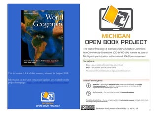
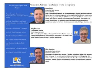
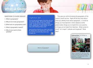
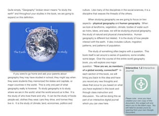
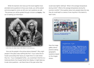
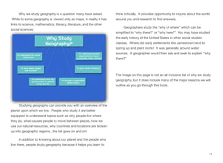
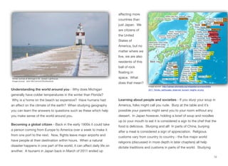
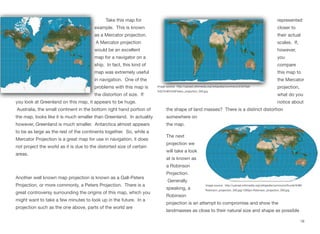
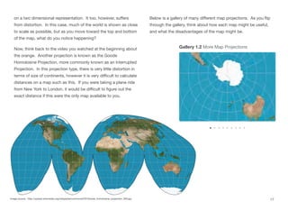
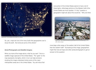
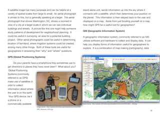
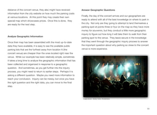
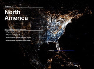
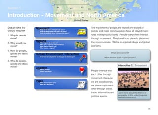
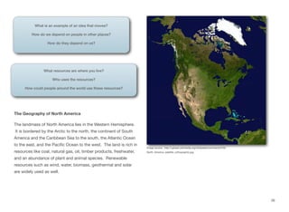
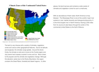
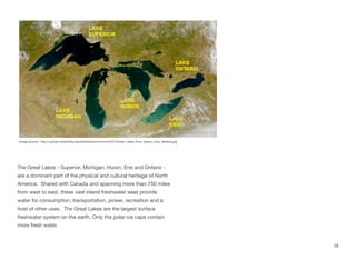
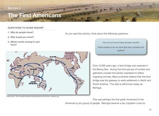
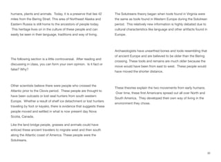
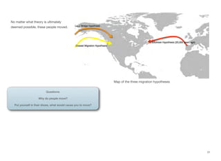
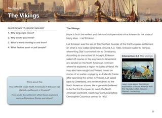
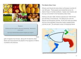
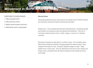
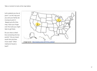
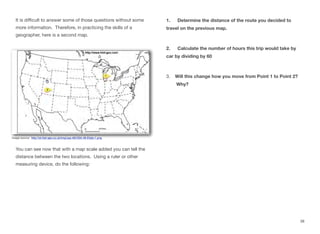
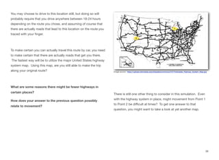
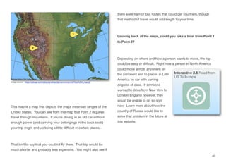
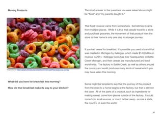
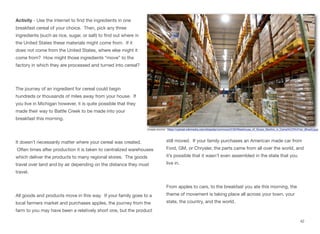
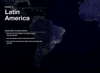
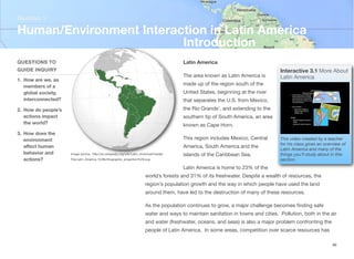
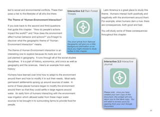
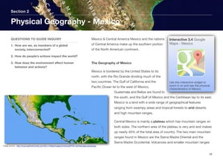
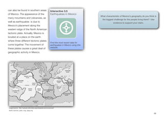
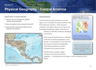
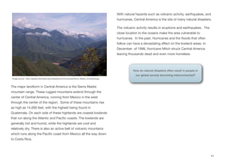
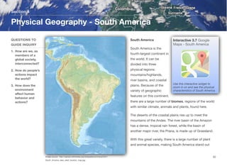
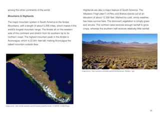
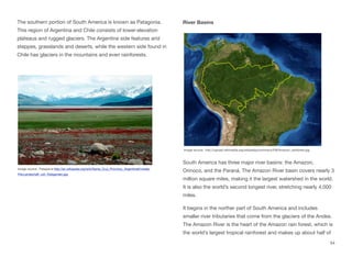
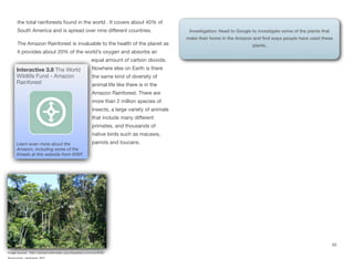
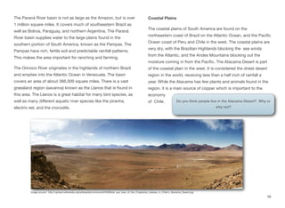
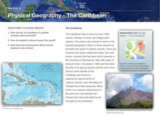
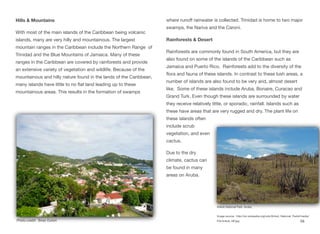
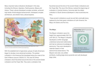
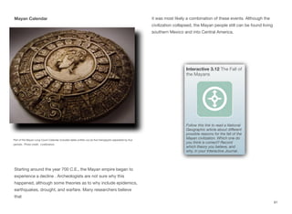
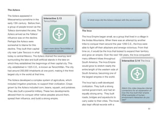
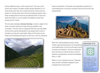
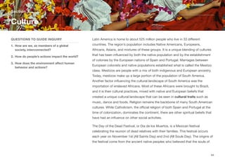
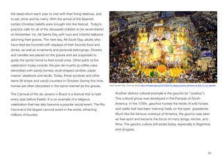
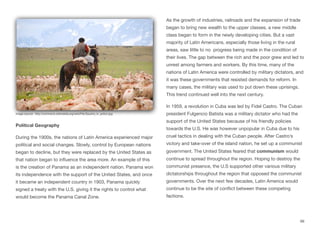
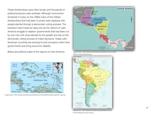
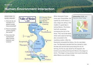
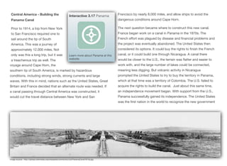
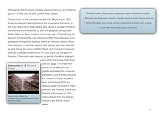
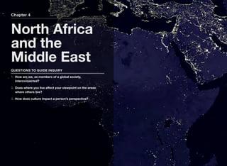

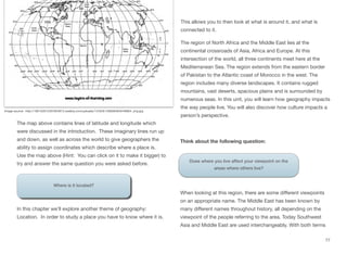
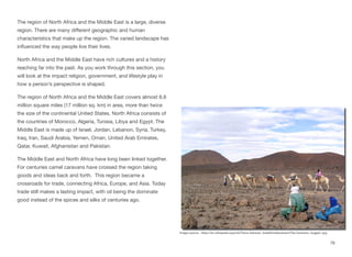
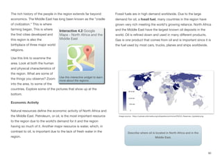
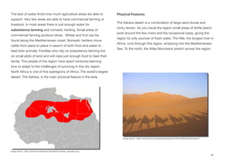
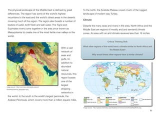
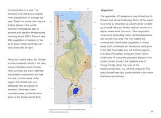

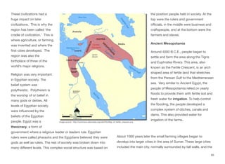
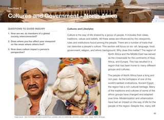
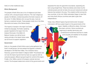
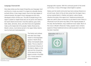
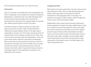
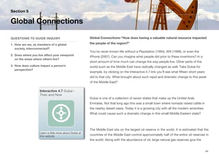
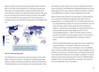
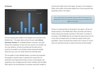
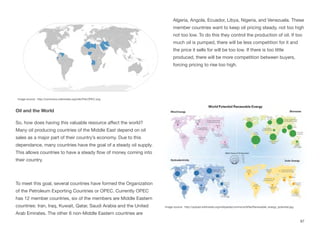
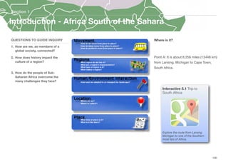
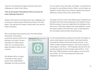
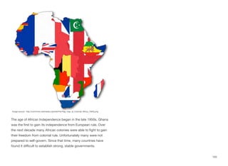
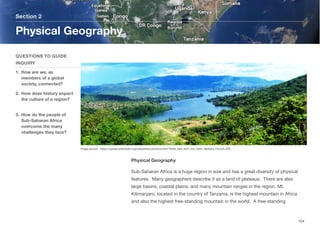
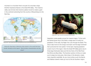

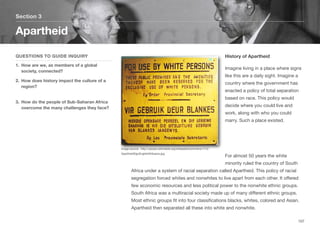
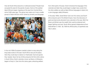
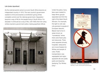
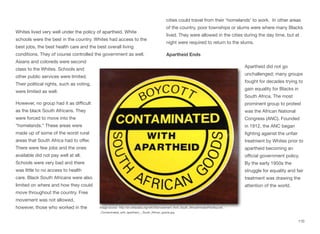
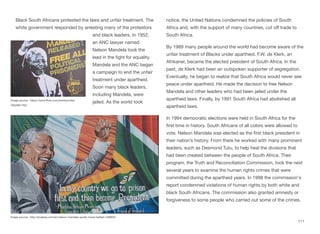
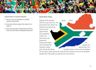

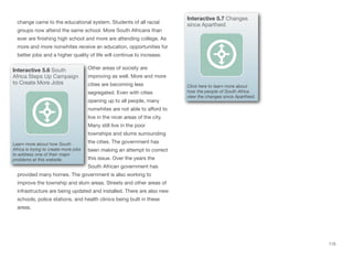
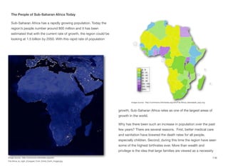
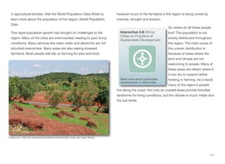
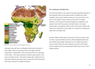
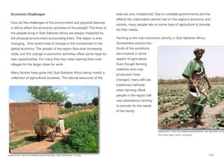
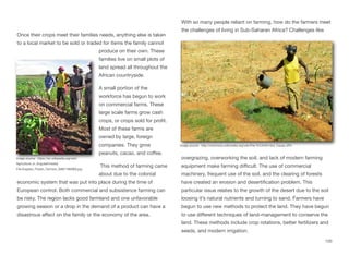
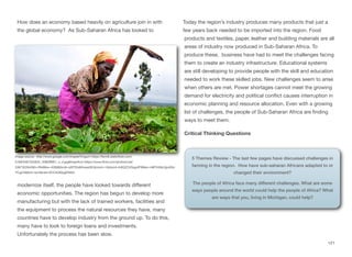
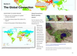
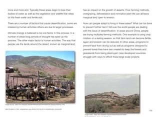
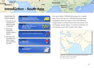
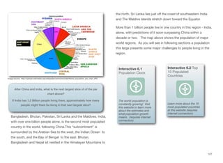
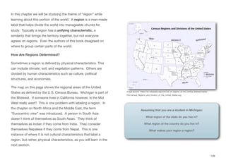
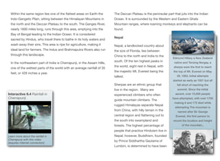
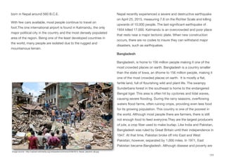
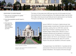
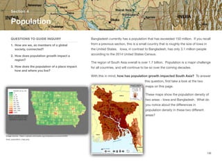

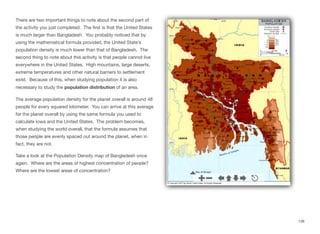
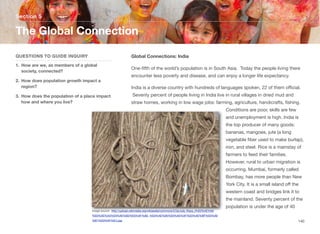
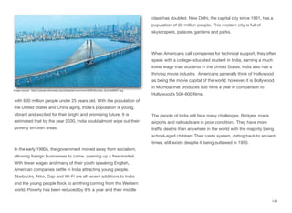
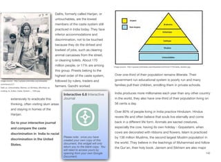
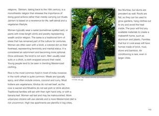
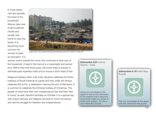
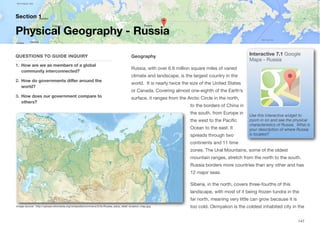
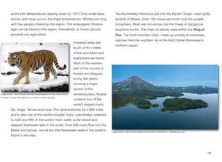
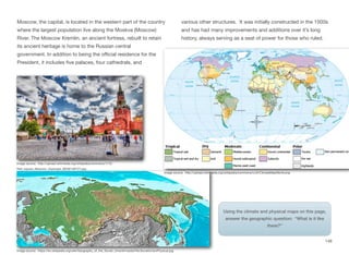
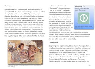
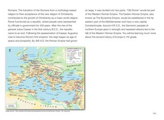
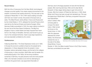
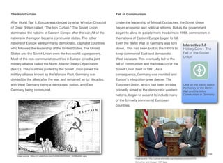
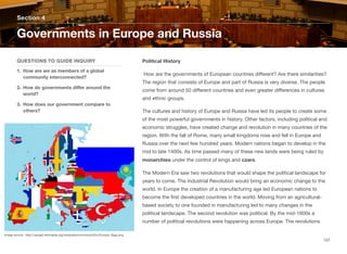
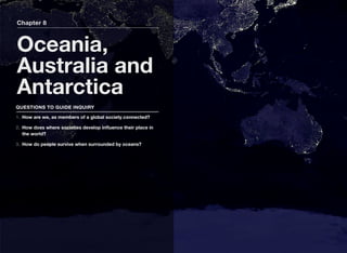
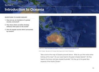
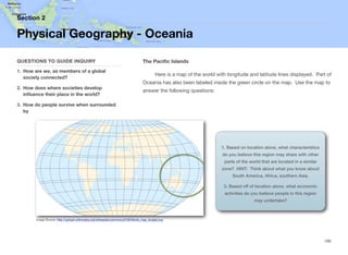
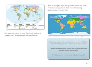
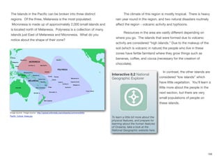
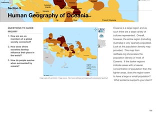
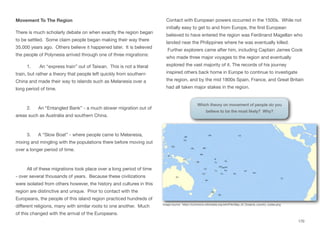
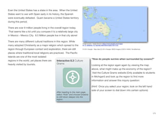
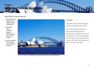
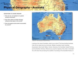
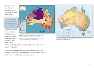
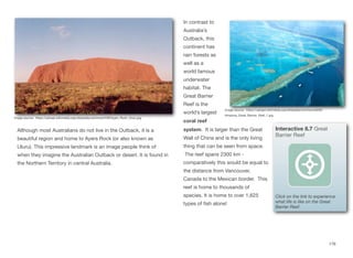
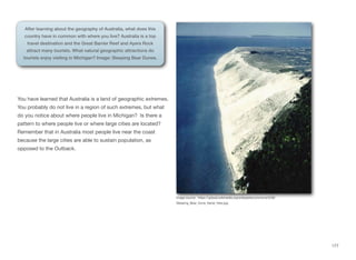
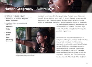
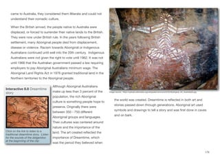
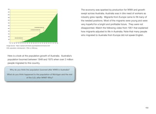
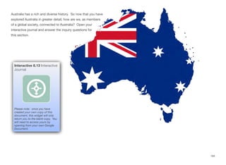
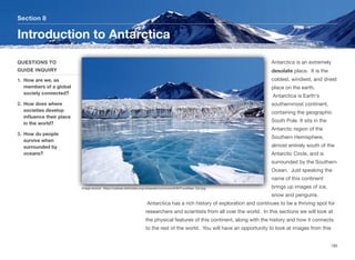
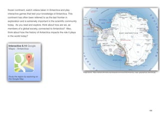
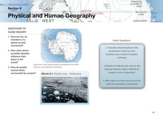
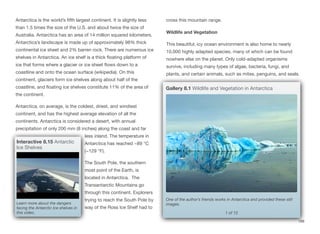
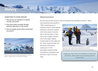
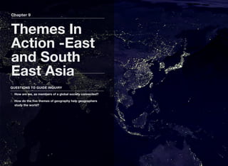
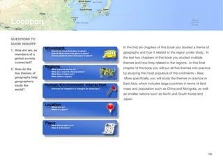
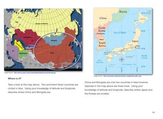
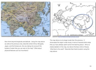
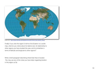
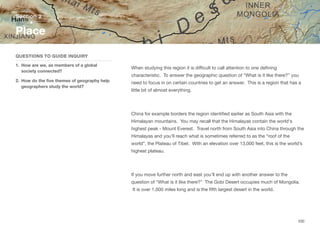
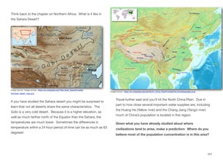
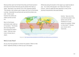
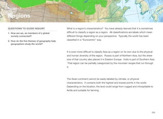
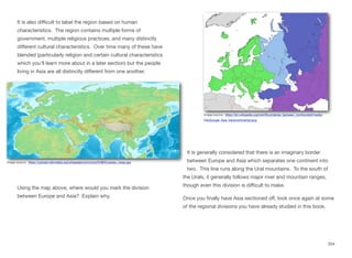
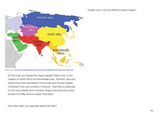
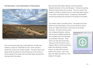
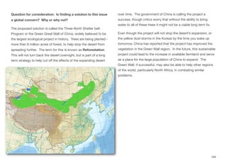
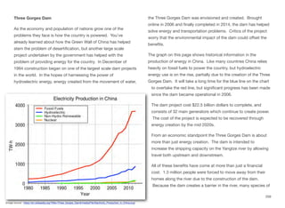
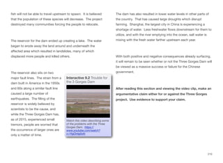

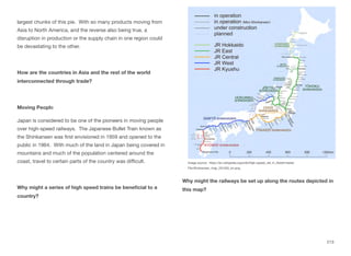


![World War I [Autosaved].pptxdetail over](https://cdn.slidesharecdn.com/ss_thumbnails/worldwariautosaved-260126125438-19cc037c-thumbnail.jpg?width=640&height=640&fit=bounds)


