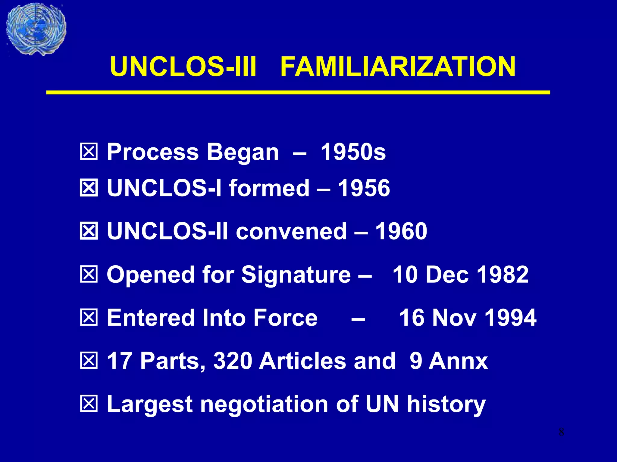
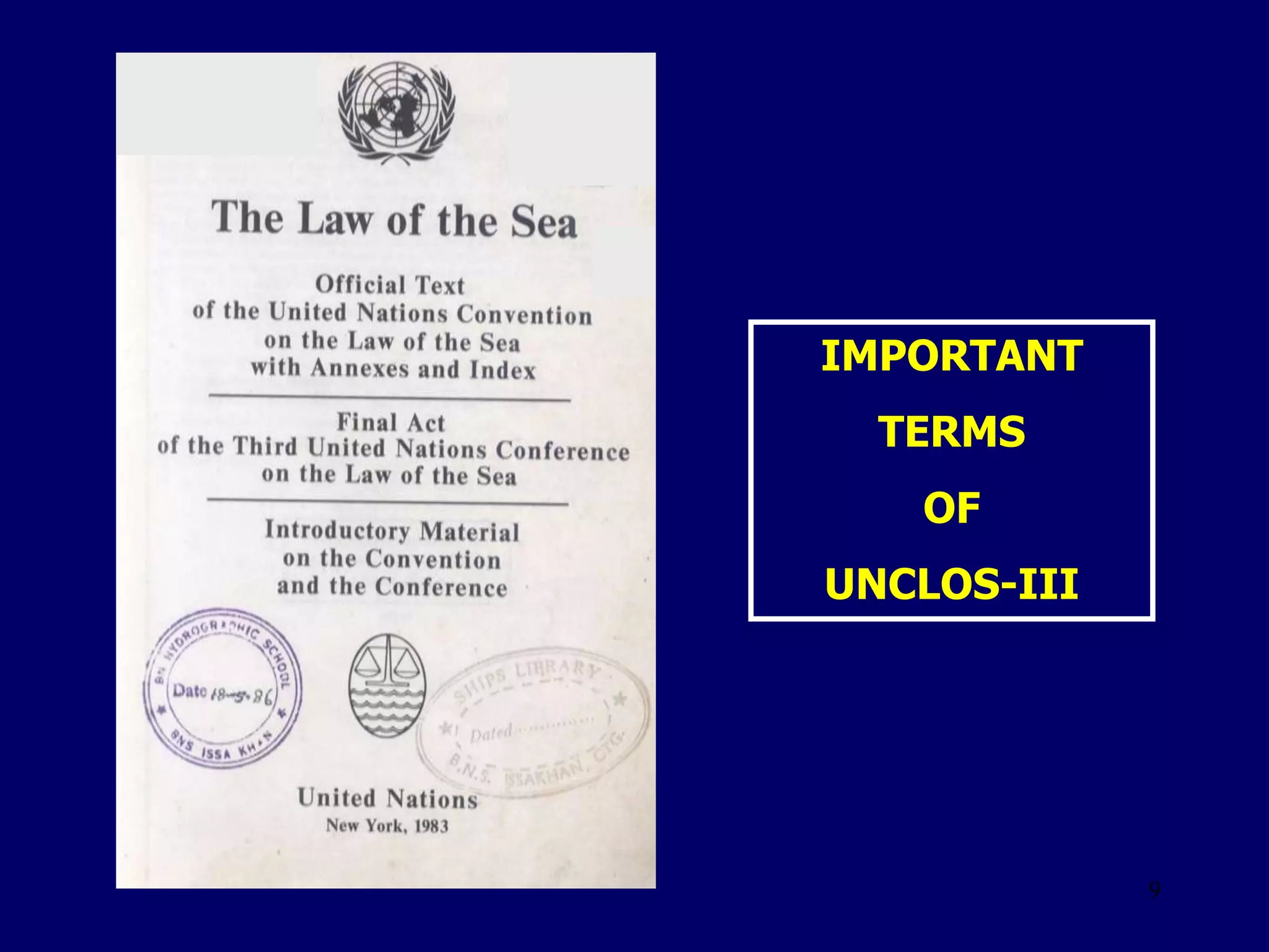
1
The Law of the Sea
United Nations Convention
on the Law of the Sea
UNCLOS-III
Cdr M I Haque,(H2),psc,BN
2
3
 Sea is the lifeline of
development
 States had a tendency
to control the sea
 It also ignites conflict
between the nations
4
 Rhodian Sea Law – is the Oldest Sea Law
 The Treaty of Tordesillias – in 1493
 Collection of local customs & traditions
 Jurisdiction exercised by the JUDGE COUNSELS
 Used for safe Navigation & Trade
5
Highlight the salient technical
aspects of UNCLOS-III and visualize
the maritime zones of Bangladesh
6
 Familiarization with UNCLOS-III
 Use of Terms & Scope
 Demarcation of Maritime Zones
 Maritime boundary delineation
 Maritime Zones Act 1974
SEQUENCE
7
COVER PAGE INNER PAGE
8
UNCLOS-III FAMILIARIZATION
 UNCLOS-I formed – 1956
 UNCLOS-II convened – 1960
 Opened for Signature – 10 Dec 1982
 Entered Into Force – 16 Nov 1994
 17 Parts, 320 Articles and 9 Annx
 Largest negotiation of UN history
 Process Began – 1950s
9
IMPORTANT
TERMS
OF
UNCLOS-III
10
BASELINES
 Normal Baseline
 Straight Baseline
 Archipelagic Straight Baseline
11
2 4 7 9 11 10 12
1 4 5 9 10 11 12
1 2 3 5 6 8 9 10 10 12 13
1 3 5 6 8 9 10 11
1 2 4 5 7 8 10 1 2 13
2 3 4 5 7 8 9 11 10 12
1 2 3 5 6 7 8 9 10 10 12 14
3 5 5 6 8 10 12 13
FOX LAND
0
0
0
0
0
Normal Baseline
12
STRAIGHT BASELINE
May be applied:
 In Indented Coast
 Mouth of River
 Mouth of Juridical Bay
13
2 4 7 4 9 10 12
1 2 4 6 7 8 10
2 6 8 10
2 3 4 7 8 9 10 12
7 6 6 7 8 9 10
3 6 6 6 6 7 8 10
8 6 6 8 10 11 12
BAN LAND
Port
Low Tide Elevation
Indented Unstable
Coast
 Follow the General Direction of the Coastline
 Not to be Drawn, TO AND FROM, Low Tide Elevations
14
LANDBAN LAND
Straight Baseline
15
Length of the
mouth is less
then 24 nm
BAY CLOSING LINE
16
2 5 7 8 6 3
4 8 10 6
2 3 4 3
3 4 10 11 12 3
2 3 4 3
3 3 2 5 9 10 13 11 10 9 3 5
4 3
5 5 6 7 9 10 13 11 9 8
6 8 10 11 14 13 10 9
7 9 11 14 18 15 9
M O N T E N E G R O
MONTENEGRO
BAY
17
B
Juridical Bay
NOT A
Juridical Bay
A
18
B
Juridical Bay
NOT A
Juridical Bay
A
19
B
Juridical Bay
NOT A
Juridical Bay
A
20
B
Juridical Bay
NOT A
Juridical Bay
A
21
B
Juridical Bay
NOT A
Juridical Bay
A
B
Land Locked
Water Area
B
Water Area of
Semi-circle
22
ARCHIPELAGIC STRAIGHT BASELINE
Archipelagic Waters
Internal Water
TS
CZ
EEZ
CS
23
24
BAN LAND
Port
2 4 7 4 9 10 12
1 2 4 6 7 8 10
2 6 8 10
2 3 4 7 8 9 10 12
7 6 6 7 8 9 10
6 6 6 7 8 10
8 6 6 8 10 11 12
12 nm
25
 Regulations for the protection of her own interest
 Establish traffic separation schemes
 May suspend the right of innocent passage
RIGHTS OVER TERRITORIAL SEA
TS
12nm
26
BAN LAND
Port
2 4 7 4 9 10 12
1 2 4 6 7 8 10
2 6 8 10
2 3 4 7 8 9 10 12
7 6 6 7 8 9 10
6 6 6 7 8 10
8 6 6 8 10 11 12
27
30 50 70 80 90 110
10 45 50 70 80 120
30 70 90 110 145
35 50 80 125 155
10 50 70 80 90 110 145
15 35 90 110 165
25 70 110 160
200 nm
E E Z
Installation of
Artificial Island
Protection of Maritime Environment
Marin Scientific
Research
28
Rise
Abyssal
Plain
FOS
CONTINENTAL SHELF
29
Limits of Continental Shelf
Formula No. 1
Extend up to that point, where the thickness
of the sedimentary rock (T) is at least 1% of
the shortest distance (D) between FOS &
that point.
 (T) = > 1% of (D)
Rise
Abyssal
Plain
FOS
Extended
Point [P]
T
D
30
Rise
Abyssal
Plain
FOS
Limits of Continental Shelf
Formula No. 2 Extend up to 60 nm from FOS
Extended Point
60
..nm
31
Rise
Abyssal
Plain
FOS
Limitation No. 1
Max length shall not exceed
350nm from baseline
Baseline
Max 350 nm
32
Rise
Abyssal
Plain
FOS
Limitation No. 2
Shall not exceed 100nm from
2500m contour
2500m Contour
Line
D = < 100nm
33
HIGH SEAS
Not included in:
 EEZ
 TS
 Internal Waters
 Archipelagic Waters
34
500m
Safety Zone
35
DUTIES AND RIGHTS
 Coastal state has right to control /
prevent unauthorized activities
 Ensure navigational and all other safety
aspects
 Protection and prevention of environment
 Conservation of living resources
 Other state can enjoy innocent / transit
passage
 Right of Hot Pursuit
36
WARSHIP’S RIGHTS
 Engaged in piracy
 Engaged in slave trade
 Engaged in unauthorized broadcasting
 Without Nationality
 Refusing to show its flag
37
MARITIME BOUNDARY DELINEATION
 Follow UNCLOS-III and other international laws
 Territorial Sea (TS) generally do not extend
beyond equidistance line
 Baseline disputes to be solved
 Desirable to have a continuous line that separates-
TS, EEZ & CS
38
METHODS OF
BOUNDARY DELINEATION
 Equidistance Method
Equidistance Line
39
METHODS OF
BOUNDARY DELINEATION
 Equidistance Method
 Equi-ratio Method
40
METHODS OF
BOUNDARY DELINEATION
 Equidistance Method
Equi-ratio Method
 General direction of the coast
90 0
41
METHODS OF
BOUNDARY DELINEATION
 Equidistance Method
 Equi-ratio Method
 General direction of the coast
 Thalwege concept
42
METHODS OF
BOUNDARY DELINEATION
 Equidistance Method
 Equi-ratio Method
 General direction of the coast
 Thalwege concept
 Proportionality
43
METHODS OF
BOUNDARY DELINEATION
 Equidistance Method
 Equi-ratio Method
 General direction of the coast
 Thalwege Concept
 Proportionality
 Prolongation of Land Boundary
Int. Land
Boundary
44
SETTLEMENT OF DISPUTES
 International Tribunal for LOS
 The ICJ
 Arbitral Tribunal
 Special Arbitral Tribunal
45
B A N G L A D E S H
Internal Waters
12 nm
18nm
Contiguous Zone
EEZ
200 nm
Maritime Zone Act 1974
46
INDIA
BOUNDARY DELINEATION
+
+
+
+
+
+
+
+
+
+
+
+
+
+
+
+
+
+
B A N G L A D E S H

HIRAN POINT
PUTNI
47
BANGLADESH
INDIA
MYANMAR
48
BANGLADESH
INDIA
MYANMAR
90 0
49
BANGLADESH
INDIA
MYANMAR
90 0
50
UNCLOS-III
IMPLICATION ON BANGLADESH
 Baseline of Bangladesh to be Reviewed
 Maritime Zones to be Reviewed
 Maritime Boundary Delineation Issues to be
Solved as per UNCLOS-III
 Peaceful Use of Bay of Bengal
51
Port
Principle of
Maritime
Demarcation
Maritime Act
1974
Re-demarcate
Maritime
Zones of
Bangladesh
Settlement of
Disputes As
Per UNCLOS-
III
52
53
Clarification
of Doubts
AFTER
A
SHORT BREAK

UNCLOS 3