"Traffic engineering isthat phase of engineering which deals with planning and
geometric design of streets, highways, abutting lands, and with traffic
operation thereon, as their use is related to the safe, convenient and economic
transportation of persons and goods".
The basic object of traffic engineering is to achieve efficient free and rapid
flow of traffic, with least number of traffic accidents.
TRAFFIC ENGINEERING
2.
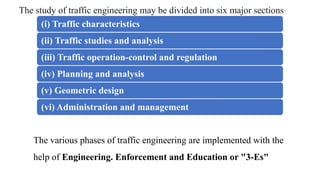
(i) Traffic characteristics
(ii)Traffic studies and analysis
(iii) Traffic operation-control and regulation
(iv) Planning and analysis
(v) Geometric design
(vi) Administration and management
The study of traffic engineering may be divided into six major sections:
The various phases of traffic engineering are implemented with the
help of Engineering. Enforcement and Education or "3-Es"
3.
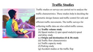
Traffic Studies
Traffic studiesor surveys are carried out to analyse the
traffic characteristics. These studies help in deciding the
geometric design feature and traffic control for safe and
efficient traffic movements. The traffic surveys for
collecting traffic data are also called traffic census.
(a) Traffic volume study
(b) Speed studies (i) spot speed study(ii) speed
and delay study
(c) Origin and destination (O & D) study
(d) Traffic flow characteristics
(e) Traffic capacity study
(f) Parking study
(g) Accident studies or the traffic flop
4.
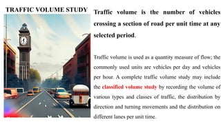
Traffic volume isthe number of vehicles
crossing a section of road per unit time at any
selected period.
Traffic volume is used as a quantity measure of flow; the
commonly used units are vehicles per day and vehicles
per hour. A complete traffic volume study may include
the classified volume study by recording the volume of
various types and classes of traffic, the distribution by
direction and turning movements and the distribution on
different lanes per unit time.
TRAFFIC VOLUME STUDY
5.
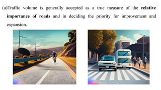
(a)Traffic volume isgenerally accepted as a true measure of the relative
importance of roads and in deciding the priority for improvement and
expansion.
6.
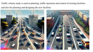
Traffic volume studyis used in planning, traffic operation and control of existing facilities
and also for planning and designing the new facilities
7.
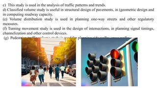
c) This studyis used in the analysis of traffic patterns and trends.
d) Classified volume study is useful in structural design of pavements, in (geometric design and
in computing roadway capacity.
(e) Volume distribution study is used in planning one-way streets and other regulatory
measures.
(f) Turning movement study is used in the design of intersections, in planning signal timings,
channelization and other control devices.
(g) Pedestrian traffic volume study is used for planning side walks, cross walks
8.
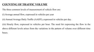
COUNTING OF TRAFFICVOLUME
The three common levels of measurement of vehicle flow are:
(i) Average annual flow, expressed in vehicles per year
(ii) Annual Average Daily Traffic (AADT), expressed in vehicles per day.
(iii) Hourly flow, expressed in vehicles per hour. The need for expressing the flow in the
above different levels arises from the variations in the pattern of volume over different time
bases.
9.
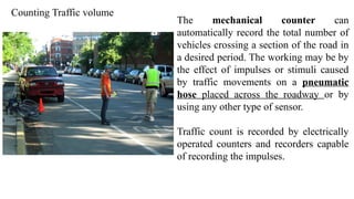
Counting Traffic volume
Themechanical counter can
automatically record the total number of
vehicles crossing a section of the road in
a desired period. The working may be by
the effect of impulses or stimuli caused
by traffic movements on a pneumatic
hose placed across the roadway or by
using any other type of sensor.
Traffic count is recorded by electrically
operated counters and recorders capable
of recording the impulses.
10.
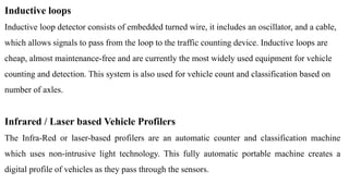
Inductive loops
Inductive loopdetector consists of embedded turned wire, it includes an oscillator, and a cable,
which allows signals to pass from the loop to the traffic counting device. Inductive loops are
cheap, almost maintenance-free and are currently the most widely used equipment for vehicle
counting and detection. This system is also used for vehicle count and classification based on
number of axles.
Infrared / Laser based Vehicle Profilers
The Infra-Red or laser-based profilers are an automatic counter and classification machine
which uses non-intrusive light technology. This fully automatic portable machine creates a
digital profile of vehicles as they pass through the sensors.
11.
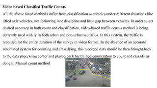
Video based ClassifiedTraffic Counts
All the above listed methods suffer from classification accuracies under different situations like
lifted axle vehicles, not following lane discipline and little gap between vehicles. In order to get
desired accuracy in both count and classification, video-based traffic census method is being
currently used widely in both urban and non-urban scenarios. In this system, the traffic is
recorded for the entire duration of the survey in video format. In the absence of an accurate
automated system for counting and classifying, this recorded data should be then brought back
to the data processing center and played back for trained enumerators to count and classify as
done in Manual count method
12.
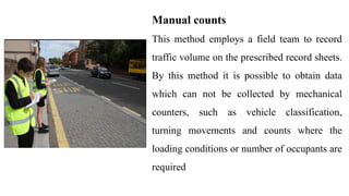
Manual counts
This methodemploys a field team to record
traffic volume on the prescribed record sheets.
By this method it is possible to obtain data
which can not be collected by mechanical
counters, such as vehicle classification,
turning movements and counts where the
loading conditions or number of occupants are
required
13.
• Annual averagedaily traffic (AADT or ADT) of the total traffic as well as
classified traffic are calculated. This helps in deciding the relative importance of a route
and in phasing the road development programme. In order to convert the different vehicle
classes to one class such as passenger car, conversion factors known as Passenger Car
Units (PCU) are used.
PRESENTATION OF TRAFFIC VOLUME DATA
• Trend charts showing volume trends over period of years are prepared. These data are
useful for planning future expansion, design and regulation.
• Variation charts showing hourly, daily and seasonal variations are also prepared. These
help in deciding the facilities and regulation needed during peak traffic periods.
14.
(d) Traffic flowmaps along the routes, (the thickness of the lines representing the traffic
volume to any desired scale), are drawn. These help to find the traffic volume distribution at
a glance.
(e) Volume flow diagram at intersections either drawn to a certain scale showing the
details of crossing and turning traffic. These data are needed for intersection design.
(1) Thirtieth highest hourly volume or the design hourly volume is found from the plot
between hourly volume and the number of hours in an year that the traffic volume is
exceeded. The 30 highest hourly volume is the hourly volume that will be exceeded only 29
times in a year and all other hourly volumes of the year will be less
15.
Passenger car unit(PCU)
The different vehicle classes have a wide range of static characteristics such as length, width etc.
and dynamic characteristics such as speed, acceleration, etc. It is difficult to estimate the traffic
volume and capacity of roadway facilities under mixed traffic flow, unless the different vehicle
classes are converted to one common standard vehicle unit. It is a common practice to consider
the passenger car as the standard vehicle unit to convert the other vehicle classes and this unit is
called Passenger Car Unit or PCU. Thus in mixed traffic flow, the traffic volume and capacity
are generally expressed as PCU per hour or PCU/lane/hour and the traffic density as PCU per
kilometre length of lane. The PCU may be considered as a measure of the relative space
requirement of a vehicle class compared to that of a passenger car under a specified set of
roadway, traffic and other conditions.
17.
ORIGIN AND DESTINATIONSTUDIES
(1)plan the road network and other facilities for vehicular traffic
(2) plan the schedule of different modes of transportation for the trip demand of commuters.
(3)The O & D studies of vehicular traffic determines their number, their origin and destination
in each zone under study. The data may also be supplemented by the number of passengers in
each vehicle, purpose of each trip, intermediate stops made and reasons etc. Origin and
destination study gives informations like the actual direction of travel, selection of routes and
length of the trip. These studies are most essential in planning new highway facilities and in
improving some of the existing systems.
18.
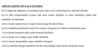
APPLICATIONS OF O& D STUDIES
(i) to judge the adequacy of existing routes and to use in planning new network ofroads.
(ii) to plan transportation system and mass transit facilities in cities including routes and
schedules of operation.
(iii) to locate expressway or major routes along the desire lines.
(iv) to establish preferential routes for various categories of vehicle including by-pass.
(v) to locate terminals and to plan terminal facilities.
(vi) to locate new bridge as per traffic demands.
(vii) to locate intermediate stops of public transport.
(viii) to establish design standards for the road, bridges and culverts along the route.
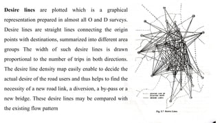
Desire lines areplotted which is a graphical
representation prepared in almost all O and D surveys.
Desire lines are straight lines connecting the origin
points with destinations, summarized into different area
groups The width of such desire lines is drawn
proportional to the number of trips in both directions.
The desire line density map easily enable to decide the
actual desire of the road users and thus helps to find the
necessity of a new road link, a diversion, a by-pass or a
new bridge. These desire lines may be compared with
the existing flow pattern
21.
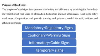
Purpose of RoadSigns
The purpose of road signs is to promote road safety and efficiency by providing for the orderly
movement of all road users on all roads in both urban and non-urban areas. Road signs notify
road users of regulations and provide warning and guidance needed for safe, uniform and
efficient operation.
Mandatory/Regulatory Signs
Cautionary/Warning Signs
Informatory/Guide Signs
temporary signs.
22.
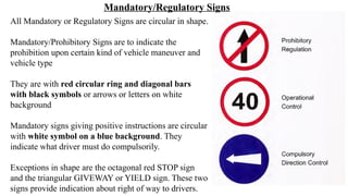
All Mandatory orRegulatory Signs are circular in shape.
Mandatory/Prohibitory Signs are to indicate the
prohibition upon certain kind of vehicle maneuver and
vehicle type
They are with red circular ring and diagonal bars
with black symbols or arrows or letters on white
background
Mandatory signs giving positive instructions are circular
with white symbol on a blue background. They
indicate what driver must do compulsorily.
Exceptions in shape are the octagonal red STOP sign
and the triangular GIVEWAY or YIELD sign. These two
signs provide indication about right of way to drivers.
Mandatory/Regulatory Signs
23.
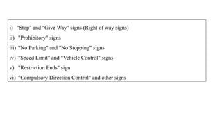
i) "Stop" and"Give Way" signs (Right of way signs)
ii) "Prohibitory" signs
iii) "No Parking" and "No Stopping" signs
iv) "Speed Limit" and "Vehicle Control" signs
v) "Restriction Ends" sign
vi) "Compulsory Direction Control" and other signs
27.
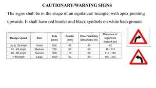
CAUTIONARY/WARNING SIGNS
The signsshall be in the shape of an equilateral triangle, with apex pointing
upwards. It shall have red border and black symbols on white background.
31.
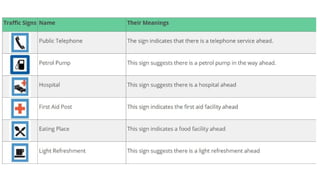
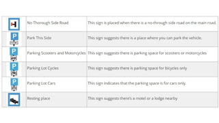
The signs illustratedin this section give information to the road user regarding
their location or facilities available in the vicinity or about the destination.
INFORMATORY SIGNS