
Recommended
More Related Content
Similar to The Critical Role Of Geospatial Information In Developing2
Similar to The Critical Role Of Geospatial Information In Developing2 (20)
The Critical Role Of Geospatial Information In Developing2
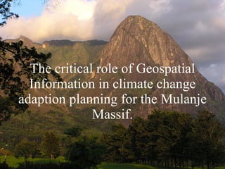
- 1. The critical role of Geospatial Information in climate change adaption planning for the Mulanje Massif.
- 8. Blantyre
- 18. Ruo
- 20. Jim Rae – Water For All Integrated Water Resource Management
Editor's Notes
- The aim of my presentation today is to give you firstly an understanding of the critical relationship between reliable geospatial information (or GI) and the MDG’s and secondly how it is possible to collect such information rapidly. To achieve that I will start by describing GI to you, then assess the GI required to satisfy just one objective of one MDG, then to compare how GI is managed between here and in Malawi so you understand the benefits of properly managed GI. Then we’ll have a look at one instant collection technology, Very High Resolution Satellite Imagery before finally making a few concluding remarks.
- So what is GI? Its basically anything that can be linked by location - directly or indirectly – on, under and above the ground. · 2 dimensional - map information – point, line, area. You will be familiar with map data at various scales, represented as points, lines and areas. This could be street furniture, fences, power lines, fields, buildings. • 3 dimensional – topography, geology Not so easily represented on a map is 3dimensional information – for instance geology, hydrology and topography. Google earth fly-through is an example of something that is created from 3 dimensional data • 4 dimensional – networks - road, rail, electric, water If we bring in time as well we can create networks that tell us how to get from a to b as quickly as possibly, or where we are going to get electricity from at peak times, or how much water flows in different locations at different times of the year. · Other GI - satellite imagery, diseases, climate, census Satellite imagery can be located because you can correlate imagery information to points on the ground. The same is true with types and spread of diseases like cholera and climatic factors like rainfall and temperature. Census data is related to a house so all the information related to that census can be indirectly located. • Metadata – water borehole Metadata is data about data. So as an example let us look at a water borehole. Its metadata could include: When it was built, by whom, for whom, maybe a picture, flow rate at different times of the year, maintenance history As much as 80% of information is spatially related. Research has shown that as much as 80% of all information can be related spatially – so it could be argued that 80% of decisions have a spatial connection.
- OS continually updates urban and rural township mapping So for just one objective in the groups first priority a multitude of spatially related information is required to make the strategies developed sustainable. I’d now like to make a few comments on GI in Malawi. I think its important though to explain first how we do it here in GB to better understand the benefits of properly managed GI. • OS continually updates urban and rural township mapping Our National Mappiing Organisation, the Ordnance Survey, has field surveyors continuously updating maps in urban and rural townships with infrastructure changes and new developments • Large scale = lots of information Many of you will be familar with the 1:50,000 maps but there are scales up to 1:1250. This larger scale is crucial to planning as it shows individual houses, utility points, access routes and types, boundaries, water features, vegetative types and other information. • Maps converted into digital format Over the last 20 years the OS has digitised and integrated the map data into a seamless database allowing network analysis. I mentioned road networks earlier as an example. • Correlated with GPS Whilst the hard copy mapping in GB was based on an old mathematical earth model the digital conversion has enabled all information to be aligned with the global positioning system, or GPS. The surveyors use GPS to collect new mapping data. • Information is widely used by professionals for planning The UK utility organisations and local authorities have agreements with the OS to get automatic updates on which to base their own records. So, while above and below ground information is not in one database, it is connected, maintained and available through a common mapping background.Everyone is singing from the same hymnsheet since all planning is based on current mapping information. • £100 billion generated in the UK economy (4% GDP) through investment of £100 million The greatest significance is that, for the £100 million the OS gets to maintain the database each year £100 billion is generated by the private sector, or 1000 times return on investment, equivalent to 4% of GDP.
- • A Geographic Information System (GIS) stores data digitally Because of the geographical linkage it is possible to combine all this seemingly disparate information into what is termed a Geographic information system or GIS • Creates new information - explain events, predict outcomes, and plan strategies eg flood protection; crime prevention; climate modelling. Its strength is in using the spatial relationships between apparently disparate datasets to create new information that would otherwise be missed. For example SEPA use it for flood monitoring so that people can be warned in advance of potential flooding to the houses and set in processes for evacuation; the police in Dumfries and Galloway use one to determine trends in burglaries. • The major challenges we face in the world today - overpopulation, pollution, deforestation, natural disasters, climate change-have a critical geographic dimension In fact all the major challenges we face in the world today like climate change have a critical geographic dimension.
- • A Geographic Information System (GIS) stores data digitally Because of the geographical linkage it is possible to combine all this seemingly disparate information into what is termed a Geographic information system or GIS • Creates new information - explain events, predict outcomes, and plan strategies eg flood protection; crime prevention; climate modelling. Its strength is in using the spatial relationships between apparently disparate datasets to create new information that would otherwise be missed. For example SEPA use it for flood monitoring so that people can be warned in advance of potential flooding to the houses and set in processes for evacuation; the police in Dumfries and Galloway use one to determine trends in burglaries. • The major challenges we face in the world today - overpopulation, pollution, deforestation, natural disasters, climate change-have a critical geographic dimension In fact all the major challenges we face in the world today like climate change have a critical geographic dimension.
- • A Geographic Information System (GIS) stores data digitally Because of the geographical linkage it is possible to combine all this seemingly disparate information into what is termed a Geographic information system or GIS • Creates new information - explain events, predict outcomes, and plan strategies eg flood protection; crime prevention; climate modelling. Its strength is in using the spatial relationships between apparently disparate datasets to create new information that would otherwise be missed. For example SEPA use it for flood monitoring so that people can be warned in advance of potential flooding to the houses and set in processes for evacuation; the police in Dumfries and Galloway use one to determine trends in burglaries. • The major challenges we face in the world today - overpopulation, pollution, deforestation, natural disasters, climate change-have a critical geographic dimension In fact all the major challenges we face in the world today like climate change have a critical geographic dimension.
- • A Geographic Information System (GIS) stores data digitally Because of the geographical linkage it is possible to combine all this seemingly disparate information into what is termed a Geographic information system or GIS • Creates new information - explain events, predict outcomes, and plan strategies eg flood protection; crime prevention; climate modelling. Its strength is in using the spatial relationships between apparently disparate datasets to create new information that would otherwise be missed. For example SEPA use it for flood monitoring so that people can be warned in advance of potential flooding to the houses and set in processes for evacuation; the police in Dumfries and Galloway use one to determine trends in burglaries. • The major challenges we face in the world today - overpopulation, pollution, deforestation, natural disasters, climate change-have a critical geographic dimension In fact all the major challenges we face in the world today like climate change have a critical geographic dimension.
- • A Geographic Information System (GIS) stores data digitally Because of the geographical linkage it is possible to combine all this seemingly disparate information into what is termed a Geographic information system or GIS • Creates new information - explain events, predict outcomes, and plan strategies eg flood protection; crime prevention; climate modelling. Its strength is in using the spatial relationships between apparently disparate datasets to create new information that would otherwise be missed. For example SEPA use it for flood monitoring so that people can be warned in advance of potential flooding to the houses and set in processes for evacuation; the police in Dumfries and Galloway use one to determine trends in burglaries. • The major challenges we face in the world today - overpopulation, pollution, deforestation, natural disasters, climate change-have a critical geographic dimension In fact all the major challenges we face in the world today like climate change have a critical geographic dimension.
- • A Geographic Information System (GIS) stores data digitally Because of the geographical linkage it is possible to combine all this seemingly disparate information into what is termed a Geographic information system or GIS • Creates new information - explain events, predict outcomes, and plan strategies eg flood protection; crime prevention; climate modelling. Its strength is in using the spatial relationships between apparently disparate datasets to create new information that would otherwise be missed. For example SEPA use it for flood monitoring so that people can be warned in advance of potential flooding to the houses and set in processes for evacuation; the police in Dumfries and Galloway use one to determine trends in burglaries. • The major challenges we face in the world today - overpopulation, pollution, deforestation, natural disasters, climate change-have a critical geographic dimension In fact all the major challenges we face in the world today like climate change have a critical geographic dimension.
- • GI and achievment of MDG’s are interlinked I’ll finish the presentation by making a few concluding remarks. I sincerely hope I’ve managed to demonstrate the crucial linkage abetween GI and achievement of the MDG’s. • Reliable and contemporary GI is crucial to development In order to meet the MDG’s we need reliable and up to date geospatial information. Knowing what information exists and how to access it is probably the biggest obstacle to using existing GI in Africa. There are commendable independent initiatives being developed but we really need everything to be collated into one national database. Everyone who holds GI must make more effort to record and share information. · Dated and limited GI in Malawi severly restricts planning I believe that if Malawian engineers and planners had access to modern mapping, like we have in the UK, into which they could correlate other GI they would be best positioned to determine MDG strategies and rely less on external organisations. Unfortunately in Malawi maps are many years out of date making their jobs very difficult. • Modern cost effective GI Technologies can satisfy many of the requirements for base mapping I believe we can produce large scale mapping in Malawi through use of the latest satellite sensors. Their information collection capabilities combined with modern processing softwares give us the potential to rapidly map the country cost effectively. • GIS facilitates knowledge sharing This mapping will then create the basis for sharing GI through integration into a GIS. Having an easily accessible GI system throughout Malawi will encourage sharing of knowlege.