Download to read offline


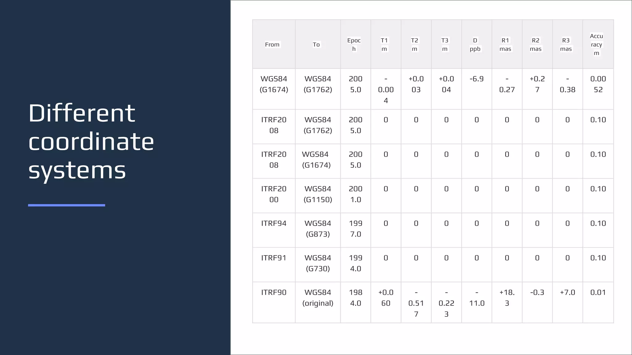

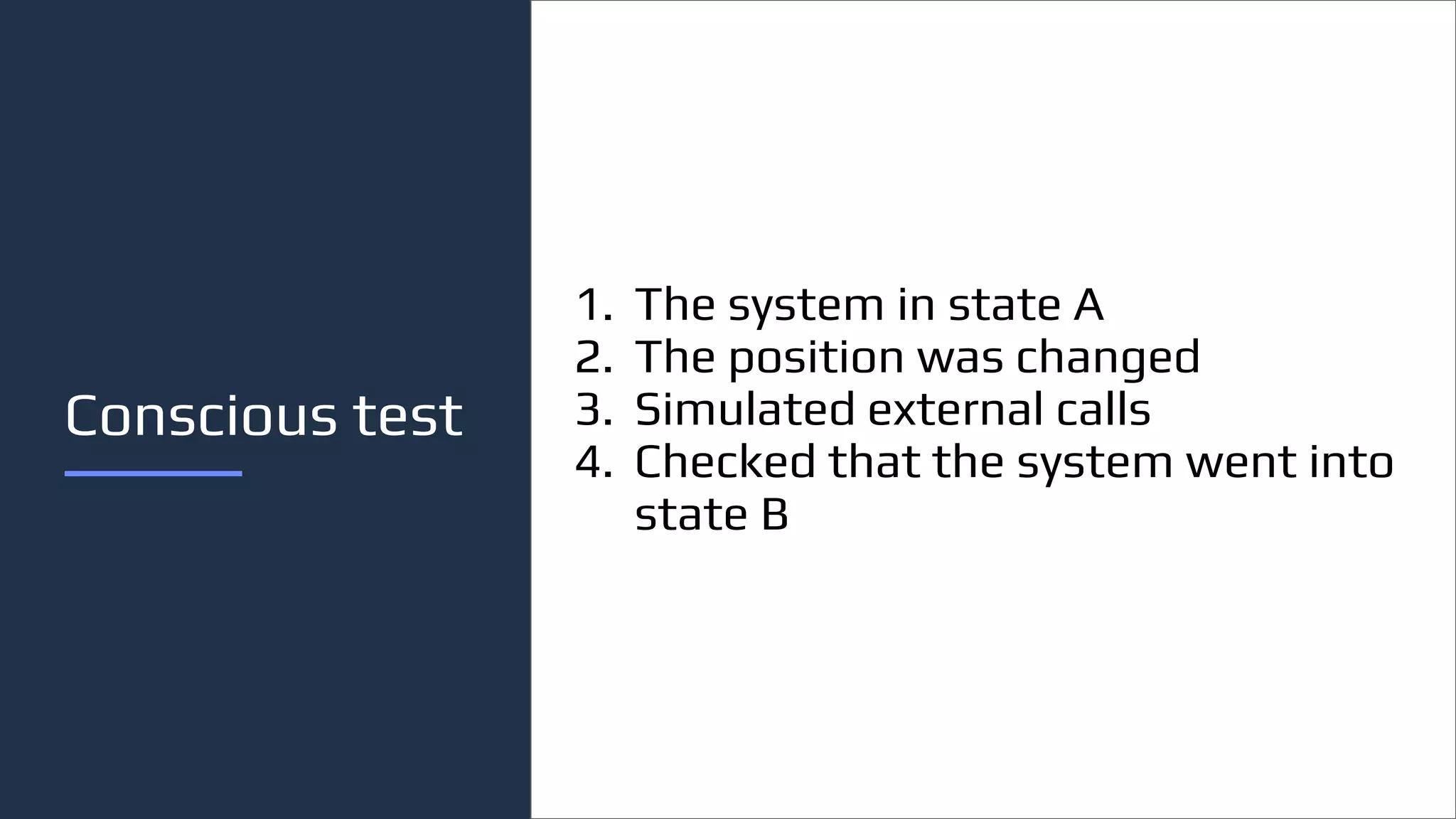

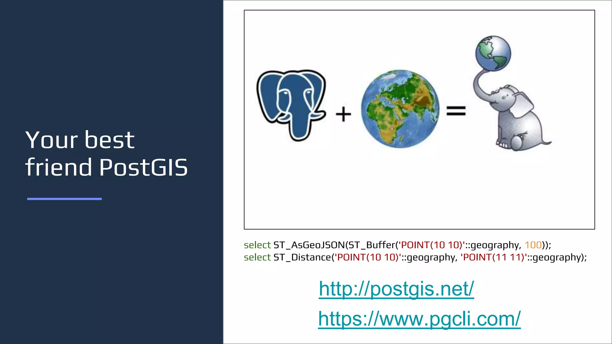
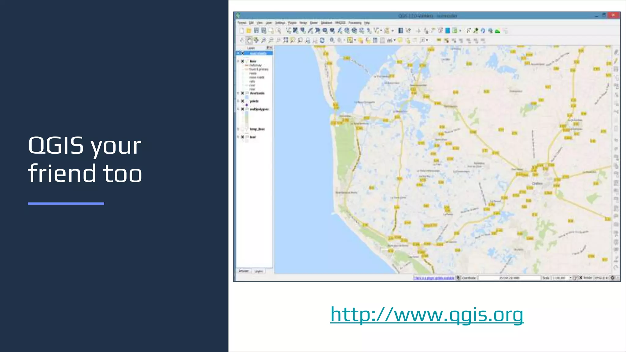
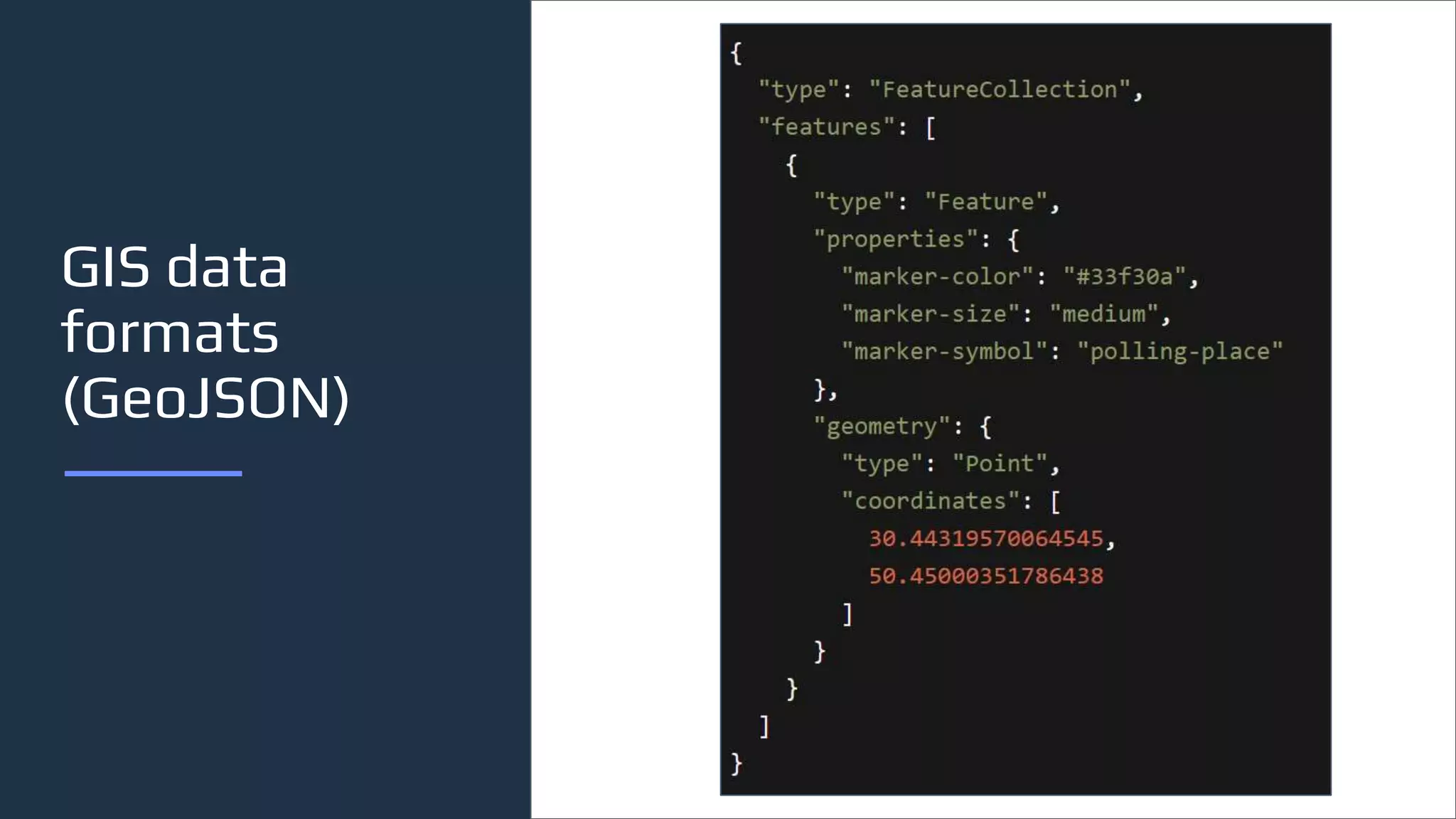
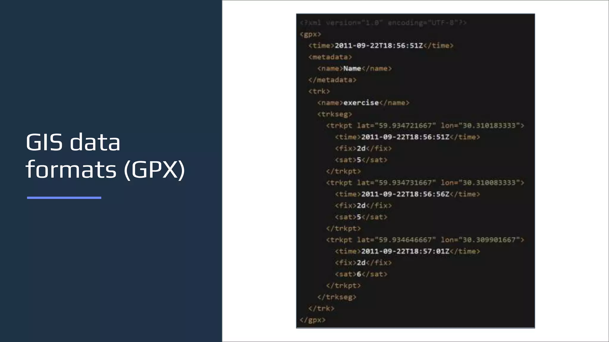


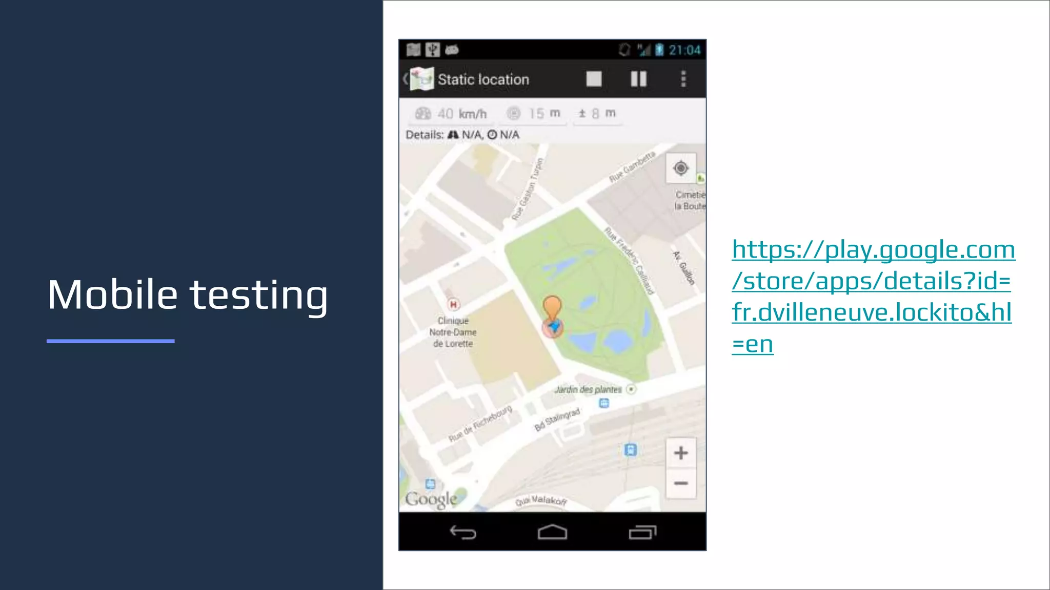


The document discusses testing of geolocation systems. It provides an overview of geolocation, including definitions and importance. It then outlines the speaker's experience and work testing GIS systems. The rest of the document details approaches to testing geolocation, including simulating calls, checking responses and databases, and verifying accuracy. It also discusses common data formats, projections, tools like PostGIS and QGIS, and potential bugs to watch for like coordinate jumbling. The conclusion emphasizes starting simple, practicing to improve, and for tests to grow with knowledge as geolocation is important for future IT.


