Project presentation joanie evans
•Download as PPTX, PDF•
0 likes•183 views
This document summarizes a GIS project that maps re-entry services and public transportation in Los Angeles to create an app for formerly incarcerated individuals and organizations. The project aims to visualize access to housing, employment, rehabilitation and other services near bus and rail lines. It analyzes the current access to services based on proximity to transit and whether a GIS app could increase access. The methods section outlines data collection of re-entry organizations and mapping of neighborhoods, rail and bus lines in Los Angeles.
Report
Share
Report
Share

Recommended
Mapping re-entry organizations & bus/rail access in Los Angeles
This is my presentation on bus and rail access to re-entry in the city of Los Angeles, California.
Wilmington University - No Abstract Style APA Formatting
Wilmington University - No Abstract Style APA FormattingWilmington University College of Arts and Sciences
How to format an APA paper without an abstract.Milestone Exercise for Eng 102
Getting the research paper process started and approach to developing a topic.
APA Stylistics and Editorial Style (Part 1)
Grammar, active and passive voice, using clear antecedents, pronouns, and mastering the art of using active and passive voice in the writing process.
Wilmington University APA Formatting Guide "Abstract + References"
Wilmington University APA Formatting Guide "Abstract + References"Wilmington University College of Arts and Sciences
WilmU APA paper format with abstract and references.Recommended
Mapping re-entry organizations & bus/rail access in Los Angeles
This is my presentation on bus and rail access to re-entry in the city of Los Angeles, California.
Wilmington University - No Abstract Style APA Formatting
Wilmington University - No Abstract Style APA FormattingWilmington University College of Arts and Sciences
How to format an APA paper without an abstract.Milestone Exercise for Eng 102
Getting the research paper process started and approach to developing a topic.
APA Stylistics and Editorial Style (Part 1)
Grammar, active and passive voice, using clear antecedents, pronouns, and mastering the art of using active and passive voice in the writing process.
Wilmington University APA Formatting Guide "Abstract + References"
Wilmington University APA Formatting Guide "Abstract + References"Wilmington University College of Arts and Sciences
WilmU APA paper format with abstract and references.Wilmington University DBA Dissertation Guide
Wilmington University's dissertation guide for doctoral candidates talks about degree candidacy, planning for dissertation, student responsibility, dissertation outline, dissertation publishing, and additional steps toward achieving a Doctorate in Business Administration (DBA).
Formatting In-Text Citation in APA Format
Simple steps to achieving proper formatting of citations in APA format.
APA Sample Research Paper "Abstract, Introduction, and References"
APA Sample Research Paper "Abstract, Introduction, and References"Wilmington University College of Arts and Sciences
How to use an APA style research paper format to submit an academic writing.BIG DATA AND BIG CITIES THE PROMISES AND LIMITATIONSOF IMPR.docx
BIG DATA AND BIG CITIES: THE PROMISES AND LIMITATIONS
OF IMPROVED MEASURES OF URBAN LIFE
EDWARD L. GLAESER, SCOTT DUKE KOMINERS, MICHAEL LUCA and NIKHIL NAIK∗
New, “big data” sources allow measurement of city characteristics and outcome
variables at higher collection frequencies and more granular geographic scales than
ever before. However, big data will not solve large urban social science questions
on its own. Big urban data has the most value for the study of cities when it allows
measurement of the previously opaque, or when it can be coupled with exogenous shocks
to people or place. We describe a number of new urban data sources and illustrate how
they can be used to improve the study and function of cities. We first show how Google
Street View images can be used to predict income in New York City, suggesting that
similar imagery data can be used to map wealth and poverty in previously unmeasured
areas of the developing world. We then discuss how survey techniques can be improved to
better measure willingness to pay for urban amenities. Finally, we explain how Internet
data is being used to improve the quality of city services. (JEL R1, C8, C18)
I. INTRODUCTION
Historically, most research on urban areas
has relied on coarse aggregate statistics and
smaller-scale surveys. Over the past decade,
∗The authors would like to acknowledge helpful com-
ments from Andy Caplin, William Kominers, Jonathan Smith,
and Mitchell Weiss. E.L.G. acknowledges support from the
Taubman Center for State and Local Government; S.D.K.
acknowledges support from the National Science Foundation
(grants CCF-1216095 and SES-1459912), the Harvard Mil-
ton Fund, the Ng Fund of the Harvard Center of Mathematical
Sciences and Applications, and the Human Capital and Eco-
nomic Opportunity Working Group (HCEO) sponsored by
the Institute for New Economic Thinking (INET); and N.N.
acknowledges support from The MIT Media Lab consortia.
Glaeser: Department of Economics, Harvard University,
Cambridge, MA 02138; John F. Kennedy School of Gov-
ernment, Harvard University, Cambridge, MA 02138;
National Bureau of Economic Research, Cambridge, MA
02138. Phone 617-496-2150, Fax 617-495-3817, E-mail
[email protected]
Kominers: Department of Economics, Harvard University,
Cambridge, MA 02138; Center of Mathematical Sciences
and Applications, Harvard University, Cambridge, MA
02138; Center for Research on Computation and Soci-
ety, Harvard University, Cambridge, MA 02138; Pro-
gram for Evolutionary Dynamics, Harvard University,
Cambridge, MA 02138; Entrepreneurial Management,
Harvard Business School, Boston, MA 02163; Soci-
ety of Fellows, Harvard University, Cambridge, MA
02138. Phone 617-495-8407, Fax 617-495-3817, E-mail
[email protected]
Luca: Negotiation, Organizations & Markets, Harvard Busi-
ness School, Boston, MA 02163. Phone 845-549-0372,
Fax 617-495-3817, E-mail [email protected]
Naik: Media Lab, Massachusetts Institute of Technology,
Cambridge, MA 02139. Phone 617-758-9.
Sustainability Committee 2009 SDAT Proposal
Sustainability Committee of the Downtown Los Angeles Neighborhood Council proposal for the 2009 AIA SDAT (Sustainable Design Assessment Team) grant
Sustainability Committee 2009 SDAT Proposal
Sustainability Committee of the Downtown Los Angeles Neighborhood Council proposal for the 2009 AIA SDAT (Sustainable Design Assessment Team) Grant
Running head LOS ANGELES UNION STATION AS A SUSTAINABLE DEVELOPME.docx
Running head: LOS ANGELES UNION STATION AS A SUSTAINABLE DEVELOPMENT PROJECT
LOS ANGELES UNION STATION AS A SUSTAINABLE DEVELOPMENT PROJECT
Los Angeles Union Station as a Sustainable Development Project
Institution
Course Name
Name
Date
I. Development description of rebuilding the Union Station in Los Angeles
Located strategically in Northeastern of Downtown Los Angeles, the Union Station celebrated its 75th anniversary this year since it began operations. Owned by Los Angeles County Metropolitan Transportation Authority, a private governing body, this public facility serves approximately 1.643 million passengers a year. Significant dates of this station include beginning official operation in 1939, added to the National Register of Historic Places in 1980 and became part of the Los Angeles Historic-Cultural Monument in 1972 (Maltzan, 2011). In September 17, 2014 the master vision of upgrading this facility was revealed. The Los Angeles County Metropolitan Transportation Authority (Metro) revealed the final project’s master plan that seek to transform this historic station into a more modern facility in the contemporary environment that need sustainability.
II. Purpose of rebuilding
The Union Station is due for major innovation to build a modern super transportation station. Although several projects including New transit station on El Monte Busway, Southern California Regional Interconnect Project, and Former Run-Through Tracks Project have been proposed before and fail to receive attention from legislators, the approved 2014 master plan was developed for California High-Speed Rail project. This project seeks to transform the Union Station into a major hub of transportation with new rail system and new railway station infrastructure. The Metro Authority indicated that the California High-Speed Rail system project will improve rail transportation and passengers will be able to travel from this station to Transbay Terminal in San Francisco in less than three hours(Chester and Horvath, 2010). As the master plan of the new station reveal, the project will feature aerial structures that will be built above the existing platform and underground structures. Apart from improving transportation, increasing convenience and serving more passengers, this project aims to utilize resource in order to enhance sustainability in the transport sector in California. In America, California is the most populous State, with most polluted cities from motor vehicles, port operations and various industries; any sustainable transportation project is welcome.
III. Demographic Snapshot of the Los Angeles
The neighborhood is an important stakeholder and a major consideration during a major infrastructure development. The proposed station will have numerous activities going on during building. During the process of rebuilding this station, it is expected to give inconveniences to the Los Angeles residents and neighboring residen.
Questing for sustainable mobilities in the global north and south
Questing for sustainable mobilities in the global north and southInstitute for Transport Studies (ITS)
Inaugural Professorial lecture by Dr Karen Lucas.
www.its.leeds.ac.uk/about/events/inaugural-lectures
www.its.leeds.ac.uk/people/k.lucas
There are two key issues to resolve for the promotion and delivery of socially sustainable mobilities for all. One is how to make sure major transport infrastructure investments do not disrupt, but rather, facilitate and support the mobilities and livelihoods of local populations, especially the poor and vulnerable. This is not rocket science and can arguably be achieved through the systematic application of social and distributional impact assessment of transport projects and policy strategies. Two is to find compelling and simple ways for transport planners and investors to deliver socially sustainable transport projects at the micro-community level. This is a much bigger challenge because ‘Big Finance’ struggles to fund potentially financially or politically unstable institutions to deliver cost-effective, small-scale, local transport projects. As such, the neo-liberal forms of transport governance that prevail in the Global North and South are the key barrier to the delivery of truly sustainable mobilities. The presentation discusses these issues with reference to the author’s empirical research with low-income populations from different geographical and social contexts.
Understanding client communities spatially for developing effective intervent...
With a professional identity grounded in the ‘Person-in-Environment’ framework, social workers are better equipped to understand the need to incorporate geographical aspects pertaining to where clients live or work as part of their practice, given that these factors have a significant influence on client well-being. Geographic Information Systems (GIS) technology aids professional social work practice by visually displaying contextual data through analytical maps and highlighting the interactions between human service program clients and their environments (Azzam & Robinson, 2013). This technology is useful for administrators and planners in order to make informed decisions regarding programs including deciding the geographic location of human service agencies, examining program outcomes and impact as well as streamlining program implementation. With a capability of engaging in visual map-based spatial analysis of social issues affecting individuals and families in various communities and neighborhoods, GIS is a relevant tool for social work practice, especially for identifying human service needs and advocating for resources. With GIS, social workers could employ cutting-edge techniques to ensure better practices at the micro, mezzo and macro levels.
This presentation aims to provide a practical insight regarding the utility of GIS technology for real world human service applications. Specific examples include a) an asset mapping exercise for a non-profit that provides health, employment and education services to families, children and seniors living in low-income housing communities in California; b) a needs assessment project for examining the availability of substance abuse treatment facilities with services in Spanish in Los Angeles County (Guerrero, Pan, Curtis & Lizano, 2011); and c) an evaluation exercise for a low-income housing project in Los Angeles to understand community risks and assets for planning human service interventions. In all the examples, ArcGIS software was used to understand existing assets and identify gaps/needs within the client communities for program planning purposes.
ParticipatoryAsset MappingCOMMUNITY RESEARCH COMMU.docx
Participatory
Asset Mapping
COMMUNITY
RESEARCH
COMMUNITY
RESEARCH
LAB
TOOLBOX
COMMUNITY
RESEARCH
LAB
TOOLBOX
A
TOOLKIT
APril 2012a program of
1PARTICIPATORY ASSET MAPPING
Acknowledgments
Acknowledgments
This toolkit was made possible through our work with
Advancement Project’s Urban Peace Institute and such
organizations as the Alliance for a Better Community
(ABC) and Community Coalition. Healthy City, through
the Community Research Lab, developed this toolkit with
funding from First 5 Los Angeles. This and other toolkits
can be accessed through the Healthy City website at
www.healthycity.org/toolbox.
content
Authors: Janice C. Burns, M.A.; Dagmar Pudrzynska Paul;
and Silvia R. Paz, B.A.
editors: Taisha Bonilla, M.T.S.; Deanna Cooke, Ph.D.;
and Tahirah Farris, AICP, M.PL
design
Rosten Woo and Colleen Corcoran / bycommittee.net
For more information, visit
www.advancementprojectca.org or contact us at
(213) 989-1300.
Copyright Dec. 2011 Advancement Project – Healthy City
Updated April 2012
All rights reserved. Use and reproduction of these mate-
rials in any format should be credited to Advancement
Project- Healthy City Community Research Lab. Materials
are not to be used or sold for commercial purposes
or profit.
About Us
AdvAncement Project
Advancement Project (www.advancementprojectca.org)
is a public policy change organization rooted in the civil
rights movement. We engi neer large-scale systems
change to remedy inequality, expand opportunity and open
paths to upward mobil ity. Our goal is that members of all
communities have the safety, opportunity and health they
need to thrive. Advancement Project’s Programs include:
Educational Equity, Equity in Public Funds, Healthy City,
and Urban Peace Institute.
HeAltHy city
Healthy City (www.healthycity.org) is an information
+ action resource that unites community voices, rigor-
ous research and innovative technologies to solve the
root causes of social inequity. We transform how people
access and use information about their communities. As
a program of Healthy City, the Community Research Lab
partners with community-based organizations to develop,
implement, and disseminate data/ mapping projects, tools,
and workshops that promote community knowledge and
Community Based Participatory Action Research.
www.healthycity.org/toolbox
http://bycommittee.net
www.advancementprojectca.org
www.advancementprojectca.org
www.healthycity.org
2PARTICIPATORY ASSET MAPPING
How cAn tHis toolkit be UsefUl in yoUr
sPecific work or Projects?
About this toolkit
How can this toolkit be used?
+ As an instructional toolkit for using and applying
Participatory Asset mapping. Community-Based
Organizations can use the concepts, methods, and
tools provided, such as the Community-Engaged
Mapping Facilitation Guide and Guide to Planning a
Community-Engaged Mapping Event, to host an event
or activity that collects knowledge and experiences
f ...
First Publication Gis Korea Markc
Abstract : The aim of this project has been to plot the locations of Community Supported Agriculture (CSA) drop-off
sites in the Milwaukee Metro Area. Based on the eleven farm’s drop-off sites, a public Google Map has been created
showing these drop-off points and the appropriately linked farms. In the focus of socioeconomic interests, these sites
have been correlated with 2000 Census tract information dealing with percentages of White and Black neighborhoods,
rates of bachelor’s degrees and areas where median income is below $10,000 dollars. Results show that drop-off sites
are clustered in those areas where there is a higher concentration of White residents, in contrast to few or no drop-off
sites in predominantly Black tracts sites. As well, the majority of locations lie in areas where there are high rates of
Bachelor degrees, showing a potential connection with educational obtainment and dietary trends. Lastly,
neighborhoods that have significant proportions of the population living below the poverty line have little or no dropoff
sites in operation. Store front and traditional churches have been identified that may act as community sites for the
establishment of new CSA locations in these disaffected areas.
Public and “Social-Public” Alternatives to Commercial Models of Water Delivery
Seminario: "Gestión territorial y autogobierno indígena"
Denver 9/28 Russ Adams
Presentation from Partners in Innovation Policy Forum in Denver, CO on September 28, 2010.
Capstone Studio: Gender-Inclusive Planning | Final Report
As part of Hunter College’s Master of Urban Planning program capstone, the Gender-Inclusive Planning studio (GenderInc) has produced a report describing planning interventions and policy recommendations to elevate LGBTQ safety and equity in the urban public realm. We used the Jackson Heights neighborhood in Queens as a focus area for our efforts, as it is home to a large LGBTQ population and has been the site of several recent instances of gender-based violence. Jackson Heights also contains varied land uses, transportation options, and a richly diverse populous, enough so to capture the wide range of planning issues that one could encounter in the rest of the city at large. Our initiatives and recommendations are aimed at reducing harassment and violence against LGBTQ people in public spaces, with a particular focus on public transit as well as on transit’s street-level access points. These recommendations and initiatives are specifically designed to be executed on a broader level across the five boroughs of New York City. Such a citywide application of the report’s findings would position New York City as a national leader in addressing gender-based violence and harassment. Our final report is now available for download, here: http://genderinc.squarespace.com/the-project/
More Related Content
Viewers also liked
Wilmington University DBA Dissertation Guide
Wilmington University's dissertation guide for doctoral candidates talks about degree candidacy, planning for dissertation, student responsibility, dissertation outline, dissertation publishing, and additional steps toward achieving a Doctorate in Business Administration (DBA).
Formatting In-Text Citation in APA Format
Simple steps to achieving proper formatting of citations in APA format.
APA Sample Research Paper "Abstract, Introduction, and References"
APA Sample Research Paper "Abstract, Introduction, and References"Wilmington University College of Arts and Sciences
How to use an APA style research paper format to submit an academic writing.Viewers also liked (6)
APA Sample Research Paper "Abstract, Introduction, and References"
APA Sample Research Paper "Abstract, Introduction, and References"
Similar to Project presentation joanie evans
BIG DATA AND BIG CITIES THE PROMISES AND LIMITATIONSOF IMPR.docx
BIG DATA AND BIG CITIES: THE PROMISES AND LIMITATIONS
OF IMPROVED MEASURES OF URBAN LIFE
EDWARD L. GLAESER, SCOTT DUKE KOMINERS, MICHAEL LUCA and NIKHIL NAIK∗
New, “big data” sources allow measurement of city characteristics and outcome
variables at higher collection frequencies and more granular geographic scales than
ever before. However, big data will not solve large urban social science questions
on its own. Big urban data has the most value for the study of cities when it allows
measurement of the previously opaque, or when it can be coupled with exogenous shocks
to people or place. We describe a number of new urban data sources and illustrate how
they can be used to improve the study and function of cities. We first show how Google
Street View images can be used to predict income in New York City, suggesting that
similar imagery data can be used to map wealth and poverty in previously unmeasured
areas of the developing world. We then discuss how survey techniques can be improved to
better measure willingness to pay for urban amenities. Finally, we explain how Internet
data is being used to improve the quality of city services. (JEL R1, C8, C18)
I. INTRODUCTION
Historically, most research on urban areas
has relied on coarse aggregate statistics and
smaller-scale surveys. Over the past decade,
∗The authors would like to acknowledge helpful com-
ments from Andy Caplin, William Kominers, Jonathan Smith,
and Mitchell Weiss. E.L.G. acknowledges support from the
Taubman Center for State and Local Government; S.D.K.
acknowledges support from the National Science Foundation
(grants CCF-1216095 and SES-1459912), the Harvard Mil-
ton Fund, the Ng Fund of the Harvard Center of Mathematical
Sciences and Applications, and the Human Capital and Eco-
nomic Opportunity Working Group (HCEO) sponsored by
the Institute for New Economic Thinking (INET); and N.N.
acknowledges support from The MIT Media Lab consortia.
Glaeser: Department of Economics, Harvard University,
Cambridge, MA 02138; John F. Kennedy School of Gov-
ernment, Harvard University, Cambridge, MA 02138;
National Bureau of Economic Research, Cambridge, MA
02138. Phone 617-496-2150, Fax 617-495-3817, E-mail
[email protected]
Kominers: Department of Economics, Harvard University,
Cambridge, MA 02138; Center of Mathematical Sciences
and Applications, Harvard University, Cambridge, MA
02138; Center for Research on Computation and Soci-
ety, Harvard University, Cambridge, MA 02138; Pro-
gram for Evolutionary Dynamics, Harvard University,
Cambridge, MA 02138; Entrepreneurial Management,
Harvard Business School, Boston, MA 02163; Soci-
ety of Fellows, Harvard University, Cambridge, MA
02138. Phone 617-495-8407, Fax 617-495-3817, E-mail
[email protected]
Luca: Negotiation, Organizations & Markets, Harvard Busi-
ness School, Boston, MA 02163. Phone 845-549-0372,
Fax 617-495-3817, E-mail [email protected]
Naik: Media Lab, Massachusetts Institute of Technology,
Cambridge, MA 02139. Phone 617-758-9.
Sustainability Committee 2009 SDAT Proposal
Sustainability Committee of the Downtown Los Angeles Neighborhood Council proposal for the 2009 AIA SDAT (Sustainable Design Assessment Team) grant
Sustainability Committee 2009 SDAT Proposal
Sustainability Committee of the Downtown Los Angeles Neighborhood Council proposal for the 2009 AIA SDAT (Sustainable Design Assessment Team) Grant
Running head LOS ANGELES UNION STATION AS A SUSTAINABLE DEVELOPME.docx
Running head: LOS ANGELES UNION STATION AS A SUSTAINABLE DEVELOPMENT PROJECT
LOS ANGELES UNION STATION AS A SUSTAINABLE DEVELOPMENT PROJECT
Los Angeles Union Station as a Sustainable Development Project
Institution
Course Name
Name
Date
I. Development description of rebuilding the Union Station in Los Angeles
Located strategically in Northeastern of Downtown Los Angeles, the Union Station celebrated its 75th anniversary this year since it began operations. Owned by Los Angeles County Metropolitan Transportation Authority, a private governing body, this public facility serves approximately 1.643 million passengers a year. Significant dates of this station include beginning official operation in 1939, added to the National Register of Historic Places in 1980 and became part of the Los Angeles Historic-Cultural Monument in 1972 (Maltzan, 2011). In September 17, 2014 the master vision of upgrading this facility was revealed. The Los Angeles County Metropolitan Transportation Authority (Metro) revealed the final project’s master plan that seek to transform this historic station into a more modern facility in the contemporary environment that need sustainability.
II. Purpose of rebuilding
The Union Station is due for major innovation to build a modern super transportation station. Although several projects including New transit station on El Monte Busway, Southern California Regional Interconnect Project, and Former Run-Through Tracks Project have been proposed before and fail to receive attention from legislators, the approved 2014 master plan was developed for California High-Speed Rail project. This project seeks to transform the Union Station into a major hub of transportation with new rail system and new railway station infrastructure. The Metro Authority indicated that the California High-Speed Rail system project will improve rail transportation and passengers will be able to travel from this station to Transbay Terminal in San Francisco in less than three hours(Chester and Horvath, 2010). As the master plan of the new station reveal, the project will feature aerial structures that will be built above the existing platform and underground structures. Apart from improving transportation, increasing convenience and serving more passengers, this project aims to utilize resource in order to enhance sustainability in the transport sector in California. In America, California is the most populous State, with most polluted cities from motor vehicles, port operations and various industries; any sustainable transportation project is welcome.
III. Demographic Snapshot of the Los Angeles
The neighborhood is an important stakeholder and a major consideration during a major infrastructure development. The proposed station will have numerous activities going on during building. During the process of rebuilding this station, it is expected to give inconveniences to the Los Angeles residents and neighboring residen.
Questing for sustainable mobilities in the global north and south
Questing for sustainable mobilities in the global north and southInstitute for Transport Studies (ITS)
Inaugural Professorial lecture by Dr Karen Lucas.
www.its.leeds.ac.uk/about/events/inaugural-lectures
www.its.leeds.ac.uk/people/k.lucas
There are two key issues to resolve for the promotion and delivery of socially sustainable mobilities for all. One is how to make sure major transport infrastructure investments do not disrupt, but rather, facilitate and support the mobilities and livelihoods of local populations, especially the poor and vulnerable. This is not rocket science and can arguably be achieved through the systematic application of social and distributional impact assessment of transport projects and policy strategies. Two is to find compelling and simple ways for transport planners and investors to deliver socially sustainable transport projects at the micro-community level. This is a much bigger challenge because ‘Big Finance’ struggles to fund potentially financially or politically unstable institutions to deliver cost-effective, small-scale, local transport projects. As such, the neo-liberal forms of transport governance that prevail in the Global North and South are the key barrier to the delivery of truly sustainable mobilities. The presentation discusses these issues with reference to the author’s empirical research with low-income populations from different geographical and social contexts.
Understanding client communities spatially for developing effective intervent...
With a professional identity grounded in the ‘Person-in-Environment’ framework, social workers are better equipped to understand the need to incorporate geographical aspects pertaining to where clients live or work as part of their practice, given that these factors have a significant influence on client well-being. Geographic Information Systems (GIS) technology aids professional social work practice by visually displaying contextual data through analytical maps and highlighting the interactions between human service program clients and their environments (Azzam & Robinson, 2013). This technology is useful for administrators and planners in order to make informed decisions regarding programs including deciding the geographic location of human service agencies, examining program outcomes and impact as well as streamlining program implementation. With a capability of engaging in visual map-based spatial analysis of social issues affecting individuals and families in various communities and neighborhoods, GIS is a relevant tool for social work practice, especially for identifying human service needs and advocating for resources. With GIS, social workers could employ cutting-edge techniques to ensure better practices at the micro, mezzo and macro levels.
This presentation aims to provide a practical insight regarding the utility of GIS technology for real world human service applications. Specific examples include a) an asset mapping exercise for a non-profit that provides health, employment and education services to families, children and seniors living in low-income housing communities in California; b) a needs assessment project for examining the availability of substance abuse treatment facilities with services in Spanish in Los Angeles County (Guerrero, Pan, Curtis & Lizano, 2011); and c) an evaluation exercise for a low-income housing project in Los Angeles to understand community risks and assets for planning human service interventions. In all the examples, ArcGIS software was used to understand existing assets and identify gaps/needs within the client communities for program planning purposes.
ParticipatoryAsset MappingCOMMUNITY RESEARCH COMMU.docx
Participatory
Asset Mapping
COMMUNITY
RESEARCH
COMMUNITY
RESEARCH
LAB
TOOLBOX
COMMUNITY
RESEARCH
LAB
TOOLBOX
A
TOOLKIT
APril 2012a program of
1PARTICIPATORY ASSET MAPPING
Acknowledgments
Acknowledgments
This toolkit was made possible through our work with
Advancement Project’s Urban Peace Institute and such
organizations as the Alliance for a Better Community
(ABC) and Community Coalition. Healthy City, through
the Community Research Lab, developed this toolkit with
funding from First 5 Los Angeles. This and other toolkits
can be accessed through the Healthy City website at
www.healthycity.org/toolbox.
content
Authors: Janice C. Burns, M.A.; Dagmar Pudrzynska Paul;
and Silvia R. Paz, B.A.
editors: Taisha Bonilla, M.T.S.; Deanna Cooke, Ph.D.;
and Tahirah Farris, AICP, M.PL
design
Rosten Woo and Colleen Corcoran / bycommittee.net
For more information, visit
www.advancementprojectca.org or contact us at
(213) 989-1300.
Copyright Dec. 2011 Advancement Project – Healthy City
Updated April 2012
All rights reserved. Use and reproduction of these mate-
rials in any format should be credited to Advancement
Project- Healthy City Community Research Lab. Materials
are not to be used or sold for commercial purposes
or profit.
About Us
AdvAncement Project
Advancement Project (www.advancementprojectca.org)
is a public policy change organization rooted in the civil
rights movement. We engi neer large-scale systems
change to remedy inequality, expand opportunity and open
paths to upward mobil ity. Our goal is that members of all
communities have the safety, opportunity and health they
need to thrive. Advancement Project’s Programs include:
Educational Equity, Equity in Public Funds, Healthy City,
and Urban Peace Institute.
HeAltHy city
Healthy City (www.healthycity.org) is an information
+ action resource that unites community voices, rigor-
ous research and innovative technologies to solve the
root causes of social inequity. We transform how people
access and use information about their communities. As
a program of Healthy City, the Community Research Lab
partners with community-based organizations to develop,
implement, and disseminate data/ mapping projects, tools,
and workshops that promote community knowledge and
Community Based Participatory Action Research.
www.healthycity.org/toolbox
http://bycommittee.net
www.advancementprojectca.org
www.advancementprojectca.org
www.healthycity.org
2PARTICIPATORY ASSET MAPPING
How cAn tHis toolkit be UsefUl in yoUr
sPecific work or Projects?
About this toolkit
How can this toolkit be used?
+ As an instructional toolkit for using and applying
Participatory Asset mapping. Community-Based
Organizations can use the concepts, methods, and
tools provided, such as the Community-Engaged
Mapping Facilitation Guide and Guide to Planning a
Community-Engaged Mapping Event, to host an event
or activity that collects knowledge and experiences
f ...
First Publication Gis Korea Markc
Abstract : The aim of this project has been to plot the locations of Community Supported Agriculture (CSA) drop-off
sites in the Milwaukee Metro Area. Based on the eleven farm’s drop-off sites, a public Google Map has been created
showing these drop-off points and the appropriately linked farms. In the focus of socioeconomic interests, these sites
have been correlated with 2000 Census tract information dealing with percentages of White and Black neighborhoods,
rates of bachelor’s degrees and areas where median income is below $10,000 dollars. Results show that drop-off sites
are clustered in those areas where there is a higher concentration of White residents, in contrast to few or no drop-off
sites in predominantly Black tracts sites. As well, the majority of locations lie in areas where there are high rates of
Bachelor degrees, showing a potential connection with educational obtainment and dietary trends. Lastly,
neighborhoods that have significant proportions of the population living below the poverty line have little or no dropoff
sites in operation. Store front and traditional churches have been identified that may act as community sites for the
establishment of new CSA locations in these disaffected areas.
Public and “Social-Public” Alternatives to Commercial Models of Water Delivery
Seminario: "Gestión territorial y autogobierno indígena"
Denver 9/28 Russ Adams
Presentation from Partners in Innovation Policy Forum in Denver, CO on September 28, 2010.
Capstone Studio: Gender-Inclusive Planning | Final Report
As part of Hunter College’s Master of Urban Planning program capstone, the Gender-Inclusive Planning studio (GenderInc) has produced a report describing planning interventions and policy recommendations to elevate LGBTQ safety and equity in the urban public realm. We used the Jackson Heights neighborhood in Queens as a focus area for our efforts, as it is home to a large LGBTQ population and has been the site of several recent instances of gender-based violence. Jackson Heights also contains varied land uses, transportation options, and a richly diverse populous, enough so to capture the wide range of planning issues that one could encounter in the rest of the city at large. Our initiatives and recommendations are aimed at reducing harassment and violence against LGBTQ people in public spaces, with a particular focus on public transit as well as on transit’s street-level access points. These recommendations and initiatives are specifically designed to be executed on a broader level across the five boroughs of New York City. Such a citywide application of the report’s findings would position New York City as a national leader in addressing gender-based violence and harassment. Our final report is now available for download, here: http://genderinc.squarespace.com/the-project/
TOPIC Why should I stop smoking An experimental study on success.docx
TOPIC: Why should I stop smoking? An experimental study on successful compliance-gaining strategies for health communication.
Relate research to health communication messages.
Schenck-Hamlin et al.’s Typology of Compliance-Seeking
(Ingratiating, Promise, Debt, Esteem, Allurement, Aversive stimulation, Threat, Guilt, Warning, Altruism, Direct request, Explanation, Hinting, and Deceit). Explain the study that Schenck-Hamlin et al. conducted to develop the 14 typologies of compliance-gaining strategies. That is how they carried out the study, the results, the participants, and so on.
Review of Other Compliance-Gaining Strategies used in Health Communication
Here, we would get about 4-5 examples of health messages and review the communication style used in those messages. It could include health campaigns, public service announcements, and health-related advertisements, amongst other things. The contents we would review will be anything trying to convince people to do health-related things.
Review of Campaigns Against Smoking
Here, we would be doing the same thing we did in the previous section, but this time we would focus on campaigns against smoking- just as a way to narrow down our scope.
The “How” of Communication.
We would talk about the fact that people also pay attention to how we present our messages and not just the content of the message. We would draw our hypotheses from this section. So, based on the content of this place, our hypotheses would look something like this:
CUSP-GX 7003 Civic Analytics and Urban Intelligence
Project: Understanding and Reducing Long-term Street Parking in Manhattan
Organizational Review Part II
MEMORANDUM
Re: NYC Department of Transportation Organizational Review – Culture, Bias, and Partnerships
Overview
The New York City Department of Transportation is charged with providing for the “safe, efficient, and environmentally responsible movement of people and goods” in the city. The agency has about 5,500 full-time employees and is currently led by Commissioner Henry Gutman, who was appointed by Mayor Bill de Blasio in February 2021. In conversations with individuals both inside and outside the agency, as well as comprehensive document research, I have identified the key characteristics of the organizational culture at DOT and developed an assessment of the state of the organization’s data and technology readiness. My research has informed an overall understanding of DOT’s engagement with issues of bias and equity as well as community interaction and outreach.
In short, the NYC Department of Transportation has operated under a
culture of fear for the last seven years. Under the control of Mayor de Blasio and the leaders he has directly and indirectly appointed to run DOT, public servants at all levels of the organization feel powerless to act independently of the mayor’s vision when it comes to transportation initiatives. While there are teams and divisions within DOT that are ve.
IRJET- Online Facility for Location of WaSH services
https://www.irjet.net/archives/V5/i3/IRJET-V5I3540.pdf
Similar to Project presentation joanie evans (20)
BIG DATA AND BIG CITIES THE PROMISES AND LIMITATIONSOF IMPR.docx
BIG DATA AND BIG CITIES THE PROMISES AND LIMITATIONSOF IMPR.docx
My Observation Of A Community Resource At Life Strategies...
My Observation Of A Community Resource At Life Strategies...
Running head LOS ANGELES UNION STATION AS A SUSTAINABLE DEVELOPME.docx
Running head LOS ANGELES UNION STATION AS A SUSTAINABLE DEVELOPME.docx
Questing for sustainable mobilities in the global north and south
Questing for sustainable mobilities in the global north and south
Understanding client communities spatially for developing effective intervent...
Understanding client communities spatially for developing effective intervent...
ParticipatoryAsset MappingCOMMUNITY RESEARCH COMMU.docx
ParticipatoryAsset MappingCOMMUNITY RESEARCH COMMU.docx
Public and “Social-Public” Alternatives to Commercial Models of Water Delivery
Public and “Social-Public” Alternatives to Commercial Models of Water Delivery
Technology and Data, Supporting the Homewood Children's Village State of the ...
Technology and Data, Supporting the Homewood Children's Village State of the ...
Capstone Studio: Gender-Inclusive Planning | Final Report
Capstone Studio: Gender-Inclusive Planning | Final Report
TOPIC Why should I stop smoking An experimental study on success.docx
TOPIC Why should I stop smoking An experimental study on success.docx
IRJET- Online Facility for Location of WaSH services
IRJET- Online Facility for Location of WaSH services
Recently uploaded
Unsubscribed: Combat Subscription Fatigue With a Membership Mentality by Head...
Unsubscribed: Combat Subscription Fatigue With a Membership Mentality by Head of Product, Amazon Games
DevOps and Testing slides at DASA Connect
My and Rik Marselis slides at 30.5.2024 DASA Connect conference. We discuss about what is testing, then what is agile testing and finally what is Testing in DevOps. Finally we had lovely workshop with the participants trying to find out different ways to think about quality and testing in different parts of the DevOps infinity loop.
Quantum Computing: Current Landscape and the Future Role of APIs
The current state of quantum computing and the role of APIs to take it mainstream.
Dev Dives: Train smarter, not harder – active learning and UiPath LLMs for do...
💥 Speed, accuracy, and scaling – discover the superpowers of GenAI in action with UiPath Document Understanding and Communications Mining™:
See how to accelerate model training and optimize model performance with active learning
Learn about the latest enhancements to out-of-the-box document processing – with little to no training required
Get an exclusive demo of the new family of UiPath LLMs – GenAI models specialized for processing different types of documents and messages
This is a hands-on session specifically designed for automation developers and AI enthusiasts seeking to enhance their knowledge in leveraging the latest intelligent document processing capabilities offered by UiPath.
Speakers:
👨🏫 Andras Palfi, Senior Product Manager, UiPath
👩🏫 Lenka Dulovicova, Product Program Manager, UiPath
FIDO Alliance Osaka Seminar: The WebAuthn API and Discoverable Credentials.pdf
FIDO Alliance Osaka Seminar
Builder.ai Founder Sachin Dev Duggal's Strategic Approach to Create an Innova...
In today's fast-changing business world, Companies that adapt and embrace new ideas often need help to keep up with the competition. However, fostering a culture of innovation takes much work. It takes vision, leadership and willingness to take risks in the right proportion. Sachin Dev Duggal, co-founder of Builder.ai, has perfected the art of this balance, creating a company culture where creativity and growth are nurtured at each stage.
Assuring Contact Center Experiences for Your Customers With ThousandEyes
Presented by Suzanne Phillips and Alex Marcotte
Securing your Kubernetes cluster_ a step-by-step guide to success !
Today, after several years of existence, an extremely active community and an ultra-dynamic ecosystem, Kubernetes has established itself as the de facto standard in container orchestration. Thanks to a wide range of managed services, it has never been so easy to set up a ready-to-use Kubernetes cluster.
However, this ease of use means that the subject of security in Kubernetes is often left for later, or even neglected. This exposes companies to significant risks.
In this talk, I'll show you step-by-step how to secure your Kubernetes cluster for greater peace of mind and reliability.
Smart TV Buyer Insights Survey 2024 by 91mobiles.pdf
91mobiles recently conducted a Smart TV Buyer Insights Survey in which we asked over 3,000 respondents about the TV they own, aspects they look at on a new TV, and their TV buying preferences.
GraphRAG is All You need? LLM & Knowledge Graph
Guy Korland, CEO and Co-founder of FalkorDB, will review two articles on the integration of language models with knowledge graphs.
1. Unifying Large Language Models and Knowledge Graphs: A Roadmap.
https://arxiv.org/abs/2306.08302
2. Microsoft Research's GraphRAG paper and a review paper on various uses of knowledge graphs:
https://www.microsoft.com/en-us/research/blog/graphrag-unlocking-llm-discovery-on-narrative-private-data/
Generative AI Deep Dive: Advancing from Proof of Concept to Production
Join Maher Hanafi, VP of Engineering at Betterworks, in this new session where he'll share a practical framework to transform Gen AI prototypes into impactful products! He'll delve into the complexities of data collection and management, model selection and optimization, and ensuring security, scalability, and responsible use.
Key Trends Shaping the Future of Infrastructure.pdf
Keynote at DIGIT West Expo, Glasgow on 29 May 2024.
Cheryl Hung, ochery.com
Sr Director, Infrastructure Ecosystem, Arm.
The key trends across hardware, cloud and open-source; exploring how these areas are likely to mature and develop over the short and long-term, and then considering how organisations can position themselves to adapt and thrive.
A tale of scale & speed: How the US Navy is enabling software delivery from l...
Rapid and secure feature delivery is a goal across every application team and every branch of the DoD. The Navy’s DevSecOps platform, Party Barge, has achieved:
- Reduction in onboarding time from 5 weeks to 1 day
- Improved developer experience and productivity through actionable findings and reduction of false positives
- Maintenance of superior security standards and inherent policy enforcement with Authorization to Operate (ATO)
Development teams can ship efficiently and ensure applications are cyber ready for Navy Authorizing Officials (AOs). In this webinar, Sigma Defense and Anchore will give attendees a look behind the scenes and demo secure pipeline automation and security artifacts that speed up application ATO and time to production.
We will cover:
- How to remove silos in DevSecOps
- How to build efficient development pipeline roles and component templates
- How to deliver security artifacts that matter for ATO’s (SBOMs, vulnerability reports, and policy evidence)
- How to streamline operations with automated policy checks on container images
State of ICS and IoT Cyber Threat Landscape Report 2024 preview
The IoT and OT threat landscape report has been prepared by the Threat Research Team at Sectrio using data from Sectrio, cyber threat intelligence farming facilities spread across over 85 cities around the world. In addition, Sectrio also runs AI-based advanced threat and payload engagement facilities that serve as sinks to attract and engage sophisticated threat actors, and newer malware including new variants and latent threats that are at an earlier stage of development.
The latest edition of the OT/ICS and IoT security Threat Landscape Report 2024 also covers:
State of global ICS asset and network exposure
Sectoral targets and attacks as well as the cost of ransom
Global APT activity, AI usage, actor and tactic profiles, and implications
Rise in volumes of AI-powered cyberattacks
Major cyber events in 2024
Malware and malicious payload trends
Cyberattack types and targets
Vulnerability exploit attempts on CVEs
Attacks on counties – USA
Expansion of bot farms – how, where, and why
In-depth analysis of the cyber threat landscape across North America, South America, Europe, APAC, and the Middle East
Why are attacks on smart factories rising?
Cyber risk predictions
Axis of attacks – Europe
Systemic attacks in the Middle East
Download the full report from here:
https://sectrio.com/resources/ot-threat-landscape-reports/sectrio-releases-ot-ics-and-iot-security-threat-landscape-report-2024/
Essentials of Automations: Optimizing FME Workflows with Parameters
Are you looking to streamline your workflows and boost your projects’ efficiency? Do you find yourself searching for ways to add flexibility and control over your FME workflows? If so, you’re in the right place.
Join us for an insightful dive into the world of FME parameters, a critical element in optimizing workflow efficiency. This webinar marks the beginning of our three-part “Essentials of Automation” series. This first webinar is designed to equip you with the knowledge and skills to utilize parameters effectively: enhancing the flexibility, maintainability, and user control of your FME projects.
Here’s what you’ll gain:
- Essentials of FME Parameters: Understand the pivotal role of parameters, including Reader/Writer, Transformer, User, and FME Flow categories. Discover how they are the key to unlocking automation and optimization within your workflows.
- Practical Applications in FME Form: Delve into key user parameter types including choice, connections, and file URLs. Allow users to control how a workflow runs, making your workflows more reusable. Learn to import values and deliver the best user experience for your workflows while enhancing accuracy.
- Optimization Strategies in FME Flow: Explore the creation and strategic deployment of parameters in FME Flow, including the use of deployment and geometry parameters, to maximize workflow efficiency.
- Pro Tips for Success: Gain insights on parameterizing connections and leveraging new features like Conditional Visibility for clarity and simplicity.
We’ll wrap up with a glimpse into future webinars, followed by a Q&A session to address your specific questions surrounding this topic.
Don’t miss this opportunity to elevate your FME expertise and drive your projects to new heights of efficiency.
Recently uploaded (20)
Unsubscribed: Combat Subscription Fatigue With a Membership Mentality by Head...
Unsubscribed: Combat Subscription Fatigue With a Membership Mentality by Head...
Quantum Computing: Current Landscape and the Future Role of APIs
Quantum Computing: Current Landscape and the Future Role of APIs
Dev Dives: Train smarter, not harder – active learning and UiPath LLMs for do...
Dev Dives: Train smarter, not harder – active learning and UiPath LLMs for do...
FIDO Alliance Osaka Seminar: The WebAuthn API and Discoverable Credentials.pdf
FIDO Alliance Osaka Seminar: The WebAuthn API and Discoverable Credentials.pdf
Assure Contact Center Experiences for Your Customers With ThousandEyes
Assure Contact Center Experiences for Your Customers With ThousandEyes
Builder.ai Founder Sachin Dev Duggal's Strategic Approach to Create an Innova...
Builder.ai Founder Sachin Dev Duggal's Strategic Approach to Create an Innova...
Assuring Contact Center Experiences for Your Customers With ThousandEyes
Assuring Contact Center Experiences for Your Customers With ThousandEyes
Securing your Kubernetes cluster_ a step-by-step guide to success !
Securing your Kubernetes cluster_ a step-by-step guide to success !
Smart TV Buyer Insights Survey 2024 by 91mobiles.pdf
Smart TV Buyer Insights Survey 2024 by 91mobiles.pdf
Generative AI Deep Dive: Advancing from Proof of Concept to Production
Generative AI Deep Dive: Advancing from Proof of Concept to Production
Key Trends Shaping the Future of Infrastructure.pdf
Key Trends Shaping the Future of Infrastructure.pdf
FIDO Alliance Osaka Seminar: Passkeys at Amazon.pdf
FIDO Alliance Osaka Seminar: Passkeys at Amazon.pdf
FIDO Alliance Osaka Seminar: FIDO Security Aspects.pdf
FIDO Alliance Osaka Seminar: FIDO Security Aspects.pdf
A tale of scale & speed: How the US Navy is enabling software delivery from l...
A tale of scale & speed: How the US Navy is enabling software delivery from l...
State of ICS and IoT Cyber Threat Landscape Report 2024 preview
State of ICS and IoT Cyber Threat Landscape Report 2024 preview
FIDO Alliance Osaka Seminar: Passkeys and the Road Ahead.pdf
FIDO Alliance Osaka Seminar: Passkeys and the Road Ahead.pdf
Essentials of Automations: Optimizing FME Workflows with Parameters
Essentials of Automations: Optimizing FME Workflows with Parameters
Project presentation joanie evans
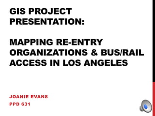
- 1. GIS PROJECT PRESENTATION: MAPPING RE-ENTRY ORGANIZATIONS & BUS/RAIL ACCESS IN LOS ANGELES JOANIE EVANS PPD 631
- 2. REVISED CONCEPT NOTE Project Focus: Mapping re-entry services (housing, food, employment, rehab, etc.) onto a base map of the city of Los Angeles. From there, I would also like to overlay Metro Bus & Rail lines. For the final product, I would like to translate this information into an app, to be used by: -Community Based Organizations -Policy Analysts -Formerly Incarcerated Populations
- 3. PROBLEM DEFINITION Defining Re-entry & Access to Re-entry Services by the Formerly Incarcerated The majority of prison inmates—95% —are going to be released back into the community, so addressing the barriers to community re-entry is important (Baillargeon et al., 2010). Recently released inmates are faced with a host of barriers to having a successful return, or re-entry, into society. Many prisoners are poor, returning to their communities with no health insurance, no government benefits, and little to no family support (Baillargeon et al., 2010).Those who have been convicted of felony drug-related offenses may be ineligible for subsidized housing, food stamps, and other government assistance (Hoge, 2007 as cited by Baillargeon et al., 2010). This is why there is a huge need for access to services that address these barriers. These services—which include food, housing, employment, and other services—are referred to generally as re-entry services.
- 4. ANALYSIS PLAN Research Questions 1. What is the current access to re-entry services based on proximity to public rail & bus lines in the city of Los Angeles? 2. Can a GIS-based web application—app—increase access to re-entry services for the formerly incarcerated? Map of Los Angeles
- 5. ANALYSIS PLAN Goals 1. To visually demonstrate access to re-entry services near rail & bus lines 2. To create an interactive/app resource for use by: local policymakers, community-based organizations, and formerly incarcerated people
- 6. METHODS: WHAT’S CHANGED? Data Search &Analysis I have identified the neighborhoods within the city of Los Angeles. I still need to add to the list of re-entry organizations, specifically those in West Los Angeles. South Los Angeles is covered. GIS Techniques I have re-named rail lines. I have also changed the colors of the lines to match their Metro-designated names. In addition, I have overlaid a polygon layer of the City of Los Angeles. I still need to re-name the bus lines. They are tougher than I expected.
- 8. PROJECT: AFTER http://joanielatidoye.wix.com/professionalwork#!re-entry-orgs-in-la-interactive- app/c19mt
- 9. QUESTIONS? E-MAIL ME AT: JOANIEEV@USC.EDU
Editor's Notes
- Baillargeon, J., Penn, J. V., Knight, K., Harzke, A. J., Baillargeon, G., & Becker, E. A. (2010). Risk of reincarceration among prisoners with co-occurring severe mental illness and substance use disorders. Administration and Policy in Mental Health and Mental Health Services Research, 37(4), 367-374. doi:10.1007/s10488-009-0252-9