Presentació de les portes de collserola a Barcelona
•
0 likes•2,630 views

El projecte de "Portes de Collserola" permetrà l'ordenació urbanística dels límits de la ciutat amb el Parc Natural i definir els equipaments que s'hi poden construir.
Report
Share
Report
Share
Download to read offline

Recommended
Sustainable Urban Planning
This document discusses sustainable urban planning strategies for Mysore City, India. It analyzes land use/land cover changes between 2001-2014 using satellite imagery, showing expansion of urban areas. Population is projected to exceed 1 million by 2020 based on census data. The document identifies suitable and unsuitable areas for future urban growth based on seasonal vegetation analysis and wetlands mapping. It also notes pressure points for expansion along major roads and a proposed highway connecting to Bangalore. Stakeholder involvement is emphasized to balance development, preservation of agriculture and wetlands, and ecological/cultural tourism.
Real estate analysis kozhikode
This document provides an analysis of the real estate market in Kozhikode, India. It finds that Kozhikode has strong growth potential as the 3rd largest city in Kerala with a high literacy rate and quality education facilities. The city's economy is well-off due to money from NRIs and the working class. Several new projects like cyber parks, an industrial investment zone, and an integrated township are fueling growth. The residential market focuses on apartments for the middle class and sees 70% of construction related to NRIs. Office and retail spaces are also active, with malls and shops concentrated along major roads. The industrial sector has declined but is seeing renewed interest with new developments. Overall, the real
Schuylkill Yards (Urban Design Case Study)
It is a mix-use development in the United States.
Site Area: 14Acres.
Schuylkill Yards features 6.5 Acres of publicly accessible open space.
A 1.3 acre public square in front of a redeveloped existing Bulletin Building
Amsterdam example of city planned
Amsterdam only exists because is planned. The canal system in Amsterdam is the result of successful urban planning with the execution of hydraulic engineering works with defensive and transport purposes since the city expanded during the 16th century. In Amsterdam, public space is cleverly planned. Among the reasons for bicycle culture are the flat terrain of the city (and the country as a whole) and the freedom of traffic, since the road rules are considered more as suggestions than as rules themselves. The Amsterdam 2025 mobility plan was designed to prevent the growth of car use, improve the public transport network, and increase the number of walking dislocations and by bicycle. To evaluate urban organization and sustainability, The Economist magazine, in partnership with Siemens, conducted a study to identify the greenest cities in Europe. In this ranking, Amsterdam is the 5th most sustainable city in the world.
different building structures in jammu & kashmir
1) Residential buildings in Jammu and Kashmir historically used local materials like mud, wood and bricks with thatched roofs to retain heat and protect from natural disasters, while modern homes use concrete, bricks, aluminum and have sloped tin roofs.
2) Monumental buildings like Pari Mahal from the 1600s were constructed by rulers for various purposes and used for astronomy, with six terraces and arch structures.
3) Commercial buildings are designed to bear heavy loads and withstand floods or fires, using beams, columns and multi-story concrete floors, with roofs of iron and tin sheets. Examples include the floating houseboats on Dal Lake.
4) Institutional buildings for schools
Neighborhood planning in India
The document discusses the proposed development of a new township along the Bangalore-Mysore corridor that will include 5 separate zones - a corporate township, commercial township, industrial township, heritage township, and eco-tourism township. It then focuses on planning the corporate township, which will be located near Bidadi on 9,800 acres of land. The proposed master plan for the corporate township includes zoning the 60,702 square meter site for residential, commercial, open space, and roads. Housing typologies include studio, LIG, MIG, and HIG units. Unit plans and a cluster model are presented.
Gandhinagar town planning and master plan study
TOWN PLANNING DETAILS OF GANDHINAGAR CITY. HISTORICAL DEVELOPMENT AND THE NEW MASTER PLAN DIFFERENCES AND DETAILS
Space frames
Space frame structures have gained popularity over the last 50 years as they allow for large open interior spaces with minimal obstructions. They are constructed using linear frame elements connected at joints to transfer loads efficiently in three dimensions. Space frames were independently developed in the early 1900s by Alexander Graham Bell and Buckminster Fuller in the 1950s, with Fuller having more influence in popularizing their architectural use. The key advantages of space frames are that they are light, structurally efficient, economical for covering large spans, and allow integrated services.
CLARENCE ARTHUR PERRY (C A PERRY)
CLARENCE ARTHUR PERRY, Clarence Arthur Perry (1872 – September 6, 1944) was an American urban planner. WHAT IS A NEIGHBOURHOOD?ORIGIN OF NEIGHBOURHOODWHAT WAS THE NEED OF PLANNING A NEIGHBOURHOOD UNIT?
Bus Karo: Bus Depot Design Guideline
This document provides guidelines for bus depot design based on case studies of existing depots. It discusses current issues with public bus transportation like declining ridership. The guidelines aim to help state transit agencies properly plan and design bus depots. It covers topics like understanding depot operations, functional area requirements, site planning considerations, and financing models like public-private partnerships. Case studies of specific depots in cities like Delhi and Jaipur are also analyzed. Tables and diagrams are used to illustrate best practices for layout, capacity needs, and spatial requirements.
Public Presentation II: Site Inventory and Analysis
The document contains an inventory and analysis of a study area, including:
1) Aerial photographs and maps of the region showing major roads, parks, and infrastructure like I-85.
2) Maps and photographs of specific sites in the study area, including Kittredge Park, Briarcliff Lake Park, and local roads, paths, and traffic patterns.
3) Analyses of land cover, impervious surfaces, tree cover, and erosion in the study area.
Bhopal mohneys table
Mahoney table which help to design climate resilient building.
it is vary city to city. this is for Bhopal city.
Site planning in Architectural Projects- Principles and Approaches
Write up is an attempt to define in principles governing the site planning and setting of the buildings in the context of site so as to make them rational and sustainable. It defines the principles and approach to site planning.
Case Study.pptx
The Research Support Facility in Golden, Colorado showcases sustainable and high-performance building design. It demonstrates integration of features that optimize passive energy strategies, daylighting, and natural ventilation. The building shapes a narrow footprint around an east-west axis for offices wings to maximize these strategies. It begins generating its own electricity using a transpired solar collector and preheats ventilation air with stored solar heat.
Site Planning Studio 1st Semester M.Plan SPAD
The document discusses a proposed site plan layout for a new development. It includes plans for a pedestrian walkway to provide connectivity to nature, a lotus pond to provide aesthetic and microclimate benefits, a multi-use zone near housing and a playground area, segregation of the utility zone from plotted housing areas, and aerial views of a planned central green belt area.
Road Network heirarchy of Ahmedabad
The presentation is a brief introduction to the road network of Ahmedabad comprising of terminals, nodes, arterial, sub-arterial, collector and local roads. It also provides an intersection detail of Paldi circle as one case study.
Clarence perry faheem atif
Clarence Perry defined the neighborhood unit as having a population of 5,000-6,000 people within a 160 acre area. The neighborhood unit centers around an elementary school located within a half mile walking distance of all homes. It also includes small shopping centers, parks, and community facilities clustered near the school. Perry's conceptualization of the neighborhood unit aimed to make key services and amenities accessible by foot to residents. Later authors refined the neighborhood unit model by suggesting smaller walking distances and connecting multiple units around shared high schools and commercial centers.
Chandigarh- A City of Two Plans
1. The document discusses and compares the two original master plans for Chandigarh - the first by American architect Albert Mayer and the second by French architect Le Corbusier.
2. The first plan envisioned a more traditional Indian city with curved roads and leaf-shaped layout, while the second created the current grid structure with sectors.
3. Key differences between what would have been under each plan include the city's shape, residential units (superblocks vs. sectors), inclusion of Sukhna Lake, and industrial area placement. The implementation of Le Corbusier's plan resulted in a more modernist design for Chandigarh.
Land pooling Policy of DDA TPS and Magarpatta
The document provides an overview and comparison of three land pooling policies: TPS Gujarat, Magarpatta City Pune, and DDA Land Pooling Policy. TPS Gujarat involves consolidating land parcels of 100-200 hectares and reorganizing plots while providing infrastructure and returning a portion of the original land to owners. Magarpatta City was a cooperative development by farmers in Hadapsar village that established an development company and returned shares rather than land portions. The DDA Land Pooling Policy aims to promote development through consolidating land into categories to be developed by private entities, with land returns of 60% and 48% respectively but lacks compensation for land given to the government.
Mcd Dda Slum Strategy Romi Roy
This document discusses strategies for making Delhi slum-free by 2013. It notes that the number of slum clusters, or jhuggi jhopri clusters, in Delhi has grown significantly since 1977. The current strategy involves relocating slum clusters to new locations and upgrading slums in-situ. However, these strategies have faced challenges including locating slum residents far from employment, inadequate infrastructure in new sites, and lack of approvals for in-situ upgrades. The document proposes a new action plan with the goals of ensuring equitable housing and shared public amenities for all. It outlines a roadmap to achieve this that includes regional transit planning, mixed income communities near transit, socio-economic surveys, design competitions,
Urban Design: Streets
The document discusses elements of urban design related to streets. It summarizes the views of several experts, including Allan Jacobs who argued that street design can build community by bringing people together, and David Sucher who advocated for "traffic calming" strategies like narrower streets, curb extensions, and trees to slow traffic and make streets more pedestrian-friendly. The document also presents examples of complete streets, transit-oriented development, and well-designed streets in cities like Vaxjo, Gdansk, and Lugano.
metro station planning ar.ravi sankar alumni(auce architecture)
This document discusses several key aspects of metro rail station planning and design, including:
1. Types of metro stations such as underground, on-grade, and elevated, as well as center and side platforms.
2. Design criteria for metro stations including passenger capacity, accessibility, construction feasibility, and life safety measures.
3. Coordination challenges between different disciplines during design and construction. International standards like NFPA 130 provide guidelines for fire protection and evacuation.
4. Interchange stations require special wayfinding signage due to their complex layouts with transfers between lines.
Clock shadow building
The Clock Shadow Building project in Milwaukee, Wisconsin achieved high levels of sustainability through its site planning and materials choices. It decreased energy consumption by 50% using salvaged wood sunscreens and optimizing natural lighting. Energy was further reduced via 27 geothermal wells and over 50% of building materials were salvaged or recycled, including the exterior wood siding and brick. Rainwater was collected and reused for flushing toilets, promoting water conservation. The project received numerous certifications and awards for its green building and sustainable design.
Udayan ~ The Condo Ville.pptx
B.V. Doshi is a pioneering Indian architect known for his contributions to modernist architecture in India. Udayan ~ The Condo Ville was a joint venture housing project between the Government of West Bengal and B.V. Doshi. The 26-acre project, completed in 2002, features over 1,600 residential units across apartment types for different income groups as well as townhouses. It established new benchmarks for public-private partnerships in social housing.
What's different between urban planning, urban design, architecture, AADI
A.Alliance Design International. What is the difference between urban planning, urban design, and architecture.
Revised Developement Plan, Ahmedabad 2013 - 2021
The document outlines Ahmedabad's development plan for 2021. It divides the city into zones and specifies the percentage of each zone that will be developed. It aims to develop affordable housing, optimize land use through compact planning, and prioritize sustainable and affordable development. The plan also focuses on developing infrastructure like roads, public transportation, green spaces, water and waste management, and heritage preservation to support the city's growth.
Chandigarh planning
Chandigarh was planned by French architect Le Corbusier as the capital of Punjab and Haryana states. He designed the city's grid plan layout with sectors, open green spaces, and a hierarchy of roads. Key buildings include the Capitol Complex with the Secretariat, High Court, and Legislative Assembly buildings. Each sector is self-sufficient and connected by roads, with amenities, greenspaces, and varying housing. Le Corbusier's modernist designs aimed to incorporate principles of function, light, and greenery into Chandigarh's planning.
Ruta fotogràfica per Barcelona
Ruta fotogràfica per Barcelona realitzada pels alumnes de 5è de l'Escola Pau Casals de Viladecans el 29 d'abril de 2012.
Presentació creada per Daniel Jiménez Gil.
More Related Content
What's hot
Space frames
Space frame structures have gained popularity over the last 50 years as they allow for large open interior spaces with minimal obstructions. They are constructed using linear frame elements connected at joints to transfer loads efficiently in three dimensions. Space frames were independently developed in the early 1900s by Alexander Graham Bell and Buckminster Fuller in the 1950s, with Fuller having more influence in popularizing their architectural use. The key advantages of space frames are that they are light, structurally efficient, economical for covering large spans, and allow integrated services.
CLARENCE ARTHUR PERRY (C A PERRY)
CLARENCE ARTHUR PERRY, Clarence Arthur Perry (1872 – September 6, 1944) was an American urban planner. WHAT IS A NEIGHBOURHOOD?ORIGIN OF NEIGHBOURHOODWHAT WAS THE NEED OF PLANNING A NEIGHBOURHOOD UNIT?
Bus Karo: Bus Depot Design Guideline
This document provides guidelines for bus depot design based on case studies of existing depots. It discusses current issues with public bus transportation like declining ridership. The guidelines aim to help state transit agencies properly plan and design bus depots. It covers topics like understanding depot operations, functional area requirements, site planning considerations, and financing models like public-private partnerships. Case studies of specific depots in cities like Delhi and Jaipur are also analyzed. Tables and diagrams are used to illustrate best practices for layout, capacity needs, and spatial requirements.
Public Presentation II: Site Inventory and Analysis
The document contains an inventory and analysis of a study area, including:
1) Aerial photographs and maps of the region showing major roads, parks, and infrastructure like I-85.
2) Maps and photographs of specific sites in the study area, including Kittredge Park, Briarcliff Lake Park, and local roads, paths, and traffic patterns.
3) Analyses of land cover, impervious surfaces, tree cover, and erosion in the study area.
Bhopal mohneys table
Mahoney table which help to design climate resilient building.
it is vary city to city. this is for Bhopal city.
Site planning in Architectural Projects- Principles and Approaches
Write up is an attempt to define in principles governing the site planning and setting of the buildings in the context of site so as to make them rational and sustainable. It defines the principles and approach to site planning.
Case Study.pptx
The Research Support Facility in Golden, Colorado showcases sustainable and high-performance building design. It demonstrates integration of features that optimize passive energy strategies, daylighting, and natural ventilation. The building shapes a narrow footprint around an east-west axis for offices wings to maximize these strategies. It begins generating its own electricity using a transpired solar collector and preheats ventilation air with stored solar heat.
Site Planning Studio 1st Semester M.Plan SPAD
The document discusses a proposed site plan layout for a new development. It includes plans for a pedestrian walkway to provide connectivity to nature, a lotus pond to provide aesthetic and microclimate benefits, a multi-use zone near housing and a playground area, segregation of the utility zone from plotted housing areas, and aerial views of a planned central green belt area.
Road Network heirarchy of Ahmedabad
The presentation is a brief introduction to the road network of Ahmedabad comprising of terminals, nodes, arterial, sub-arterial, collector and local roads. It also provides an intersection detail of Paldi circle as one case study.
Clarence perry faheem atif
Clarence Perry defined the neighborhood unit as having a population of 5,000-6,000 people within a 160 acre area. The neighborhood unit centers around an elementary school located within a half mile walking distance of all homes. It also includes small shopping centers, parks, and community facilities clustered near the school. Perry's conceptualization of the neighborhood unit aimed to make key services and amenities accessible by foot to residents. Later authors refined the neighborhood unit model by suggesting smaller walking distances and connecting multiple units around shared high schools and commercial centers.
Chandigarh- A City of Two Plans
1. The document discusses and compares the two original master plans for Chandigarh - the first by American architect Albert Mayer and the second by French architect Le Corbusier.
2. The first plan envisioned a more traditional Indian city with curved roads and leaf-shaped layout, while the second created the current grid structure with sectors.
3. Key differences between what would have been under each plan include the city's shape, residential units (superblocks vs. sectors), inclusion of Sukhna Lake, and industrial area placement. The implementation of Le Corbusier's plan resulted in a more modernist design for Chandigarh.
Land pooling Policy of DDA TPS and Magarpatta
The document provides an overview and comparison of three land pooling policies: TPS Gujarat, Magarpatta City Pune, and DDA Land Pooling Policy. TPS Gujarat involves consolidating land parcels of 100-200 hectares and reorganizing plots while providing infrastructure and returning a portion of the original land to owners. Magarpatta City was a cooperative development by farmers in Hadapsar village that established an development company and returned shares rather than land portions. The DDA Land Pooling Policy aims to promote development through consolidating land into categories to be developed by private entities, with land returns of 60% and 48% respectively but lacks compensation for land given to the government.
Mcd Dda Slum Strategy Romi Roy
This document discusses strategies for making Delhi slum-free by 2013. It notes that the number of slum clusters, or jhuggi jhopri clusters, in Delhi has grown significantly since 1977. The current strategy involves relocating slum clusters to new locations and upgrading slums in-situ. However, these strategies have faced challenges including locating slum residents far from employment, inadequate infrastructure in new sites, and lack of approvals for in-situ upgrades. The document proposes a new action plan with the goals of ensuring equitable housing and shared public amenities for all. It outlines a roadmap to achieve this that includes regional transit planning, mixed income communities near transit, socio-economic surveys, design competitions,
Urban Design: Streets
The document discusses elements of urban design related to streets. It summarizes the views of several experts, including Allan Jacobs who argued that street design can build community by bringing people together, and David Sucher who advocated for "traffic calming" strategies like narrower streets, curb extensions, and trees to slow traffic and make streets more pedestrian-friendly. The document also presents examples of complete streets, transit-oriented development, and well-designed streets in cities like Vaxjo, Gdansk, and Lugano.
metro station planning ar.ravi sankar alumni(auce architecture)
This document discusses several key aspects of metro rail station planning and design, including:
1. Types of metro stations such as underground, on-grade, and elevated, as well as center and side platforms.
2. Design criteria for metro stations including passenger capacity, accessibility, construction feasibility, and life safety measures.
3. Coordination challenges between different disciplines during design and construction. International standards like NFPA 130 provide guidelines for fire protection and evacuation.
4. Interchange stations require special wayfinding signage due to their complex layouts with transfers between lines.
Clock shadow building
The Clock Shadow Building project in Milwaukee, Wisconsin achieved high levels of sustainability through its site planning and materials choices. It decreased energy consumption by 50% using salvaged wood sunscreens and optimizing natural lighting. Energy was further reduced via 27 geothermal wells and over 50% of building materials were salvaged or recycled, including the exterior wood siding and brick. Rainwater was collected and reused for flushing toilets, promoting water conservation. The project received numerous certifications and awards for its green building and sustainable design.
Udayan ~ The Condo Ville.pptx
B.V. Doshi is a pioneering Indian architect known for his contributions to modernist architecture in India. Udayan ~ The Condo Ville was a joint venture housing project between the Government of West Bengal and B.V. Doshi. The 26-acre project, completed in 2002, features over 1,600 residential units across apartment types for different income groups as well as townhouses. It established new benchmarks for public-private partnerships in social housing.
What's different between urban planning, urban design, architecture, AADI
A.Alliance Design International. What is the difference between urban planning, urban design, and architecture.
Revised Developement Plan, Ahmedabad 2013 - 2021
The document outlines Ahmedabad's development plan for 2021. It divides the city into zones and specifies the percentage of each zone that will be developed. It aims to develop affordable housing, optimize land use through compact planning, and prioritize sustainable and affordable development. The plan also focuses on developing infrastructure like roads, public transportation, green spaces, water and waste management, and heritage preservation to support the city's growth.
Chandigarh planning
Chandigarh was planned by French architect Le Corbusier as the capital of Punjab and Haryana states. He designed the city's grid plan layout with sectors, open green spaces, and a hierarchy of roads. Key buildings include the Capitol Complex with the Secretariat, High Court, and Legislative Assembly buildings. Each sector is self-sufficient and connected by roads, with amenities, greenspaces, and varying housing. Le Corbusier's modernist designs aimed to incorporate principles of function, light, and greenery into Chandigarh's planning.
What's hot (20)
Public Presentation II: Site Inventory and Analysis
Public Presentation II: Site Inventory and Analysis
Site planning in Architectural Projects- Principles and Approaches
Site planning in Architectural Projects- Principles and Approaches
metro station planning ar.ravi sankar alumni(auce architecture)
metro station planning ar.ravi sankar alumni(auce architecture)
What's different between urban planning, urban design, architecture, AADI
What's different between urban planning, urban design, architecture, AADI
Similar to Presentació de les portes de collserola a Barcelona
Ruta fotogràfica per Barcelona
Ruta fotogràfica per Barcelona realitzada pels alumnes de 5è de l'Escola Pau Casals de Viladecans el 29 d'abril de 2012.
Presentació creada per Daniel Jiménez Gil.
Proposta de continuïtat del passeig marítim del Molinar
El que es pretén amb la present proposta és donar continuïtat al passeig marítim del Molinar sense haver d'intervenir en el seu mollet i, així, conservar l'entorn heretat del barri. Per a permetre dita continuïtat al voltant del port, es planteja restringir el trànsit rodat del carrer del Vicari Joaquim Fuster en el tram de devers 250 m que hi ha entre els carrers Gràcia i Joan Nicolau i Barceló, mitjançant l'aplicació d'una zona ACIRE. És a dir, només es permetrà la circulació de vehicles autoritzats.
El copyright d'aquest document pertany a En Tomeu Duran i Gelabert.
Queden expressament prohibides la reproducció, la distribució i la comunicació pública, inclosa la seva modalitat de posada a disposició, de la totalitat o part dels continguts d'aquest projecte, en qualsevol suport i per qualsevol mitjà tècnic, sense l'autorització prèvia de l'autor.
Es permet la inclusió de l'enllaç virtual com a referència de la present obra.
The copyright of this document belongs to Tomeu Duran Gelabert.
Any republication, reproduction, distribution, and presentation to the public, including facilitating the availability, of all or any part of the contents of this project, in any technical format, without prior permission by the author is strictly prohibited.
The inclusion of the link as a reference of this work is allowed
Informacions generals de la ciutat
Aquest powerpoint tracta com diu el títol sobre les informacions generals de Barcelona.
Quadern de viatge : Comarques de Barcelona: Propostes úniques i experiències ...
Quadern de viatge : Comarques de Barcelona: Propostes úniques i experiències ...Diputació de Barcelona
A prop de Barcelona hi trobaràs mil fórmules per gaudir d’un merescut parèntesi en l’atrafegada vida quotidiana. Viu l’emoció de les festes populars a la Patum de Berga o a la Diada Castellera de Sant Fèlix, a Vilafranca del Penedès. Estira la tovallola en una de les moltes platges dels més de cent quilòmetres de litoral i col·lecciona moments especials tot fent castells de sorra amb els petits, capbussades amb els amics o passejades amb la teva parella. Aprofita per visitar un museu, sopar en un restaurant amb estrella, practicar el teu esport preferit, fer un tast de vins, visitar un santuari o penjar-te la motxilla a l’esquena i recórrer els boscos i les muntanyes d’algun dels setze parcs i espais naturals situats al voltant de la ciutat de Barcelona.reCvolució - Proposta pel barri del rec d'Igualada BUUR+Lavola
RECVOLUCIÓ – Barri del Rec d’Igualada
BUUR and Lavola developed a proposal on the transformation of the Rec industrial neighborhood in Igualada, Catalonia. The competition, organized by the Architects Council of Catalonia, the city of Igualada and the IAAC, aimed at raising new ideas on urban renewal strategies for this neighbourhood, rich in cultural and industrial heritage.
The Rec of Igualada is one of the most important industrial neighborhoods in Catalonia. During the last decades, the decline of the textile and leather industries have left an incredibly valuable heritage partially abandoned. We face now a crucial historical moment. The current challenges demand for new strategies to open a new historical episode to the life of the neighborhood.
Our proposal reCvolution claims for urban experimentation, innovation and new processes to construct collectively the future of the Rec. Three urban revolutions can reveal the latent potentials of the neighborhood.
A productive reCvolution: a neighborhood to live and to work combining the traditional remaining leather industries, with the emerging creative economies (leather and fashion industries, designers, etc.) and research institutions. Development strategies were proposed on how to transform and integrate traditional manufacturing with new clean uses, as well as on how to attract new creative economies.
An ecologic reCvolution: the naturalization of the neighborhood blending it into the surrounding landscape. This is achieved by restoring the river valley for soft recreational activities, the creation of new small parks and squares, and the reconversion of the transversal streets into green arteries linking the city centre to the Rec neighborhood.
A cultural reCvolution: the cultural and architectural heritage is the DNA of the neighborhood. Engaged citizens have fought for its protection by raising awareness of its value, organizing festivals and other cultural initiatives. Capitalizing on these dynamics is crucial to accelerate the urban transition process. The construction of new public facilities, local services, and a wide range of housing typologies is basic to activate and inhabit the area.
The neighborhood becomes a pilot project, where new planning tools are used dealing with flexibility, temporality and alternative managing and funding methods.
Similar to Presentació de les portes de collserola a Barcelona (20)
Proposta de continuïtat del passeig marítim del Molinar
Proposta de continuïtat del passeig marítim del Molinar
25 anys del Pla Especial del Barri Vell de Girona (1)
25 anys del Pla Especial del Barri Vell de Girona (1)
Quadern de viatge : Comarques de Barcelona: Propostes úniques i experiències ...
Quadern de viatge : Comarques de Barcelona: Propostes úniques i experiències ...
reCvolució - Proposta pel barri del rec d'Igualada BUUR+Lavola
reCvolució - Proposta pel barri del rec d'Igualada BUUR+Lavola
More from Ajuntament de Barcelona
Mesura de govern: Generació d’energia solar fotovoltaica a Barcelona.
Mesura de govern:
Generació d’energia solar fotovoltaica a Barcelona. Accelerem la generació
d’energia fotovoltaica a Barcelona
Presentada al Plenari del Consell Municipal en sessió ordinària de 26 d'abril de 2024
Com combatre l'edatisme vers les persones grans
L’Associació SomSeniors, amb la col·laboració del Departament de Promoció de les Persones Grans, ha elaborat aquest document amb informació teoricopràctica i recomanacions per combatre l’edatisme vers les persones grans.
Estat de la ciutat 2022
Informe de l'Estat de la ciutat 2022.
Elaborat pel departament d'anàlisi de l'Oficina Municipal de Dades.
Aquest document recull l’evolució de les dades de població, activitat econòmica, mercat de treball, mobilitat, qualitat ambiental i la resta d’aspectes de la vida quotidiana. Bona part dels indicadors mostren la recuperació de l’activitat econòmica i especialment del mercat de treball durant el 2022 així com de l’activitat cultural i esportiva de la ciutat.
Presentat al Consell Plenari ordinari del mes de febrer de 2023.
Pla de Salut Mental 2023-2030
Mesura de Govern "Pla de Salut Mental 2023-2030".
Elaborat per l'Àrea de Drets Socials, Justícia Global, Feminismes i LGTBI de l'Ajuntament de Barcelona.
Barcelona presenta el seu segon pla de salut mental per afermar l’empenta que va fer la ciutat l’any 2016 quan va iniciar el desplegament del seu primer pla. El segon pla consolida a la ciutat com a capdavantera en polítiques públiques en salut mental i amb una perspectiva comunitària Així mateix, dona continuïtat al desenvolupament de polítiques locals de prevenció i promoció de la salut mental a l’hora que fomentar l’atenció a les necessitats en salut mental de la ciutadania.
Com no podria ser d’una altra manera, aquest segon pla segueix alineat amb les recomanacions i polítiques per d’altres institucions més globals com l’Organització Mundial de la Salut (OMS) i la Comissió Europea així com el Pacte Nacional de Catalunya en Salut Mental promogut pel Govern de la Generalitat de Catalunya.
Aquest document va ser presentat al Consell Plenari Ordinari del mes de febrer de 2023.
Petita infància i educació inclusiva a les escoles bressol municipals
Informe "Petita infància i educació inclusiva a les escoles bressol municipals". Avenços i reptes en la detecció i atenció precoç de necessitats específiques de suport educatiu (NESE) a les escoles bressol municipals de Barcelona.
Presentat a la Comissió de Drets Socials, Cultura i Esports del mes del 13 de desembre de 2022.
Pla director de Biblioteques de Barcelona 2030
Pla director de biblioteques de Barcelona 2030.
Dret a la a lectura, a l'accés a la informació i al coneixement. Foment de les pràctiques creatives i de la participació comunitària.
Pla de drets culturals de Barcelona.
Presentat al Plenari del Consell Municipal, el 25 de novembre de 2022.
Balanç de Festes Majors de tardor 2022
Us dels principals reptes d’aquest estiu i tardor han estat les celebracions, en un context de plena normalitat post Covid, de les festes majors d’alguns dels barris de Barcelona, i, en especial, de les festes de La Mercè, per la gran quantitat de públic que atrauen, en un entorn de civisme i seguretat.
Enguany, amb la previsió d’aquesta recuperada normalitat, amb programacions sense les restriccions COVID i l’accés lliure als espais i als espectacles, es van dissenyar dispositius de serveis de prevenció i seguretat entre Guàrdia Urbana i Mossos d’Esquadra, i espais de coordinació amb els organitzadors de les festes i la resta de serveis municipals especialment implicats en manteniment de l’espai públic i la convivència amb l’objectiu d’ajustar i corregir, en el seu cas, els recursos inicialment dimensionats.
Els cossos de seguretat han treballat conjuntament en l’avaluació de les diferents festes majors per donar resposta a les necessitats i als riscos, establint dispositius de prevenció i preveient equips d’intervenció, en el seu cas. El manteniment de la seguretat i la convivència han estat la principal ocupació.
Aquestes festes, sobretot La Mercè, son concorregudes no només pels veïns i veïnes de Barcelona sinó que atrauen a gran quantitat de persones d’altres ciutats, per la seva oferta cultural i d’activitats singulars i per l’atractiu d’oci nocturn que ofereixen.
Informe d’inici del curs escolar 2022-2023
Aquest informe pretén ser un recull de la dimensió formal del sistema escolar i de la situació de l’inici del curs escolar a les diferents etapes educatives a la ciutat de Barcelona. Tot i així, no podem oblidar la dimensió transversal de l’educació, que va molt més enllà d’escoles i instituts, i de les oportunitats
educatives fora del temps escolar com el temps de migdia, les tardes o els caps de setmana, que com a
ciutat educadora no podem oblidar.
La gestió d'incidències i la millora contínua 2021 - 1T 2022
Informe d'anàlisi de la gestió de les incidències als sistemes informàtics de l'Ajuntament de Barcelona.
El document elaborat per l'Institut Municipal d'Informàtica (IMI) avalua el nivell de servei i les assistències significatives que s’han produït durant l’any 2021 i primer trimestre del 2022.
Presentat a la comissió de Presidència, Drets de Ciutadania, Participació, Seguretat i Prevenció el 21 de setembre de 2022.
Informe estiu 2022, balanç del dispositiu de seguretat i convivència a la ciutat
Informe estiu 2022, balanç del dispositiu de seguretat i convivència a la ciutatAjuntament de Barcelona
Balanç del dispositiu de seguretat i convivència a la ciutat dut a terme l'estiu 2022.
Presentat a la comissió de Presidència, Drets de Ciutadania, Participació, Seguretat i Prevenció el 21 de setembre de 2022.Primer Informe de seguiment de la mesura de govern “Avançar cap a la intercul...
Primer Informe de seguiment de la mesura de govern “Avançar cap a la intercul...Ajuntament de Barcelona
L’objectiu del present informe de govern és fer balanç i seguiment de les accions dutes a terme i impulsades per l’Ajuntament durant el darrer any amb relació a la mesura
de govern “Avançar cap a la interculturalitat. Instruments i mecanismes de governança”, presentada al plenari municipal el 28 de maig de 2021 i que desenvolupa l’eix 5 del pla Barcelona Interculturalitat 2021-2030.Medición de la inversión presupuestaria en la infancia en los presupuestos ap...
Medición de la inversión presupuestaria en la infancia en los presupuestos ap...Ajuntament de Barcelona
El presente documento tiene como objetivo identificar y cuantificar la inversión destinada a infancia en los presupuestos aprobados de 2021 del Ayuntamiento de Barcelona. Ello se enmarca en el proceso que UNICEF España ha venido llevando a cabo para analizar el esfuerzo presupuestario que, desde las Administraciones Públicas, se hace para garantizar el cumplimiento de los derechos y el bienestar de la infancia mediante una metodología y una herramienta presentada en 2018 en el documento de trabajo “Medición de la inversión presupuestaria en la infancia. Propuesta metodológica y primeros resultados en España”1. En este sentido, el presente trabajo es una aplicación de dicha metodología.TAULA CIUTADANA PER A UNA NIT CÍVICA I SEGURA
Durant l’estiu del 2021, després de dos anys de confinament i de restriccions, tant a Barcelona com a d’altres ciutats europees van proliferar les reunions multitudinàries de persones que es congregaven a diferents punts de la ciutat per ballar, relacionar-se i beure alcohol, sovint fins a altes hores de la matinada.
En aquest context s’aprovava la Mesura de Govern que crea la Taula Ciutadana per a una Nit Cívica i Segura, que impulsada per la Cinquena Tinència d’Alcaldia de Prevenció i Seguretat, neix com l’espai de participació ciutadana on hi intervenen entitats ciutadanes, associacions professionals, grups polítics municipals, àrees de l’Ajuntament i altres administracions com el Síndic de Greuges de Barcelona i Mossos d’Esquadra.
L’ACOLLIDA A PERSONES IMMIGRADES I REFUGIADES. ESTRATÈGIA BARCELONA 2022-2025
L’ACOLLIDA A PERSONES IMMIGRADES I REFUGIADES. ESTRATÈGIA BARCELONA 2022-2025Ajuntament de Barcelona
Aquesta estratègia forma part de les polítiques de governança de la diversitat de la ciutat, com ara el Pla Barcelona Interculturalitat i la Mesura per una Barcelona antiracista. També es vincula amb plans i programes sectorials de la ciutat que s’adrecen al conjunt de la ciutadania, com el Pla d’adolescència i joventut, l’Estratègia municipal contra la soledat 2020-2030, l’informe de la Unitat Municipal contra el Tràfic d’Éssers Humans (UTEH), el Pla per la justícia de gènere 2021-2025, el Pla de salut mental 2016-2022, els plans d’acció comunitària i el Pla de barris.Seguiment Pla Actuació Impulsem 2020- 2023
Un procés de reflexió i acció sobre els Centres de Serveis Socials.
220614 Drets Socials_Informe_Seguiment_Pla Adolescència i Joventut.pdf
Pla d’Adolescència i Joventut 2017-2021.
Informe final de seguiment 2021.
Departament de Joventut, Ajuntament de Barcelona.
Reglament de Participació Ciutadana de Barcelona.pdf
Aquest reglament desenvolupa les previsions de la Carta municipal de Barcelona respecte a la participació ciutadana, i regular els canals de relació entre la ciutadania i l'Ajuntament per facilitar i promoure aquesta participació en els processos de presa de decisions polítiques i en la gestió dels serveis i els assumptes d'interès municipal.
Barcelona Ciutat Patrimoni
Amb aquesta mesura es vol donar sortida operativa a les indicacions
recollides al llarg dels treballs previs que l’Administració ha anat realitzant
en els darrers anys i que han començat a delinear una nova mirada patrimonial,
en la que s’hi sumen els elements immaterials i de memòria
col·lectiva.
More from Ajuntament de Barcelona (20)
Mesura de govern: Generació d’energia solar fotovoltaica a Barcelona.
Mesura de govern: Generació d’energia solar fotovoltaica a Barcelona.
240214_Presidència_Informe_elaboració_Pla_Local_Seguretat.pdf
240214_Presidència_Informe_elaboració_Pla_Local_Seguretat.pdf
Petita infància i educació inclusiva a les escoles bressol municipals
Petita infància i educació inclusiva a les escoles bressol municipals
La gestió d'incidències i la millora contínua 2021 - 1T 2022
La gestió d'incidències i la millora contínua 2021 - 1T 2022
Informe estiu 2022, balanç del dispositiu de seguretat i convivència a la ciutat
Informe estiu 2022, balanç del dispositiu de seguretat i convivència a la ciutat
Primer Informe de seguiment de la mesura de govern “Avançar cap a la intercul...
Primer Informe de seguiment de la mesura de govern “Avançar cap a la intercul...
Medición de la inversión presupuestaria en la infancia en los presupuestos ap...
Medición de la inversión presupuestaria en la infancia en los presupuestos ap...
L’ACOLLIDA A PERSONES IMMIGRADES I REFUGIADES. ESTRATÈGIA BARCELONA 2022-2025
L’ACOLLIDA A PERSONES IMMIGRADES I REFUGIADES. ESTRATÈGIA BARCELONA 2022-2025
220614 Drets Socials_Informe_Seguiment_Pla Adolescència i Joventut.pdf
220614 Drets Socials_Informe_Seguiment_Pla Adolescència i Joventut.pdf
Reglament de Participació Ciutadana de Barcelona.pdf
Reglament de Participació Ciutadana de Barcelona.pdf
Presentació de les portes de collserola a Barcelona
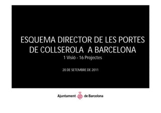
- 1. ESQUEMA DIRECTOR DE LES PORTES DE COLLSEROLA A BARCELONA 1 Visió - 16 Projectes 20 DE SETEMBRE DE 2011
- 2. Reptes: Re-naturalitzar la ciutat Connectar la ciutat i el Parc Millorar els barris de muntanya
- 5. ÀMBITS DE LES 16 PORTES DE COLLSEROLA
- 6. Oportunitat: Acabar el Passeig de les Aigües
- 7. ESQUEMA BÀSIC D’UNA PORTA DE COLLSEROLA
- 8. 1. PORTA DE LA DIAGONAL
- 9. 2. PORTA DE PEDRALBLES
- 10. 3. PORTA DE SARRIÀ
- 11. 4A. PORTA DE VALLVIDRERA 4B. PORTA DE LES PLANES
- 12. 5. PORTA DE BELLESGUARD
- 13. 6. PORTA DEL TIBIDABO
- 14. 7. PORTA DE PENITENTS
- 15. 8. PORTA DE SANT GENÍS
- 16. 9. PORTA DE MONTBAU
- 18. 11. PORTA DE CANYELLES
- 19. 12. PORTA DE LA GUINEUETA
- 20. 13. PORTA DE LA TRINITAT
- 21. 14. PORTA DE TORRE BARÓ
- 22. 15. PORTA DE CIUTAT MERIDIANA
- 23. QUADRE RESUM DESENVOLUPAMENT DEL PROCÉS
- 24. QUADRE RESUM DESENVOLUPAMENT DEL CONCURS
- 25. 2011 3T Presentació dels diferents concursos de projectes 4T Selecció dels equips interdisciplinaris 2012 1T Presentació del guanyadors 2T Presentació Programa d’actuació i inici del desenvolupament dels projectes
- 26. ESQUEMA DIRECTOR DE LES PORTES DE COLLSEROLA A BARCELONA 1 Visió - 16 Projectes 20 DE SETEMBRE DE 2011