
Recommended
More Related Content
More from Carlos A. Catunta Flores
More from Carlos A. Catunta Flores (7)
Recently uploaded
Recently uploaded (20)
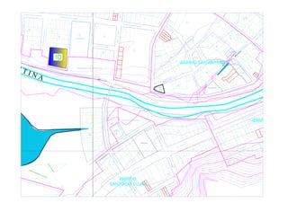
plano celestino paye_recover-Layout2.pdf
- 1. JIR ÓN HUANCANÉ PARQUE J I R Ó N V I A C R U C I S J IR Ó N C U S C O J I R Ó N D E U S T U A J I R Ó N B O L I V A R JIRÓN SANTA ROSA JIR Ó N H U A N C A N É J I R Ó N S A N T A R O S A JIR Ó N D E U S TU A J IR Ó N J IR Ó N V IA C R U C IS JIR Ó N V IA C R U C IS PARQUE DEPORTIVA ÁREA EDUCACIÓN MALECÓN WENCESLAO MOLINA MALECÓN PARQUE PLAZA 1 C B A F E G H J D I 1 2 3 4 5 6 1 2 3 4 5 6 7 1 2 3 4 5 6 7 8 9 10 11 12 13 14 15 17 18 19 20 21 22 23 25 1 2 5 6 7 8 1 2 3 4 5 6 7 8 9 10 11 12 8 1 2 3 4 5 6 7 8 9 10 11 12 1 2A 3 4 5 6 8 9 10 12 13 14 15 16 17 1 2 1 2 3 4 6 7 8A 9 10 11 C O M E R C I O JIR Ó N B O LIV A R WENCESLAO MOLINA J IR Ó N C U S C O OTROS FINES P A S A J E 2 PASAJE 1 P A S A J E 2 J I R Ó N P R O G R E S O W E N C E S L A O M O L I N A M A L E C Ó N 2B 2C 8B EDUCACIÓN 1 H P G F Q R 11 12 13 14 15 16 17 18 19 1A 1 2 2 3 4 5 7 8 9 11 12 1 2 3 4 5 6 7 8 9 10 11 12 13 14 15 16 17 1 2 3 4 5 6 7 8 9 10 11 12 13 JIRÓN CÉSAR VALLEJO JIRÓ N INMA CUL ADA CON CEP CIÓN JIRÓN MIRAFLORE JIR ÓN CA LV AR IO JIR ÓN CA LV AR IO JIRÓN LAMPA JIRÓN RICARDO PALMA JIRÓN RICARDO PALMA JIR ÓN MI RA FL OR ES JIR ÓN CA HU IDE JIR ÓN CA HU IDE JIRÓN PROG RESO MALECÓN WENCESLAO MOLINA MALECÓN WENCESLAO MOLINA JIRÓN RICARDO PALMA PROPIEDAD DE TERCEROS 6 1B JIR Ó N D O S D E M A Y O J I R Ó N B O L I V A R E 1 7 8 9 10 12 13 14 15 16 17 18 19 20 1 2 J IR Ó N L A U N IÓ N JIRÓN LIZANDRO LUNA JIRÓ N LIBERTAD A 1 2 3 4 5 6 7 8 9 10 1 1 2 3 4 5 6 7 8 9 2 3 4 41 42 43 44 45 46 48 J IR Ó N L A U N IÓ N 12A 5 6 7 8 9 10 11 13 14 12B J I R Ó N L O S I N C A S J I R Ó N L O S I N C A S JIR Ó N LA G U N A TE M P O R A L J I R Ó N C A J A M A R C A JIR Ó N C EN TEN AR IO JIRÓN LIBERTAD JIR Ó N LIB E R TA D J I R Ó N C A J A M A R C A J IR Ó N L A U N IÓ N DEPORTIVA ÁREA K E D G H N I 1 1 1 1 1 1 1 4 5 7 8 2 3 4 5 6 7 8 9 10 11 12 2 3 4 5 6 7 8 9 10 11 12 13 14 15 16 2 3 4 5 6 7 8 9 10 11 12 13 14 15 16 17 3 4 5 6 13 2 7 8 9 10 11 2 3 4 5 6 7 8 9 4 5 6 7 8 9 10 11 OTROS USOS SERVICIOS DE ELECTRIFICACIÓN F RONDA RONDA P U T I N A BARRIO SAN ANTONIO BARRIO LIBERTAD BARRIO SANTIAGO LUJAN P U E N T E F U N D IC IO N E2 E1 1 2 3 4 1 2 3 4 5 6 7 8 9 10 11 12 13 14 15 16 17 18 19 20 21 JIR Ó N L A G U N A T E M P O R A L JIRÓN LOS INCAS AREA=275.14 M2 PERIMETRO= 69.02 ML J I R O N T O T O R A L B AREA DE RESERVA NATURAL J I R O N T O T O R A L AREA DE RESERVA NATURAL J I R Ó N L O S I N C A S J I R Ó N L O S I N C A S C D 1 2 3 4 5 6 7 8 9 10 11 12 13 14 15 16 17 6 7 8 9 10 11 1 2 3 4 5 6 7 8 9 10 11 OTROS USOS BARRIO SANTIAGO LUJAN JIR Ó N L A G U N A T E M P O R A L 24A 11 A 5 A 5 A 7B 40 A 6 A 5 B 11 B 5 B 5 C 5 D 5 E 5 F 40 B 6 B 13B 13A 24B 24C 24D 7D 7C