Plan Bothnia project: the fascinating story of how we made it
•Download as PPTX, PDF•
0 likes•517 views

The document summarizes the process of creating a pilot maritime spatial plan for the Bothnian Sea between Sweden and Finland. It involved collecting spatial data on various human uses and natural features of the Baltic Sea from the HELCOM map service to understand that the Baltic Sea is a busy area with oil rigs, wind farms, shipping lanes, fishing grounds, and protected areas. The project tested a transboundary, offshore maritime spatial planning process and found it important to make all data and plans openly available online. It concluded that planning is an ongoing and iterative process.

Recommended
More Related Content
What's hot
What's hot (10)
Similar to Plan Bothnia project: the fascinating story of how we made it
Similar to Plan Bothnia project: the fascinating story of how we made it (6)
More from Manuel Frias
More from Manuel Frias (20)
Recently uploaded
Recently uploaded (20)
Plan Bothnia project: the fascinating story of how we made it
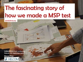
- 1. The fascinating story of how we made a MSP test planbothnia.org Manuel Frias SUBMARINER final conference Gdansk, 5th September 2013
- 2. Once upon a time...
- 4. DG MARE Co-funded under European Integrated Maritime Policy Phase 1 Data collection December 2010 Phase 2 Spatial Plan May 2012
- 5. Objective: Test a MSP process Transboundary Offshore
- 6. The Bothnian Sea: a pear-shaped sea
- 7. Why is Maritime Spatial Planning important?
- 8. The Baltic Sea: a quiet corner of Northern Europe Manuel Frias. Data available in HELCOM GIS
- 9. Really?
- 10. The Baltic Sea: a quiet corner of Northern Europe? Really? Oil rigs Manuel Frias. Data available in HELCOM GIS
- 11. The Baltic Sea: a quiet corner of Northern Europe? Really? Oil rigs Wind farms (current and projects) Manuel Frias. Data available in HELCOM GIS
- 12. The Baltic Sea: a quiet corner of Northern Europe? Really? Oil rigs Wind farms (current and projects) Baltic Sea Protected Areas Manuel Frias. Data available in HELCOM GIS
- 13. The Baltic Sea: a quiet corner of Northern Europe? Really? Oil rigs Wind farms (current and projects) Baltic Sea Protected Areas Natura 2000 Manuel Frias. Data available in HELCOM GIS
- 14. The Baltic Sea: a quiet corner of Northern Europe? Really? Oil rigs Wind farms (current and projects) Baltic Sea Protected Areas Natura 2000 Shipping accidents (2009) Manuel Frias. Data available in HELCOM GIS
- 15. The Baltic Sea: a quiet corner of Northern Europe? Really? Oil rigs Wind farms (current and projects) Baltic Sea Protected Areas Natura 2000 Shipping accidents (2009) Illegal oil spills (2009) Manuel Frias. Data available in HELCOM GIS
- 16. The Baltic Sea: a quiet corner of Northern Europe? Really? Oil rigs Wind farms (current and projects) Baltic Sea Protected Areas Natura 2000 Shipping accidents (2009) Illegal oil spills (2009) Fisheries (Surface and mid. gear 2007) Manuel Frias. Data available in HELCOM GIS
- 17. The Baltic Sea: a quiet corner of Northern Europe? Really? Oil rigs Wind farms (current and projects) Baltic Sea Protected Areas Natura 2000 Shipping accidents (2009) Illegal oil spills (2009) Fisheries (Surface and mid. gear 2007) Shipping density (2009) and much more... Manuel Frias. Data available in HELCOM GIS
- 18. The Baltic Sea: a quiet corner of Northern Europe? Really? Oil rigs Wind farms (current and projects) Baltic Sea Protected Areas Natura 2000 Shipping accidents (2009) Illegal oil spills (2009) Fisheries (Surface and mid. gear 2007) Shipping density (2009) Not really... The Baltic Sea is busy – and getting busier! and much more... Manuel Frias. Data available in HELCOM GIS
- 20. Where is the data?
- 21. Luckily we have the HELCOM map and data service maps.helcom.fi
- 27. The process Data collection Synthesis The pilot plan!
- 28. What did we learn?
- 29. Everthing we did was open!
- 32. Maritime Archaeology @ University of Southern DK's We found very little or no data at all for certain topics as offshore underwater archaeology
- 33. Summing up
- 35. maps.helcom.fi HELCOM map and data service to the rescue
- 36. (Try to) be open!!
- 37. PLAN BOTHNIA.org Manuel Frias ”Plans are nothing planning is everything” Dwight D. Eisenhower