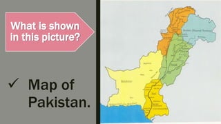
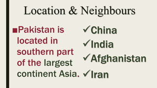
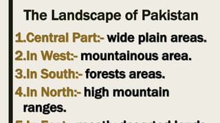
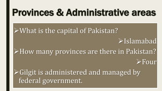
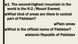
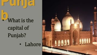
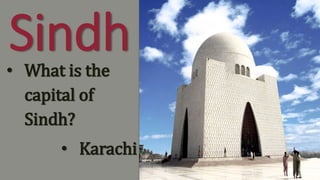
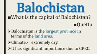
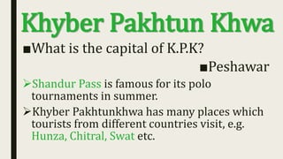
Social
Studies
Continents Oceans
Africa Arctic Ocean
Europe Atlantic Ocean
Asia Pacific Ocean
North America Indian Ocean
astronaut
An imaginary line round the middle of the
Earth
revolution The path of the planet
orbit Half of the earth
globe A circular movement around another object
axis A person trained to travel in a spacecraft
equator
An imaginary line through the centre of the
earth
hemisphere A spherical model of the earth
What is shown
in this picture?
 Map of
Pakistan.
OUR
COUNTRY
Presenter: Miss Sobia
 What is the name of our country?
 Pakistan
 Name the highest mountain in Pakistan?
 K-2
 Name the capital of Pakistan?
 Islamabad
Learning Objectives
THE GEOGRAPHICAL
LOCATION OF PAKISTAN.
PHYSICAL FEATURES OF
PAKISTAN.
PROVINCES AND
ADMINISTRATIVE AREAS
OF PAKISTAN.
Introduction
The official name of Pakistan is the Islamic Republic of
Pakistan.
It is a South Asian country.
It is the world’s sixth largest populated country.
There are the world’s highest mountain peaks are in
Pakistan.
Pakistan has one of the largest population of Muslims in
the world.
Location & Neighbours
■Pakistan is
located in
southern part
of the largest
continent Asia.
China
India
Afghanistan
Iran
The Landscape of Pakistan
1.Central Part:- wide plain areas.
2.In West:- mountainous area.
3.In South:- forests areas.
4.In North:- high mountain
ranges.
Provinces & Administrative areas
What is the capital of Pakistan?
Islamabad
How many provinces are there in Pakistan?
Four
Gilgit is administered and managed by
federal government.
■1. The second-highest mountain in the
world is the K-2 /Mount Everest.
■What kind of areas are there in central
part of Pakistan?
■Plain areas
■What is the official name of Pakistan?
■Islamic Republic of Pakistan
■ Describe the shape of the Earth. What is
this shape called?
■ How are seasons caused?
■ Where on Earth’s surface is the sun hottest
throughout the year?
■ Explain what a globe and a map are and
the differences between them?
■ What is revolution?
TestofSummerPack
questionanswers
Punja
b• What is the
capital of
Punjab?
• Lahore
Sindh• What is the
capital of
Sindh?
• Karachi
Balochistan■What is the capital of Balochistan?
■Quetta
Balochistan is the largest province in
terms of the land area.
Climate:- extremely dry.
It has significant importance due to CPEC.
Khyber Pakhtun Khwa
■What is the capital of K.P.K?
■Peshawar
Shandur Pass is famous for its polo
tournaments in summer.
Khyber Pakhtunkhwa has many places which
tourists from different countries visit, e.g.
Hunza, Chitral, Swat etc.
■ What does CPEC stands for?
• (CPEC stands for China Pakistan-Economic-Corridor).
■ Which pass is famous for Polo tournaments?
• Shandur pass
 Which is the largest province of Pakistan area wise?
• Balochistan
Our country
Our country

Our country

  • 3.
  • 5.
    Continents Oceans Africa ArcticOcean Europe Atlantic Ocean Asia Pacific Ocean North America Indian Ocean
  • 6.
    astronaut An imaginary lineround the middle of the Earth revolution The path of the planet orbit Half of the earth globe A circular movement around another object axis A person trained to travel in a spacecraft equator An imaginary line through the centre of the earth hemisphere A spherical model of the earth
  • 7.
    What is shown inthis picture?  Map of Pakistan.
  • 8.
  • 9.
     What isthe name of our country?  Pakistan  Name the highest mountain in Pakistan?  K-2  Name the capital of Pakistan?  Islamabad
  • 10.
    Learning Objectives THE GEOGRAPHICAL LOCATIONOF PAKISTAN. PHYSICAL FEATURES OF PAKISTAN. PROVINCES AND ADMINISTRATIVE AREAS OF PAKISTAN.
  • 11.
    Introduction The official nameof Pakistan is the Islamic Republic of Pakistan. It is a South Asian country. It is the world’s sixth largest populated country. There are the world’s highest mountain peaks are in Pakistan. Pakistan has one of the largest population of Muslims in the world.
  • 12.
    Location & Neighbours ■Pakistanis located in southern part of the largest continent Asia. China India Afghanistan Iran
  • 13.
    The Landscape ofPakistan 1.Central Part:- wide plain areas. 2.In West:- mountainous area. 3.In South:- forests areas. 4.In North:- high mountain ranges.
  • 14.
    Provinces & Administrativeareas What is the capital of Pakistan? Islamabad How many provinces are there in Pakistan? Four Gilgit is administered and managed by federal government.
  • 15.
    ■1. The second-highestmountain in the world is the K-2 /Mount Everest. ■What kind of areas are there in central part of Pakistan? ■Plain areas ■What is the official name of Pakistan? ■Islamic Republic of Pakistan
  • 16.
    ■ Describe theshape of the Earth. What is this shape called? ■ How are seasons caused? ■ Where on Earth’s surface is the sun hottest throughout the year? ■ Explain what a globe and a map are and the differences between them? ■ What is revolution? TestofSummerPack questionanswers
  • 17.
    Punja b• What isthe capital of Punjab? • Lahore
  • 18.
    Sindh• What isthe capital of Sindh? • Karachi
  • 19.
    Balochistan■What is thecapital of Balochistan? ■Quetta Balochistan is the largest province in terms of the land area. Climate:- extremely dry. It has significant importance due to CPEC.
  • 20.
    Khyber Pakhtun Khwa ■Whatis the capital of K.P.K? ■Peshawar Shandur Pass is famous for its polo tournaments in summer. Khyber Pakhtunkhwa has many places which tourists from different countries visit, e.g. Hunza, Chitral, Swat etc.
  • 21.
    ■ What doesCPEC stands for? • (CPEC stands for China Pakistan-Economic-Corridor). ■ Which pass is famous for Polo tournaments? • Shandur pass  Which is the largest province of Pakistan area wise? • Balochistan