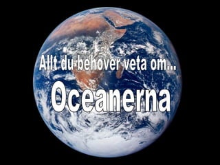
Oceanerna ge år 7
•Download as PPT, PDF•
0 likes•2,149 views

Världshaven och vattnets rörelser
Report
Share
Report
Share

Recommended
overfishing 10-8 2011
The document discusses the issue of overfishing and its negative impacts. It defines overfishing as catching fish faster than populations can replenish. While the world's oceans could theoretically support four planets' worth of fish, many species have become reduced or extinct due to overfishing. The document also examines fishing down the food chain, bycatch, bottom trawling, and how both overfishing and government subsidies of the fishing industry can harm marine ecosystems.
major domains of earth
The document discusses the four spheres or realms of Earth: the atmosphere, lithosphere, hydrosphere, and biosphere. The atmosphere is the gaseous layer surrounding Earth that redistributes heat and moisture. The lithosphere is the outer solid layer that provides a platform for life. The hydrosphere is principally the oceans but also includes ice. Most of the biosphere exists within the top 100 meters of the oceans and land surface.
Ch 19 ppt
The document summarizes different features of the seafloor geography. It describes the continental shelf, continental slope, abyssal plains, seamounts, mid-ocean ridges, subduction zones, and resources found in different areas of the seafloor. It also discusses life in the oceans including producers, consumers, food chains, reproduction, plankton, nekton, benthos, beach habitats, estuaries, coral reefs, and pollution sources affecting the oceans.
Class-7 science Chapter-4Heat
This document discusses heat and temperature. It defines temperature as a measure of an object's hotness, and explains that thermometers are used to measure temperature. Clinical thermometers measure body temperature between 35-42°C, while laboratory thermometers measure a wider range from -10-110°C. Heat is transferred between objects in three ways: conduction through direct contact, convection in liquids and gases, and radiation without a medium. Dark surfaces absorb more heat from sunlight but also radiate more heat than light surfaces. The types of clothes worn in different seasons also relate to heat transfer.
Ocean currents of the world
Here is another creative presentation by your slide maker on the topic "OCEAN CURRENTS OF THE WORLD". Hope you like it. If you like it then please, *like*, *Download* and *Share*.
By- Slide_maker4u (Abhishek Sharma)
*******For presentation Orders, contact me on the Email addresses Written below********
Email- Sharmaabhishek576@gmail.com
or
Sharmacomputers87@gmail.com
*******THANK YOU***************
"Casas Ekko live Alpha one alphaville" 11-98659-1838
Este documento fornece o nome Álvaro Menegatti, seu número de contato 11-98659-1838 e seu número Creci 80992-F.
Clear Concept Of Oceanic Temperature
The document discusses several key aspects of ocean temperature:
1. There are three main layers in the ocean - the surface layer, thermocline, and deep ocean.
2. The thermocline experiences rapid temperature changes and is located between 50-500m deep. It is permanent in the tropics and seasonal at temperate latitudes.
3. Ocean currents influence sea surface temperatures and consequently air temperatures over land. Therefore, ocean heat transport patterns impact regional climates.
Ocean circulation
Global ocean circulation patterns, adapted from Gilroy ECA presentation on ocean circulation.
Website: gilroyeca.blogspot.com
Moon Phases
The moon does not produce its own light but reflects sunlight. Moon phases occur as the illuminated portion of the moon visible from Earth changes due to the relative positions of the sun, Earth, and moon. Major moon phases include new, crescent, first quarter, gibbous, full, third quarter, and waning crescent as the illuminated area of the moon waxes and wanes over the course of about a week each.
8 oceanography ppt
This document provides information about oceanography and beaches. It discusses how the oceans formed from volcanic activity and impacts from comets and meteorites over 4.6 billion years. Key topics covered include ocean composition, temperature variation with depth, ocean currents like gyres, and coastal landforms shaped by wave erosion and deposition such as barrier islands, spits, and sea stacks. Ocean features like continental shelves, trenches, and guyots are also mentioned.
16. movement of air notes
Wind is caused by uneven heating of the Earth's surface and atmosphere, creating areas of high and low pressure. Warm air rises and cold air sinks, driving wind from high to low pressure areas. Additional factors like the rotation of the Earth and differences in how land and water absorb and release heat cause global wind patterns like trade winds and jet streams to form and influence weather.
Introduction to Marine Pollution Control
1. The document discusses marine pollution, including its sources, impacts, and methods of control and prevention. It defines marine pollution and examines its various sources from land-based industries and activities, as well as from shipping. The impacts on marine life and ecosystems are also outlined.
2. International and local regulatory bodies that monitor and control marine pollution are identified, including the IMO and Malaysia Marine Department. Methods of prevention under conventions like MARPOL and mitigation efforts like beach cleanups are described.
3. In conclusion, the document stresses the importance of protecting the marine environment for sustainable development and recommends introducing new technologies and educational campaigns targeted at youth.
Higher Geography Ocean Currents
Ocean currents play an important role in redistributing heat around the globe. They transfer warm water towards the poles and cool water towards the equator, making sure temperatures remain balanced. Ocean currents are driven by thermohaline circulation, where differences in water density due to temperature and salinity cause convection currents. Major currents like the Gulf Stream can flow for thousands of kilometers and have a significant impact on nearby climates, such as northwest Europe which is warmer than expected for its northern latitude due to the Gulf Stream.
tides powerpoint.pptx
The document summarizes tides and their causes. Tides are the daily rise and fall of sea levels caused by the gravitational pull of the Moon and Earth's rotation. The Moon's closer proximity to Earth means it has a stronger gravitational pull than the Sun. This pull creates bulges in the oceans on the sides facing and facing away from the Moon. As Earth rotates, different locations experience high and low tides passing through these bulges. Spring tides occur during full and new Moons when the Sun and Moon pull together, creating higher tides. Neap tides happen at half Moons when their pulls are at right angles, resulting in smaller tides.
Temperature and it’s distribution(ocean)
This document discusses the horizontal and vertical distribution of temperature in oceans. It notes that ocean temperatures are highest at the equator (26.7°C on average) and decrease towards the poles. Factors like latitude, ocean currents, prevailing winds, local weather, and depth influence ocean temperatures. Temperature decreases with depth but not uniformly, dropping more rapidly in the top 200m (photic zone) and leveling off below 2000m. The thermocline zone between 300-1000m marks the transition between warmer surface waters and colder deeper waters.
Sea Level Rise
Sea levels are rising due to global warming caused by human emissions of greenhouse gases. The two main causes of sea level rise are the thermal expansion of ocean water as it warms and the melting of land ice sheets and glaciers. Current estimates show sea levels rising 3.2 mm per year globally but faster in some areas, threatening coastal communities with problems like flooding and erosion. To mitigate further dangerous sea level rise, experts recommend reducing greenhouse gas emissions by 80% by 2050, though even that may only limit warming to 4-6 degrees Celsius by 2100.
Importance of ocean
Oceanography is the study of oceans and formally began with a British expedition in 1873-1876. The oceans play an important role by supplying water vapor for rain, connecting continents and islands, and providing minerals from the ocean floor. The deepest part of the ocean is the Mariana Trench, which is about 10,800 meters below sea level, deeper than Mount Everest is tall. The Earth's major oceans are the Pacific, Atlantic, Indian, Arctic, and Southern oceans. The Pacific Ocean is the largest and deepest ocean, occupying one third of the total ocean area.
Fishing
Fishing is an important primary industry in Pakistan. It includes both marine and inland fishing, which provide food and income. Marine fishing occurs along the coasts of Sindh and Makran and provides greater catches due to Pakistan's continental shelf, though Makran faces infrastructure challenges. Inland fishing takes place in rivers, lakes, and fish farms, particularly in Punjab and Sindh, and provides local employment and markets. However, the fishing industry in Pakistan faces issues such as lack of capital, skills and infrastructure, water pollution, and overfishing that limit its development and sustainability. The government is taking steps to address these problems and modernize the industry.
Sea Surface temperature
The document analyzes sea surface temperature data in the Arctic from 1982 to 2006. It describes using imaging software to measure the area of water below 15 degrees Celsius over time. The results found the area fluctuated without a clear decreasing or increasing trend. This disproved the hypothesis that the area would consistently decrease due to global warming. Future small changes are possible but human impacts are minimal currently.
The raising level of the sea
The document discusses how climate change is causing sea levels to rise globally. It notes that the ocean absorbs over 90% of the excess heat from the atmosphere due to greenhouse gas emissions. This thermal expansion combined with melting land ice causes sea levels to rise. Satellite data like from the Jason-3 mission shows that global sea levels have increased over 2 inches in the past few decades and continue rising at a rate of 1/8 inch per year. If emissions are not reduced, sea level rise could flood coastal cities and displace hundreds of millions of people by 2100.
08. Winds, Storms and Cyclone by Dilip Kumar Chandra
Air is a mixture of gases that exerts pressure in all directions. Uneven heating of the Earth's surface causes wind currents as warm air rises and is replaced by cooler air. Convection currents occur due to rising warm air and sinking cool air and help distribute the Sun's heat globally. Thunderstorms develop from strong upward winds carrying water droplets that freeze and fall as rain or hail, along with changes in air pressure. Cyclones form due to these pressure changes and can cause severe damage to life and property from high winds. Effective safety measures include early warning systems, shelters, and preparing necessary supplies.
The atmosphere and the oceans
The document discusses the composition and structure of Earth's atmosphere. It describes the different layers of the atmosphere, including the troposphere, stratosphere, mesosphere, thermosphere, and exosphere. It explains how solar energy is transferred throughout the atmosphere using radiation, conduction, and convection. The document also mentions clouds and the water cycle.
Mountains and flat lands
1. Plains are large areas of flat land. Many plains have fertile soil used for growing crops.
2. Valleys are flat lands between mountains. Rivers start in the mountains and flow through the valleys.
3. Mountains have summits, slopes, and feet. The summit is the highest point, the slopes are the sides, and the foot is the lowest part.
Properties of sea ice (vish).
Sea ice properties depend on the salinity of the original seawater, temperature, air content, pressure, and ice formation speed. Salinity decreases with ice thickness as brine seeps out over time. Density is affected by air content, brine amount, and freezing temperature. Specific heat depends on salinity and temperature, and is higher for sea ice than pure ice due to salt content. The latent heat of fusion and vapor pressure of sea ice are similar to but not exactly the same as pure ice due to salt content. The coefficient of thermal expansion ranges from positive to negative values depending on temperature and salinity. Thermal conductivity is lower near the surface than deeper portions of sea ice.
TYPES OF AIR MASS PRESENTATION.pptx
This document defines and describes the different types of air masses. It begins by introducing air masses and how they determine regional climates. It then defines air masses as large bodies of air with consistent temperature and humidity properties. The document outlines six primary types of global air masses that are categorized based on their source region over land or water and whether that region is arctic, polar, tropical, or equatorial. Each air mass type is described in terms of its characteristic weather patterns. In conclusion, the document emphasizes the crucial role air masses play in forming regional weather and climate patterns around the world.
Lesson 3 the glacier landform system
Glacial erosion consists of 4 key types: abrasion, plucking, fracture and traction, and dilation. Meltwater can also play a role in erosion. Stresses within a glacier cause glacial erosion. Glaciers will retreat when ablation exceeds accumulation, and advance when accumulation exceeds ablation. The balance between these processes is important for understanding glacier movement and how glaciers respond to environmental changes. Common types of glacial erosion include abrasion, plucking, fracture and traction, dilation, and meltwater erosion.
Atmosfären ge år 7
Power Point om atmosfären. Genomgång för elever i årskurs 7 i grundskolan.
Tyvärr fungerar inte vissa lager i presentationen samt att vissa rubriker faller bo
More Related Content
What's hot
Ocean circulation
Global ocean circulation patterns, adapted from Gilroy ECA presentation on ocean circulation.
Website: gilroyeca.blogspot.com
Moon Phases
The moon does not produce its own light but reflects sunlight. Moon phases occur as the illuminated portion of the moon visible from Earth changes due to the relative positions of the sun, Earth, and moon. Major moon phases include new, crescent, first quarter, gibbous, full, third quarter, and waning crescent as the illuminated area of the moon waxes and wanes over the course of about a week each.
8 oceanography ppt
This document provides information about oceanography and beaches. It discusses how the oceans formed from volcanic activity and impacts from comets and meteorites over 4.6 billion years. Key topics covered include ocean composition, temperature variation with depth, ocean currents like gyres, and coastal landforms shaped by wave erosion and deposition such as barrier islands, spits, and sea stacks. Ocean features like continental shelves, trenches, and guyots are also mentioned.
16. movement of air notes
Wind is caused by uneven heating of the Earth's surface and atmosphere, creating areas of high and low pressure. Warm air rises and cold air sinks, driving wind from high to low pressure areas. Additional factors like the rotation of the Earth and differences in how land and water absorb and release heat cause global wind patterns like trade winds and jet streams to form and influence weather.
Introduction to Marine Pollution Control
1. The document discusses marine pollution, including its sources, impacts, and methods of control and prevention. It defines marine pollution and examines its various sources from land-based industries and activities, as well as from shipping. The impacts on marine life and ecosystems are also outlined.
2. International and local regulatory bodies that monitor and control marine pollution are identified, including the IMO and Malaysia Marine Department. Methods of prevention under conventions like MARPOL and mitigation efforts like beach cleanups are described.
3. In conclusion, the document stresses the importance of protecting the marine environment for sustainable development and recommends introducing new technologies and educational campaigns targeted at youth.
Higher Geography Ocean Currents
Ocean currents play an important role in redistributing heat around the globe. They transfer warm water towards the poles and cool water towards the equator, making sure temperatures remain balanced. Ocean currents are driven by thermohaline circulation, where differences in water density due to temperature and salinity cause convection currents. Major currents like the Gulf Stream can flow for thousands of kilometers and have a significant impact on nearby climates, such as northwest Europe which is warmer than expected for its northern latitude due to the Gulf Stream.
tides powerpoint.pptx
The document summarizes tides and their causes. Tides are the daily rise and fall of sea levels caused by the gravitational pull of the Moon and Earth's rotation. The Moon's closer proximity to Earth means it has a stronger gravitational pull than the Sun. This pull creates bulges in the oceans on the sides facing and facing away from the Moon. As Earth rotates, different locations experience high and low tides passing through these bulges. Spring tides occur during full and new Moons when the Sun and Moon pull together, creating higher tides. Neap tides happen at half Moons when their pulls are at right angles, resulting in smaller tides.
Temperature and it’s distribution(ocean)
This document discusses the horizontal and vertical distribution of temperature in oceans. It notes that ocean temperatures are highest at the equator (26.7°C on average) and decrease towards the poles. Factors like latitude, ocean currents, prevailing winds, local weather, and depth influence ocean temperatures. Temperature decreases with depth but not uniformly, dropping more rapidly in the top 200m (photic zone) and leveling off below 2000m. The thermocline zone between 300-1000m marks the transition between warmer surface waters and colder deeper waters.
Sea Level Rise
Sea levels are rising due to global warming caused by human emissions of greenhouse gases. The two main causes of sea level rise are the thermal expansion of ocean water as it warms and the melting of land ice sheets and glaciers. Current estimates show sea levels rising 3.2 mm per year globally but faster in some areas, threatening coastal communities with problems like flooding and erosion. To mitigate further dangerous sea level rise, experts recommend reducing greenhouse gas emissions by 80% by 2050, though even that may only limit warming to 4-6 degrees Celsius by 2100.
Importance of ocean
Oceanography is the study of oceans and formally began with a British expedition in 1873-1876. The oceans play an important role by supplying water vapor for rain, connecting continents and islands, and providing minerals from the ocean floor. The deepest part of the ocean is the Mariana Trench, which is about 10,800 meters below sea level, deeper than Mount Everest is tall. The Earth's major oceans are the Pacific, Atlantic, Indian, Arctic, and Southern oceans. The Pacific Ocean is the largest and deepest ocean, occupying one third of the total ocean area.
Fishing
Fishing is an important primary industry in Pakistan. It includes both marine and inland fishing, which provide food and income. Marine fishing occurs along the coasts of Sindh and Makran and provides greater catches due to Pakistan's continental shelf, though Makran faces infrastructure challenges. Inland fishing takes place in rivers, lakes, and fish farms, particularly in Punjab and Sindh, and provides local employment and markets. However, the fishing industry in Pakistan faces issues such as lack of capital, skills and infrastructure, water pollution, and overfishing that limit its development and sustainability. The government is taking steps to address these problems and modernize the industry.
Sea Surface temperature
The document analyzes sea surface temperature data in the Arctic from 1982 to 2006. It describes using imaging software to measure the area of water below 15 degrees Celsius over time. The results found the area fluctuated without a clear decreasing or increasing trend. This disproved the hypothesis that the area would consistently decrease due to global warming. Future small changes are possible but human impacts are minimal currently.
The raising level of the sea
The document discusses how climate change is causing sea levels to rise globally. It notes that the ocean absorbs over 90% of the excess heat from the atmosphere due to greenhouse gas emissions. This thermal expansion combined with melting land ice causes sea levels to rise. Satellite data like from the Jason-3 mission shows that global sea levels have increased over 2 inches in the past few decades and continue rising at a rate of 1/8 inch per year. If emissions are not reduced, sea level rise could flood coastal cities and displace hundreds of millions of people by 2100.
08. Winds, Storms and Cyclone by Dilip Kumar Chandra
Air is a mixture of gases that exerts pressure in all directions. Uneven heating of the Earth's surface causes wind currents as warm air rises and is replaced by cooler air. Convection currents occur due to rising warm air and sinking cool air and help distribute the Sun's heat globally. Thunderstorms develop from strong upward winds carrying water droplets that freeze and fall as rain or hail, along with changes in air pressure. Cyclones form due to these pressure changes and can cause severe damage to life and property from high winds. Effective safety measures include early warning systems, shelters, and preparing necessary supplies.
The atmosphere and the oceans
The document discusses the composition and structure of Earth's atmosphere. It describes the different layers of the atmosphere, including the troposphere, stratosphere, mesosphere, thermosphere, and exosphere. It explains how solar energy is transferred throughout the atmosphere using radiation, conduction, and convection. The document also mentions clouds and the water cycle.
Mountains and flat lands
1. Plains are large areas of flat land. Many plains have fertile soil used for growing crops.
2. Valleys are flat lands between mountains. Rivers start in the mountains and flow through the valleys.
3. Mountains have summits, slopes, and feet. The summit is the highest point, the slopes are the sides, and the foot is the lowest part.
Properties of sea ice (vish).
Sea ice properties depend on the salinity of the original seawater, temperature, air content, pressure, and ice formation speed. Salinity decreases with ice thickness as brine seeps out over time. Density is affected by air content, brine amount, and freezing temperature. Specific heat depends on salinity and temperature, and is higher for sea ice than pure ice due to salt content. The latent heat of fusion and vapor pressure of sea ice are similar to but not exactly the same as pure ice due to salt content. The coefficient of thermal expansion ranges from positive to negative values depending on temperature and salinity. Thermal conductivity is lower near the surface than deeper portions of sea ice.
TYPES OF AIR MASS PRESENTATION.pptx
This document defines and describes the different types of air masses. It begins by introducing air masses and how they determine regional climates. It then defines air masses as large bodies of air with consistent temperature and humidity properties. The document outlines six primary types of global air masses that are categorized based on their source region over land or water and whether that region is arctic, polar, tropical, or equatorial. Each air mass type is described in terms of its characteristic weather patterns. In conclusion, the document emphasizes the crucial role air masses play in forming regional weather and climate patterns around the world.
Lesson 3 the glacier landform system
Glacial erosion consists of 4 key types: abrasion, plucking, fracture and traction, and dilation. Meltwater can also play a role in erosion. Stresses within a glacier cause glacial erosion. Glaciers will retreat when ablation exceeds accumulation, and advance when accumulation exceeds ablation. The balance between these processes is important for understanding glacier movement and how glaciers respond to environmental changes. Common types of glacial erosion include abrasion, plucking, fracture and traction, dilation, and meltwater erosion.
What's hot (20)
08. Winds, Storms and Cyclone by Dilip Kumar Chandra
08. Winds, Storms and Cyclone by Dilip Kumar Chandra
Viewers also liked
Atmosfären ge år 7
Power Point om atmosfären. Genomgång för elever i årskurs 7 i grundskolan.
Tyvärr fungerar inte vissa lager i presentationen samt att vissa rubriker faller bo
Resurser och näringar år 8
Beskrivning av resurser och näringar. Gäller främst för de nordiska länderna.
Nationalstatens framväxt hi år 8-9
Förklaring av nationalismens påverkan på världskrigstidens utbrott.
Viewers also liked (7)
Oceanerna ge år 7
- 2. Det finns mer vatten än land!Det finns mer vatten än land! Haven täcker ca 70% av jordens yta (30% land)Haven täcker ca 70% av jordens yta (30% land) Mest vatten finns på södra halvklotet och på denMest vatten finns på södra halvklotet och på den delen av jorden där Stilla havet ligger.delen av jorden där Stilla havet ligger.
- 3. De största oceanerna är 1. Stilla havet 2. Atlanten 3. Indiska oceanen Dessutom är de arktiska- och antarktiska oceanerna stora…
- 4. Saltvatten; 95% Sötvatten; 5% Av allt vatten i världen så är hela 95% saltvatten och bara 5% är sötvatten. …men allt går inte att använda till dricksvatten.
- 5. 95,0% 3,0% 1,5% 0,5% Saltvatten Is & snö Bundet eller i atmosfären Kvar att använda Om allt vatten på jorden var en liter så skulle det vatten vi kan dricka bara bestå av en tesked…
- 6. Kontinentalsockel Kontinentalbrant Bergskedjor Djuphavsslätt Djuphavsgrav Vulkanöar 80% av all havsbotten Medeldjup: 4000 m. (ex. Mittatlantiska ryggen. Världens längsta bergskedja) (ex. Marianergraven, världens största djup som är ca. 11.000 meter under havet)
- 7. …och nu lite enklare!
- 9. - Det är mer vatten i en gurka än i havet! - Så kan man väl inte säga? - Jo, om man räknar i procent så är det faktiskt så att en gurka innehåller 98% vatten medan havet bara innehåller 96,5% vatten. - Havet innehåller 3,5% salter och andra mineraler.
- 10. Salthalten i promille runt Sveriges kust Salthalten i haven varierar kraftigt. •Regn späder ut havsvattnet och sänker salthalten •Stora flöden från floder späder ut havsvattnet och sänker salthalten •Stor avdunstning höjer salthalten i havsvattnet
- 11. Vinden sätter havets ytvatten i rörelse - Vågor bildas beroende av hur stark vinden är
- 12. Solen värmer upp vattnet och sätter det i rörelse. Vattnet värms upp vid ekvatorn och kyls ner vid polerna – skapar cirkulation, havsströmmar.
- 13. Varmt vatten vid ytan och kallt efter botten Solen värmer upp ytvattnet som strömmar mot polerna där det kyls ner och sjunker. Det kalla vattnet färdas därefter på djupet tillbaka mot ekvatorn igen (kretslopp)
- 14. Viktig för oss i Skandinavien. Förflyttar varmt vatten från ekvatorn upp till Nordatlanten. Ger ett behagligt klimat långt norrut.
- 15. Månens och solens dragningskraft påverkar vattnet
- 16. Månens dragningskraft är större än solens eftersom den är mycket närmare