Download to read offline
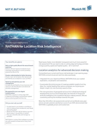
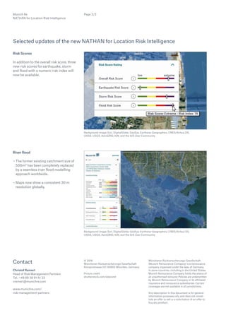

Nathan for location risk intelligence provides advanced risk assessment through real-time, integrated local data and powerful analytics. With over 50 million assessments conducted annually and a customer satisfaction score exceeding 90%, it aids businesses in optimizing risk management and decision-making. Leveraging cloud-based technology and AI, it identifies risk hotspots and assists in diversifying portfolios for improved profitability.