
More Related Content
More from sakaik
More from sakaik (20)
Recently uploaded
Recently uploaded (7)
MySQLとGISと私・この1年~MySQL Innovation Day LT
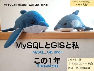
- 1. MySQLとGISと私 この1年 2018/11/21 日本MySQLユーザ会 坂井 恵(@sakaik) MySQL Innovation Day 2018 Fall MySQL, GIS and I This past year ハッシュタグ(Hashtag): #mysql_jp
- 2. Who am I ? • SAKAI Kei (@sakaik) 坂井 恵 • MySQL Nippon Association(MyNA)(=user group) Staff member. 日本MySQLユーザ会 副代表 • MySQL GIS evangelist (nobody call me so :-p) GISエバ、、、いや、なんでもないです。。
- 3. お知らせ(Announce) • MySQLユーザ会望年LT大会をやります。 • 12/03(Mon) 19:00~ • 赤坂@東京にて、ワインバー貸切 • 30人くらいまで • 参加してください • GISアドベントカレンダやります。 • https://qiita.com/advent-calendar/2018/rdbms_gis • 参加してください • 空き枠、いっぱいあります。 MySQL User group(MyNA)'s Christmas LT party RDBMS GIS Advent calendar 2018
- 4. この1年・・・ GIS機能の調査、普及に努めて参りました。 『GIS機能は、楽しい!』を伝えたい。 なぜこれほどまでに、GIS機能に惹かれるのか→ This past year... I love GIS! But, today's "The State of the Dolphin" by Ulin does not contain abou GIS..
- 5. この1年・・・ RDBMSは 世の中のすべてを格納できるもの そこに今、位置に関する情報 が加わった! This past year... RDBMS can contain "Everything in the world". Now we can also store the SPATIAL data! Yeah!!
- 6. MySQLのGIS機能 2003/?? MySQL 4.1.0 MyISAMに "Spatial Extensions" 2016/09 MySQL 8.0.0 GIS本気宣言 • Remove many non "ST_*" functions. • 「MySQLは8.0 になり、地球が丸いことを知った」 → より「本当の」地球の形を知った! • 以後、バージョンが上がるたびに、色々な関数も 「地球が丸いこと」を覚えていく GIS on MySQL Now, MySQL 8 knows the Earth is spheroid. ... and many GIS functions learned the shape of the earth in each minor versions.
- 7. 私のこの1年・・・ MySQLのGIS機能が面白そうだな、、と漠然と 思っていたある日・・・・ 私の普段の行動圏内に「日本の高さの基準とな る原点」があるらしい、と知る。 →知ってしまったからには 当然、見に行きます。 My this past year... One day, I realized "Japanese datum of leveling" (Leveling origin of Japan) is in Tokyo, my daily living area. Of cource I go !! Yeah!!
- 8. 私のこの1年・・・ そこから転落の道へ・・・・ 2017/11/02 水準原点を見に行ってしまう 2017/12/26 日本経緯度原点を見に行く 2018/02/10 浜松の一等三角点を見に行く 2018/05/23 水準原点公開日に見に行く 2018/07/06 札幌の基線南端北端に行く 2018/08/29 伊能忠敬記念館に行ってみる 2018/10/07 明石東経135度線を見に行く My this past year... I went several Mecca of GIS, like Level Origin, Lat/Long origin, Baseline Triangulation point, Inoh Tadataka museum, and J.S.T.M.(135E)
- 10. 私のこの1年・・・ 2018/02/11 OSC Hamanako LT 「MySQLにGIS機能がやってきた」 2018/07/07 OSC Hokkaido 「MySQLに本格GIS機能がやってきた」 2018/07/23 日本MySQLユーザ会会 (MyNA会) 「MySQLのGIS機能とか超入門」 2018/08/31 ClubMySQL 「周辺知識から理解するMySQLのGIS機能」 2018/10/28 OSC Tokyo/Fall 「MySQL8.0の新機能 "地理情報" を理解しよう入門~いまからはじめるGIS~ 2018/11/04 FOSS4G Okayama 「MySQL 8.0で強化されたGIS機能のご紹介」 2018/12/08(予定) OSC Fukuoka 「MySQL 8.0 で強化されたGIS(地理情報)機能を使ってみよう」 My this past year... いろいろしゃべってきました Seminars
- 11. この1年の発表資料 発表資料はすべて slideshare に上がっているので、 ご覧ください。 • https://www.slideshare.net/sakaik/ で検索
- 12. 地球の形 「MySQLは8.0になって地球が丸いことを知った」 ↓ 実は 5.7 でも、一部の機能たちは「もしかしたら丸いんじゃ ないか」と気づき始めていました。 (ST_distance_sphere() など) ↓ でも惜しい!5.7ではまだ「地球は球型だ」と思っていたよう です。(8.0では「回転楕円体」) In MySQL 5.7, the Earth is Sphere. Now MySQL 8.0 knows the Earth is Spheroid.
- 13. MySQL 8.0 が知る「地球」 • SRS(Spatial Reference System) • さまざまな地球の形のモデル • 479種の地球の形 (GEOGCS) • それを平面に落とす方法4,628種(PROJCS) • 世界でよく使われるのは WGS84 (SRID:4326) • 日本で今よく使われるのは JGD2011 (SRID:6668) • 2001年までは Tokyo (SRID:4301) MySQL 8.0's 「Earth」
- 14. 80度の液体。熱い?ぬるい? こたえ:わからない ※80度という数字だけでは、温度をあらわしていない。 どのモノサシでの、80度なのか。 摂氏? 華氏? The liquid is 80 degree. Is it Hot or Cold? A: unknown. ※ Is it Celsiou? or Fahrenheit? → 緯度・経度でも同じことが言えるのです。 It's same aboue lat-long.
- 15. 東経135度? 「JGD2011で 東経135度」のように言うのが正確。 実際には WGS84 と JGD2011 は、ほぼズレはない Tokyo(2001年まで使用されていた)と JGD2011は、結構違う "135E" → "135E (JGD2011)" WGS84 ≒ JGD2011 Tokyo <> JGD2011
- 16. 東経135度 日本人なら誰でも知っている 「日本標準時子午線」(明石市など) Every Japanese know 135E is JSTM(Japan Standard Time Meridian)(Akashi city) さて問題。 この「135度」は、 なんの135度? Which geometry is this 135 degree ?
- 17. 東経135度 • 赤:天文台 • 緑: JGD2011(WGS84) • 青:Tokyo みんな「135度」!
- 18. 測地系、重要! このように、測地系によって同じ「135度」でも、 指し示す場所が異なる。 測地系のしくみを理解して、MySQLのGIS機能 を活用しましょう。 You should study about Geom.
- 19. MySQLのGIS機能・今後の 課題 • 緯度経度を元にした点、線、ポリゴン等の情報は、問題 なく管理できる • 基本的な判定、計算類の関数は揃っている • でも、もっと今後関数の充実が期待される(集約型関数な ど) • 事例が増えてきてほしいナ • 「PostGISではできるのにね」という言葉を聞きたくな い! Status of MySQL GIS Point, LineString, Polygons are Perfect. Basic functions (extract, compare, calculate) are OK. But we need more functions like PostGIS. (e.g. Aggregate functions(ST_Union, ST_Extent), ST_Voronoi* functions, etc.) I don't want to hear "PostGIS can XXX, but how about MySQL?" I'm very happy that good implementation example will increase.
- 20. MySQLのGIS機能 みんなで楽しく 盛り上げましょう Let's GIS ! ちょっと試してみたりして、 GIS Advent Calendar への参加も、ぜひ!