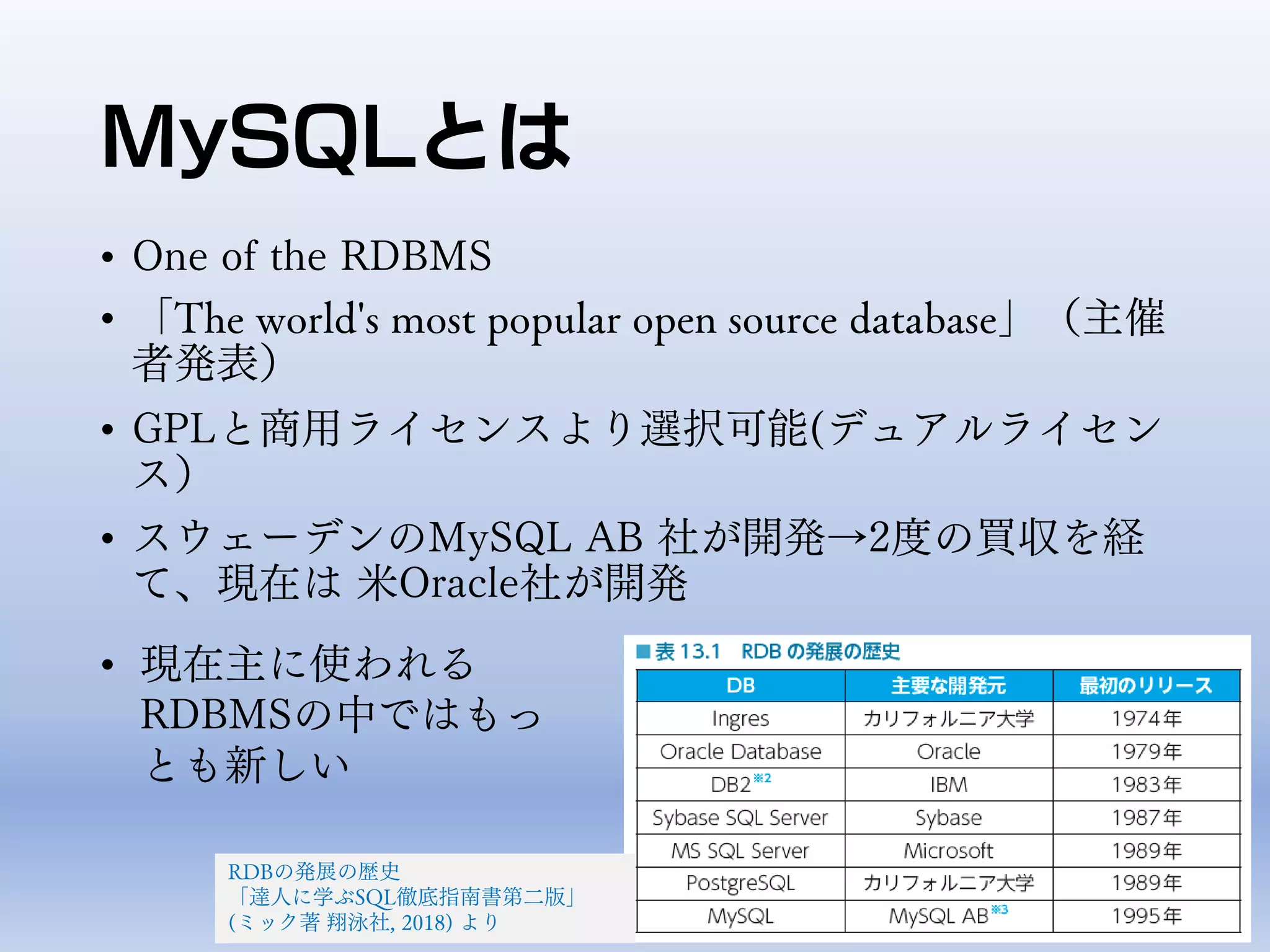
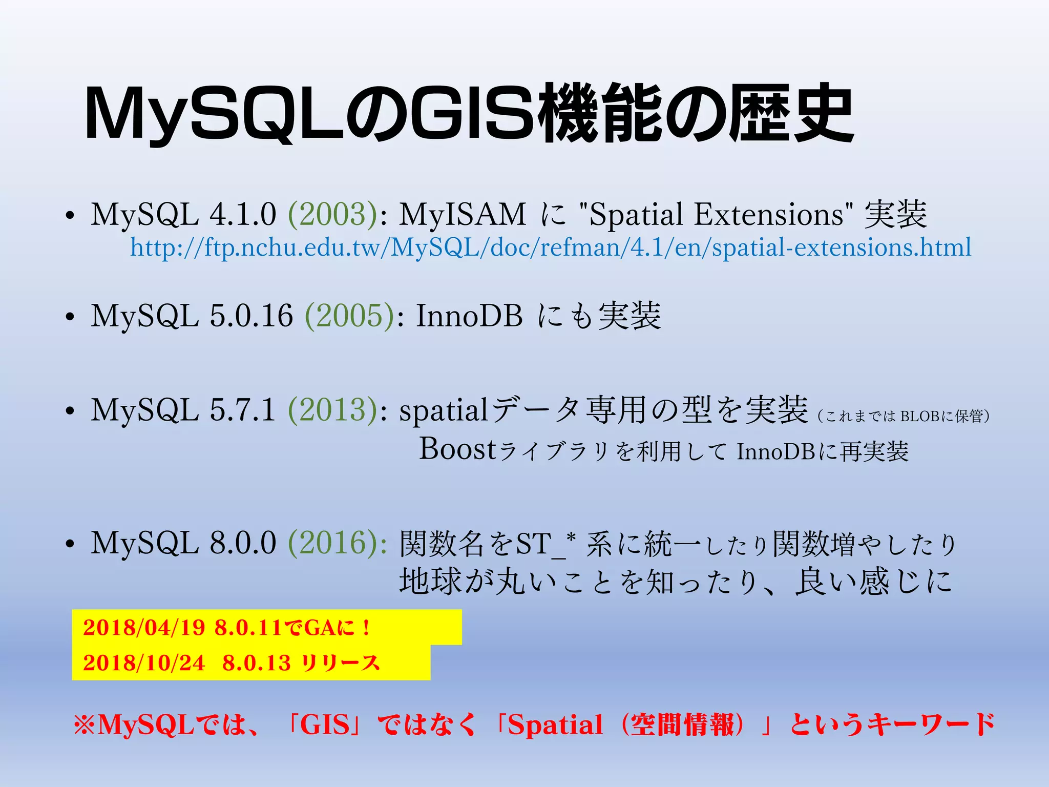
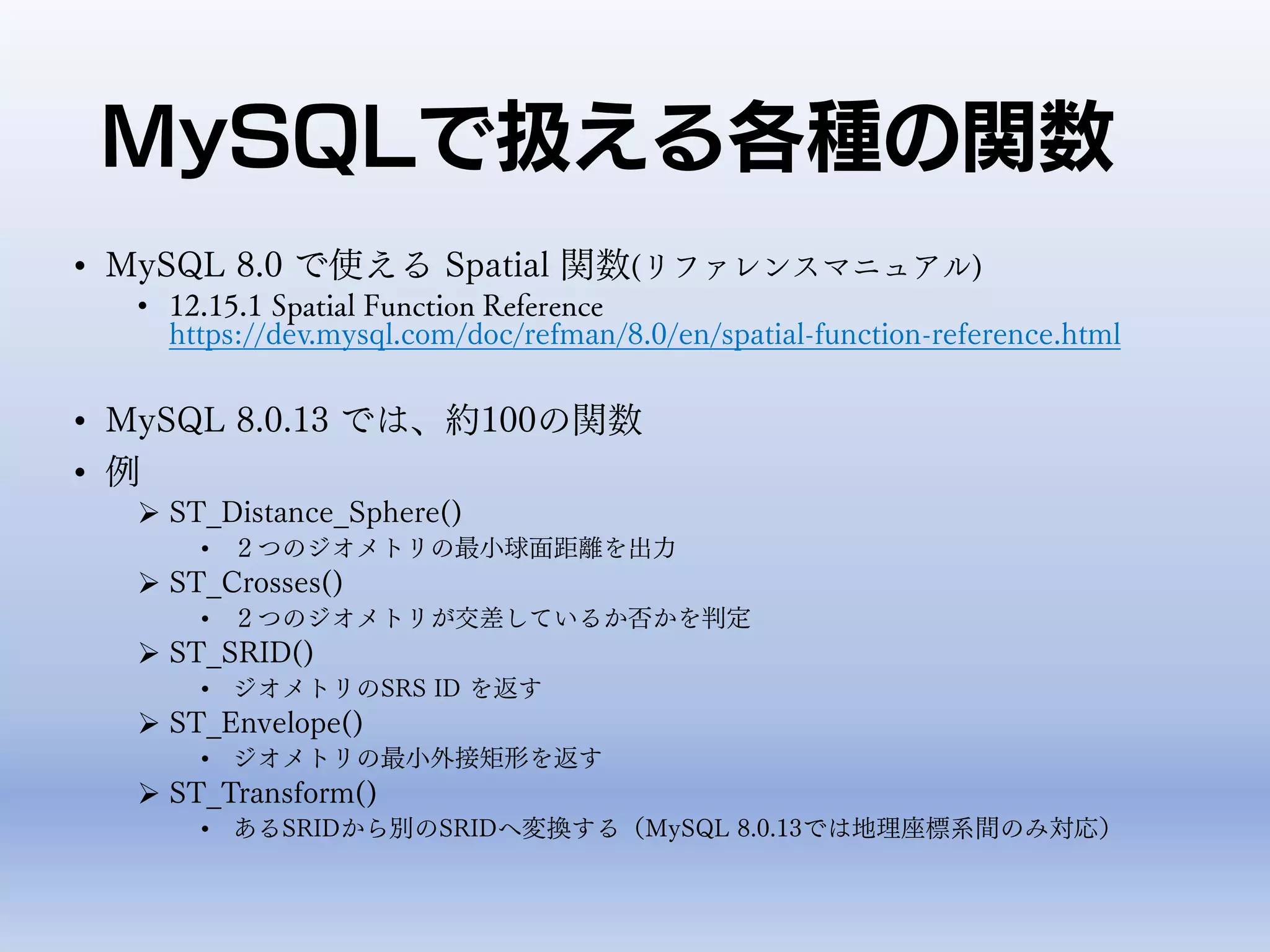
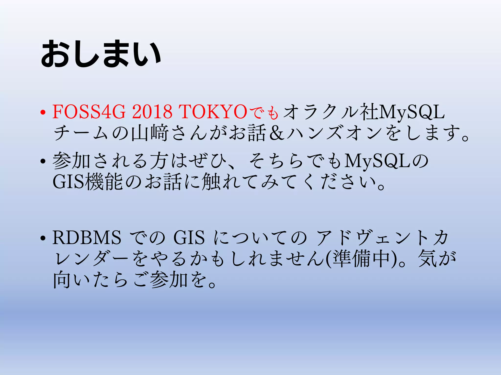
This document summarizes the history and capabilities of MySQL's geographic information system (GIS) functions. Key points include:
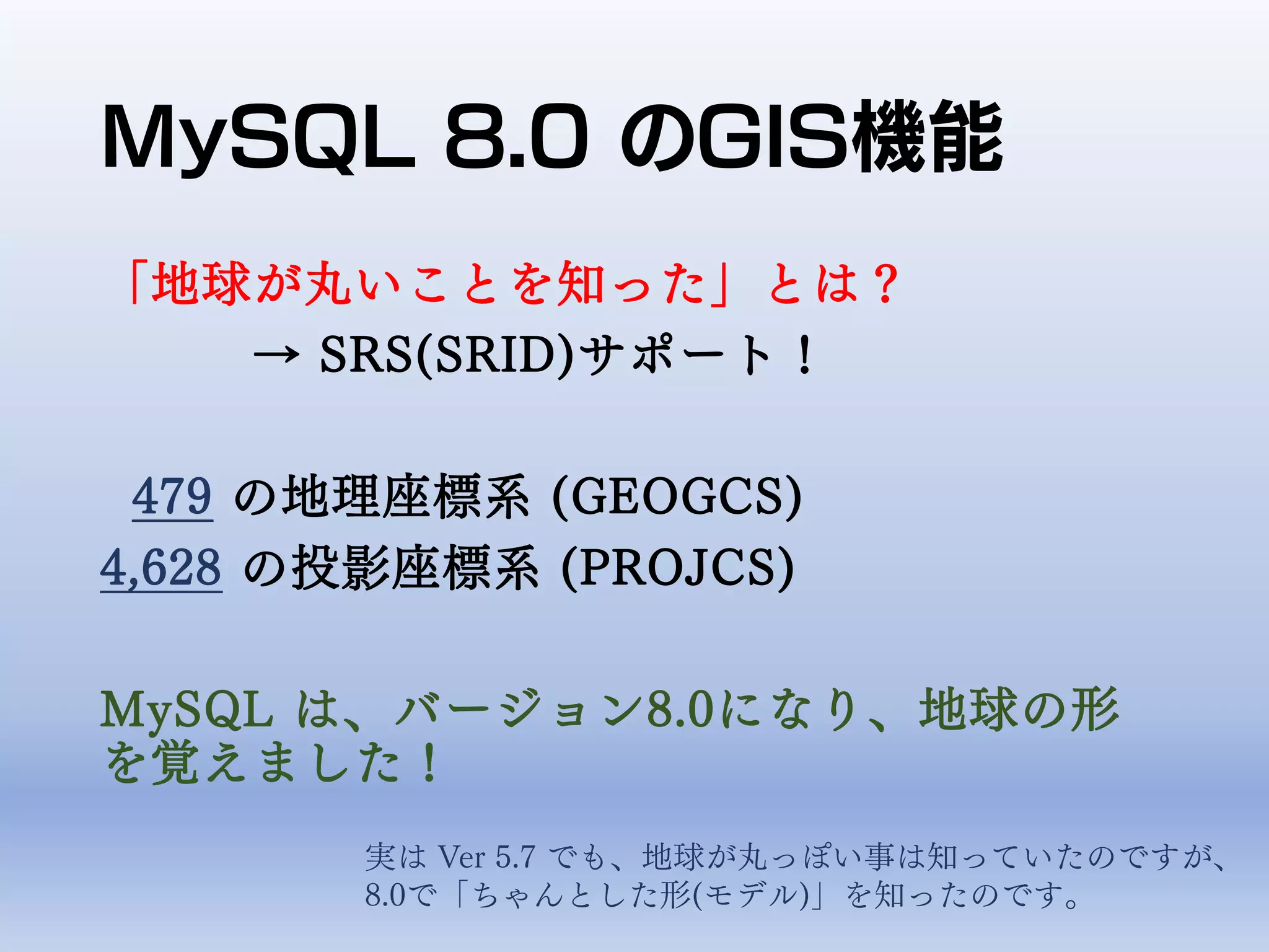
- MySQL has included basic GIS functions since version 4.1 in 2003, with improvements in versions 5.0, 5.7, and 8.0.
- Version 8.0 added support for over 400 spatial reference systems and over 100 new spatial functions.
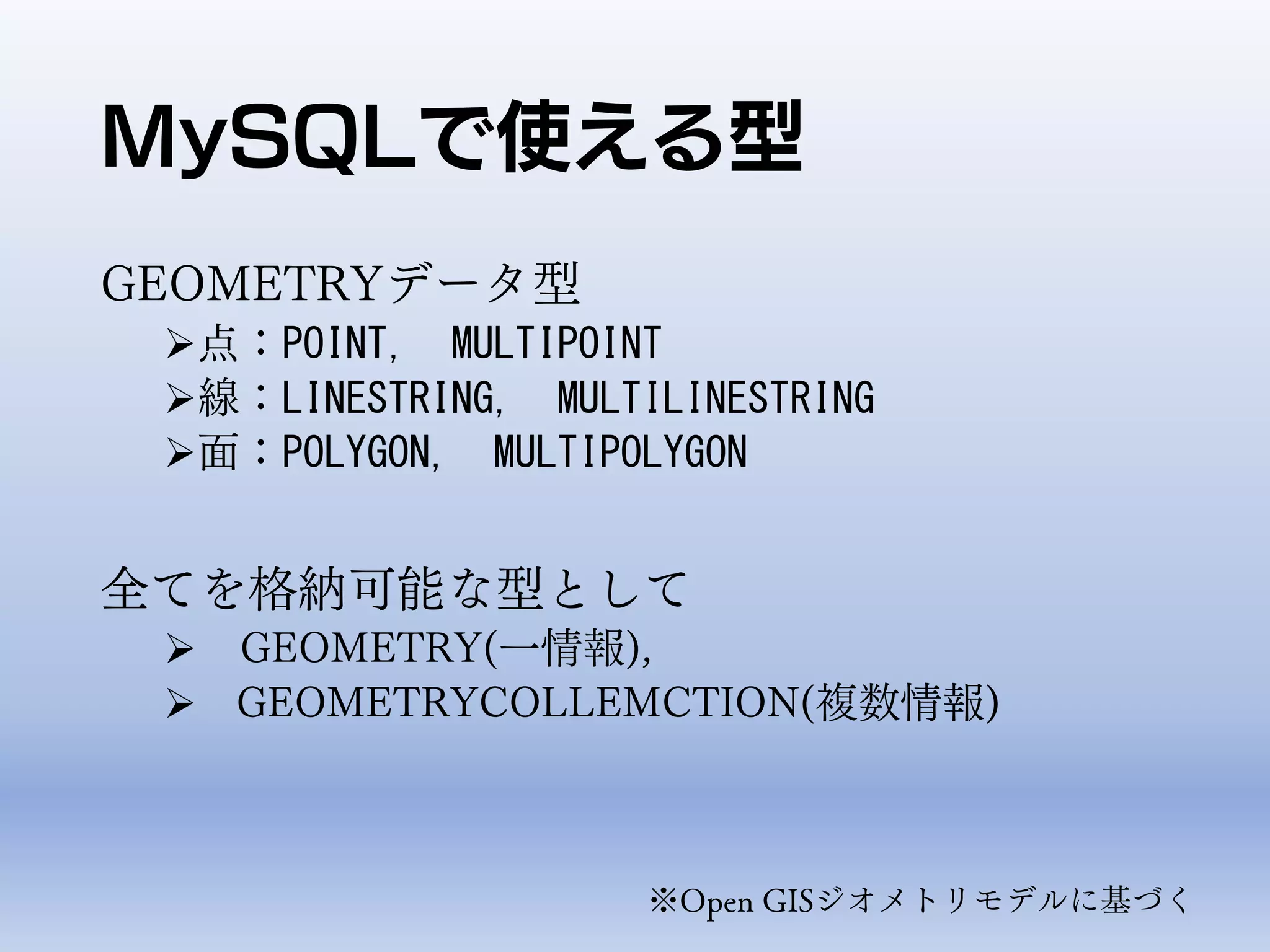
- MySQL spatial types include POINT, LINESTRING, POLYGON, and GEOMETRYCOLLECTION, and functions allow operations like distance calculations and coordinate transformations.


![GeoJSON
• 空間データを扱うためのフォーマットのひとつ
例
{"type": "Point",
"coordinates": [34.68711, 133.9188]}
{"type": "LineString",
"coordinates": [34.68711, 133.9188],
[34.89664, 133.7132] }
※MySQL 5.7から
• MySQL Reference Manual:
12.15.11 Spatial GeoJSON Functions
https://dev.mysql.com/doc/refman/8.0/en/spatial-geojson-functions.html](https://image.slidesharecdn.com/foss4g2018okayama20181104forrelease-181104045830/75/MySQL-8-0-GIS-FOSS4G-Okayama-21-2048.jpg)
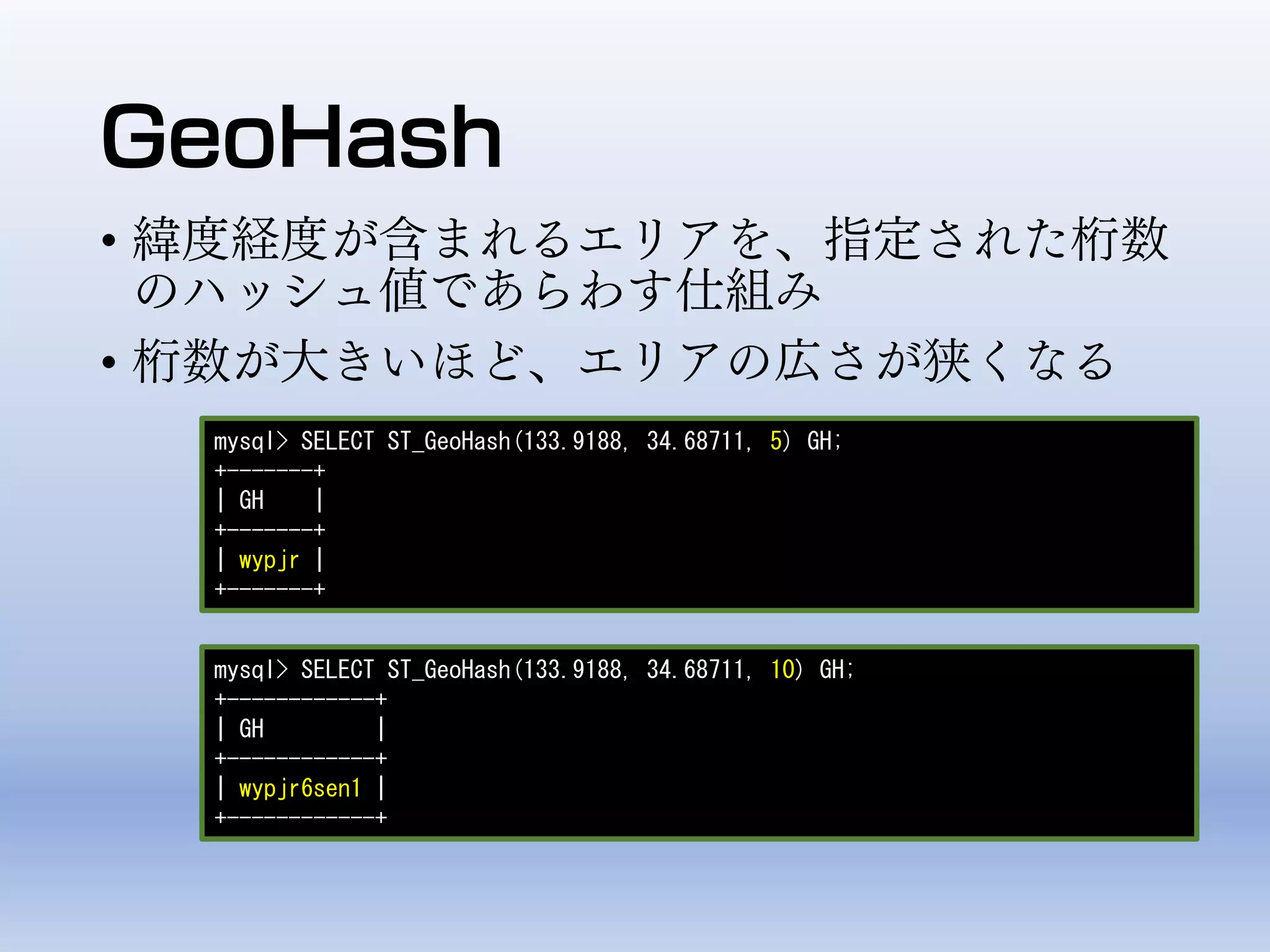
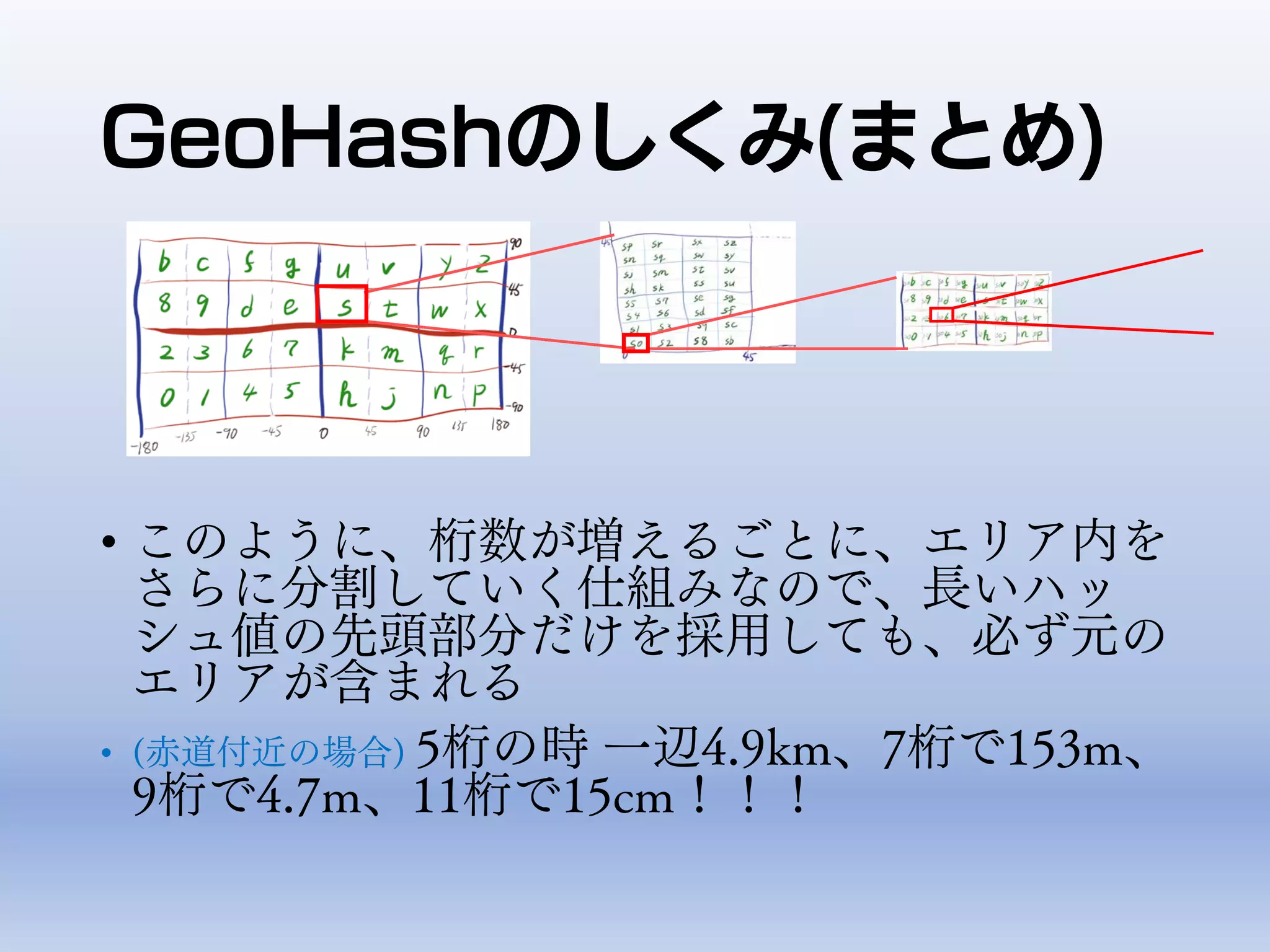
![GeoHashのしくみ
• [0-9a-z]の中の32文字を使用する
• 1桁目を決めるために、地球全体を32分割して値を決定する
• 2桁目を決めるために、1桁目で定まったエリア内を32分割して値を割り振る
• 以下同様に3桁目4桁目、、、と指定桁数まで分割を繰り返す](https://image.slidesharecdn.com/foss4g2018okayama20181104forrelease-181104045830/75/MySQL-8-0-GIS-FOSS4G-Okayama-24-2048.jpg)


![OSC2019-Hamanko LT 浜松の[三角点の]紹介](https://cdn.slidesharecdn.com/ss_thumbnails/osc2019hamanakoltforrelease-190421121818-thumbnail.jpg?width=640&height=640&fit=bounds)


