Patrick Meier: Changing the world one map at a time (Sept 2011 Wavelength breakout)
•Download as PPTX, PDF•
2 likes•614 views

The document outlines Patrick Meier's work using mapping technology to help people in crisis situations from 2008 to 2011, including creating maps during earthquakes, conflicts in Libya, and famine in Somalia and the Horn of Africa. It notes that Meier founded Crisis Mappers and a Standby Volunteer Task Force to provide real-time maps integrating satellite imagery to help direct aid efforts, though emphasizes that technology is only 10% of the solution and human aspects are more important.

Recommended
More Related Content
More from Wavelength
More from Wavelength (20)
Recently uploaded
Recently uploaded (20)
Patrick Meier: Changing the world one map at a time (Sept 2011 Wavelength breakout)
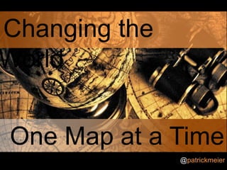
- 1. Changing the World One Map at a Time @patrickmeier
- 4. The First World War
- 21. “[We are] using your project every second of the day to get aid and assistance to the people that need it most”
- 29. Mass atrocities in Libya
- 33. www.CrisisMappers.net Standby Volunteer Task Force
- 36. Horror in the Horn of Africa
- 37. Saving Somalia
- 38. Saving Somalia
- 41. “Having a real-time map complete with satellite photos, of where everyone is at any one moment is almost as good as having your own helicopter”
- 46. So what’s next? @patrickmeier
- 51. Don’t get too jazzed up! Tech is only 10% of the solution
Editor's Notes
- Lets begin our first map on January 12th, 2010, at 4pm, to be exact. We turn on the TV and see this…
- In the early days of the war, generals tried to direct tactics from headquarters many miles from the front, with messages being carried back and forth by couriers on motorcycles. It was soon realized that more immediate methods of communication were needed.Radio sets of the period were too heavy to carry into battle, and phone lines laid were quickly broken. Runners, flashing lights, and mirrors were often used instead; dogs were also used, though they were only used occasionally as troops tended to adopt them as pets and men would volunteer to go as runners in the dog's place. There were also aircraft (called "contact patrols") that could carry messages between headquarters and forward positions, sometimes dropping their messages without landing.
- And that’s because the information ecosystem looked something like this in the 1930s. Largely disconnected and broadcast only, ie, one-to-many. Can anyone point out an important node that should be included in this ecosystem? That’s right, the newspaper. But the paper would not have been printed at the speed that the radio broadcast was taking place to help counter fears; unlike today, of course, thanks to online news.
- In the early days of the war, generals tried to direct tactics from headquarters many miles from the front, with messages being carried back and forth by couriers on motorcycles. It was soon realized that more immediate methods of communication were needed.Radio sets of the period were too heavy to carry into battle, and phone lines laid were quickly broken. Runners, flashing lights, and mirrors were often used instead; dogs were also used, though they were only used occasionally as troops tended to adopt them as pets and men would volunteer to go as runners in the dog's place. There were also aircraft (called "contact patrols") that could carry messages between headquarters and forward positions, sometimes dropping their messages without landing.
- Lets begin our first map on January 12th, 2010, at 4pm, to be exact. We turn on the TV and see this…
- I began mapping reports shared by a dozen people tweeting live from Port-au-Prince. I also mapped news reports from CNN and pictures emailed to me from the disaster affected area. I did this using the Ushahidi platform, a free and open source technology for live mapping. Did I have a plan? No. Did I know whether this would help anyone? No. Did I know the following would happen 10 days later?
- No.
- That evening, a dozen friends showed up in my living room. I’ve looked at this picture a hundred times but only yesterday did I realize the number of different nationalities represented: American, Iranian, Norwegian, British, French, Czech Republic. They stayed up all night with me, mapping while the snow fell quietly outside.
- Between them, these volunteers mapped over 3,500 individual reports from hundreds of sources and you can see just how densely populated the map was. Not only that, but the map was being updated every 10-15 minutes with dozens of new dots, this map was truly alive.
- 5
- Rise of crowdfeeding