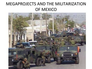
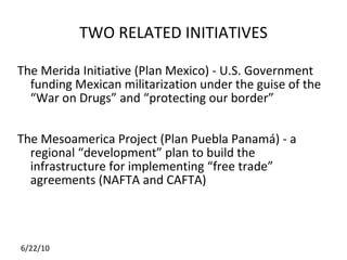
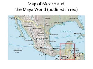
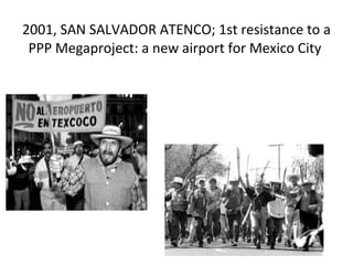
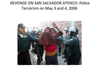
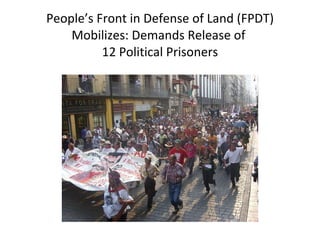
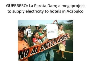
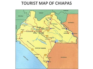
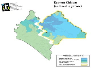
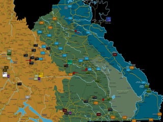
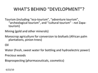
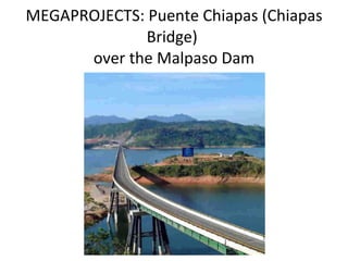
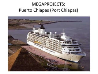
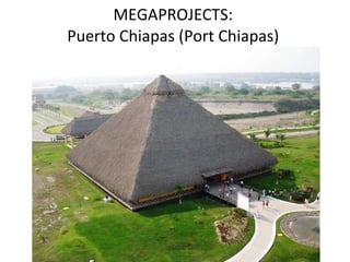
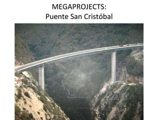
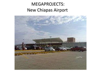
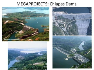
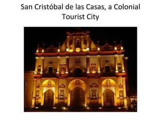
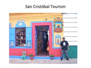
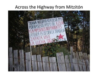
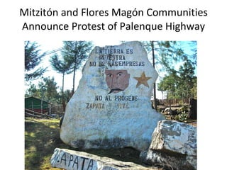
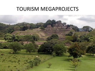
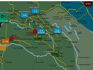
MEGAPROJECTS AND THE MILITARIZATION OF MEXICO
TWO RELATED INITIATIVES The Merida Initiative (Plan Mexico) - U.S. Government funding Mexican militarization under the guise of the “War on Drugs” and “protecting our border” The Mesoamerica Project (Plan Puebla Panamá) - a regional “development” plan to build the infrastructure for implementing “free trade” agreements (NAFTA and CAFTA)
Map of Mexico and  the Maya World (outlined in red)
2001, SAN SALVADOR ATENCO; 1st resistance to a PPP Megaproject: a new airport for Mexico City
REVENGE ON SAN SALVADOR ATENCO: Police Terrorism on May 3 and 4, 2006
People’s Front in Defense of Land (FPDT) Mobilizes: Demands Release of  12 Political Prisoners
GUERRERO: La Parota Dam; a megaproject to supply electricity to hotels in Acapulco
TOURIST MAP OF CHIAPAS
Eastern Chiapas  (outlined in yellow)
 
WHAT’S BEHIND “DEVELOPMENT”? Tourism (including “eco-tourism”, “adventure tourism”, “archeological tourism”, and “cultural tourism” -  not  Zapa-tourism) Mining (gold and other minerals) Monocrop agriculture for conversion to biofuels (African palm plantations, pinion trees) Oil Water (fresh, sweet water for bottling and hydroelectric power) Precious woods Bioprospecting (pharmaceuticals, cosmetics)
MEGAPROJECTS: Puente Chiapas (Chiapas Bridge)  over the Malpaso Dam
MEGAPROJECTS:  Puerto Chiapas (Port Chiapas)
MEGAPROJECTS:  Puente San Cristóbal
MEGAPROJECTS:  New Chiapas Airport
MEGAPROJECTS: Chiapas Dams
TWO CURRENT PROJECTS San Crist óbal to Palenque superhighway Ruta Maya (Maya Route) ecotourism project
San Cristóbal de las Casas, a Colonial Tourist City
San Crist óbal Tourism
TierrAdentro, a Zapatista Space  in San Cris
TierrAdentro,  a Zapa-Space  in San Cris.
The Palace at Palenque, a Ceremonial Center of the Ancient Maya
Agua Azul Cascades: attacking the Zapatistas to make way for a  “World Class Resort Destination”
 
Agua Clara, a Swimming Spot Next to Agua Azul
Misol Ha Waterfall
Mitzitón and Flores Magón Communities Announce Protest of New Palenque Highway
Murder of Aurelio Hernández, July 2009. Mitzitón Protests and Blocks Road
Across the Highway from Mitzitón
Mitzitón and Flores Magón Communities Announce Protest of Palenque Highway
TOURISM MEGAPROJECTS
 
MILITARIZATION NEAR PLANNED MEGAPROJECTS
CHIAPAS:  Montes Azules Biosphere Reserve; evicting the Maya to make way for the “Ruta Maya”
 
Deep in the Cañadas (Canyons) East of Ocosingo, one part of the Lacandón Jungle
Upper Jataté River Flows Through the Cañadas
Bonampak Ruins Yaxchilán Ruins
Maya Ruins of Yaxchilán
Getting to the Yaxchilán Ruins – Crossing The Usumacinta River
 

Megaprojects militarization

Editor's Notes

  • #5 The community of San Salvador Atenco organized the People’s Front in Defense of Land (FPDT) when they learned about the expropriation. Here, the FPDT is protesting in resistance to the expropriation of their lands by the federal government. Photos are from November 2001.1 person died in the protests due to police repression. But, the government cancelled the expropriation!
  • #6 2 young men died as a result of the police terrorism, many were injured, homes were entered and searched illegally, ____ were detained and taken to prison. 12 remain in prison.
  • #7 The Mexican Supreme Court is expected to rule at the end of June 2010 on the legality of the prison sentences. Pictured above is the May 4, 2010 March to Mexico City.
  • #11 Military positions in eastern chiapas.
  • #12 What do the corporations want?
  • #13 This PPP project reduced the driving time to Mexico City by about 10 hours.
  • #14 Puerto Chiapas, a deep water port for cruise ships, mega-tourism and export of agricultural products.
  • #15 One of the palapas at Puerto Chiapas.
  • #16 Puente San Cristóbal spans the new super highway (toll road) between the capital (Tuxtla Gutiérrez) and San Cristóbal de las Casas.
  • #17 Ángel Albino Corzo Airport near Tuxtla Gutiérrez
  • #18 Top: Malpaso (left) and Chicoasen (right) Bottom: Angostura (left) and Peñitas (right)
  • #20 Cathedral on the Zócalo (Central Plaza) of San Cristóbal de las Casas (SCLC). The city has many colonial churches and, situated in a mountain valley, has a pleasant climate.
  • #21 Quaint Shops, Cobblestone Streets, Interesting art and graphic design inspired by the Zapatistas.
  • #22 Note Artisan Shops on either side of Mural.
  • #25 The Agua Azul Cascades, located in between San Cristóbal de las Casas, Chiapas and Palenque.
  • #27 Operated by the Good Government Junta of Morelia!
  • #28 Next to Agua Clara
  • #29 July, 2009: Highway construction will mot be permitted in Mitzitón and Flores Magón (in black). The land is ours, not the corporations. PROHIBITED: the entry of engineers and strangers to the territory. He who is surprised will be put at the people’s disposition.
  • #31 It says: “Land recuperated since 1995 by EZLNB Support Bases and Independent Campesinos (peasants). The Land belongs to those who work it. Zapata Lives! The Struggle Continues.
  • #32 March, 2010: Painted Boulder along the current SCLC-Palenque Highway. It says: The land is ours, not the corporations. No to Procede (misspelled) Zapata Lives!
  • #33 TONINÁ Archaeological Site, located at the entrance to the Canyons east of the city of Ocosingo, Chiapas, Mexico. Recent discoveries indicate that this may be one of the largest cities of the ancient Maya.
  • #35 Mexican Army Base – across the road from Toniná
  • #36 January 27, 2010: Police set house on fire during eviction of Laguna San Pedro, a Zapatista community in the Montes Azules. Mexico’s environmental cops, known as the Profepa, participated, as did
  • #38 Double Rainbow, 2005.
  • #39 A Huge Question Is: What does the government intend to do with this part of the Jataté?
  • #40 Bonampak Ruins – Famous Paintings
  • #41 The Palace at Yaxchilán (left) and Stone Sculpture (right).
  • #42 Bonampak Ruins – Famous Paintings
  • #43 Major lakes, rivers and archaeological sites in Guatemala.