
Recommended
More Related Content
Viewers also liked
Viewers also liked (20)
Similar to LCLUP_compiled
Similar to LCLUP_compiled (20)
More from peterdandb
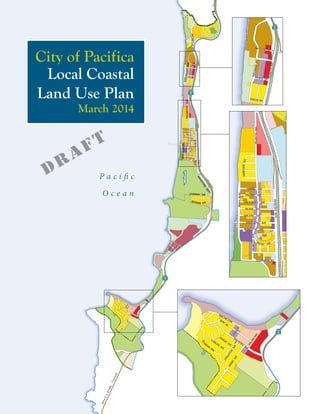
LCLUP_compiled
- 1. GAT EWAY DR FIRECRESTAVE INVERNESSDR M O NTER EYRD PALMETTOAVE MANOR DR SKYLINE BLVD GLENCOURT MONTEREY RD PAOTTEMLAVE EDGEM AR DR MILLERAVE AVALON DR OCEANABLVD PALOMA AVE TALBOT AVE BRADFORD WAY S HARP PARK RD MOANA WA Y LUNDYWAY FAIRWAY DR RIDGEWAY DR BEACHBLVD REINA DEL MAR AVE ROCKA WA YB EACH AVE TERRA NOVA BLVD EVERGLADES DR O DDSTAD BLVD CRESPI DR LERID A WAY C RESPI DR SEVILLE DR M A N ZANITA DRALICA NTE DRLINDA MAR BLVD ROSITA RD ROSITA RD ADOBE RD PERALTA RD DESO LO LINDA M AR BLVD FASSLER A V E PARK LIN COL N W ESTBOROUGH KING DR SKYLINE BLVD MILAGRA DR HICKEYBLVD ESPLANADEAVE MANOR DR ROBERTSRD SHARP PARKRD SEASIDE DR CLARENDON RD P a c i fi c O c e a n Devil’sSlide Tunnel ESPLANADEAVEPAOTTEMLAVE DVLBHCAEB MANOR DR AVALON DR MONTEREY RD PALMETTOAVE SHOREVIEWAVE SALADA AVE LINDA SANTA ROSA AVE MONTECITO AVE CLARENDON RD PAOTTEMLAVE CARMEL AVE PALOMA AVE PACIFIC AVE DVLBOCSICNARF SAN JOSE AVE SANTA MARIA AVE GRAND AVE SAN PEDRO AVE DANMANN HALLINGWAY SHELTER COVE STANLEY AVE KENT RD OLY M PIAN W AY STERLING AVE LIVINGSTON AVE Local Coastal Land Use Plan March 2014 City of Pacifica DRAFT
- 2. Pacifica City Council Mayor Len Stone Mayor Pro Tem Mary Ann Nihart Councilmember Sue Digre Councilmember Karen Ervin Councilmember Mike O’Neill Planning Commissioners Charles Evans, Chair Mike Brown, Vice Chair Richard Campbell Josh Gordon, Vice Chair Jeffery Cooper John Nibbelin Sue Vaterlaus Lorie Tinfow, City Manager George White, Planning Director
- 3. Prepared for City of Pacifica by DKS Associates Economic & Planning Systems (EPS) ESA May 2013Local Coastal Land Use Plan March 2014 City of Pacifica DRAFT
- 5. TABLE OF CONTENTS 1 Introduction........................................................................................... 1-1 1.1 Purpose of the Local Coastal Land Use Plan.................................................................... 1-2 1.2 Planning Context..................................................................................................................... 1-5 1.3 Local Coastal Land Use Plan Requirements...................................................................... 1-5 1.4 Relationship to Other Plans and Regulations ................................................................... 1-6 1.5 Guide to Using This Document........................................................................................... 1-7 1.6 Plan Administration ................................................................................................................ 1-9 2 Land Use and Development................................................................. 2-1 2.1 Coastal Act Framework ........................................................................................................ 2-2 2.2 Current Land Use Pattern .................................................................................................... 2-2 2.3 Land Use Framework............................................................................................................. 2-7 2.4 Coastal Development Priorities ........................................................................................ 2-15 2.5 Development Capacity and Adequacy of Public Services............................................ 2-31 3 Public Access and Recreation .............................................................. 3-1 3.1 Coastal Act Framework ........................................................................................................ 3-2 3.2 Coastal Access......................................................................................................................... 3-2 3.3 Open Space and Recreation ............................................................................................... 3-10 3.4 Trail System............................................................................................................................ 3-19 3.5 Bicycle and Pedestrian Network ....................................................................................... 3-25 3.6 Roadway Network and Planned Improvements ............................................................ 3-31 3.7 Public Transportation........................................................................................................... 3-40 3.8 Parking ..................................................................................................................................... 3-45 4 Environmental and Scenic Resources ................................................. 4-1 4.1 Coastal Act Framework ........................................................................................................ 4-2 4.2 Hydrology and Water Quality ............................................................................................. 4-2 4.3 Biological Resources............................................................................................................. 4-13 4.4 Natural Shorelines ................................................................................................................ 4-28 4.5 Agriculture, Forestry and Fishing ...................................................................................... 4-30
- 6. PACIFICA LOCAL COASTAL LAND USE PLAN – ADMINISTRATIVE DRAFT ii 4.6 Cultural Resources ............................................................................................................... 4-31 4.7 Scenic and Visual Qualities.................................................................................................. 4-33 5 Natural Hazards .................................................................................... 5-1 5.1 Coastal Act Framework ........................................................................................................ 5-2 5.2 Seismic and Geologic Hazards ............................................................................................. 5-2 5.3 Flooding................................................................................................................................... 5-16 A California Coastal Act Policies ........................................................... A-1 References .....................................................................................................................R-1 Glossary ...................................................................................................................... G-1
- 7. TABLE OF CONTENTS iii LIST OF FIGURES Figure 1-1: Pacifica and the Pacifica Coastal Zone .......................................................................1-3 Figure 2-1: Current Land Use Distribution in the Coastal Zone .............................................2-4 Figure 2-2: Existing Land Use in the Coastal Zone......................................................................2-5 Figure 2-3: Land Use Diagram...........................................................................................................2-9 Figure 2-4: Sub-Areas and Specific Sites ...................................................................................... 2-17 Figure 2-5: Pacifica Coastal Zone, North.................................................................................... 2-18 Figure 2-6: Pacifica Coastal Zone, Central.................................................................................. 2-21 Figure 2-7: Pacifica Coastal Zone, South..................................................................................... 2-25 Figure 3-1: Coastal Access.................................................................................................................3-3 Figure 3-2: Parks and Open Space System.................................................................................. 3-13 Figure 3-3: Trail System................................................................................................................... 3-21 Figure 3-4: Bicycle Network........................................................................................................... 3-27 Figure 3-5: Roadway Network and Planned Improvements ................................................... 3-33 Figure 3-6: Transit Routes and Facilities...................................................................................... 3-41 Figure 4-1: Hydrology .........................................................................................................................4-5 Figure 4-2: Vegetation...................................................................................................................... 4-17 Figure 4-3: Sensitive & Critical Habitat........................................................................................ 4-21 Figure 4-4: Visual Resources........................................................................................................... 4-35 Figure 5-1: Liquefaction and Fault Lines..........................................................................................5-5 Figure 5-2: Slope Failure and Coastal Erosion...............................................................................5-9 Figure 5-3: Flood Zones .................................................................................................................. 5-17 Figure 5-4: Fire Hazards .................................................................................................................. 5-23
- 8. PACIFICA LOCAL COASTAL LAND USE PLAN – ADMINISTRATIVE DRAFT iv LIST OF TABLES Table 1-1: Correspondence Between Coastal Zone Chapters and General Plan Elements ...........................................................................................1-8 Table 2-1: Land Use Classifications and Density and Intensity Standards.......................... 2-13 Table 2-2: Residential Development Capacity in the Coastal Zone Under the Local Coastal Land Use Plan ................................................................. 2-33 Table 2-3: Non-Residential Development Capacity in the Coastal Zone Under the Local Coastal Land Use Plan ................................................................. 2-34 Table 3-1: Coastal Access Points ....................................................................................................3-6 Table 3-1: Coastal Access Points (continued)..............................................................................3-7 Table 3-2: Regional Parks and Beaches in the Coastal Zone................................................. 3-11 Table 3-3: Mode Priorities by Roadway Type........................................................................... 3-32 Table 3-4: Definition of Multi-modal Level of Service Indicators ......................................... 3-35 Table 3-5: Beach Visitor Parking .................................................................................................. 3-47
- 9. 1 INTRODUCTION The Pacifica 2035 Local Coastal Land Use Plan (LCLUP) is a policy document for the long-range development of the portion of the City of Pacifica within the Coastal Zone. The Coastal Zone includes all land west of State Route 1, as well as Shelldance Nursery and some land south of City limits (see Figure 1-1, City of Pacifica and Coastal Zone). The LCLUP is an essential component of the City’s Local Coastal Program as required by the California Coastal Act. The LCLUP has been developed in tandem with the General Plan, which provides the direction for the future growth of the City, and articulates a vision of what Pacifica aspires to be.
- 10. PACIFICA LOCAL COASTAL LAND USE PLAN – PUBLIC REVIEW DRAFT 1-2 1.1 PURPOSE OF THE LOCAL COASTAL LAND USE PLAN The California Coastal Act requires every city and county lying partly or wholly within the Coastal Zone to prepare a Local Coastal Program (LCP). The LCP consists of a local coastal land use plan or plans; zoning ordinances; zoning district maps; and other actions which taken together implement the Coastal Act provisions. These provisions seek to ensure that public access to and along the shoreline is maintained; that water quality, marine life, and environmentally sensitive habitat areas are protected; and that coastal visual resources and special communities are preserved. The Coastal Act establishes certain land use priorities within the Coastal Zone: recreation and visitor-serving uses, fishing, boating, and other coastal-dependent uses, and public works and industrial facilities needed to support priority uses. Other resource-based uses are also prioritized by the Coastal Act. The Coastal Act is implemented through a partnership between the California Coastal Commission and local counties and cities, including Pacifica. By certifying an LCP, the Coastal Commission grants authority to the local jurisdiction to issue coastal development permits that are required for nearly all types of development in the Coastal Zone. The LCLUP is the first and primary element of the City’s LCP. It will serve as the basis for the City to update its zoning code and any other implementing tools needed in the Coastal Zone, and apply to the Coastal Commission for recertification of the LCP. As of August 2013, the City of Pacifica had a certified LCP dating to 1980, with two areas of deferred certification: Shelldance Nursery and the Quarry Site. In these areas, the Coastal Commission maintains permit-issuing authority. Why Update Now? The City of Pacifica last comprehensively updated its General Plan and LCLUP in 1980. In the more than 30 years since then, many of its goals have been carried out, including a zoning code with regulations to protect slopes and preserve open space, and the revitalization of the Rockaway Beach area. Many issues facing Pacifica are enduring but the legal environment governing land use, environmental preservation, housing, and other planning issues has changed. New priorities have emerged with a new generation of Pacifica residents and stakeholders. The General Plan and LCLUP update will provide for a comprehensive assessment of current conditions, and allow today’s residents to express a vision for the future. A major revision of the Plans is therefore necessary to eliminate obsolete text and policies, ensure legal conformity, and address today’s challenges. The Plans respond to the desires of the present community and the need to accommodate projected growth.
- 11. P a c i fi c O c e a n Devil’sSlide Tunnel Figure 1-1 Pacifica and the Pacifica Coastal Zone Coastal Zone Planning Area City Limits 0 1/2 11/4 MILES 2 Source: City of Pacifica, 2008; County of San Mateo, 2009; Dyett & Bhatia, 2013. Pacifica Pier S h a r p P a r k G o l f C o u r s e M o r i P o i n t ( G G N R A ) P e d r o P o i n t H e a d l a n d s ( G G N R A ) Sharp Park Beach Rockaway Beach Pacifica State Beach Northern Coastal Bluffs (GGNRA) Water Recycling Plant OLDCOASTHWY PAOTTEMLAVE FRANCISCOBLVD BRADFORD WAY FAIRWAY DR DVLBHCAEB GRAND AVE ESPLANADEAVE SEASIDE DR CLARENDON RD 1 92 35 1 1 1 280 Pacifica 380 280 101 101 280 101 280 80 101 Brisbane Burlingame Colma Daly City Half Moon Bay Hillsborough MillbraePacifica San Bruno South San Francisco Montara Emery S A N F R A N C I S C O S A N M A T E O San Francisco Bay Pacific Ocean Pacifica Planning Area County Lines Urbanized Area Freeways Highways Major Arterials BART Caltrain
- 12. PACIFICA LOCAL COASTAL LAND USE PLAN – PUBLIC REVIEW DRAFT 1-4 This page intentionally left blank.
- 13. CHAPTER 1: INTRODUCTION 1-5 1.2 PLANNING CONTEXT Regional Location Pacifica is within the San Francisco-Oakland-San Jose metropolitan area, and at its northern end is just 10 miles from downtown San Francisco. The cities of Daly City, South San Francisco, and San Bruno border the City on the north and east, and include urban development up to the City’s borders. Much of the land to the southeast and south is preserved as units of the Golden Gate National Recreation Area, State and County parks, and the San Francisco watershed, and rural and agricultural land is prevalent to the south. The Pacific Ocean borders Pacifica to the west. Access to Pacifica is primarily via State Route 1 (SR 1, or Coast Highway) and State Route 35 (SR 35, or Skyline Boulevard.) Land west of SR 1 in Pacifica, in addition to Shelldance Nursery, is part of the State-designated Coastal Zone, and subject to the Local Coastal Land Use Plan. Historic Development Pacifica remained a mainly agricultural and undeveloped area until the construction of the Ocean Shore Railroad in 1905 stimulated development of small coastside communities including Edgemar, Vallemar, Sharp Park, Pedro Point, and Rockaway Beach. These communities, together with Pacific Manor, Westview, Fairway Park, and Linda Mar incorporated in 1957 as the City of Pacifica. The City grew rapidly in the 1950s and 1960s. Growth slowed in the 1970s, and then slowed further in the following decades, owing to the scarcity of developable land and infrastructure constraints. About 1,210 housing units have been built over the last 20 years, along with a limited amount of commercial development. The Coastal Zone Land within Pacifica west of State Route 1, as well as the Shelldance Nursery property and some land east of SR 1 south of City limits, is part of the Coastal Zone, subject to Pacifica’s Local Coastal Land Use Plan and the policies of the California Coastal Act. Pacifica’s Coastal Zone comprises approximately 1,286 acres of land. It includes a high proportion of the City’s commercial land and visitor destinations. The Pacifica Planning Area boundary, Coastal Zone boundary, and City limits are shown in Figure 1-1. Pacifica's Coastal Zone contains a wide variety of land uses, including public recreation areas, distinct residential neighborhoods, visitor-serving and neighborhood commercial development, and highly sensitive wildlife habitats. The varied types of development of each coastal sub-area and the geographic relationships between them are an inherent and vital part of the character of the City. The General Plan and LCLUP strive to designate land uses and intensities suitable to the unique circumstances of each coastal area, adequately meet the needs of the City's residents and visitors, and be consistent with State Coastal Act policies. Chapter 2 provides detailed area maps and summary descriptions of seven identified sub-areas in Pacifica’s Coastal Zone. 1.3 LOCAL COASTAL LAND USE PLAN REQUIREMENTS Local Coastal Programs The California Coastal Act of 1976 gave the California Coastal Commission broad authority to ensure that development along the coastline would protect and enhance coastal resources. The Commission carries out this responsibility in partnership with local governments, through the development and certification of LCPs.
- 14. PACIFICA LOCAL COASTAL LAND USE PLAN – PUBLIC REVIEW DRAFT 1-6 California Public Resources Code (PRC) Sections 30000 et seq. establish the State’s coastal management policies and the procedures for preparation, approval, and certification of LCPs. An LCP includes a local government's land use plans, zoning ordinances, zoning maps, and other implementing actions for sensitive resource areas. These documents must be consistent and work together to implement the policies and provisions of the Coastal Act at the local level. The Coastal Act’s policies are provided in Appendix A of this Plan. Local Coastal Land Use Plan To meet the requirements of State law, the LCLUP must be “sufficiently detailed to indicate the kinds, location, and intensity of land uses, the applicable resource protection and development policies, and, where necessary, a listing of implementing actions.” (Section 30108.5 of the PRC). An example of such would be the Pacifica LCLUP’s requirement for detailed geotechnical studies in certain locations to establish bluff edge setbacks and other appropriate siting or design mitigation measures to accomplish the policies of the plan. The LCLUP includes a public access component as part of Chapter 4: Public Access and Recreation, “to assure that maximum public access to the coast and public recreation areas is provided” (Section 30500). During all phases of the LCLUP’s development, the public as well as affected agencies must be provided with extensive opportunities to participate. In the case of the Pacifica General Plan and LCLUP update, the planning process, including public participation, is detailed in Section 1.2. Implementation Plan The implementation component of the LCP comprises the zoning ordinance, zoning district maps, and other implementing actions within sensitive coastal resources areas. These are typically referred to together as the Implementation Plan (IP). The IP may be submitted to the Coastal Commission separately following submission of the LCLUP, and this is the intended approach in Pacifica. The relationship between the LCLUP and zoning is covered further in the following section. 1.4 RELATIONSHIP TO OTHER PLANS AND REGULATIONS The Local Coastal Land Use Plan and Zoning As described above, LCPs consist of local land use plans together with zoning codes, zoning maps, and any other implementation tools that are needed to assure that Coastal Act policies are property carried out at the local level. LCPs are prepared in consultation with Coastal Commission staff. After Coastal Commission certification, all programs are implemented by local governments. This LCLUP represents the first part of the LCP for Pacifica, and the framework on which zoning, and, if needed, specific plans or other needed implementing actions, will be based. The Local Coastal Land Use Plan and the General Plan The General Plan and LCLUP updates have been conducted in tandem. While they are two separate documents, much of the descriptive text and many of the policies are overlapping. Policies that are included in both the General Plan and the LCLUP are marked with a in the General Plan.
- 15. CHAPTER 1: INTRODUCTION 1-7 Much of the background text is also the same in both documents. Detailed discussion of Coastal Act requirements and goals is included only in the LCLUP, while issues that are not relevant to Coastal Act requirements and goals are covered only in the General Plan. The term “Planning Area” is used to refer to the General Plan’s Planning Area, while the term “Coastal Zone” is used to refer to the area subject to the LCLUP. Each plan has a different organizational structure, to match its purpose. Plan organization is covered in Section 1.5. One EIR describes the expected environmental impacts of both plans. Plan Bay Area The Metropolitan Transportation Commission (MTC), Association of Bay Area Governments (ABAG), Bay Area Air Quality Management District (BAAQMD), and Bay Conservation and Development Commission (BCDC) have adopted the Plan Bay Area. This Plan will be the San Francisco Bay Area’s Regional Transportation Plan, and will satisfy the Sustainable Communities Strategy (SCS) requirement established by SB 375 (see summary above). The effort is focused on bringing together transportation, land use, and housing policies at the regional scale to support greenhouse gas emissions reduction while ensuring mobility. Regional priorities for transportation investments will influence Pacifica’s future circulation system. Coastal Regional Sediment Management Plan A consortium of State and federal agencies, including the California Department of Natural Resources and the US Army Corps of Engineers, is organizing a series of Regional Sediment Management (RSM) plans. The primary focus is on facilitating the movement of excess clean sand to areas experiencing high levels of erosion. Goals include restoring and preserving beaches; sustaining recreation; enhancing public safety; and restoring coastal habitats. The San Francisco Littoral Cell Coastal RSM Plan is currently being developed for the coastline between the Golden Gate and Pedro Point Headlands. The Plan’s purpose is to assist communities by providing information for decision-makers and offering recommendations specific to the coastlines of San Francisco, Daly City and Pacifica. The Pacifica General Plan and Local Coastal Land Use Plan may provide a vehicle for enacting RSM recommendations. 1.5 GUIDE TO USING THIS DOCUMENT Plan Organization This section describes the organization of the Pacifica 2035 Local Coastal Land Use Plan and the structure of guiding and implementing policies. The LCLUP is organized to follow the topical sections of the Coastal Act policies, and is organized as follows: 1. Introduction. This chapter summarizes the key themes and initiatives of the Plan. It covers the Plan’s purpose, process, planning context, State requirements, relationships to other plans, plan organization (here), and requirements for administration of the Plan. 2. Land Use and Development. This chapter describes the existing land use pattern and provides the physical framework for land use and development in the Coastal Zone. It enumerates development demand and capacity, and provides detailed descriptions of land use issues by sub-area. It describes how the land use plan and related policies support development prioritized under the Coastal Act. 3. Public Access and Recreation. This chapter includes policies, programs, and standards to ensure that public access to the coast is provided according to the policies of the Coastal Act, serving as the
- 16. PACIFICA LOCAL COASTAL LAND USE PLAN – PUBLIC REVIEW DRAFT 1-8 public access component of the Plan. It identifies future street and traffic improvements, and addresses walking, biking, transit, and parking to enable a multi-modal circulation system in the Coastal Zone. This chapter also contains policies relating to regional open spaces and beaches, the trail system, City parks and recreation, as they pertain to Coastal Act policies to ensure the public has adequate access to coastal recreation opportunities. 4. Environmental and Scenic Resources. This chapter includes policies relating to hydrology and water quality, biological resources, agriculture and coastal sediment, air quality and greenhouse gas emissions, and historic and archaeological resources and conservation. It also addresses water supply, sewerage, solid waste management, and recycling, as well as stormwater management and sustainable site planning. It also includes urban design policies to improve the city’s visual quality and livability, including its neighborhoods, mixed-use areas, hillside and coastal areas, and scenic routes. Policies are presented in terms of their satisfaction of Coastal Act provisions. 5. Natural Hazards. This chapter addresses the hazards posed by seismic and geologic hazards, flooding, and wildland fires, and provides detailed policies that respond to Coastal Act provisions for minimizing adverse impacts. Table 1-1 shows how the chapters in the LCLUP related to General Plan Elements. TABLE 1-1: CORRESPONDENCE BETWEEN COASTAL ZONE CHAPTERS AND GENERAL PLAN ELEMENTS LCLUP Chapter Related General Plan Elements Chapter 1: Introduction Chapter 1: Introduction Chapter 2: Land Use and Development Chapter 4: Land Use Chapter 3: Public Access and Recreation Chapter 5: Circulation Chapter 6: Open Space & Community Facilities Chapter 4: Environmental and Scenic Resources Chapter 7: Conservation Chapter 3: Community Design Chapter 5: Natural Hazards Chapter 8: Safety Chapter 3: Community Design Source: Dyett & Bhatia, 2013. Policy Structure Each chapter of the Plan includes background information to establish the context for policies in the chapter. This background information is followed by two sets of policies, which together articulate a vision for Pacifica’s Coastal Zone that the Plan seeks to achieve: • Guiding Policies are the City’s statements of its goals and philosophy. • Implementing Policies represent commitments to specific actions. They may refer to existing programs or call for establishment of new ones. Policies provide guidance for development review, infrastructure planning, community facilities and services, and protection for the city’s resources, by establishing planning requirements, programs, standards, and criteria for project review. Explanatory material or commentary accompanies some policies. The use of “should” or “would” indicates that a statement is advisory, not binding; details will need to be resolved in LCP implementation. Where the same topic is addressed in more than one chapter, sections and policies are cross-referenced.
- 17. CHAPTER 1: INTRODUCTION 1-9 Diagrams and Land Use Classifications Diagrams in the LCLUP illustrate a number of policies relating to land use, coastal access, circulation, environmental and scenic resources, and hazards. Diagrams, and in particular the Land Use Diagram in Chapter 2, are important parts of the plan that contain information not presented anywhere else. The Land Use Diagram, other figures, and the Land Use Classifications are also adopted parts of the Plan. Appendix, Glossary and List of Acronyms Appendix A presents the coastal resources planning and management policies that comprise Chapter 3 of the California Coastal Act, or Section 30200 et seq. of the Public Resources Code. These policies are organized in seven topical articles, which guide the organization of the LCLUP chapters. The Plan concludes with a glossary to define important terms and concepts, and a list of acronyms that may appear in the preceding chapters. 1.6 PLAN ADMINISTRATION Certification The LCP may be submitted to the Coastal Commission all at one time, or in two phases, with the LCLUP first and the implementing actions second, and each may be separately certified. The LCP may also be split geographically. An LCP is not fully certified by the Coastal Commission until all parts have been certified. The Commission is also expected to review all certified LCPs from time to time to determine whether they are being implemented in conformity with State law. The Coastal Commission reviews the LCLUP for conformance with the coastal resources planning and management policies of the Coastal Act. At least one public hearing is required prior to land use plan certification; additional meetings may be required if the Commission finds substantial conformity issues. Review of the implementation plan (e.g., zoning) is focused on its adequacy to carry out the provisions of the certified LCLUP, including the public access component. At least one public hearing is required before certification (or rejection) of proposed zoning. Following certification of the LCP, the City of Pacifica will be granted authority to issue most coastal development permits (CDPs) under the new Local Coastal Land Use Plan and updated zoning map and zoning code. Some decisions may be appealed to the Coastal Commission. The Commission retains jurisdiction over public trust lands and tidelands, and may retain jurisdiction over sensitive lands. The Coastal Commission retains jurisdiction over permitting at the Quarry site and Shelldance Nursery site in Pacifica’s Coastal Zone as of July 2011. Amendments to the Plan and Periodic Review The LCLUP is less flexible than a General Plan in that its amendment, even after certification, requires the approval of the Coastal Commission as well as the City. An exception exists for minor amendments if the
- 18. PACIFICA LOCAL COASTAL LAND USE PLAN – PUBLIC REVIEW DRAFT 1-10 Coastal Commission’s executive director determines that they are “de minimis,” having no impact on coastal resources and remaining consistent with Coastal Act policies. Although Pacifica's LCLUP and General Plan are integrated, the coastal policies are clearly identified in order to facilitate the amendment process should that be desired in the future. The Coastal Commission periodically reviews certified LCPs to ensure that coastal resources are being effectively protected.
- 19. 2 LAND USE AND DEVELOPMENT The purpose of this chapter is to describe existing and planned land use in the Coastal Zone and present the policy framework that will guide the City on development decisions. The chapter includes the Land Use Diagram, land use classifications, standards for density and intensity, and limitations on development. The land use framework for each sub-area is then provided in greater detail. Guiding and implementing policies aim to define the Coastal Zone’s physical development and reinforce the community’s vision while supporting Coastal Act goals.
- 20. PACIFICA LOCAL COASTAL LAND USE PLAN – PUBLIC REVIEW DRAFT 2-2 2.1 COASTAL ACT FRAMEWORK The California Coastal Act establishes certain priorities for the location and type of new development along the coast. These may be summarized in three broader categories: concentration of development, prioritization of coastal-dependent, visitor and recreation uses; and provision of public services. Policies especially relevant to this chapter are below; refer to Appendix B for the full text of each Coastal Act policy. Coastal Act Policies Article 2: Public Access • Section 30213 Lower cost visitor and recreational facilities; encouragement and provision; overnight room rentals Article 3: Recreation • Section 30221 Oceanfront land; protection for recreational use and development • Section 30222 Private lands; priority of development purposes Article 6: Development • Section 30250 Location; existing developed area • Section 30252 Maintenance and enhancement of public access • Section 30254 Public works facilities • Section 30254.5 Terms or conditions on sewage treatment plant development; prohibition • Section 30255 Priority of coastal-dependent developments Article 7: Industrial Development • Section 30260 Location or expansion • Section 30262 Oil and gas development • Section 30263 Refineries or petrochemical facilities • Section 30264 Thermal electric generating plants 2.2 CURRENT LAND USE PATTERN Background Originally visited by the Portola expedition in 1769, Pacifica remained primarily agricultural until after the San Francisco Earthquake in 1906. Land speculators, stimulated by the construction of the Ocean Shore Railroad in 1905, subdivided and developed a series of small coastside communities including Edgemar, Vallemar, and the areas now known as Sharp Park, Pedro Point, and Rockaway Beach. These communities, together with Pacific Manor, Westview, Fairway Park, and Linda Mar incorporated in 1957 as the City of Pacifica. The city grew rapidly in the 1950s and 1960s, and most of its current housing was built during those decades, primarily east of Highway 1. Growth slowed in the 1970s, and then slowed further in the following decades, owing to the scarcity of developable land and infrastructure constraints. The Pacifica Coastal Zone is described in more detail by land use type in the paragraphs that follow.
- 21. CHAPTER 2: LAND USE AND DEVELOPMENT 2-3 Current Land Use Pattern Parks and Open Space The Coastal Zone covers 998 acres, not including road rights-of-way. Nearly half (479 acres) of this land is preserved as open space. This includes Mori Point, the Northern Coastal Bluffs, and Pedro Point Headlands, current and likely future parts of the Golden Gate National Recreation Area; Sharp Park Golf Course; and Pacifica State and Sharp Park Beaches. Residential Residential use makes up 21 percent of the Coastal Zone and 69 percent of developed land1 in the Coastal Zone, covering 206 acres. Most residential land in Pacifica’s Coastal Zone (70 percent) contains single-family housing, but multi-family housing makes up a majority (57 percent) of housing in the Coastal Zone. Multi- family units are interspersed among single-family houses and commercial uses in the West Sharp Park neighborhood and concentrated along the coast in the West Edgemar-Pacific Manor neighborhood. The Coastal Zone also includes Pacifica’s only mobile homes and most of the City’s mixed use development, which account for 2 and 1 percent of housing units in the Coastal Zone, respectively. Commercial, Industrial, and Mixed Use The Coastal Zone includes 41 acres of commercial uses. Commercial land is located at Pacific Manor and Pedro Point shopping centers, and in commercial districts at Rockaway Beach, Palmetto Avenue, and Francisco Boulevard. Pacifica has a small amount of mixed-use development, along Palmetto Avenue in West Sharp Park, in Rockaway Beach, and in Pedro Point. Overall, West Sharp Park has the greatest mix of uses throughout the neighborhood. Hotels, along with most visitor-serving commercial uses, are primarily in the Rockaway Beach neighborhood. The Coastal Zone also has a small amount of industrial land (13 acres) located along Palmetto north of the West Sharp Park commercial area. Public and Institutional Uses Public, community, and institutional uses occupy 39 acres of land in the Coastal Zone, including Ingrid B. Lacy Middle School; the Calera Creek Water Recycling Plant; City Hall; the Sharp Park branch library; and other public administrative buildings. Agriculture and Recreation There are approximately nine acres of land with agricultural-related uses in the Coastal Zone, outside city limits, at Shamrock Ranch along Highway 1. Undeveloped and Vacant Land Vacant or undeveloped land covers 206 acres or 20 percent of land in the Coastal Zone. About 29 acres of this land is outside City limits. Undeveloped land is present along the Northern Coastal Bluffs, the Rockaway Quarry site, Rockaway Headlands, and Pedro Point Headlands. Smaller vacant “infill” lots are scattered in neighborhoods. Given environmental factors such as slope and sensitive species, there are constraints on the development potential of many of these sites. Figure 2-2 maps the Coastal Zone land use pattern, while Figure 2-1 charts the relative distribution of land by land use in the Coastal Zone. 1 Developed land includes all land uses except for Open Space, Agriculture, or Vacant/Undeveloped.
- 22. PACIFICA LOCAL COASTAL LAND USE PLAN – PUBLIC REVIEW DRAFT 2-4 Figure 2-1: Current Land Use Distribution in the Coastal Zone Open Space 48% Public/ Community/ Ins9tu9onal 4% Residen9al Uses 21% Commercial and Mixed Use 4% Industrial Uses 1% Agriculture, Undeveloped, or Vacant 22%
- 23. P a c i fi c O c e a n PAOTTEMLAVE SHOREVIEWAVE SALADA AVE SANTA ROSA AVE MONTECITO AVE CLARENDON RD PAOTTEMLAVE CARMEL AVE PALOMA AVE PACIFIC AVE SAN JOSE AVE SANTA MARIA AVE GRAND AVE SAN PEDRO AVE DANMANN HALLINGWAY SHELTER COVE STANLEY AVE KENT RD OLY M PIAN W AY STERLING AVE LIVINGSTON AVE ROCKAW AY BEACH DONDEE ST OLD COUNTY RD SAN MARLO WAY 2 1 1 2 3 4 6 5 7 Devil’sSlide Tunnel Figure 2-2: Existing Land Use in the Coastal Zone Single-family Resdiential Multi-family Residential Mobile Homes Commerical Auto Services Hotels, Motels Office Mixed Use Utilities Industrial Schools Church Other Public or Community Uses Other Open Space Parks & Accessible Open Space Beach Agriculture Vacant/Undeveloped Coastal Zone Planning Area City Limits 0 1/2 11/4 MILES 2 Source: City of Pacifica, 2008; County of San Mateo, 2009; Dyett & Bhatia, 2013. Visitor Accommodations 1 San Francisco RV Resort 2 America’s Best Value Inn Pacifica 3 Best Western Lighthouse Hotel 4 Sea Breeze Motel 5 Pacifica Motor Inn 6 Holiday Inn Express & Suites Pacifica 7 Pacifica Beach Hotel Pacifica Pier S h a r p P a r k G o l f C o u r s e M o r i P o i n t ( G G N R A ) P e d r o P o i n t H e a d l a n d s ( G G N R A ) Sharp Park Beach Rockaway Beach Pacifica State Beach Northern Coastal Bluffs (GGNRA) Water Recycling Plant Pacifica Pier Rockaway Beach Pacifica State Beach OLDCOASTHWY PAOTTEMLAVE BRADFORD WAY FAIRWAY DR BEACHBLVD GRAND AVE ESPLANADEAVE SEASIDE DR ESPLANADEAVE DVLBHCAEB DVLBOCSICNARF MANOR DR AVALON DR MONTEREY RD FRANCISCOBLVD
- 24. PACIFICA LOCAL COASTAL LAND USE PLAN – PUBLIC REVIEW DRAFT 2-6 This page intentionally left blank.
- 25. CHAPTER 2: LAND USE AND DEVELOPMENT 2-7 2.3 LAND USE FRAMEWORK The Land Use Diagram, (Figure 2-3) illustrates the community’s vision for land use in 2035. It reflects the Coastal Act priorities presented in Chapter 1, as well as the planning themes laid out in the General Plan. The land use classifications depicted indicate the use and form of development. New development will be guided by Plan policies and programs for hillside and open space preservation; housing; and commercial and public facility development. Land Use Diagram The Land Use Diagram is a graphic representation of planned land use classifications; it will be used in conjunction with policies established in the Plan to review and approve, modify or deny proposed development projects. The Land Use Diagram includes a legend that shows land use categories whose densities and allowable uses are specified in the Land Use Classifications section. Land Use Classifications Land use classifications establish allowed uses, maximum density and intensity, and the type and character of development that is expected. Details on development standards are established in the zoning ordinance and Local Coastal Implementing Plan, and more than one zoning district may be consistent with a General Plan/LCLUP land use classification. According to State law, the General Plan must establish standards of population density and building intensity for each land use classification. The General Plan and LCLUP stipulate residential densities in housing units per gross acre; population density can be obtained by applying average persons per housing unit1 to the housing unit densities. For nonresidential uses, the Plan specifies a maximum permitted ratio of gross floor area to site area (Floor Area Ratio or FAR). Recommended density and intensity standards do not imply that development projects must be approved at the intensity specified for each use. Zoning regulations consistent with General Plan policies and/or site conditions may reduce development potential within the stated ranges. Table 2-1 shows gross density standards for residential categories and FAR standards for the other uses. Residential Pacifica’s five residential classifications provide for a range of densities, consistent with neighborhood character and planned land use. RESIDENTIAL/OPEN SPACE/AGRICULTURE In the Residential/Open Space/Agriculture (ROSA) classification, residential, agriculture, and recreation uses are allowed at a gross density of up to one unit per five acres (or 0.2 acres per unit). The allowable density on a site will be determined by slope, geology, soils, access, availability of utilities, public safety, and open space values. The density assumed for buildout calculations is 0.15 units per gross acre. VERY LOW DENSITY RESIDENTIAL The Very Low Density Residential (VLDR) classification provides for clustered development of up to two units per gross acre. Residential care facilities, schools, and community uses are permitted. The density assumed for buildout calculations is 1.5 units per gross acre. 1 Based on 2010 U.S. Census data, the number of persons per total housing units is 2.56.
- 26. PACIFICA LOCAL COASTAL LAND USE PLAN – PUBLIC REVIEW DRAFT 2-8 LOW DENSITY RESIDENTIAL The Low Density Residential (LDR) designation is intended for single-family housing development ranging from three to nine dwelling units per gross acre. Residential care facilities, schools, and community uses are permitted. Clusters of small-lot development as well as standard subdivisions will be allowed. Buildout is calculated at 6.5 units per gross acre. MEDIUM DENSITY RESIDENTIAL Medium Density Residential (MDR) is intended for a mix of housing types, including small-lot single family, attached single family, apartments, duplexes, townhomes and mobile home parks at densities of up to 15 units per gross acre. Residential care facilities, schools, and community uses are permitted. Buildout is calculated at 12.5 units per gross acre. HIGH DENSITY RESIDENTIAL High Density Residential (HDR) is intended for multifamily apartments, condominiums and townhomes. in two to three story buildings located near shopping areas and transit. The density will be up to 21 dwelling units per gross acre. Residential care facilities, schools, and community uses are permitted. Buildout is calculated at 25 units per gross acre. Mixed Use The Plan provides three mixed use classifications to create areas where housing and active commercial uses may be integrated. Visitor-oriented commercial uses are allowed as-of-right in all mixed use areas within the Coastal Zone. COASTAL RESIDENTIAL MIXED USE The Coastal Residential Mixed Use (CRMU) designation is intended for sites in the Coastal Zone with residential mixed use development potential, including housing at a range of densities, mixed use with housing over retail, and/or small-scale visitor-oriented commercial uses such as vacation rental or time-share units. Hotels are not permitted. Coastal access and public open space must also be provided, and environmental resources must be evaluated and protected. Sites may be developed up to an overall density of up to 15 units per gross acre, with clustering and sensitive site planning. Non-residential development may have an FAR up to 0.5 FAR. The total FAR (residential and non-residential) cannot exceed 1.0. Buildout is calculated at 15 units per gross acre and 0.10 FAR of non-residential use. MIXED USE NEIGHBORHOOD In the Mixed Use Neighborhood (MUN) classification, new development may include multi-family housing and building with ground-floor retail, restaurant or service uses and housing or offices above. Public or community uses and hotels may be permitted at appropriate locations. The MUN classification allows up to 26 units per acre and non-residential development with an FAR up to 1.0. The total FAR (residential and non-residential) cannot exceed 2.0. Buildout is calculated based on a 0.25 FAR for non-residential uses and 25 residential units per gross acre. MIXED USE CENTER The Mixed Use Center (MUC) classification is intended for high-density mixed use development, including public or community uses and hotels. Allowable uses include ground-floor retail, restaurant or service uses and housing or offices on upper levels. The MUC classification permits housing up to 50 units per acre and a 2.5 FAR of non-residential development provide the overall FAR not to exceed 2.5. Buildout is calculated at an FAR of 0.35 for non-residential uses and 25 units per gross acre for housing.
- 27. GAT EWAY DR FIRECRESTAVE INVERNESSDR M O NTER EYRD PALMETTOAVE MANOR DR SKYLINE BLVD GLENCOURT MONTEREY RD PAOTTEMLAVE EDGEM AR DR MILLERAVE AVALON DR OCEANABLVD PALOMA AVE TALBOT AVE BRADFORD WAY S HARP PARK RD MOANA WA Y LUNDYWAY FAIRWAY DR RIDGEWAY DR BEACHBLVD REINA DEL MAR AVE ROCKA WA YB EACH AVE TERRA NOVA BLVD EVERGLADES DR O DDSTAD BLVD CRESPI DR LERID A WAY C RESPI DR SEVILLE DR M A N ZANITA DRALICA NTE DRLINDA MAR BLVD ROSITA RD ROSITA RD ADOBE RD PERALTA RD DESO LO LINDA M AR BLVD FASSLER A V E PARK LIN COL N GRAND AVE W ESTBOROUGH KING DR SKYLINE BLVD MILAGRA DR HICKEYBLVD ESPLANADEAVE MANOR DR ROBERTSRD SHARP PARKRD SEASIDE DR CLARENDON RD P a c i fi c O c e a n Devil’sSlide Tunnel Figure 2-3: Land Use Diagram 0 1/2 11/4 MILES 2 Source: City of Pacifica, 2008; San Mateo County, 2009; Dyett & Bhatia, 2013. Planning Area City Limits Residential/Open Space/Agriculture (up to 0.2 units/acre)* Very Low Density Residential (0.2 -2.0 units/acre)* Low Density Residential (3 -9 units/acre)* Medium Density Residential (10 -15 units/acre)* High Density Residential (16 -21 or 31* units/acre)* Coastal Residential Mixed Use Mixed Use Neighborhood (16 -26 or 40* units/acre) Mixed Use Center (up to 50 units/acre) Retail Commercial Office/Commercial Service Commercial Visitor-Serving Commercial Low Intensity Visitor- Serving Commercial Public and Semi-Public Beach/Commuter Parking Utilities Park Conservation Sandy Beach Urban Reserve (Unincorporated) Transportation Corridor Coastal Zone *Senior or affordable housing may be developed at up to 1.5 times the maximum with the Density Bonus program. ESPLANADEAVEPAOTTEMLAVE DVLBHCAEB MANOR DR AVALON DR MONTEREY RD PALMETTOAVE SHOREVIEWAVE SALADA AVE LINDA SANTA ROSA AVE MONTECITO AVE CLARENDON RD PAOTTEMLAVE CARMEL AVE PALOMA AVE PACIFIC AVE DVLBOCSICNARF SAN JOSE AVE SANTA MARIA AVE GRAND AVE SAN PEDRO AVE DANMANN HALLINGWAY SHELTER COVE STANLEY AVE KENT RD OLY M PIAN W AY STERLING AVE LIVINGSTON AVE
- 28. PACIFICA LOCAL COASTAL LAND USE PLAN – PUBLIC REVIEW DRAFT 2-10 This page intentionally left blank.
- 29. CHAPTER 2: LAND USE AND DEVELOPMENT 2-11 Commercial Uses The General Plan and LCLUP establish five commercial classifications to accommodate a variety of potential commercial activities. Visitor-oriented commercial uses are allowed as-of-right in all commercial areas within the Coastal Zone. RETAIL COMMERCIAL The Retail Commercial (RC) classification is intended for retail, restaurant, and service uses, typically in single-or two-story buildings within shopping centers or on sites in the Highway 1 corridor. New development will be pedestrian- oriented. Offices may be located above the ground floor. The maximum FAR is 1.0 FAR. Buildout is calculated with an FAR of 0.25. OFFICE/COMMERCIAL The Office/Commercial (OC) classification permits offices as well as retail and service uses in buildings of two to three stories. The maximum FAR is 1.5; buildout is calculated with an FAR of 0. 35. SERVICE COMMERCIAL The Service Commercial (SC) classification is for industrial and heavy commercial uses, such as auto repair, equipment rental, storage, and materials salvage. The maximum FAR is 0.6; buildout is calculated with an FAR of 0.25. VISITOR-SERVING COMMERCIAL The Visitor-Serving Commercial (VC) designation is intended to foster and protect areas that attract and cater to visitors, including hotels or a visitor attraction, such as an interpretive center or conference center, restaurants, retail and services, commercial recreation, or other compatible uses. The maximum FAR is 3.0 FAR. Buildout is calculated with an FAR of 0.35. LOW-INTENSITY VISITOR-SERVING COMMERCIAL The Low-Intensity Visitor-Serving Commercial (LIVC) district allows uses that create public access to the coastal setting and are adaptable to changing environmental conditions: campgrounds, rustic lodging, concession stands, warming huts, outdoor event sites, and similar uses. Existing permitted businesses that do not conform to the description of LIVC may remain. In these areas, the designation indicates the long-term goal of transition to recreation-oriented land uses. Development may occur at up to 0.20 FAR, but must have an overall very low-intensity character on sites of more than one acre. Buildout is assumed at 0.05 FAR, recognizing the large land areas and minimal building expected to support recreational uses. Public and Community Uses Designations for public uses such as schools, civic buildings, utilities, and public parking areas are designated on the Land Use Diagram, and summarized below. Public park land is covered separately in the following section. PUBLIC AND SEMI-PUBLIC The Public and Semi-Public (PSP) designation indicates public or private schools, libraries, police and fire stations, and other civic and community uses. In the case that public facilities are converted or sold for new uses, Plan land use classifications shall be updated. If a public school is discontinued, any proposed new use should be compatible with the adjacent neighborhood. The maximum FAR in this district is 1.0. Buildout is assumed at 0.35 FAR.
- 30. PACIFICA LOCAL COASTAL LAND USE PLAN – PUBLIC REVIEW DRAFT 2-12 BEACH AND COMMUTER PARKING The Beach and Commuter Parking (BCP) designation applies to areas where the priority use is public parking to serve beach visitors and/or transit users. Sites are located adjacent to Pacifica State Beach and at Crespi Drive and Highway 1. Beach parking at the City’s Beach Boulevard property serving Pacifica Pier and Sharp Park should be conserved as part of development of that site. UTILITIES The Utilities (U) designation indicates the location of water tanks communications facilities including cellular facilities, and other utilities serving the City. The maximum FAR in this district is 1.0. Parks and Open Space Pacifica is defined by its extensive open space system, with extensive land preserved as public open space, or designated for conservation. These categories are detailed below. PARK The Park (P) designation is applied to public land either now developed for active recreation use or intended for future recreation development. The designation applies to City parks as well as to park or open space areas whose primary character is undeveloped and natural, or that is managed for use by residents of the larger region and beyond. The City does not have permitting authority on lands owned by other public agencies. CONSERVATION The Conservation (C) district takes the place of the Greenbelt district from the previous Plan. It applies to publicly- or privately-owned open areas not intended for development. These areas may include: • Watershed lands; • Land which is physically unsuitable for development due to geotechnical hazards, excessive steepness, or other environmental constraints, or lies within stream channels; • Areas to remain undeveloped as a result of density transfer or clustered development, or covered by open space, recreational or scenic easements; • Open areas providing a physical and visual buffer between developed or open areas; and • Open space required as mitigation for environmental impacts. SANDY BEACH The Sandy Beach (SB) designation applies to properties that are fully on beaches or coastal dunes or bluffs. No physical development is appropriate on these sites. Urban Reserve The Urban Reserve (UR) designation is created to apply to private lands outside of City limits but within the Planning Area. The City does not have permitting authority in this area. The Pacifica General Plan and LCLUP intends for agriculture and residential development with a minimum site area of 5 acres per unit to be the predominant uses on land designated Urban Reserve. Actual density may be limited by the physical conditions of a site such as geological hazards, access, and potential habitat. For sites larger than 50 acres, the City should work with San Mateo County to ensure that subdivision and development be considered in the context of a Plan Update.
- 31. CHAPTER 2: LAND USE AND DEVELOPMENT 2-13 TABLE 2-1: LAND USE CLASSIFICATIONS AND DENSITY AND INTENSITY STANDARDS Land Use1 Residential Density (gross units per acre): Range2 Non-Residential Intensity (FAR): Maximum3 Residential ROSA Residential/Open Space/Agriculture Up to 0.2 VLDR Very Low Density Residential 0.2 to 2 LDR Low Density Residential 3 to 9 MDR Medium Density Residential 10 to 15 HDR High Density Residential 16 to 21 Mixed Use CRMU Coastal Residential Mixed Use 10 to 15 0.5 MUN Mixed Use Neighborhood 16 to 26 1.0 MUC Mixed Use Center Up to 50 2.5 Commercial RC Retail Commercial 1.0 OC Office/Commercial 1.5 SC Service Commercial 0.6 VC Visitor-Serving Commercial 3.0 LIVC Low-Intensity Visitor-Serving Commercial 0.2 Public and Community Uses PSP Public and Semi-Public 1.0 U Utilities 1.0 BCP Beach and Commuter Parking - Parks and Open Space and Urban Reserve P Park C Conservation SB Sandy Beach UR Urban Reserve Notes: 1. All land use classifications are shown except those in the Parks and Open Space category. No development is projected in these areas. 2. Density ranges are rounded to the nearest whole number, except where less than 1 unit per acre. Senior or affordable housing may be developed at up to 1.5 times the maximum with the Density Bonus program. 3. For mixed use designations, the following maximum total FAR, including both residential and non-residential uses, is established: CRMU: 1.0 FAR maximum; MUN: 2.0 FAR maximum; MUC: 2.5 FAR maximum Source: City of Pacifica, Dyett & Bhatia, 2013. Coastal Development Review The City’s zoning code features a Coastal Zone (CZ) Combining District, with development regulations based on Coastal Act goals. These include the provision of public access to the shoreline and recreational opportunities, the protection and enhancement of the coastal environment, and the prioritization of coastal- dependent and visitor-serving uses. The Coastal Zone requirements supplement the underlying zoning regulations and new development must obtain a coastal development permit on all property subject to the LCLUP. Pursuant to the Coastal Act, certain categories of development are exempt from coastal development permit requirements, including development improvements of less than ten percent increase in building height, bulk or floor area to existing single-family structures; improvements of less than ten percent increase for other structures, except in situations involving a risk of adverse environmental impact; and certain other categories. Lot line and boundary adjustments; small grading projects and minor public works improvements
- 32. PACIFICA LOCAL COASTAL LAND USE PLAN – PUBLIC REVIEW DRAFT 2-14 are excluded from permit requirements, with certain exceptions. Following adoption of the LCLUP, the CZ District will be updated to be consistent with the new guidance provided here. Policies Implementing Policies LD-I-1 Zoning Consistency. Update the Zoning Ordinance and zoning map and apply zoning to all land within the City, consistent with General Plan and LCLUP policies and land use designations. LD-I-2 Land Divisions in the Coastal Zone. Continue to require coastal development permits for all land divisions within the Coastal Zone. Land divisions in the Coastal Zone shall be: • Designed to minimize impacts to public access, recreation, and coastal resources. • Designed to minimize site disturbance, landform alteration, and the removal of native vegetation for development or fire safety. • Prohibited on properties that include any areas that are within or adjacent to an Environmentally Sensitive Habitat Area (ESHA) unless the resulting parcels can be developed without building or requiring vegetation clearance in the ESHA or ESHA buffer, or unless the resulting parcels are set aside for conservation. • Permitted only in areas with adequate public services to serve development on the resulting parcels. • Any land division that would result in a parcel that could not be developed in accordance with the policies of this LCLUP is not allowed. LD-I-3 Coastal Development Permit Findings. For all development that requires a coastal development permit, continue to require written findings that it is consistent with all LCLUP policies and Implementation Plan provisions of the City’s certified Local Coastal Program. If there is a conflict between a provision of this LCP and a provision of the General Plan, or any other City-adopted plan, resolution, or ordinance not included in the LCP, and it is not possible for the development to comply with both the LCP and such other plan, resolution or ordinance, the LCP shall take precedence and the development shall not be approved unless it complies with the LCP provision. LD-I-4 Coordinate with the County to protect the Urban Reserve. Coordinate with the County to ensure that new development in unincorporated areas occurs at a maximum density of five acres per unit, and request that subdivision of 50 acres or more is subject to master planning and annexation as a condition of any urban development. A General Plan amendment also will be required, and a LCLUP amendment will be required for land within the Coastal Zone.
- 33. CHAPTER 2: LAND USE AND DEVELOPMENT 2-15 2.4 COASTAL DEVELOPMENT PRIORITIES The LCLUP aims to ensure that the goals of the California Coastal Act are furthered by land use actions and policies that affect land within the Coastal Zone as defined by the California Coastal Commission. LCLUP provisions for public shoreline access and recreation are provided in Chapter 3. Policies to protect water quality, sensitive habitats, and natural and scenic resources are in Chapter 4. Policies to protect against seismic hazards, erosion and flooding, and other natural hazards are in Chapter 5. This chapter covers how this Plan supports Coastal Act priorities for development, as follows. Concentrated Development The Coastal Act seeks to concentrate new development along the coast in already-developed areas and areas where it will not adversely affect coastal resources (Section 30250). Pacifica’s Local Coastal Land Use Plan reinforces the clear distinctions between areas of preserved open space (nearly 50 percent of the Planning Area) and established neighborhoods. It seeks to ensure that sensitive coastal open spaces on the Northern Coastal Bluffs and Pedro Point Headlands are preserved and enhanced, while promoting new development in and directly adjacent to the Rockaway Beach and West Sharp Park districts, and make these areas more commercially vibrant and transit-supportive, as described in Section 30252. These efforts are clearly defined in policies of this section as well as policies for each sub-area detailed in Section 3.3. Coastal-Dependent, Visitor-Serving and Recreational Development Section 30255 of the Coastal Act states that “coastal-dependent developments shall have priority over other developments on or near the shoreline.” Lower-cost visitor and recreation facilities (Section 30213); recreational uses and development (Section 30221); and coastal-dependent industry (Section 30260) are specifically called out. Section 30222 provides that “the use of private lands suitable for visitor-serving commercial recreational facilities designed to enhance public opportunities for coastal recreation shall have priority over private residential, general industrial, or general commercial development.” San Francisco and San Mateo Counties are major tourist destinations, attracting domestic as well as international travelers. The nine-county Bay Area region accounts for almost 30 percent of the visitor- generated tax receipts in California. Located along scenic Highway 1, south of San Francisco, Pacifica enjoys exposure to a number of visitors to the County’s coast, State parks, and other attractions. Pacifica itself has a wealth of public park land and amenities along the coastline, including Pacifica State Beach and the Pacifica Pier at Sharp Park Beach. The current demand for hotel rooms in Pacifica is served by six hotels with a total of 282 rooms. The establishments are moderately-priced with an average daily rate of $144.2 A majority of these hotels are clustered around Rockaway Beach. Pacifica is also home to the San Francisco RV Park. These accommodations are shown on the Existing Land Use map, Figure 2-2. The General Plan provides a tourism- related economic development strategy that will help Pacifica to better leverage its coastal location and other physical and cultural amenities, and a land use plan that emphasizes visitor-oriented commercial development. In the Visitor-Serving Commercial (VC) designation, for larger sites (with developable areas of two acres or larger), a hotel or visitor attraction is a required part of new development. Development on large sites may 2 Source: Respective hotels; City of Pacifica; hotels.com; Economic & Planning Systems, Inc., 2008.
- 34. PACIFICA LOCAL COASTAL LAND USE PLAN – PUBLIC REVIEW DRAFT 2-16 also include restaurants, retail and services, commercial recreation, or other compatible uses. New inns, resorts, or other overnight lodging should enliven the Rockaway Beach district and provide a basis for new development on the Quarry site. Such uses can enhance the public’s enjoyment of the coastal setting. The extensive public lands in Pacifica’s Coastal Zone and the recreation opportunities they afford are protected with Park and Conservation designations. The LIVC district allows uses that create public access to the natural setting and are adaptable to changing environmental conditions. Low-intensity visitor-serving development along northern Palmetto would add new ways of enjoying the coast. Potential uses such as rustic lodging or “hikers' huts” could occur on the Rockaway Headlands and enrich the recreational appeal of both Pacifica State Beach and Rockaway Beach for visitors. Energy Facilities and Coastal Dependent Industries Pacifica does not currently contain any coastal-dependent industry or energy facilities, and the Plan does not accommodate the new development of these uses. The types of industries that are the subject of Coastal Act policies—tanker facilities, oil and gas development, refineries, and thermal electric generating plants—are not foreseen to be feasible or appropriate. However, in keeping with the Coastal Act, new coastal-dependent industries may be permitted in the Coastal Zone under specific conditions, as outlined in the policies below. Sub-Areas and Specific Sites Pacifica's Coastal Zone extends from the eastern edge of Highway 1 to the Pacific Ocean. The Coastal Zone features a wide variety of land uses, including public recreation areas, distinct residential neighborhoods, visitor-serving and neighborhood commercial development, and sensitive wildlife habitats. The varied types of development of each coastal sub-area and the geographic relationships between them are an inherent and vital part of the character of the City. The LCLUP strives to designate land uses and intensities suitable to the unique circumstances of each coastal area, adequately meet the needs of the City's residents and visitors, and be consistent with State Coastal Act policies. Figure 2-4 shows seven sub-areas. Sub-areas may be referred to as neighborhoods at times. The “sub-area” designation is not intended to correspond with any jurisdictional boundaries, but to help readers understand the way the LCLUP affects Pacifica’s distinct geographic areas. Figure 2-4 also identifies specific sites that are the subject of Plan policies. This chapter contains land use policies for specific sites. In many cases, site- specific policies touch on a range of issues, including biological resources and natural hazards. These policies are included here, and are also relevant to later chapters. Citywide policies on open space, parks and coastal access are in Chapter 3. Policies on environmental and visual resources are in Chapter 4. Policies on natural hazards are in Chapter 5. Figure 4-5 also serves as a key map for the three maps that follow, showing these sub-areas and specific sites at a larger scale. These maps show LCLUP land use at the parcel level, as well as coastal access points; park opportunity sites; coastal view corridors; trails and proposed trail improvements. The sub-area maps and the sub-area descriptions below are intended to demonstrate how various aspects of the Plan—including land use, parks and recreation facilities, coastal access, and environmental resources and hazards—work together in the more localized context. The maps do not show different information than is contained in other LCLUP maps.
- 35. West Edgemar, Pacific Manor Fairmont West West Sharp Park Sharp Park GC, West Fairway Park, and Mori Point Pedro Point and Shelter Cove Rockaway Beach, Quarry, and Headlands Pacifica State Beach F Northern Coastal Bluffs Bowl Site Pacific Manor Industrial Northern Palmetto Promenade and Beach Boulevard Property Palmetto Ave Eureka Square and Mixed Use Center Sharp Park Golf Course Rockaway Quarry Site Rockaway Beach Rockaway Headlands Calson Site Pedro Point Shopping Center Shamrock Ranch P a c i fi c O c e a n Devil’sSlide Tunnel 0 1/2 11/4 MILES 2 Source: City of Pacifica, 2008; San Mateo County, 2009; Dyett & Bhatia, 2013. Figure 2-4: Sub-Areas & Specific Sites Subarea Specific Sites Coastal Zone City Limits Planning AreaOLDCOASTHWY PAOTTEMLAVE BRADFORD WAY FAIRWAY DR DVLBHCAEB GRAND AVE ESPLANADEAVE SEASIDE DR Figure 2-7 Figure 2-5 Figure 2-6 Key to Area Maps
- 36. Northern Coastal Bluffs (GGNRA) Bowl Pacific Manor Shopping Center Industrial Northern Palmetto Beach Boulevard Property Palmetto Ave Eureka Square and Mixed Use Center Fish Undercrossing Fairmont West Park Ingrid B. Lacy Middle School City Hall Promenade Sharp Park Golf Course Overcrossing Overcrossing San Francisco RV Park Pacifica Pier Talbot Rd Trail CoastalTrail West Edgemar, Pacific Manor West Sharp Park Fairmont West Lands End Apts. 9 7 8 6 3 4 2 1 5 7 7 PAOTTEMLAVE BEACHBLVD PALMETTOAVE ESPLANADEAV E FRANCISCOBLVD Residential/Open Space/Agriculture (up to 0.2 units/acre)* Low Density Residential (3 -9 units/acre)* Medium Density Residential (10 -15 units/acre)* High Density Residential (16 -21 or 31* units/acre)* Mixed Use Neighborhood (16 -26 or 40* units/acre) Mixed Use Center (up to 50 units/acre) Retail Commercial Office/Commercial Service Commercial Low Intensity Visitor- Serving Commercial Public and Semi-Public** Park Conservation Transportation Corridor Coastal Access Points (Beach) Coastal Access Points (Bluff top/View) Park Opportunity Site View Corridor 7 8 * Senior or affordable housing may be developed at up to 1.5 times the maximum with the Density Bonus program. 0 1/4 1/2 MILES 1 Existing Trail Proposed Trail On-street trail Subareas Specific Sites Coastal Zone City Limits Planning Area Coastal Access Points are keyed to Table6-5 Figure 2-5: Pacifica Coastal Zone, North
- 37. CHAPTER 2: LAND USE AND DEVELOPMENT 2-19 Northern Pacifica Coastal Zone Figure 2-5 covers the Coastal Zone north of Sharp Park, including Fairmont West; West Edgemar-Pacific Manor; and West Sharp Park. This area includes Palmetto Avenue, the Pacifica Pier and Promenade, the Pacific Manor shopping area, and the northern coastal bluffs. FAIRMONT WEST Fairmont West is a small residential area in northwestern Pacifica between Highway 1 and the Pacific Ocean, extending from Daly City along the Northern Coastal Bluffs. It is separated from inland neighborhoods by the highway and a significant grade change. Fairmont West is composed mainly of single-family houses, with a condominium development and a neighborhood park. Palmetto Avenue is Fairmont West’s principal roadway, and provides open views of the Pacific Ocean. The National Park Service owns approximately 14 acres of land on the northern coastal bluffs along the west side of Palmetto Avenue as part of the GGNRA. Given the extraordinary natural and scenic value, the interest of public access, and the potential erosion hazards, undeveloped land on the northern coastal bluffs is designated Residential/Open Space/Agriculture, and identified as a priority for permanent conservation. Sensitive, clustered development could occur on the east side of Palmetto. GGNRA plans to continue to manage its land along the northern coastal bluffs as a “natural zone” emphasizing protection of habitat and natural coastal processes. No formal beach access exists or is planned. Undeveloped land west of Palmetto Avenue contains areas of Coastal bluff scrub, which is considered a special status community of high value, important for stabilizing sand dunes. The entire bluff-top area is currently undeveloped and offers an open, highly scenic view of the entire length of Pacifica's coastline. WEST EDGEMAR-PACIFIC MANOR West Edgemar-Pacific Manor is an established coastal neighborhood extending from north of the Land’s End Apartments to south of the San Francisco RV Park between Highway 1 and the ocean. The area is centered on the Pacific Manor shopping center. Multi-family development accounts for over 90 percent of the area’s approximately 870 housing units. West Edgemar-Pacific Manor’s residential areas have the highest density in Pacifica. As envisioned by the Plan, redevelopment and/or shopping center improvements will enhance the area’s walkability, help integrate the commercial center with its coastal setting, and improve the area’s visual appeal. The City-owned bluff-top land along the west side of Esplanade Avenue may present an opportunity to develop a small park, if this can be done without aggravating slope instability. Esplanade Avenue is also identified as a future bluff-top coastal access point, which may be achieved by redesigning the Esplanade right-of-way to enhance views and pedestrian access. WEST SHARP PARK Sharp Park is one of Pacifica’s original beach communities. Its western and eastern portions are divided by Highway 1. The northern half of West Sharp Park includes some of Pacifica’s only industrial and service commercial uses. The southern half of the neighborhood has a mixture of single-family and multi-family housing, with retail commercial uses prevailing along Palmetto Avenue, and commercial and civic buildings along Francisco Boulevard. A majority of the neighborhood’s approximately 900 housing units are in multi- family buildings. West Sharp Park includes many of Pacifica's community facilities, including a branch of the San Mateo County Library, the Pacifica Resource Center, and City Hall. The neighborhood features the
- 38. PACIFICA LOCAL COASTAL LAND USE PLAN – PUBLIC REVIEW DRAFT 2-20 Pacifica Pier and Beach Boulevard Promenade, and public parking for the Pier, Promenade, and Sharp Park Beach. The Plan envisions the area along northern Palmetto transitioning to commercial recreation uses over time. Southern Palmetto Avenue will grow into a higher-density mixed use corridor, supported by higher-intensity development on Francisco Boulevard, and with an enhanced connection to the coast achieved with redevelopment of the Beach Boulevard property. The Beach Boulevard Promenade and park, together with the Pier and Sharp Park Beach, provide extensive recreation opportunities, and are tremendous assets for both the neighborhood and the City. The maintenance of park facilities, the pier, and public parking at this location is a high priority. Views to and along the ocean are essential to the neighborhood's character and must be maintained. Central Pacifica Coastal Zone Figure 2-6 shows the central section of Pacifica’s Coastal Zone. The map includes Sharp Park Golf Course, the West Fairway Park neighborhood, Mori Point, the Rockaway Quarry, Rockaway Beach, the Rockaway Headlands, and the Shelldance Nursery. SHARP PARK GOLF COURSE, WEST FAIRWAY PARK, AND MORI POINT The central stretch of Pacifica’s coast includes Sharp Park Golf Course, Mori Point, and the small single- family subdivision of West Fairway Park. Sharp Park Municipal Golf Course is part of a land bequest made early in the 20th Century on the condition that the land be used for public recreation. Laguna Salada and its marsh, located on the western side of the golf course, provide habitat for the San Francisco garter snake and California red-legged frog. West Fairway Park is a small single-family subdivision. On the south, the neighborhood meets the base of undeveloped Mori Point, managed as part of Golden Gate National Recreation Area. The Plan designates Sharp Park Golf Course and Mori Point as regional park land. Current characteristics may be maintained, and environmental restoration will be a priority. The West Fairway Park neighborhood's existing land use is reinforced by the Plan’s land use designations. Sharp Park Beach is open to the public between the Pier and Mori Point, while Sharp Park Golf Course provides a unique recreational asset. Mori Point is a spectacular section of the GGNRA. The General Plan proposes trail improvements and critical new trail segments that would link the coastal trails with the inland ridges. This segment of the Pacifica coastline includes view corridors from Highway 1 into Sharp Park Golf Course and toward Mori Point and Mori Ridge that will be preserved. ROCKAWAY BEACH, QUARRY, AND HEADLANDS Rockaway Beach is a small, pedestrian-oriented area with shops, restaurants, and lodging and a small beach, with parking and other amenities. The vacant Quarry site occupies about 94 acres west of Highway 1 and south of Mori Point. About 30 acres of the site are on slopes of 35 percent or steeper. The Calera Creek Water Recycling Plant, at the north end of the former quarry, releases treated wastewater into Calera Creek, which has a naturalized channel, a restored riparian corridor, and a paved walking and cycling path. The Headlands is a rocky promontory separating Rockaway Beach and Pacifica State Beach, and is crossed by a scenic trail.
- 39. Sharp Park Golf Course, West Fairway Park & Mori Point Rockaway Beach, Quarry, & Headlands Pacifica State Beach Rockaway Quarry Site Rockaway BeachRockaway Headlands Water Recycling Plant Flats Pad Proposed Overcrossing Undercrossing CoastalTrail CoastalTrail BRADFORD WAY FAIRWAY DR SEASIDE DR M o r i P o i n t ( G G N R A ) S h a r p P a r k & G o l f C o u r s e Sharp Park Beach 9 11 10 12 13 14 15 16 17 18 19 7 8 0 1/4 1/2 MILES 1 Residential/Open Space/Agriculture (up to 0.2 units/acre)* Low Density Residential (3 -9 units/acre)* Medium Density Residential (10 -15 units/acre)* High Density Residential (16 -21 or 31* units/acre)* Mixed Use Neighborhood (16 -26 or 40* units/acre) Mixed Use Center (up to 50 units/acre) Retail Commercial Office/Commercial Service Commercial Low Intensity Visitor- Serving Commercial Public and Semi-Public** Park Conservation Transportation Corridor Coastal Access Points (Beach) Coastal Access Points (Bluff top/View) Park Opportunity Site View Corridor * Senior or affordable housing may be developed at up to 1.5 times the maximum with the Density Bonus program. Existing Trail Proposed Trail On-street trail Subareas Specific Sites Coastal Zone City Limits Planning Area Coastal Access Points are keyed to Table6-5 Figure 2-6: Pacifica Coastal Zone, Central
- 40. PACIFICA LOCAL COASTAL LAND USE PLAN – PUBLIC REVIEW DRAFT 2-22 This page intentionally left blank.
- 41. CHAPTER 2: LAND USE AND DEVELOPMENT 2-23 The Quarry site is Pacifica's most visible potential development site. Approximately half of the site, including the upland areas and the Calera Creek riparian corridor, is designated for Conservation. This area will remain open space, with trail improvements connecting Mori Point with Rockaway Beach. The Flats and the Pad overlooking Rockaway Beach are designated for Visitor-Serving Commercial development, supporting such potential uses as a resort hotel, boutique hotels, visitor attractions, and retail uses integrated with the Rockaway Beach district. Redevelopment of the Quarry site could expand this visitor-oriented area. Any development of the Quarry site will require detailed evaluation of biological resources to ensure that sensitive habitat and wetlands are protected; the likely footprint of development could be much smaller than the area designated. While upper-story housing may be proposed as part of a specific plan for the site, this would require a vote. Development in the Quarry Flats should include new public open space. The existing Rockaway Beach district also offers opportunities for infill and redevelopment. The Plan envisions the Rockaway Beach district growing into a more distinct and high-profile visitor destination, with strong links to the natural setting of beaches, headlands, and ridges. The Plan proposes new coastal trail segments, and new trails would link the coastal trails with the inland ridges. Improvements to Highway 1 should ease travel, accommodate vehicles as well as bikes and pedestrians, and improve access into the Rockaway Beach district. Coastal views from Highway 1 toward Mori Point, Cattle Hill, and the Rockaway Headlands are important in establishing the identity of this area and Pacifica as a whole. Southern Pacifica Coastal Zone Figure 2-7 shows the southern part of the Coastal Zone, including Pacifica State Beach, Shelter Cove, and the Pedro Point neighborhood, as well as Pedro Point Headlands. PACIFICA STATE BEACH Pacifica State Beach, also known as Linda Mar Beach, is a long sandy beach on a small bay formed by the Rockaway Headlands and Pedro Point. Pacifica State Beach is an outstanding recreational asset for the City and attracts over one million visitors annually from the region and beyond for its surfing, beach environment and scenery in close proximity to San Francisco. Recent restoration work and improvements to parking and access has helped to ensure that the beach will remain a popular natural environment for years to come. Views from Highway 1 toward the crescent sweep of Pacifica State Beach, the Headlands, and Pedro Point are a defining element for Pacifica, and will be preserved across the protected park land. Pacifica State Beach supports primarily wintering and/or migrating Western snowy plovers, a federally threatened bird species. The beach must continue to be managed to ensure that recreational use does not interfere with the species' habitat requirements. Steelhead trout from the Central California Coast Ecologically Significant Unit are listed as threatened under the federal Endangered Species Act. Steelhead are known to spawn in several parts of San Pedro Creek, and the City will continue to support the preservation of viable steelhead migration. PEDRO POINT AND SHELTER COVE The Pedro Point neighborhood sits on the slope of the promontory that marks Pacifica’s southern boundary. The neighborhood is characterized by single-family houses climbing up the slope, with some commercial development, including a small shopping center, on the flat land near the beach. The neighborhood is separated from the coastline by the berm of the former Ocean Shore Railroad. Pedro Point abuts City- and State-owned land at the Point’s higher elevations. This land is within the Golden Gate National Recreation
- 42. PACIFICA LOCAL COASTAL LAND USE PLAN – PUBLIC REVIEW DRAFT 2-24 Area’s legislative boundary, and could be included in the park in the future. The western tip of Pedro Point descends to Shelter Cove, where another cluster of houses exists on a single 17-acre parcel. The Plan reinforces existing land use patterns for all developed parts of the sub-area. There is potential for Pedro Point shopping center and adjacent parcels to accommodate some new retail development, which could provide local convenience shopping as well as visitor-oriented businesses. The Plan retains flexibility for any future development on the vacant site west of the shopping center, which could have residential and small- scale commercial and visitor-oriented uses. Future development should include a small park and access to the berm and the beach beyond. Completion of the Devils Slide Tunnel project has provided the opportunity to create a new trailhead and trails through open space land on the headlands. SPHERE OF INFLUENCE San Pedro Mountain and Pedro Point Headlands define the southern boundary of Pacifica’s Sphere of Influence. The Plan designates existing public open space in the Sphere of Influence as park land, and designates all other land as Urban Reserve. The Urban Reserve area is intended to remain largely undeveloped.
- 43. Pacifica State Beach Pedro Point & Shelter Cove PPeeddrrooPPooiinnttTTrraaiill CCooaassttaallTTrraaiill Undeveloped San Pedro Ave Site Pedro Point Shopping Center Shamrock Ranch GRAND AVE SAN PEDRO AVE DDeevviill’’ssSSlliiddeeTTrraaii ll DEVIL’SSLIDETUNNEL Pedro Point Headlands (GGNRA) Pacifica State Beach 20 16 17 18 1921 22 Residential/Open Space/Agriculture (up to 0.2 units/acre)* Very Low Density Residential (0.2 -2.0 units/acre)* Low Density Residential (3 -9 units/acre)* Mixed Use Neighborhood (16 -26 or 40* units/acre) Retail Commercial Low Intensity Visitor- Serving Commercial Beach/Commuter Parking Utilities Park Conservation Urban Reserve Transportation Corridor * Senior or affordable housing may be developed at up to 1.5 times the maximum with the Density Bonus program. 0 1/4 1/2 MILES 1 Existing Trail Proposed Trail On-street trail Existing Trailhead Proposed Trailhead Coastal Access Points (Beach) Coastal Access Points (Bluff top/View) View Corridor 16 20 Subareas Specific Sites Coastal Zone City Limits Planning Area Coastal Access Points are keyed to Table6-5 Figure 2-7: Pacifica Coastal Zone, South
- 44. PACIFICA LOCAL COASTAL LAND USE PLAN – PUBLIC REVIEW DRAFT 2-26 This page intentionally left blank.
- 45. CHAPTER 2: LAND USE AND DEVELOPMENT 2-27 POLICIES Guiding Policies LD-G-1 Coastal Development. Ensure that development maximizes beach and coastal open space access and is oriented as much as possible to each particular coastal environment in use, design, and intensity. Policies related to coastal access are provided in Chapter 3. LD-G-2 Concentrated Development. Focus new development in or directly adjacent to already- developed areas, where it can be served by existing public services and where it will not have significant impacts on coastal or other resources. LD-G-3 Future Residential Development. Limit development to sites that are not critical for open space connections or habitat preservation, and which will be in harmony with the surrounding natural setting. LD-G-4 Higher-Density Housing. Locate higher-density housing in accessible places close to community shopping areas and transportation. LD-G-5 Commercial Area Revitalization. Facilitate the revitalization of shopping areas and the creation of distinct commercial districts in Pacifica, resulting in wider shopping and dining opportunities for residents, enhanced attractions for visitors, increased sales tax revenues, and a stronger community image. LD-G-6 Compact Mixed Use Development. Facilitate compact mixed-use development on sites with good access to transit. Mixed-use development may include housing or office space with retail, restaurants, or personal service businesses. LD-G-7 Open Space Conservation and Habitat Protection. Protect beaches, oceanfront bluffs, ridgelines, hillside areas adjacent to existing open space, and areas that support critical wildlife habitat and special status species. Implementing Policies COASTAL DEVELOPMENT PRIORITIES See Chapter 3 for policies concerning public access and recreation, Chapter 4 for policies that concern environmental and resource protection, and Chapter 5 for protection from natural hazards. LD-I-5 Lower Cost Visitor and Recreational Facilities. Protect lower-cost visitor and recreational facilities along the coastline. These include major, free recreational attractions such as Pacifica Pier and Pacifica State Beach; the public golf course at Sharp Park; the San Francisco RV Park; and numerous beaches accessible at no cost.
- 46. PACIFICA LOCAL COASTAL LAND USE PLAN – PUBLIC REVIEW DRAFT 2-28 LD-I-6 Oceanfront Land for Recreational Use. Protect land adjacent to Sharp Park and Pacifica State Beaches for low-intensity recreational use. Allowable uses should include recreation outfitters, campgrounds, rustic lodging, hikers’ huts, or view restaurants. LD-I-7 Development Priority for Visitor-Serving and Recreational Uses. Allow visitor-oriented uses as-of-right in all areas designated for Visitor-Serving Commercial or Low-Intensity Visitor-Serving Commercial, and all commercial or mixed-use districts within the Coastal Zone. Development on Visitor-Serving Commercial sites with developable areas of two acres or larger must include a visitor attraction, hotel, conference center, or similar use, and may also include a range of retail and service uses. Smaller sites may have any visitor- or pedestrian-oriented retail or service use. LD-I-8 Walkable and Transit-Oriented Development. Facilitate higher-density, mixed use development at specific locations along the coastline where an active, pedestrian environment is desired. Future development along Palmetto Avenue and at the Eureka Square site; on lower Linda Mar Boulevard and Crespi Drive in West Linda Mar; at the Pacific Manor Shopping Center; and at Rockaway Beach and Quarry are easily accessible along the Highway 1 corridor and transit routes. Such development should help to make the coastline more accessible to residents and visitors. LD-I-9 Coastal-Dependent Industry. Only allow new coastal-dependent industry if alternative locations outside the Coastal Zone are infeasible or more environmentally damaging or because to do otherwise would adversely affect the public welfare, and potential impacts to visual resources, sensitive species and habitat, water quality are mitigated to the maximum extent feasible. Future development of oil and gas facilities, refineries or petrochemical facilities, or thermal electric generating plants will be permitted only according to the terms established in Sections 30262, 30263, and 30264 of the Coastal Act, and Conditions of Approval that will ensure consistency with all Coastal Act policies. LD-I-10 Aquaculture. If oceanfront land is found to be suitable for coastal-dependent aquaculture, give such use priority over non-coastal-dependent uses. POLICIES FOR SPECIFIC SITES LD-I-11 Pacific Manor. Establish appropriate zoning for the Pacific Manor shopping district to facilitate Retail Commercial improvements and Mixed Use redevelopment. Redevelopment or improvements should enhance the area’s walkability and visual appeal, and should include pedestrian realm improvements that help to integrate the district with its coastal setting. LD-I-12 Northern Palmetto. Establish zoning standards that support the transition to low-intensity visitor-serving commercial uses over time along the west side of Palmetto Avenue in northern
- 47. CHAPTER 2: LAND USE AND DEVELOPMENT 2-29 West Sharp Park, and require improvement of the visual appearance of permitted older industrial uses when improvements are proposed to these uses. Geotechnical studies are required to determine the “net developable area.” New uses are required to provide appropriate setbacks along the coastal bluffs to protect new structures from loss during their design life, and to provide public access to and along the shoreline. LD-I-13 Palmetto Avenue. Establish zoning standards and/or Design Guidelines to enhance Palmetto Avenue between north of Paloma Avenue and Clarendon Road as a pedestrian-oriented main street with retail, restaurants and services as well as multi-family housing and mixed-use development. This will foster a character that will attract both residents and tourists. LD-I-14 Promenade Area and Beach Boulevard Property. Establish zoning standards to enhance the Promenade area as a local community and tourist destination. Redevelopment of the city-owned 2212 Beach Boulevard property should provide an anchor for Palmetto Avenue and enhance the beachfront experience. Appropriate uses will include a library and/or other civic use; a boutique hotel and restaurant; mixed use development including cafes, restaurants, retail, and upper-level housing; and townhouses and apartments. LD-I-15 Francisco Boulevard. Establish zoning standards to facilitate office commercial as well as retail development along the three blocks of Francisco Avenue north of City Hall, and higher-intensity mixed use development on the three blocks between City Hall and Montecito Avenue. A core of high-intensity and civic uses here should help to support retail and restaurants along Palmetto Avenue by bringing more residents and workers and by enhancing visibility from Highway 1. LD-I-16 Rockaway Quarry Site. Establish zoning and a specific or master plan to enable the responsible development and environmental conservation of the Quarry Site. Allowable development should provide City revenues, substantial public open space, and commercial uses and public spaces attractive to both visitors and local residents. Uses may include an inn or hotel; shops and restaurants; performance or conference spaces; and public uses. Residential use in mixed-use buildings may be included, but will require a public vote. Development should be integrated with the Rockaway Beach district, to create an expanded visitor-oriented area in a memorable natural setting. Environmental protection is a priority at this site and includes preserving upland areas as open space, preserving the riparian corridor along Calera Creek, and preserving critical habitat. Any development of the Quarry site will require detailed evaluation of biological resources to ensure that sensitive habitat and wetlands are protected; the likely footprint of development could be much smaller than the area designated. LD-I-17 Rockaway Beach. Establish zoning to facilitate continued improvements in the Rockaway Beach district and promote infill development emphasizing active ground-floor and visitor- oriented uses and links to the Quarry site.
- 48. PACIFICA LOCAL COASTAL LAND USE PLAN – PUBLIC REVIEW DRAFT 2-30 The Rockaway Beach area could be included in a Specific Plan that also covers the Quarry site. LD-I-18 Rockaway Headlands. Establish zoning to facilitate very low-intensity visitor-serving commercial use on the Headlands between Rockaway and Pacifica State Beach, such as rustic lodging, hikers’ huts, or similar uses. Maintain the Coastal Trail connecting the two beaches. LD-I-19 Pedro Point Shopping Center. Facilitate improvements to the existing Shopping Center that more fully use the property while enhancing its appeal for both neigh-borhood residents and visitors. Maintain beach access along the Shoreside Drive right-of-way. LD-I-20 Undeveloped San Pedro Avenue Site. Establish a Coastal Residential Mixed Use zoning district to allow development at up to 15 units per gross acre, and/or small-scale visitor- oriented commercial uses. Housing may be clustered, and uses may be mixed. Development must include public coastal access and must provide public open space. A survey is required to delineate potential wetlands on the site, if any, as part of the development application and environmental review process. The land directly west of the Pedro Point Shopping Center was identified as a commercial recreation site in the previous General Plan, and has been zoned for general commercial uses. Residential use has been sought for the site, and the potential for wetlands on the site has been identified. The Planning Commission supported “limited housing, park, no hotel,” but City Council did not make a conclusion about the site. CREATING A DESTINATION LD-I-21 Town Center. Through a combination of mixed use land use designations/zoning, streetscape improvements, targeted public investment, and marketing strategies, promote Palmetto Avenue as a pedestrian-oriented destination with shops and services for residents and visitors alike. LD-I-22 Business Improvement District. Work with property owners and the Palmetto Business Association to establish a Business Improvement District (BID) to finance local public improvements in the corridor. LD-I-23 City-Owned Catalyst Projects. Use city-owned properties as catalysts for new development in the Palmetto area and elsewhere in the city. For key opportunity sites such as the Old Wastewater Treatment Plant site on Beach Boulevard, the City may issue Request for Proposals for development. LD-I-24 Recycling Center Relocation. Work with Recology, Inc. to identify a new location for a recycling yard to free up land for visitor-based economic development. LD-I-25 Increase Tourism. Prepare a multi-faceted program to encourage tourism, focusing on: • Attracting new hotels or inns, a visitor’s center or other key attraction, tourism-based shopping, and other components; and • “Branding” and marketing Pacifica’s parks, open spaces, beaches, and other natural amenities.
- 49. CHAPTER 2: LAND USE AND DEVELOPMENT 2-31 LD-I-26 Enhanced Visitor Node. Create a highly distinct visitor-oriented commercial and hospitality node at Rockaway Beach and on developable portions of the Rockaway Quarry site. A key component of this strategy would be to pursue a boutique or high end/resort-oriented hotel and supporting tourist-oriented shopping and dining opportunities. 2.5 DEVELOPMENT CAPACITY AND ADEQUACY OF PUBLIC SERVICES Development Demand and Capacity One purpose of the General Plan and LCLUP is to ensure that the City can accommodate projected population and job growth over the planning period (to 2035). To meet the requirements of State housing law, the City must also have adequate sites where housing affordable to moderate- and low-income households can reasonably be developed. The Plan seeks to meet these needs while also satisfying other community goals and ensuring safety and environmental protection. This section estimates projected demand for new housing and non-residential space, and the development potential provided under the General Plan land use framework. Population and Employment POPULATION AND HOUSING TRENDS Pacifica grew rapidly in the 1950s and 1960s, but has grown very little since then. The City gained an average of 790 persons per decade in the 1970s, 1980s, and 1990s. Pacifica’s population was 37,234 in 2010, down 3 percent from the 38,390 counted in the 2000 Census, and down about 1.1 percent since 1990. Despite the slight decline in population, the City added 934 housing units between 1990 and 2010, as average household size declined from 2.82 to 2.67 persons. As in much of the state, Pacifica’s population has grown older in recent decades. Between 1990 and 2010, the 30-to-44 age cohort declined from 30 to 21 percent of the population, and there were also declines in the younger age cohorts. Meanwhile the 45-to-61 group grew from 18 to 28 percent and the population age 62 or greater rose from 10 to 16 percent.3 POPULATION PROJECTIONS AND HOUSING DEMAND ABAG periodically undertakes population projections for each jurisdiction within the nine counties that make up the Bay Area. The 2009 ABAG projections point to continued slow growth in Pacifica over the planning period, to a buildout population of 39,800 by 2035.4 However, ABAG’s projections assumed a population of 39,100 in 2010, while the Census counted only 37,234. This Plan conservatively uses the Census as a baseline and assumes that Pacifica and its Sphere of Influence will reach the projected population of 39,800 by 2035. Pacifica, then, is projected to have a demand for approximately 980 new housing units by 2035 to accommodate population growth.5 4 Association of Bay Area Governments (ABAG), 2010. 4 Association of Bay Area Governments (ABAG), 2010. 5 ABAG’s most recent forecast for growth in the Bay Area by jurisdiction are from the Plan Bay Area Jobs-Housing Connection Strategy, 2012. This forecast supports the new regional transportation and land use plan, which was adopted in July 2013. It projects 14,640 households in Pacifica and its Sphere of Influence in 2040. This may represent slightly slower growth than the 2009 projections, which anticipate 14,630 households in 2035. Note that the Plan Bay Area forecast does not address the year 2035, which is the buildout year for this General Plan.