1. COMMUNITY PLAN
IMPERIAL AVEStation
Station
805
94
805
1/4MileRadius
1/2 Mile Radius
1/4 Mile
Radius
IMPERIAL AVE
MARKET ST
HILLTOP DR
47THST
EUCLIDAVEEUCLIDAVE
LOGAN AVE
KELTON
RD
ROSW
ELL
ST
LUBER ST
OLD MEM O
CHURCHWARD ST
VALENCIA
PKWY
OLVERA AVE
SANJACINTO
58THST
N a t i o n a l
C i t y
F
MERLIN
DIVISION ST
M
ARKE
T
ST
GUYM
O
N
ST
NARANJA ST
BONITA
DR
MAGNUS
WAY
CERVANTES AVE
ALTA VISTA AVE
IMPERIAL AVE
TRINIDAD
W
AY
CERVANTES AVE
GENEVA AVE
PYRAMID
ST
WINSTONDR
GREYCOURT AV
ENCINA
DR
LA PAZ DR
GLORIAAVE
REYNOLDS ST
COBAN ST
WILLIEJAMESJONESAVE
MANZANARES WAY
SANTA MARGARITA ST
GROVELAND DR
53RDST
49THST
HILLTOP DR
46THST
F ST
45THST
F ST
44THST
48THST
DUVALST
LOSFLORESTERRACE
T ST
PALIN ST
SOLOLA AVE
MARIPOS
A PL
58THST
PARADISE
RD
DREAM ST
HOLLY DR
DUNNELL ST
R
ADIO
DR
LENOX DR
BOLLENBACHER
ST
ALVIN
ST
PITAST
South Branch C hol
las
C
reek
47THST
Euclid & Market
Village District
En
Encanto Planning Framework
Euclid Ave
Master Plan
Euclid & Market
Land Use and Mobility
Master Plan Area
Chollas Creek
Enhancement Plan
Chollas Creek
Enhancement Plan
City of San Diego
2. City of San Diego Encanto Neighborhoods Community Plan
2
ENCANTO NEIGHBORHOODS COMMUNITY PLANNING GROUP
Kenneth Malbrough, Chairperson
Leslie Dudley
Andrea Hill
Monte Jones
Ardelle Matthews
Brian Pollard
Gayle Reid
Khalada Salaam-Alaji
Maxine Sherard
Ricky Valdez
Steven Ward
Alfredo Ybarra
Marry Young
MAYOR
Kevin Faulconer
CITY ATTORNEY
Jan Goldsmith
CITY COUNCIL
Sherri Lightner, District 1
Lorie Zapf, District 2
Todd Gloria, District 3
Myrtle Cole, District 4
Mark Kersey, District 5
Chris Cate, District 6
Scott Sherman, District 7
David Alvarez, District 8
Marti Emerald, District 9
PLANNING COMMISSION
Tim Golba, Chairperson
Douglas Austin
Stephen Haase
Theresa Quiroz
Susan Peerson
Anthony Wagner
James Whalen
Prepared by
Chen/Ryan Associates
Keyser Marston Associates, Inc.
MW Steele Group Inc.
RECON Environmental, Inc.
Spurlock Poirier Landscape Architects
Ninyo & Moore
Page & Turnbull
Dexter Wilson Engineering, Inc.
Assisted by
PLANNING DEPARTMENT
Jeff Murphy, Director
Tom Tomlinson, Assistant Director
Nancy Bragado, Deputy Director
Cathy Winterrowd, Deputy Director
Lara Gates, Supervising Planner
Karen Bucey, Senior Planner
Samir Hajjiri, Senior Traffic Engineer
Maureen Gardiner, Associate Traffic Engineer
Tait Galloway, Principal Planner
Jeff Harkness, Parks Planner
Kelley Stanco, Historic Planner
Scott Mercer, Facilities Financing
Vicki Burgess, Facilities Financing
Michael Klein, Information System Analyst
Leo DeJesus, Principal Engineering Aide
Richard Brown, Graphic Designer
Keryna Johnson, Intern
Tara Lieberman, Intern
Admin Espinoza, Intern
Myra Herrmann, Environmental Analyst
DEVELOPMENT SERVICES DEPARTMENT
Dan Normandin, Land Development Code
3. Table of Contents
3
ENCANTO NEIGHBORHOODS
COMMUNITY PLAN
DATE APPROVED BY
PLANNING COMMISSION
RESOLUTION
NUMBER
DATE ADOPTED BY
CITY COUNCIL
RESOLUTION
NUMBER
PC - 4740October 22, 2015 November 16, 2015
R - 310077
R - 310078
4. City of San Diego Encanto Neighborhoods Community Plan
4
5. Table of Contents
i
TABLE OF CONTENTS
1 INTRODUCTION..............................................................................................1-1
1.1 Overview......................................................................................................................................................... 1-2
1.2 Vision and Guiding Principles.......................................................................................................................... 1-4
1.3 Community Profile........................................................................................................................................... 1-4
1.4 Planning Framework..................................................................................................................................... 1-11
2 LAND USE....................................................................................................2-1
2.1 Land Use Framework...................................................................................................................................... 2-3
2.2 Future Development....................................................................................................................................... 2-4
2.3 Village Area and Key Corridors..................................................................................................................... 2-12
2.4 Residential Land Use.................................................................................................................................... 2-20
2.5 Commercial, Employment, and Industrial Land Use...................................................................................... 2-23
2.6 Institutional Uses and Open Space............................................................................................................... 2-25
2.7 Environmental Justice................................................................................................................................... 2-26
2.8 Noise............................................................................................................................................................. 2-32
3 MOBILITY....................................................................................................3-1
3.1 Active Transportation..................................................................................................................................... 3-3
3.2 Public Transit.................................................................................................................................................. 3-7
3.3 Streets and Freeway System.......................................................................................................................... 3-9
3.4 Intelligent Transportation Systems............................................................................................................... 3-10
3.5 Transportation Demand Management (TDM)............................................................................................... 3-10
3.6 Parking......................................................................................................................................................... 3-11
6. City of San Diego Encanto Neighborhoods Community Plan
ii
4 URBAN DESIGN..............................................................................................4-1
4.1 Urban Design Framework............................................................................................................................... 4-2
4.2 Development Design....................................................................................................................................... 4-7
4.3 Streetscape and Public Realm...................................................................................................................... 4-16
4.4 Urban Forest................................................................................................................................................. 4-23
4.5 Urban Design Vision Illustratives.................................................................................................................. 4-26
5 ECONOMIC PROSPERITY...................................................................................5-1
5.1 Market Conditions & Demand Projections...................................................................................................... 5-3
5.2 Employment Generation ................................................................................................................................. 5-3
5.3 Business Improvement .................................................................................................................................. 5-5
5.4 Entertainment Districts................................................................................................................................... 5-5
5.5 Financial Feasibility of Future Development................................................................................................... 5-6
6 PUBLIC FACILITIES, SERVICES, AND SAFETY..........................................................6-1
6.1 Public Facilities and Services.......................................................................................................................... 6-3
6.2 Infrastructure.................................................................................................................................................. 6-7
6.3 Health and Safety............................................................................................................................................ 6-9
7 RECREATION.................................................................................................7-1
7.1 Parks and Recreation Facilities....................................................................................................................... 7-3
7.2 Preservation, Protection and Enhancement................................................................................................. 7-13
7.3 Accessibility................................................................................................................................................... 7-14
7.4 Open Space Lands and Resource-based Parks .......................................................................................... 7-15
8 CONSERVATION AND SUSTAINABILITY.................................................................8-1
8.1 Sustainability................................................................................................................................................... 8-3
8.2 Resource Management and Preservation...................................................................................................... 8-6
8.3 Community Gardens and Urban Agriculture.................................................................................................. 8-16
7. Table of Contents
iii
9 HISTORIC PRESERVATION.................................................................................9-1
9.1 Identification and Preservation of Historical Resources................................................................................ 9-2
9.2 Educational Opportunities and Incentives Related to Historic Preservation................................................ 9-12
10 ARTS AND CULTURE......................................................................................10-1
10.1 Cultural Character......................................................................................................................................... 10-3
10.2 Public Art...................................................................................................................................................... 10-3
10.3 Arts Programs and Facilities........................................................................................................................ 10-3
11 IMPLEMENTATION........................................................................................11-1
11.1 Purpose........................................................................................................................................................ 11-2
11.2 Incentive Programs ..................................................................................................................................... 11-2
11.3 Financing Mechanisms ................................................................................................................................. 11-3
11.4 Priority Public Improvements and Funding................................................................................................... 11-3
11.5 Action Items and Priorities............................................................................................................................ 11-9
8. City of San Diego Encanto Neighborhoods Community Plan
iv
LIST OF FIGURES
Figure 1-1: Regional Location...................................................................................................................................... 1-6
Figure 1-2: Encanto Neighborhoods Planning Area and Neighborhood..................................................................... 1-7
Figure 1-3: Planning Framework................................................................................................................................ 1-14
Figure 2-1: Community Plan Land Use......................................................................................................................... 2-5
Figure 2-2: Active Frontage........................................................................................................................................ 2-11
Figure 2-3: Areas of Land Use Change and Village District Boundaries.................................................................... 2-15
Figure 2-4: Existing Noise Contours........................................................................................................................... 2-30
Figure 2-5: Future Noise Contours............................................................................................................................ 2-31
Figure 3-1: Pedestrian Routes .................................................................................................................................... 3-4
Figure 3-2: Planned Bicycle Network........................................................................................................................... 3-6
Figure 3-3: Public Transit Facilities.............................................................................................................................. 3-8
Figure 3-4: Market Street west of 47th Street.......................................................................................................... 3-12
Figure 3-5: 47th Street at Castana Street.................................................................................................................. 3-14
Figure 3-6: Euclid Avenue between Guymon Street and Lise Street.......................................................................... 3-16
Figure 3-7: Existing (2012) Functional Street Classifications and Daily Traffic ........................................................ 3-18
Figure 3-8: Buildout Street Classifications and Daily Traffic ...................................................................................... 3-19
Figure 4-1: Neighborhoods.......................................................................................................................................... 4-2
Figure 4-2: Anchors and Gateways.............................................................................................................................. 4-3
Figure 4-3: Urban Design Concept Map....................................................................................................................... 4-5
Figure 4-4: Site Design................................................................................................................................................. 4-7
Figure 4-5: Building Corners........................................................................................................................................ 4-7
Figure 4-6: Building Transition..................................................................................................................................... 4-8
Figure 4-7: Storefront Design...................................................................................................................................... 4-9
Figure 4-8: Building Orientation................................................................................................................................. 4-11
Figure 4-9: Building Orientation to Open Space........................................................................................................ 4-13
Figure 4-10: Corner Plaza............................................................................................................................................ 4-17
Figure 4-11: Site Connectivity....................................................................................................................................... 4-18
9. Table of Contents
v
Figure 4-12: Sidewalk Zones........................................................................................................................................ 4-19
Figure 4-13: Street Tree Corridors and Proposed Neighborhood Street Trees.......................................................... 4-25
Figure 6-1: Existing and Planned Public Facilities in the Encanto Neighborhoods ..................................................... 6-5
Figure 6-2: Geological, Seismic and Flooding Hazards ............................................................................................. 6-13
Figure 7-1: Existing Parks and Recreation Facilities.................................................................................................... 7-5
Figure 7-2: Existing and Proposed Parks and Park Equivalencies.............................................................................. 7-7
Figure 7-3: Open Space and Trail System.................................................................................................................. 7-17
Figure 7-4: Chollas Creek Detail 1.............................................................................................................................. 7-20
Figure 7-5: Chollas Creek Detail 2.............................................................................................................................. 7-21
Figure 7-6: Chollas Creek Detail 3.............................................................................................................................. 7-22
Figure 7-7: Chollas Creek Detail 4.............................................................................................................................. 7-23
Figure 8-1: Sustainable Development Diagram............................................................................................................ 8-3
Figure 8-2: Open Space, Hillsides, and Views in Encanto............................................................................................ 8-7
Figure 8-3: Tree Canopy and Habitat......................................................................................................................... 8-15
Figure 9-1: Historic Resources..................................................................................................................................... 9-9
LIST OF TABLES AND CHARTS
Chart 1-1: Race and Ethnicity in Encanto Neighborhoods and San Diego (2012).................................................. 1-10
Table 1-2: General and Community Plan Elements................................................................................................... 1-13
Table 2-1: Land Use Topics Also Covered in Other Plan Elements............................................................................. 2-2
Table 2-2: Existing Land Uses in the Encanto Neighborhoods................................................................................... 2-3
Chart 2-1: Existing Land Use in the Planning Area by Percent Share........................................................................ 2-3
Chart 2-2: Development Types and Land Use Classifications..................................................................................... 2-6
Table 2-3: Land Use Classifications and Permitted Densities/Intensities................................................................... 2-9
Chart 2-3: Future Land Use in the Planning Area by Percent Share........................................................................ 2-12
Table 2-4: Land Use Classifications in the Encanto Neighborhoods......................................................................... 2-13
Table 2-5: Potential Development Under the Encanto Neighborhoods Community Plan......................................... 2-13
10. City of San Diego Encanto Neighborhoods Community Plan
vi
Table 2-6: Additional Standards and Incentives in Villages...................................................................................... 2-17
Table 3-1: Mobility Topics Also Covered in Other Plan Elements................................................................................ 3-2
Table 3-2: Proposed Bicycle Facility Typologies......................................................................................................... 3-5
Table 4-1: General Plan “Crosswalk” Table ............................................................................................................... 4-6
Table 5-1: Economic Prosperity Topics Also Covered in Other Plan Elements........................................................... 5-2
Table 6-1: Public Facilities, Services and Safety Topics Also Covered in Other Plan Elements.................................. 6-2
Table 7-1: Recreation Topics Also Covered in Other Plan Elements........................................................................... 7-2
Table 7-2: Population-based Parks and Park Equivalencies Inventory ..................................................................... 7-6
Table 7-3: Existing and Proposed Population-Based Park Inventory and Recreation Facility Summary ................ 7-12
Table 8-1: Conservation and Sustainability Topics Also Covered in Other Plan Elements.......................................... 8-2
Table 9-1: Historic Preservation Topics Also Covered in Other Plan Elements.......................................................... 9-2
Table 10-1: Arts and Culture Topics Also Covered in Other Plan Elements................................................................ 10-2
Table 11-1: City of San Diego Financing Methods ..................................................................................................... 11-4
Table 11-2: Local, State and Federal Financing Methods ......................................................................................... 11-5
Table 11-3: Developer/Property Owner/User Financing Methods ............................................................................. 11-7
Table 11-4: Implementation Schedule...................................................................................................................... 11-10
12. 1-2
City of San Diego Encanto Neighborhoods Community Plan
1.1 Overview
Background
The community of Encanto Neighborhoods, or “enchant-
ment” in Spanish, was a rural but self-sufficient town for
much of the late nineteenth and early twentieth centuries,
connected to the city by rail but containing little more than
rolling hills of open space and farmland. It was not until
after World War II that the area was targeted for suburban
development and population boomed, with new residents
eager to capitalize on the availability of large lots located so
close to the city center. Today Encanto Neighborhoods is
one of the most culturally diverse communities in the City
of San Diego, reflecting its long history as an ethnic en-
clave, and as one of the first communities within the City
where African-Americans, Mexican-Americans and Asian-
Americans could own land, businesses and homes. Encanto
Neighborhoods’ deep cultural heritage, social resiliency and
legacy of diversity has shaped its past and will continue to
inform its future, through this Community Plan and the
land use and development in the decades to come.
Plan Purpose and Process
The Community Plan is designed to guide growth
and development within Encanto Neighborhoods.
This Plan is a revision of the previous Southeastern
San Diego Community Plan which included Encanto
Neighborhoods. The Southeastern San Diego Commu-
nity Plan was originally adopted in 1969, was compre-
hensively updated in 1987, and has undergone several
amendments in the intervening years. This document
seeks to update the Plan by:
• Evaluating what land use changes have occurred
since the previous update;
• Analyzing changes in demographics that may
inform current and future land use needs,
including demand for housing and commercial
development;
• Working with community members and
stakeholders to determine key issues and desires,
establishing a vision, goals, and policies for
The Community Plan is designed to guide growth and development in Encanto Neighborhoods.
13. Introduction
1
1-3
reviewing development proposals and public
projects;
• Providing guidance to the City of San Diego,
public agencies, property owners, and private
developers to design projects that enhance the
character of the community;
• Providing strategies and specific implementing
actions to help ensure the land use vision is
accomplished;
• Ensuring that policies and recommendations
remain in harmony with the General Plan and
citywide policies;
• Incorporating higher intensity mixed use
designations around trolley stops.
This Plan is a living document. It is intended to pro-
vide guidance for the orderly growth and development
of the Encanto Neighborhoods community. In order
to respond to unanticipated changes in environmental,
social or economic conditions and to remain relevant
to community and City needs, the Plan must be moni-
tored and amended when necessary. Two additional
steps are included as part of the adoption: Implemen-
tation and Review. Implementation is the process of
putting Plan policies and recommendations into effect.
Review refers to the process of monitoring the com-
munity development and growth conditions and rec-
ommending changes to the Plan as these conditions
change.
While this Plan sets forth procedures for implementa-
tion, it does not establish regulations or legislation, nor
does it rezone property. Controls on development and
use of public and private property including zoning,
design controls, and implementation of transportation
improvements are included as part of the plan imple-
mentation program. The rezoning actions and overlay
zones recommended in the Implementation Element
of this Plan were enacted concurrently as part of the
plan adoption. Zoning used to implement this com-
munity plan complies with the General Plan policies
(See GP LU-F.1) and proposals within this Plan have
been coordinated with and are consistent with the
General Plan. Periodic comprehensive reviews of the
General Plan may affect the Encanto Neighborhoods
Community Plan.
Policies are provided in the Plan, but the actual work
must be based on a cooperative effort of private citi-
zens, developers, city officials and other agencies. It is
contemplated that the residents of Encanto Neighbor-
hoods and other private citizen and business organi-
zations will provide the continuity needed for a sus-
tained, effective implementation program. This update
provides a new Community Plan for Encanto Neigh-
borhoods specifically; in instances where existing poli-
cies continue to reflect community needs, these will be
retained.
Environmental Impact Report
The Environmental Impact Report (EIR) on the En-
canto Neighborhoods Community Plan and the South-
eastern San Diego Community Plan provides an as-
sessment of potential impacts that may occur with the
implementation of the Community Plans, pursuant to
the California Environmental Quality Act (CEQA).
Because Encanto Neighborhoods is an urban area, the
nature of impacts primarily relates to the changes in
land use, use intensity and traffic rather than effects on
Policies are provided in the Plan, but the actual work
must be based on a cooperative effort of private
citizens, developers, city officials and other agencies.
14. 1-4
City of San Diego Encanto Neighborhoods Community Plan
natural resources. Potential impacts were anticipated
during preparation of the Community Plan, and many
of the policies and implementing regulations were de-
signed to reduce or avoid such impacts.
The EIR has three purposes:
• Satisfy CEQA requirements for analysis of environ-
mental impacts by including a complete and com-
prehensive programmatic evaluation of the physical
impacts of the proposed Community Plan Updates
(CPUs) and their alternatives.
• Inform decision-makers and the public of the poten-
tial environmental impacts of the proposed CPUs prior
to city decision-makers taking action on them.
• Provide a basis for the review of subsequent devel-
opment projects and public improvements proposed
within the planning area.
The EIR does not examine the effects of potential site-
specific projects or activities that may occur under the
overall umbrella of the proposed CPUs. However, it
may serve as the EIR for subsequent activities or imple-
menting actions to the extent it contemplates and ad-
equately analyzes the potential environmental impacts
of those subsequent projects. If in examining these
future actions the City finds no new effects could oc-
cur, or no new mitigation measures would be required
other than those analyzed and/or required in the EIR
for the CPUs, the City can approve the activity and no
new environmental documentation would be required.
If additional analysis is required, it can be streamlined.
1.2 Vision and Guiding Principles
Public Participation
In order to ensure that the Encanto Neighborhoods Com-
munityPlanwasacommunity-drivenupdate,theCitycon-
ducted an extensive community outreach process, where a
wealth of valuable community information was received
through a variety of avenues, including workshops, meet-
ings and community outreach sessions at various places in
the community. During each phase of the process broad
public input was obtained through a series of meetings
where residents, employees, property owners, as well as rep-
resentatives of advocacy groups and the surrounding neigh-
borhoods, weighed in on issues and provided recommen-
dations, concerns, and preferences. To ensure that outreach
activities reached a broad spectrum of the population, out-
reach materials were available in English and Spanish, and
bilingual interpretation was available at community work-
shops. Through these meetings, the community confirmed
its Vision and developed a set of Guiding Principles that
were used as criteria in crafting each of the Plan Elements.
1.3 Community Profile
Social and Historical Context
Encanto, part of the South Chollas Valley was decidedly
rural in the late nineteenth and early twentieth centu-
ries. The area was part of an 3,350.5 acre tract owned by
Abraham Klauber. After the booming real estate market
crashed in the late 1880s, Klauber platted and subdivid-
ed the land around his country house into ten-acre lots.
His daughter Ella is credited with naming the subdivi-
sion Encanto, Spanish for “enchantment” or “charm.”
During each phase of the process broad public input
was obtained through a series of meetings, including
a visioning workshop in April 2013 (top and middle)
and an open house in July 2014 (bottom.)
15. Introduction
1
1-5
COMMUNITY VISION
Encanto Neighborhoods residents envision their community as a scenic, vibrant and healthy community recognized as a jewel in San
Diego.The Encanto Neighborhoods will be known for their panoramic views, unique arts and culture, night life and entertainment,
employment, education, and housing opportunities.The community will enjoy new mixed-use transit-oriented development and a
diversity of housing types clustered close to the intermodal transit stations. Historic single family neighborhoods in the northern and
eastern parts of the community enjoy a semi-rural “country living in the city” atmosphere.The community will boast great parks and
high-quality recreational facilities including multi-use trails along Chollas Creek, area canyons and other open spaces.The community will
offer opportunities for high educational attainment and an overall unmatched quality of life and environment for children to learn, play and
grow, nurturing the next generation of great community leaders.
GUIDING PRINCIPLES
1. Celebrate Encanto Neighborhoods’ cultural diversity by
fostering inclusive neighborhoods that are known as a
destination for arts, culture, food and entertainment.
2. Maintain the overall dominant single-family character of the
community while focusing new transit-oriented development
at densities high enough to attract new investment and foster
revitalization around the 62nd Street, Euclid Avenue, and 47th
Street inter-modal transit stations as well as along key walkable,
mixed-use, nodes on the Imperial Avenue and Market Street
corridors.
3. Promote active living and healthy lifestyles by furthering
access to trails and open spaces, creating walkable and safe
neighborhoods, promoting fresh food choices and urban
agriculture, and establishing community gardens.
4. Foster high educational attainment for the younger generations
by creating additional educational and employment
opportunities.
5. Enhance opportunities for neighborhood commerce and retail
uses, encouraging well-paying employment-oriented uses and
emphasizing creative enterprises.
6. Restore and enhance the open space network that is formed by
parks, canyons, and Chollas Creek corridors.
7. Improve the community’s streets and sidewalks, above ground
and underground utilities, parks, and other public infrastructure
in order to promote a safe and attractive public realm.
8. Create an environment of economic opportunity, and flexibility
to adapt to changing circumstances.
9. Develop sustainable practices for new development, mobility,
water, and energy conservation, in order to reduce greenhouse
gas emissions.
16. 1-6
City of San Diego Encanto Neighborhoods Community Plan
Figure 1-1: REGIONAL LOCATION
DIVISION ST
EUCLI
LOGAN AVE
ENCIABLVD
PARADISE VALLEY RD
PLAZA BLVD
DAVE
47THST
IM
VALE
SKYLINE DR
LISEncanto
Neighborhoods
69THST
HOM
E
AVE
FAIRM
EUCLIDAVE
Coronado
Chula
Vista
IMPERIAL AVE
28THST
12THAVE
BROADWAY
NATIONAL AVE
FERNST
PARKBLVD
6THAVE
UNIVERSITY AVE
EL CAJON BLVD
30THST
E. HARBOR
DR
DIVISION ST
NATIONALCITYBLVD
HIGHLANDAVE
E. 30TH
ST
EUCLIDAVE
47THST
69THST
LOGAN AVE
HOM
E
AVE
FAIRMOUNTAVE
EUCLIDAVE
54THST
W.LAUREL ST
PACIFIC
HWYBARNETT AVE
ROSECRANS
ST
CATALINABLVD
PT
LOMA
AVE
SUNSET
CLIFFS
BLVD
SEA WORLD DR
CANON
ST
ROSECRANSST
INGRAHAMST
FRIARS
RD
UNIVERSITY
AVE
FLORIDAST
TEXASST
EL
CAJON BLVD
UNIVERSITY AVE
EL CAJON
BLVD
W. MISSION
B
AY
DR
W. POINT LOMA
DR
CHATSWORT
H
BLVD
TALBOT ST
3RD
ST4TH
ST
ALAMEDA
BLVD
ORANGE
AVE
SILVER
STRAND
BLVD
MISSION
BLVD
W
.
W
ASHINGTON ST
N. H
ARBORDR
N. HARBOR DR
ULRICST
MASSACHUSETTSAVE
LEMON
GROVE
AVE
IM
PERIA
L
AVE
VALENCIABLVD
SKYLINE DR
LISBON ST
JAMACHA RD
M
EADO
WBROOKDR
E. 24TH
ST
BRIARWOO
D RD
REO
DR
SWEETWATER
RD
4THAVE
BROADWAY
BONITA
RD
EUCLIDAVE
E ST
NIMITZBLVD
NARRAGANSETT
AVE
W.MORENA
BLVD LINDA VISTA RD
MISSION
CENTERRD
MONTEZUMA RD
COLLEGE
AVE
COLLWOODBLVD
FAIRMOUNTAVE
P
ERSHINGDR
E.HARBORDR
PARADISE VALLEY RD
CABRILLOMEMORIALDR
WOODMAN
ST
PLAZA BLVD
H ST
L ST
PALOMAR ST
EAST H ST
TELEGRAPH CANYON RD
PASEORANCHERO
OTAY LAKES RD
94
15
8
8
805
75
805
15
163
5
54
5
125
75
125
National
City
Balboa
Park
Barrio
Logan
Downtown
Naval Base
San Diego
Greater
Golden Hill
Greater
North
Park
Uptown
Oldtown
San
Diego
Midway-
Pacific
Highway
Marine Corps
Recruit Depot
San Diego
International
AirportPeninsula
Mid-city:
Normal
Heights Mid-city:
Kensington-
Talmadge
Mid-city:
City Heights
Mid-city:
Eastern Area
Skyline-
Paradise Hills
Encanto
Neighborhoods
Lemon
Grove
MARKET ST
Encanto Neighborhoods
Community Planning Area
Orange Line Trolley
Blue Line Trolley
Greenline Trolley
City Limits
0 1 2 53 4
MILES
17. Introduction
1
1-7
Figure 1-2: ENCANTO NEIGHBORHOODS PLANNING AREA AND NEIGHBORHOOD
O ’ F a r r e l l
GUYM
ON ST
IMPERIAL AVE
MARKET ST
IMPERIAL AVE
MARKET ST
HILLTOP DR
FEDERAL BLVD
47THST
EUCLIDAVEEUCLIDAVE
OCEAN VIEW BLVD
LOGAN AVE
47THST
BAYV
IEW
HEIGHT
S
DR
KELTON
RD
ROSWELL ST
LUBER
S
T
OLD MEM
ORYLN
BROADWAY
60THST
M
ADERA
ST
FEDERAL BLVD
MALLARD ST
IM
PERIAL
AVE
CHURCHWARD ST
VALENCIA
PKW
Y
61STST
SKYLINE DR
OLVERA AVE
SAN
JACINTO
DR
58THST
PLAZA BLVD
WOODMANST
ORANGE LINE TROLLEY
E n c a n t o
V a l e n c i a
P a r k
L i n c o l n
P a r k
C h o l l a s
V i e w
E m e r a l d
H i l l s
A l t a
V i s t a
BROADWAY
HEIGHTS
N A T I O N A L
C I T Y
Cemetery
LATIMERST
FENNELLAVE
VARNEY DR
69THST
RADIO
DR
MERLIN
D
R
DIVISION ST
BENSON AVE
65THST
MADRONE AVE
63RDST
AKINS AVE
65THST
66THSTKLAUBERAVE
C I T Y H E I G H T S
E A S T E R N
A R E A
L E M O N
G R O V E
S K Y L I N E
PA R A D I S E
H I L L S
S O U T H E A S T E R N
S A N D I E G O
E N C A N T O
N E I G H B O R H O O D S
JACOBDEKEMA
FW
Y
M
ARTIN
LUTHER KING, JR
FW
Y
805
94
94
805
Station
Station
Encanto Neighborhoods
0 1/2 1
MILES
1/4
FIGURE 1-2: Encanto Neighborhoods Planning Area and Neighborhoods
18. 1-8
City of San Diego Encanto Neighborhoods Community Plan
Much of Encanto Neighborhoods was developed in
the postwar years. It became among the most racially
integrated areas of the city.
In 1907, the Richland Realty Company purchased
1,100 acres in Encanto Neighborhoods and re-platted
it into one-half, five- and ten-acre lots. The new sub-
division, Encanto Heights, was the first suburban stop
outside of San Diego on the San Diego, Cuyamaca and
Eastern Railway line.
The city again grew rapidly in the post-World War II
years, which saw the creation of new suburban devel-
opment in the Chollas Valley. Many African-Ameri-
cans moved to Encanto and Valencia Park from Logan
Heights in the 1950s and 1960s, taking advantage of the
first opportunity they had to own homes.
The Encanto Neighborhoods today remain one of the
most ethnically diverse communities in San Diego.
Location and Boundaries
The Planning Area encompasses 3,811 acres, and is
located approximately five miles east of Downtown,
as shown in Figure 1-1. The community is bounded
by State Route 94/Martin Luther King, Jr. Freeway
to the north and Interstate 805 (I-805) to the west,
providing access to local and regional destinations. The
Mid-City community is to the north, Southeastern San
Diego is to the west, and Skyline-Paradise Hills is to
the southeast. The City of Lemon Grove defines the
northeast boundary of the Planning Area roughly along
69th Street, while the City of National City defines the
western half of the Planning Area’s southern boundary.
Plaza Boulevard marks the southern boundary to the
east.
Specific neighborhoods in the community include Chol-
las View, Lincoln Park, Valencia Park, O’Farrell, Alta
Vista, Emerald Hills, Encanto, and Broadway Heights, as
shown in Figure 1-2.
Neighborhoods
Chollas View
Chollas View is bounded on the north by SR-94/Martin
Luther King, Jr. Freeway, on the south by the San Diego
Arizona Eastern Railroad tracks (which also serve the San
Diego trolley Orange line), on the east by Euclid Avenue,
and on the west by I-805. The neighborhood derived its
name from the abundance of the cholla cactus that cov-
ered the land.
In 1919, the Catholic Diocese opened Holy Cross Cem-
etery on 40 acres of land between 44th and 46th Streets
north of Hilltop Drive. The cemetery provides a pan-
oramic view to the north, east, and west. From 1941 to
March 1942, nearly 40,000 families were in need of mili-
tary housing in San Diego. In response to that need, the
federal government eventually built more defense housing
in San Diego than in any other American city. One of
those projects was located in Chollas View neighborhood
and was located between 44th and 45th Street and “F”
and “G” Streets. The project was developed as duplexes,
many of which remain today. In the 1950s a neighbor-
hood began to develop around the war housing project
south of Holy Cross Cemetery.
Emerald Hills
Emerald Hills is bounded on the north by SR-94/Martin
Luther King, Jr. Freeway and Federal Boulevard, on the
south by Market Street, on the east by 60th Street and
Merlin Avenue, and on the west by Euclid Avenue.
The neighborhood is named after the Emerald Hills
Country Club and Gold Course, established in the area in
1929 and sold to developers to be used for homes in 1958.
19. Introduction
1
1-9
The area includes open space, including Radio Canyon,
and a portion of Chollas Creek.
Lincoln Park
Lincoln Park is bounded on the north by the Orange Line
San Diego trolley tracks, on the south by the City of Na-
tional City, on the east by Euclid Avenue, and on the west
by I-805.
Lincoln High School, named after Abraham Lincoln, con-
tinues to serve as a focal point for the neighborhood. The
significant feature of this neighborhood is its abundance
of land dedicated to public schools, the most dominate
being Lincoln High School. The neighborhood also in-
cludes two elementary schools: Harley Know Elementary
School and John F. Kennedy Elementary School.
The area contains a wide range of topographic features,
including rolling hills, mesa tops and floodplains
Broadway Heights
Broadway Heights is bounded on the north and east by
the City of Lemon Grove, on the south by Mallard Street,
and on the west by Federal Boulevard.
The 140-lot subdivision known as Broadway Heights was
approved in the late 1950s, and most of the homes were
built around 1960. A smaller “Rancho Valle” 43-lot sub-
division is located immediately to the east of the Broad-
way Heights subdivision.
The neighborhood is atop the highest peaks in the com-
munity with an average elevation of over 400 feet above
sea level. The highest parcels are along Mallard Street, with
the remainder of the neighborhood terraced down in the
northern portion of the subdivision.
Encanto
Encanto is bounded on the north by SR-94/Martin Lu-
ther King, Jr. Freeway and Mallard Street; on the south by
Imperial Avenue; on the east by the city of Lemon Grove
and Broadway; and on the west by Federal Boulevard,
60th Street and Merlin Avenue.
In 1899, Abraham Klauber platted and subdivided the
land around his country house into ten-acre lots. His
daughter, Ella is credited with naming the subdivision
Encanto, Spanish for “enchantment” or “charm.” The
area contains a series of natural canyons and rolling hills.
Radio Canyon, which cuts diagonally from the northeast
to the southwest corners of Encanto, is a major natural
open space system. Encanto is also home to the Encanto
Cultural Fair, which annually brings thousands of people
together to celebrate family, community, and culture.
Valencia Park
Valencia Park is bounded on the north by Market Street,
on the south by the city of National City and Division
Street, on the east by Valencia Parkway, and on the west
by Euclid Avenue.
The area contains a wide range of topographic features
including steep slopes and rolling hills, plateaus, canyons
and floodplains .The highest point, located in the south-
ern corner of the neighborhood, near 58th Street and Ar-
royo Avenue, provides a 360 degree view of San Diego.
Valencia Canyon, located north of Valencia Park Elemen-
tary School, is a major natural open space.
O’Farrell
O’Farrel is bounded on the north by Imperial Avenue; on
the south by Division Street and Varney Drive; on the east
20. 1-10
City of San Diego Encanto Neighborhoods Community Plan
Alta Vista
Alta Vista is bounded on the north by Division Street and
Varney Street, on the south by Mariposa Place and Plaza
Boulevard, on the east by Woodman Street, and on the
west by the city of National City.
The subdivision known as “Alta Vista” was approved in
the early 1960s, and was located in the western portion
of the neighborhood. Development continued to the east
during the mid-1970s and early 1980s. The neighbor-
hood is made up of varied terrain, with two minor creeks
running north/south through the western portion of the
neighborhood.
Demographic Profile
AccordingtoSanDiegoAssociationofGovernments(SAN-
DAG), Encanto Neighborhoods had 47,706 residents in
2012. Compared to the city overall, the community has a
somewhat younger population, with a median age of 30
years and approximately 30 percent of the population un-
der 18 years old. Households in Encanto Neighborhoods
also have substantially lower median incomes: less than
$47,000 in 2010 compared to nearly $67,000 citywide.
Approximately 52 percent of residents in Encanto
Neighborhoods are Hispanic compared with 29 per-
cent citywide (see Chart 1-1). According to the 2011
American Community Survey (Five-Year Estimates), 57
percent of the population speaks a language other than
English at home.
Asian
Other
Black
White
Hispanic
24,735 (52%)
Encanto
Neighborhoods CPA
City of San Diego
388,890 (29%)
585,515 (44%)
77,722 (6%)
212,587 (16%)
56,601 (4%)
3,204 (7%)
10,413 (22%)
7,330 (15%)
2,024 (4%)
Chart 1-1: RACE AND ETHNICITY IN
ENCANTO NEIGHBORHOODS
AND SAN DIEGO (2012)
Source: SANDAG Regional Warehouse Data, 2012.
by Woodman Street; and on the west by Valencia Park-
way, Latimer Street, Fennell Avenue, and Thrush Street.
The area contains a wide range of topographic features
including steep slopes and rolling hills, plateaus, and can-
yons.
21. Introduction
1
1-11
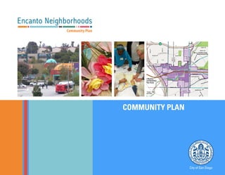
1.4 Planning Framework
Plan Organization
The Encanto Neighborhoods Community Plan con-
tains eight elements and an Implementation Section.
The chapters mirror the elements in the City’s General
Plan, as shown in Table 1-2 on page 1-12. The Plan and
its coordinating elements are organized as follows:
• Chapter 1: Introduction includes an overview
of the project and history of the community,
outlines the Planning Area, and discusses the
existing planning context, including the adopted
and ongoing planning efforts and policies.
• Chapter 2: Land Use contains detailed
descriptions and distributions of land uses,
delineated Community Village, and specific
policies for the development of commercial,
industrial, and institutional uses, and a discussion
of environmental justice and noise issues.
• Chapter 3: Mobility describes existing and future
conditions related to streets, vehicles, and parking,
as well as bicycles, pedestrians, and public transit.
• Chapter 4: Urban Design describes community
character and identity and explores urban form,
including public spaces and village design,
neighborhood and community gateways and
linkages, building types and massing, streetscape
and pedestrian orientation, and other unique
aspects of the community.
• Chapter 5: Economic Prosperity links economic
prosperity goals with land use distribution and
employment land use policies, including specific
policies aimed at supporting existing and new
businesses to preserve and create job opportunities
for residents, primarily through commercial,
industrial and office development incentives.
• Chapter 6: Public Facilities, Services, and Safety
identifies and proposes public facilities and
services needed to serve existing and future
residents, including educational facilities, public
safety services, and infrastructure systems. This
element also addresses key environmental topics
including: natural hazards, air quality, emissions,
and hazardous materials.
• Chapter 7: Recreation contains recommendations
addressing parks and recreation facilities and
opportunities, preservation, accessibility and open
space lands.
• Chapter 8: Conservation and Sustainability
addresses policies related to: managing
and preserving the natural resources of the
community, climate change, and urban
agriculture.
• Chapter 9: Historic Preservation describes
education opportunities and preservation of
significant historical resources.
• Chapter 10: Arts and Culture describes the
artwork, music and other cultural expressions that
express the community character and enrich the
public realm.
• Chapter 11: Implementation Plan explains
the different mechanisms through which the
community vision can be realized, including the
necessary actions and key parties responsible. This
element also includes a discussion of the Impact
Fee Study update and any zoning changes that
22. 1-12
City of San Diego Encanto Neighborhoods Community Plan
may occur concurrently with the Community
Plan Update.
In addition, each element contains the following key
sections:
Introduction: Provides a summary of key community
issues specific to the chapter topic
Goals: Expresses the broad intent and results of imple-
menting policies, recommendations and guidelines
Discussion: Explains the importance of the issue and its
relevance to the community
Policies: Reflects the specific direction, practice, guid-
ance, or directives that may need to be developed fur-
ther and/or carried out through implementing plans by
the City or other governmental agencies
How to Use the Community Plan
The Encanto Neighborhoods Community Plan pro-
vides a long-range physical development guide for
elected officials, property owners, and citizens. The plan
contains specific goals and policies to provide direction
on what types of future uses and public improvements
should be developed in the Encanto Neighborhoods.
When using this community plan to develop projects
or determine what uses are appropriate for a site, the
applicable zoning regulations found in the City’s Land
Development Code along with the Encanto Neighbor-
hoods Impact Fee Study should also be reviewed to en-
sure full implementation of this plan.
Relationship to the General Plan
The City of San Diego General Plan, adopted in
2008, is the comprehensive constitution for San Di-
ego’s growth and development over the next 20 years,
and is the foundation upon all land use decisions in
the City are based. The Encanto Neighborhoods Com-
munity Plan intends to express the broad citywide vi-
sion, Guiding Principles and development framework
provided in the General Plan through community-level
recommendations, goals, and policies. The two docu-
ments work together to establish the framework for
growth and development in Encanto Neighborhoods.
Central to the General Plan is the City of Villages
strategy, which focuses growth into compact, pedes-
trian-friendly, mixed-use activity centers linked to
an im¬proved regional transit system that provides
better connections between homes, jobs and services
throughout the region. Infill development is promot-
ed to conserve regional open space, promote transit,
and revitalize existing communities. Figure 1-3 shows
the community’s Trolley and bus routes, and indicates
“Village” areas where higher-density and mixed-use de-
velopment is facilitated by the community plan. His-
toric districts are also shown.
Relationship to the Municipal Code
The Community Plan and the General Plan work to-
gether to guide growth and development in Encanto
Neighborhoods, while the Municipal Code serves to
implement the Community Plan policies and recom-
mendations through zoning and development regula-
tions and controls pertaining to land use density and
intensity, building massing, landscaping, streetscaping
and other development characteristics. With the ex-
pectation of the projects occurring on property owned
by other government agencies, all development in En-
Master plans for key corridors and areas are
incorporated into this Plan. The Plan supports the
City’s goal to focus growth into mixed-use activity
centers linked to the transit system.
23. Introduction
1
1-13
Table 1-2: GENERAL AND COMMUNITY PLAN ELEMENTS
GENERAL PLAN ELEMENT COMMUNITY PLAN ELEMENT
Introduction Introduction
Strategic Framework Introduction
Land Use and Community Planning Land Use
Mobility Mobility
Urban Design Urban Design, Arts and Culture
Economic Prosperity Economic Prosperity
Public Facilities, Services and Safety Public Facilities, Services and Safety
Recreation Recreation
Conservation Conservation and Sustainability
Noise Land Use
Historic Preservation Historic Preservation
GENERAL PLAN GUIDING PRINCIPLES
1. An open space network formed by parks,
canyons, river valleys, habitats, beaches,
and the Pacific Ocean
2. Diverse residential communities formed by
the open space network
3. Compact and walkable mixed-use villages
of different scales within communities
4. Employment centers for a strong economy
5. An integrated regional transportation
network of walkways, bikeways, transit,
roadways, and freeways that efficiently link
communities and villages to each other and
to employment centers
6. High quality, affordable, and well-
maintained public facilities to serve the
City’s population, workers, and visitors
7. Historic districts and sites that respect our
heritage
8. Balanced communities that offer
opportunities for all San Diegans and share
citywide responsibilities
9. A clean and sustainable environment
10. A high aesthetic standard
24. 1-14
City of San Diego Encanto Neighborhoods Community Plan
IMPERIAL AVE
805
94
94
805
1/4MileRadius
1/2 Mile Radius
1/2 Mile Radius
1/4 Mile Radius1/4 Mile
Radius
IMPERIAL AVE
MARKET ST
HILLTOP DR
47THST
EUCLIDAVEEUCLIDAVE
LOGAN AVE
KELTON
RD
ROSW
ELL
ST
LUBER ST
OLD MEM O
RYLN
BROADWAY
60THST
M
ADERA
ST
FEDERAL BLVD
MALLARD ST
IM
PERIAL
AVE
CHURCHWARD ST
VALENCIA
PKWY
61STST
SKYLINE DR
OLVERA AVE
SANJACINTO
58THST
PLAZA BLVD
WOODMANST
N a t i o n a l
C i t y
LATIM
ERST
FENNELL AVE
VARNEY DR
69THST
RADIO
DR
MERLIN
DR
DIVISION ST
BENSON AVE
65THST
MADRONE AVE
63RDST
65THST
66THST
M
ARKE
T
ST
IMPERIAL AVE
ORANGE LINE TROLLEY
GUYM
O
N
ST
BROOKLYN AVE
RADIO
DR
TOOLEY ST
WINNETTST
ORIOLEST
NARANJA ST
BONITA
DR
MAGNUS
WAY
VALENCIAPKWY
CERVANTES AVE
61STST
ALTA VISTA AVE
IMPERIAL AVE
60THST
TRINIDAD
W
AY
CERVANTES AVE
66THST
SPRINGFIELD
ST
HILGER
ST
KLAU
BER
AVE
GENEVA AVE
PYRAMID
ST
WINSTONDR
DIVISION
ST
BITTERN
ST
GREYCOURT AVE
ENCINA
DR
LA PAZ DR
GLORIAAVE
REYNOLDS ST
COBAN ST
WILLIEJAMESJONESAVE
MANZANARES WAY
SANTA MARGARITA ST
GROVELAND DR
53RDST
49THST
HILLTOP DR
46THST
F ST
45THST
F ST
44THST
48THST
DUVALST
FERGUSST
WUNDERLIN AVE
HENSONST
LOSFLORESTERRACE
T ST
PALIN ST
SOLOLA AVE
MARIPOS
A PL
DAISY PL
58THST
PARADISE
RD
DREAM ST
HOLLY DR
DUNNELL ST
R
ADIO
DR
ALDERLY ST
SULLIVAN AVE
SWEETWOODST
AKINS AVE
IONADR
LENOX DR
BOLLENBACHER
ST
ALVIN
ST
WEAVERST
REPUBLIC
ST
SWANST
M
ULBERRY
ST
SCIMITAR DR
W
REN
ST
PLOVERST
ZELLERST
TARBOX
ST
BLUEBIRD
ST
C
HARLENE AVE
PITAST
South Branc h C h ol
las
C
reek
47THST
Euclid & Market
Village District
Encanto Village
District
M
ARTIN
LUTHER
KING, JR
FW
Y
JACOBDEKEMAFWY
Encanto Planning Framework
0 1/2 1
MILES
1/4
Village District
Community
Mixed Use
Master Plan Areas
Chollas Creek
Enhancement Plan Area
Parks/Open Space
Major Enhanced
Streetscape
Class I Bike Path
Proposed
Class II Bike Lane
Proposed
Trolley Line
Encanto
Community Plan
Station
Euclid Ave
Master Plan
Euclid & Market
Land Use and Mobility
Master Plan Area
Chollas Creek
Enhancement Plan
Chollas Creek
Enhancement Plan
Station
Station
Station
Figure 1-3: PLANNING FRAMEWORK
25. Introduction
1
1-15
canto Neighborhoods must comply with the Municipal
Code.
Other Related Land Use Plans and Documents
In addition to this Plan, several other studies and ad-
opted plans provide more detail on specific topics and
subdistricts.
Euclid + Market Land Use and Mobility Plan
Completed in 2013, the Euclid + Market Land Use and
Mobility Plan (EMLUMP) seeks to promote improved
mobility, encourage economic development, and en-
hance quality of life in the vicinity of Euclid Avenue
and Market Street in Encanto Neighborhoods. The
plan recommends physical and policy actions related
to land use and transportation in the 227-acre area in
the vicinity of the Village at Market Creek and the 47th
Street and Euclid Avenue Trolley Stations. These poli-
cies and programs are included in and implemented by
the Encanto Neighborhoods Community Plan.
Euclid Gateway Master Plan
The Euclid Gateway Master Plan was initiated for the
segment of Euclid Avenue extending from State Route
94/Martin Luther King, Jr. Freeway south to Guymon
Street in Encanto Neighborhoods. A major purpose of
the Euclid Gateway Master Plan is to recommend an
appropriate mix of land uses and densities, and bal-
ance the needs of all modes of travel along the corridor,
resulting in a welcoming roadway that enhances con-
nectivity to residential areas, schools, parks, recreation,
shopping and other commercial activities. The Euclid
Gateway Master Plan is intended to develop a “gate-
way” into the transit-oriented development center at
Euclid Avenue and Market Street, supporting higher-
density infill development and advancing the City’s ef-
forts to revitalize this urban area in an innovative and
sustainable manner.
Chollas Creek Enhancement Program
For Chollas Creek, the Plan envisions parks and open spaces, bicycle and pedestrian linkages, a return to the natural state of the
creek where feasible, and development that is integrated with the creek.
26. 1-16
City of San Diego Encanto Neighborhoods Community Plan
The Chollas Creek Enhancement Program expresses
the community’s vision for Chollas Creek and includes
detailed policies, funding strategies, and a phasing plan
to guide the plan’s implementation. Chollas Creek
is the natural drainage system that traverses Encanto
Neighborhoods. The Emerald Hills Branch runs along
SR-94/Martin Luther King, Jr. Freeway, the Encanto
Branch along Imperial Avenue, and the South Branch
from Market Creek Plaza southwest toward Southeast-
ern San Diego.
Chollas Creek is an urban creek with little native veg-
etation and is channelized with concrete or culverts.
However, many creek segments, particularly along the
South Branch, run within an earthen channel. The
Enhancement Program envisions a series of parks and
open spaces, bicycle and pedestrian linkages, a return to
the natural state of the creek where feasible, and devel-
opment that is integrated with the creek and accessible
open space to create attractive sustainable space
Multiple Species Conservation Program, San Diego
Subarea Plan
The City of San Diego MSCP Subarea Plan, adopted in
1997, covers approximately 56,831 acres, and includes
both publicly-owned and private lands. The Plan antici-
pates that 94 percent of included public lands would be
preserved. Some private lands would be completely pre-
served through agreements. On other private lands in-
cluded in the Plan, development is limited to 25 percent
of the parcel, and directed to areas of lower quality habitat
and/or areas considered less important to the long-term
viability of the MHPA. Compatible land uses may include
passive recreation, utility lines and roads, essential public
facilities, and limited low density residential uses.
27. The Encanto Neighborhoods community planning
area consists of primarily residential neighborhoods,
with commercial areas located on Imperial and Euclid
avenues and industrial located along Federal Boulevard
and Market Street, the community’s primary east-west
and north-south corridors. Encanto Neighborhoods
has seen little development in recent years with
the exception of Market Creek Plaza and a variety
of institutional uses, despite an in-city location and
accessibility by the freeway and transit systems. The
community is known for its panoramic views, its unique
arts and culture, and its canyons and creek habitat.
2LAND USE
28. 2-2
City of San Diego Encanto Neighborhoods Community Plan
The Land Use Element consists of narrative goals and
policies, as well as figures and maps, including a Land
Use Map. It also includes land use designations that
describe the uses shown on the Land Use Map.
Many aspects of the Land Use Element overlap with
issues that are also covered in other Community Plan
elements. For example, commercial and employment
land use areas are where Economic Prosperity strategies
are based. The relationship between transit-oriented
development and transit access is also a topic concern-
ing Mobility and Urban Design. Table 2-1 shows some
of the issues that may be addressed in more than one
Plan chapter.
GOALS
1. A mix of uses and development
intensity that supports transit use within
the designated community Village
District and promotes transit-oriented-
development.
2. A diverse mixture of residential
opportunities including rental and
for sale housing, senior and multi-
generational housing and small lot
townhome development.
3. A vibrant and connected pedestrian-
oriented community with unique, local
character that provides higher density
residential, commercial, office and civic
uses within the Village District and along
transportation corridors.
4. A compatible mix of land uses that
promote a healthy environment.
5. Increased job opportunities, stable base
sector employment uses, and supportive
commercial and industrial services.
6. Well-designed and aesthetically pleasing
neighborhood and community-serving
commercial and institutional uses that
provide destinations and which meet the
daily needs of the residents.
7. Special districts and villages that
address the unique commercial needs
of the community including the Village
at Market Creek and Imperial Avenue
Village.
8. Preservation of existing historical
resources, and a framework for
identification and evaluation of historic
properties.
9. A community that understands and
celebrates the important periods, events,
themes and historical context of the
neighborhood, including its history
of ethnic diversity and community
resiliency.
10. Walkable, mixed-use development
with integrated land use and mobility
planning that encourages active modes
of transportation, including wayfinding
and designated routes for walking and
biking.
11. Collaboration with public health
professionals and others to reduce
undesirable health outcomes through
neighborhoods that support healthy and
active living.
12. Convenient and equitable opportunities
to obtain healthy foods and fresh fruits
and vegetables in all neighborhood
restaurants and markets, with safe
and walkable routes to food retail
opportunities.
Table 2-1: LAND USE TOPICS ALSO COVERED IN OTHER PLAN ELEMENTS
LAND USE TOPIC AREAS
MOBILITY
URBANDESIGN
ECONOMIC
PROSPERITY
PUBLICFACILITIES
ANDSERVICES
RECREATION
CONSERVATION
AND
SUSTAINABILITY
HISTORIC
PRESERVATION
Transportation and land use relationship X X
Development standards; building form and character X X
Commercial and employment uses X
Parks and open space uses X X X X
29. Land Use
2
2-3
2.1 Land Use Framework
Existing Land Use Snapshot
The Encanto Neighborhoods community is dominated
by single family residential neighborhoods, with a band
of higher density residential areas in the Imperial Ave-
nue corridor. Neighborhoods west of Euclid Avenue are
somewhat older and characterized by gridded streets
and a mixture of land uses. Neighborhoods to the east
are interspersed with hillsides and canyons and feature
larger lots. Commercial development is located along
the Imperial Avenue, Market Street, and Euclid Avenue
corridors, with a small amount of light industrial de-
velopment along Federal Boulevard in the far northeast
and along portions of Market Street. The area around
Market Street and Euclid Avenue has the potential to
grow as the community’s mixed-use core.
Table 2-2 and Chart 2-1 shows the proportion of land
occupied by different uses in the community. Encanto
Neighborhoods includes 3,821 gross acres of land.
A majority of the community is not anticipated to
change significantly in land use or development inten-
sity over the next 20 years. Heightened development
potential for reuse or intensification over the next 20
years is targeted specifically along major transit corri-
dors including Imperial Avenue, Euclid Avenue, Mar-
ket Street and 47th Street. Discussion or mapping of
a site as an area of change does not necessarily mean
that the site will undergo a use or intensity change over
the next 20 years, as development would result from
private property owner initiative.
Table 2-2: EXISTING LAND USES IN THE ENCANTO
NEIGHBORHOODS
COMMUNITY PLAN LAND USE ACRES PERCENT
Single-family Housing 1,950 65%
Multifamily Housing 159 5%
Community Facilities 248 8%
Parks and Open Space 267 9%
Commercial Uses 58 2%
Industrial Uses and Utilities 78 3%
Holy Cross Cemetery 45 2%
Vacant Land 190 6%
TOTAL 3,000 100%
Note: Does not include streets and public right-of-way
Source: Dyett & Bhatia, 2013.
Chart 2-1: Existing Land Use In The Planning Area
by Percent Share1
Vacant
6%
Residential
70%
Industrial and
Utilities
3%
Commercial,
Office, & Parking
2%
Community
Facilities
8%
Park &
Open Space
9%
Cemetery
2%
1. Does not include roads and other rights-of-way.
Source: City of San Diego, 2008; Dyett & Bhatia, 2013.
Over 70 percent of Encanto Neighborhoods is residen-
tial (top). Lincoln High School is an important commu-
nity facility (bottom).
30. 2-4
City of San Diego Encanto Neighborhoods Community Plan
Classification of Uses
The land use framework consists of the land use clas-
sifications, the Land Use map (Figure 2-1), and Active
Frontage Required map (Figure 2-2) that work togeth-
er to define activities and capacities. These represent
adopted city policy, and will guide zoning revisions.
Table 2-3 outlines the land use classification system for
Encanto Neighborhoods. It describes permitted land
uses and mixes, and the density and/or intensity (floor
area ratio or FAR) for each designation. Density and
intensity of land use have implications in terms of com-
munity character as well as traffic generated and public
facility needs. Chart 2-2 includes a description of the
land uses, as well as renderings and photographs of ex-
amples of the building typologies associated with each
land use.
Active Frontage
Active frontage refers to street frontages where there is
an active visual engagement between those on the street
and those on the ground floors of buildings. This qual-
ity is assisted where the front façade of the buildings,
including the main entrance, faces and opens towards
the street. In order to promote vibrant areas in the Vil-
lage District, Figure 2-2: Active Frontage map shows
two designations, with the requirements below:
• Active Frontage Required. Along these
streets, new development must be pedestrian-
oriented, and all sites where designations
require a commercial use (Community Mixed
Use, Neighborhood Mixed Use, Community
Commercial or Neighborhood Commercial),
development should provide retail, restaurants,
and other similar active commercial uses at the
ground level.
• Active Frontage Permitted. Along these streets,
retail, restaurants, offices, live/work spaces,
galleries, hotel lobbies, or other business
establishments are permitted, but not required, at
the ground level.
Limitations on retail in other areas would be in accor-
dance with the designated Land Use Classification and
zoning.
2.2 Future Development
Land Use Distribution at Plan Buildout
The proportion of land in planned land use designation is
shown inTable 2-4 and Chart 2-3. The predominant land
use designation in Encanto Neighborhoods will remain
residential, with Residential – Low Density (1, 258 acres,
with another 582 acres in the Residential – Very Low cat-
egory) mirroring the current prevalence of single-family
houses. Land use categories allowing both commercial
and residential would comprise about 147 acres or 5 per-
cent of the community, around Euclid and Market as well
as surrounding Imperial Avenue and 62nd Street.
Buildout
Potential development under the Plan is referred to
as buildout. The Plan has a 2035 horizon; however, it
does not specify or anticipate when buildout will oc-
cur, as long-range demographic and economic trends
are difficult to predict. The designation of a site for a
certain use also does not necessarily mean that the site
will be developed or redeveloped with that use during
the planning period, as most development will depend
31. Land Use
2
2-5
S.D.
County
VESTA
ST
I-805
I-805
94
94
15
IMPERIAL AV
IMPERIAL AVE
MARKET ST
60THST
D
IVISIO
N
ST
MERLINDR
DIVISION ST
FEDERAL BL
SEUCLIDAV
MARKET ST
EUCLIDAV
S47THST
47THST
IMPERIAL AV
SPRINGFIELD
ST
60THST
WUNDERLIN AV
49THST
CHURCHWARD ST
BROOKLYN AV
51STST
66THST
S49THST
63RDST
69THST
MADRONE AV
65THST
GROVELAND DR
PATTENST
ZIRCON ST
53RDST
BALLINADR
DASSCOST
AGUAVISTAWY
FRANKLIN AV
CAROLINALN
COTTONST
SANTA MARIA TR
UPLAND ST
LORENZAV
HANOVERST
PELUSA ST
THRUSH ST
DULUTH AV
THEODOREDR
EDMONDS ST
ALCEDO
ST
SWEETWOODST
KENWOOD ST
OAKHURSTDR
PITTSBURGH AV
BEVERLYST
67THST
CHAUMONT DR
45THST
64THST
ELK ST
TREEWOODST
50THST
ESCUELAST
ELWOODAV
SAN
M
ATEO
DR
BLUEBIRD
ST
ALDERLEY ST
LUBER ST
ALTA VISTA AV
MANOMET ST
DAISY AV
BURIAN ST
STORKST
GREWIA ST
GREYCOURT AV
BITTERN
ST
SULLIVAN AV
CAREFREEDR
DUVALST
FERGUSST
CIELO DR
OMEARAST
LATIM
ERST
SSANJACINTODR
MANZANARES WY
57THST
EVELYN
ST
LASFLORESTR
ZELLERST
W
REN
ST
68THST
GLORIAST
EBBSST
PLOVERST
NOGAL ST
NARANJA ST
OCEAN VIEW BL
DREAM
ST
SANTA MARGARITA ST
49THST
59THST
CHARLENE AV
BROOKLYN AV
VALENCIAPY
62NDSTREPUBLICST
C ST
S66THST
M
ULBERRY
ST
46THST
PALIN ST
LEGHORNAV
61STST
LISE AV
S58THST
MAGNUS WY
56THST
HENSONST
SPRINGFIELD
ST
AVAST
WUNDERLIN AV
WINSTONDR
LENOX DR
GIBSON
ST
MARIPOSAPL
ALVIN
ST
EIDER ST
COBAN ST
PARADISE
ST
G ST
VARNEY DR
GENEVA AV
LA PAZ DR
GUYMON ST
HILGERST
OLVERA AV
LOGAN AV
ORIOLEST
SWANST
WINNETTST
S65THST
SVALENCIAPY
63RDST
KELTONRD
M
ADERA
ST
TRINIDAD
W
Y
BONITA
DR
44THST
W
EAVER
ST
BENSON AV
MALLARD ST
S61STST
KLAUBER AV
SOLOLA AV
ROSW
ELL ST
PLAZA
BL
TOOLEY ST
F ST
HILLTOP DR
BROADWAY
SKYLINE DR
RADIO
DR
JACOBDEKEMAFWY
MARTIN LUTHER KING JR. FWY
S.D.
County
EASTERN AREA
SOUTHEASTERN
SAN DIEGO 48THST
Gompers
Park
CITY HEIGHTS
GREATER
NORTH PARK
SOUTHEASTERN
SAN DIEGO
LEMON
GROVE
NATIONAL
CITY
Holy Cross
Cemetery
Euclid+Market
Village District
Encanto
Village District
Valencia Park/
Malcolm X
Library
San Diego
Fire Dept.
Nye
Elementary
Martin Luther
king Community
Park
O'Farrell
Community
Center for
Advanced
Academy
Valencia
Park
Elementary
Knox
Elementary
John
F.
Kennedy
Park
Porter
Elementary
Lincoln
High
Horton
Elementary
Gompers Charter
Middle & Gompers
Prep. Academy
Johnson
Elementary
Emerald
Hills
Park
Encanto
Elementary
Encanto
Community
Park
Promise
Charter
School
Chollas/
Mead
Elementary
1/20
MILES
1/4
Trolley Stops
Trolley Line
Proposed Streets
Proposed Ramps
Village District
Residential Overlay District
Encanto Neighborhoods Community
Plan Boundary
10/20/2014
Fig 2.1: Community Plan Land Use
Land Use Classifications
Mixed Use
Neighborhood Mixed Use-Low (15-
29 du/ac)
Neighborhood Mixed Use-Medium
(30-44 du/ac)
Community Mixed Use-Low (15-29
du/ac)
Community Mixed Use-Medium (30-
44 du/ac)
Residential
Residential - Very Low (0-4 du/ac)
Residential - Low (5-9 du/ac)
Residential - Low Medium (10-14
du/ac)
Residential - Medium (15-29 du/ac)
Residential - Medium High (30-44
du/ac)
Commercial, Employment, and Industrial
Community Commercial - Residential
Prohibited
Business Park - Residential Permitted
Business Park - Residential Prohibited
Institutional and Public/Semi-Public
Facilities
Institutional
Parks, Open Space & Recreation
Population-based Park
Open Space
Figure 2-1: Community Plan Land Use
32. 2-6
City of San Diego Encanto Neighborhoods Community Plan
Chart 2-2: Development Types and Land Use Classifications
Residential - Low Medium
foranalmostequalmixofsingle-
Town homes or row homes may
be clustered in groups of 4 to 6
units. Parking is integrated into
individually secured garages.
Garages are accessed from the
rear of the site.
Residential - Medium Residential - Medium High
-
condominium/apartment build-
ings that are typically designed
with single or double-loaded ac-
cess corridors. Parking should be
integrated into the ground level
of the development or below
grade, in individually secured
such as a gym, bbq deck, play-
ground or computer lab are an
integral part of the develop-
ment. Private and shared open
space is provided and a key
component of the design.
Residential - Very Low
for areas with predominantly
-
opment on large lots, in a “rural-
Single- family homes may be ar-
ranged as stand alone detached
and side yards. Parking should
be integrated into the ground-
secured garages. Garages may
be accessed from the front or
rear of the site
Residential - Low
for areas with predominantly
-
opment on small lots. Single-
family homes may be arranged
as stand alone detached units,
with modest front, rear and side
yards. Parking should be inte-
the units in individually secured
garages, preferably accessed
from the side or rear of the site.
-
posed primarily of town homes
and garden apartments/condo-
miniums, with some opportuni-
are organized around a central
courtyard with individual or col-
building residents to use. Park-
ing includes a mixture of garag-
es and surface spaces. Parking
spaces should be individually
secured and accessed from the
rear of the site or a central,
landscaped drive court.
33. Land Use
2
2-7
Community Commercial
Community Commercial focuses
on commercial uses, however,
gathering spaces are also
Street” character is encouraged
design.
Neighborhood Mixed Use
Neighborhood Mixed-Use pro-
vides housing in a mixed-use
-
ping, civic uses and services
(such as healthy food stores,
“mom and pop” stores) within
an approximate three mile radi-
can range between 15 to 29 du/
ac townhomes to 30 to 44 du/ac
walk-up apartments. These uses
are intended to be at the heart
of the community where other
complementary land uses are
proximity to one another.
Community Mixed Use
Community Mixed-Use encour-
ages community-wide retail
and mixed-use development
centers. Buildings are typically
medium-scaled and integrated
into a mixed-use development,
can range between 15 to 29 du/
ac or 30 to 44 du/ac. This type
of development accommodates
medium-scale retail, housing,
uses, grocery stores, drug stores
small-scale hotels, assembly
Regional Commercial
Regional Commercial supports
regional retail and commercial
-
-
munity but also serves the re-
Buildings are typically larger-
footprint and urban-scaled; up
to 4 stories in height. Also medi-
entertainment uses, shopping
malls and limited industrial uses
Chart 2-2: Development Types and Land Use Classifications (Continued)
34. 2-8
City of San Diego Encanto Neighborhoods Community Plan
Business Park
represents employment-gener-
jobs and a pleasant and safe
streetscape environment. In-
-
search and development, and
light manufacturing. Storage
-
ited retail is allowed, to augment
commercial uses and serve near-
intended as a primary use.
Open Space/ Park/
Institutional
Parks applies to both public and
-
space areas. It will allow for fa-
-
Light Industrial
Light Industrial allows a wide
variety of industrial uses, such
as light manufacturing, research
and development uses, and oth-
er industrial uses such as storage
-
industrial uses and corporate
-
-
mercial uses should be accessory
to the primary industrial uses.
Heavy industrial uses that have
-
ited, complementary retail uses.
Buildings tend to be a medium-
sized footprint and urban scaled,
with one to two stories in height.
-
rently exist in the community
and are desired to remain.
Chart 2-2: Development Types and Land Use Classifications (Continued)
35. Land Use
2
2-9
Table 2-3: LAND USE CLASSIFICATIONS AND PERMITTED DENSITIES/INTENSITIES
COMMUNITY PLAN LAND USE DESCRIPTION RESIDENTIAL
DENSITY (DU/AC)
MAXIMUM FLOOR AREA RATIO (FAR;
MINIMUM WHERE SPECIFIED)1
Mixed Use
Community Mixed Use – Medium Serves the commercial needs of the community at large and provides
housing in a mixed-use, moderately high intensity setting within
approximately ¼-mile of aTrolley stop. Integration of commercial
and residential use is emphasized, and civic uses are an important
component. Ground level commercial uses are required along
designated retail streets.
Up to 44
(included in
overall FAR
calculations)
1.0 - 2.0 Commercial, only
+1.2 - +2.0 Residential Bonus
Community Mixed Use – Low Up to 29
(included in
overall FAR
calculations)
1.0 Commercial, only
+0.5 or +0.75 Residential
Bonus
Neighborhood Mixed Use –
Medium
Provides convenience shopping and services and housing in a mixed-
use setting, as well civic uses, within generally ½-mile of aTrolley
stop, as well as focused locations. Ground level commercial uses are
required along designated retail streets.
Up to 44
(included in
overall FAR
calculations)
1.0 Commercial, only
+1.2 - +2.0 Residential Bonus
Neighborhood Mixed Use — Low Up to 29
(included in
overall FAR
calculations)
1.0 Commercial, only
+0.5 or +0.75 Residential
Bonus
Residential
Residential - Medium High Provides for multifamily housing within a medium-high density range. 30 to 44 1.8
Residential - Medium Provides for both single-family and multifamily housing within a
medium density range.
15 to 29 0.9 to 1.35, as specified in the
Municipal Code
Residential - Low Medium Provides for both single-family and multifamily housing within a low-
medium density range.
10 to 14 0.75 to 0.8, as specified in the
Municipal Code
Residential - Low Provides for both single-family and multifamily housing within a low-
density range.
5 to 9 Varies; seeTable 131-04J of
the Municipal Code
Residential - Very Low Provides for single-family housing within the lowest density range. 0 to 4 Varies; seeTable 131-04J of
the the Municipal Code
Commercial, Employment, and Industrial
Community Commercial,
Residential Prohibited
Provides for shopping areas with retail, service, civic, and office uses
for the community at large within 3 to 6 miles.
Not Applicable 0.75 to 1.5
36. 2-10
City of San Diego Encanto Neighborhoods Community Plan
Table 2-3: LAND USE CLASSIFICATIONS AND PERMITTED DENSITIES/INTENSITIES
COMMUNITY PLAN LAND USE DESCRIPTION RESIDENTIAL
DENSITY (DU/AC)
MAXIMUM FLOOR AREA RATIO (FAR;
MINIMUM WHERE SPECIFIED)1
Regional Commercial, Residential
Prohibited
Serves the region, from five to 25-plus miles, with a wide variety of
uses including commercial service, civic, retail, office, and limited
industrial uses.
Not Applicable Up to 1.5
Office Commercial Provides for office employment uses with limited, complementary retail
uses. Residential uses may occur only as part of a mixed-use project.
Not Applicable Up to 1.5
Business Park Allows office, research & development, and light manufacturing uses. Not Applicable 2.0
Light Industrial Allows a wide variety of industrial uses such as warehousing, storage,
wholesale distribution and transportation terminals in addition to uses
allowed in Business Park areas.
Not Applicable 2.0
Institutional and Public and Semi-Public Facilities
Institutional Provides a designation for uses that are identified as public or semi-
public facilities in the Community Plan, including but not limited to
schools, libraries, police and fire facilities, and cemeteries.
Not Applicable Not Applicable
Park, Open Space and Recreation
Open Space Applies to land or water areas generally free from development
or developed with very low-intensity uses that respect natural
environmental characteristics.
Not Applicable Not Applicable
Population-based Parks Provides for areas designated for passive and/or active recreational
uses, such as community parks and neighborhood parks.
Not Applicable Not Applicable
Notes:
1. Floor Area Ratio (FAR) represents total allowed FAR, as follows:
• For Community Mixed Use and Neighborhood Mixed Use: FAR includes both residential and non-residential uses.
• For Neighborhood Commercial and Community Commercial: FAR includes only non-residential uses.
• For Residential only uses: Projects would need to comply with both density and FAR standards.
2. New residential development is required to be within the density range (both maximum and minimum) specified in the applicable designation as shown in Table 2-2. Residential density is applied to overall parcel area, excluding
land that is not developable because of steep slopes or other natural constraints. Clustering is permitted in all residential designations to encourage open space conservation and preservation of natural topography; this may
result in portions of a site developed at a density higher than the applicable density range, which is acceptable as long as the density for the overall development site is not exceeded.
37. Land Use
2
2-11
Figure 2-2: Active Frontage
S.D.
County
VESTA
ST
I-805
I-805
94
94
15
IMPERIAL AV
IMPERIAL AVE
MARKET ST
60THST
D
IVISIO
N
ST
MERLINDR
DIVISION ST
FEDERAL BL
SEUCLIDAV
MARKET ST
EUCLIDAV
S47THST
47THST
IMPERIAL AV
SPRINGFIELD
ST
60THST
WUNDERLIN AV
49THST
CHURCHWARD ST
BROOKLYN AV
51STST
66THST
S49THST
63RDST
69THST
MADRONE AV
65THST
GROVELAND DR
PATTENST
ZIRCON ST
53RDST
BALLINADR
DASSCOST
AGUAVISTAWY
FRANKLIN AV
CAROLINALN
COTTONST
SANTA MARIA TR
UPLAND ST
LORENZAV
HANOVERST
PELUSA ST
THRUSH ST
DULUTH AV
THEODOREDR
EDMONDS ST
ALCEDO
ST
SWEETWOODST
KENWOOD ST
OAKHURSTDR
PITTSBURGH AV
BEVERLYST
67THST
CHAUMONT DR
45THST
64THST
ELK ST
TREEWOODST
50THST
ESCUELAST
ELWOODAV
SAN
M
ATEO
DR
BLUEBIRD
ST
ALDERLEY ST
LUBER ST
ALTA VISTA AV
MANOMET ST
DAISY AV
BURIAN ST
STORKST
GREWIA ST
GREYCOURT AV
BITTERN
ST
SULLIVAN AV
CAREFREEDR
DUVALST
FERGUSST
CIELO DR
OMEARAST
LATIM
ERST
SSANJACINTODR
MANZANARES WY
57THST
EVELYN
ST
LASFLORESTR
ZELLERST
W
REN
ST
68THST
GLORIAST
EBBSST
PLOVERST
NOGAL ST
NARANJA ST
OCEAN VIEW BL
DREAM
ST
SANTA MARGARITA ST
49THST
59THST
CHARLENE AV
BROOKLYN AV
VALENCIAPY
62NDSTREPUBLICST
C ST
S66THST
M
ULBERRY
ST
46THST
PALIN ST
LEGHORNAV
61STST
LISE AV
S58THST
MAGNUS WY
56THST
HENSONST
SPRINGFIELD
ST
AVAST
WUNDERLIN AV
WINSTONDR
LENOX DR
GIBSON
ST
MARIPOSAPL
ALVIN
ST
EIDER ST
COBAN ST
PARADISE
ST
G ST
VARNEY DR
GENEVA AV
LA PAZ DR
GUYMON ST
HILGERST
OLVERA AV
LOGAN AV
ORIOLEST
SWANST
WINNETTST
S65THST
SVALENCIAPY
63RDST
KELTONRD
M
ADERA
ST
TRINIDAD
W
Y
BONITA
DR
44THST
W
EAVER
ST
BENSON AV
MALLARD ST
S61STST
KLAUBER AV
SOLOLA AV
ROSW
ELL ST
PLAZA
BL
TOOLEY ST
F ST
HILLTOP DR
BROADWAY
SKYLINE DR
RADIO
DR
JACOBDEKEMAFWY
MARTIN LUTHER KING JR. FWY
S.D.
County
EASTERN AREA
SOUTHEASTERN
SAN DIEGO
CITY HEIGHTS
48THST
CITY HEIGHTS
GREATER
NORTH PARK
SOUTHEASTERN
SAN DIEGO
LEMON
GROVE
NATIONAL
CITY
Holy Cross
Cemetery
Euclid+Market
Village District
Encanto
Village District
1/20
MILES
1/4
Trolley Stops
Trolley Line
Proposed Streets
Proposed Ramps
Village District
Active Frontage
Active Frontage Required
Active Frontage Permitted
Encanto Neighborhoods Community
Plan Boundary
10/14/2014
Active Frontage Required:
Along these streets, new development must be pedestrian-
oriented, and all sites where designations require a commercial
use (Community Mixed Use, Neighborhood Mixed Use,
Community Commercial or Neighborhood Commercial)
development should provide retail, restaurants, and other
similar active commercial uses at the ground level.
Active Frontage Permitted:
Along these streets, retail, restaurants, offices, live/work spaces,
galleries, hotel lobbies, or other business establishments are
permitted but not required, at the ground level.
Fig 2.2: Active Frontage
38. 2-12
City of San Diego Encanto Neighborhoods Community Plan
on property owner initiative.
Table 2-5 shows potential development resulting from
application of land uses shown on the Land Use Map
on vacant and underutilized sites. This includes devel-
opment already permitted but not yet built. As shown
in the tables, the existing inventory of 13,223 housing
units could increase by 7,874 (60 percent) to a total
of 21,097. Commercial, office and industrial develop-
ment are projected to increase by almost six times the
current amount.
Policies
P-LU-1: Provide a variety of land use types to main-
tain the existing balance of land uses (refer
to General Plan Policy LU-H.7)
P-LU-2: Protect public health by evaluating the
effects of noise and air pollution from free-
way traffic on community land uses. Re-
duce, or eliminate where feasible, impacts
on sensitive land uses, including housing,
schools and outdoor athletic areas, through
appropriate buffers, barriers and best-prac-
tice construction measures.
2.3 Village District and Key
Corridors
This section describes the Community Plan’s approach
to fostering growth that enhances the community
along its key corridors and around trolley stations. To
fulfill the City of San Diego General Plan’s key strategy
of becoming a “City of Villages,” the Village at Mar-
ket Creek and Imperial Avenue Village is envisioned
as the mixed-use center for Encanto Neighborhoods.
This Village District is shown in Figure 2-3, which also
highlights the areas of Encanto Neighborhoods where
land use or intensity may change as a result of the
Community Plan.
Village at Market Creek and Imperial Avenue
Village
The Village at Market Creek and Imperial Avenue Vil-
lage is envisioned as the mixed-use center of Encan-
to Neighborhoods and the center of the community.
As shown in Figure 2.3, the Village encompasses the
Euclid Avenue, 47th Street, and 62nd Street trolley
Residential, 70%
ParksandOpenSpace9%
Residential 77%
MixedUse5%
Commercial,Employment,
andIndustrial,1%
Institutionaland
Publicand
Sem
i-PublicFacilities
8%
Chart 2-3: Future Land Use in the Planning
Area by Percent Share
Source: Dyett & Bhatia, 2013.
39. Land Use
2
2-13
Table 2-4: LAND USE CLASSIFICATIONS IN THE ENCANTO NEIGHBORHOODS
COMMUNITY PLAN LAND USE ACRES PERCENT
Mixed Use
Community Mixed Use-Medium (30-44 du/
ac)
69 2%
Community Mixed Use-Low (15-29 du/ac) 4 <0.5%
Neighborhood Mixed Use-Medium (30-44
du/ac)
27 1%
Neighborhood Mixed Use-Low (15-29 du/ac) 32 1%
MIXED USE TOTAL 132 4%
Residential
Residential - Medium High 26 1%
Residential - Medium 191 6%
Residential - Low Medium 255 9%
Residential - Low 1,261 42%
Residential - Very Low 584 19%
RESIDENTIAL TOTAL 2,317 78%
Commercial, Employment, and Industrial
Community Commercial – Residential
Prohibited
14 <0.5%
Residential Prohibited 22 1%
COMMERCIAL, EMPLOYMENT, AND INDUSTRIAL
TOTAL
36 1%
Institutional and Public and Semi–Public Facilities
Institutional 235 8%
INSTITUTIONAL AND PUBLIC AND SEMI-PUBLIC
FACILITIES TOTAL
235 8%
Parks and Open Space
Population-based Park 69 2%
Open Space 198 7%
PARKS AND OPEN SPACE TOTAL 267 9%
TOTAL 2,987 100%
Source: Dyett & Bhatia, 2015
Table 2-5: POTENTIAL DEVELOPMENT UNDER THE ENCANTO NEIGHBORHOODS
COMMUNITY PLAN
EXISTING (2008) NET NEW TOTAL (2035)
Residential Development
Single-Family Units 9,846 (203) 9,027
MultiFamily Units 3,333 8,077 12,070
TOTAL RESIDENTIAL 13,179 7,874 21,097
Non-Residential
Commercial 413,900 867,600 1,281,500
Office 150,200 (15,200) 135,000
Industrial and Utilities 465,400 88,700 554,100
Community Facilities 2,035,400 (34,400) 2,001,000
TOTAL
NON-RESIDENTIAL
3,064,900 906,700 3,971,600
Notes:
1 Includes detached single-family, multiple-unit single-family, and mobile homes.
2 Includes residential units in mixed-use development.
Sources: City of San Diego, 2014; Dyett & Bhatia, 2014; City of San Diego, 2008.
40. 2-14
City of San Diego Encanto Neighborhoods Community Plan
stations. It is planned to grow into a dynamic higher
density mixed-use hub that caters to the needs of the
existing and evolving community. The integration of
commercial and residential uses is emphasized in the
Villages, including uses such as retail, professional/ad-
ministrative offices, commercial, entertainment, recre-
ation facilities, and service industries. The Community
Plan envisions that the Villages will draw on the ex-
isting cluster of activities and the high level of transit
access and use. It will include a diversity of housing
types, employment and retail uses, and public realm
enhancements.
Village District Community Plan
Implementation Overlay Zone
The Community Plan Implementation Overlay Zone
(CPIOZ), Type-A applies to the Village District as
defined in Figure 2-3. CPIOZ Type-A is intended to
determine if new projects are required to provide traf-
fic improvements based on density/intensity. Based on
density/intensity established in the CPIOZ Type- A
criteria located in the Land Use Element of the CPU,
projects may be required to submit a greenhouse gas
emissions analysis as well as an acoustical study. The
following Supplemental Development Regulations
(SDR) do not apply to interior modifications, repair,
exterior repairs, or maintenance that does not expand
the floor area of the existing building.
Future development that is consistent with the base
zone regulations and the following Supplemental De-
velopment Regulations (SDR) will be processed min-
isterially in accordance with the procedures of the
Community Plan Implementation Overlay Zone (Mu-
nicipal Code Chapter 13, Article 2, Division 14.)
Projects that do not meet one of the following criteria
(a-e) would be required to apply for a discretionary per-
mit in accordance with the LDC.
SDR-1 A proposed development shall apply for dis-
cretionary approval unless it meets any of the following
criteria:
a. Proposed project is greater than or equal to
20 dwelling units per acre and is 165 dwelling
units or less; OR
b. Proposed project is mixed-use, greater than
or equal to 20 dwelling units per acre, and does
not exceed 100 dwelling units and 10,000 s.f. of
commercial use; OR
c. Proposed project is less than 20 dwelling units
per acre and is 125 dwelling units or less; OR
d. Proposed project is mixed use, less than 20
dwelling units per acre, and does not exceed 75
dwelling units and 10,000 s.f. of commercial use;
OR
e. Submit documentation from a California
Registered Traffic Engineer, confirmed and
accepted by the City Engineer, stating one of
the following:
i.The proposed project generates less
than 1,000 ADT’s; OR
ii.Proposed project generates 1,000
ADT’s or more, however has no significant
impacts onto the transportation system.
Market Creek Village would be joined by additional
buildings, street and creek enhancements as the Euclid
and Market area becomes a vibrant, mixed use “village.”
41. Land Use
2
2-15
Figure 2-3: Areas of Land Use Change and Village District Boundaries
S.D.
County
VESTA
ST
I-805
I-805
94
94
15
IMPERIAL AV
IMPERIAL AVE
MARKET ST
60THST
D
IVISIO
N
ST
MERLINDRDIVISION ST
FEDERAL BL
SEUCLIDAV
MARKET ST
EUCLIDAV
S47THST
47THST
IMPERIAL AV
SPRINGFIELD
ST
60THST
WUNDERLIN AV
49THST
CHURCHWARD ST
BROOKLYN AV
51STST
66THST
S49THST
63RDST
69THST
MADRONE AV
65THST
GROVELAND DR
PATTENST
ZIRCON ST
53RDST
BALLINADR
DASSCOST
AGUAVISTAWYFRANKLIN AV
CAROLINALN
COTTONST
SANTA MARIA TR
UPLAND ST
LORENZAV
HANOVERST
PELUSA ST
THRUSH ST
DULUTH AV
THEODOREDR
EDMONDS ST
ALCEDO
ST
SWEETWOODST
KENWOOD ST
OAKHURSTDR
PITTSBURGH AV
BEVERLYST
67THST
CHAUMONT DR
45THST
64THST
ELK ST
TREEWOODST
50THST
ESCUELAST
ELWOODAV
SAN
M
ATEO
DR
BLUEBIRD
ST
ALDERLEY ST
LUBER ST
ALTA VISTA AV
MANOMET ST
DAISY AV
BURIAN ST
STORKST
GREWIA ST
GREYCOURT AV
BITTERN
ST
SULLIVAN AV
CAREFREEDR
DUVALST
FERGUSST
CIELO DR
OMEARAST
LATIM
ERST
SSANJACINTODR
MANZANARES WY
57THST
EVELYN
ST
LASFLORESTR
ZELLERST
W
REN
ST
68THST
GLORIAST
EBBSST
PLOVERST
NOGAL ST
NARANJA ST
OCEAN VIEW BL
DREAM
ST
SANTA MARGARITA ST
49THST
59THST
CHARLENE AV
BROOKLYN AV
VALENCIAPY
62NDSTREPUBLICST
C ST
S66THST
M
ULBERRY
ST
46THST
PALIN ST
LEGHORNAV
61STST
LISE AV
S58THST
MAGNUS WY
56THST
HENSONST
SPRINGFIELD
ST
AVAST
WUNDERLIN AV
WINSTONDR
LENOX DR
GIBSON
ST
MARIPOSAPL
ALVIN
ST
EIDER ST
COBAN ST
PARADISE
ST
G ST
VARNEY DR
GENEVA AV
LA PAZ DR
GUYMON ST
HILGERST
OLVERA AV
LOGAN AV
ORIOLEST
SWANST
WINNETTST
S65THST
SVALENCIAPY
63RDST
KELTONRD
M
ADERA
ST
TRINIDAD
W
Y
BONITA
DR
44THST
W
EAVER
ST
BENSON AV
MALLARD ST
S61STST
KLAUBER AV
SOLOLA AV
ROSW
ELL ST
PLAZA
BL
TOOLEY ST
F ST
HILLTOP DR
BROADWAY
SKYLINE DR
RADIO
DR
JACOBDEKEMAFWY
MARTIN LUTHER KING JR. FWY
S.D.
County
EASTERN AREA
SOUTHEASTERN
SAN DIEGO
CITY HEIGHTS
48THST
CITY HEIGHTS
GREATER
NORTH PARK
SOUTHEASTERN
SAN DIEGO
NATIONAL
CITY
LEMON
GROVE
Holy Cross
Cemetery
Euclid+Market
Village District
Encanto
Village District
1/20
MILES
1/4
Trolley Stops
Trolley Line
Bus Routes
Proposed Streets
Proposed Ramps
Village District
Encanto Neighborhoods Community
Plan Boundary
Land Use Classifications
Mixed Use
Neighborhood Mixed Use-Low (15-
29 du/ac)
Neighborhood Mixed Use-Medium
(30-44 du/ac)
Community Mixed Use-Low (15-29
du/ac)
Community Mixed Use-Medium (30-
44 du/ac)
Residential
Residential - Low (5-9 du/ac)
Residential - Low Medium (10-14
du/ac)
Residential - Medium (15-29 du/ac)
Residential - Medium High (30-44
du/ac)
Commercial, Employment, and Industrial
Community Commercial - Residential
Prohibited
Business Park - Residential Permitted
Business Park - Residential Prohibited
Parks, Open Space & Recreation
Population-based Park
Open Space
Fig 2.3: Land Use Change and Village Boundaries
10/14/2014
Quarter Mile Radius from
Trolley Stop
Half Mile Radius from
Trolley Stop
42. 2-16
City of San Diego Encanto Neighborhoods Community Plan
SDR 2. Based on the City of San Diego interim
screening criteria for GHG emission analysis, all new
projects will have greenhouse gas emissions (GHG
emissions) less than 900 metric tons of CO2e measure.
For projects exceeding 900 metric tons of CO2e, the
greenhouse gas analysis must show how the project will
reduce its GHG emissions by 20.5% compared to the
business as usual scenario. The reduction measures
should include, but are not limited to, onsite recycling,
water use reductions, and transportation features such
as increased transit accessibility, improved pedestrian
networks, and improved bikeability.
a. Prior to adoption of the City of San Diego
Climate Action Plan: Projects shall submit a
GHG emissions analysis accepted by the City
of San Diego showing GHG emissions less than
900 metric tons of CO2e measure; OR a GHG
emissions reduction of 20.5%; OR
b. Upon the adoption of the City of San Diego
Climate Action Plan: Projects shall submit a
completed Climate Action Plan consistency
review checklist.
SDR 3. Any habitable space located within a CNEL of
greater than 60 dBA shall require an acoustical study
consistent with Table NE-4 (Acoustical Study Guide-
lines – General Plan). The proposed building, wall, and
roof-ceiling assemblies shall be designed to limit in-
truding noise to the allowable interior noise level with
all exterior doors and windows in the closed position.
Documentation of the noise attenuation measures shall
include building assemblies section including, but not
limited to, a wall and roof-ceiling assemblies section.
Design of noise attenuation measures shall include the
following:
a. For residential, institutional, and visitor
accommodation uses: The allowable interior
noise level is 45 dBA. Wall and roof-ceiling
assemblies making up the building envelope shall
attenuate noise to meet applicable building code
requirements.
b. For retail and office uses: The allowable
interior noise level is 50 dBA. Wall and roof-
ceiling assemblies making up the building
envelope shall attenuate noise to meet applicable
building code requirements.
For mixed-use buildings, residential, institutional, and
visitor accommodation spaces must attenuate to (a)
and non-residential spaces shall attenuate to (b).
Density Incentives for Transit-Oriented
Development
The Community Plan is designed around a strong
transit-oriented development (TOD) framework that
focuses new higher density and intensity development
within a village core in close proximity to major tran-
sit services. The plan enables development of complete
neighborhoods that include a diverse array of residen-
tial, commercial, mixed-use, employment, and recre-
ational opportunities. Higher density development will
include urban design guidelines to foster enhancement
of the public realm, pedestrian and bicycle movement,
and public safety. Density incentives in the Village Dis-
tricts are summarized in Table 2-6: Standards and In-
centives in the Village District. The Urban Design and
Recreation elements also detail streetscape and pocket
park improvements.
43. Land Use
2
2-17
Table 2-6: ADDITIONAL STANDARDS AND INCENTIVES IN THE VILLAGE DISTRICT
CATEGORY COMMUNITY PLAN AND MUNICIPAL CODE REGULATIONS VILLAGE DISTRICT
Minimum Density
and Intensity
The density is planned as a range with minimum as well
as maximum development intensity. Exceptions to the
range would require discretionary approval or a zone
amendment.
Density may be transferred within the Village District boundaries or to sites
within 1/4 mile radius of trolley stops or major mass transit stations.
Reduction in
Required Parking
The first 5,000 square feet of commercial/retail contained
in a mixed-use development is not required to provide
parking.
Reduced parking ratio equivalent to theTransit Area Overlay Zone parking
standards and Affordable Housing parking standards where residential is
included.
Shared Parking Required visitor parking for new non-residential
development shall be available for general use.
Shared parking agreements shall be allowed throughout the Village District.
Retail/Restaurant
Location
Active ground-floor commercial uses are required in mixed-use
developments.
Publicly-
Accessible Open
Space
Usable open space is required in all projects. Inclusion of public plaza, paseos, and open space (dedicated or with public
access easement; minimum 500 square feet in size) are eligible for FAR
bonus.
Every 100 SF of improved public space dedicated may earn 200 square feet
of additional building area up to total 1 FAR bonus (Up to ½ of the site may
be dedicated to open space).
Parking
Structures
Parking shall be provided in conformance with the San
Diego Municipal Code
Structured parking shall not be counted as part of building floor area ratio
The San Diego Municipal Code facilitates higher-density/intensity development through affordable housing density bonuses, transit demand management, tandem parking, shared parking, parking assessment districts, and reduced
parking requirements depending on housing type.