1. Public Review Draft December 2012
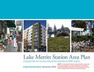
Lake Merritt Station Area Plan
A Specific Plan for the Area Around the Lake Merritt BART Station
NOTE: The Lake Merritt Station Area Plan DEIR contains the
most recent anaylisis, including clarifications to proposed
General Plan Map amendments, proposed Height Limit Map,
map of existing Historic Resources, Opportunity Sites
2. Acknowledgments
City of Oakland
Edward Manasse, Strategic Planning Manager
Christina Ferracane, Planner
Alicia Parker, Planner
BART
Tim Chan, Senior Planner
Peralta Community College District and
Laney College
José D. Ortiz, Peralta District Chancellor
Abel Guillén, Peralta Board Trustee
Elñora Webb, Laney College President
Marco Menéndez, Laney College Dean
Metropolitan Transportation
Commission
Therese Trivedi, Transportation Planner
Association of Bay Area Governments
Gillian Adams, Regional Planner
Project Website
http://www.business2oakland.com/lakemerrittsap/
Oakland City Council
Jane Brunner, Council District 1
Patricia Kernighan, Council District 2
Nancy Nadel, Council District 3
Libby Schaaf, Council District 4
Ignacio De La Fuente, Council District 5
Desley Brooks, Council District 6
Larry Reid, Council President, Council District 7
Rebecca Kaplan, Councilmember At Large
Oakland City Planning Commission
Vien Truong, Chair
C. Blake Huntsman, Vice Chairr
Michael Colbruno
Jim Moore
Jonelyn Whales
Chris Pattillo
Michael Coleman
Madeline Zayas-Mart*
*Former Planning Commission Member.
Community Stakeholders Group and
Technical Advisory Committee
Abel Guillen, Peralta Board of Trustees
Ada Chan, Council aide, City of Oakland – City
Council At Large
Alan Yee, Oakland Chinatown Advisory Committee
Aliza Gallo, City of Oakland
Allen Dreyfuss, Coalition of Advocates for Lake
Merritt
Anna Naruta, Landmarks Board Member
Arnie Fong, Business Owner – Lake Pharmacy
Berit Eriksson, Sailors Union of the Pacific –
Director of Workforce Development
Bill Harvey, Lake Merritt Business Association,
Comm Workers of Am
Bill McMorris, Oakland Museum of California
Billy Wu, Hotel Oakland Tenants Association
Bruce Williams, City of Oakland
Calvin Wong, Parks and Recreation Advisory
Committee
Carletta Starks, Council aide, City of Oakland –
City Council District 3
Carole Ward-Allen, Peralta Community College
District
Chris Hwang, Walk Oakland Bike Oakland
Christia Mulvey, City of Oakland
This Plan was generously funded through a grant from the Metropolitan Transportation Commission, the Bay Area Rapid Transit District, the Peralta
Community College District, and the City of Oakland. Thank you to the following individuals who participated in the development of this Plan:
3. Christopher Buckley, Oakland Heritage Alliance
Christy Riviere, Bay Area Air Quality Management
District
Colland Jang, Business owner, Architecture, AIA
Corinne Jan, Family Bridges
Cory LaVigne, AC Transit
Dana Riley, City of Oakland
David Kakishiba, Oakland Unified School District
Board, District #2
Diane Stark, Alameda County Transportation
Commission (ACTC)
Doug Cole, City of Oakland
Ed Loo, Madison Square Park Tai Chi & Other
Exercisers
Elnora Webb, Laney College
Ener Chiu, East Bay Asian Local Development
Corporation
Esther Tam, City of Oakland
Garret Fitzgerald, City of Oakland
Gary Knecht, SONIC, Jack London District
Association, Artists’ Legacy Foundation
Gilbert Gong, Lincoln Recreation Center
Gillian Adams, Association of Bay Area
Governments
Hamid Ghaemmaghami, City of Oakland
Heather Lee, City of Oakland
Jackie Trevino, CIM Group
Jason Patton, City of Oakland
Jeff Ordway, BART
Jennie Gerard, Council Aide, City of Oakland –
District 2
Jennie Ong, Oakland Chinatown Chamber of
Commerce
Jens Hillmer, City of Oakland
Joann Pavlinec, City of Oakland
Joel Peter, City of Oakland
Joel Ramos, TransForm
John Covert, Chinatown Salvation Army
John Rennels, BART
Jon Gresley, Oakland Housing Authority
Jose Macias, Business Owner/La Estrellita Café,
East Lake Merchants Association
Jose Martinez, City of Oakland
Karen Engel, Oakland Metropolitan Chamber of
Commerce
Kathleen Kennedy, Alameda County
Keira Williams, City of Oakland
Kristen Zaremba, City of Oakland
Laura Jerrard, CCE Red. District PAC, CDBG.D2
Adv. Board, 17X NCPC, ASLA
Leroy Griffin, City of Oakland
Lesley Estes, City of Oakland
Lori Fogarty, Oakland Museum of California
Madeline Zayas-Mart, Oakland Planning
Commission
Marco Menendez, Laney College
Maria Rocha, City of Oakland
Marina Carlson, Resident
Mark Hall, City of Oakland
Michael Coleman, League of Women Voters of
Oakland
Michael Lok, National Council on Crime and
Delinquency
Nancy Nadel, Councilmember, Oakland City
Council, District #3
Nathan Landau, AC Transit
Nhi Chau, Oakland Asian Student Educational
Services
Noel Pinto, City of Oakland
Obaid Khan, City of Alameda Public Works Dept.
Pat Kernighan, Councilmember, Oakland City
Council, District #2
Peter Chun, City of Oakland
Phuc H. Tran, Oakland Vietnamese Chamber of
Commerce
Rebecca Kaplan, Councilmember, Oakland City
Council At Large
Robert Raburn, BART, Board for Directors
Sandra Taylor, City of Oakland
Sara Bedford, City of Oakland
Sean A. Diest Lorgion, AC Transit
Sherry Hirota, Asian Health Services, Community
Engagement Process contractor
Steve Terusaki, Buddhist Church of Oakland
4. Susan Tom, Lincoln Elementary School
Tadashi Nakadegawa, Oakland Unified School
District
Teri Green, MTC
Tim Chan, BART
Val Menotti, BART
Victor Uno, International Brotherhood of Electrical
Workers, Port of Oakland
Vivian Yi Huang, Asian Pacific Environmental
Network (APEN)
Wilma Chan, Supervisor, Alameda County Board,
District #3
Consulting Team
Lead Consultants
Leslie Gould, Principal
Rajeev Bhatia, Principal
Hannah Lindelof, Senior Associate
Chris Ford, Senior Associate
Mark Chambers & Diana Nankin, Graphics Managers
Melinda Hue, Associate
Peter Winch, Planner
Bottomley Design & Planning
Terry Bottomley
Roy Chan, Cultural Resources
Conley Consulting Group, Economics
Denise Conley
Lauren Pitts
Kittelson & Associates, Inc., Transportation
Steve Colman
Alice Chen
Field Paoli, Architects
Frank Fuller
Kimley-Horn Associates, Inc., Transportation and Infrastructure
James M. Daisa
Benjamin Q. Huie
Peter Reinhofer
Felicia Dean
Willliam Wong, Historic Resources
5. Public Review Draft December 2012
Lake Merritt Station Area Plan
A Specific Plan for the Area Around the Lake Merritt BART Station
6.
7. LAKE MERRITT DRAFT STATION AREA PLAN | i
TABLEOFCONTENTS
Table of Contents
1 INTRODUCTION............................................................................................................1-1
1.1 Introduction............................................................................................................................................1-2
1.2 Purpose and Definition of a Specific Plan........................................................................................1-5
1.3 Planning Context...................................................................................................................................1-6
1.4 Community Based Planning Process..............................................................................................1-15
1.5 Document Overview...........................................................................................................................1-19
2 EXISTING CONDITIONS...............................................................................................2-1
2.1 Community..............................................................................................................................................2-2
2.2 Land Use Context................................................................................................................................. 2-6
2.3 Plan Districts: Existing Context........................................................................................................2-13
2.4 Market Conditions...............................................................................................................................2-21
2.5 Circulation and Parking..................................................................................................................... 2-24
2.6 Infrastructure...................................................................................................................................... 2-28
3 VISION...........................................................................................................................3-1
3.1 Lake Merritt Station Area Plan Vision and Goals...........................................................................3-2
3.2 Plan Concepts....................................................................................................................................... 3-6
3.3 Vision by Plan District......................................................................................................................... 3-8
4 LAND USE.....................................................................................................................4-1
4.1 Land Use Character............................................................................................................................. 4-2
4.2 Height and Massing Concepts........................................................................................................... 4-9
4.3 Developer Incentive Program...........................................................................................................4-14
4.4 Summary of Development Potential................................................................................................4-15
4.5 Affordable Housing Strategy............................................................................................................4-16
4.6 Public Health and the Built Environment....................................................................................... 4-28
Policies.........................................................................................................................................................4-31
8. ii | PUBLIC REVIEW DRAFT DECEMBER 2012
TABLEOFCONTENTS
5 OPEN SPACE.................................................................................................................5-1
5.1 Existing Open Space.............................................................................................................................5-2
5.2 Community Needs Assessment......................................................................................................... 5-6
5.3 Proposed Park Improvements and New Open Spaces..................................................................5-7
5.4 Existing Policies and Best Practices...............................................................................................5-17
Policies..........................................................................................................................................................5-18
6 STREETSCAPE AND CIRCULATION............................................................................6-1
6.1 Vision and Phasing................................................................................................................................6-2
6.2 Circulation Improvements.................................................................................................................6-11
6.3 Parking and Loading.......................................................................................................................... 6-23
6.4 Recommendations for Key Streets................................................................................................. 6-28
Policies.........................................................................................................................................................6-59
7 COMMUNITY RESOURCES.........................................................................................7-1
7.1 Historic Resources................................................................................................................................7-2
7.2 Cultural Resources..............................................................................................................................7-10
7.3 Community Facilities...........................................................................................................................7-15
7.4 Educational Facilities..........................................................................................................................7-16
Policies..........................................................................................................................................................7-21
8 ECONOMIC DEVELOPMENT........................................................................................8-1
8.1 Economic Development Objectives...................................................................................................8-2
8.2 Components of the Economic Development Strategy.................................................................. 8-4
Policies..........................................................................................................................................................8-10
9. LAKE MERRITT DRAFT STATION AREA PLAN | iii
TABLEOFCONTENTS
9 INFRASTRUCTURE AND UTILITIES ...........................................................................9-1
9.1 Dry Utilities............................................................................................................................................ 9-2
9.2 Sanitary Sewer Service...................................................................................................................... 9-3
9.3 Water Service....................................................................................................................................... 9-6
9.4 Recycled Water System Service....................................................................................................... 9-8
9.5 Storm Drain...........................................................................................................................................9-10
9.6 Solid Waste Disposal..........................................................................................................................9-12
Policies..........................................................................................................................................................9-12
10 IMPLEMENTATION.....................................................................................................10-1
10.1 Regulatory Actions............................................................................................................................. 10-3
10.2 Implementation Strategy Elements................................................................................................ 10-4
10.3 Improvement and Infrastructure Funding Mechanisms.......................................................... 10-22
10.4 Overview of Community Benefits................................................................................................. 10-29
10.5 Detailed Infrastructure and Improvement Costs.......................................................................10-33
APPENDIX A: LAKE MERRITT STATION AREA PLAN
DEVELOPMENT POTENTIAL............................................................................................. A-1
LAKE MERRITT STATION AREA PLAN DESIGN GUIDELINES............ Under Separate Cover
10. iv | PUBLIC REVIEW DRAFT DECEMBER 2012
TABLEOFCONTENTS
LIST OF FIGURES
Figure 1.1: Local Context of the Planning Area...........................................................................................1-3
Figure 1.2: Planning Area Context..................................................................................................................1-4
Figure 1.3: Planning Boundary........................................................................................................................1-8
Figure 1.4: Project Timeline...........................................................................................................................1-18
Figure 2.1: Existing Land Use (2010)............................................................................................................. 2-8
Figure 2.2: Opportunity Sites (Sites Most Likely to Redevelop) ............................................................2-12
Figure 2.3: Plan Districts................................................................................................................................2-14
Figure 2.4: Pedestrian Activity..................................................................................................................... 2-26
Figure 2.5: Street Classifications by Existing Traffic Volumes.............................................................. 2-28
Figure 3.1: 14th Street Corridor Plan District.............................................................................................. 3-9
Figure 3.2: Upper Chinatown Plan District.................................................................................................3-11
Figure 3.3: Chinatown Commercial Center Plan District..........................................................................3-13
Figure 3.4: BART Station Area District.......................................................................................................3-15
Figure 3.5: I-880 Freeway Plan District.......................................................................................................3-17
Figure 3.6: EastLake Gateway Plan District...............................................................................................3-19
Figure 3.7: Laney/Peralta Plan District....................................................................................................... 3-21
Figure 4.1: Draft Area Character .................................................................................................................. 4-3
Figure 4.2: Proposed General Plan Amendment......................................................................................... 4-5
Figure 4.3: Active Ground Floor Uses........................................................................................................... 4-8
Figure 4.4: Draft Height Map.........................................................................................................................4-13
Figure 4.5: Existing and Future Area View Looking Southeast..............................................................4-16
Figure 4.6: Existing and Future Area View Looking East.........................................................................4-17
Figure 4.7: Condo Conversion Impact Area............................................................................................... 4-20
Figure 4.8: Toxic Air Contaminants in the Planning Area....................................................................... 4-29
Figure 5.1: Public Parks and Other Publicly Accessible Open Spaces.................................................. 5-4
Figure 5.2: Open Space Opportunities.........................................................................................................5-13
11. LAKE MERRITT DRAFT STATION AREA PLAN | v
TABLEOFCONTENTS
Figure 6.1: Streetscape and Circulation Vision.......................................................................................... 6-5
Figure 6.2: Short-Term Circulation Improvement Strategy.......................................................................6-7
Figure 6.3: Long-Term Circulation Improvement Strategy........................................................................ 6-8
Figure 6.4: Street Improvement Phasing: Existing..................................................................................... 6-9
Figure 6.5: Measure DD Improvements.......................................................................................................6-12
Figure 6.6: Priority Pedestrian and Bicycle Improvements.....................................................................6-13
Figure 6.7: Street View Pedestrian Improvements...................................................................................6-14
Figure 6.8: Transit Hub................................................................................................................................... 6-20
Figure 6.9: Streetscape Improvements (Phase I)..................................................................................... 6-29
Figure 6.10: 14th Street....................................................................................................................................6-30
Figure 6.11: 12th Street.................................................................................................................................... 6-31
Figure 6.12: 10th Street (West of Madison Street)....................................................................................6-33
Figure 6.13: 10th Street (East of Madison Street)......................................................................................6-33
Figure 6.14: 9th Street Chinatown Core.......................................................................................................6-36
Figure 6.15: 9th Street East of Chinatown Core..........................................................................................6-38
Figure 6.16: 8th Street Chinatown Core....................................................................................................... 6-41
Figure 6.17: 8th Street East of Chinatown Core..........................................................................................6-43
Figure 6.18: 7th Street East of Fallon............................................................................................................6-45
Figure 6.19: Webster Street............................................................................................................................6-47
Figure 6.20: Harrison Street............................................................................................................................6-49
Figure 6.21: Alice Street..................................................................................................................................6-50
Figure 6.22: Madison Street............................................................................................................................ 6-51
Figure 6.23: Oak Street....................................................................................................................................6-52
Figure 6.24: Fallon Street................................................................................................................................6-54
Figure 6.25: Clear Pedestrian Access...........................................................................................................6-63
12. vi | PUBLIC REVIEW DRAFT DECEMBER 2012
TABLEOFCONTENTS
Figure 7.1: Historic Resources........................................................................................................................7-4
Figure 7.2: Historic Resources and Opportunity Sites...............................................................................7-5
Figure 7.3: Community Facilities...................................................................................................................7-13
Figure 9.1: Sanitary Sewer System............................................................................................................... 9-5
Figure 9.2: Potable Water System..................................................................................................................9-7
Figure 9.3: Recycled Water System ............................................................................................................. 9-9
Figure 9.4: Storm Drain System ...................................................................................................................9-11
LIST OF TABLES
Table 2.1: Existing Land Use within One-Half Mile of the Lake Merritt BART Station......................2-7
Table 2.2: Association of Bay Area Governments and Alameda County Transportation
Commission Projections 2009...................................................................................................2-10
Table 2.3: 2010 Market Opportunity Analysis (2010-2035).....................................................................2-21
Table 4.1: Planning Area Development Potential ...................................................................................4-15
Table 4.2: Regional Housing Need Allocation (RHNA) for the Planning Area................................... 4-22
Table 5.1: Existing Land Zoned as Open Space within One-Half Mile of the Lake Merritt
BART Station................................................................................................................................. 5-3
Table 5.2: Other Publicly Accessible Open Spaces in the Planning Area............................................ 5-3
Table 6.1: Overview of Advantages and Disadvantages of Two-Way Versus
One-Way Streets........................................................................................................................ 6-21
Table 6.2: Summary Circulation and Streetscape Improvement Phasing and
Recommendations......................................................................................................................6-57
Table 7.1: City of Oakland Historic Resource Rating System..................................................................7-3
Table 7.2: Community Services, Cultural Resources, and Public Facilities........................................7-12
Table 7.3: Schools that Service the Planning Area.................................................................................7-18
Table 10.1: Implementation Responsibility, Costs, Timing, and Funding Mechanisms..................... 10-6
Table 10.2: Infrastructure and Improvement Costs................................................................................10-34
13. IN THIS CHAPTER
1.1 Introduction........................................ 1-2
1.2 Purpose and Definition of
a Specific Plan .................................. 1-5
1.3 Planning Context .............................. 1-6
1.4 Community Based
Planning Process.............................1-15
1.5 Document Overview........................1-19
1 INTRODUCTION
14. 1-2 | PUBLIC REVIEW DRAFT DECEMBER 2012
INTRODUCTION
1
1.1 Introduction
The Lake Merritt Station Area Plan is a Specific
Plan for the roughly one-half mile radius around
the Lake Merrit BART Station in Downtown
Oakland, as shown in Figure 1.1. The purpose
of the Plan is to provide a roadmap to bring the
community-based vision to reality: it establishes
policies and improvements that support the vision,
then outlines an implementation action plan to
realize a range of programmatic and project-based
improvements that together realize the vision. Over
the next 25 years the Plan looks to add 4,900 new
housing units, 4,100 new jobs, 404,000 square feet
of additional retail, and 1,229,000 square feet of
office uses to this neighborhood.
The Lake Merritt Station Area (referred to herein
as the Planning Area) encompasses a diverse com-
munity of residents, students, employees, and
commercial business owners in the heart of Down-
town Oakland, including Chinatown, Laney Col-
lege, the Oakland Museum of California, and
Alameda County Courthouse and offices. The
central context of the Planning Area is shown in
Figure 1.2. The Lake Merritt Station Area Plan
(referred to herein as the Plan) connects the many
existing assets in this unique and vibrant area to
create a destination and a highly livable, vibrant,
pedestrian-oriented, safe, healthy, and economi-
cally diverse neighborhood.
The City of Oakland, community members, San
Francisco Bay Area Rapid Transit (BART), and the
Peralta Community College District have worked
together over the past four years to develop this
Plan. It has been developed with extensive com-
munity input, as well as consideration of local and
regional Transit-Oriented Development (TOD)
goals. It reflects the desires and aspirations of a wide
range of community members, stakeholders, City
staff, the Planning Commission, and City Council.
Objectives and Policies
The Plan seeks to address the diverse needs of the
community, as well as the needs of BART related
to ridership, and the needs of the College Dis-
trict related to education. BART has stated that
it envisions the area transitioning from its current
status as an “Urban Neighborhood Station” to a
“Regional Center” station type.
The Plan seeks to achieve a nuanced vision for the
area and a wide range of goals and objectives. Key
objectives include:
• Increasing activity and vibrancy of the area;
• Improving connections both within the
Planning Area as well as to major destinations
outside the area;
• Improving safety and pedestrian-orientation;
• Accommodating the future population,
including residents of all incomes households of
all sizes, including families;
• Increasing the number of jobs and developing
the local economy;
• Identifying additional recreation and open
space opportunities and improving existing
resources;
• Establishing a clear identity as a center for
equitable and sustainable development; and
• Defining an achievable vision for the area’s
future that is compelling for implementation of
future projects and public improvements.
The Plan provides policies at the end of each chap-
ter (with the exception of Chapters 1, 2, and 3).
Design Guidelines are provided under separate
cover and Zoning and General Plan amendments
will be adopted concurrently. Policies are devel-
oped to identify a range of actions that together
realize the Plan objectives, vision, and goals. Some
policies direct the City to adopt standards for new
development. Other policies recommend pub-
lic improvements to support a physically attrac-
tive and economically healthy neighborhood that
is also a cultural and community activity center.
In many cases, policies identify opportunities for
various community groups, institutions, busi-
ness, and public agencies to work together. Design
guidelines are meant to influence the design of
new buildings and public spaces so that they con-
tribute to a better overall whole.
The Station Area Plan aims to cultivate the already
diverse range of uses existing in the neighborhood
to ensure opportunities to live, work and play; and
further promote and expand the rich businesses
environment of Chinatown. It calls for enhanc-
ing the pedestrian, bicycle, transit, auto circula-
tion network, and streetscape to ensure safe and
efficient access within the Planning Area and
improved connectivity to nearby destinations.
15. LAKE MERRITT DRAFT STATION AREA PLAN | 1-3
Broadway/
Valdez
Eastlake
L a k e
M e r r i t t
O a k l a n d E s t u a r y
C i t y o f A l a m e d a
Old
Oakland
Adams
Point
Clinton
Park
Ivy
Hill
Cleveland
Heights
Trestle
Glen
Jack London
Square
Uptown
West
Oakland
Northgate
Lakeside
Park
Snow
Park
Peralta
Park
Estuary
Park
Harrison
Square
Lowell
Park
Laney
College
Lincoln
Park
Madison
Park
Kaiser
Center
Oakland
Museum
AMTRAK
Station
Jack
London
District
Railroad
Yards
Downtown/
City Center
Chinatown
Peralta
Park
Harrison
Square
Laney
College
Lincoln
Park
Madison
Park
Kaiser
Center
Oakland
Museum
AMTRAK
Jack
London
District
Ra
Y
Chinatown
14TH ST
12TH ST
11TH ST
10TH ST
9TH ST
8TH ST
7TH ST
5TH ST
4TH ST
3RD ST
2ND ST
MADISONS
E. 10TH ST
5T
JACKSONST
HAR
WEBSTERST
BROADW
RANKLINST
BROADWAY
ALICEST
OAKST
FALLONST
2NDAVE
3RDAV
1STAV
Lake
Merritt
Station
LAK
E
MERRITT BLVD
880
980
580
14TH ST
12TH ST
11TH ST
10TH ST
9TH ST
8TH ST
7TH ST
5TH ST
4TH ST
3RD ST
2ND ST
EMBARCADERO WEST
17TH STMADISONST
LAKESIDEDR
E. 18TH ST
FOOTHILL BLVD
INTERNATIONAL BLVD
E. 12TH ST
E. 10TH ST
E. 15TH ST
5THAVE
JACKSONST
HARRISONST
WEBSTERST
FRANKLINST
BROADWAY
WEBSTERTUBE
FRANKLINST
BROADWAY
POSEYTUBE
ALICEST
OAKST
FALLONST
1ST ST
19TH ST
E. 18TH ST
TELEGRAPHAVE
SAN
PABLO
AVE
LAKESHORE
AVE
GRAND AVE
W. GRAND AVE
BROADWAY
SAN
PABLO
AVE
TELEGRAPHAVE
MARTINLUTHERKINGJRWAY
MARKETST
MARKETST
7TH ST
10TH ST
14TH ST
12TH ST
16TH ST
18TH ST
W. GRAND AVE
3RD ST
4TH ST
3RD ST
2ND ST
WASHINGTONST
CLAYST
MARTINLUTHERKINGJRWAY
JEFFERSONST
27TH ST
25TH ST
29TH ST
WESTST
WESTST
20TH ST
21ST ST
24TH ST
HARRISONST
27TH ST
OAKLANDAVE
P
ERKINSST
LEEST
BELLVUEAVE
15TH ST
EUCLID
AVE
ORANGEST
VERNONSTADAMSST
BAY
PL
BELLVU
E
AVE
2NDAVE
3RDAVE
1STAVE
W
AYNE PL
E. 17TH ST
E. 19TH ST
E. 20TH ST
E. 21ST ST
E. 22ND ST
E. 23RD ST
E. 24TH ST
5THAVE
6THAVE
7THAVE
8THAVE
9THAVE
10THAVE
11THAVE
12THAVE
13THAVE
14THAVE
E. 11TH ST
E. 8TH ST
PARK
BLVD
PARK
BLVD
IVY
DR
BROOKLYN AVE
CLEVELAND ST
ATHO
L AV
E
MCKINLEY AVE
MACARTHUR BLVD
M
AC
ARTHUR
BLVD
34TH ST
33RD ST
32ND ST
31ST ST
30TH ST
30TH ST
HAWTHORNE AVE
WEBSTERST
23RD ST
22ND ST
28TH ST
LENOXAVE
STATENAVE
PALMAVE
GRANDAVE
SAN
T
A
CLAR
A
AVE
MANDANA BLVD
WALKERAVE
LAKESHO
REAVE
TRESTLE GLEN RD
LONG RIDGE R
MAND
ANA BLVD
PRINCE ST
SANTA RAY AVE
C
ALMAR
AVE
BALFOURAVE
WELDON
A
VE
ELWOOD AVE
NORHTVALE RD
WESLEYAVE
HANOVERAVE
STOW
AVE
LESTER
AVE
HADDONRD
MERRITTAVE
PROSPECT AVE
HI
LGIRT CI
CENTRALAVE
29TH ST
24TH ST
ISABELLA
ST
ATHEN
SAVE
M
EAD
AVEM
ILTO
N
ST
22ND ST
21ST ST
20TH ST
19TH ST
MYRTLEST
FILBERTST
LINDENST
26TH ST
FILBERTST
FILBERTST
11TH ST
10TH ST
8TH ST
7TH ST
17TH ST
SYCAMORE ST
VAN BUREN AVE
12th St
Station
19th St
Station
Lake
Merritt
Station
LAK
E
MERRITT BLVD
0 1/4 1/2
MILES
1/8
BART Station
BART
City Park
Planning Area
Railroad (Amtrak & Freight)
Figure 1.1
Planning Area Context
1/2 Mile Radius
Figure 1.1:
LOCAL CONTEXT OF THE
PLANNING AREA
16. 1-4 | PUBLIC REVIEW DRAFT DECEMBER 2012
Figure 1.2:
PLANNING AREA CONTEXT
Central
Business
District
Commercial and
Residential Areas
Jack London
District
Lake Merritt
BART Station
Lake Merritt Open
Space and Recreational
Opportunities
Broadway/
Valdez
Eastlake
L a k e
M e r r i t t
O a k l a n d E s t u a r y
C i t y o f A l a m e d a
Old
Oakland
Adams
Point
Clinton
Park
Ivy
Hill
Cleveland
Heights
Trestle
Glen
Jack London
Square
Uptown
West
Oakland
Northgate
Lakeside
Park
Snow
Park
Peralta
Park
Estuary
Park
Harrison
Square
Lowell
Park
Laney
College
Lincoln
Park
Madison
Park
Kaiser
Center
Oakland
Museum
AMTRAK
Station
Jack
London
District
Railroad
Yards
Downtown/
City Center
Chinatown
Peralta
Park
Harrison
Square
Laney
College
Lincoln
Park
Madison
Park
Kaiser
Center
Oakland
Museum
AMTRAK
Jack
London
District
Ra
Y
Chinatown
14TH ST
12TH ST
11TH ST
10TH ST
9TH ST
8TH ST
7TH ST
5TH ST
4TH ST
3RD ST
2ND ST
MADISONS
E. 10TH ST
5T
JACKSONST
HAR
WEBSTERST
BROADW
RANKLINST
BROADWAY
ALICEST
OAKST
FALLONST
2NDAVE
3RDAV
1STAV
Lake
Merritt
Station
LAK
E
MERRITT BLVD
880
980
580
14TH ST
12TH ST
11TH ST
10TH ST
9TH ST
8TH ST
7TH ST
5TH ST
4TH ST
3RD ST
2ND ST
EMBARCADERO WEST
17TH ST
MADISONST
LAKESIDEDR
E. 18TH ST
FOOTHILL BLVD
INTERNATIONAL BLVD
E. 12TH ST
E. 10TH ST
E. 15TH ST
5THAVE
JACKSONST
HARRISONST
WEBSTERST
FRANKLINST
BROADWAY
WEBSTERTUBE
FRANKLINST
BROADWAY
POSEYTUBE
ALICEST
OAKST
FALLONST
1ST ST
19TH ST
E. 18TH ST
TELEGRAPHAVE
SAN
PABLO
AVE
LAKESHORE
AVE
GRAND AVE
W. GRAND AVE
BROADWAY
SAN
PABLO
AVE
TELEGRAPHAVE
MARTINLUTHERKINGJRWAY
MARKETST
MARKETST
7TH ST
10TH ST
14TH ST
12TH ST
16TH ST
18TH ST
W. GRAND AVE
3RD ST
4TH ST
3RD ST
2ND ST
WASHINGTONST
CLAYST
MARTINLUTHERKINGJRWAY
JEFFERSONST
27TH ST
25TH ST
29TH ST
WESTST
WESTST
20TH ST
21ST ST
24TH ST
HARRISONST
27TH ST
OAKLANDAVE
P
ERKINSST
LEEST
BELLVUEAVE
15TH ST
EUCLID
AVE
ORANGEST
VERNONSTADAMSST
BAY
PL
BELLVU
E
AVE
2NDAVE
3RDAVE
1STAVE
W
AYNE PL
E. 17TH ST
E. 19TH ST
E. 20TH ST
E. 21ST ST
E. 22ND ST
E. 23RD ST
E. 24TH ST
5THAVE
6THAVE
7THAVE
8THAVE
9THAVE
10THAVE
11THAVE
12THAVE
13THAVE
14THAVE
E. 11TH ST
E. 8TH ST
PARK
BLVD
PARK
BLVD
IVY
DR
BROOKLYN AVE
CLEVELAND ST
ATHO
L AV
E
MCKINLEY AVE
MACARTHUR BLVD
M
AC
ARTHUR
BLVD
34TH ST
33RD ST
32ND ST
31ST ST
30TH ST
30TH ST
HAWTHORNE AVE
WEBSTERST
23RD ST
22ND ST
28TH ST
LENOXAVE
STATENAVE
PALMAVE
GRANDAVE
SAN
T
A
CLAR
A
AVE
MANDANA BLVD
ERAVE
LAKESHO
REAVE
TRESTLE GLEN RD
LONG RIDGE R
CE ST
SANTA RAY AVE
BALF
ELWOOD AVE
NORHTVALE RD
WESLEYAVE
HANOVERAVE
STOW
AVE
LESTER
AVE
HADDONRD
MERRITTAVE
PROSPECT AVE
HI
LGIRT CI
CENTRALAVE
29TH ST
24TH ST
ISABELLA
ST
ATHEN
SAVE
M
EAD
AVEM
ILTO
N
ST
22ND ST
21ST ST
20TH ST
19TH ST
MYRTLEST
FILBERTST
LINDENST
26TH ST
FILBERTST
FILBERTST
11TH ST
10TH ST
8TH ST
7TH ST
17TH ST
SYCAMORE ST
VAN BUREN AVE
12th St
Station
19th St
Station
Lake
Merritt
Station
LAK
E
MERRITT BLVD
0 1/4
MILES
1/8
BART Station
BART
City Park
Planning Area
Railroad (Amtra
1/2 Mile Radius
17. LAKE MERRITT DRAFT STATION AREA PLAN | 1-5
INTRODUCTION
1
1.2 Purpose and Definition of a Specific Plan
This Plan is a Specific Plan, as defined by the
Governor’s Office of Planning and Research. It
includes policies and programs that address land
use, buildings, housing, design, circulation, tran-
sit improvements, streetscape improvements, and
parks and public spaces. It identifies actions the
City and other entities should take to improve the
area, and establishes regulations for development
projects on private property. It is a long-term docu-
ment consisting of written text and diagrams that
express how the community should develop, and is
a key tool for improving quality of life.
The Plan will be adopted and approved concur-
rently with General Plan and Planning Code
amendments, Design Guidelines, and any updates
to the City’s Standard Conditions of Approval.
These documents include additional details on
allowable land uses, and detailed standards for new
development. Together, these documents establish
the basis for development project review and other
decision-making by policymakers, such as the
Planning Commission and the City Council.
Specific Plans cover land use, development den-
sity, circulation and infrastructure, and have legal
authority as a regulatory document. Because Spe-
cific Plans are mechanisms for executing the goals
and policies of a community’s general plan, State
law requires that specific plans are consistent with
the general plan, and that they must include text
and a diagram or diagrams which specify a range
of topics in detail, including:
1. The distribution, location, and extent of the
uses of land, including open space, within the
area covered by the plan.
2. The proposed distribution, location, and extent
and intensity of major components of public
and private transportation, sewage, water,
drainage, solid waste disposal, energy, and
other essential facilities proposed to be located
within the area covered by the plan and needed
to support the land uses described in the plan.
3. Standards and criteria by which development
will proceed, and standards for the
conservation, development, and utilization of
natural resources, where applicable.
4. A program of implementation measures
including regulations, programs, public works
projects, and financing measures necessary to
carry out paragraphs (1), (2), and (3).
The Plan will guide all new development in the
Planning Area, which will be required to follow
the policies, programs and guidelines set forth in
this Plan and related documents. Consistent with
State law, an Environmental Impact Report will
be completed to identify and analyze any environ-
mental impacts that may result from implementa-
tion of the Plan, consistent with California Envi-
ronmental Quality Act, prior to the Plan’s adop-
tion.
What is a Specific Plan?
According to the Governor’s Office of Plan-
ning and Research, “A specific plan is a tool
for the systematic implementation of the
general plan. It effectively establishes a link
between implementing policies of the gen-
eral plan and the individual development
proposals in a defined area. A specific plan
may be as general as setting forth broad
policy concepts, or as detailed as provid-
ing direction to every facet of development
from the type, location and intensity of uses
to the design and capacity of infrastructure;
from the resources used to finance public
improvements to the design guidelines of a
subdivision.”
18. 1-6 | PUBLIC REVIEW DRAFT DECEMBER 2012
INTRODUCTION
1
Key existing assets include the Lake Merritt BART Station, the
Chinatown Commercial core, and Laney College (numbers 7, 5,
and 8 on Figure 1.3, respectively).
1.3 Planning Context
Regional Context and Planning Area
Boundaries
The Planning Area encompasses 315 acres in the
heart of Oakland, a major urban center within the
San Francisco Bay Area. Adjacent neighborhoods
and destinations include Downtown Oakland,
Lake Merritt, the Jack London District, Old Oak-
land, and Uptown. The Planning Area’s strategic
location within this context is shown in Figure
1.1, and a closer look at the Planning Area itself is
shown in Figure 1.3
Building on Existing Assets
The Planning Area is located within a vibrant
urban community, complete with urban ameni-
ties as well as community, cultural, and historic
resources. Several key assets include (but are cer-
tainly not limited to):
• Lake Merritt BART: The Lake Merritt BART
Station provides rail transit service to the
Planning Area and throughout the Bay Area.
The two Lake Merritt BART blocks located at
the center of the Planning Area are historically
part of Oakland Chinatown, and are currently
potential development sites.
• Oakland Chinatown: Chinatown is a vibrant
commercial and residential neighborhood.
Chinatown has active streets in the commercial
core, a vibrant retail trade, and acts as a
cultural center in the east Bay Area for the
Asian community. Chinatown also makes up
the core residential community within the
Planning Area and a multitude of invaluable
community resources and services are located
in Chinatown.
• Laney College: Laney College is the largest of
the four Peralta Community Colleges, located
adjacent to the Lake Merritt BART Station on
about 60 acres of land devoted to classrooms,
vocational technology workshop/classrooms,
and computer and science labs, as well as a
bookstore, library, gymnasium, swimming
pool, childcare center, two large auditoriums
and a performing arts theater. The school serves
a diverse student population of over 14,000
students each semester and has more than 400
full-time and adjunct positions.
• The Pacific Renaissance Plaza: The Pacific
Renaissance Plaza houses the Asian Branch
Public Library, the Oakland Asian Cultural
Center which offers a range of cultural
resources, the Chinatown Chamber of
Commerce, two levels of shops and restaurants,
residential units above the ground floors, and
underground parking. A large plaza with a
fountain acts as a gathering space for residents
and visitors to the area.
• The Oakland Museum of California
(OMCA): Established in 1969 as a “museum
for the people,” OMCA is a leading cultural
institution of the Bay Area and a resource for
the research and understanding of California’s
19. LAKE MERRITT DRAFT STATION AREA PLAN | 1-7
dynamic cultural and environmental heritage.
OMCA is located one block north of the Lake
Merritt BART Station.
• Oakland Public Library: The Main Library
for the Oakland Public Library system is one
of the largest public library facilities in the Bay
Area. It includes an extensive collection and
includes a large and active Children’s Room
and a TeenZone.
• Lincoln Square Recreation Center: The
Recreation Center is located in Lincoln Square
Park and features programs such as arts and
crafts, cooking, games and cultural programs,
excursions, and annual traditions such as the
Lunar New Year art contest. The Center has a
multi-purpose gym and an outdoor playground
which offers a wide range of classes such as
Chinese calligraphy, Chinese lion dance,
Chinese orchestra, table tennis, basketball, line
dance, and youth dance. The Center serves as
an active open space and community gathering
space for youth during and after school; and for
adults and seniors throughout the day.
• The recreational amenities of Lake Merritt,
the Estuary, and the Lake Merritt Channel:
Lake Merritt was declared a Wildlife Refuge
under the California Wildlife Act in 1870
and plays an important role as a recreational
asset for the City. The trails around the lake
are very popular for walking and jogging.
The Channel, which connects Lake Merritt
to the Estuary, runs through the Planning
Area. Recent improvements to the Lake edge
have been completed through Measure DD,
with additional improvements underway. Lake
Key assets include the Pacific Renaissance Center, Lincoln
Square Recreation Center and Madison Square Park (numbers
1, 2, and 6 on Figure 1.3, respectively).
Merritt is also listed in the National Register
of Historic Places, and the Lake Merritt Wild
Duck Refuge is a National Historic Landmark.
• The Kaiser Convention Center: Originally
opened in 1914 as a multi-purpose arena, the
Center is currently closed. The convention
center is located adjacent to the OMCA, south
of Lake Merritt and north of Laney College.
The Center has historically been a venue for a
variety of cultural events and entertainment,
and has great potential for future reuse.
• Alameda County Offices: A major source of
employment and services, the County offices
and County Courthouse are located primarily
along Oak and 12th Streets.
20. 1-8 | PUBLIC REVIEW DRAFT DECEMBER 2012
11TH
ST
TUNNEL
14TH ST
13TH ST
12TH ST
11TH ST
10TH ST
9TH ST
8TH ST
7TH ST
6TH ST
5TH ST
4TH ST
3RD ST
2ND ST
EMBARCADERO WEST
4TH ST
15TH ST
17TH ST
MADISONST
LAKESIDEDR
LAKESHORE
AVE
E. 18TH ST
ATHO
L
AVE
FOOTHILL BLVD
INTERNATIONAL BLVD
E. 12TH ST
E. 11TH ST
E. 10TH ST
E. 15TH ST
1STAVE
2NDAVE
3RDAVE
4THAVE
5THAVE
E. 7TH ST
JACKSONST
ALICEST
HARRISONST
WEBSTERST
FRANKLINST
BROADWAY
WEBSTERST
FRANKLINST
BROADWAY
HARRISONST
JACKSONST
ALICEST
MADISONST
OAKSTOAKST
FALLONST
WATER ST
1ST ST
EMBARCADERO
19TH ST
880
WEBSTERPL
VICTORY CT
L
AKE
M
ERRITT
B
LVD
0 500 1000
FEET
100
Fig. 1.3
Planning Boundary
Planning Area
Key Assets
AMTRAK
Laney
Parking
Peralta Community
College District
Administration
Oakland
Unified
School
District
Laney College
Oakland
Museum of
California
Kaiser
Auditorium
MTC/
ABAG
Lake
Merritt
BART
BART
Parking
Madison
Square
Park
Chinese
Garden
Park
Lincoln
Square
Park
Pacific
Renaissance
Plaza
Lincoln
Elementary
Post
Office
County
Court
Public
Library
L a k e
M e r r i t t
12th St
BART
Oakland Unified
School District
Downtown
Campus
County
Offices
Oakland Chinatown
Chan
n
e l
Estuary
1 2
3
4
98
765
Figure 1.3:
PLANNING BOUNDARY
21. LAKE MERRITT DRAFT STATION AREA PLAN | 1-9
INTRODUCTION
1
Range of Issues
While the Planning Area has many assets to build
on, there are also challenges and issues that the
Plan seeks to address. Issues identified and con-
cerns expressed by community members include:
• Need to ensure active community participation
in the planning process.
• Concerns regarding safety, related to crime and
traffic.
• Lack of sufficient housing, both affordable and
new market rate housing.
• Need to improve the pedestrian environment,
bicycle circulation, and transit access.
• Need to better connect the area to other
neighborhoods and destinations.
• Need to preserve and enhance the historic and
cultural resources in the Planning Area.
• Need for economic development by building
on the existing vibrancy of Chinatown and
adding more high quality jobs.
• Need to ensure access to community services,
including educational and community facilities
and high quality open spaces.
• Concerns related to environmental quality and
health, in particular as related to the I-880
freeway.
Key concerns and issues identified at the outset of
the process were developed over an iterative pro-
cess working with the community into a series of
vision statements and goals, outlined in Chapter 3.
Relationship to Other Plans
As a Specific Plan, the Plan has been developed to
strategically implement the goals and policies of
the General Plan, and must be consistent with the
General Plan per State law.
The Plan will be adopted concurrently with Gen-
eral Plan and Planning Code amendments that are
consistent with the Plan and include additional
details on allowable land uses, and detailed stan-
dards for new development.
The following section outlines the Plan’s consis-
tency with the City of Oakland’s General Plan ele-
ments and other relevant planning documents.
Oakland General Plan Consistency
This section provides additional detail related to
Plan consistency with key elements of the Oakland
General Plan. The Oakland General Plan outlines
a vision for Oakland’s long-range development and
growth. The General Plan provides policies and
actions to help implement this vision. The Gen-
eral Plan includes the following elements: Land
Use and Transportation (LUTE); Open Space,
Conservation, and Recreation (OSCAR); Historic
Preservation; Bicycle Master Plan; Pedestrian Mas-
ter Plan; Noise; Safety; Housing; and the Estuary
Policy Plan.
Land Use and Transportation Element (LUTE)
Overall, the concepts included in this Plan further
and help implement the goals of the Oakland Gen-
eral Plan elements, including the LUTE’s specific
Key assets include the Oakland Museum of California, the
Kaiser Convention Center, and recreational assets along the
Lake Merritt Channel (numbers 3, 4 and 9 on Figure 1.3, respec-
tively).
22. 1-10 | PUBLIC REVIEW DRAFT DECEMBER 2012
INTRODUCTION
1
Transportation and Transit-Oriented Development
• T2: Provide mixed use, transit-oriented
development that encourages public transit use
and increases pedestrian and bicycle trips at
major transportation nodes.
• T3: Provide a hierarchical network of roads
that reflects desired land use patterns and
strives for acceptable levels of service at
intersections.
• T4: Increase use of alternatives modes of
transportation.
• T6: Make streets safe, pedestrian accessible,
and attractive.
• T7: Reduce air pollutants caused by vehicles.
Downtown
• D1: Enhance the identity of Downtown
Oakland and its distinctive districts.
• D2: Enhance the visual quality of downtown
by preserving and improving existing housing
stock and encouraging new, high quality,
development.
• D3: Create a Pedestrian-friendly downtown.
• D4: Increase the economic vitality of
downtown.
• D5: Enhance the safety and perception of
safety downtown at all hours.
• D9: Emphasize the establishment, promotion,
and retention of commercial businesses that
serve the needs of downtown workers and
residents.
• D10: Maximize housing opportunities in
the downtown to create a better sense of
community.
• D11: Foster mixed use developments to help
create a diverse, lively, and vibrant downtown.
• D12: Make downtown Oakland a regional
destination for innovative learning programs,
cultural resources, art, and entertainment.
• D13: Create and coordinate a well-balanced
regional and local transportation system to
serve the downtown.
Neighborhoods
• N1: Provide for healthy, vital, and accessible
commercial areas that help meet local
consumer needs in the neighborhoods.
• N2: Encourage adequate civic, institutional,
and educational facilities located within
Oakland, appropriately designed and sited to
serve the community.
• N3: Encourage the construction, conservation,
and enhancement of housing resources to meet
the current and future needs of the Oakland
community.
• N4: Actively encourage the provision of
affordable housing throughout the Bay Area.
• N6: Encourage a mix of housing costs, unit
sizes, types, and ownership structures.
• N8: Direct urban density and mixed use
housing development to locate near transit
or commercial corridors, transit stations,
the Downtown, waterfront, underutilized
properties where residential uses do not
presently exist but may be appropriate, areas
where this type of development already exists
and is compatible with desired neighborhood
character, and other suitable locations.
goal of Transit-Oriented Development for Down-
town Oakland. The LUTE designates the majority
of the Planning Area as part of the “Central Busi-
ness District” (CBD), which is intended to encour-
age, support and enhance the downtown area as a
high density mixed-use urban center of regional
importance and a primary hub for business, com-
munications, office, government, high technol-
ogy, retail, entertainment, and transportation in
Northern California. The CBD land use classifi-
cation includes a mix of large-scale offices, com-
mercial, urban (high-rise) residential, institutional,
open space, cultural, educational, arts, entertain-
ment, service, community facilities, and visitor
uses. The General Plan designates parks in the area
as “Open Space,” while the Oakland Museum and
the Kaiser Center are designated as “Institutional.”
The area east of the Kaiser Convention Center and
North of Laney College is designated as “Urban
Residential.” Peralta Community College District
property is designated “Business Mix” and the
majority of Laney College land is designated as
“Institutional.”
Key General Plan LUTE objectives supported by
the Plan include:
Industry and Commerce
• I/C1: Expand and retain Oakland’s job base
and economic strength.
• I/C3: Ensure that Oakland is adequately
served by a wide variety of commercial uses,
appropriately sited to provide for competitive
retail merchandising and diversified office uses,
as well as personal and professional services.
23. LAKE MERRITT DRAFT STATION AREA PLAN | 1-11
INTRODUCTION
1
• N10: Support and create social, informational,
cultural, and active economic centers in the
neighborhoods.
• N11: Provide adequate infrastructure to meet
the needs of Oakland’s growing community.
Open Space, Conservation, and Recreation
(OSCAR) Element
A major objective of the OSCAR Element of the
General Plan is to reduce deficiencies in park acreage
and recreational facilities in the most equitable, cost
effective way possible. The general strategy described
in the Plan implements that objective, first, by mak-
ing the most out of existing spaces; secondly, by
recommending shared use of open space and recre-
ational facilities owned by public entities such as the
Oakland Unified School District and Laney Col-
lege; and third, expanding the amount of new parks
acreage and recreation facilities. Key objectives and
policies include:
Objective OS-2: Urban Parks, Schoolyards, and
Gardens
• OS 2.2: Schoolyard Enhancement. Enhance
the availability and usefulness of Oakland’s
schoolyards and athletic fields as open space
resources.
• OS 2.6: Street Closures for Parks, Plazas and
Gardens. Where there is broad community and
local support and where legally permissible,
allow local street closures as a way of creating
new parks, plazas, and garden sites in urban
neighborhoods.
Objective OS-7: Shoreline Access
• OS 7.5: Lateral Access and Links to the
Flatlands. Improve lateral access along the
Oakland shoreline and linkages between
the shoreline and nearby neighborhoods...
[including] a connection between Estuary
Park and the linear park along Lake Merritt
Channel... The connection requires a bridge
spanning two sets of railroad tracks between
I-880 and the Embarcadero.
Objective OS-11: Civic Open Space
• OS 11.1: Access to Downtown Open Space.
Provide better access to attractive, sunlit
open spaces for persons working or living in
downtown Oakland. The development of
rooftop gardens is encouraged.
• OS 11.1.2: Downtown Open Space
Requirements and Bonuses. Study the
feasibility of (a) useable open space
requirements for downtown commercial
development (or an in-lieu fee for downtown
open space); and (b) density bonuses for
developers providing plazas, rooftop gardens,
and other amenities within new development
projects.
• OS 11.1.3: New Civic Open Space. Create
new civic open spaces at BART Stations, in
neighborhood commercial areas, on parking
garages, and in other areas where high-intensity
redevelopment is proposed.
Objective REC-2: Park Design and Compatibility of
Uses
• REC 2.2: Conflicts Between Park Uses. Site
park activities and facilities in a manner which
minimizes conflict between park users.
• REC-2.3: Environmentally Sensitive Design.
Protect natural areas within parks.
• REC-2.4: Off-site Conflicts. Manage park
facilities and activities in a manner which
minimizes negative impacts on adjacent
residential, commercial or industrial areas.
• REC-2.5: Park Visibility. Plan and design parks
in a way which maximizes their visibility, while
minimizing conflicts between pedestrians,
bicyclists and automobiles.
• REC-2.6: Historic Park Features. Respect
historic park features when designing park
improvements or programming new park
activities.
Objective REC-4: Maintenance and Rehabilitation
• REC 4.3: Renovation and Rehabilitation
Priorities. Where cost savings and equivalent
benefits would be achieved, renovate and
rehabilitate existing facilities before building
new facilities.
Objective REC-5: Park Safety
• REC 5.1: Increased Range of Activities.
Provide an increased range of activities within
Oakland’s parks as a means of introducing
new users to the parks and improving safety
through numbers.
24. 1-12 | PUBLIC REVIEW DRAFT DECEMBER 2012
INTRODUCTION
1
• REC-5.2: Safety-Oriented Design. Use a wide
range of physical design solutions to improve
safety at Oakland’s parks, including lighting,
signage, landscape design, fencing, vandal-
resistant building materials, and emergency
response features.
Objective REC-6: Joint Use of Recreational Facilities
• REC 6.1: Joint Use Agreements. Promote joint
use agreements between the City, the Oakland
Unified School District, and other public
agencies to maximize the use of school and
other non-park recreational facilities during
non-school hours.
• REC 6.2: Public-Private Partnerships.
Encourage “public-private partnerships” as a
means of providing new recreational facilities
on privately-owned sites.
Objective REC-7: Recreational Programs
• REC 7.5: Multi-Culturalism. Design
recreational services which respond to the
many cultures, ethnic groups, and language
groups represented in Oakland. Design
recreational programs to reflect the specific
needs of Oakland neighborhoods and the
values and priorities of local residents.
Objective REC-10: Funding
• REC 10.2: Parkland Dedication and Impact
Fee. To the extent permitted by law, require
recreational needs created by future growth
to be offset by resources contributed by that
growth.
Historic Preservation Element
The Historic Preservation Element notes that the
preservation and enhancement of historic resources
can significantly contribute to an area’s economy,
affordable housing stock, overall image, and qual-
ity of life. The Plan aims to protect the value of
historic resources, by promoting preservation of
resources via existing programs and regulations,
and by ensuring compatible development through
design guidelines and massing regulations. His-
toric Preservation is addressed in greater detail in
Chapter 7. Key objectives and policies include:
Objective 2: Preservation Incentives and Regulations
• Policy 2.1: Preservation Incentives and
Regulations for Designated Historic Properties.
The City will use a combination of incentives
and regulations to encourage preservation
of significant older properties and areas
which have been designated as Landmarks,
Preservation Districts, or Heritage Properties.
• Policy 2.6: Preservation Incentives.
–– Landmarks and all properties contributing
or potentially contributing to a Preservation
District will be eligible for the following
preservation incentives:
ºº Mills Act contracts for reducing property
tax assessments;
ºº State Historical Building Code and
other related alternative codes for older
buildings;
ºº Conservation easements to reduce
property tax assessments and, for
National Register properties, to obtain
income tax deductions;
ºº Broader range of permitted or
conditionally permitted uses;
ºº Transferable development rights;
ºº Priority for economic development
and community development project
assistance and eligibility for possible
historic preservation grants for low-
income housing;
ºº Eligibility for acquisition, rehabilitation,
and other development assistance from
a possible historic preservation revolving
fund or possible Marks historical
rehabilitation bond program; and
ºº Fee waivers or reductions for City permits
for demolition, new construction, or
alterations.
–– Compatible new development on vacant
noncontributing Preservation District
parcels will be eligible for Incentives (iv), (v),
(vi) and (vii).
Objective 3: Historic Preservation and Ongoing City
Activities
• Policy 3.1: Avoid or Minimize Adverse Historic
Preservation Impacts Related to Discretionary
City Actions.
• Policy 3.5: Historic Preservation and
Discretionary Permit Approvals. For additions
or alteration to Heritage Properties or Potential
Designated Historic Properties requiring
discretionary City permits, the City will make
a finding that (1) the design matches or is
compatible with, but not necessarily identical
to, the property’s existing or historical design;
25. LAKE MERRITT DRAFT STATION AREA PLAN | 1-13
INTRODUCTION
1
or (2) the proposed design comprehensively
modifies and is at least equal in quality to
the existing design and is compatible with
the character of the neighborhood; or (3)
the existing design is undistinguished and
does not warrant retention and the proposed
design is compatible with the character of the
neighborhood.
• Policy 3.6: Historic Preservation and City-
Sponsored or Assisted Projects. To the extent
consistent with other Oakland General Plan
provisions, City-sponsored or assisted projects
involving an existing or Potential Designated
Historic Property, except small-scale projects,
will:
–– be selected and designed to avoid or
minimize adverse effects;
–– incorporate preservation efforts based in part
on the importance of each property; and
–– be considered to have no adverse effects on
these properties if they conform with the
Secretary of the Interior’s Standards for the
Treatment of Historic Properties.
• Policy 3.9: Consistency of Zoning with
Existing or Eligible Preservation Districts.
–– Unless necessary to achieve some other
Oakland General Plan goal or policy which
is of greater significance, the base zone of
existing or eligible Preservation Districts
shall not encourage demolition or removal
of a district’s contributing or potentially
contributing properties nor encourage new
construction that is incompatible with these
properties.
–– The City will always consider including a
historic preservation component in areawide
or specfiic plans.
Bicycle Master Plan
The Plan includes all the bikeways (bike lanes,
shared lanes, pathways) that are identified in the
Bicycle Master Plan for the Planning Area, and
will provide necessary environmental clearance to
implement many of these bikeways. Bicycle access
is addressed in greater detail in Chapter 6.
Estuary Policy Plan
The Estuary Policy Plan, which identifies land use
designations for the Jack London District, located
just south of the Planning Area, also identifies parks
along the Channel edge in the Planning Area. The
Plan aligns with open space policies in the Estuary
Policy Plan, including its direction to “Create a sys-
tem of public open spaces that connects Lake Mer-
ritt Channel to the Estuary” and to “Work with
public agencies to extend the open space inland from
the Channel. Key objectives and policies include:
• Objective SA-2: Punctuate the Estuary
shoreline promenade with a series of parks and
larger open spaces.
• Objective SA-5: Enhance natural areas
along the shoreline. There are significant
opportunities along the Estuary shoreline and
Lake Merritt Channel to enhance remnant
tidal marshes and other natural areas.
Some of this is part of the current Measure DD
projects, such as a new tidal wetland being
created between 10th and 12th Street on the west
side of the Channel.
The Lake Merritt Station Area Plan builds on existing plans that
address bicycle access, historic resources, and community
transportation.
26. 1-14 | PUBLIC REVIEW DRAFT DECEMBER 2012
INTRODUCTION
1
• OAK-2.1: Expand Estuary Park. Encourage
aquatic sports within the mouth of Lake
Merritt Channel.
• OAK-2.2: Create a major new park on the east
side of the mouth of the Lake Merritt Channel,
at the Estuary.
• OAK-3: Link the Estuary to Lake Merritt by
enhancing the Lake Merritt Channel.
• OAK-3.1: Create a system of public open spaces
that connects Lake Merritt Channel to the
Estuary.
• OAK-3.2: Work with public agencies in the
area to extend the open space system inland
from the Channel.
This applies to the new four-acre park being built
as part of the 12th Street reconstruction. This also
encourages the creation of public open spaces along
the edges of the Channel itself, and describes the
need to create a bicycle and pedestrian overpass
between Estuary Park and the Channel shoreline
to the north.
Other Relevant Plans and Planning Processes
The Plan also has the benefit of building on a
significant amount of planning completed in
or around the Planning Area in the past several
years. In particular, the plan supports and builds
on the Lake Merritt Park Master Plan (2002),
the Revive Chinatown Community Transportation
Plan (2004), the Lake Merritt BART Station Final
Summary Report (2006), and the Measure DD
improvements around Lake Merritt (underway).
BART Request for Qualifications
In September 2011, BART issued a Request for
Qualifications (RFQ) to select a developer who
will work jointly with the City of Oakland, the
community, and BART to determine the feasibility
of development on the two BART-owned blocks at
the Lake Merritt BART Station. One block cur-
rently includes a station entrance, plaza, and office
uses below grade; the other block includes addi-
tional station entrances and a surface parking lot
that serves the station. Should development be fea-
sible, the developer would then collaboratively for-
mulate a plan to transform the Property into an
exciting Transit-Oriented Development project.
27. LAKE MERRITT DRAFT STATION AREA PLAN | 1-15
INTRODUCTION
1
1.4 Community Based Planning Process
Community Involvement in the Plan
Development
As described earlier, many diverse residents, mer-
chants, workers, and students make up the com-
munity of the Planning Area. This community has
taken a very active role in developing and refining
this Plan. Feedback from the community through-
out the process has been an essential component
of the planning process and has taken a variety of
forms. Key elements of the community participa-
tion strategy are outlined in this section.
Advisory Groups
A key element of community participation is the
involvement of advisory groups that act to guide
the planning process. These groups serve various
purposes and include:
Community Stakeholder Group. The Commu-
nity Stakeholder Group (CSG) aims to represent
all interests from within the Planning Area, and
is comprised of about 50 members. The forum
is designed to focus on policy development and
direction in response to community input. CSG
members have provided feedback on documents
throughout the planning process. CSG members
additionally serve as conduits to expand the role of
public participation by providing advice regarding
potential methods to effectively communicate and
solicit general public input. They also serve as con-
duits to their respective constituencies, by inform-
ing them about the planning process and how the
public can participate, distributing information
about the planning program and workshop fly-
ers, and encouraging participation in the planning
process.
The CSG has been engaged throughout the plan-
ning process. Importantly, through participation
in a series of working meetings over the summer
of 2011, the CSG guided the development of the
Preferred Plan, which is the framework document
that this Plan is based on. These meetings started
with community feedback from public workshops
and developed the framework for the Preferred
Plan through an iterative process between CSG
members, City staff, and consultant work. To date,
13 meetings of the CSG have been held.
Executive Committee of the Community Stake-
holder Group. An Executive Committee of the
CSG (ExCSG) acts as a sounding board regard-
ing comments received from the Technical Advi-
sory Committee (described below) and the CSG,
addresses specific issues of concern, and develops
recommendations and/or compromise solutions
in the event that the CSG cannot reach consensus
on important issues. Composition of the ExCSG
includes a Peralta Community College District/
Laney College representative, a BART representa-
tive, representatives from Oakland City Council
Districts 2 and 3, and two representatives from the
Chinatown Coalition. Participants are expected
to provide input that balances the various interest
groups represented in the larger CSG, and have an Merchants’ Tea, Community Workshop #1, and the Subareas
Workshop (top to bottom).
28. 1-16 | PUBLIC REVIEW DRAFT DECEMBER 2012
INTRODUCTION
1
interest and understanding of development issues
in Oakland. Six meetings of the ExCSG have been
held to date.
Technical Advisory Committee. The Technical
Advisory Committee (TAC) is made up of City
staff and representatives from other agencies with
technical knowledge about the Planning Area.
Five TAC meetings have been held to date, and
TAC members are invited to CSG meetings as
appropriate.
Community Outreach
In addition to meetings of the groups noted above,
a variety of strategies have been employed to
engage and involve the community in the planning
process. Language accessibility has been a central
component of all community outreach, including
presentation of meeting materials translated into
Chinese and Vietnamese as well as English, and bi-
lingual meeting facilitators and interpreters (Man-
darin, Cantonese, Vietnamese). To date, outreach
strategies have included:
Initial Engagement. An initial Community
Engagement Process was conducted in 2008-2009.
For this process, the City of Oakland partnered
with Asian Health Services (AHS), the Oak-
land Chinatown Chamber of Commerce, and the
Asian Pacific Environmental Network (APEN)
to begin community outreach for the Plan. Four
well-attended community meetings were con-
ducted from 2008 to 2009 and a 19-question sur-
vey which garnered 1,100 results was conducted in
March and April 2009.
Partnerships. Partnerships with local commu-
nity-based organizations were established, includ-
ing, but not limited to: Chinatown Chamber of
Commerce, Asian Health Services, East Bay Asian
Local Development Corporation, Transform, East
Bay Housing Organizations, Walk Oakland Bike
Oakland, East Bay Bicycle Coalition, Oakland
Asian Cultural Center, and Asian Pacific Environ-
mental Network.
Stakeholder Interviews. A total of 50 stakehold-
ers, including 18 City staff, were interviewed indi-
vidually or in groups, in sessions generally lasting
about one hour.
Community Workshops. Four community work-
shops have been held to date, to solicit feedback on
a variety of topics. The first workshop focused on
identifying issues and goals, the second and third
workshops (divided by subareas) focused on spe-
cific improvements community members felt were
important, and the fourth workshop presented
the Emerging Plan concepts for feedback. A fifth
workshop will be held to review the Draft Plan.
Focus Groups/Neighborhood Teas. A series of
focus groups/neighborhood teas were held to assess
goals and concerns of local residents who typically
do not attend large public meetings in a more inti-
mate and informal setting. These meetings specifi-
cally engaged brokers and property owners, mer-
chants, families, Laney College students and fac-
ulty, and youth.
Surveys. Business surveys were administered to
participants of Merchant’s Tea.
29. LAKE MERRITT DRAFT STATION AREA PLAN | 1-17
INTRODUCTION
1
Other meetings. Other meetings have been held
throughout the process to engage other institutions
and community groups, such as the Peralta Board
meeting, Lake Merritt Station Area Plan Institu-
tions meeting, Jack London District Association
meeting, Mayor’s Cantonese Town Hall meeting,
BART Board workshop, and Oakland Bicycle and
Pedestrian Advisory Committee meeting.
Summary of Feedback
Feedback from these meetings is summarized in
the following documents, all of which are available
on the project website http://www.business2oak-
land.com/lakemerrittsap in the Workshops and
Meetings, and Report sections.
• Lake Merritt BART Station Area Community
Engagement Final Report, completed by
Asian Health Services, Oakland Chinatown
Chamber of Commerce, and the City of
Oakland in June 2009.
• Stakeholder Interviews Report, completed by
Dyett & Bhatia and the City of Oakland in
May, 2010.
• Community Workshop #1 Report, completed by
Dyett & Bhatia and the City of Oakland in
May, 2010.
• Summary of Community Feedback, completed
by Dyett & Bhatia and the City of Oakland
in April, 2011. This document includes
feedback given at the Subarea Workshops, at
the CSG meeting on the central blocks, the
neighborhood teas, and feedback from other
community-led focus groups.
• Emerging Plan Open House Summary Report,
completed by Dyett & Bhatia and the City of
Oakland in October, 2011.
Formal Public Review of the Plan
The Preferred Plan, which is the framework docu-
ment that this Plan is based on, was reviewed by
several advisory and decision-making bodies over
the winter of 2011-2012 at a series of public meet-
ings. This Plan will also be reviewed by the same
set of boards and decision-making bodies, includ-
ing:
• City Council.
• Community and Economic Development
(CED) Committee.
• Planning Commission.
• Parks and Recreation Advisory Commission
(PRAC).
• Landmark Preservation Advisory Board
(LPAB).
• Bicycle and Pedestrian Advisory Committee
(BPAC).
Based on the guidance of these decision-makers,
the Preferred Plan was further developed and
refined, with continued input from community
members, the CSG, and the TAC into this Plan.
There will be several future opportunities for par-
ticipation, as shown in the overall project timeline,
shown in Figure 1-4. Interested community mem-
bers may also make comments at any public meet-
ing, by email (Lake_merritt_plan@oaklandnet.
com), or by phone (510.238.7904).
A variety of community participation methods used during the
planning process include community mapping, small group
discussions, and open houses (top to bottom).
30. 1-18 | PUBLIC REVIEW DRAFT DECEMBER 2012
INTRODUCTION
1
Background Work Completed
In addition to community outreach, several back-
ground documents were completed as part of the
process of drafting the Plan. These documents
were completed by the consulting team and the
City of Oakland. These include:
• Affordable Housing Technical Memo (February
2010), reviews strategies for meeting State and
City affordable housing requirements.
• Existing Conditions Report (June 2010),
summarizes the primary findings of all the
background research on a wide range of topics
related to the Planning Area.
• Market Opportunity Report (June 2010),
evaluates the market factors supporting
development within the Planning Area.
• Emerging Plan Report (September 2011),
establishes a planning framework and provides
an analysis of initial plan concepts.
• Preferred Plan (November 2011), develops and
refines the Plan framework and concepts.
Schedule
The overall project timeline is shown in Figure 1-4.
Check the project website http://www.busines-
s2oakland.com/lakemerrittsap for updates regard-
ing the dates and times of upcoming meetings.
Community
Engagement
Community
Workshop
Subarea
Workshops
Community
Stakeholders
Group (ongoing
meetings)
Community
Open House
VISION & GOALS EMERGING PLAN & ALTERNATIVES
Spring 2010 Spring 2011 Ongoing Sept. 20112008 – 2009
Focus Groups
(students,
merchants,
families)
Community
Workshop
Review by Board and
Commissions, Adoption
by City Council
PREFERRED PLAN DRAFT PLAN & EIR FINAL PLAN & EIR
Review by Boards,
Commissions and
City Council
Draft
Plan
Dec. 2011 – March 2012 Dec. 2012 Feb. 2013 Jan. - Apr. 2013 Apr. - Dec. 2013
Review by Boards,
Commissions and
City Council
Figure 1.4:
PROJECT TIMELINE
Draft
EIR
31. LAKE MERRITT DRAFT STATION AREA PLAN | 1-19
INTRODUCTION
1
1.5 Document Overview
The Lake Merritt Station Area Plan is organized
into ten complementary chapters with one appen-
dix and Design Guidelines under separate cover.
• Chapter 1: Introduction. This chapter
provides an overview of the purpose and
objectives of the Plan, the planning context,
the Plan’s relationship to other plans, and a
detailed summary of the planning process and
community participation.
• Chapter 2: Existing Conditions. This chapter
provides an overview of existing conditions in
the Planning Area.
• Chapter 3: Vision. This chapter describes the
overall vision for the Planning Area, including
the vision statements and goals of the project,
as well as a detailed vision for each plan
district.
• Chapter 4: Land Use. This chapter outlines
land use strategies that would ensure that new
development will enhance the neighborhood
character and sense of place.
• Chapter 5: Open Space. This chapter describes
strategies for improved access, maintenance,
and usability of existing parks, as well as
development of new parks, that are essential to
ensure a high quality of life in this increasingly
dense urban setting.
• Chapter 6: Streetscape and Circulation. This
chapter describes the circulation strategies
designed to minimize the need for auto travel
and promote the use of walking, bicycling,
and transit as modes of travel in the Planning
Area. This chapter also provides an overview of
the streetscape vision and specific streetscape
improvement recommendations for the
Planning Area’s key streets.
• Chapter 7: Community Resources. This
chapter highlights strategies for enhancing
community resources, including cultural,
historic, and educational resources as key
components to a vibrant and complete
neighborhood.
• Chapter 8: Economic Development. This
chapter provides a strategy for economic
development that would work in tandem
with new building construction, as well as
improvements to streets, parks, and safety,
to benefit existing and new businesses and
residents.
• Chapter 9: Infrastructure and Utilities. This
chapter provides a detailed understanding
of the infrastructure and utility needs in the
Planning Area.
• Chapter 10: Implementation. This chapter
provides a detailed implementation plan,
including financing and phasing strategies.
• Appendix A: Detailed Development Potential.
This appendix includes details related to the
total development potential.
• Design Guidelines. This document includes
detailed design guidelines to direct future
development and ensure high quality design
and neighborhood consistency.
32. 1-20 | PUBLIC REVIEW DRAFT DECEMBER 2012
INTRODUCTION
1
This page intentionally left blank.
33. IN THIS CHAPTER
2.1 Community.......................................... 2-2
2.2 Land Use Context.............................. 2-6
2.3 Plan Districts:
Existing Context...............................2-13
2.4 Market Conditions........................... 2-21
2.5 Circulation and Parking................. 2-24
2.6 Infrastructure...................................2-28
2 EXISTING CONDITIONS
34. 2-2 | PUBLIC REVIEW DRAFT DECEMBER 2012
EXISTINGCONDITIONS
2
2.1 Community
Demographics
Approximately 12,000 people, or three percent
of the city’s population, live within one-half mile
of the Lake Merritt BART Station. Compared to
the rest of Oakland, the area’s population is more
Asian (especially Chinese), older, has smaller sized
households, is lower income, and is more likely to
rent its housing.
• According to Claritas Inc. data from 2009,
around two-thirds of the local population is
Asian/Pacific Islander, with the balance split
almost evenly between African-American, White,
and other races (and seven percent Hispanic). For
comparison, the citywide population is 17 percent
Asian, and 27 percent Hispanic.
• Of the 64 percent who are Asian/Pacific
Islanders, 84 percent are Chinese, who make
up 53 percent of the Asian population citywide.
• The median age of the Planning Area
population (46) is higher than that of
Oakland as a whole (37), largely because of
a larger senior population. Only 15 percent
of households include someone under the
age of 18, compared to 34 percent citywide.
Approximately 30 percent of the Planning Area
population is age 60 or older, compared to 16
percent citywide.
• The area’s population has a relatively small
household size: 1.94 people per household
compared to a citywide average of 2.65,
probably due to seniors.
• Household income within the Planning Area
is lower than that of Oakland, with a median
household income of $27,800 compared
to $49,500 citywide. Around half of this
difference can be accounted for by smaller
household size, but approximately 33 percent
of the area’s households have an income of less
than $15,000, compared to just 13 percent
citywide.
• Almost 79 percent of the area’s population rents
its housing, compared to 59 percent citywide.
Just over half of the housing units in the area are
in structures with 50 or more units, a significant
difference from eight percent citywide. In fact,
a quarter of the city’s apartment buildings with
50+ units are located within one-half mile of the
Lake Merritt BART station.
Community Resources
The Planning Area is rich with cultural resources,
including a wealth of libraries, schools, commu-
nity facilities and cultural gathering spaces, and
serves as a base for many organizations and non-
profit service providers such as churches and health
clinics. Existing community resources and strate-
gies to preserve and enhance them are described in
Chapter 8.
Existing Conditions
The existing Planning Area is a diverse
urban neighborhood with a range of assets
and challenges. Understanding the existing
condition is essential to developing a vision
and detailed plan for the future. This chapter
provides an overview of existing conditions.
Additional detail is available in the Existing
Conditions Report, available on the project
website.
35. LAKE MERRITT DRAFT STATION AREA PLAN | 2-3
EXISTINGCONDITIONS
2
Historic Resources
Development of Oakland
The Planning Area is one of the oldest areas of
Oakland. The city, incorporated in 1852, grew
around its waterfront. The influx of people follow-
ing the 1906 earthquake and fire in San Francisco
prompted the development of new residential areas
in Oakland. Older neighborhoods became more
densely populated as new apartment buildings and
related growth became part of Oakland’s residen-
tial fabric.
Throughout the 20th century, commercial enter-
prises and industrial development, particularly
the Port of Oakland and the Oakland Municipal
Airport, played a vital role in Oakland’s growth.
During World War II, Oakland was the largest
shipping center on the West Coast and within two
decades was the largest container terminal on the
West Coast.
As suburbs grew outward during the 1950s, the
inner core of the City began to decline as residents
left for the outlying areas. This trend began to
reverse in the 1980s as reinvestment and redevel-
opment helped to invigorate the City’s image and
prospects.1
Historic Setting of the Planning Area
The Planning Area includes portions of all of seven
designated historic districts. These areas are briefly
covered here and described in more detail in the
Existing Conditions Report.
1 LSA Associates, City of Oakland Measure DD
Implementation Project EIR, July 2007.
Community resources include Laney College, the Asian Branch
of the Public Library and Lincoln Square Park (top to bottom).
Chinatown Commercial District
The Chinatown Commercial District is character-
ized by small-scale, early 20th-century commercial
buildings. The area is characterized by high den-
sity and lively sidewalk activity. It draws not only
residents, but also workers from nearby downtown
office buildings, including the City Hall area, as
well as Chinese and other Asians from Oakland
and other East Bay communities. The exceptional
importance of the Chinatown Commercial Dis-
trict is that Oakland has the only historic urban
Chinatown surviving in California outside San
Francisco.
7th Street/Harrison Square Residential District
Most of the buildings in the 7th Street/Harrison
Square Residential District are detached one- or
two-story wood frame structures set back from the
sidewalk line, including many Queen Anne and
Colonial Revival cottages and houses. The district
began as a residential area and continues largely so
to this day.
The district is part of a larger area once called Mad-
ison Square. In the late 1800s and early 1900s, the
Madison Square area was a desirable housing area
for the white middle-class population of Oakland.
As Oakland expanded to the north and east, other
areas further from the city’s original core became
more desirable, resulting in the gradual departure
of the white middle-class to newer, more desirable
areas. Chinese began living in the district’s houses
in the early 20th century, after the 1906 San Fran-
cisco earthquake and fire and in the decades fol-
lowing.
36. 2-4 | PUBLIC REVIEW DRAFT DECEMBER 2012
EXISTINGCONDITIONS
2
nificant history for the Chinatown community.
These blocks were once called the Madison Square
area and were largely occuped by Chinese familiies
from the 1920s to the 1960s, drawn by the con-
venient location and important cultural and social
services.
These residences were removed in the 1960s for the
construction of the Lake Merritt BART station,
BART headquarters building (since demolished
due to seismic concerns), and a parking lot. This
displacement had a disruptive effect on Oakland’s
Chinatown community.
The construction of BART and the displacement
it caused were part of a larger era of redevelop-
ment that caused significant disruption in com-
munities. Construction of the I-880 freeway in the
1950s took with it scores of neighborhood build-
ings, including the previous home of the Buddhist
Church of Oakland.
Meanwhile, the land where Laney College now
stands had been cleared for redevelopment, first as
wartime housing, later as the community college.
The Oakland Museum of California was com-
pleted in 1969.
The Planning Area carries a history of displace-
ment of its communities. The Station Area Plan’s
strategies and policies are meant to recognize that
history, and help to rebuild the urban fabric.
Highlight of
Historic Resources
Historic Areas of Primary Importance
• Chinatown Commercial District
• 7th Street/Harrison Square Residential
Historic District
• King Block
• Coit
• Real Estate Union Houses
• Lake Merritt District (partial)
• Downtown District (partial)
Landmark Buildings
• Kaiser Convention Center
• Lincoln Square Park
• Oakland Hotel
• Main Post Office
• Oakland Museum of California
• 801-33 Harrison Street
• The Chinese Presbyterian Church
(265-73 8th Street)
• Buddhist Church of Oakland
Civic Resources Near Lake Merritt
There has also been significant development of civic
buildings in the Planning Area, including the Kai-
ser Auditorium in the 1910s, the Alameda County
Courthouse in the 1930s, the Oakland Museum
of California in the 1960s, and Laney College and
the Metropolitan Transportation Commission
Building in the 1970s. These buildings and insti-
tutions contribute to the Planning Area’s physical
and social character. Some are historic resources in
their own right and others may be considered his-
toric in the future.
History of Displacement
The Planning Area is situated within a territory
occupied by Costanoan (also commonly referred to
as Ohlone) language groups. The Huchiun tribelet
is believed to have occupied the Oakland area at
the time of Spanish contact.2
The land—occupied
by Native Americans—was granted to Luis Maria
Peralta in 1820 as part of the Rancho San Antonio
land grant, and later became incorporated as part
of the City of Oakland in 1852.
Chinese people first came to Oakland in the 1850s,
living in at least four different areas until they set-
tled at the corner of 8th and Webster Streets by the
1870s. This corner remains the center of the Chi-
natown Commercial District today, with residents
expanding into the 7th Street/Harrison Square
Residential District. Immediately adjacent to these
areas are three blocks—bounded by Jackson Street
on the west, 9th Street on the north, Fallon Street
on the east, and 8th Street on the south—with sig-
2 Randall Milliken, as cited in LSA Associates, City of
Oakland Measure DD Implementation Project EIR,
July 2007.
37. LAKE MERRITT DRAFT STATION AREA PLAN | 2-5
EXISTINGCONDITIONS
2
Historic resources in the Planning Area include Lincoln Square
Park, Hotel Oakland, and the Main Post Office (top to bottom).
Historic resources in the Planning Area include residences
that make up the 7th Street API, 801-33 Harrison Street, and the
Buddhist Church of Oakland (top to bottom).
Historic resources include the Kaiser Convention Center, the
Alameda County Courthouse, and the Oakland Museum of
California (top to bottom).
38. 2-6 | PUBLIC REVIEW DRAFT DECEMBER 2012
EXISTINGCONDITIONS
2
2.2 Land Use Context
Existing Land Use
The existing land uses within one-half mile of the
Lake Merritt BART station are shown in Table 2.1
and Figure 2.1. Major land uses within one-half
mile of the Lake Merritt BART Station include:
• Public and institutional uses, which cover 92
acres and make up 32 percent of the one-half
mile radius. These uses are largely consolidated
along the Estuary Channel and along 13th
Street.
• Residential uses cover 51 acres (18 percent)
of the area within the half-mile radius, and
are focused into several areas, including the
Eastlake neighborhood, Chinatown, the
Lakeside Apartment District to the north, and
the Jack London District to the south. Existing
residential density in Chinatown is generally
lowest in the area bound by Harrison, 11th,
Fallon and 6th Streets, with 20-60 units per
acre. In some parts of Chinatown there are
higher densities, between 61 and 100 units per
acre; and a few areas acheiving 100 and 200
units per acre. Historic single family housing
– most of which has been converted to multi-
family housing – is located in the eight blocks
bounded by 6th, 8th, Fallon, and Alice Streets.
• Mixed-use developments cover 19 acres (about
seven percent of the area within the half-
mile radius). The mixed use developments
are primarily of three characters: retail at the
ground floor with residential units above, retail
at the ground floor with office space above,
or office at the ground floor with residential
units above. The majority of mixed-use
developments (nearly 90 percent) include retail
at the ground floor. Most retail and office uses
in the Planning Area are located in mixed-use
buildings.
• Existing parkland makes up about 35 acres
within the half-mile radius. New parkland at
the southern edge of Lake Merritt will add
four acres, resulting in a total of 39 acres in the
one-half mile radius. Acreage specific to the
Planning Area and new parks underway are
discussed in Chapter 5.
• Light industrial and warehouse uses cover 24
acres, or about nine percent of the half-mile
radius, and are primarily located south of
I-880, outside of the Planning Area.
• Other notable land uses in the Planning Area
include parking, schools, churches, and hotels.
Affordable housing is an important issue in the
community. Given the household incomes in the
project area, there is a distinct need for housing
for low income households. However, there is also
demand for market-rate housing. The area cur-
rently has a substantial supply of affordable hous-
ing—within a half-mile mile radius of the Lake
Merritt Station there are around 1,700 public or
publicly supported affordable housing, represent-
ing around 30 percent of the housing units in the
half-mile radius of the Lake Merritt BART Sta-
tion. Redevelopment funds, which have recently
been discontinued, helped to build many of those
units. Affordable housing is addressed at greater
length in Chapter 4.
39. LAKE MERRITT DRAFT STATION AREA PLAN | 2-7
EXISTINGCONDITIONS
2
Table 2.1: EXISTING LAND USE WITHIN ONE-HALF MILE OF THE LAKE MERRITT BART STATION
EXISTING LAND USE ACRES PERCENT OF TOTAL
Public/Institutional 92 32%
Residential 51 18%
Residential Multi-Family 46 16%
Residential Single Family 3 1%
Multifamily Housing of Substandard Quality 2 1%
Park 35 12%
Light Industrial/Warehouse 24 9%
Mixed Use 19 7%
Mixed Use Office/Retail 7 2%
Mixed Use Residential/Office 2 1%
Mixed Use Residential/Retail 10 4%
Parking 15 5%
Office 13 5%
Retail & Restaurants 7 2%
Schools/Pre-K/Childcare 7 3%
Vacant 7 2%
Commercial 6 2%
Churches/Temple 3 1%
Hotel/Motel 3 1%
Auto Services 3 1%
Boarding or Rooming 1 0%
GrandTotal1
286 100%
1 Total acreage excludes right of way and bodies of water. Total acreage is 315 acres.
Source: Dyett & Bhatia, 2009; City of Oakland, 2009; County of Alameda, 2009.
40. 2-8 | ADMINISTRATIVE DRAFT JULY 2012
11TH
ST
TUNNEL
14TH ST
13TH ST
12TH ST
11TH ST
10TH ST
9TH ST
8TH ST
7TH ST
6TH ST
5TH ST
4TH ST
3RD ST
2ND ST
EMBARCADERO WEST
4TH ST
15TH ST
17TH ST
MADISONST
LAKESIDEDR
LAKESHORE
AVE
E. 18TH ST
ATHO
L
AVE
FOOTHILL BLVD
INTERNATIONAL BLVD
E. 12TH ST
E. 11TH ST
E. 10TH ST
E. 15TH ST
1STAVE
2NDAVE
3RDAVE
4THAVE
5THAVE
E. 7TH ST
JACKSONST
ALICEST
HARRISONST
WEBSTERST
FRANKLINST
BROADWAY
WEBSTERST
FRANKLINST
BROADWAY
HARRISONST
JACKSONST
ALICEST
MADISONST
OAKSTOAKST
FALLONST
WATER ST
1ST ST
EMBARCADERO
19TH ST
880
WEBSTERPL
VICTORY CT
LAKE
MERRIT
T
BLVD
OAKST
WEBSTERST
ALICEST
MADISONST
JACKSONST
HARRISONST
0 500 1000
FEET
100
Figure 2.1
Existing Land Use (2010)
Single Family
Residential
Multi-family
Residential
Substandard
Multifamily
Boarding or Rooming
Hotel/Motel
Commercial
Retail/Restaurant
Mixed Use
Residential/
Retail
Mixed Use
Residential/
Office
Mixed Use
Office/Retail
Auto Services
Office
Light Industrial/
Warehouse
Public/Institutional
Churches/Temples
Schools/Pre-K
Childcare
Parking
Vacant
Open Space
Planning Area
1/2 Mile Radius
AMTRAK
Laney
Parking
Peralta Community
College District
Administration
Oakland
Unified
School
District
Laney College
Oakland
Museum of
California
Kaiser
Auditorium
MTC/
ABAG
Lake
Merritt
BART
BART
Parking
Madison
Square
Park
Chinese
Garden
Park
Lincoln
Square
ParkPacific
Renaissance
Plaza
Lincoln
Elementary
Post
Office
County
Court
Public
Library
L a k e
M e r r i t t
12th St
BART
Oakland Unified
School District
Downtown
Campus
Laney College
Athletic Fields
County
Offices
County
Parking
30
Figure 2.1:
EXISTING LAND USE (2010)
41. LAKE MERRITT DRAFT STATION AREA PLAN | 2-9
EXISTINGCONDITIONS
2
New play equipment at Lincoln Square Park (top), Lake Merritt
Channel Park (middle), and publicly-accessible open space at
Oakland Museum of California (bottom).
As of 2005, the area within one-half mile of the
Lake Merritt BART Station encompassed approxi-
mately 30,000 jobs, or about 15 percent of all jobs
in the city. The distribution of jobs by category is
largely consistent with that for the city overall:
• About 40 percent of these jobs are service jobs,
including health, educational, recreational,
financial, and professional jobs.
• Jobs categorized as ‘other’ make up an
additional 40 percent of jobs.
• Retail jobs provide 14 percent of jobs in the
area.
• Manufacturing, wholesale/trade, and
agriculture, fishery and mining make up the
rest of the jobs in the area.
Open Space
There are several different types of outdoor recre-
ational areas in the Planning Area. This section
describes those spaces. Chapter 6 also includes an
analysis of park needs and strategies for improving
access to outdoor recreational areas.
City Parks
A brief description of each of the City parks in the
Planning Area follows:
• Lincoln Square Park is adjacent to Lincoln
Elementary School and includes a recreation
center, children’s play area, and several
basketball courts. It is heavily used in both
daytime and evening hours.
• Madison Square Park includes grass areas,
as well as a small children’s play area. It is
heavily used for Tai Chi in the mornings, for
basketball at mid-day, and by OUSD classes
at other times of the day. However, there are
times when it is fairly empty, particularly in the
afternoons and evenings.
• Chinese Garden Park (formerly Harrison
Square) features a Hall of Pioneers and Sun
Yat Sen Memorial Hall, along with a pagoda.
The hall serves as the Hong Lok Senior Center,
a drop in-center for seniors ages 55 years
and older, and as a general social hall and
community garden.
• Lake Merritt is a fresh and salt-water lake,
3.4 miles around, which includes a variety
of amenities, including various recreational
centers and a walking path around the lake.
Measure DD improvements will create a new
four-acre park at the southern edge of the lake,
in the Planning Area.
• Estuary Park is located along the Waterfront,
south of Embarcadero, and includes Jack
London Aquatic Center, a community facility
providing youth and adult programs in rowing,
a grass field, a public boat launching ramp and
a group picnic area.
• Peralta Park is located next to the Henry
J. Kaiser Convention Center and south of
Lake Merritt, between 10th and 12th Streets
to the west of the Lake Merritt Channel.
Major improvements underway will improve
pedestrian and bicycle connections, and open
the connection between the lake and the
channel.