Download as PDF, PPTX

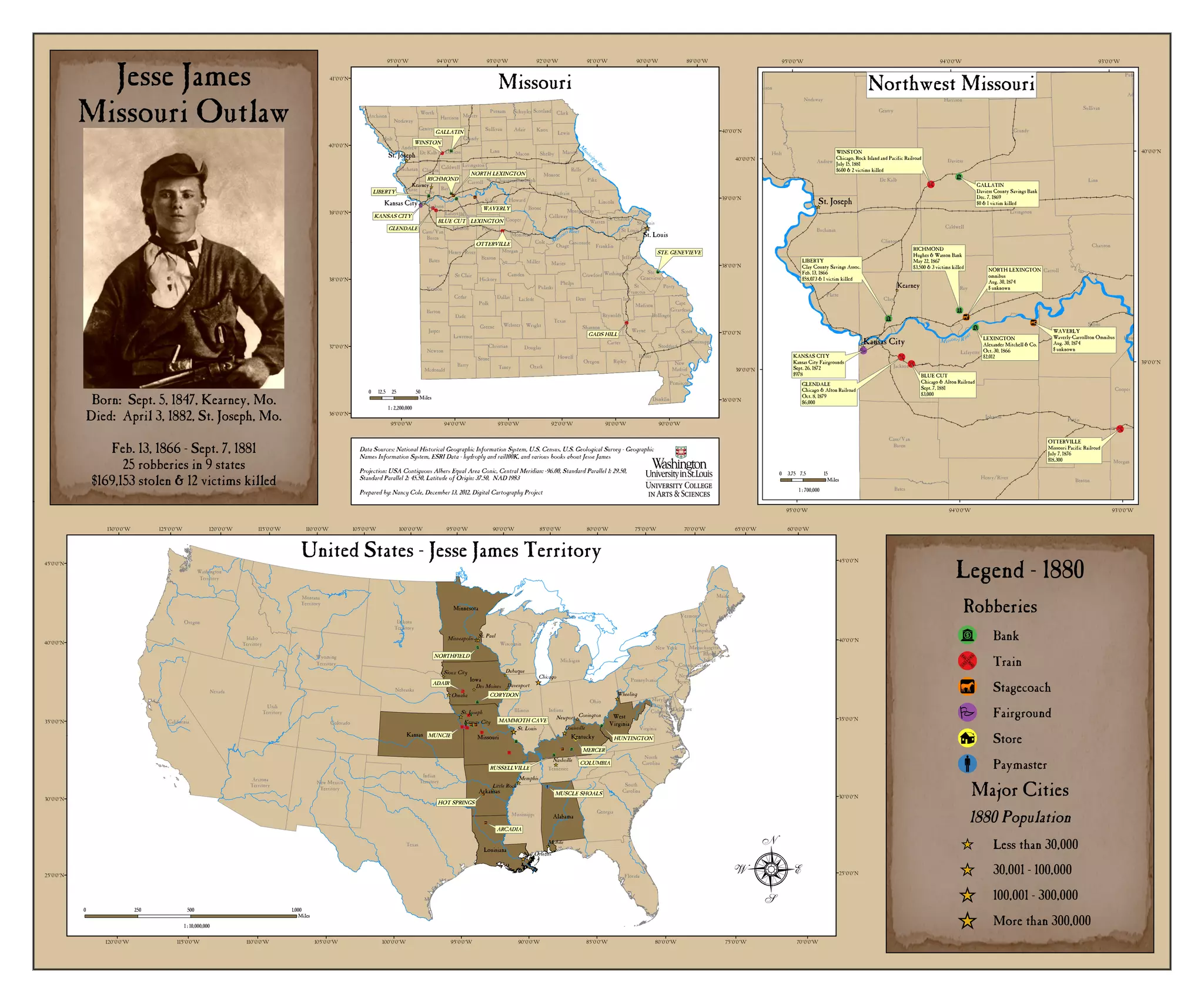

This document contains a map of Missouri with place names of towns and cities. It also lists dates and locations of robberies committed by the outlaw Jesse James between 1866 and 1881, including the amounts stolen and victims killed. Accompanying the list are short biographical details about Jesse James, born in Missouri in 1847 and killed there in 1882, who committed at least 25 robberies across 9 states, stealing over $169,000 and killing 12 victims. The map shows the locations of these robberies and major cities in Missouri in 1880 with their populations.


