Download to read offline
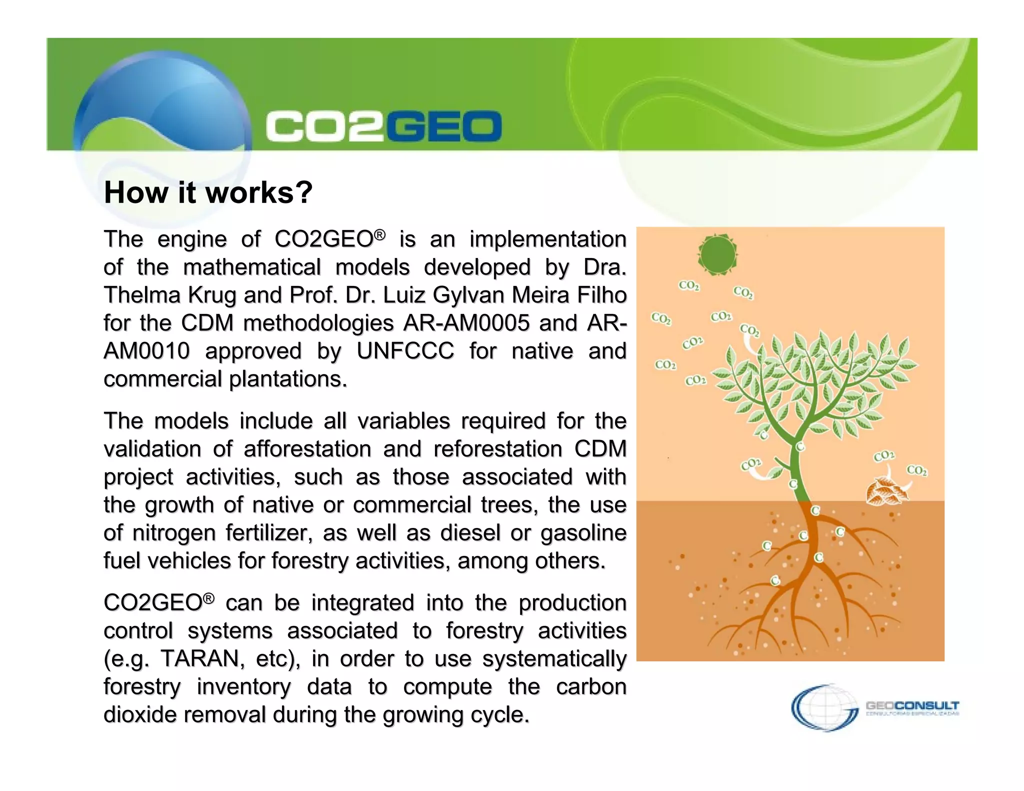
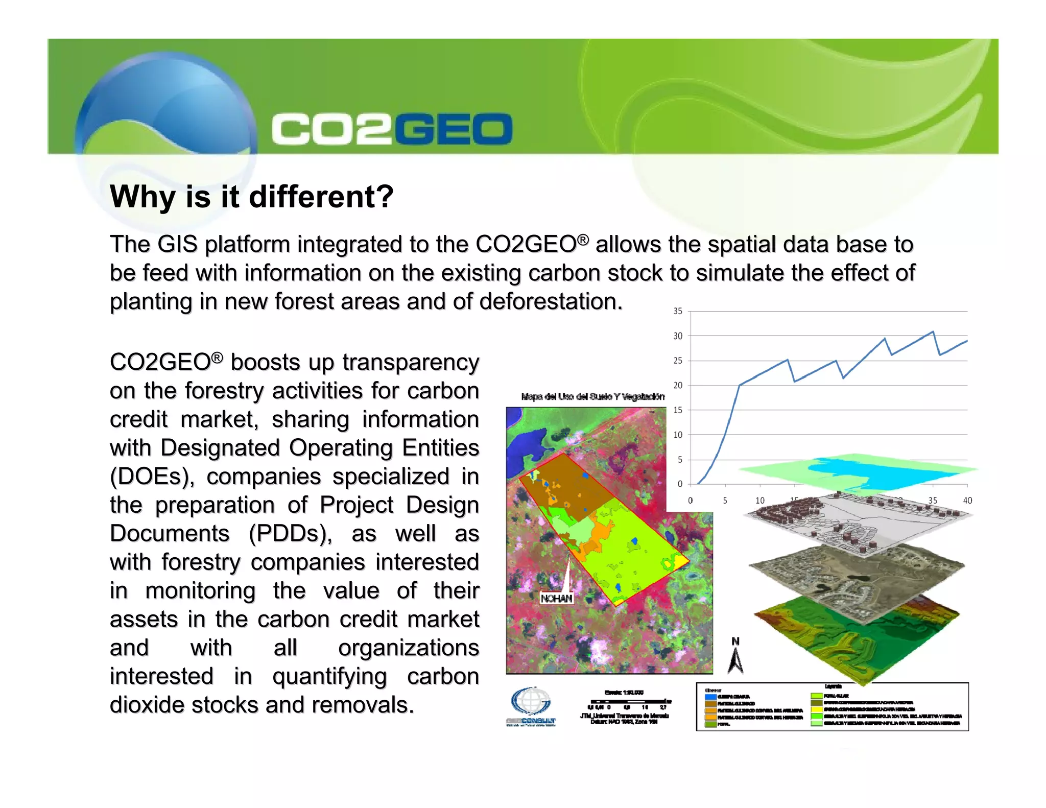
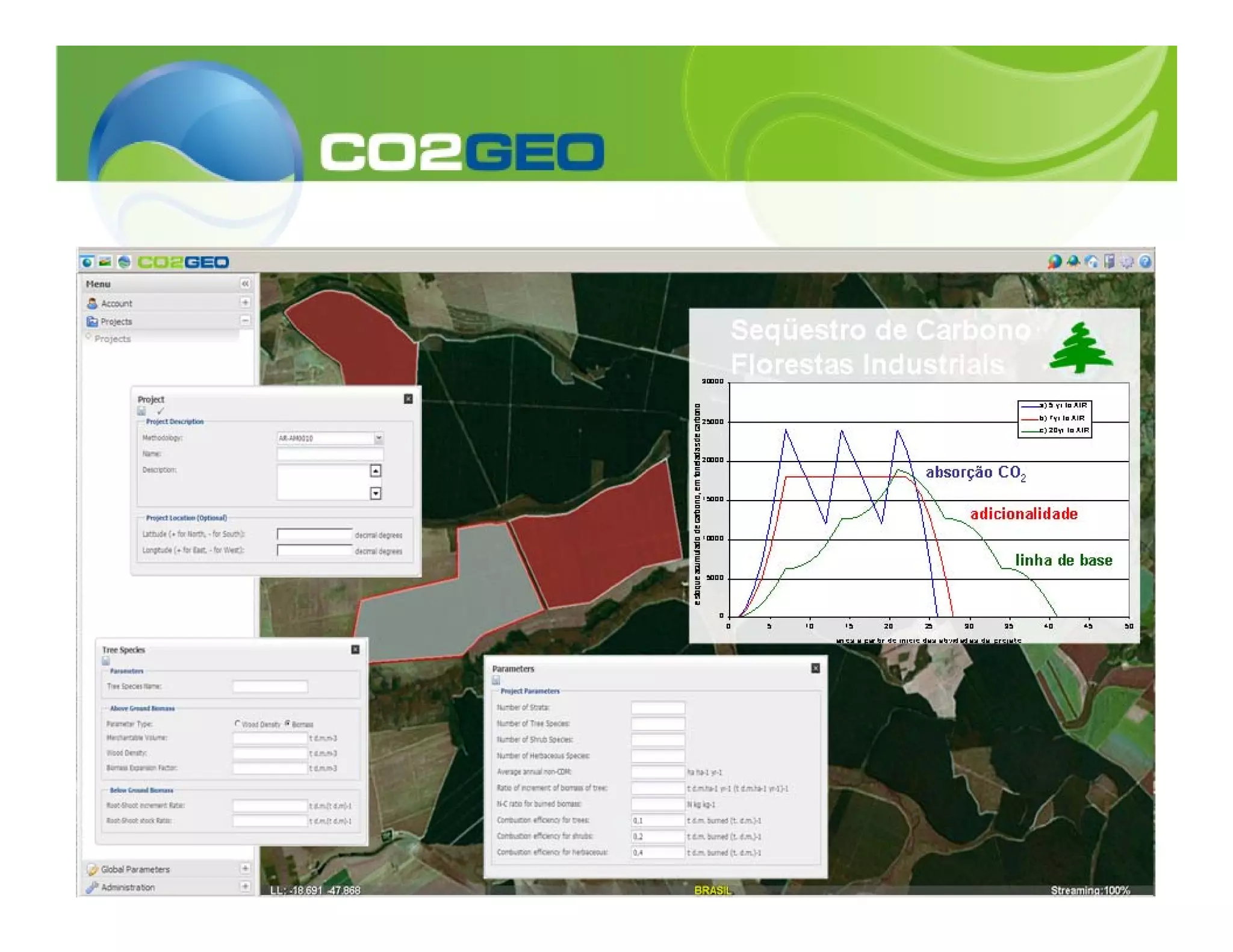

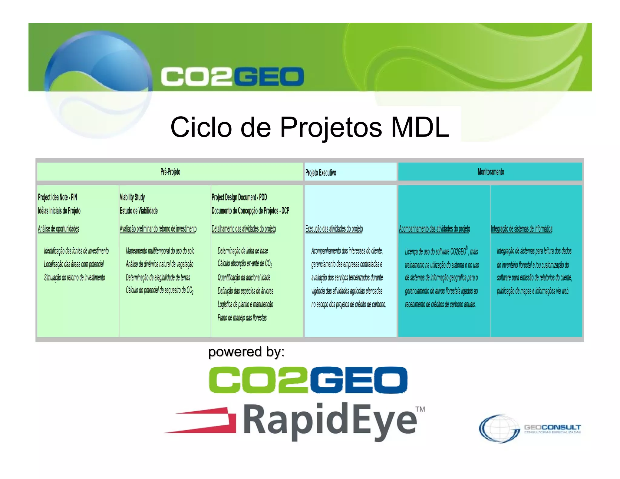
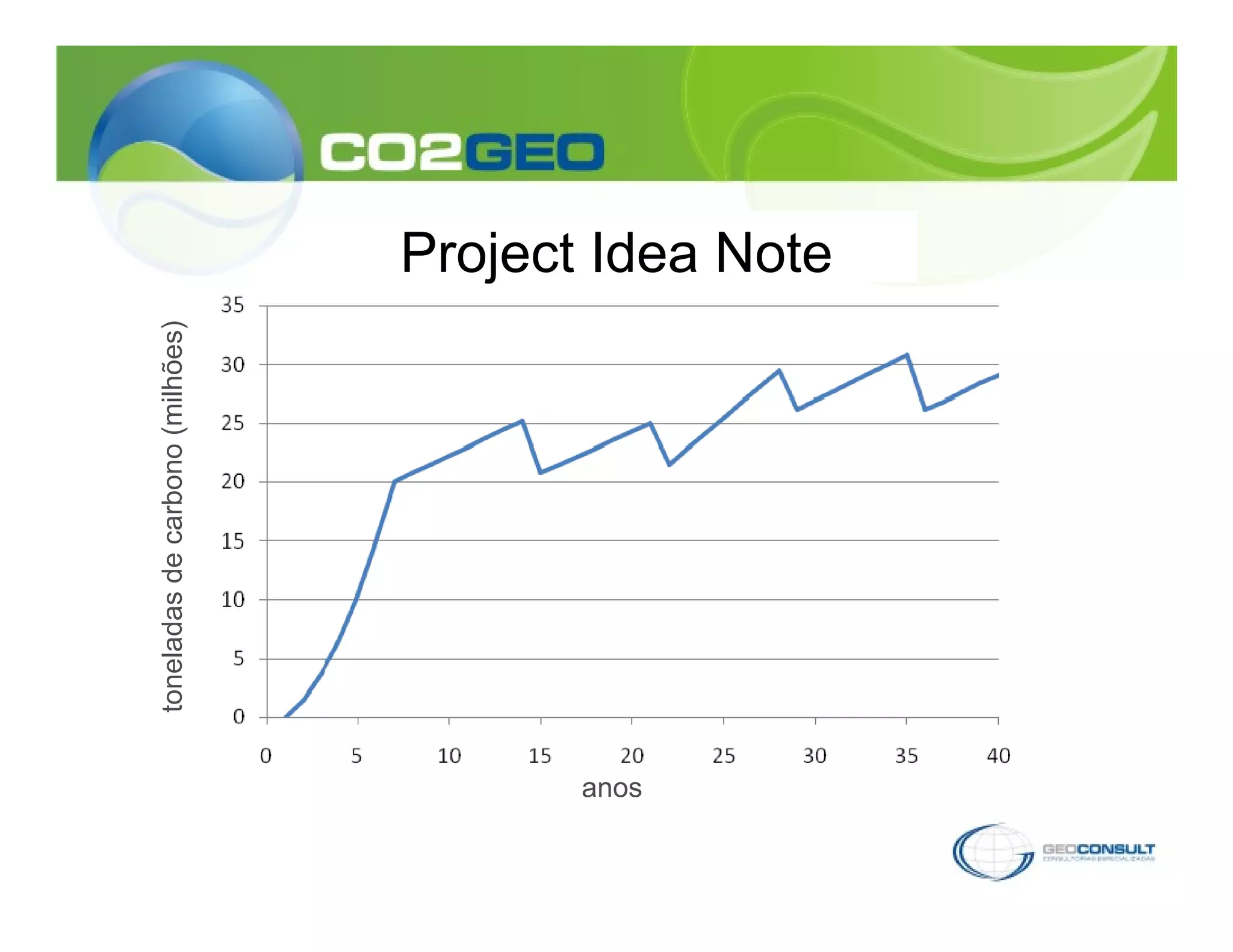
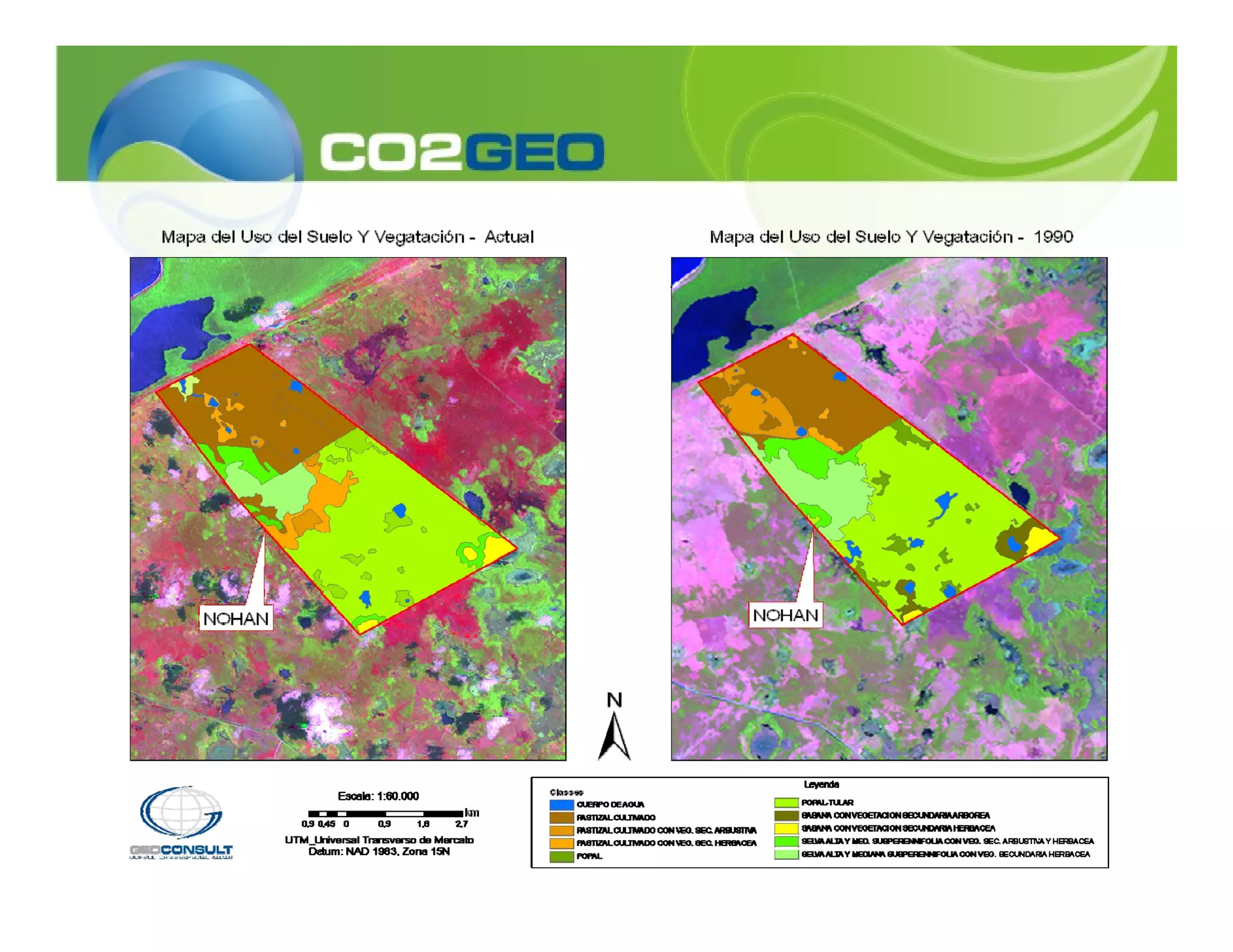
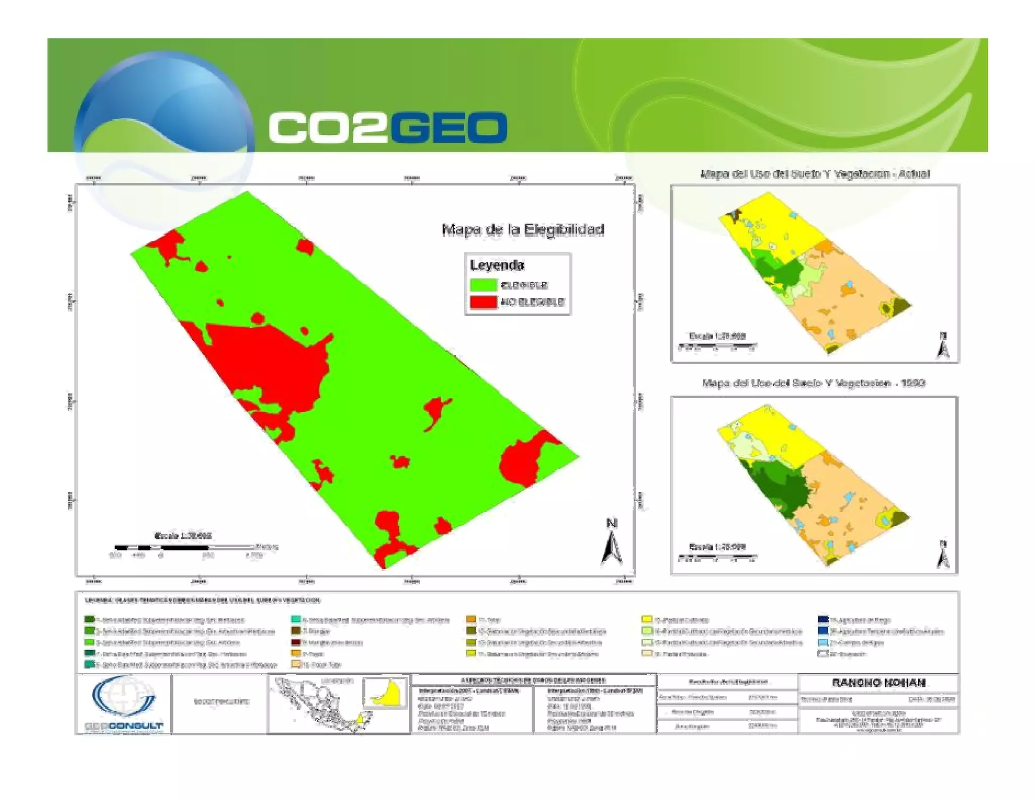
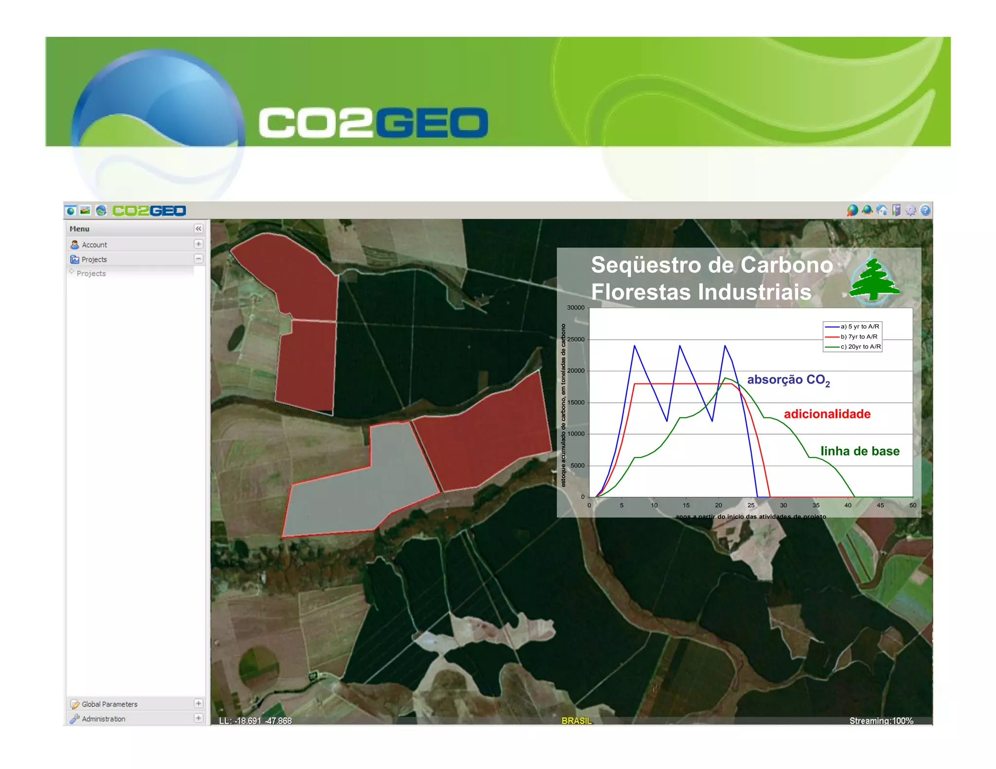

CO2GEO® is software that calculates the climate impact of planting trees by estimating the removal of carbon dioxide from the atmosphere through tree growth and emissions of other greenhouse gases from forestry activities. It uses geographic information systems and models approved by the UNFCCC to estimate carbon credits from afforestation/reforestation projects. Geoconsult offers consulting services using CO2GEO® to support the development of CDM forestry projects and monitoring of carbon removal and credits.


