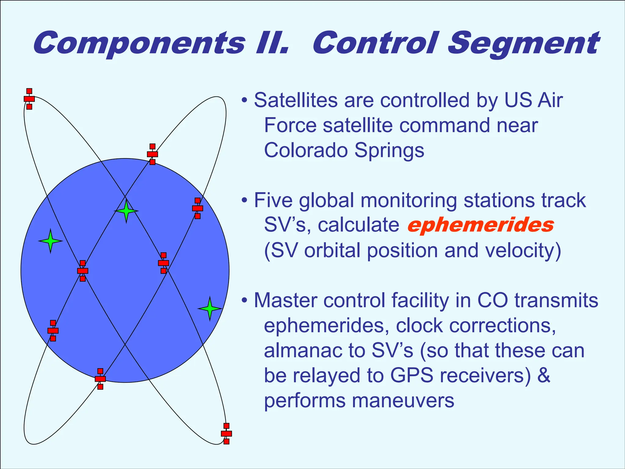
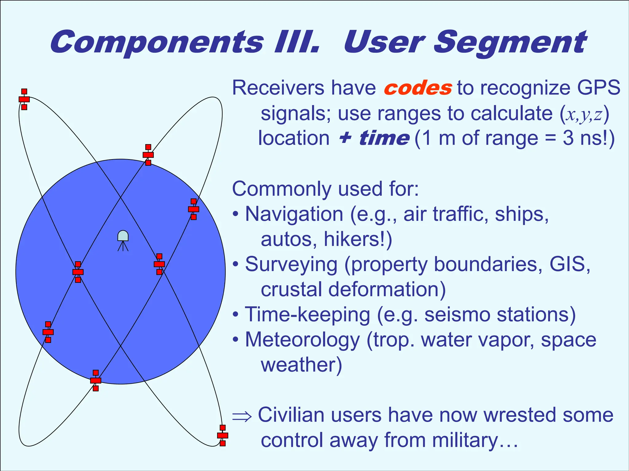
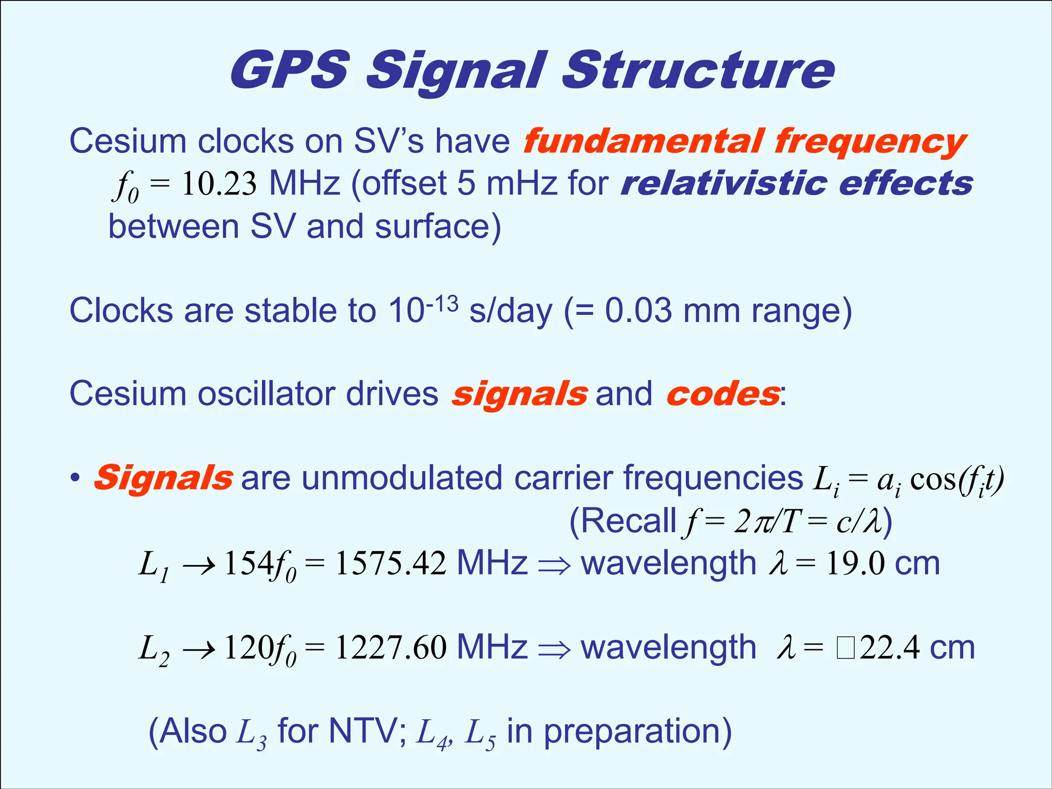
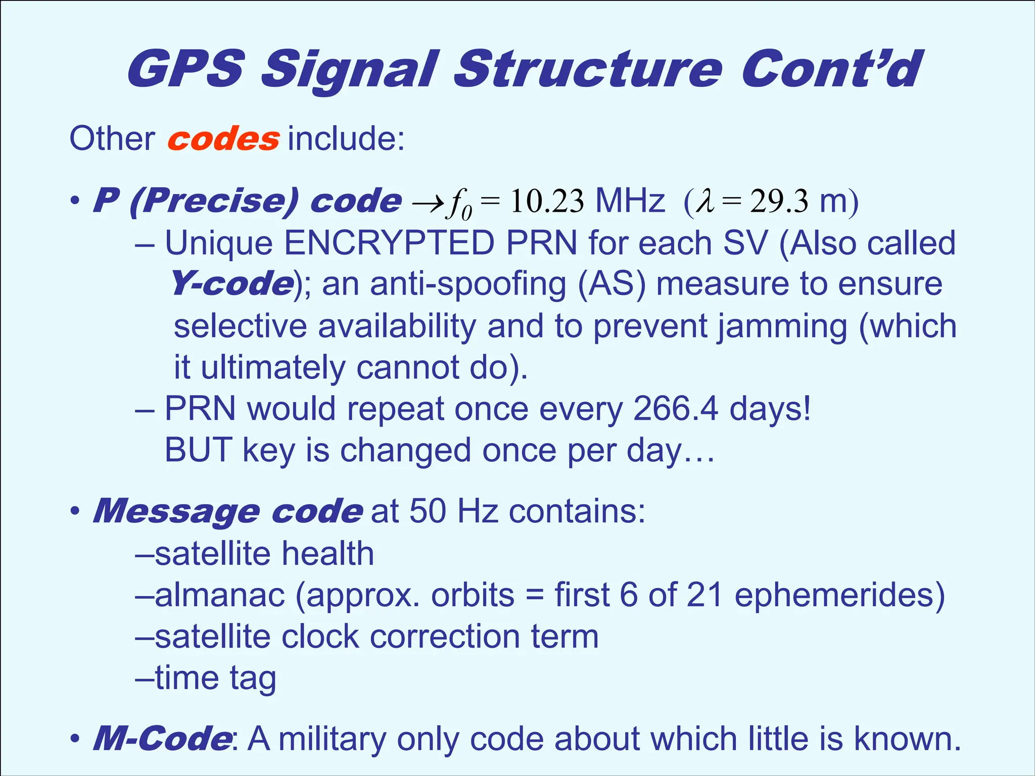
Last time: Terrestrial Positioning
• Leveling measures difference in height from an instrument
to a level rod or staff, relative to the geoid; can be accurate
to ~ 1 mm or less…
• Electronic Distance Measurement accurate to ~ 1 cm
(less for e.g. two-color laser which reduces refraction error).
• Space-based positioning (GPS, InSAR) is cheaper and as or
more accurate, so dominates modern tectonic geodesy.
GPS Positioning
• Resection (location of intersecting ranges) uses 3 comp’ts:
• Space segment (satellite vehicles  active transmission)
• Control segment (orbit determination & communication)
• User segment (antenna/receiver  passive)
Geology 6690/7690
Geodesy & Crustal Deformation
06 Sep 2013
© A.R. Lowry 2013
Read for Mon 9 Sep: Wahr §1 (1-3); §2.5 24-75
(The view from Earth Science/Engineering, KAUST)
Reminder: Read for next Wed (11 Sep)
Luttrell, K., Mencin, D., Francis, O., & Hurwitz, S. (2013).
Constraints on the upper crustal magma reservoir beneath
Yellowstone Caldera inferred from lake‐seiche induced
strain observations. Geophysical Research Letters 40(3)
501–506.
Discussion lead should be prepared with
• Slides with each of the important figures from the paper
• Summary slides of the observations, methodology,
& results
• Supporting slides from other sources that help to illustrate
important or unfamiliar tools, concepts, ideas
• Critical thinking skills switched to “ON”
Who wants it?
Critical Thinking Skills (I):
When reading ANY paper, it’s important to make certain
you understand the terminology being used, e.g.:
• Seiche
• Borehole strainmeter
• Load
• Spectrogram
Critical Thinking Skills (II):
Always Look Carefully at the Data Analysis:
• Is there a better way to quantify the data?
• Is there a potential for multiple signal sources?
• Is there an approach to analysis that might remove
signals that aren’t relevant for processes you wish
to understand?
• Are there quantitative tools that might have been
used to extract more information from the data?
Critical Thinking Skills (III):
When reading a paper that involves dynamical modeling,
it’s always helpful to think about:
• What are the assumptions of boundary conditions
(and do they matter?)
• What are the assumptions of initial conditions
(and do they matter?)
• What physical processes are being modeled
(and are there neglected physical processes that
could conceivably be important?)
• What observations are being modeled
(and how are they related? Qualitative or quantitative?
Comparison or inversion? What is the criterion for a
“Good Match” to the observations? Are there other
observations that might be relevant?)
• Does the model make testable predictions? How might
you test it?
Critical Thinking Skills (IV):
Assumptions matter!
• What was assumed about the system being studied in
order to simplify or approximate the dynamics? Are
these assumptions reasonable?
Numbers matter!
• What are the assumptions of rock material properties?
Do they gibe with laboratory measurements?
Do they gibe with geophysical measurements of
in-situ properties?
• What are the numerical values of other physical
properties? Are they reasonable? Is there
observational support?
Components I. Space Segment
• Constellation of 24+ satellites (21
navigational plus 3+ active spares) in
12-hour circular orbits at 20,200 km
(currently 31 + 3-4 decommissioned)
• Six planes (4+ space vehicles– SV’s–
each) inclined 55° from equatorial
• Six to twelve satellites in view from
anywhere on Earth, at any given time
• SV’s transmit low-level microwave
signals
• Four atomic clocks each (2 cesium;
2 rubidium)
(Courtesy US DOD!)
Components II. Control Segment
• Satellites are controlled by US Air
Force satellite command near
Colorado Springs
• Five global monitoring stations track
SV’s, calculate ephemerides
(SV orbital position and velocity)
• Master control facility in CO transmits
ephemerides, clock corrections,
almanac to SV’s (so that these can
be relayed to GPS receivers) &
performs maneuvers
Components III. User Segment
Receivers have codes to recognize GPS
signals; use ranges to calculate (x,y,z)
location + time (1 m of range = 3 ns!)
Commonly used for:
• Navigation (e.g., air traffic, ships,
autos, hikers!)
• Surveying (property boundaries, GIS,
crustal deformation)
• Time-keeping (e.g. seismo stations)
• Meteorology (trop. water vapor, space
weather)
Civilian users have now wrested some
control away from military…
GPS Signal Structure
Cesium clocks on SV’s have fundamental frequency
f0 = 10.23 MHz (offset 5 mHz for relativistic effects
between SV and surface)
Clocks are stable to 10-13 s/day (= 0.03 mm range)
Cesium oscillator drives signals and codes:
• Signals are unmodulated carrier frequencies Li = ai cos(fit)
(Recall f = 2p/T = c/l)
L1  154f0 = 1575.42 MHz wavelength l = 19.0 cm
L2  120f0 = 1227.60 MHz wavelength l= 22.4 cm
(Also L3 for NTV; L4, L5 in preparation)
GPS Signal Structure Cont’d
Carrier frequencies are modulated (multiplied) by +1 or –1
using three binary codes:
• C/A (Coarse Acquisition) code  fo/10 = 1.023 MHz
(l = 293 m)
– Unique, public pseudo-random noise (PRN) code for each SV
– PRN repeats once per millisecond
– Receivers use known PRN to cross-correlate with antenna
measured microwave signal and pull out individual SV signals!
+1
–1
1 1
1
1
0 0 0 “chips”
GPS Signal Structure Cont’d
Other codes include:
• P (Precise) code f0 = 10.23 MHz (l = 29.3 m)
– Unique ENCRYPTED PRN for each SV (Also called
Y-code); an anti-spoofing (AS) measure to ensure
selective availability and to prevent jamming (which
it ultimately cannot do).
– PRN would repeat once every 266.4 days!
BUT key is changed once per day…
• Message code at 50 Hz contains:
–satellite health
–almanac (approx. orbits = first 6 of 21 ephemerides)
–satellite clock correction term
–time tag
• M-Code: A military only code about which little is known.

GPS_measure_continue1.ppt satellite data gps measuememnt

  • 1.
    Last time: TerrestrialPositioning • Leveling measures difference in height from an instrument to a level rod or staff, relative to the geoid; can be accurate to ~ 1 mm or less… • Electronic Distance Measurement accurate to ~ 1 cm (less for e.g. two-color laser which reduces refraction error). • Space-based positioning (GPS, InSAR) is cheaper and as or more accurate, so dominates modern tectonic geodesy. GPS Positioning • Resection (location of intersecting ranges) uses 3 comp’ts: • Space segment (satellite vehicles  active transmission) • Control segment (orbit determination & communication) • User segment (antenna/receiver  passive) Geology 6690/7690 Geodesy & Crustal Deformation 06 Sep 2013 © A.R. Lowry 2013 Read for Mon 9 Sep: Wahr §1 (1-3); §2.5 24-75
  • 2.
    (The view fromEarth Science/Engineering, KAUST)
  • 3.
    Reminder: Read fornext Wed (11 Sep) Luttrell, K., Mencin, D., Francis, O., & Hurwitz, S. (2013). Constraints on the upper crustal magma reservoir beneath Yellowstone Caldera inferred from lake‐seiche induced strain observations. Geophysical Research Letters 40(3) 501–506. Discussion lead should be prepared with • Slides with each of the important figures from the paper • Summary slides of the observations, methodology, & results • Supporting slides from other sources that help to illustrate important or unfamiliar tools, concepts, ideas • Critical thinking skills switched to “ON” Who wants it?
  • 4.
    Critical Thinking Skills(I): When reading ANY paper, it’s important to make certain you understand the terminology being used, e.g.: • Seiche • Borehole strainmeter • Load • Spectrogram
  • 5.
    Critical Thinking Skills(II): Always Look Carefully at the Data Analysis: • Is there a better way to quantify the data? • Is there a potential for multiple signal sources? • Is there an approach to analysis that might remove signals that aren’t relevant for processes you wish to understand? • Are there quantitative tools that might have been used to extract more information from the data?
  • 6.
    Critical Thinking Skills(III): When reading a paper that involves dynamical modeling, it’s always helpful to think about: • What are the assumptions of boundary conditions (and do they matter?) • What are the assumptions of initial conditions (and do they matter?) • What physical processes are being modeled (and are there neglected physical processes that could conceivably be important?) • What observations are being modeled (and how are they related? Qualitative or quantitative? Comparison or inversion? What is the criterion for a “Good Match” to the observations? Are there other observations that might be relevant?) • Does the model make testable predictions? How might you test it?
  • 7.
    Critical Thinking Skills(IV): Assumptions matter! • What was assumed about the system being studied in order to simplify or approximate the dynamics? Are these assumptions reasonable? Numbers matter! • What are the assumptions of rock material properties? Do they gibe with laboratory measurements? Do they gibe with geophysical measurements of in-situ properties? • What are the numerical values of other physical properties? Are they reasonable? Is there observational support?
  • 8.
    Components I. SpaceSegment • Constellation of 24+ satellites (21 navigational plus 3+ active spares) in 12-hour circular orbits at 20,200 km (currently 31 + 3-4 decommissioned) • Six planes (4+ space vehicles– SV’s– each) inclined 55° from equatorial • Six to twelve satellites in view from anywhere on Earth, at any given time • SV’s transmit low-level microwave signals • Four atomic clocks each (2 cesium; 2 rubidium) (Courtesy US DOD!)
  • 9.
    Components II. ControlSegment • Satellites are controlled by US Air Force satellite command near Colorado Springs • Five global monitoring stations track SV’s, calculate ephemerides (SV orbital position and velocity) • Master control facility in CO transmits ephemerides, clock corrections, almanac to SV’s (so that these can be relayed to GPS receivers) & performs maneuvers
  • 10.
    Components III. UserSegment Receivers have codes to recognize GPS signals; use ranges to calculate (x,y,z) location + time (1 m of range = 3 ns!) Commonly used for: • Navigation (e.g., air traffic, ships, autos, hikers!) • Surveying (property boundaries, GIS, crustal deformation) • Time-keeping (e.g. seismo stations) • Meteorology (trop. water vapor, space weather) Civilian users have now wrested some control away from military…
  • 11.
    GPS Signal Structure Cesiumclocks on SV’s have fundamental frequency f0 = 10.23 MHz (offset 5 mHz for relativistic effects between SV and surface) Clocks are stable to 10-13 s/day (= 0.03 mm range) Cesium oscillator drives signals and codes: • Signals are unmodulated carrier frequencies Li = ai cos(fit) (Recall f = 2p/T = c/l) L1  154f0 = 1575.42 MHz wavelength l = 19.0 cm L2  120f0 = 1227.60 MHz wavelength l= 22.4 cm (Also L3 for NTV; L4, L5 in preparation)
  • 12.
    GPS Signal StructureCont’d Carrier frequencies are modulated (multiplied) by +1 or –1 using three binary codes: • C/A (Coarse Acquisition) code  fo/10 = 1.023 MHz (l = 293 m) – Unique, public pseudo-random noise (PRN) code for each SV – PRN repeats once per millisecond – Receivers use known PRN to cross-correlate with antenna measured microwave signal and pull out individual SV signals! +1 –1 1 1 1 1 0 0 0 “chips”
  • 13.
    GPS Signal StructureCont’d Other codes include: • P (Precise) code f0 = 10.23 MHz (l = 29.3 m) – Unique ENCRYPTED PRN for each SV (Also called Y-code); an anti-spoofing (AS) measure to ensure selective availability and to prevent jamming (which it ultimately cannot do). – PRN would repeat once every 266.4 days! BUT key is changed once per day… • Message code at 50 Hz contains: –satellite health –almanac (approx. orbits = first 6 of 21 ephemerides) –satellite clock correction term –time tag • M-Code: A military only code about which little is known.