
Recommended
Recommended
More Related Content
Similar to Goldsboro Food Entrepreneurship Plan
Similar to Goldsboro Food Entrepreneurship Plan (20)
More from Luis Nieves-Ruiz
More from Luis Nieves-Ruiz (18)
Recently uploaded
Recently uploaded (10)
Goldsboro Food Entrepreneurship Plan
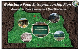
- 1. Goldsboro Food Entrepreneurship Plan Growing the Local Economy with Food Production
- 2. Table of Contents 1 About 2 Introduction 3 Existing Conditions Analysis 4 Land Use Regulations 5 Zoning Districts 6 Other City Plans and Documents 7 Incorporated Food Uses 10 Using Food Production to Revitalize Historic Goldsboro 12 Food Entrepreneurship Development Strategies
- 3. ABOUT THE EAST CENTRAL FLORDIA REGIONAL PLANNING COUNCIL (ECFRPC) Established in 1962 as an area‐wide association of local governments, the ECFRPC is one of Florida’s ten regional planning councils. Council staff provides technical assistance in many areas including land use and environmental planning, emergency preparedness, geographic information systems (GIS), and economic and iscal analysis, among others. Because of the ECFRPC, member governments have received more than $13.8 million in federal and state grants since 2011. This represents a return on investment of $3.59 for every dollar paid in assessments. The ECFRPC is currently designated by the U.S Economic Development Administration as the region’s Economic Development District (EDD). The EDD program provides economic technical assistance to public and private organizations within the eight‐ county region. This includes performing economic impact analyses using the REMI model, developing economic strategic plans, and assisting with grant applications. For more information about ECFRPC programs, visit the organization’s website at www.ecfrpc.org. ABOUT THE AUTHORS Luis Nieves‐Ruiz, AICP Originally from Puerto Rico, Luis holds a Master’s Degree in Regional Planning from Cornell University. He currently serves as the ECFRPC’s Economic Development Manager and has previously completed economic development plans for the cities of DeBary, Kissimmee, Lake Helen, Sanford, and Tavares. His areas of professional expertise include industry cluster analysis, economic modeling, planning research methods, and health and food systems planning. He can be reached at luis@ecfrpc.org. Matt Siebert A graduate of the University of Central Florida, Matt Siebert works as Economic Development Planner I at ECFRPC. He assists in updating and implementing the region’s Comprehensive Economic Development Strategy plan and with the development of special projects, contracts, and grants. Special Acknowledgements Donna Walsh Florida Department of Health in Seminole County Anna Scuteri Florida Department of Health in Seminole County Venise White Florida Department of Health in Seminole County Derrick Thomas Del’s Italian Ice + Florida Department of Health in Seminole County Christine Dalton City of Sanford Sonia Fonseca City of Sanford Steve Mello MelloSteve’s Pnuts Hannah Wooten University of Florida/IFAS Extension, Seminole County Kate Kapalo ECFRPC Timothy Hill ECFRPC
- 4. Introduction Originally incorporated in 1891, Sanford’s Historic Goldsboro neighborhood is celebrated for being the second oldest African American township in the state of Florida. In April of 1911, the town of Goldsboro was forcibly annexed by Sanford. Street names in Goldsboro, originally named after the city’s founders, were renamed to conform to Sanford's street grid. Today, the community is generally bounded by SR 46 (1st Street) on the north, US 17‐92 (French Street) on the east, 18th Street on the south and Persimmon Avenue on the west. For several years the Sanford Housing Authority owned and managed ive public housing sites totaling 380 family units. Deemed uninhabitable by HUD in 2010, these buildings were demolished and its residents relocated to other parts of the county. Today, the area’s economic conditions are very dire. At 36%, Goldsboro’s poverty rate is signi icantly higher than that of Sanford (23%) and nearly three times that of Seminole County (13%) The neighborhood’s unemployment rate is almost double that of the city at large. There is also a large number of people out of the workforce because of a disability (24%). To help remediate these conditions, the Sanford Housing Authority (SHA) and the City of Sanford applied to and were awarded a $500K HUD Choice Neighborhoods Initiative (CNI) Planning Grant to support a 24‐month planning process in the Goldsboro neighborhood. As part of this process, the planning team created seven working groups comprised of Goldsboro residents, business owners, and other regional stakeholders. The Career and Economic Opportunity working group members identi ied food production as an important economic development opportunity for Goldsboro. Several working group members own food businesses and would bene it from having a shared commercial kitchen built in the neighborhood. In addition, working with the Goldsboro Front Porch Council, the Florida Department of Health‐Seminole County recently started a farmers’ market that provides additional opportunities for food entrepreneurs to sell their products. To help support and guide these efforts, the East Central Florida Regional Planning Council (ECFRPC) applied for and received a $30K Community Planning Technical Assistance grant to develop a food entrepreneurship plan. This document identi ies potential opportunities for Goldsboro based on current conditions, appropriate sites, and recommends changes to the City’s regulations based on the project’s indings. Economic Indicators by Jurisdiction Sources: 2014 American Community Survey, CNI Survey Historic Goldsboro Street Map
- 5. Goldsboro Existing Conditions Analysis According to the Seminole County Property Appraiser, Sanford’s Historic Goldsboro neighborhood is comprised of about 568 acres divided in to just over 1,700 parcels. Like many other historic African American communities, the Goldsboro neighborhood has suffered from many years of neglect and disinvestment. This narrative was compounded by the demolition of the SHAs public housing projects in 2013, which left about 47.9 acres of vacant land in the middle of the community. Today about a third of the community’s parcels remain undeveloped. However, the predominant land use is residential, speci ically single‐ family homes. Non‐residential land (commercial, industrial, and institutional uses) represents another third of the area’s land uses. The community’s commercial uses are concentrated along Historic Goldsboro Boulevard, S.R. 46 and U.S. 17‐92. Goldsboro also has 17 parcels with industrial uses including light manufacturing operations, warehouses, and open storage areas. Finally, most of the neighborhood’s institutional land is owned by the Seminole County School District, which operates three schools within the area: Goldsboro Elementary, Sanford Middle School, and the Crooms Academy of Information Technology magnet school. This analysis will focus on analyzing the characteristics of Goldsboro’s vacant parcels. Most of these lots are small having a median size of about a quarter of an acre. However, there are several properties larger than ive acres. These include two 10‐acre parcels owned by the SHA, another six‐acre lot owned by the National Railroad Passenger Corporation (Amtrak), and a ive‐acre parcel owned by the City of Sanford. These three governmental entities are also the largest property owners within the study area. Together they hold over 80 acres of land. Overall though, most vacant land proprietors own parcels that are less than one acre in size. These lots are owned by over 350 individuals and entities and are mostly concentrated south of Historic Goldsboro Boulevard. This could represent a redevelopment challenge, especially because most the contiguous parcels have different owners. On a positive note, 60 percent of these vacant property owners reside within the City of Sanford. The rest of them either live in other Florida cities or outside the state.
- 6. Land Use Regulations When discussing development and redevelopment opportunities within any community, it is important to understand the underlying land use regulations that govern its growth. Through its Comprehensive Plan, Sanford has adopted a series of goals, policies and other criteria that envision how all properties must be developed in order to preserve the City’s character and manage its growth. The Future Land Use Map (FLUM) describes the allowed development densities and intensities for all properties within the City’s boundaries. Sanford’s FLUM includes a total of 17 future land use (FLU) categories, but only nine of them are present within the Goldsboro community. This analysis focuses on discussing the FLU designations of the neighborhood’s vacant parcels. About 68 percent of all the vacant parcels within the Goldsboro community have one of three residential future land use designations: Low Density Residential, Medium Density Residential‐15, and High Density Residential. Most of these properties are concentrated around the center and southern borders of the neighborhood. The maximum development density allowed within these FLU designations ranges between six and twenty units per acre. There are 17 acres of undeveloped land along Historic Goldsboro Boulevard (between South Persimmon Avenue and Lake Street) with a Neighborhood Commercial future land use designation. The purpose of this FLU category is to accommodate commercial uses that serve residential or specialized markets. Community‐oriented retail sales and services are restricted to the properties with a General Commercial future land use designation. Several vacant parcels along Historic Goldsboro Boulevard (between Lake and 17‐92) and alongside the north and east perimeters of the neighborhood have this FLU designation. Finally, there are several large vacant industrial parcels distributed throughout the neighborhood. This future land use designation is for allocating more intense activities such as manufacturing and fabrication, storage, and the distribution of goods. Understanding the distribution of these FLU designations across the neighborhood will help to identity ways to incorporate food uses into Goldsboro. All these FLU designations are implemented using Sanford’s zoning district and land use regulations, which specify the allowed uses and speci ic development standards for all these properties. FLU Designations in Goldsboro Community Sources: Seminole County Property Appraiser, ECFRPC research
- 7. Goldsboro Zoning Districts The City of Sanford has 17 different zoning districts that help to implement the vision of the Comprehensive Plan by providing a set of property development standards and specifying the allowed uses. The predominant zoning district designations within the Goldsboro neighborhood are General Commercial (GC‐2), Multiple Family Residential (MR‐ 2 and MR‐3). Properties with a GC‐2 zoning district are concentrated along the community’s North and East boundaries as well as Historic Goldsboro Boulevard. These parcels can accommodate a variety of retail sales and services. The MR‐2 and MR‐3 zoning districts allow multi‐family developments and their related accessory uses. Two dense clusters of parcels with MR‐2 zoning can be found towards the center and southern parts of the neighborhood. The Sanford Housing Authority owns the largest parcels, which are located in the middle of Goldsboro. However, the majority of these lots are found in the southern part of the neighborhood. These are mostly small non‐contiguous lots owned by different parties. Therefore, it will be very dif icult to develop a large multi‐family project in this part of Goldsboro. The MR‐3 zoned properties found along the northern part of the neighborhood. Parcels with other zoning district designations are distributed across the neighborhood and are mostly developed. The only property with Agriculture (AG) Zoning houses the Goldsboro Elementary School. Parcels with a Single‐Family Residential Dwelling (SR‐1), Multiple‐Family Residential/Of ice/Institutional (RMOI), RMOI, and Restricted Commercial (RC‐1), and Restricted Industrial (RI‐1) zoning designations are concentrated on different parts of the neighborhood. Most single‐family lots are located in the Academy Manor subdivision. All parcels with RMOI zoning are located along W. 1st Street between South Mulbery and Avocado Avenues. This is about three blocks in the study area’s northern boundary. This mixed‐use zoning district allows high density residential, of ice and commercial uses. However, most of these parcels are very small, comprising less than ive acres when combined. Properties with a RC‐1 zoning district are concentrated on the corner of W. 13th Street and Persimmon Avenue and are intended to serve neighborhood commercial uses. Properties with R1‐1 zoning, which allow light manufacturing and wholesale uses, are located along the railroad line. The neighborhood also contains one parcel with a Medium Industrial (MI‐2) zoning district designation and another that houses a planned development (PD). Both are already developed. Finally, all neighborhood parks are zoned as a Parks, Recreation, and Open Space (PRO). Zoning Districts within the Goldsboro Community Predominant Zoning Districts in Goldsboro Community
- 8. Other City Plans and Documents As part of this analysis process, the ECFRPC reviewed several City documents including the Future Land Use Element of Sanford’s Comprehensive Plan, the City’s Economic Development Strategic Plan, and the more recent draft of the Goldsboro Transformation Plan. The objective of this study was to ind if the documents make any references to food production. Future Land Use policies 1‐1.1.5 and 1‐1.2.6 address how Sanford will manage agricultural lands within City boundaries. First, the City commits to support the goals of the Seminole County Rural Boundary and the protection of rural lands by complying with the County’s provisions regarding land use changes and annexations. The City also created the Suburban Estates FLU designation to identify all properties that it anticipates will remain as agricultural or used for agricultural purposes. The development density within this FLU is restricted to 1du/acre. The 12 properties with this FLU designation are located east of Goldsboro. Sanford’s Economic Development Strategic Plan proposes that the City focus its efforts on recruiting businesses and suppliers falling within four economic subsectors: Transportation, Health, Professional, and Hospitality Sectors. The Economic Strategic Plan lists several food production industries/activities that are complimentary to the Hospitality subsector including food production/manufacturing, agricultural production/farmers, cold storage, and commercial kitchens. Finally, the draft of the Goldsboro Transformation Plan was submitted to HUD in December, 2017. Among its many goals, the plan recommends increasing the availability of healthy food offerings within the community and fostering entrepreneurship among Goldsboro residents. These goals will be achieved by expanding the offerings available at the farmers’ market, building upon the Goldsboro Community Gardening Initiative, and constructing a shared commercial kitchen that will assist with the development of food businesses. These indings and the previous work performed for this project indicate that conditions are ripe within the City of Sanford to incorporate food production as an economic development engine with the Goldsboro community being the epicenter of this new activity. This goal could be accomplished by developing a set of robust strategies based on Best Practices identi ied in Deliverable 1. Source: City of Sanford Economic Development Strategic Plan Sanford Economic Development Strategic Plan Hospitality Cluster Strategy
- 9. Incorporating Food Uses in Sanford’s Zoning Code Based on a review of best practices and existing conditions, the ECFRPC is recommending the City of Sanford to add urban agriculture, artisanal food production, and shared kitchen to the permitted uses table (Schedule B). Urban Agriculture Urban agriculture is the repurposing of unused community spaces to grow food through various methods including raised‐beds, rooftop gardens, and climate controlled greenhouses. When regulating urban agriculture operations, Sanford should adopt an approach similar to the cities of Atlanta and Minneapolis. In residential districts, urban farms would be permitted as an accessory to an institutional use such as a houses of worship, schools or day care facilities. The urban farm could be considered part of the landscaping requirements, but should not occupy more than 30 percent of the property. In residential undeveloped parcels, an urban garden should be allowed as a principal use when the owner applies for a conditional use permit. Residential urban farms should be no larger than 10,000 square feet. Proponents would be required to submit a site plan containing the exact lot dimensions, adjoining streets, location and dimension of structures, the speci ic use/purpose of each structure, and any changes to be made to the site. To avoid traf ic and congestion problems, on site retail sales would be prohibited in residential areas. Proponent would only be allowed to use household equipment, which should be stored in an enclosed building or screened from public view. Accessory structures cannot exceed 1,000 square feet in size or occupy more than 15 percent of the lot area, whichever is greater. Their maximum height would be restricted to no more than 6.5 feet. Fences should not exceed four feet in height or follow Sanford’s requirements. Any open lot area between the fence and the street lines needs to be planted with grass or other vegetation. Within residential districts, signs should only be allowed when the farm is a principal use. Since no retail is allowed, signs would be prohibited. Finally, on site composting would be allowed but it would be limited to the agricultural use of the subject property, and required to be located at least 20 feet from any habitable building or adjacent properties. In non‐residential areas, urban farms should be permitted as a principal use in the general commercial (GC2) and industrial (MR1 and MR2) zoning districts. Urban farms should meet all the zoning district’s development site standards. However, crops should not be taller than six feet in height. Portrait of a Goldsboro Food Business Derrick Thomas and Delvis Stallworth co-own Del’s Ital- ian Ice. This is a special events Italian ice business that caters to local farmers markets, festivals, school events Proposed Changes to City of Sanford Permitted Use Table
- 10. Food Processing Sanford could support small scale food production within City limits by allowing artisanal food production facilities within its commercial zoning districts. These irms will specialize in producing small‐scale, hand crafted specialty food and beverage products for wholesale and retail purposes. Operations that are less than 2,500 square feet in size should be allowed in the RC‐1 zoning district as long as the operation has a retail component. Larger operations should be restricted to the city’s GC‐2 and industrial zoning districts. In addition to artisanal food production, the City should also create a new use called shared kitchen/kitchen incubator. This use would be de ined as a shared‐use, commercial food preparation facility containing kitchen stations, preparation spaces, baking equipment, and dry/cold freezer storage that can be rented by the hour or block of time in order to commercially produce food products. Shared Kitchen/Kitchen Incubators should be allowed in the City’s GC‐2 and industrial zoning districts. However, the City should also consider allowing commercial kitchens as an accessory use in residential districts as long as the property is located within a house of worship or other publicly owned or operated uses excluding home occupations, day care facilities, and adult foster care homes. This accessory commercial kitchens should occupy less than ive percent of the building’s loor area and cannot be used as part of an on‐site eating and drinking establishment. Operating hours will be restricted to 6:00 a.m.‐9:00 p.m. on weekdays and 8:00 a.m. to 9:00 p.m. on weekends. Finally, the proponent would need to submit a parking plan to the Planning Director that shows adequate on‐site parking for the kitchen’s users. Mobile Vending The ECFRPC is not recommending any changes to the City of Sanford’s mobile vending rules for several reasons. On the one hand, the ECFRPC’s literature review did not uncover any ground breaking policies that could be described as best practices. Despite their popularity, most jurisdictions are still very strict when regulating mobile vendors. This is because of a litany of concerns including direct competition with brick and mortar restaurants, vehicle sanitation and health requirements, parking and traf ic generation, hours of operation, use of public spaces, and neighborhood aesthetics, among others. Finally, Sanford is already home to two successful farmers’ markets that should have enough capacity to accommodate additional mobile vendors. Portrait of a Goldsboro Food Business Steven E. Smith, a 4th generation entrepreneur, is co- owner of Mello Steve’s Pnuts. This local cottage food busi- ness offers Cajun jumbo boiled peanuts prepared with smoked meat flavored broth. COMMERCIAL RC-1+ GC-2+ SC-3+ RI-1 MI-2 Retail Sales and Service Indoor P P P D D Retail Sales and Service Outdoor Storage C C C Artisanal Food Production P P P P P COMMERCIAL SR-1AA SR-1A MR-1 MR-2 MR-3 GC-2+ RI-1 MI-2 Shared Kitchen/Kitchen Incubator D D D D D P P P Recommended Food Processing Uses
- 11. Florida Food Cottage Law The most important thing that City of icials can do to promote food entrepreneurship in Goldsboro is to adopt the Florida Cottage Food Law, which allows individuals to prepare non‐hazardous food items in a home kitchen. Some of these products include breads, cakes, cookies, candies, jams, jellies, and fruit pies. Cottage food operators can sell directly to the consumer from their home, farmers markets, and lea markets. The gross sales ceiling for cottage food operators was recently raised to $50,000, which can be considered a full‐time position. Several jurisdictions have adopted a local cottage food ordinance including Orange County and the cities of Orlando and Winter Springs. Using Food Production to Revitalize Historic Goldsboro Based on the recommended changes to Sanford’s land use regulations, the indings of the CNI project, and the neighborhood’s existing land use patterns, the ECFRPC suggests that the following food uses should be used to revitalize the Historic Goldsboro neighborhood: urban agriculture, shared kitchen, artisanal food production, and food distribution and processing. The ECFRPC also developed a conceptual plan that depicts the prospective location of these uses within the Goldsboro community. The next sections discuss in more detail the reasoning behind these recommendations. Farmers Market The Florida Department of Health in Seminole County identi ied the Goldsboro community as a food desert. Because of this, FDOH‐SC was awarded $25,000 with an additional grant from the CNI to bring more physical and economic accessibility to healthy foods. With direction from the Goldsboro Front Porch Council, a farmers market was opened in December 2016 and held every Friday afternoon. The original spot for the market was temporary and has since moved to the Allen Chapel AME with a pavilion structure being constructed to house the event.
- 12. Urban Agriculture The ideal location for urban agriculture would be south of Historic Goldsboro Boulevard. This part of the neighborhood is comprised of over 170 vacant lots owned by multiple proprietors. The properties allow the construction of multi‐family development, which would be dif icult to build because most of the lots are not contiguous. Urban farms can help to activate these spaces by transforming these parcels into productive uses. As previously explained, the City of Sanford would need to change its zoning code to allow for agricultural uses in the residential properties. Shared Commercial Kitchen The Goldsboro CNI Plan envisions the commercial kitchen as part of the proposed 6,000‐square foot Community Resource Center, which would be built along Historic Goldsboro Boulevard. This is a city‐owned property located across from the Sanford Public Safety Complex that can also serve as a gateway to the community. While funding becomes available to construct this new facility, the City of Sanford should consider inquiring with neighborhood’s churches to see if they have a licensed commercial kitchen that could be rented to the area entrepreneurs. The commercial kitchen should also be treated as a business incubation space where entrepreneurs are provided with assistance to develop their operations. Some of these vendors can then start selling their product in the Goldsboro Farmers Market or open a brick and mortar store somewhere else in the neighborhood. Artisanal Food The ECFRPC recommends the City of Sanford create a new artisanal food production category in its zoning code to allow small food producers in commercial properties. There are three properties along Historic Goldsboro Boulevard where these food artisans could locate. The properties currently have a GC‐2 Zoning District and a Neighborhood Commercial FLU designation. They will need to be rezoned to RC‐1.
- 13. Wholesale Food Distribution and Processing This industrial site on the corner of Persimmon Avenue and the rail road tracks would be an ideal location for a produce processing and distribution facility. It could also be the home for a large food manufacturer such as a wholesale bakery. The property will need to be rezoned to the MI‐2 zoning district. Food Entrepreneurship Development Strategies The Goldsboro Food Entrepreneurship Plan focuses on examining the neighborhood’s existing conditions to identify areas where food production uses could be located. The plan also recommends how to best incorporate several of these food uses into the Sanford Zoning Code. Besides these land use changes, there are several other strategies that City leaders could follow to increase entrepreneurship within Goldsboro the neighborhood. These strategies are listed are grouped along three main focus areas: land use regulations, shared commercial kitchen, other. Land Use The Goldsboro Food Entrepreneurship Plan proposes the addition of several food uses to Schedule B‐Permitted Uses of the Sanford City Code. The ECFRPC recognizes that food production is a fairly new topic, and that there needs to be more education around this issue. For this reason, the organization would like to convene with City planners and other staff to discuss the proposed changes to Sanford’s zoning regulations. This process will help present the proposed changes and ascertain what would be the best way to implement them based on staff’s experience. As part of this process, the ECFRPC will work with staff to schedule a presentation with the City’s Planning and Zoning Commission to discuss the proposed changes. Of particular importance to Goldsboro entrepreneurs is the City’s adoption of the Florida Food Cottage Law. The ECFRPC will connect the City of Sanford with resources that can assist with the development of such ordinance. Finally, the ECFRPC commits to assist Sanford’s Planners with the development of a food zoning ordinance. During its analysis of Goldsboro’s land use patterns, the ECFRPC also identi ied several properties with FLU and zoning inconsistencies throughout the neighborhood. The City of Sanford should coordinate with the property owners to rezone these parcels to the correct zoning district.
- 14. Shared Kitchen The main motive behind this project is the development of a shared commercial kitchen within the Goldsboro community. This is a need that entrepreneurs expressed several times at CNI meetings and City staff is committed to make this facility a reality. An important step in this process is to determine the type of commercial kitchen to be built in Goldsboro. Other issues such as ownership, management, and funding also need to be resolved. During the development of the Entrepreneurship Plan, the ECFRPC came upon the Shared Kitchen Toolkit which is a free web‐based resource that provides guidance on the feasibility and planning for new kitchen projects. ECFRPC staff has also made additional contacts that have experience with developing this type of project. Therefore, the ECFRPC can continue to assist the City of Sanford with this project. As previously discussed in this plan, the CNI Plan is recommending that the shared kitchen be part of the Goldsboro Community Resource Center. However, the City of Sanford might want to look for a short‐term solution to assist the community’s food entrepreneurs while the Resource Center is built. One recommendation is to ascertain the interest from local houses of worship and other institutional partners to house a starter commercial kitchen. This will help to alleviate the need for having such a facility in the community. Once the planning tasks are completed, the ECFRPC can assist the City with identifying grants to fund the commercial kitchen. Entrepreneurship There are many steps that the City of Sanford could take to promote food entrepreneurship besides addressing land use issues and building the commercial kitchen. The irst step is to continue supporting the Goldsboro Farmers Market, which is the epicenter of food activity within the community. City of Sanford Economic Development staff should also make a concerted effort to recruit food production operations to locate within Goldsboro. This is also an opportunity to develop partnerships with other county and state agencies that can assist current and potential food entrepreneurs such as the Seminole County Business Development Center and the University of Florida/IFAS Extension, Seminole County Of ice. In the long‐term, the City’s Economic Development Of ice can also stimulate the development of stronger linkages between downtown Sanford businesses and Goldsboro entrepreneurs. Focus Area Implementation Strategies Potential Partner Organizations Create a stakeholder group to examine proposed changes to the Zoning Code City of Sanford, ECFRPC, Business Owners, others Review how other Central Florida jurisdictions have adopted the Florida Cottage Food Law City of Sanford, ECFRPC, IFAS-Seminole County Create ordinance making changes to the different zoning districts to incorporate food production uses into the City's Zoning Code City of Sanford, ECFRPC Coordinate with property owners to eliminate FLU/Zoning inconsistencies within non-residential vacant properties City of Sanford, ECFRPC Land Use Focus Area Implementation Strategies Potential Partner Organizations Evaluate different shared commercial kitchen models and select most appropriate choice City of Sanford, ECFRC, Goldsboro Front Porch Council, Others Identify if there are any churches within Sanford that could house the starter commercial kitchen City of Sanford, ECFRPC Follow up on potential funding sources for the construction of the kitchen ECFRPC, City of Sanford Shared Kitchen Focus Area Implementation Strategies Potential Partner Organizations Continue to support the Goldsboro Farmers Market City of Sanford, Florida Department of Health at Seminole County Identify food businesses that might be interested in locating within the Goldsboro area City of Sanford Partner with Seminole County Business Development Center (SBDC) to offer classes to food entrepreneurs City of Sanford Coordinate with the University of Florida/IFAS Extension to offer agricultural classes to community residents City of Sanford, IFAS-Seminole County Develop stronger linkages between downtown Sanford and Goldsboro entrepreneurs City of Sanford Entrepreneurship
- 15. Appendix I. Maps
- 17. 0 0.25 0.5 0.75 10.125 Miles Sources: InfoGroup, University of Florida GeoPlan Center, ECFRPC Largest Employers by Size All provided GIS data is to be considered a generalized spatial representation which is subject to revisions. The data is provided as is with no implied warranty for usability. The data used for this application were developed from various sources and scales. The map information is not a survey. ECFRPC makes no warranty, explicit or implied, regarding the accuracy or use of this information. Use at your own risk. The features here represented are not to be used to establish legal boundaries or entitlements. For specific information, contact the appropriate department or agency. This information is provided as a visual representation only and is not intended to be used as a legal or official representation of legal boundaries or entitlements. The user assumes all responsibility for determining whether this file is appropriate for a particular purpose. These environmental data and related items of information have not been formally disseminated by NOAA and do not represent and should not be construed to represent any agency determination, view or policy. Sources: Esri, HERE, DeLorme, USGS, Intermap, INCREMENT P, NRCan, Esri Japan, METI, Esri China (Hong Kong), Esri Korea, Esri (Thailand), MapmyIndia, NGCC, © OpenStreetMap contributors, and the GIS User Community ¯ Text Largest Vacant Land Owners by Acreage Sanford Housing Authority AMTRAK City of Sanford Goldsboro Boundary
- 18. SANFORD Source: Esri, DigitalGlobe, GeoEye, Earthstar Geographics, CNES/Airbus DS, USDA, USGS, AeroGRID, IGN, and the GIS User Community Text Food Distribution and Processing Site Goldsboro Boundaries Food Distribution and Processing Sources: InfoGroup, University of Florida GeoPlan Center, ECFRPC Largest Employers by Size All provided GIS data is to be considered a generalized spatial representation which is subject to revisions. The data is provided as is with no implied warranty for usability. The data used for this application were developed from various sources and scales. The map information is not a survey. ECFRPC makes no warranty, explicit or implied, regarding the accuracy or use of this information. Use at your own risk. The features here represented are not to be used to establish legal boundaries or entitlements. For specific information, contact the appropriate department or agency. This information is provided as a visual representation only and is not intended to be used as a legal or official representation of legal boundaries or entitlements. The user assumes all responsibility for determining whether this file is appropriate for a particular purpose. These environmental data and related items of information have not been formally disseminated by NOAA and do not represent and should not be construed to represent any agency determination, view or pol ¯ 0 0.05 0.1 0.15 0.20.025 Miles
- 19. SANFORD Source: Esri, DigitalGlobe, GeoEye, Earthstar Geographics, CNES/Airbus DS, USDA, USGS, AeroGRID, IGN, and the GIS User Community Text Artisanal Food Sites Goldsboro Boundaries Artisanal Food Sources: InfoGroup, University of Florida GeoPlan Center, ECFRPC Largest Employers by Size All provided GIS data is to be considered a generalized spatial representation which is subject to revisions. The data is provided as is with no implied warranty for usability. The data used for this application were developed from various sources and scales. The map information is not a survey. ECFRPC makes no warranty, explicit or implied, regarding the accuracy or use of this information. Use at your own risk. The features here represented are not to be used to establish legal boundaries or entitlements. For specific information, contact the appropriate department or agency. This information is provided as a visual representation only and is not intended to be used as a legal or official representation of legal boundaries or entitlements. The user assumes all responsibility for determining whether this file is appropriate for a particular purpose. These environmental data and related items of information have not been formally disseminated by NOAA and do not represent and should not be construed to represent any agency determination, view or pol ¯ 0 0.075 0.15 0.225 0.30.0375 Miles Historic Goldsboro Boulevard
- 20. Source: Esri, DigitalGlobe, GeoEye, Earthstar Geographics, CNES/Airbus DS, USDA, USGS, AeroGRID, IGN, and the GIS User Community Artisanal Food Sites ¯ Sources: InfoGroup, University of Florida GeoPlan Center, ECFRPC Largest Employers by Size All provided GIS data is to be considered a generalized spatial representation which is subject to revisions. The data is provided as is with no implied warranty for usability. The data used for this application were developed from various sources and scales. The map information is not a survey. ECFRPC makes no warranty, explicit or implied, regarding the accuracy or use of this information. Use at your own risk. The features here represented are not to be used to establish legal boundaries or entitlements. For specific information, contact the appropriate department or agency. This information is provided as a visual representation only and is not intended to be used as a legal or official representation of legal boundaries or entitlements. The user assumes all responsibility for determining whether this file is appropriate for a particular purpose. These environmental data and related items of information have not been formally disseminated by NOAA and do not represent and should not be construed to represent any agency determination, view or pol Artisanal Food Goldsboro Boundaries 0 0.09 0.18 0.27 0.360.045 Miles Historic Goldsboro Boulevard
- 21. SANFORD Source: Esri, DigitalGlobe, GeoEye, Earthstar Geographics, CNES/Airbus DS, USDA, USGS, AeroGRID, IGN, and the GIS User Community Text Shared Kitchen Sites Goldsboro Boundaries Shared Kitchen Sources: InfoGroup, University of Florida GeoPlan Center, ECFRPC Largest Employers by Size All provided GIS data is to be considered a generalized spatial representation which is subject to revisions. The data is provided as is with no implied warranty for usability. The data used for this application were developed from various sources and scales. The map information is not a survey. ECFRPC makes no warranty, explicit or implied, regarding the accuracy or use of this information. Use at your own risk. The features here represented are not to be used to establish legal boundaries or entitlements. For specific information, contact the appropriate department or agency. This information is provided as a visual representation only and is not intended to be used as a legal or official representation of legal boundaries or entitlements. The user assumes all responsibility for determining whether this file is appropriate for a particular purpose. These environmental data and related items of information have not been formally disseminated by NOAA and do not represent and should not be construed to represent any agency determination, view or pol ¯ 0 0.03 0.06 0.09 0.120.015 Miles Historic Goldsboro Boulevard
- 22. SANFORD Source: Esri, DigitalGlobe, GeoEye, Earthstar Geographics, CNES/Airbus DS, USDA, USGS, AeroGRID, IGN, and the GIS User Community Text Urban Agriculture Sites Goldsboro Boundaries Urban Agriculture Sites Sources: InfoGroup, University of Florida GeoPlan Center, ECFRPC Largest Employers by Size All provided GIS data is to be considered a generalized spatial representation which is subject to revisions. The data is provided as is with no implied warranty for usability. The data used for this application were developed from various sources and scales. The map information is not a survey. ECFRPC makes no warranty, explicit or implied, regarding the accuracy or use of this information. Use at your own risk. The features here represented are not to be used to establish legal boundaries or entitlements. For specific information, contact the appropriate department or agency. This information is provided as a visual representation only and is not intended to be used as a legal or official representation of legal boundaries or entitlements. The user assumes all responsibility for determining whether this file is appropriate for a particular purpose. These environmental data and related items of information have not been formally disseminated by NOAA and do not represent and should not be construed to represent any agency determination, view or pol ¯ 0 0.1 0.2 0.3 0.40.05 Miles Historic Goldsboro Boulevard
- 23. Source: Esri, DigitalGlobe, GeoEye, Earthstar Geographics, CNES/Airbus DS, USDA, USGS, AeroGRID, IGN, and the GIS User Community Location of Food Entrepreneurship Spaces by Type in Goldsboro ¯ Sources: InfoGroup, University of Florida GeoPlan Center, ECFRPC Largest Employers by Size All provided GIS data is to be considered a generalized spatial representation which is subject to revisions. The data is provided as is with no implied warranty for usability. The data used for this application were developed from various sources and scales. The map information is not a survey. ECFRPC makes no warranty, explicit or implied, regarding the accuracy or use of this information. Use at your own risk. The features here represented are not to be used to establish legal boundaries or entitlements. For specific information, contact the appropriate department or agency. This information is provided as a visual representation only and is not intended to be used as a legal or official representation of legal boundaries or entitlements. The user assumes all responsibility for determining whether this file is appropriate for a particular purpose. These environmental data and related items of information have not been formally disseminated by NOAA and do not represent and should not be construed to represent any agency determination, view or pol Shared Kitchen Food Distribution and Processing Artisanal Food Urban Agriculture Sites Goldsboro Boundaries 0 0.3 0.6 0.9 1.20.15 Miles XFarmers Market FrenchAvenue 1st Street 18th Street
- 24. < Double-click to enter text > SANFORD LAKE MARY Suburban Estates within Sanford, Florida¯ Sources: InfoGroup, University of Florida GeoPlan Center, ECFRPC Largest Employers by Size All provided GIS data is to be considered a generalized spatial representation which is subject to revisions. The data is provided as is with no implied warranty for usability. The data used for this application were developed from various sources and scales. The map information is not a survey. ECFRPC makes no warranty, explicit or implied, regarding the accuracy or use of this information. Use at your own risk. The features here represented are not to be used to establish legal boundaries or entitlements. For specific information, contact the appropriate department or agency. This information is provided as a visual representation only and is not intended to be used as a legal or official representation of legal boundaries or entitlements. The user assumes all responsibility for determining whether this file is appropriate for a particular purpose. These environmental data and related items of information have not been formally disseminated by NOAA and do not represent and should not be construed to represent any agency determination, view or pol Goldsboro_Boundaries Suburban Estates 0 0.95 1.9 2.85 3.80.475 Miles
- 25. 0 0.25 0.5 0.75 10.125 Miles Sources: InfoGroup, University of Florida GeoPlan Center, ECFRPC Largest Employers by Size All provided GIS data is to be considered a generalized spatial representation which is subject to revisions. The data is provided as is with no implied warranty for usability. The data used for this application were developed from various sources and scales. The map information is not a survey. ECFRPC makes no warranty, explicit or implied, regarding the accuracy or use of this information. Use at your own risk. The features here represented are not to be used to establish legal boundaries or entitlements. For specific information, contact the appropriate department or agency. This information is provided as a visual representation only and is not intended to be used as a legal or official representation of legal boundaries or entitlements. The user assumes all responsibility for determining whether this file is appropriate for a particular purpose. These environmental data and related items of information have not been formally disseminated by NOAA and do not represent and should not be construed to represent any agency determination, view or policy. GC2 RI1 MR2 AG MR2 SR1 MR3 GC2 MR2 MR2 MR2 RI1 GC2 MR2 RI1 MR3 PRO SR1 MR2 MR2 GC2 SR1 GC2 MR2 SR1 MR2 SR1 MR3 MR2 GC2 MR3 MR2 MR3 MR2 MR2 RC1 GC2 MI2 MR2 PRO GC2 RI1 SR1 SR1 GC2 MR2 MR2 GC2 GC2 GC2 PRO SR1 MR3 PD GC2 MR2 MR2 MR2 SR1 MR2 GC2 MR3 MR2 GC2 MR2 GC2 MR2MR2 MR3 PRO MR2 MR2 MR3 GC2 MR3 MR2 MR3 MR2 MR2 MR3MR3 PRO MR2 MR3 MR3 MR3 MR3 MR3 MR2 MR3 MR3 MR3 MR2 MR2 RC1 MR3 RI1 MR2 MR3 MR2 MR3MR3 GC2 MR2 GC2GC2 GC2 MR2 MR2 MR2 MR2 MR2 MR2 GC2 MR2 RMOI MR3 MR2 MR2 MR2 SR1 GC2 GC2 RMOI MR2 MR2 GC2 MR2 MR2 MR2 MR2 MR2 GC2 MR2 MR2 MR2 MR2MR2 MR2MR2 MR2 MR2MR2 MR2 MR2 MR2 MR2MR2 MR2 MR2 MR2 MR2 MR2 MR2 RC1 MR2 GC2 MR2MR2 MR2MR2 MR2 MR2 MR2 MR2 GC2GC2 GC2GC2GC2 MR2 MR2 MR2MR2 MR2MR2 MR2 MR2 GC2 MR2 MR2 MR2 MR3 MR2 RC1 MR2 MR2 MR2 MR2MR2 MR2 MR2 MR2 MR2 MR2MR2MR2 MR2MR2 MR2 MR2 GC2 GC2 MR3 RC1RC1 MR2 GC2 GC2 GC2GC2 GC2 GC2 GC2 MR3 MR3 MR3 GC2 MR3 GC2 GC2 GC2 GC2 GC2 GC2 GC2 GC2 GC2 GC2 MR3MR3 GC2 GC2GC2 MR3 MR2 MR2MR2 MR2 MR2 MR2MR2 MR3 RC1 GC2GC2 MR2 MR2 GC2 MR2 MR2 GC2 RI1 GC2 RMOIGC2 GC2 MR2 Sources: Esri, HERE, DeLorme, USGS, Intermap, INCREMENT P, NRCan, Esri Japan, METI, Esri China (Hong Kong), Esri Korea, Esri (Thailand), MapmyIndia, NGCC, © OpenStreetMap contributors, and the GIS User Community ¯ Text Goldsboro Land Use Entitlements Future Land Use Low Density Residential Medium Density Residential High Density Residential Neighborhood Commercial General Commercial Industrial Parks, Recreation & Open Space Public / Semi-Public Resource Protection
- 27. Land Use Category SR-1AA SR-1A SR-1 SR-2 MR-1 MR-2 MR-3 RMOI RC-1 + GC-2 + SC-3 + RI-1 MI-2 AG PD PRO COMMERCIAL Retail sales and service (3): Indoor P P P D D * Outdoor storage C C C * Temporary commercial D D D D D Business and professional office P P P P P P * Bail bond P P P Exceptional uses (3) (20) C Nonhazardous research and testing lab (3) P P P * Business training schools D P D(23) P P * Restaurant P P P D D * Drive-thru restaurant D P * Artisanal Food Production P(26) P(26) P(26) P P Sidewalk café D(22) MISCELLANEOUS BUSINESS AND SERVICES Aircraft sales establishment: Indoor P P * Outdoor P P * Small animal boarding kennel: Indoor C P D P P D * Outdoor C P P D * Veterinarian and animal hospital: Indoor C P D P P D * Outdoor C P P D * Welding establishment (3) D P P * Shared Commercial Kitchen/Kitchen Incubator D(27) D(27) D(27) D(27) D(27) D(27) P P P AGRICULTURAL Agriculture P * Urban Agriculture C(28) C(28) C(28) C(28) C(28) C(28) P P P P P P P P Animal raising C * Mining (3) * Agriculture processing establishment C C C * Schedule B - PERMITTED USES[1] (Several land use categories were eliminated so table could fit in one page)
- 28. FOOTNOTES: "P" Indicates that the use listed is permitted as-of-right within the corresponding zoning district (See Schedule C, Area and Dimension Regulations). "D" Indicates that the use is permitted as a minor conditional use and is allowed within the corresponding zoning district only after review by the Development Review Team and approval by the Director of Planning and Development Services. "C" Indicates that the use listed is allowed within the corresponding zoning district only after being approved by the Planning and Zoning Commission as a major conditional use. "*" Indicates that the use listed is allowed subject to complying with Planned Development Project Regulations (See Schedule D, Planned Development Project Regulations). (1) Residential uses in the RMOI Zoning district shall be only in conjunction with office and/or institutional uses. (2) Day care is only permitted as an accessory use to a residential complex or development and is not permitted in an individual residential unit. (3) This use is subject to certain specific requirements. (See Schedule E, Additional Requirements and Provisions for Specific Uses.) (4) A house of worship located in the SR-1AA, SR-1A, SR-1, MR-1, MR-2 and MR-3 zoning districts shall be permitted to have only limited educational and day care facilities and only as an accessory use. No facilities defined in Schedule A, Glossary, as community resource facilities shall be permitted as accessories to a house of worship in these residential zoning districts. (5) In addition to the parking requirements of Schedule H, the rental use shall provide parking for rental vehicles and/or equipment. (6) Government owned uses are allowed subject to the same requirements as non-government owned uses of the same type except for noncommercial amusement facilities which shall be allowed within any zoning district and shall not require conditional use approval. (7) Reserved for future use. (8) Automobile and Truck Service includes the following: Automobile Parking Establishment, Automobile Cleaning Establishment and Gasoline Service Station. (9) Automotive Dealer Sales includes the following: Automobile Sales, Truck Sales, Boat Sales, Major Equipment Sales, Mobile Home Sales, Travel Trailer Sales and Automotive Specialty Sales. (10) Wholesale and Storage includes the following: Construction and Contractor Yards, Heating Fuel Sales and Nonretail Sales and Service. (11) If such use is in conjunction with a church and/or an elementary school, such use is allowed as a conditional use. (12) Such use is allowed within the corresponding zoning district only after being approved as a conditional use and after approval by the City Commission. (13) Such use shall be allowed provided that such use shall not be located within a radius of 1,000 feet of another existing Community Residential Home. (14) Such use shall be allowed provided that such use shall not be located within a radius of 1,200 feet of another home in a Multi-Family Zone or within 500 feet of a Single Family Zone boundary. (15) Such use shall be allowed provided that such use shall not be located within 500 feet of a Single Family zone. (16) Such use shall be allowed as a conditional use provided that such use shall not be located within a radius of 1,200 feet of another residential care facility or a community residential home in a multi-family zone or within 500 feet of a single family boundary. (17) Crematory facilities only allowed in RI-1 and MI-2 Zoning Districts. (18) Adult Performance Establishments shall comply with all requirements and provisions set forth in Ordinance No. 3185, entitled "The City of Sanford Adult Entertainment Code" and all other applicable provisions of the Sanford City Code and state law. (19) Communication towers up to a maximum height of 200 feet shall be allowed by right. Communication towers greater than 200 feet in height shall be allowed only after being approved as a conditional use. Such use is allowed within corresponding zoning district only after being approved as a Conditional Use. Further, such use shall not be located within a radius of 1,500 feet of another such use nor shall such use be located within 300 feet of a school, church, park or residentially zoned land. (20) Such use is allowed within corresponding zoning district only after being approved as a Conditional Use. Further, such use shall not be located within a radius of 1,500 feet of another such use nor shall such use be located within 300 feet of a school, church, park or residentially zoned land. (21) Such use is allowed within corresponding zoning district only after being approved as a Conditional Use and after approval by the City Commission. Further, such use shall not be located within a radius of 1,500 feet of another such use nor shall such use be located within 300 feet of a school, church, park or residentially zoned land. The City Commission shall have the authority to waive this provision during the approval process if the Commission determines that the proposed community resource facility primarily serves the interests of the specific neighborhood. (22) See Schedule E, Section 20.0 for Sidewalk Café procedures and requirements. (23) Business training schools are not permitted on the ground floor. (24) Schedule E may impose additional requirements on some uses. Section 15.B (Permitted Use) of Schedule E does not apply for Two Family Dwellings in any single family zoning district pursuant to Ordinance No. 4226. (25) Such uses shall be allowed within the Downtown Overlay District and Riverfront Overlay District, according to Schedule U. (26) When located in RC-1 and GC-2 Zoning Districts, artisanal food production facilities must have a retail component (27) Shared Kitchens are and accessory use restricted to institutional uses such as houses of worship another institutional uses with the exception of home occupations, day care facilities, and adult foster care homes. The use should occupy less than five percent of building floor area and cannot be used as part of an on-site eating and drinking establishment. Operating hours will be restricted to 6:00 a.m.-9:00 p.m. on weekdays and 8:00 a.m. to 9:00 p.m. on weekends. Finally, the proponent would need to submit a parking plan to the Planning Director that shows adequate on-site parking for the kitchen’s users. (28) In residential districts, urban Agriculture operations can be considered an accessory to an institutional use such as a houses of worship, schools or day care facilities. The urban farm could be considered part of the landscaping requirements, but should not occupy more than 30 percent of the property. In residential undeveloped parcels, an urban garden should be allowed as a principal use when the owner applies for a conditional use permit. Finally, urban agriculture operations in residential districts can be no larger than 10,000 square feet. (Ord. No. 4337, § 2, 3-23-2015) Footnotes: