SlideShare a Scribd company logo
1 of 51
Download to read offline
Prepared By:
DeBary SunRail Station Area
Economic Development Strategic Plan
May 2014
Funded By:
2
Table of Contents
Introduction...................................................................................................................................................3
Existing Conditions Analysis...........................................................................................................................5
DeBary SunRail Station Study Area Current Land Uses.......................................................................5
Vacant Land.........................................................................................................................................5
Nonresidential.....................................................................................................................................6
Residential.......................................................................................................................................... 7
Conclusions.........................................................................................................................................7
Existing Conditions Map Series............................................................................................................7
DeBary Industry Profile.......................................................................................................................9
Current Policies and Regulations Assessment.............................................................................................10
DeBary Comprehensive Plan Policies Assessment.............................................................................10
DeBary Station Regulatory Framework..............................................................................................14
DeBary TOD Implementation.............................................................................................................19
DeBary Economic Strategic Plan..................................................................................................................19
Industry Specialization........................................................................................................................19
Economic Development Recommendations......................................................................................23
TOD Funding Strategies......................................................................................................................24
Economic Development Plan Goals, Objectives, and Strategies..................................................................27
Appendix I - Maps........................................................................................................................................32
Appendix II - Land Use Categories................................................................................................................39
Appendix III - Volusia County Business Agglomerations..............................................................................40
Appendix IV - Targeted Industries................................................................................................................45
Appendiz V - TOD Case Studies.....................................................................................................................46
3
Introduction
Central Florida’s commuter rail transit service, SunRail began operation in May of 2014.
The 61 mile SunRail corridor runs along the CSX rail line linking communities across
Orange, Osceola, Seminole and Volusia counties. An important part of the SunRail project is the
activation of its seventeen commuter rail stations. In 2010, the East Central Sustainable Communities
Consortium (a partnership between the Regional Planning Council and twenty-six agencies and
local governments) was awarded a $2.4 million grant from the Department of Housing and Urban
Development to plan for sustainable transit oriented development around future SunRail
station locations.
The majority of the Sustainable Communities grant funds will be passed directly to local governments to
develop and prepare for implementation of these community planning efforts. SunRail represents a
historic opportunity to transform Central Florida communities by using commuter rail service as a catalyst for
sustainable and inclusive growth, particularly in minority and/or low-income neighborhoods adjacent to
the stations. The Sustainable Communities funding supports detailed station area planning for six out of
twelve Phase I SunRail stations, including DeBary, affordable housing assessments for all twelve Phase I
stations, and regional collaboration to share best practices and to guide future transit planning in
East Central Florida.
Figure 1: DeBary TOD Overlay District
Currently the City of DeBary is the only Volusia County municipality with access to the SunRail commuter rail
system. The station is located near the intersection of Fort Florida Road and U.S. Hwy. 17-92 (Figure 1).
4
The plans for the station call for a park and ride lot with a bus drop-off area. As part of its planning
efforts, the City of DeBary is conducting studies on infrastructure feasibility, developing bicycle/pedestrian
initiatives, and completing a workforce housing assessment. The City Council also adopted the city's
Evaluation and Appraisal (EAR) based amendments, which includes a Transit Oriented Development (TOD)
Overlay District. This planning concept integrates land use and transit by promoting the combination of
residential and nonresidential uses within a comfortable walking distance to maximize access to public
transportation. DeBary’s TOD Overlay District comprises approximately 262 acres and is located on the south
side of Dirksen Road on the east and west sides ofU.S. Hwy. 17-92; running approximately 210 feet south of
Buckley Drive. The TOD Overlay District is divided into three parts: TOD Core, Outside TOD Core, and
Transitional areas.
Figure 2: DeBary TOD Overlay District by Subarea
The purpose of the DeBary SunRail Station Economic Strategic Plan is to serve as a blueprint for the
long term development of the City’s TOD area. The document is divided into three main sections. The
existing conditions analysis provides an overview of the land use and economic characteristics of
Debary’s TOD Overlay area. This is followed by an assessment of Debary’s Comprehensive Plan policies
and the regulations that govern the TOD Overlay. For a more throughout analysis, the ECFRPC compared
Debary’s TOD site standards and regulations with those of similar projects from across the nation. This
section also discusses some of the challenges faced by these jurisdictions to implement their TOD projects.
SunRail will not only improve DeBary’s connectivity to the region, but it also has the capacity to create new
economic development opportunities for the city. The economic strategic plan suggests several
industries that could locate in the station area based on Volusia County’s and DeBary’s competitive
advantages. It also provides a list of potential funding sources to help implement the TOD project. Finally,
the project lists a series of strategies to implement the ECFRPC recommendations and make the City’s vision
a reality.
5
Existing Conditions Analysis
This section of the project will identify the DeBary SunRail Station study area’s existing resources and
characteristics based on the best available information. This will include an analysis of the current land uses as
wellasaprofileofthecurrentconditionsoftheareadevelopedusingGeographicInformationSystem(GIS)data.
DeBary SunRail Station Study Area Current Land Uses
The DeBary SunRail Station study area includes nearly 202 acres of land which are divided into 41 parcels.
As part of the existing conditions analysis, the ECFRPC prepared a current land use map using Volusia County
Property Appraiser land use codes (refer to Current Land Use map in Appendix I). This map details the most
recent characteristics of the study area. In order to simplify the analysis, similar land use codes were combined
into three main land use categories: vacant, residential, and nonresidential. The complete list of DOR codes
can be foud in Appendix II.
Figure 3: Total Number of Parcels and Acreage by Current Land Use
Figure 3 depicts the number of parcels and the amount of acreage by current land use. A description of each
land use is provided below. The largest land use category is vacant land, followed by nonresidential and
residential uses.
Vacant Land
Vacant land comprises about 81 percent of the land within the DeBary TOD. Most vacant land
within the TOD boundary is classified as agricultural or industrial, and there are three significant
agglomerations as depicted in Figure 4. There are two large clusters of undeveloped land in the
northern part of the study area. West of U.S. Highway 17-92, there are nine parcels of vacant
industrial land that total approximately 40 acres (Figure 3 see #1). These properties have multiple owners
which could make it more difficult to plan cohesively.
Some of the largest vacant parcels are classified as agricultural and are located east of 17-92. They
are assessed as pasture land so there is not crop activity in the area. While agricultural land is
predominant in the DeBary TOD area, this is not a viable long term use for these properties. The largest
agricultural parcel is 55 acres and is part of a group of contiguous properties owned by the DeBary Town
Center LLC (Figure 3 see #2). There is another large agricultural parcel on the southeastern side of the
study area (Figure 3 see #3). The size of this lot is about 47 acres. These large tracts of land provide the
best opportunities for development, but the City must find ways to connect them to the SunRail station.
 
1. For the purpose of this study, properties classified as vacant and agricultural uses were grouped together to create a new vacant land use category. This was done
because agricultural land does not fit with the development of a TOD concept
6
Figure 4: Vacant Parcels within the TOD Boundary
In addition to the industrial and agricultural parcels, there are also vacant residential and commercial lots
scattered on the east side of U.S Highway 17-92. Most of these properties are noncontiguous and less than
five acres which could hinder their development potential.
Nonresidential
The nonresidential land use category includes all properties that contain existing office, commercial,
institutional, and industrial uses. These nonresidential uses comprise less than 15 percent of all the land
in the study area. Most of this land is owned by government and utility companies. It includes 7.6 acres
owned by the Florida Department of Transportation where the SunRail station is being developed. To the
south of these properties are another 6.6 acres owned by Florida Power and Light. All of these properties
are adjacent to the SunRail tracks and U.S. Highway 17-92, and thus might be prime land for development in
the future.
There are another eight nonresidential parcels within the study area that comprise about 15 acres. These
properties tend to be small and are dispersed throughout the study area.
7
The Beaulieu property includes two contiguous parcels that comprise about 10 acres. This site is home to a
junkyard/salvage yard. This property would require some type of environmental remediation before more
intense development can occur. The other lots contain small buildings such as warehouses and offices.
Residential
There are only three parcels developed for residential purposes in the study area. These include two
single family homes on the east side of US Hwy 17-92 and the Lake Villa Estates Mobile Home Park north of
Fort Florida Road.
Conclusions
With over 81 percent of the land being classified as vacant, the DeBary SunRail Station study area contains
plenty of land that could be developed. The agricultural parcels are large which bodes well for future
development. There is also group of properties owned by Florida Power and Light to the south of the
commuter rail station. Some of this land could be developed in the future. On the other hand,
most of these large parcels are located on the east side of the rail corridor. These properties will
need to be better connected to the train station to make any future developments successful. This
challenge has been recognized by the City of DeBary which is using some of the Sustainable
Communities funds to develop a bicycle and pedestrian infrastructure study for the TOD area. The
success of the DeBary station will depend on creating a destination that is walkable and interconnected.
This analysis also found that most parcels within the TOD area are less than five acres and are
owned by multiple parties. This could hinder redevelopment of the area or lead to piecemeal
development. The City of DeBary could create policies within the Overlay District that promote the
aggregation of parcels before development. Finally, the Beaulieu property is a potential brownfield
site that will require some environmental remediation before it can be developed into another use.
Existing Conditions Map Series
The maps included in this analysis serve as a snapshot of the current conditions and characteristics of the
City of DeBary, Volusia County, and the DeBary Train Station study area. The will include a series of the
following maps: Study Area Basemap, TOD Overlay, Biodiversity Hot Spots, Current Land Uses, Emergency
Services, Future Land Use, Transportation Network, Utility Services, and Wetlands. All maps and figures can
be found in Appendix I.
Study Area Basemap
The basemap includes fundamental information about the study area that will be used with data sets related
to the project. This dataset includes: an ESRI™ generated layer that includes roads, geographical features,
landmarks, and water bodies; a boundary of the City of DeBary; a boundary of the DeBary SunRail
Station study area.
TOD Overlay
The TOD Overlay area is comprised of several properties located between Benson Junction and Dirksen
roads on the north and Buckley Drive on the south. U.S. Highway 17-92 bisects the study area.
8
The Biodiversity Hot Spots map includes information provided by the Florida Fish and Wildlife Conservation
Commission (FFWCC). This data contains information related to the biological diversity of 44 focal species
and predictive habitats. Within the Study Area, there are three categories of hotspots based on the number
of potential species: 0 – 2, 3 – 4, and 5 or more. While the study area appears to contain some potential
biodiversity hotspots near the north and south edges of the site, this information would need to be verified
with a groundtruthing study.
Current Land Uses
The Volusia County Property Appraiser’s Office classifies the properties within the TOD area into 16 different
land use categories. For analysis purposes, these codes where consolidated into three main groups.
Emergency Services
The Emergency Services map includes locational information of fire stations and police patrol zones. The
DeBary SunRail Station study area is in Sheriff Office Zones 61 and 62. The zones are divided by U.S. Highway
17-92. The area is serviced by DeBary Fire Station #29.
Future Land Use
The entire study area is designated as the South East Mixed Use Area (SEMUA). The SEMUA Future Land Use
designation is one of DeBary’s mixed use land use classifications. The City has introduced specific regulations
for this area (besides the overlay) and requires rezoning to the Planned Development (PD) Zoning District
before any construction is allowed.
Transportation Network
The area’s transportation network is comprised of rail, roads, and trails. The SunRail tracks and
station are located on the west side of the TOD overlay area. The main roads are U.S. Highway 17-
92, which bisects the TOD area, and Interstate 4 located to the east. Other important streets are Fort
Florida Road, which is the main east-west connector, and Benson Junction Road north of the
TOD overlay. The station area is also connected to the Spring to Spring Trail which connects
several historic and natural amenities. This trail is a recreational asset that could also spur economic
activity.
Utility Services
The Utility Services map includes information about the local utility service area in relation to the study area.
Water and sewer services are provided by Volusia County.
Wetlands
The Wetlands map provides geographical information of identified wetlands based on the Florida Land Use
and Cover Classification System (FLUCCS). The data is derived from photo-interpreted aerial photographs to
determine land use/land cover features and then categorized by FLUCCS. Figure 5 represents wetland types
and the total acreage identified within the study area.
Biodiversity Hot Spots
9
DeBary Industry Profile
The objective of the economic profile is to identify the major industries that comprise DeBary’s
business structure, which could help pinpoint the City’s competitive economic advantages. The
information used in this profile was provided by Infogroup’s ReferenceUSA.gov, an online
reference service that contains information on more than 14 million businesses. Figure 6 shows the
economic profile for the City of DeBary. Businesses were categorized using the North American
Industry Classification System (NAICS), a coding standard that classifies firms based on their production
processes.
Fifty-two percent of the businesses in the City of DeBary fall within three supersector groupings:
Professional and Business Services (20.5%); Trade, Transportation, and Utilities (17%); and Construction
(14.8%). The Professional and Business Services supersector includes businesses that provide technical
expertise or support activities to organizations and businesses. Establishments within this category include
law firms, engineering companies, and administrative services. The Trade, Transportation, and Utilities group
encompasses all establishments in the retail trade, wholesale trade, and transportation industries. The high
concentration of businesses in these particular industries might be partly due to the City’s proximity to
the rail line. Finally, construction contractors might be benefiting from having access to warehouse space
in the area.
Figure 6: Number and Percentage of Establishments by NAICS
Supersector in the City of DeBary
2. A supersector is an aggregation of NAICS 2-digit sectors done by the U.S. Economic Classification Policy Committee (part of the U.S Bureau of Labor Statistics)
for analysis purposes. The 20 NAICS industry sectors (excluding unclassified establishments) are grouped into 11 larger categories to facilitate data analysis. More
information on supersectors can be found at http://www.bls.gov/ces/cessuper.htm.
Figure 5: Wetlands
10
There are six businesses within the DeBary TOD Overlay District area (Figure 7). Most of these
businesses are probably located within this area because they need space to park commercial
vehicles, store unsafe materials, utilize outside storage, or perform intense work onsite such as car
repairs. As the area develops, there could be conflicts between these uses and new businesses.
Figure 7: Existing Businesses within the DeBary TOD Overlay District
Current Policies and Regulations Assessment
The next part of this analysis assesses the comprehensive plan policies and regulations developed to
implement the TOD Overlay District. The successful implementation of any initiative requires that it be
grounded in the realities found in the field. Therefore, this assessment takes into account the findings of the
existing conditions analysis.
DeBary Comprehensive Plan Policies Assessment
ECFRPC staff reviewed the City of DeBary’s Comprehensive Plan Goals, Objectives, and
Policies (GOPS) to select those policies that could have an influence on the development of the
TOD Overlay District. The intent of these policies was evaluated based on the findings of the
existing conditions analysis. The selected policies can be found below organized by Element.
Figure 8: City of DeBary Economic Development Policies
Source: City of DeBary Comprehensive Plan GOPS, 2010
11
The City’s current economic development policies strive to create a good business environment by
promoting business recruitment, providing a good mix of land uses across the city, and creating strong
employment centers. None of these policies currently address the TOD Overlay District directly. This area
could become a new destination center for Volusia County, but it would require new policies to make this a
reality. Multiple ownership of the area’s parcels and a lack of adequate infrastructure pose significant
challenges. The City needs to make parcel aggregation a goal in the TOD area. Any infrastructure prob-
lems could be addressed through the Capital Improvements Plan. Moreover, there might be opportu-
nities to use the state and federal brownfields programs to redevelop some of the parcels within the
Overlay District.
Figure 9: Future Land Use Policy for the TOD Overlay District
Figures 9 and 10 depict the future land use policies that address the TOD Overlay District area. FLU
policy 5.1097 addresses land use compatibility issues within the DeBary area. This is important
because it protects the long term viability of the TOD.
Policy 5.406 describes the Southeast Mixed Used Area (SEMUA) Future Land Use designation, which
permits commercial, light industrial, lodging, and medium density residential uses along U.S
Highway 17-92. The maximum residential density allowed is 8 du/acre and the intensity for
nonresidential uses is limited to a floor-area-ratio (FAR) of 2 to 1. Retail development is only
allowed as an accessory use to a larger development, not as a free standing use. Finally, all developments
within this mixed use area are required to be approved through the planned development process,
and require infrastructure to be in place before the construction of any phase. Policy 5.406(5) established
the transit oriented development (TOD) overlay within the SEMUA, and opt-in based district that
promotes the development of compact and pedestrian friendly environment around the DeBary
SunRail station (Figure 10). Making the TOD Overlay District optional might not be a good idea, as the
properties within the study area are owned by multiple parties which can make cohesive development more
challenging near the station area.
Sources City of DeBary Comprehensive Plan GOPS, 2010
12
Figure 10: DeBary FLU Policy 5.406 (5) (a) and (b)
Section c) of Policy 5.406 (DeBary GOPS, 2010) details the desired land use percentages for the TOD
Overlay District by subarea. The purpose of the TOD designation is to develop higher density mixed use
developments within walking distance of public transportation. The mix of uses (residential,
office/commercial) also favors a pedestrian environment. TOD projects have become ubiquitous in cities
served by mass transit, including commuter rail. These projects also help to boost mass transit ridership and
create communities with a sense of place.
In the case of the Debary SunRail Station, the TOD Overlay District’s land use densities vary depending on
their proximity to the rail line.
• Commercial Retail and Services-Maximum 40 percent within ¼ mile of the DeBary Commuter Rail Station 	
and maximum 12 percent within the remainder of the SEMUA/TOD
• Office-Minimum 10 percent within the SEMUA/TOD; maximum 40 percent within ¼ mile of the DeBary 	
Commuter Rail Station and maximum 20 percent within the reminder of the SEMUA/TOD
• Hotel /Conference Center- Maximum 10 percent within SEMUA/TOD
• TOD Residential (14 to 32 DU/acre) - Minimum 30 percent and maximum 65 percent within SEMUA/TOD. 	
The highest residential density shall be concentrated within ¼ mile of the DeBary Commuter Rail Station 	
with a minimum 16 DU/acre to a maximum of 32 DU/acre. In the remainder of the SEMUA/TOD,
residential density shall a minimum of 14/DU/acre to a maximum of 20 DU/acre.
The regulations emphasize the development of residential uses within the TOD (as much as 65
percent). This is important because the area is mostly vacant, and the addition of new
residential units will potentially increase the number of SunRail riders. The overlay district recognizes the
difficulties of some of the small lots within the study area by allowing the property owners some
flexibility. There is also an opportunity to create an employment center near the station area.
Source: City of DeBary Comprehensive Plan GOPS, 2010
13
Per the existing conditions analysis, most of the TOD area is currently vacant or has a suburban context.
Moreover, the area is separated by U.S Highway 17-92. These two characteristics will make
implementation of the TOD Overlay very challenging. FLU Policy 5.407 created a TOD Overlay District “to
encourage compact development and require street design that creates public space that is safe and
welcoming for pedestrians.” There will also likely be some pressure to approve strip mall patterns of
development on the properties along the highway. This is another reason why allowing the TOD
Overlay District to be optional may not be a good policy. The challenge will be to create that pedestrian
connection between the two sides of the study area. The Urban Design principles described in
Policy 5.502(k) such as buffering, signage, and intermodal connections could help to improve the pedestrian
environment.
There are three transportation policies that specifically refer to the DeBary SunRail Station (Figure 11).
Hence, they will also affect the implementation of the TOD Overlay District. These policies address the City of
DeBary’s role in promoting alternative modes of transportation. The policies do not mention the Votran bus
service or the Volusia Transportation Planning Organization, which are two very important partners in the
passenger transportation process.
Figure 11: Transportation Element Policies for the DeBary SunRail Station
Finally, there are three policies in the City’s Public Facilities Infrastructure Element that address sanitary
sewer, storm water management, and solid waste provision. For the TOD Overlay District to be successful, the
City of DeBary must work to correct any infrastructure deficiencies that could impede the densification of
the area. This relates to Policy 3.301, which discusses the development of the Capital Improvements Plan
(CIP) annual budget. The SEMUA FLU designation requires adequate infrastructure to be in place before the
development of any projects, which could help with infrastucture provision.
 
Source: City of DeBary Comprehensive Plan GOPS, 2010
14
DeBary Station Regulatory Framework
In addition to targeting specific industries, the success of the DeBary Station area will depend on having the
right set of regulations. While the TOD concept has been discussed for several years, it is not until recently
that many of these developments began to be built. For discussion purposes, the ECFRPC looked at
several other TOD projects within suburban rail stations across the United States to compare their regulations
with DeBary’s TOD area. The ECFRPC identified three cities that have implemented, or are in some stage of
implementing, TOD projects: Lebanon, Tennessee; Farmington, Utah; and Aberdeen, Maryland. Each city
utilizes a different transit system, and they were selected based on their similarities with the City of DeBary.
All cities had approximately the same number of residents, the station areas front or are near major arterial
roads, and they are located near the end of the rail lines.
The ECFRPC examined the land-use designations, urban design standards, strategies, and
policies of each of these TODs to provide recommendations best suited for the DeBary Station Area.
The analysis focused on land use requirements, zoning site standards, other site regulations, and
implementation challenges. More information about these case studies can be found in Appendix V.
Figure 12: Comparison of TOD Subdistricts
The DeBary TOD overlay is divided into four main districts: U.S Highway 17-92, TOD Core, Outside TOD Core,
and Transitional Areas (Figure 12). Both cities of Farmington and Aberdeen each have three districts, while
the City of Lebanon has five. The lower amount of districts simplifies the implementation of the TOD code.
Farmington and Aberdeen follow a transect model of development where the mixed use, regional scale, and
higher intensity uses are to be located in a core district. The two additional districts facilitate a transition from
more to less intense development. Lebanon has deemed these sub districts villages, and they are governed by
density/intensity and have very specific roles. For example, the Village Commercial sub district, fronting
Highway 70 is expected to be comprised of traditional highway commercial uses combined with office. It
recognizes that a major road creates pressures to develop suburban type commercial uses. This could
potentially occur within parts of the DeBary TOD fronting 17-92, and it is addressed in the code mainly through
streetscape design standards and by only allowing drive-through uses within this sub district. Based on the
size and depth of several of these lots, most of these parcels will likely become commercial uses and may not
be suitable for residential uses.
Sources: City of DeBary, City of Lebanon; City of Farmington; and City of Aberdeen TOD Ordinances
15
Figure 13: Density and Intensity Requirements by TOD Sub District
Sources: City of DeBary, City of Lebanon; City of Farmington; and City of Aberdeen TOD Ordinances
These jurisdictions vary in the degree of density and intensity allowed in each of their sub districts (Figure
13). The City of DeBary adopted minimum and maximum densities for all of its sub districts. Developers in
the Core sub district are allowed between 16 du/acre and 32 du/acre. The other two districts are less intense,
allowing between 14 du/acre and 20 du/acre. The City of DeBary also adopted a maximum intensity of 2.0 FAR.
Overall, the ECFRPC thinks that DeBary’s TOD density/intensity regulations are good aspirational goals.
However, the suburban nature of this area and the high number of vacant properties could act as
deterrents to the realization of the higher densities. The other cities studied, with the exception of
Aberdeen, opted to adopt lower density and intensity requirements than DeBary. The City of Lebanon
adopted density requirements between 5 and 25 du/acre. Farmington opted not to have a density limit on its
core district. However, the maximum residential density on its residential districts is 13.25 du/acre.
Aberdeen’s decision not to adopt any density requirements is probably due to the city adopting a form based
code for the area near its rail station.
While density and intensity requirements are important, the zoning site standards are key guidelines for the
successful implementation of TOD communities. These standards include minimum lot size and lot width
requirements, setbacks, and height restrictions. The City of DeBary decided to adopt site standards that
vary depending on the proposed uses in the property (single-family, multifamily, and nonresidential). The
DeBary TOD does not have minimum lot size requirements for residential uses. The lot size requirements for
nonresidential uses range from 5,000 feet for commercial uses to 43,560 feet for mixed uses. Only
commercial uses require a minimum lot width (front building line), which is 50 feet. Property setbacks vary
by use and sub district. The maximum height allowed in the DeBary TOD is 45 feet, which translates to
about three stories.
16
Figure 14: Site Zoning Standards
Like DeBary, none of the cities studied adopted minimum lot size standards. This decision helps to
provide flexibility for the development of these communities. However, the minimum lot width
requirements were different for all of the cities. The City of Lebanon does not specify any minimum lot
width. However, it requires all building facades to have frontage between 50 and 70 percent of the lot size.
Farmington’s minimum lot width requirements range from 30 feet in the Core sub district to 50 feet in the
Secondary sub district. There are several reasons why it is important to have lot width requirements. First
of all, in urban areas they can help make the environment more hospitable for walkers. On the other hand,
they also discourage less intense development and promote the consolidation of lots. In the case of DeBary
TOD area, which has several small lots, this might be a good tool to promote the consolidation of parcels.
Another important urban design standard is property setbacks. These tend to be lower in urban districts
to allow more intensity on smaller lots and to promote more cohesion between buildings. With the
exception of clustered communities, property setbacks tend to be larger in suburban districts.
All the communities studied want to promote a compact and walkable environment. Therefore, their
setbacks tend to be low. In the case of Lebanon, the development decided to adopt streetside zones and
buffer yards rather than setbacks. A buffer yard is a landscape requirement used by traditional neighborhood
developments to allow mixed uses. The width of the buffer is applied to the type of vegetation that
will be used to separate the uses. Streetside Zones are the portion of the right-of-way between
the back of the curb and the property line. In the case of Hamilton Springs, these buffer yards and
streetside zones differ depending on the sub district and the type of street abutting the property.
17
Finally, height requirements help to promote the construction of multifamily developments within the TOD.
The height restrictions adopted by these TOD communities range from 24 to 100 feet. These requirements
translate into developments with buildings between one (single-family units) and nine stories (office towers).
Based on the previous discussion, the City of DeBary adopted an adequate number of TOD sub districts
that allow higher densities in the core and transitional areas. Just like the City of Lebanon, DeBary will
also face pressures to develop highway commercial uses on the parcels facing the major roads. Adopt-
ing a different sub district for this area was a very good decision. Because of the suburban location of
the City’s station, the DeBary TOD may experience some problems developing to the adopted densities.
The DeBary TOD criteria is currently considered as optional, which is an additional deterrent to reaching
the desired densities. There are two options that the City can consider to address these challenges. First,
DeBary could consider lowering its minimum densities to a number between 5 and 14 units per acre. The
other cities studied had lower minimum densities or none at all. On the other hand, DeBary may want
to adopt higher densities and stricter zoning requirements for the parcels located within the TOD area.
While none of the TODs adopted lot size standards, two of them have minimum lot width
requirements. In the case of DeBary, lot width standards may facilitate the consolidation of parcels in
the TOD area. Finally, the City of Aberdeen is an example of how perceptions about safety can affect the
development of a TOD project. The DeBary station will benefit from connecting the two sides of the TOD
area, probably through a pedestrian bridge. This will allow commuters to feel safe when they use the station.
TOD Implementation
The ECFRPC believes it is important to discuss the experiences that these communities have had while
implementing their TOD districts, especially financing options and specific challenges. This information should
help DeBary to anticipate some of the implementation challenges it might experience as it develops the
TOD area.
Figure 15: TOD Financing
Each jurisdiction has taken a different approach to the development of their commuter rail stations.
In Lebanon, the Regional Transit Authority received a $1.6 million grant from the Federal Highway
Administration’s Congestion Mitigation and Air Quality Improvement Program to develop the new rail
station. However, the station is being built by a single developer. Farmington is following the same approach.
Sources: City of Lebanon; City of Farmington; and City of Aberdeen TOD Ordinances
18
Finally, these three projects have grappled with different challenges that have deterred their
implementation. In the cases of Lebanon and Farmington, the projects were delayed because of the
economic recession. Both developments are currently active. In the case of Aberdeen, the lack of
access to the station has been a problem. Passengers arriving on one side of the station need
to cross via a circuitous pedestrian bridge or through an unwelcoming tunnel below the station.
Moreover, the commuter rail station is unattended for most of the day, giving a perception of poor
security in the vicinity of the tunnel. This is a lesson for the DeBary commuter rail station. Commuters
want direct access to the station and to feel safe when they are commuting. This is a good argument to
consider building a pedestrian bridge across 17-92 to help the development of the east side of the TOD.
Figure 16: Implementation Challenges
The TOD site is already home to a large commercial development, and its owners are also working on the
TOD development. The Aberdeen TOD is the only one that has used government programs to support
its development. In 2009, both the City of Aberdeen and Harford County were designated as BRAC zones.
This designation provides incentives to fund infrastructure improvements. Moreover, in 2010 the
Aberdeen station area was designated for TOD support by the State of Maryland. This designation
allowed the Maryland Department of Transportation to partner with local leaders to
advance TOD, allowing planners to pursue a broader range of grant and local financing
mechanisms. As one of the partner governments within the HUD Sustainable Communities
Consortium, the City of DeBary has received funds to plan a variety of projects within the TOD area.
Other prospective funding options for the implementation of the DeBary TOD are discussed later in this
report.
19
Economic Strategic Plan
The successful integration of the DeBary TOD area into the City of DeBary will be partially
dependent upon careful planning that emphasizes the area’s assets and addresses its challenges. The
purpose of this strategic plan to develop a framework for potential industries that could be located with-
in the study area. For this economic analysis, the ECFRPC utilized three primary criteria to recommend
industries:industryspecialization,targetedindustries,andotherindustries.Industryspecializationreferstothe
industries that make the region economically competitive at the national level. DeBary could target
these types of businesses to complement the strengths of the region. Targeted industries are those
promoted by the state and regional economic development agencies to diversify the local economy.
Finally, this report will discuss other economic industries/concepts that might not be included in the
previous options.
Industry Specialization
When developing an economic strategy, it is important to understand the difference between traded
and non-traded industries. Traded industries sell their products across different regions, and thus their
growth is not dependent on local factors, but on national and international demand. On the other hand,
non-tradedindustriesarethosethatprovidegoodsandservicesalmostexclusivelytoareasproximatetowhere
they are located. For economic development purposes, it is important to understand the difference in the
impacts that traded and non-traded industries have on the local economy. Regional growth is driven by
traded industries because they have a higher multiplier effect on jobs and investment and generate money
from outside of the region. Conversely, the economic effect of non-traded industries is smaller. Rather
than generating additional demand, firms within a non-basic sector compete against each other for a share
of the local market.
To identify traded industries within the region, planners use Location Quotients (LQ). This is the ra-
tio that compares the percentage of employment in a particular industry to the percentage of
employment in the same industry in a reference economy (McLean and Voytek, 2000). For the
purpose of this analysis, Volusia County was used as the local economy and the United States served as the
reference economy. The LQ measure is popular because it is easy to understand. A ratio higher than
1 implies that there is an excess capacity in that particular industry, meaning that the local economy
probably exports these goods and services to other jurisdictions. Figure 12 depicts the industries with
the highest LQs in Volusia County. Volusia County has a high specialization in agricultural industries
(nurseries and orange groves), several types of manufacturing, and industries related to tourism services.
Another important principle of economic development is business agglomeration. Similar businesses tend
to agglomerate because they benefit from being close in proximity to one another. These agglomerations
usually include groups of producers, suppliers, and other organizations that work with each
other. Based on the strength of the Location Quotient and the number of business, the ECFRPC found
that Volusia County had several significant business agglomerations which are described below.
20
Figure 17: Comparison of LQs for Selected Industries in Volusia County
• Real Estate and Construction: This grouping includes a variety of specialty trade contractors that
are usually subcontracted by larger companies to perform specific building activities such as site
preparation, carpentry, roofing, and painting. Volusia County has a very robust residential construction
industry, most likely spurred by the strength of tourism and the second home market. These
contractors purchase some of their supplies from local hardware stores and other building materials dealers.
• Nursery and Floriculture: This agglomeration is mainly comprised of wholesale distributors of flowers and
nursery stock. It also includes establishments that provide specialized services to the floriculture industry
including plant fertilizers and tissue culture companies.
3. Business agglomerations can include a variety of businesses and services. The decision to combine industries together into an agglomeration is
usually left to the researcher’s discretion based on previous experience and other information. For this study, the ECFRPC used a search engine to find more
information about individual companies before including them in an agglomeration. The complete list of industries by agglomeration can be found in Appendix I.
• Transportation Equipment and Other Machinery Manufacturing: Volusia County is home to one of
the most important NASCAR races (the Daytona 500), one of the nation’s largest motorcycle events (Bike
Week), and several marinas. This has led to an agglomeration of companies that manufacture and dis-
tribute parts for boats, race cars, and motorcycles. Most of these companies are located along the
coast. Near Deland, there are companies that specialize in robotics and factory automation systems.
• Leisure and Recreation: This agglomeration includes companies directly involved in leisure and
hospitality such as lodging establishments (hotels, campgrounds), travel arrangement services, and
recreational facilities (marinas, golf courses).
21
• Health Care Services: Volusia County has many facilities that provide ambulatory procedures
and treatments. Establishments within this group include physician offices, emergency medical
services, and other health practitioners. The County’s strength in medical services may be due to the
large number of retirees living in the area (see the Retirement and Senior Services agglomeration).
• Retirement and Senior Services: Volusia County shows a high level of specialization for companies that
provide residential and personal care services for the elderly, including assisted living facilities, on-site
nursing care, and home health care services.
• Direct Marketing and Research: Volusia County has several companies that focus on
preparing product mailings and catalogs. The County is also home to several telemarketing call
centers and specialized advertising agencies. This group also includes clinical research trial companies.
• Other Manufacturing: Besides vehicles and machines, Volusia County has developed strengths in
other manufacturing areas such as metal alloys, cosmetics and skin products, and medical and
laboratory products. The Metal Alloys and Other Materials sector includes companies that
develop specialty materials for a variety of industries including boats, semiconductors, and
aerospace. The Cosmetic and Skin Products sector includes companies that develop sunscreen
and antiaging creams. Finally, companies within the Medical Devices and Laboratory Products
sector develop a variety of products including prosthetics, x-ray machines, and medical billing software.
Figure 18 shows the DeBary businesses categorized by business agglomeration. The largest agglomeration
in DeBary is Real Estate and Construction with 140 establishments. Although there are no hospitals within
the city limits, Health Care Services is the second largest agglomeration, totaling 35 businesses. DeBary is a
lso home to several businesses that fall within the Nursery and Floriculture, Transportation and Other
Machinery Manufacturing, Tourism and Leisure, Senior and Retirement Services, and Direct Marketing
Research agglomerations.
One important asset of the DeBary SunRail station is its proximity to several natural amenities such as
Gemini Springs Park, which directly connects with the St. Johns River-to-Sea Loop via the nearby Spring-
to-Spring Trail. This multiuse trail will connect Orlando to the east central Florida coast. The ECFRPC
considers the trail to be an important economic asset that could make the DeBary SunRail Station a
desirable destination.
22
Targeted Industries
Targeted industries are those that are pursued by the state and regional economic development agencies to
diversify the economy and create higher paying jobs in the region. Because they complement the economic
competitiveness of the region, every economic development plan must consider these industries.
Moreover, the City of DeBary may receive assistance from these economic development entities when
recruiting businesses within these industries. These targeted industries encompass a variety of businesses
(see Appendix IV for more information).
Based on the ECFRPC’s research, Enterprise Florida and Team Volusia are focused on attracting 10 industries:
• Manufacturing 			 • Regional Headquarters
• Aviation/Aerospace			 • Logistics and Distribution
• Financial/Professional Services • Modeling Simulation and Training
• Cleantech				 • Life Sciences
• Digital Media			 • Information Technology	
Figure 18: Businesses by Agglomeration
Source: Inforoup, 2013
23
The City of DeBary is home to several establishments within the Manufacturing, Information Technology,
and Logistics and Distribution industries. Thesy are targeted by regional and state economic
development organizations because they provide high wage jobs and local investment. The City of DeBary
must be careful not to alienate these businesses, including the ones that are already located within the
TOD area. While attracting businesses within any of these targeted industries will be positive for the City
of DeBary, the industries that may best complement the location of the Debary TOD are Customer Service
Centers Regional Headquarters. These industries are employment centers and could make the
DeBary station a destination for hundreds of commuters and help spur the development of new housing and
commercial developments.
Economic Development Recommendations
Based on the previous analysis, the ECFRPC recommends that the City focus on attracting the following
industries for the development of the DeBary Station area: Leisure and Recreation, Customer Service
Centers/Regional Headquarters, and Health Care and Education. These industries are complementary and do
not conflict with one another.
Leisure and Recreation Industries: The commuter rail station’s proximity to Gemini Springs Park and access
to the Spring-to-Spring Trail could make it an important hub for leisure and recreation services in the region.
The East Coast Greenway Alliance and Bike Florida are currently working on the 260-mile St. Johns River-to-
Sea Loop, a trail that would connect the rural and coastal parts of the state. The organizations consider the
DeBary SunRail Station as a catalyst for generating widespread use of the Loop because it connects the area
to the Metro Orlando region.
The positive economic impact of trails has been well documented in several studies, and in our
region the City of Winter Garden serves as an important case study. After the opening of the West
Orange Trail, its once dormant downtown was transformed into a destination for trail users.
According to a 2011 study prepared by the ECFRPC, the trail represented a total economic impact of
$5 million annually for the City of Winter Garden. Most of this impact resulted from visitor expenditures. The
establishment of the trail also led to an increase in property values in the downtown area and spurred the
development of higher end housing in the City. In DeBary, the economic impact could be greater because
the trail is envisioned as a touring stop for long-distance bikers that would require complementary uses such
as overnight lodging, meals, and other services.
Customer Service Centers/Regional Headquarters: Serving as a suburban commuter rail station, the City
of DeBary will probably benefit from attracting a major employer that could draw commuters to the area.
Such an anchor establishment could spur additional investment in areas such as retail, housing, and
personal services. Based on the location quotients and the total number of establishments, Volusia County
has a competitive advantage in attracting direct mailing companies and customer service centers. Direct
mailing companies include establishments that specialize in the direct distribution of advertising
materials or sell mailing lists to other advertisers. Customer service centers work on behalf of other
companiesby promoting their products or services, taking orders for clients, or providing information
or assistance regarding a client’s products.
24
Team Volusia is also trying to lure more regional corporate headquarters to the County which
provide supporting services or serve as regional branches to larger corporations. The Verizon
corporate finance hub that will open in Lake Mary this year is a local example of this type of
project. This type of facility could bring between 250 and 700 jobs to the DeBary Station Area, which could
spur the demand for additional services such as retail and housing near the station. Moreover, this type of
business should not be in direct conflict with the leisure services industry.
HealthCare/Education: According to Infogroup, the City of DeBary has over 35 medical
establishments, several businesses that serve the elderly, and two clinical research facilities.
However, based on the ECFRPC research, there is not a hospital clinic within city limits. Similarly,
there are not any institutions of higher education located in the area. These types of facilities could
serve as an anchor for the DeBary Station by bringing an influx of daily commuters to the TOD area.
Business Incubator: One final use that the City should consider is the establishment of a business
incubator in the TOD area. This type of facility helps startup companies by providing them with low
cost workspace and a variety of business assistance programs. The University of Central Florida has
successfully partnered with several communities across the region to create a network of business
incubators. Currently, the only Volusia County incubator is located at the Daytona Beach International
Airport.
The SunRail station is primed to become a catalyst for the transformation of the City of DeBary. While there
is no exact mix of uses that could accelerate development in the area, focusing on the above mentioned
industries could help the area become a destination and generate the necessary economic activity.
TOD Funding Strategies
Available funding is another critical aspect of TOD implementation. Due to the current economic recession,
the past six years have been challenging for federal, state, and local governments. For infrastructure projects
like SunRail, this has meant a dearth of funding mechanisms. The following programs may assist TOD efforts
in the DeBary Station Area.
Federal Programs
Several programs exist at the federal level that, although not focused on the planning of TODs, could
benefit the implementation of the DeBary TOD. Although the amount of federal funds dedicated to these
programshasdwindledoverthelastfouryears,theEnvironmentalProtectionAgency(EPA)andtheDepartment
of Transportation (USDOT) still have several grant programs that will assist with the financing of this
type of project.
25
Brownfields and Land Revitalization Grants
The Environmental Protection Agency’s Brownfields Program provides funding to cover the costs
of environmental assessment and cleanup activities for areas affected by contamination. The
ECFRPC recommends this program specifically to address any environmental issues that may arise
at the Beaulieu properties located in the southeast part of the TOD (Figure 19). About eleven acres
of this site are currently used as a junkyard. There are different types of grants under this program:
• Assessment Pilot Grants - This program provides funding to inventory, characterize, assess, and conduct
planning and community involvement related to brownfield sites. The grants range between $200,000 and
$350,000, with a performance period of three years.
• Clean-Up Grants - These grants provide direct funding for cleanup activities at specific brownfield sites for
contaminants including petroleum and hazardous substances.
• Targeted Brownfield Assessments - The EPA hires a private contractor to perform the environmental assess-
ment activities.
Transit-Oriented Development Planning Pilot
The Federal Transit Administration authorized the Transit-Oriented Development Planning Pilot to
award comprehensive planning grants that can enhance economic development, facilitate multimodal
connectivity including pedestrian and bicycle traffic, facilitate mixed-use development, and identify
infrastructure needs associated with the transit project. This is a discretionary program funded through
appropriations from Congress. A total of $10 million should be made available to support this program in fiscal
year 2014.
Figure 19. Beaulieu Property in DeBary TOD
26
Transportation Investment Generating Economic Recovery (TIGER) Discretionary Grants
The United States Department of Transportation created the TIGER Discretionary Grant program to
invest in rail, transit and port projects that deliver the following outcomes: safety, economic
competitiveness and recovery, state of good repair, livability, and environmental sustainability. Unlike
other DOT programs, TIGER grants can provide capital funding directly to municipalities. TIGER is a highly
competitive grants program and requires a local funding match of at least 20 percent of the total project.
State Programs
The State of Florida also has a Brownfields Program that provides a list of incentives from the Florida
Department of Environmental Protection (FDEP), the Department of Economic Opportunity (DEO),
and the Florida Department of Revenue (FDOR). Most of the program’s benefits are similar to those
available on the federal program. However, housing and mixed use developments within a
designated brownfield area can get a sales tax refund for the building materials purchased to redevelop the
property.
Local Funding Mechanisms
Due to budget constraints at the federal level, local governments will need to find ways to finance new
infrastructure with local dollars. In the case of DeBary, most of the properties within the TOD area are
currently vacant and will require infrastructure improvements to allow for development around the
station. Common sources of funding at the local level include Special Assessment Districts (SAD) and
Community Development Districts (CDD). Both of these mechanisms require approval from the area’s
property owners to be established.
Community Development District (CDD)
Chapter 190 of the Florida Statutes authorized the creation of CDDs, a local special purpose
government, as an alternative method for managing and financing the infrastructure required to support
residential and nonresidential real estate investments. The CDD is permitted to issue municipal bonds to pay
for infrastructure including water supply and management projects, roads, street lighting, and parks. The CDD
can then levy special taxes or assessments on properties within the district to pay for these bonds over time.
The State of Florida currently has over 600 CDDs across the state, most of which were approved
between 2003 and 2008. Several went into default during the crash of the real estate market because
developers were not selling enough homes and did not have enough cash in reserves to cover the bonds.
Local governments do not get involved in any of the CDD processes apart from approving the creation of the
district. The CDD is controlled by its own Board of Supervisors elected by the landowners in the district.
The Board will elect an administrator that will be responsible for administering the CDD bonds and
operatingthecommunityfacilities.InanareawithlargevacantparcelssuchastheDeBaryTOD,theCDDmodelisa
good funding alternative.
27
Special Assessment District
A Special Assessment District refers to a geographic area that receives a tax that is apportioned to
properties to recover the costs of public improvements like roads and utilities. This concept is often used
to revitalize economically distressed areas or to pay for additional services when there are no other
sources of funding. The basic principle is that government must regain the costs of new infrastructure
improvements if these investments increase the adjacent property values. This assessment is based on
the value of the properties within the district and is usually collected with property taxes. To establish a
Special Assessment District within the TOD, the City of DeBary will require the approval of the local property
owners.
Economic Development Plan Goals, Objectives, and Strategies
This section provides a series of strategies based on the findings of this report. These recommendations are
presented by topic: Economic Development, Land Use and Community Design, and Funding Sources.
Goal 1: POSITION THE DEBARY STATION TO BECOME A CATALYST FOR LONG TERM ECONOMIC DEVELOPMENT
One of the most important components of transit systems is their ability to attract new development. On
this aspect, the DeBary station’s suburban location puts it at a competitive disadvantage when compared
with other SunRail stations like Church Street Station and Florida Hospital. These urban areas have been
established for many years and are anchored by institutions that already attract thousands of
daily commuters.
Based on Volusia County’s industry agglomerations and the City’s economic profile, the City of DeBary
should focus on attracting businesses within the following industries: customer service centers/regional
headquarters, health care, and higher education. To be successful in this endeavor, the City of DeBary will
need to partner with other public and private agencies across the region.
The DeBary SunRail Station would benefit from recruiting a company that could attract commuters to the
station. On the other hand, the success of the DeBary station will hinge upon finding a specific niche for the
TOD area that is not met by other areas in the region. The natural resources available near the DeBary SunRail
Station make it an ideal location for the development of recreational uses.
Objective 1.1. Identify a major employer that could locate in the DeBary TOD area
Strategy 1.1.1. Create a business/marketing campaign for the TOD area that describes the attributes that
make DeBary a good place to locate a business
Strategy 1.1.2. Coordinate with Team Volusia and the Volusia County Economic Development Department to
promote the TOD area to business site selectors and other organizations
Strategy 1.1.3. Encourage City officials to participate in tradeshows sponsored by Team Volusia and Enter-
prise Florida
Strategy 1.1.4. Meet with officials from Volusia County’s higher education institutions to see if there is any
interest to build a satellite campus in the TOD area
28
Strategy 1.1.5. Contact the University of Central Florida Office of Research and Commercialization to learn
how the City of DeBary can partner to create a business incubator in the TOD
Objective 1.2. Use the DeBary station’s connection to Gemini Springs to spur recreational uses along the
station
Strategy 1.2.1. Continue working with the East Coast Alliance and Volusia County to develop a bike trail con-
nection to the St. Johns River-to-Sea-Loop Trail
Strategy 1.2.2. Identify properties that may need to be considered as easements for the trail
Strategy 1.2.3. Create a tourism and leisure campaign for the City of DeBary that promotes the TOD’s rail
and trails connection
Strategy 1.2.4. Partner with Visit Florida to promote DeBary as a destination for bicycle enthusiasts
Strategy 1.2.5. Develop a market plan for the City of DeBary and the station area
Goal 2: SUPPORT THE CREATION OF A COMPLETE COMMUNITY WITHIN THE TOD AREA
Communities across the nation have implemented the TOD model in a variety of ways. Based on the case
studies discussed on this report, the ECFRPC is not recommending any major changes to DeBary’s TOD
regulations. However, some of the challenges that the City will need to grapple with include implementing
the TOD vision, working with multiple owners, and finding ways to connect the east and west parts of the
TOD area.
Objective 2.1. Promote the original vision of the TOD development
Strategy 2.1.1. Hold a meeting with all the property owners within the TOD area to discuss the City’s vision
for the TOD area and the advantages of developing using the overlay
Strategy 2.1.2. Market the TOD area to a national developer that could serve as master planner for the
whole community
Strategy 2.1.3. Discourage piecemeal development within the TOD by adopting a minimum lot width re-
quirement for all parcels
Objective 2.2. Facilitate pedestrian and bicycle connections within the TOD district
Strategy 2.2.1. Encourage parcel owners to allow cross traffic across contiguous parcels
Strategy 2.2.2. Discuss with FDOT the possibility of allowing some traffic calming features along S.R 17-92
near the SunRail Station, which could include lowering the road’s speed limit and installing pedestrian signal
lights and crosswalks
Strategy 2.2.3. Research the costs of building a pedestrian/bicycle bridge over S.R 17-92
29
Strategy 2.2.4. Continue working with the ECFRPC to create a trails plan for the TOD area
Objective 2.3. Make small changes to the TOD regulations to allow for the better planning of the area
Strategy 2.3.1. Adopt lower minimum density requirements for the TOD area (between 5 and 14 units per
acre)
Strategy 2.3.2. Increase the maximum height standard of the TOD to 50 feet (about four stories)
GOAL 3: EXPLORE A VARIETY OF FUNDING MECHANISMS TO FINANCE THE IMPLEMENTATION
OF THE TOD PLAN
One of the most important factors for the success of the DeBary TOD is the development of its
infrastructure. The main issue is how to pay for the new improvements needed in the area. This
report identified several programs that could be used to finance the implementation of the TOD model in
the City of DeBary. The following strategies reiterate some of the information discussed previously in this
report.
Objective 3.1. Monitor federal and state grant programs to find additional funds for the implementation of
the TOD
Strategy 3.1.1. Continue working with the ECFRPC on the Sustainable Communities Program
Strategy 3.1.2. Watch for opportunities to apply for federal discretionary funding programs like the TOD
Pilot and TIGER grants
Objective 3.2. Use the Federal and States Brownfields Programs to facilitate the development of sites within
the TOD that might be polluted
Strategy 3.2.1. Contact the owners of the Beaulieu property to help them designate their property as a
brownfield.
Objective 3.3. Maximize the availability of local funding resources to implement the TOD
Strategy 3.3.1. Use DeBary’s Capital Improvements Plan to fund infrastructure improvements within the
TOD
Strategy 3.3.2. Promote the use of the City’s opportunity fund in the TOD area
Strategy 3.3.3. Assess if there is any interest from the property owners to establish a Community Develop-
ment District or a Special Assessment District within the TOD
30
Appendix I
Maps
City of DeBary Study Area Basemap
31
City of DeBary- TOD Overlay District
32
Biodiversity Hot Spots
33
Current Land Use
34
Emergency Services
35
Future Land Use
36
Transportation Network
37
Utilities
38
Wetlands
39
Appendix II
Land Use Categories
Source: Volusia County Property Apprasier’s Office
40
Appendix III
Volusia County Business Agglomerations
Sources: BLS and Infogroup
Real Estate and Construction
41
Sources: BLS and Infogroup
Nursery and Floriculture
Transportation Equipment and Other Machinery Manufacturing
42
Sources: BLS and Infogroup
Health Care Services
Retirement and Senior Services
43
Tourism and Leisure
Cosmetics and Skin Products
Sources: BLS and Infogroup
44
Sources: BLS and Infogroup
Metals and Other Materials
Medical Devices and Laboratory Products
Sources: BLS and Infogroup
Direct Marketing and Consumer Research
45
Appendix IV
Targeted Industries
46
Appendix V
TOD Case Studies
Lebanon, TN
The Regional Transportation Authority (RTA) of Middle Tennessee was created by statute in
1988 to plan and develop a regional transit system for the citizens of Middle Tennessee. The RTA
commissioned Music City Star commuter rail service began operations on September 18, 2006. The
six-station East Corridor Line runs from Nashville approximately thirty-one miles east to its
terminus at the City of Lebanon in Wilson County, pictured below. Lebanon encompasses about 38.63 square
miles and had a population of 27,710 in 2012 according to U.S. Census estimates. The present Lebanon
Station is located west of the intersection of U.S. 70 and U.S. 231, and three miles north of Interstate
40.
Figure 1: Music City Star Commuter Rail Service
Plans for a new Music City Star stop in Lebanon are at the epicenter of Tennessee’s first transit-
oriented development, Hamilton Springs. The plan will create the rail line’s seventh stop, and the
second in Lebanon. The TOD project is located off U.S. 70 about 3.5 miles west of the current
Lebanon station. This TOD community is being financed and built by a local developer from the Lebanon
area.
Figure 2: Current and Proposed Views of the Hamilton Springs Site
Hamilton Springs is designed like a traditional neighborhood with a mix of single-family homes,
multifamily, and retail uses designed to be within walking distance from each other. Initial plans for
the development begun in 2006, but were reworked between then and when construction crews
broke ground for the development’s first phase, Hamilton Station, in 2012. Hamilton Station opened in
October, 2013. In total, 396 apartment units are planned for the site 221-acre Hamilton Springs TOD.
47
Figure 3: Hamilton Springs Master Concept Plan
This TOD development falls within a Specific Plan (SP) zoning district (not an overlay), as described in the
City’s Zoning Ordinance. SP’s are context sensitive developments that promote flexibility in the location,
integration, and arrangement of land uses, buildings, structures, utilities, access, transit, parking and streets.
These SP zoning districts are required to substantially conform to the layout and format of the zoning district
regulations in the Zoning Ordinance. All plans for the development are contained in the Hamilton Springs
Specific Plan. The development is divided into four sub districts: Village Center, Village, Village
Commercial, and Walkable Suburban. The general design standards for each specific sub district can be
found in the development’s Master Concept Plan. The document includes a Land-Use Chart that lists all the
permitted uses within the community.
In 2013, the local Metropolitan Planning Organization completed a Health Impact Assessment to evaluate
the possibility of building a school within the community. The analysis concluded that if a school was located
within the TOD community, all residents would be within a half-mile walking distance, and busing would not
be needed.
48
Farmington, UT
The Utah Transit Authority (UTA) began operating the State’s first light rail line to serve the Salt Lake
City Metro area in 1999. Since its inception, UTA has made a goal of promoting the development of
TOD around stations for the purpose of enhancing community, increasing transit, and generating new
revenue sources to fund transit operations. Currently there are numerous TOD developments in some
stage of development, including the Farmington stop (highlighted) along the UTA’S FrontRunner line.
Figure 4: UTA Rail Station Map
Farmington, UT, located in Davis County, is part of the Ogden-Clearfield Metropolitan area.
According to the U.S. Census, the 9.86 square mile city had a population of 20,750 in 2012. Around the
FrontRunner station, Farmington designated a Transportation Oriented Development Zoning District (TOD
Zone) to provide development standards for all the areas in proximity to the commuter rail stop. When rail
operation began in 2008, there was little development around the Farmington station. The District Court-
house and County jail were within walking distance, and the Lagoon Amusement Park was reachable by
shuttle.
The decision to construct a TOD development around the Farmington FrontRunner Station was
driven by the site’s accessibility. The station is located at the convergence of Interstate 15 and Highway 89.
49
Figure 5: Farmington TOD Regulatory Plan
The first phase of the Station Park TOD project consisted of commercial development on 160 acres. The
project has generally been regarded as a success. While the project aspires to be a mix of retail, office
and eventually residential, shopping is its central element. The developer said the project aims to create a
downtown village atmosphere. Station Park, which is estimated to have cost over $200 million, is projected
to be completed by spring of 2014.
The developer cites Station Park’s prime location as a key factor for its success. Located at the junction of
several major highways and arterial connectors and built around a commuter rail stop, Station Park has
some of the highest daily traffic counts in the state. A representative for the developer said the goal from
the beginning has been to create the finest retail and commercial environment in the Intermountain states.
Residential development is in the works for the TOD, and though not directly a part of it, Station Park’s
success has spurred residential development nearby. Just north of Station Park, a 320 unit residential
development is being developed as the result of an $18.5 million grant from the County’s
redevelopment agency.
50
Figure 6: Pictures from Station Park’s Development
Aberdeen, MD
The Penn Line of the Amtrak Maryland Area Regional Commuter (MARC) rail system runs 77 miles
from Washington D.C.’s Union Station to the City of Perryville. The Aberdeen Station is the second to
last stop on this line. Aberdeen is also served by Amtrak’s Northeast Regional high speed rail service.
Harford Transit operates seven fixed bus routes in the Aberdeen area. According to U.S. Census data, the
2010 land area was 6.80 sq. mi. The estimated 2012 population is 15,018, according to U.S. Census data.
Figure 7: MARC Train System
51
In 2012, Aberdeen passed the Aberdeen Comprehensive Plan to be a guide for the physical
development of the City until 2030. One objective of the plan included development of zoning requirements
that support mixed land use design, TOD, main street development, urban revitalization, transit supportive
uses around the train station, and incentives for new businesses and residential development in proximity to
TOD. The Aberdeen TOD Master Plan was adopted in March 2012, and the following year the city updated their
Development Code to provide for regulations relating to transit oriented development.
Figure 8: Views from Aberdeen MARC Station
Five TOD concept areas within the 0.5 mile radius identified as the TOD boundary surround the train
station. The TOD districts include three transect zones: TOD Downtown (TOD-D), TOD Corridor
(TOD-C), and TOD Neighborhood (TOD-N). These areas are illustrated in further detail in the Master Plan. The
development of the station has not been as successful as the previous case studies. One of the
challenges for the area is a perception of poor security. The station is unattended for most of the day
and passengers arriving from Washington D.C. must cross through an unwelcoming tunnel to access their
cars.

More Related Content

Similar to DeBary SunRail Station Economic Development Strategic Plan

Bexar County Parks and Open Space Master Plan
Bexar County Parks and Open Space Master PlanBexar County Parks and Open Space Master Plan
Bexar County Parks and Open Space Master PlanShandrianJarvisUgwok
 
Eureka WEP Public Review_May12.pdf
Eureka WEP Public Review_May12.pdfEureka WEP Public Review_May12.pdf
Eureka WEP Public Review_May12.pdfDarin Dinsmore
 
Ocean City's adopted Master Plan re-examination 2012
Ocean City's adopted Master Plan re-examination 2012Ocean City's adopted Master Plan re-examination 2012
Ocean City's adopted Master Plan re-examination 2012OceanCityGazette
 
BURLINGTON SITE PLAN REPORT
BURLINGTON SITE PLAN REPORTBURLINGTON SITE PLAN REPORT
BURLINGTON SITE PLAN REPORTYuri Langlois
 
2040 lrtp executive summary
2040 lrtp executive summary2040 lrtp executive summary
2040 lrtp executive summaryBrendan O'Connor
 
GROWING THROUGH TRANSIT: a plan for transit oriented development in downtown ...
GROWING THROUGH TRANSIT: a plan for transit oriented development in downtown ...GROWING THROUGH TRANSIT: a plan for transit oriented development in downtown ...
GROWING THROUGH TRANSIT: a plan for transit oriented development in downtown ...John-Mark Palacios
 
Parramore redevelopment pre
Parramore redevelopment preParramore redevelopment pre
Parramore redevelopment preBrendan O'Connor
 
2.26.2014_Northern VA Realtor_Korean Forum 5
2.26.2014_Northern VA Realtor_Korean Forum 52.26.2014_Northern VA Realtor_Korean Forum 5
2.26.2014_Northern VA Realtor_Korean Forum 5Hyojung Garland
 
RFP for Coachella Valley Associated Governments (CVAG)
RFP for Coachella Valley Associated Governments (CVAG)RFP for Coachella Valley Associated Governments (CVAG)
RFP for Coachella Valley Associated Governments (CVAG)apwacoachellavalley
 
Middlesbrough ELR
Middlesbrough ELRMiddlesbrough ELR
Middlesbrough ELRAdam Price
 
PlanBayArea unified slide deck
PlanBayArea unified slide deckPlanBayArea unified slide deck
PlanBayArea unified slide deckAdina Levin
 
Transferable Development Rights
Transferable Development RightsTransferable Development Rights
Transferable Development RightsAman Kudesia
 
Solar Power Analysis and Design Specifications
 Solar Power Analysis and Design Specifications Solar Power Analysis and Design Specifications
Solar Power Analysis and Design SpecificationsCalifornia Free Solar
 
2012-2016 Town of Dyer Indiana Parks and Recreation master plan
2012-2016 Town of Dyer Indiana Parks and Recreation master plan2012-2016 Town of Dyer Indiana Parks and Recreation master plan
2012-2016 Town of Dyer Indiana Parks and Recreation master planTown of Dyer Parks & Recreation
 
Kissimmee Medical Arts District Strategic Plan
Kissimmee Medical Arts District Strategic Plan Kissimmee Medical Arts District Strategic Plan
Kissimmee Medical Arts District Strategic Plan Luis Nieves-Ruiz
 

Similar to DeBary SunRail Station Economic Development Strategic Plan (20)

spatial planning
spatial planning spatial planning
spatial planning
 
Southside Area Neighborhood Plan
Southside Area Neighborhood PlanSouthside Area Neighborhood Plan
Southside Area Neighborhood Plan
 
UPDD Zoning_Code_Draft 12-13
UPDD Zoning_Code_Draft 12-13UPDD Zoning_Code_Draft 12-13
UPDD Zoning_Code_Draft 12-13
 
Bexar County Parks and Open Space Master Plan
Bexar County Parks and Open Space Master PlanBexar County Parks and Open Space Master Plan
Bexar County Parks and Open Space Master Plan
 
Eureka WEP Public Review_May12.pdf
Eureka WEP Public Review_May12.pdfEureka WEP Public Review_May12.pdf
Eureka WEP Public Review_May12.pdf
 
Ocean City's adopted Master Plan re-examination 2012
Ocean City's adopted Master Plan re-examination 2012Ocean City's adopted Master Plan re-examination 2012
Ocean City's adopted Master Plan re-examination 2012
 
BURLINGTON SITE PLAN REPORT
BURLINGTON SITE PLAN REPORTBURLINGTON SITE PLAN REPORT
BURLINGTON SITE PLAN REPORT
 
2040 lrtp executive summary
2040 lrtp executive summary2040 lrtp executive summary
2040 lrtp executive summary
 
GROWING THROUGH TRANSIT: a plan for transit oriented development in downtown ...
GROWING THROUGH TRANSIT: a plan for transit oriented development in downtown ...GROWING THROUGH TRANSIT: a plan for transit oriented development in downtown ...
GROWING THROUGH TRANSIT: a plan for transit oriented development in downtown ...
 
Parramore redevelopment pre
Parramore redevelopment preParramore redevelopment pre
Parramore redevelopment pre
 
2.26.2014_Northern VA Realtor_Korean Forum 5
2.26.2014_Northern VA Realtor_Korean Forum 52.26.2014_Northern VA Realtor_Korean Forum 5
2.26.2014_Northern VA Realtor_Korean Forum 5
 
RFP for Coachella Valley Associated Governments (CVAG)
RFP for Coachella Valley Associated Governments (CVAG)RFP for Coachella Valley Associated Governments (CVAG)
RFP for Coachella Valley Associated Governments (CVAG)
 
Middlesbrough ELR
Middlesbrough ELRMiddlesbrough ELR
Middlesbrough ELR
 
PlanBayArea unified slide deck
PlanBayArea unified slide deckPlanBayArea unified slide deck
PlanBayArea unified slide deck
 
Transferable Development Rights
Transferable Development RightsTransferable Development Rights
Transferable Development Rights
 
Solar Power Analysis and Design Specifications
 Solar Power Analysis and Design Specifications Solar Power Analysis and Design Specifications
Solar Power Analysis and Design Specifications
 
Houston solar
Houston solarHouston solar
Houston solar
 
2012-2016 Town of Dyer Indiana Parks and Recreation master plan
2012-2016 Town of Dyer Indiana Parks and Recreation master plan2012-2016 Town of Dyer Indiana Parks and Recreation master plan
2012-2016 Town of Dyer Indiana Parks and Recreation master plan
 
West Loop Design Guidelines Draft
West Loop Design Guidelines DraftWest Loop Design Guidelines Draft
West Loop Design Guidelines Draft
 
Kissimmee Medical Arts District Strategic Plan
Kissimmee Medical Arts District Strategic Plan Kissimmee Medical Arts District Strategic Plan
Kissimmee Medical Arts District Strategic Plan
 

More from Luis Nieves-Ruiz

Goldsboro Food Entrepreneurship Plan
Goldsboro Food Entrepreneurship Plan Goldsboro Food Entrepreneurship Plan
Goldsboro Food Entrepreneurship Plan Luis Nieves-Ruiz
 
Seminole County Food Market Analysis
Seminole County Food Market AnalysisSeminole County Food Market Analysis
Seminole County Food Market AnalysisLuis Nieves-Ruiz
 
Goldsboro Food Entrepreneurship Plan
Goldsboro Food Entrepreneurship Plan Goldsboro Food Entrepreneurship Plan
Goldsboro Food Entrepreneurship Plan Luis Nieves-Ruiz
 
Economic Research Initative Issue #6 Findings and Conclusions
Economic Research Initative Issue #6 Findings and ConclusionsEconomic Research Initative Issue #6 Findings and Conclusions
Economic Research Initative Issue #6 Findings and ConclusionsLuis Nieves-Ruiz
 
Visionaries in Preservation
Visionaries in PreservationVisionaries in Preservation
Visionaries in PreservationLuis Nieves-Ruiz
 
Implementing Food Systems in Orange County
Implementing Food Systems in Orange CountyImplementing Food Systems in Orange County
Implementing Food Systems in Orange CountyLuis Nieves-Ruiz
 
Research Workshop Presentation
Research Workshop PresentationResearch Workshop Presentation
Research Workshop PresentationLuis Nieves-Ruiz
 
Orange County Economic Element
Orange County Economic Element Orange County Economic Element
Orange County Economic Element Luis Nieves-Ruiz
 
State Road 429 Cluster Study
State Road 429 Cluster Study State Road 429 Cluster Study
State Road 429 Cluster Study Luis Nieves-Ruiz
 
Healthcare Industry in Orange County
Healthcare Industry in Orange CountyHealthcare Industry in Orange County
Healthcare Industry in Orange CountyLuis Nieves-Ruiz
 
High Technology Sector in Orange County
High Technology Sector in Orange CountyHigh Technology Sector in Orange County
High Technology Sector in Orange CountyLuis Nieves-Ruiz
 
Nursery and Floriculture Sector in Orange County
Nursery and Floriculture Sector in Orange County Nursery and Floriculture Sector in Orange County
Nursery and Floriculture Sector in Orange County Luis Nieves-Ruiz
 
Orange county cohousing White Paper
Orange county cohousing White PaperOrange county cohousing White Paper
Orange county cohousing White PaperLuis Nieves-Ruiz
 
Food Production in Orange County
Food Production in Orange CountyFood Production in Orange County
Food Production in Orange CountyLuis Nieves-Ruiz
 

More from Luis Nieves-Ruiz (17)

Goldsboro Food Entrepreneurship Plan
Goldsboro Food Entrepreneurship Plan Goldsboro Food Entrepreneurship Plan
Goldsboro Food Entrepreneurship Plan
 
Seminole County Food Market Analysis
Seminole County Food Market AnalysisSeminole County Food Market Analysis
Seminole County Food Market Analysis
 
Goldsboro Food Entrepreneurship Plan
Goldsboro Food Entrepreneurship Plan Goldsboro Food Entrepreneurship Plan
Goldsboro Food Entrepreneurship Plan
 
Food Zoning Toolkit
Food Zoning Toolkit Food Zoning Toolkit
Food Zoning Toolkit
 
Economic Research Initative Issue #6 Findings and Conclusions
Economic Research Initative Issue #6 Findings and ConclusionsEconomic Research Initative Issue #6 Findings and Conclusions
Economic Research Initative Issue #6 Findings and Conclusions
 
Visionaries in Preservation
Visionaries in PreservationVisionaries in Preservation
Visionaries in Preservation
 
AICP study course
AICP study courseAICP study course
AICP study course
 
Implementing Food Systems in Orange County
Implementing Food Systems in Orange CountyImplementing Food Systems in Orange County
Implementing Food Systems in Orange County
 
Research Workshop Presentation
Research Workshop PresentationResearch Workshop Presentation
Research Workshop Presentation
 
Orange County Economic Element
Orange County Economic Element Orange County Economic Element
Orange County Economic Element
 
State Road 429 Cluster Study
State Road 429 Cluster Study State Road 429 Cluster Study
State Road 429 Cluster Study
 
Healthcare Industry in Orange County
Healthcare Industry in Orange CountyHealthcare Industry in Orange County
Healthcare Industry in Orange County
 
High Technology Sector in Orange County
High Technology Sector in Orange CountyHigh Technology Sector in Orange County
High Technology Sector in Orange County
 
Nursery and Floriculture Sector in Orange County
Nursery and Floriculture Sector in Orange County Nursery and Floriculture Sector in Orange County
Nursery and Floriculture Sector in Orange County
 
Orange county cohousing White Paper
Orange county cohousing White PaperOrange county cohousing White Paper
Orange county cohousing White Paper
 
Food Zoning Paper
Food Zoning PaperFood Zoning Paper
Food Zoning Paper
 
Food Production in Orange County
Food Production in Orange CountyFood Production in Orange County
Food Production in Orange County
 

Recently uploaded

06_Joeri Van Speybroek_Dell_MeetupDora&Cybersecurity.pdf
06_Joeri Van Speybroek_Dell_MeetupDora&Cybersecurity.pdf06_Joeri Van Speybroek_Dell_MeetupDora&Cybersecurity.pdf
06_Joeri Van Speybroek_Dell_MeetupDora&Cybersecurity.pdfFinTech Belgium
 
Interimreport1 January–31 March2024 Elo Mutual Pension Insurance Company
Interimreport1 January–31 March2024 Elo Mutual Pension Insurance CompanyInterimreport1 January–31 March2024 Elo Mutual Pension Insurance Company
Interimreport1 January–31 March2024 Elo Mutual Pension Insurance CompanyTyöeläkeyhtiö Elo
 
Russian Call Girls In Gtb Nagar (Delhi) 9711199012 💋✔💕😘 Naughty Call Girls Se...
Russian Call Girls In Gtb Nagar (Delhi) 9711199012 💋✔💕😘 Naughty Call Girls Se...Russian Call Girls In Gtb Nagar (Delhi) 9711199012 💋✔💕😘 Naughty Call Girls Se...
Russian Call Girls In Gtb Nagar (Delhi) 9711199012 💋✔💕😘 Naughty Call Girls Se...shivangimorya083
 
00_Main ppt_MeetupDORA&CyberSecurity.pptx
00_Main ppt_MeetupDORA&CyberSecurity.pptx00_Main ppt_MeetupDORA&CyberSecurity.pptx
00_Main ppt_MeetupDORA&CyberSecurity.pptxFinTech Belgium
 
High Class Call Girls Nashik Maya 7001305949 Independent Escort Service Nashik
High Class Call Girls Nashik Maya 7001305949 Independent Escort Service NashikHigh Class Call Girls Nashik Maya 7001305949 Independent Escort Service Nashik
High Class Call Girls Nashik Maya 7001305949 Independent Escort Service NashikCall Girls in Nagpur High Profile
 
Call US 📞 9892124323 ✅ Kurla Call Girls In Kurla ( Mumbai ) secure service
Call US 📞 9892124323 ✅ Kurla Call Girls In Kurla ( Mumbai ) secure serviceCall US 📞 9892124323 ✅ Kurla Call Girls In Kurla ( Mumbai ) secure service
Call US 📞 9892124323 ✅ Kurla Call Girls In Kurla ( Mumbai ) secure servicePooja Nehwal
 
Independent Call Girl Number in Kurla Mumbai📲 Pooja Nehwal 9892124323 💞 Full ...
Independent Call Girl Number in Kurla Mumbai📲 Pooja Nehwal 9892124323 💞 Full ...Independent Call Girl Number in Kurla Mumbai📲 Pooja Nehwal 9892124323 💞 Full ...
Independent Call Girl Number in Kurla Mumbai📲 Pooja Nehwal 9892124323 💞 Full ...Pooja Nehwal
 
TEST BANK For Corporate Finance, 13th Edition By Stephen Ross, Randolph Weste...
TEST BANK For Corporate Finance, 13th Edition By Stephen Ross, Randolph Weste...TEST BANK For Corporate Finance, 13th Edition By Stephen Ross, Randolph Weste...
TEST BANK For Corporate Finance, 13th Edition By Stephen Ross, Randolph Weste...ssifa0344
 
20240417-Calibre-April-2024-Investor-Presentation.pdf
20240417-Calibre-April-2024-Investor-Presentation.pdf20240417-Calibre-April-2024-Investor-Presentation.pdf
20240417-Calibre-April-2024-Investor-Presentation.pdfAdnet Communications
 
The Economic History of the U.S. Lecture 19.pdf
The Economic History of the U.S. Lecture 19.pdfThe Economic History of the U.S. Lecture 19.pdf
The Economic History of the U.S. Lecture 19.pdfGale Pooley
 
High Class Call Girls Nagpur Grishma Call 7001035870 Meet With Nagpur Escorts
High Class Call Girls Nagpur Grishma Call 7001035870 Meet With Nagpur EscortsHigh Class Call Girls Nagpur Grishma Call 7001035870 Meet With Nagpur Escorts
High Class Call Girls Nagpur Grishma Call 7001035870 Meet With Nagpur Escortsranjana rawat
 
VIP Call Girls Service Dilsukhnagar Hyderabad Call +91-8250192130
VIP Call Girls Service Dilsukhnagar Hyderabad Call +91-8250192130VIP Call Girls Service Dilsukhnagar Hyderabad Call +91-8250192130
VIP Call Girls Service Dilsukhnagar Hyderabad Call +91-8250192130Suhani Kapoor
 
Solution Manual for Principles of Corporate Finance 14th Edition by Richard B...
Solution Manual for Principles of Corporate Finance 14th Edition by Richard B...Solution Manual for Principles of Corporate Finance 14th Edition by Richard B...
Solution Manual for Principles of Corporate Finance 14th Edition by Richard B...ssifa0344
 
Log your LOA pain with Pension Lab's brilliant campaign
Log your LOA pain with Pension Lab's brilliant campaignLog your LOA pain with Pension Lab's brilliant campaign
Log your LOA pain with Pension Lab's brilliant campaignHenry Tapper
 
VVIP Pune Call Girls Katraj (7001035870) Pune Escorts Nearby with Complete Sa...
VVIP Pune Call Girls Katraj (7001035870) Pune Escorts Nearby with Complete Sa...VVIP Pune Call Girls Katraj (7001035870) Pune Escorts Nearby with Complete Sa...
VVIP Pune Call Girls Katraj (7001035870) Pune Escorts Nearby with Complete Sa...Call Girls in Nagpur High Profile
 
Call Girls Service Nagpur Maya Call 7001035870 Meet With Nagpur Escorts
Call Girls Service Nagpur Maya Call 7001035870 Meet With Nagpur EscortsCall Girls Service Nagpur Maya Call 7001035870 Meet With Nagpur Escorts
Call Girls Service Nagpur Maya Call 7001035870 Meet With Nagpur Escortsranjana rawat
 
Dividend Policy and Dividend Decision Theories.pptx
Dividend Policy and Dividend Decision Theories.pptxDividend Policy and Dividend Decision Theories.pptx
Dividend Policy and Dividend Decision Theories.pptxanshikagoel52
 
Instant Issue Debit Cards - High School Spirit
Instant Issue Debit Cards - High School SpiritInstant Issue Debit Cards - High School Spirit
Instant Issue Debit Cards - High School Spiritegoetzinger
 
Booking open Available Pune Call Girls Shivane 6297143586 Call Hot Indian Gi...
Booking open Available Pune Call Girls Shivane  6297143586 Call Hot Indian Gi...Booking open Available Pune Call Girls Shivane  6297143586 Call Hot Indian Gi...
Booking open Available Pune Call Girls Shivane 6297143586 Call Hot Indian Gi...Call Girls in Nagpur High Profile
 
Instant Issue Debit Cards - School Designs
Instant Issue Debit Cards - School DesignsInstant Issue Debit Cards - School Designs
Instant Issue Debit Cards - School Designsegoetzinger
 

Recently uploaded (20)

06_Joeri Van Speybroek_Dell_MeetupDora&Cybersecurity.pdf
06_Joeri Van Speybroek_Dell_MeetupDora&Cybersecurity.pdf06_Joeri Van Speybroek_Dell_MeetupDora&Cybersecurity.pdf
06_Joeri Van Speybroek_Dell_MeetupDora&Cybersecurity.pdf
 
Interimreport1 January–31 March2024 Elo Mutual Pension Insurance Company
Interimreport1 January–31 March2024 Elo Mutual Pension Insurance CompanyInterimreport1 January–31 March2024 Elo Mutual Pension Insurance Company
Interimreport1 January–31 March2024 Elo Mutual Pension Insurance Company
 
Russian Call Girls In Gtb Nagar (Delhi) 9711199012 💋✔💕😘 Naughty Call Girls Se...
Russian Call Girls In Gtb Nagar (Delhi) 9711199012 💋✔💕😘 Naughty Call Girls Se...Russian Call Girls In Gtb Nagar (Delhi) 9711199012 💋✔💕😘 Naughty Call Girls Se...
Russian Call Girls In Gtb Nagar (Delhi) 9711199012 💋✔💕😘 Naughty Call Girls Se...
 
00_Main ppt_MeetupDORA&CyberSecurity.pptx
00_Main ppt_MeetupDORA&CyberSecurity.pptx00_Main ppt_MeetupDORA&CyberSecurity.pptx
00_Main ppt_MeetupDORA&CyberSecurity.pptx
 
High Class Call Girls Nashik Maya 7001305949 Independent Escort Service Nashik
High Class Call Girls Nashik Maya 7001305949 Independent Escort Service NashikHigh Class Call Girls Nashik Maya 7001305949 Independent Escort Service Nashik
High Class Call Girls Nashik Maya 7001305949 Independent Escort Service Nashik
 
Call US 📞 9892124323 ✅ Kurla Call Girls In Kurla ( Mumbai ) secure service
Call US 📞 9892124323 ✅ Kurla Call Girls In Kurla ( Mumbai ) secure serviceCall US 📞 9892124323 ✅ Kurla Call Girls In Kurla ( Mumbai ) secure service
Call US 📞 9892124323 ✅ Kurla Call Girls In Kurla ( Mumbai ) secure service
 
Independent Call Girl Number in Kurla Mumbai📲 Pooja Nehwal 9892124323 💞 Full ...
Independent Call Girl Number in Kurla Mumbai📲 Pooja Nehwal 9892124323 💞 Full ...Independent Call Girl Number in Kurla Mumbai📲 Pooja Nehwal 9892124323 💞 Full ...
Independent Call Girl Number in Kurla Mumbai📲 Pooja Nehwal 9892124323 💞 Full ...
 
TEST BANK For Corporate Finance, 13th Edition By Stephen Ross, Randolph Weste...
TEST BANK For Corporate Finance, 13th Edition By Stephen Ross, Randolph Weste...TEST BANK For Corporate Finance, 13th Edition By Stephen Ross, Randolph Weste...
TEST BANK For Corporate Finance, 13th Edition By Stephen Ross, Randolph Weste...
 
20240417-Calibre-April-2024-Investor-Presentation.pdf
20240417-Calibre-April-2024-Investor-Presentation.pdf20240417-Calibre-April-2024-Investor-Presentation.pdf
20240417-Calibre-April-2024-Investor-Presentation.pdf
 
The Economic History of the U.S. Lecture 19.pdf
The Economic History of the U.S. Lecture 19.pdfThe Economic History of the U.S. Lecture 19.pdf
The Economic History of the U.S. Lecture 19.pdf
 
High Class Call Girls Nagpur Grishma Call 7001035870 Meet With Nagpur Escorts
High Class Call Girls Nagpur Grishma Call 7001035870 Meet With Nagpur EscortsHigh Class Call Girls Nagpur Grishma Call 7001035870 Meet With Nagpur Escorts
High Class Call Girls Nagpur Grishma Call 7001035870 Meet With Nagpur Escorts
 
VIP Call Girls Service Dilsukhnagar Hyderabad Call +91-8250192130
VIP Call Girls Service Dilsukhnagar Hyderabad Call +91-8250192130VIP Call Girls Service Dilsukhnagar Hyderabad Call +91-8250192130
VIP Call Girls Service Dilsukhnagar Hyderabad Call +91-8250192130
 
Solution Manual for Principles of Corporate Finance 14th Edition by Richard B...
Solution Manual for Principles of Corporate Finance 14th Edition by Richard B...Solution Manual for Principles of Corporate Finance 14th Edition by Richard B...
Solution Manual for Principles of Corporate Finance 14th Edition by Richard B...
 
Log your LOA pain with Pension Lab's brilliant campaign
Log your LOA pain with Pension Lab's brilliant campaignLog your LOA pain with Pension Lab's brilliant campaign
Log your LOA pain with Pension Lab's brilliant campaign
 
VVIP Pune Call Girls Katraj (7001035870) Pune Escorts Nearby with Complete Sa...
VVIP Pune Call Girls Katraj (7001035870) Pune Escorts Nearby with Complete Sa...VVIP Pune Call Girls Katraj (7001035870) Pune Escorts Nearby with Complete Sa...
VVIP Pune Call Girls Katraj (7001035870) Pune Escorts Nearby with Complete Sa...
 
Call Girls Service Nagpur Maya Call 7001035870 Meet With Nagpur Escorts
Call Girls Service Nagpur Maya Call 7001035870 Meet With Nagpur EscortsCall Girls Service Nagpur Maya Call 7001035870 Meet With Nagpur Escorts
Call Girls Service Nagpur Maya Call 7001035870 Meet With Nagpur Escorts
 
Dividend Policy and Dividend Decision Theories.pptx
Dividend Policy and Dividend Decision Theories.pptxDividend Policy and Dividend Decision Theories.pptx
Dividend Policy and Dividend Decision Theories.pptx
 
Instant Issue Debit Cards - High School Spirit
Instant Issue Debit Cards - High School SpiritInstant Issue Debit Cards - High School Spirit
Instant Issue Debit Cards - High School Spirit
 
Booking open Available Pune Call Girls Shivane 6297143586 Call Hot Indian Gi...
Booking open Available Pune Call Girls Shivane  6297143586 Call Hot Indian Gi...Booking open Available Pune Call Girls Shivane  6297143586 Call Hot Indian Gi...
Booking open Available Pune Call Girls Shivane 6297143586 Call Hot Indian Gi...
 
Instant Issue Debit Cards - School Designs
Instant Issue Debit Cards - School DesignsInstant Issue Debit Cards - School Designs
Instant Issue Debit Cards - School Designs
 

DeBary SunRail Station Economic Development Strategic Plan

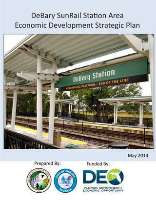
  • 1. Prepared By: DeBary SunRail Station Area Economic Development Strategic Plan May 2014 Funded By:
  • 2. 2 Table of Contents Introduction...................................................................................................................................................3 Existing Conditions Analysis...........................................................................................................................5 DeBary SunRail Station Study Area Current Land Uses.......................................................................5 Vacant Land.........................................................................................................................................5 Nonresidential.....................................................................................................................................6 Residential.......................................................................................................................................... 7 Conclusions.........................................................................................................................................7 Existing Conditions Map Series............................................................................................................7 DeBary Industry Profile.......................................................................................................................9 Current Policies and Regulations Assessment.............................................................................................10 DeBary Comprehensive Plan Policies Assessment.............................................................................10 DeBary Station Regulatory Framework..............................................................................................14 DeBary TOD Implementation.............................................................................................................19 DeBary Economic Strategic Plan..................................................................................................................19 Industry Specialization........................................................................................................................19 Economic Development Recommendations......................................................................................23 TOD Funding Strategies......................................................................................................................24 Economic Development Plan Goals, Objectives, and Strategies..................................................................27 Appendix I - Maps........................................................................................................................................32 Appendix II - Land Use Categories................................................................................................................39 Appendix III - Volusia County Business Agglomerations..............................................................................40 Appendix IV - Targeted Industries................................................................................................................45 Appendiz V - TOD Case Studies.....................................................................................................................46
  • 3. 3 Introduction Central Florida’s commuter rail transit service, SunRail began operation in May of 2014. The 61 mile SunRail corridor runs along the CSX rail line linking communities across Orange, Osceola, Seminole and Volusia counties. An important part of the SunRail project is the activation of its seventeen commuter rail stations. In 2010, the East Central Sustainable Communities Consortium (a partnership between the Regional Planning Council and twenty-six agencies and local governments) was awarded a $2.4 million grant from the Department of Housing and Urban Development to plan for sustainable transit oriented development around future SunRail station locations. The majority of the Sustainable Communities grant funds will be passed directly to local governments to develop and prepare for implementation of these community planning efforts. SunRail represents a historic opportunity to transform Central Florida communities by using commuter rail service as a catalyst for sustainable and inclusive growth, particularly in minority and/or low-income neighborhoods adjacent to the stations. The Sustainable Communities funding supports detailed station area planning for six out of twelve Phase I SunRail stations, including DeBary, affordable housing assessments for all twelve Phase I stations, and regional collaboration to share best practices and to guide future transit planning in East Central Florida. Figure 1: DeBary TOD Overlay District Currently the City of DeBary is the only Volusia County municipality with access to the SunRail commuter rail system. The station is located near the intersection of Fort Florida Road and U.S. Hwy. 17-92 (Figure 1).
  • 4. 4 The plans for the station call for a park and ride lot with a bus drop-off area. As part of its planning efforts, the City of DeBary is conducting studies on infrastructure feasibility, developing bicycle/pedestrian initiatives, and completing a workforce housing assessment. The City Council also adopted the city's Evaluation and Appraisal (EAR) based amendments, which includes a Transit Oriented Development (TOD) Overlay District. This planning concept integrates land use and transit by promoting the combination of residential and nonresidential uses within a comfortable walking distance to maximize access to public transportation. DeBary’s TOD Overlay District comprises approximately 262 acres and is located on the south side of Dirksen Road on the east and west sides ofU.S. Hwy. 17-92; running approximately 210 feet south of Buckley Drive. The TOD Overlay District is divided into three parts: TOD Core, Outside TOD Core, and Transitional areas. Figure 2: DeBary TOD Overlay District by Subarea The purpose of the DeBary SunRail Station Economic Strategic Plan is to serve as a blueprint for the long term development of the City’s TOD area. The document is divided into three main sections. The existing conditions analysis provides an overview of the land use and economic characteristics of Debary’s TOD Overlay area. This is followed by an assessment of Debary’s Comprehensive Plan policies and the regulations that govern the TOD Overlay. For a more throughout analysis, the ECFRPC compared Debary’s TOD site standards and regulations with those of similar projects from across the nation. This section also discusses some of the challenges faced by these jurisdictions to implement their TOD projects. SunRail will not only improve DeBary’s connectivity to the region, but it also has the capacity to create new economic development opportunities for the city. The economic strategic plan suggests several industries that could locate in the station area based on Volusia County’s and DeBary’s competitive advantages. It also provides a list of potential funding sources to help implement the TOD project. Finally, the project lists a series of strategies to implement the ECFRPC recommendations and make the City’s vision a reality.
  • 5. 5 Existing Conditions Analysis This section of the project will identify the DeBary SunRail Station study area’s existing resources and characteristics based on the best available information. This will include an analysis of the current land uses as wellasaprofileofthecurrentconditionsoftheareadevelopedusingGeographicInformationSystem(GIS)data. DeBary SunRail Station Study Area Current Land Uses The DeBary SunRail Station study area includes nearly 202 acres of land which are divided into 41 parcels. As part of the existing conditions analysis, the ECFRPC prepared a current land use map using Volusia County Property Appraiser land use codes (refer to Current Land Use map in Appendix I). This map details the most recent characteristics of the study area. In order to simplify the analysis, similar land use codes were combined into three main land use categories: vacant, residential, and nonresidential. The complete list of DOR codes can be foud in Appendix II. Figure 3: Total Number of Parcels and Acreage by Current Land Use Figure 3 depicts the number of parcels and the amount of acreage by current land use. A description of each land use is provided below. The largest land use category is vacant land, followed by nonresidential and residential uses. Vacant Land Vacant land comprises about 81 percent of the land within the DeBary TOD. Most vacant land within the TOD boundary is classified as agricultural or industrial, and there are three significant agglomerations as depicted in Figure 4. There are two large clusters of undeveloped land in the northern part of the study area. West of U.S. Highway 17-92, there are nine parcels of vacant industrial land that total approximately 40 acres (Figure 3 see #1). These properties have multiple owners which could make it more difficult to plan cohesively. Some of the largest vacant parcels are classified as agricultural and are located east of 17-92. They are assessed as pasture land so there is not crop activity in the area. While agricultural land is predominant in the DeBary TOD area, this is not a viable long term use for these properties. The largest agricultural parcel is 55 acres and is part of a group of contiguous properties owned by the DeBary Town Center LLC (Figure 3 see #2). There is another large agricultural parcel on the southeastern side of the study area (Figure 3 see #3). The size of this lot is about 47 acres. These large tracts of land provide the best opportunities for development, but the City must find ways to connect them to the SunRail station.   1. For the purpose of this study, properties classified as vacant and agricultural uses were grouped together to create a new vacant land use category. This was done because agricultural land does not fit with the development of a TOD concept
  • 6. 6 Figure 4: Vacant Parcels within the TOD Boundary In addition to the industrial and agricultural parcels, there are also vacant residential and commercial lots scattered on the east side of U.S Highway 17-92. Most of these properties are noncontiguous and less than five acres which could hinder their development potential. Nonresidential The nonresidential land use category includes all properties that contain existing office, commercial, institutional, and industrial uses. These nonresidential uses comprise less than 15 percent of all the land in the study area. Most of this land is owned by government and utility companies. It includes 7.6 acres owned by the Florida Department of Transportation where the SunRail station is being developed. To the south of these properties are another 6.6 acres owned by Florida Power and Light. All of these properties are adjacent to the SunRail tracks and U.S. Highway 17-92, and thus might be prime land for development in the future. There are another eight nonresidential parcels within the study area that comprise about 15 acres. These properties tend to be small and are dispersed throughout the study area.
  • 7. 7 The Beaulieu property includes two contiguous parcels that comprise about 10 acres. This site is home to a junkyard/salvage yard. This property would require some type of environmental remediation before more intense development can occur. The other lots contain small buildings such as warehouses and offices. Residential There are only three parcels developed for residential purposes in the study area. These include two single family homes on the east side of US Hwy 17-92 and the Lake Villa Estates Mobile Home Park north of Fort Florida Road. Conclusions With over 81 percent of the land being classified as vacant, the DeBary SunRail Station study area contains plenty of land that could be developed. The agricultural parcels are large which bodes well for future development. There is also group of properties owned by Florida Power and Light to the south of the commuter rail station. Some of this land could be developed in the future. On the other hand, most of these large parcels are located on the east side of the rail corridor. These properties will need to be better connected to the train station to make any future developments successful. This challenge has been recognized by the City of DeBary which is using some of the Sustainable Communities funds to develop a bicycle and pedestrian infrastructure study for the TOD area. The success of the DeBary station will depend on creating a destination that is walkable and interconnected. This analysis also found that most parcels within the TOD area are less than five acres and are owned by multiple parties. This could hinder redevelopment of the area or lead to piecemeal development. The City of DeBary could create policies within the Overlay District that promote the aggregation of parcels before development. Finally, the Beaulieu property is a potential brownfield site that will require some environmental remediation before it can be developed into another use. Existing Conditions Map Series The maps included in this analysis serve as a snapshot of the current conditions and characteristics of the City of DeBary, Volusia County, and the DeBary Train Station study area. The will include a series of the following maps: Study Area Basemap, TOD Overlay, Biodiversity Hot Spots, Current Land Uses, Emergency Services, Future Land Use, Transportation Network, Utility Services, and Wetlands. All maps and figures can be found in Appendix I. Study Area Basemap The basemap includes fundamental information about the study area that will be used with data sets related to the project. This dataset includes: an ESRI™ generated layer that includes roads, geographical features, landmarks, and water bodies; a boundary of the City of DeBary; a boundary of the DeBary SunRail Station study area. TOD Overlay The TOD Overlay area is comprised of several properties located between Benson Junction and Dirksen roads on the north and Buckley Drive on the south. U.S. Highway 17-92 bisects the study area.
  • 8. 8 The Biodiversity Hot Spots map includes information provided by the Florida Fish and Wildlife Conservation Commission (FFWCC). This data contains information related to the biological diversity of 44 focal species and predictive habitats. Within the Study Area, there are three categories of hotspots based on the number of potential species: 0 – 2, 3 – 4, and 5 or more. While the study area appears to contain some potential biodiversity hotspots near the north and south edges of the site, this information would need to be verified with a groundtruthing study. Current Land Uses The Volusia County Property Appraiser’s Office classifies the properties within the TOD area into 16 different land use categories. For analysis purposes, these codes where consolidated into three main groups. Emergency Services The Emergency Services map includes locational information of fire stations and police patrol zones. The DeBary SunRail Station study area is in Sheriff Office Zones 61 and 62. The zones are divided by U.S. Highway 17-92. The area is serviced by DeBary Fire Station #29. Future Land Use The entire study area is designated as the South East Mixed Use Area (SEMUA). The SEMUA Future Land Use designation is one of DeBary’s mixed use land use classifications. The City has introduced specific regulations for this area (besides the overlay) and requires rezoning to the Planned Development (PD) Zoning District before any construction is allowed. Transportation Network The area’s transportation network is comprised of rail, roads, and trails. The SunRail tracks and station are located on the west side of the TOD overlay area. The main roads are U.S. Highway 17- 92, which bisects the TOD area, and Interstate 4 located to the east. Other important streets are Fort Florida Road, which is the main east-west connector, and Benson Junction Road north of the TOD overlay. The station area is also connected to the Spring to Spring Trail which connects several historic and natural amenities. This trail is a recreational asset that could also spur economic activity. Utility Services The Utility Services map includes information about the local utility service area in relation to the study area. Water and sewer services are provided by Volusia County. Wetlands The Wetlands map provides geographical information of identified wetlands based on the Florida Land Use and Cover Classification System (FLUCCS). The data is derived from photo-interpreted aerial photographs to determine land use/land cover features and then categorized by FLUCCS. Figure 5 represents wetland types and the total acreage identified within the study area. Biodiversity Hot Spots
  • 9. 9 DeBary Industry Profile The objective of the economic profile is to identify the major industries that comprise DeBary’s business structure, which could help pinpoint the City’s competitive economic advantages. The information used in this profile was provided by Infogroup’s ReferenceUSA.gov, an online reference service that contains information on more than 14 million businesses. Figure 6 shows the economic profile for the City of DeBary. Businesses were categorized using the North American Industry Classification System (NAICS), a coding standard that classifies firms based on their production processes. Fifty-two percent of the businesses in the City of DeBary fall within three supersector groupings: Professional and Business Services (20.5%); Trade, Transportation, and Utilities (17%); and Construction (14.8%). The Professional and Business Services supersector includes businesses that provide technical expertise or support activities to organizations and businesses. Establishments within this category include law firms, engineering companies, and administrative services. The Trade, Transportation, and Utilities group encompasses all establishments in the retail trade, wholesale trade, and transportation industries. The high concentration of businesses in these particular industries might be partly due to the City’s proximity to the rail line. Finally, construction contractors might be benefiting from having access to warehouse space in the area. Figure 6: Number and Percentage of Establishments by NAICS Supersector in the City of DeBary 2. A supersector is an aggregation of NAICS 2-digit sectors done by the U.S. Economic Classification Policy Committee (part of the U.S Bureau of Labor Statistics) for analysis purposes. The 20 NAICS industry sectors (excluding unclassified establishments) are grouped into 11 larger categories to facilitate data analysis. More information on supersectors can be found at http://www.bls.gov/ces/cessuper.htm. Figure 5: Wetlands
  • 10. 10 There are six businesses within the DeBary TOD Overlay District area (Figure 7). Most of these businesses are probably located within this area because they need space to park commercial vehicles, store unsafe materials, utilize outside storage, or perform intense work onsite such as car repairs. As the area develops, there could be conflicts between these uses and new businesses. Figure 7: Existing Businesses within the DeBary TOD Overlay District Current Policies and Regulations Assessment The next part of this analysis assesses the comprehensive plan policies and regulations developed to implement the TOD Overlay District. The successful implementation of any initiative requires that it be grounded in the realities found in the field. Therefore, this assessment takes into account the findings of the existing conditions analysis. DeBary Comprehensive Plan Policies Assessment ECFRPC staff reviewed the City of DeBary’s Comprehensive Plan Goals, Objectives, and Policies (GOPS) to select those policies that could have an influence on the development of the TOD Overlay District. The intent of these policies was evaluated based on the findings of the existing conditions analysis. The selected policies can be found below organized by Element. Figure 8: City of DeBary Economic Development Policies Source: City of DeBary Comprehensive Plan GOPS, 2010
  • 11. 11 The City’s current economic development policies strive to create a good business environment by promoting business recruitment, providing a good mix of land uses across the city, and creating strong employment centers. None of these policies currently address the TOD Overlay District directly. This area could become a new destination center for Volusia County, but it would require new policies to make this a reality. Multiple ownership of the area’s parcels and a lack of adequate infrastructure pose significant challenges. The City needs to make parcel aggregation a goal in the TOD area. Any infrastructure prob- lems could be addressed through the Capital Improvements Plan. Moreover, there might be opportu- nities to use the state and federal brownfields programs to redevelop some of the parcels within the Overlay District. Figure 9: Future Land Use Policy for the TOD Overlay District Figures 9 and 10 depict the future land use policies that address the TOD Overlay District area. FLU policy 5.1097 addresses land use compatibility issues within the DeBary area. This is important because it protects the long term viability of the TOD. Policy 5.406 describes the Southeast Mixed Used Area (SEMUA) Future Land Use designation, which permits commercial, light industrial, lodging, and medium density residential uses along U.S Highway 17-92. The maximum residential density allowed is 8 du/acre and the intensity for nonresidential uses is limited to a floor-area-ratio (FAR) of 2 to 1. Retail development is only allowed as an accessory use to a larger development, not as a free standing use. Finally, all developments within this mixed use area are required to be approved through the planned development process, and require infrastructure to be in place before the construction of any phase. Policy 5.406(5) established the transit oriented development (TOD) overlay within the SEMUA, and opt-in based district that promotes the development of compact and pedestrian friendly environment around the DeBary SunRail station (Figure 10). Making the TOD Overlay District optional might not be a good idea, as the properties within the study area are owned by multiple parties which can make cohesive development more challenging near the station area. Sources City of DeBary Comprehensive Plan GOPS, 2010
  • 12. 12 Figure 10: DeBary FLU Policy 5.406 (5) (a) and (b) Section c) of Policy 5.406 (DeBary GOPS, 2010) details the desired land use percentages for the TOD Overlay District by subarea. The purpose of the TOD designation is to develop higher density mixed use developments within walking distance of public transportation. The mix of uses (residential, office/commercial) also favors a pedestrian environment. TOD projects have become ubiquitous in cities served by mass transit, including commuter rail. These projects also help to boost mass transit ridership and create communities with a sense of place. In the case of the Debary SunRail Station, the TOD Overlay District’s land use densities vary depending on their proximity to the rail line. • Commercial Retail and Services-Maximum 40 percent within ¼ mile of the DeBary Commuter Rail Station and maximum 12 percent within the remainder of the SEMUA/TOD • Office-Minimum 10 percent within the SEMUA/TOD; maximum 40 percent within ¼ mile of the DeBary Commuter Rail Station and maximum 20 percent within the reminder of the SEMUA/TOD • Hotel /Conference Center- Maximum 10 percent within SEMUA/TOD • TOD Residential (14 to 32 DU/acre) - Minimum 30 percent and maximum 65 percent within SEMUA/TOD. The highest residential density shall be concentrated within ¼ mile of the DeBary Commuter Rail Station with a minimum 16 DU/acre to a maximum of 32 DU/acre. In the remainder of the SEMUA/TOD, residential density shall a minimum of 14/DU/acre to a maximum of 20 DU/acre. The regulations emphasize the development of residential uses within the TOD (as much as 65 percent). This is important because the area is mostly vacant, and the addition of new residential units will potentially increase the number of SunRail riders. The overlay district recognizes the difficulties of some of the small lots within the study area by allowing the property owners some flexibility. There is also an opportunity to create an employment center near the station area. Source: City of DeBary Comprehensive Plan GOPS, 2010
  • 13. 13 Per the existing conditions analysis, most of the TOD area is currently vacant or has a suburban context. Moreover, the area is separated by U.S Highway 17-92. These two characteristics will make implementation of the TOD Overlay very challenging. FLU Policy 5.407 created a TOD Overlay District “to encourage compact development and require street design that creates public space that is safe and welcoming for pedestrians.” There will also likely be some pressure to approve strip mall patterns of development on the properties along the highway. This is another reason why allowing the TOD Overlay District to be optional may not be a good policy. The challenge will be to create that pedestrian connection between the two sides of the study area. The Urban Design principles described in Policy 5.502(k) such as buffering, signage, and intermodal connections could help to improve the pedestrian environment. There are three transportation policies that specifically refer to the DeBary SunRail Station (Figure 11). Hence, they will also affect the implementation of the TOD Overlay District. These policies address the City of DeBary’s role in promoting alternative modes of transportation. The policies do not mention the Votran bus service or the Volusia Transportation Planning Organization, which are two very important partners in the passenger transportation process. Figure 11: Transportation Element Policies for the DeBary SunRail Station Finally, there are three policies in the City’s Public Facilities Infrastructure Element that address sanitary sewer, storm water management, and solid waste provision. For the TOD Overlay District to be successful, the City of DeBary must work to correct any infrastructure deficiencies that could impede the densification of the area. This relates to Policy 3.301, which discusses the development of the Capital Improvements Plan (CIP) annual budget. The SEMUA FLU designation requires adequate infrastructure to be in place before the development of any projects, which could help with infrastucture provision.   Source: City of DeBary Comprehensive Plan GOPS, 2010
  • 14. 14 DeBary Station Regulatory Framework In addition to targeting specific industries, the success of the DeBary Station area will depend on having the right set of regulations. While the TOD concept has been discussed for several years, it is not until recently that many of these developments began to be built. For discussion purposes, the ECFRPC looked at several other TOD projects within suburban rail stations across the United States to compare their regulations with DeBary’s TOD area. The ECFRPC identified three cities that have implemented, or are in some stage of implementing, TOD projects: Lebanon, Tennessee; Farmington, Utah; and Aberdeen, Maryland. Each city utilizes a different transit system, and they were selected based on their similarities with the City of DeBary. All cities had approximately the same number of residents, the station areas front or are near major arterial roads, and they are located near the end of the rail lines. The ECFRPC examined the land-use designations, urban design standards, strategies, and policies of each of these TODs to provide recommendations best suited for the DeBary Station Area. The analysis focused on land use requirements, zoning site standards, other site regulations, and implementation challenges. More information about these case studies can be found in Appendix V. Figure 12: Comparison of TOD Subdistricts The DeBary TOD overlay is divided into four main districts: U.S Highway 17-92, TOD Core, Outside TOD Core, and Transitional Areas (Figure 12). Both cities of Farmington and Aberdeen each have three districts, while the City of Lebanon has five. The lower amount of districts simplifies the implementation of the TOD code. Farmington and Aberdeen follow a transect model of development where the mixed use, regional scale, and higher intensity uses are to be located in a core district. The two additional districts facilitate a transition from more to less intense development. Lebanon has deemed these sub districts villages, and they are governed by density/intensity and have very specific roles. For example, the Village Commercial sub district, fronting Highway 70 is expected to be comprised of traditional highway commercial uses combined with office. It recognizes that a major road creates pressures to develop suburban type commercial uses. This could potentially occur within parts of the DeBary TOD fronting 17-92, and it is addressed in the code mainly through streetscape design standards and by only allowing drive-through uses within this sub district. Based on the size and depth of several of these lots, most of these parcels will likely become commercial uses and may not be suitable for residential uses. Sources: City of DeBary, City of Lebanon; City of Farmington; and City of Aberdeen TOD Ordinances
  • 15. 15 Figure 13: Density and Intensity Requirements by TOD Sub District Sources: City of DeBary, City of Lebanon; City of Farmington; and City of Aberdeen TOD Ordinances These jurisdictions vary in the degree of density and intensity allowed in each of their sub districts (Figure 13). The City of DeBary adopted minimum and maximum densities for all of its sub districts. Developers in the Core sub district are allowed between 16 du/acre and 32 du/acre. The other two districts are less intense, allowing between 14 du/acre and 20 du/acre. The City of DeBary also adopted a maximum intensity of 2.0 FAR. Overall, the ECFRPC thinks that DeBary’s TOD density/intensity regulations are good aspirational goals. However, the suburban nature of this area and the high number of vacant properties could act as deterrents to the realization of the higher densities. The other cities studied, with the exception of Aberdeen, opted to adopt lower density and intensity requirements than DeBary. The City of Lebanon adopted density requirements between 5 and 25 du/acre. Farmington opted not to have a density limit on its core district. However, the maximum residential density on its residential districts is 13.25 du/acre. Aberdeen’s decision not to adopt any density requirements is probably due to the city adopting a form based code for the area near its rail station. While density and intensity requirements are important, the zoning site standards are key guidelines for the successful implementation of TOD communities. These standards include minimum lot size and lot width requirements, setbacks, and height restrictions. The City of DeBary decided to adopt site standards that vary depending on the proposed uses in the property (single-family, multifamily, and nonresidential). The DeBary TOD does not have minimum lot size requirements for residential uses. The lot size requirements for nonresidential uses range from 5,000 feet for commercial uses to 43,560 feet for mixed uses. Only commercial uses require a minimum lot width (front building line), which is 50 feet. Property setbacks vary by use and sub district. The maximum height allowed in the DeBary TOD is 45 feet, which translates to about three stories.
  • 16. 16 Figure 14: Site Zoning Standards Like DeBary, none of the cities studied adopted minimum lot size standards. This decision helps to provide flexibility for the development of these communities. However, the minimum lot width requirements were different for all of the cities. The City of Lebanon does not specify any minimum lot width. However, it requires all building facades to have frontage between 50 and 70 percent of the lot size. Farmington’s minimum lot width requirements range from 30 feet in the Core sub district to 50 feet in the Secondary sub district. There are several reasons why it is important to have lot width requirements. First of all, in urban areas they can help make the environment more hospitable for walkers. On the other hand, they also discourage less intense development and promote the consolidation of lots. In the case of DeBary TOD area, which has several small lots, this might be a good tool to promote the consolidation of parcels. Another important urban design standard is property setbacks. These tend to be lower in urban districts to allow more intensity on smaller lots and to promote more cohesion between buildings. With the exception of clustered communities, property setbacks tend to be larger in suburban districts. All the communities studied want to promote a compact and walkable environment. Therefore, their setbacks tend to be low. In the case of Lebanon, the development decided to adopt streetside zones and buffer yards rather than setbacks. A buffer yard is a landscape requirement used by traditional neighborhood developments to allow mixed uses. The width of the buffer is applied to the type of vegetation that will be used to separate the uses. Streetside Zones are the portion of the right-of-way between the back of the curb and the property line. In the case of Hamilton Springs, these buffer yards and streetside zones differ depending on the sub district and the type of street abutting the property.
  • 17. 17 Finally, height requirements help to promote the construction of multifamily developments within the TOD. The height restrictions adopted by these TOD communities range from 24 to 100 feet. These requirements translate into developments with buildings between one (single-family units) and nine stories (office towers). Based on the previous discussion, the City of DeBary adopted an adequate number of TOD sub districts that allow higher densities in the core and transitional areas. Just like the City of Lebanon, DeBary will also face pressures to develop highway commercial uses on the parcels facing the major roads. Adopt- ing a different sub district for this area was a very good decision. Because of the suburban location of the City’s station, the DeBary TOD may experience some problems developing to the adopted densities. The DeBary TOD criteria is currently considered as optional, which is an additional deterrent to reaching the desired densities. There are two options that the City can consider to address these challenges. First, DeBary could consider lowering its minimum densities to a number between 5 and 14 units per acre. The other cities studied had lower minimum densities or none at all. On the other hand, DeBary may want to adopt higher densities and stricter zoning requirements for the parcels located within the TOD area. While none of the TODs adopted lot size standards, two of them have minimum lot width requirements. In the case of DeBary, lot width standards may facilitate the consolidation of parcels in the TOD area. Finally, the City of Aberdeen is an example of how perceptions about safety can affect the development of a TOD project. The DeBary station will benefit from connecting the two sides of the TOD area, probably through a pedestrian bridge. This will allow commuters to feel safe when they use the station. TOD Implementation The ECFRPC believes it is important to discuss the experiences that these communities have had while implementing their TOD districts, especially financing options and specific challenges. This information should help DeBary to anticipate some of the implementation challenges it might experience as it develops the TOD area. Figure 15: TOD Financing Each jurisdiction has taken a different approach to the development of their commuter rail stations. In Lebanon, the Regional Transit Authority received a $1.6 million grant from the Federal Highway Administration’s Congestion Mitigation and Air Quality Improvement Program to develop the new rail station. However, the station is being built by a single developer. Farmington is following the same approach. Sources: City of Lebanon; City of Farmington; and City of Aberdeen TOD Ordinances
  • 18. 18 Finally, these three projects have grappled with different challenges that have deterred their implementation. In the cases of Lebanon and Farmington, the projects were delayed because of the economic recession. Both developments are currently active. In the case of Aberdeen, the lack of access to the station has been a problem. Passengers arriving on one side of the station need to cross via a circuitous pedestrian bridge or through an unwelcoming tunnel below the station. Moreover, the commuter rail station is unattended for most of the day, giving a perception of poor security in the vicinity of the tunnel. This is a lesson for the DeBary commuter rail station. Commuters want direct access to the station and to feel safe when they are commuting. This is a good argument to consider building a pedestrian bridge across 17-92 to help the development of the east side of the TOD. Figure 16: Implementation Challenges The TOD site is already home to a large commercial development, and its owners are also working on the TOD development. The Aberdeen TOD is the only one that has used government programs to support its development. In 2009, both the City of Aberdeen and Harford County were designated as BRAC zones. This designation provides incentives to fund infrastructure improvements. Moreover, in 2010 the Aberdeen station area was designated for TOD support by the State of Maryland. This designation allowed the Maryland Department of Transportation to partner with local leaders to advance TOD, allowing planners to pursue a broader range of grant and local financing mechanisms. As one of the partner governments within the HUD Sustainable Communities Consortium, the City of DeBary has received funds to plan a variety of projects within the TOD area. Other prospective funding options for the implementation of the DeBary TOD are discussed later in this report.
  • 19. 19 Economic Strategic Plan The successful integration of the DeBary TOD area into the City of DeBary will be partially dependent upon careful planning that emphasizes the area’s assets and addresses its challenges. The purpose of this strategic plan to develop a framework for potential industries that could be located with- in the study area. For this economic analysis, the ECFRPC utilized three primary criteria to recommend industries:industryspecialization,targetedindustries,andotherindustries.Industryspecializationreferstothe industries that make the region economically competitive at the national level. DeBary could target these types of businesses to complement the strengths of the region. Targeted industries are those promoted by the state and regional economic development agencies to diversify the local economy. Finally, this report will discuss other economic industries/concepts that might not be included in the previous options. Industry Specialization When developing an economic strategy, it is important to understand the difference between traded and non-traded industries. Traded industries sell their products across different regions, and thus their growth is not dependent on local factors, but on national and international demand. On the other hand, non-tradedindustriesarethosethatprovidegoodsandservicesalmostexclusivelytoareasproximatetowhere they are located. For economic development purposes, it is important to understand the difference in the impacts that traded and non-traded industries have on the local economy. Regional growth is driven by traded industries because they have a higher multiplier effect on jobs and investment and generate money from outside of the region. Conversely, the economic effect of non-traded industries is smaller. Rather than generating additional demand, firms within a non-basic sector compete against each other for a share of the local market. To identify traded industries within the region, planners use Location Quotients (LQ). This is the ra- tio that compares the percentage of employment in a particular industry to the percentage of employment in the same industry in a reference economy (McLean and Voytek, 2000). For the purpose of this analysis, Volusia County was used as the local economy and the United States served as the reference economy. The LQ measure is popular because it is easy to understand. A ratio higher than 1 implies that there is an excess capacity in that particular industry, meaning that the local economy probably exports these goods and services to other jurisdictions. Figure 12 depicts the industries with the highest LQs in Volusia County. Volusia County has a high specialization in agricultural industries (nurseries and orange groves), several types of manufacturing, and industries related to tourism services. Another important principle of economic development is business agglomeration. Similar businesses tend to agglomerate because they benefit from being close in proximity to one another. These agglomerations usually include groups of producers, suppliers, and other organizations that work with each other. Based on the strength of the Location Quotient and the number of business, the ECFRPC found that Volusia County had several significant business agglomerations which are described below.
  • 20. 20 Figure 17: Comparison of LQs for Selected Industries in Volusia County • Real Estate and Construction: This grouping includes a variety of specialty trade contractors that are usually subcontracted by larger companies to perform specific building activities such as site preparation, carpentry, roofing, and painting. Volusia County has a very robust residential construction industry, most likely spurred by the strength of tourism and the second home market. These contractors purchase some of their supplies from local hardware stores and other building materials dealers. • Nursery and Floriculture: This agglomeration is mainly comprised of wholesale distributors of flowers and nursery stock. It also includes establishments that provide specialized services to the floriculture industry including plant fertilizers and tissue culture companies. 3. Business agglomerations can include a variety of businesses and services. The decision to combine industries together into an agglomeration is usually left to the researcher’s discretion based on previous experience and other information. For this study, the ECFRPC used a search engine to find more information about individual companies before including them in an agglomeration. The complete list of industries by agglomeration can be found in Appendix I. • Transportation Equipment and Other Machinery Manufacturing: Volusia County is home to one of the most important NASCAR races (the Daytona 500), one of the nation’s largest motorcycle events (Bike Week), and several marinas. This has led to an agglomeration of companies that manufacture and dis- tribute parts for boats, race cars, and motorcycles. Most of these companies are located along the coast. Near Deland, there are companies that specialize in robotics and factory automation systems. • Leisure and Recreation: This agglomeration includes companies directly involved in leisure and hospitality such as lodging establishments (hotels, campgrounds), travel arrangement services, and recreational facilities (marinas, golf courses).
  • 21. 21 • Health Care Services: Volusia County has many facilities that provide ambulatory procedures and treatments. Establishments within this group include physician offices, emergency medical services, and other health practitioners. The County’s strength in medical services may be due to the large number of retirees living in the area (see the Retirement and Senior Services agglomeration). • Retirement and Senior Services: Volusia County shows a high level of specialization for companies that provide residential and personal care services for the elderly, including assisted living facilities, on-site nursing care, and home health care services. • Direct Marketing and Research: Volusia County has several companies that focus on preparing product mailings and catalogs. The County is also home to several telemarketing call centers and specialized advertising agencies. This group also includes clinical research trial companies. • Other Manufacturing: Besides vehicles and machines, Volusia County has developed strengths in other manufacturing areas such as metal alloys, cosmetics and skin products, and medical and laboratory products. The Metal Alloys and Other Materials sector includes companies that develop specialty materials for a variety of industries including boats, semiconductors, and aerospace. The Cosmetic and Skin Products sector includes companies that develop sunscreen and antiaging creams. Finally, companies within the Medical Devices and Laboratory Products sector develop a variety of products including prosthetics, x-ray machines, and medical billing software. Figure 18 shows the DeBary businesses categorized by business agglomeration. The largest agglomeration in DeBary is Real Estate and Construction with 140 establishments. Although there are no hospitals within the city limits, Health Care Services is the second largest agglomeration, totaling 35 businesses. DeBary is a lso home to several businesses that fall within the Nursery and Floriculture, Transportation and Other Machinery Manufacturing, Tourism and Leisure, Senior and Retirement Services, and Direct Marketing Research agglomerations. One important asset of the DeBary SunRail station is its proximity to several natural amenities such as Gemini Springs Park, which directly connects with the St. Johns River-to-Sea Loop via the nearby Spring- to-Spring Trail. This multiuse trail will connect Orlando to the east central Florida coast. The ECFRPC considers the trail to be an important economic asset that could make the DeBary SunRail Station a desirable destination.
  • 22. 22 Targeted Industries Targeted industries are those that are pursued by the state and regional economic development agencies to diversify the economy and create higher paying jobs in the region. Because they complement the economic competitiveness of the region, every economic development plan must consider these industries. Moreover, the City of DeBary may receive assistance from these economic development entities when recruiting businesses within these industries. These targeted industries encompass a variety of businesses (see Appendix IV for more information). Based on the ECFRPC’s research, Enterprise Florida and Team Volusia are focused on attracting 10 industries: • Manufacturing • Regional Headquarters • Aviation/Aerospace • Logistics and Distribution • Financial/Professional Services • Modeling Simulation and Training • Cleantech • Life Sciences • Digital Media • Information Technology Figure 18: Businesses by Agglomeration Source: Inforoup, 2013
  • 23. 23 The City of DeBary is home to several establishments within the Manufacturing, Information Technology, and Logistics and Distribution industries. Thesy are targeted by regional and state economic development organizations because they provide high wage jobs and local investment. The City of DeBary must be careful not to alienate these businesses, including the ones that are already located within the TOD area. While attracting businesses within any of these targeted industries will be positive for the City of DeBary, the industries that may best complement the location of the Debary TOD are Customer Service Centers Regional Headquarters. These industries are employment centers and could make the DeBary station a destination for hundreds of commuters and help spur the development of new housing and commercial developments. Economic Development Recommendations Based on the previous analysis, the ECFRPC recommends that the City focus on attracting the following industries for the development of the DeBary Station area: Leisure and Recreation, Customer Service Centers/Regional Headquarters, and Health Care and Education. These industries are complementary and do not conflict with one another. Leisure and Recreation Industries: The commuter rail station’s proximity to Gemini Springs Park and access to the Spring-to-Spring Trail could make it an important hub for leisure and recreation services in the region. The East Coast Greenway Alliance and Bike Florida are currently working on the 260-mile St. Johns River-to- Sea Loop, a trail that would connect the rural and coastal parts of the state. The organizations consider the DeBary SunRail Station as a catalyst for generating widespread use of the Loop because it connects the area to the Metro Orlando region. The positive economic impact of trails has been well documented in several studies, and in our region the City of Winter Garden serves as an important case study. After the opening of the West Orange Trail, its once dormant downtown was transformed into a destination for trail users. According to a 2011 study prepared by the ECFRPC, the trail represented a total economic impact of $5 million annually for the City of Winter Garden. Most of this impact resulted from visitor expenditures. The establishment of the trail also led to an increase in property values in the downtown area and spurred the development of higher end housing in the City. In DeBary, the economic impact could be greater because the trail is envisioned as a touring stop for long-distance bikers that would require complementary uses such as overnight lodging, meals, and other services. Customer Service Centers/Regional Headquarters: Serving as a suburban commuter rail station, the City of DeBary will probably benefit from attracting a major employer that could draw commuters to the area. Such an anchor establishment could spur additional investment in areas such as retail, housing, and personal services. Based on the location quotients and the total number of establishments, Volusia County has a competitive advantage in attracting direct mailing companies and customer service centers. Direct mailing companies include establishments that specialize in the direct distribution of advertising materials or sell mailing lists to other advertisers. Customer service centers work on behalf of other companiesby promoting their products or services, taking orders for clients, or providing information or assistance regarding a client’s products.
  • 24. 24 Team Volusia is also trying to lure more regional corporate headquarters to the County which provide supporting services or serve as regional branches to larger corporations. The Verizon corporate finance hub that will open in Lake Mary this year is a local example of this type of project. This type of facility could bring between 250 and 700 jobs to the DeBary Station Area, which could spur the demand for additional services such as retail and housing near the station. Moreover, this type of business should not be in direct conflict with the leisure services industry. HealthCare/Education: According to Infogroup, the City of DeBary has over 35 medical establishments, several businesses that serve the elderly, and two clinical research facilities. However, based on the ECFRPC research, there is not a hospital clinic within city limits. Similarly, there are not any institutions of higher education located in the area. These types of facilities could serve as an anchor for the DeBary Station by bringing an influx of daily commuters to the TOD area. Business Incubator: One final use that the City should consider is the establishment of a business incubator in the TOD area. This type of facility helps startup companies by providing them with low cost workspace and a variety of business assistance programs. The University of Central Florida has successfully partnered with several communities across the region to create a network of business incubators. Currently, the only Volusia County incubator is located at the Daytona Beach International Airport. The SunRail station is primed to become a catalyst for the transformation of the City of DeBary. While there is no exact mix of uses that could accelerate development in the area, focusing on the above mentioned industries could help the area become a destination and generate the necessary economic activity. TOD Funding Strategies Available funding is another critical aspect of TOD implementation. Due to the current economic recession, the past six years have been challenging for federal, state, and local governments. For infrastructure projects like SunRail, this has meant a dearth of funding mechanisms. The following programs may assist TOD efforts in the DeBary Station Area. Federal Programs Several programs exist at the federal level that, although not focused on the planning of TODs, could benefit the implementation of the DeBary TOD. Although the amount of federal funds dedicated to these programshasdwindledoverthelastfouryears,theEnvironmentalProtectionAgency(EPA)andtheDepartment of Transportation (USDOT) still have several grant programs that will assist with the financing of this type of project.
  • 25. 25 Brownfields and Land Revitalization Grants The Environmental Protection Agency’s Brownfields Program provides funding to cover the costs of environmental assessment and cleanup activities for areas affected by contamination. The ECFRPC recommends this program specifically to address any environmental issues that may arise at the Beaulieu properties located in the southeast part of the TOD (Figure 19). About eleven acres of this site are currently used as a junkyard. There are different types of grants under this program: • Assessment Pilot Grants - This program provides funding to inventory, characterize, assess, and conduct planning and community involvement related to brownfield sites. The grants range between $200,000 and $350,000, with a performance period of three years. • Clean-Up Grants - These grants provide direct funding for cleanup activities at specific brownfield sites for contaminants including petroleum and hazardous substances. • Targeted Brownfield Assessments - The EPA hires a private contractor to perform the environmental assess- ment activities. Transit-Oriented Development Planning Pilot The Federal Transit Administration authorized the Transit-Oriented Development Planning Pilot to award comprehensive planning grants that can enhance economic development, facilitate multimodal connectivity including pedestrian and bicycle traffic, facilitate mixed-use development, and identify infrastructure needs associated with the transit project. This is a discretionary program funded through appropriations from Congress. A total of $10 million should be made available to support this program in fiscal year 2014. Figure 19. Beaulieu Property in DeBary TOD
  • 26. 26 Transportation Investment Generating Economic Recovery (TIGER) Discretionary Grants The United States Department of Transportation created the TIGER Discretionary Grant program to invest in rail, transit and port projects that deliver the following outcomes: safety, economic competitiveness and recovery, state of good repair, livability, and environmental sustainability. Unlike other DOT programs, TIGER grants can provide capital funding directly to municipalities. TIGER is a highly competitive grants program and requires a local funding match of at least 20 percent of the total project. State Programs The State of Florida also has a Brownfields Program that provides a list of incentives from the Florida Department of Environmental Protection (FDEP), the Department of Economic Opportunity (DEO), and the Florida Department of Revenue (FDOR). Most of the program’s benefits are similar to those available on the federal program. However, housing and mixed use developments within a designated brownfield area can get a sales tax refund for the building materials purchased to redevelop the property. Local Funding Mechanisms Due to budget constraints at the federal level, local governments will need to find ways to finance new infrastructure with local dollars. In the case of DeBary, most of the properties within the TOD area are currently vacant and will require infrastructure improvements to allow for development around the station. Common sources of funding at the local level include Special Assessment Districts (SAD) and Community Development Districts (CDD). Both of these mechanisms require approval from the area’s property owners to be established. Community Development District (CDD) Chapter 190 of the Florida Statutes authorized the creation of CDDs, a local special purpose government, as an alternative method for managing and financing the infrastructure required to support residential and nonresidential real estate investments. The CDD is permitted to issue municipal bonds to pay for infrastructure including water supply and management projects, roads, street lighting, and parks. The CDD can then levy special taxes or assessments on properties within the district to pay for these bonds over time. The State of Florida currently has over 600 CDDs across the state, most of which were approved between 2003 and 2008. Several went into default during the crash of the real estate market because developers were not selling enough homes and did not have enough cash in reserves to cover the bonds. Local governments do not get involved in any of the CDD processes apart from approving the creation of the district. The CDD is controlled by its own Board of Supervisors elected by the landowners in the district. The Board will elect an administrator that will be responsible for administering the CDD bonds and operatingthecommunityfacilities.InanareawithlargevacantparcelssuchastheDeBaryTOD,theCDDmodelisa good funding alternative.
  • 27. 27 Special Assessment District A Special Assessment District refers to a geographic area that receives a tax that is apportioned to properties to recover the costs of public improvements like roads and utilities. This concept is often used to revitalize economically distressed areas or to pay for additional services when there are no other sources of funding. The basic principle is that government must regain the costs of new infrastructure improvements if these investments increase the adjacent property values. This assessment is based on the value of the properties within the district and is usually collected with property taxes. To establish a Special Assessment District within the TOD, the City of DeBary will require the approval of the local property owners. Economic Development Plan Goals, Objectives, and Strategies This section provides a series of strategies based on the findings of this report. These recommendations are presented by topic: Economic Development, Land Use and Community Design, and Funding Sources. Goal 1: POSITION THE DEBARY STATION TO BECOME A CATALYST FOR LONG TERM ECONOMIC DEVELOPMENT One of the most important components of transit systems is their ability to attract new development. On this aspect, the DeBary station’s suburban location puts it at a competitive disadvantage when compared with other SunRail stations like Church Street Station and Florida Hospital. These urban areas have been established for many years and are anchored by institutions that already attract thousands of daily commuters. Based on Volusia County’s industry agglomerations and the City’s economic profile, the City of DeBary should focus on attracting businesses within the following industries: customer service centers/regional headquarters, health care, and higher education. To be successful in this endeavor, the City of DeBary will need to partner with other public and private agencies across the region. The DeBary SunRail Station would benefit from recruiting a company that could attract commuters to the station. On the other hand, the success of the DeBary station will hinge upon finding a specific niche for the TOD area that is not met by other areas in the region. The natural resources available near the DeBary SunRail Station make it an ideal location for the development of recreational uses. Objective 1.1. Identify a major employer that could locate in the DeBary TOD area Strategy 1.1.1. Create a business/marketing campaign for the TOD area that describes the attributes that make DeBary a good place to locate a business Strategy 1.1.2. Coordinate with Team Volusia and the Volusia County Economic Development Department to promote the TOD area to business site selectors and other organizations Strategy 1.1.3. Encourage City officials to participate in tradeshows sponsored by Team Volusia and Enter- prise Florida Strategy 1.1.4. Meet with officials from Volusia County’s higher education institutions to see if there is any interest to build a satellite campus in the TOD area
  • 28. 28 Strategy 1.1.5. Contact the University of Central Florida Office of Research and Commercialization to learn how the City of DeBary can partner to create a business incubator in the TOD Objective 1.2. Use the DeBary station’s connection to Gemini Springs to spur recreational uses along the station Strategy 1.2.1. Continue working with the East Coast Alliance and Volusia County to develop a bike trail con- nection to the St. Johns River-to-Sea-Loop Trail Strategy 1.2.2. Identify properties that may need to be considered as easements for the trail Strategy 1.2.3. Create a tourism and leisure campaign for the City of DeBary that promotes the TOD’s rail and trails connection Strategy 1.2.4. Partner with Visit Florida to promote DeBary as a destination for bicycle enthusiasts Strategy 1.2.5. Develop a market plan for the City of DeBary and the station area Goal 2: SUPPORT THE CREATION OF A COMPLETE COMMUNITY WITHIN THE TOD AREA Communities across the nation have implemented the TOD model in a variety of ways. Based on the case studies discussed on this report, the ECFRPC is not recommending any major changes to DeBary’s TOD regulations. However, some of the challenges that the City will need to grapple with include implementing the TOD vision, working with multiple owners, and finding ways to connect the east and west parts of the TOD area. Objective 2.1. Promote the original vision of the TOD development Strategy 2.1.1. Hold a meeting with all the property owners within the TOD area to discuss the City’s vision for the TOD area and the advantages of developing using the overlay Strategy 2.1.2. Market the TOD area to a national developer that could serve as master planner for the whole community Strategy 2.1.3. Discourage piecemeal development within the TOD by adopting a minimum lot width re- quirement for all parcels Objective 2.2. Facilitate pedestrian and bicycle connections within the TOD district Strategy 2.2.1. Encourage parcel owners to allow cross traffic across contiguous parcels Strategy 2.2.2. Discuss with FDOT the possibility of allowing some traffic calming features along S.R 17-92 near the SunRail Station, which could include lowering the road’s speed limit and installing pedestrian signal lights and crosswalks Strategy 2.2.3. Research the costs of building a pedestrian/bicycle bridge over S.R 17-92
  • 29. 29 Strategy 2.2.4. Continue working with the ECFRPC to create a trails plan for the TOD area Objective 2.3. Make small changes to the TOD regulations to allow for the better planning of the area Strategy 2.3.1. Adopt lower minimum density requirements for the TOD area (between 5 and 14 units per acre) Strategy 2.3.2. Increase the maximum height standard of the TOD to 50 feet (about four stories) GOAL 3: EXPLORE A VARIETY OF FUNDING MECHANISMS TO FINANCE THE IMPLEMENTATION OF THE TOD PLAN One of the most important factors for the success of the DeBary TOD is the development of its infrastructure. The main issue is how to pay for the new improvements needed in the area. This report identified several programs that could be used to finance the implementation of the TOD model in the City of DeBary. The following strategies reiterate some of the information discussed previously in this report. Objective 3.1. Monitor federal and state grant programs to find additional funds for the implementation of the TOD Strategy 3.1.1. Continue working with the ECFRPC on the Sustainable Communities Program Strategy 3.1.2. Watch for opportunities to apply for federal discretionary funding programs like the TOD Pilot and TIGER grants Objective 3.2. Use the Federal and States Brownfields Programs to facilitate the development of sites within the TOD that might be polluted Strategy 3.2.1. Contact the owners of the Beaulieu property to help them designate their property as a brownfield. Objective 3.3. Maximize the availability of local funding resources to implement the TOD Strategy 3.3.1. Use DeBary’s Capital Improvements Plan to fund infrastructure improvements within the TOD Strategy 3.3.2. Promote the use of the City’s opportunity fund in the TOD area Strategy 3.3.3. Assess if there is any interest from the property owners to establish a Community Develop- ment District or a Special Assessment District within the TOD
  • 30. 30 Appendix I Maps City of DeBary Study Area Basemap
  • 31. 31 City of DeBary- TOD Overlay District
  • 39. 39 Appendix II Land Use Categories Source: Volusia County Property Apprasier’s Office
  • 40. 40 Appendix III Volusia County Business Agglomerations Sources: BLS and Infogroup Real Estate and Construction
  • 41. 41 Sources: BLS and Infogroup Sources: BLS and Infogroup Nursery and Floriculture Transportation Equipment and Other Machinery Manufacturing
  • 42. 42 Sources: BLS and Infogroup Sources: BLS and Infogroup Health Care Services Retirement and Senior Services
  • 43. 43 Tourism and Leisure Cosmetics and Skin Products Sources: BLS and Infogroup Sources: BLS and Infogroup
  • 44. 44 Sources: BLS and Infogroup Metals and Other Materials Medical Devices and Laboratory Products Sources: BLS and Infogroup Sources: BLS and Infogroup Direct Marketing and Consumer Research
  • 46. 46 Appendix V TOD Case Studies Lebanon, TN The Regional Transportation Authority (RTA) of Middle Tennessee was created by statute in 1988 to plan and develop a regional transit system for the citizens of Middle Tennessee. The RTA commissioned Music City Star commuter rail service began operations on September 18, 2006. The six-station East Corridor Line runs from Nashville approximately thirty-one miles east to its terminus at the City of Lebanon in Wilson County, pictured below. Lebanon encompasses about 38.63 square miles and had a population of 27,710 in 2012 according to U.S. Census estimates. The present Lebanon Station is located west of the intersection of U.S. 70 and U.S. 231, and three miles north of Interstate 40. Figure 1: Music City Star Commuter Rail Service Plans for a new Music City Star stop in Lebanon are at the epicenter of Tennessee’s first transit- oriented development, Hamilton Springs. The plan will create the rail line’s seventh stop, and the second in Lebanon. The TOD project is located off U.S. 70 about 3.5 miles west of the current Lebanon station. This TOD community is being financed and built by a local developer from the Lebanon area. Figure 2: Current and Proposed Views of the Hamilton Springs Site Hamilton Springs is designed like a traditional neighborhood with a mix of single-family homes, multifamily, and retail uses designed to be within walking distance from each other. Initial plans for the development begun in 2006, but were reworked between then and when construction crews broke ground for the development’s first phase, Hamilton Station, in 2012. Hamilton Station opened in October, 2013. In total, 396 apartment units are planned for the site 221-acre Hamilton Springs TOD.
  • 47. 47 Figure 3: Hamilton Springs Master Concept Plan This TOD development falls within a Specific Plan (SP) zoning district (not an overlay), as described in the City’s Zoning Ordinance. SP’s are context sensitive developments that promote flexibility in the location, integration, and arrangement of land uses, buildings, structures, utilities, access, transit, parking and streets. These SP zoning districts are required to substantially conform to the layout and format of the zoning district regulations in the Zoning Ordinance. All plans for the development are contained in the Hamilton Springs Specific Plan. The development is divided into four sub districts: Village Center, Village, Village Commercial, and Walkable Suburban. The general design standards for each specific sub district can be found in the development’s Master Concept Plan. The document includes a Land-Use Chart that lists all the permitted uses within the community. In 2013, the local Metropolitan Planning Organization completed a Health Impact Assessment to evaluate the possibility of building a school within the community. The analysis concluded that if a school was located within the TOD community, all residents would be within a half-mile walking distance, and busing would not be needed.
  • 48. 48 Farmington, UT The Utah Transit Authority (UTA) began operating the State’s first light rail line to serve the Salt Lake City Metro area in 1999. Since its inception, UTA has made a goal of promoting the development of TOD around stations for the purpose of enhancing community, increasing transit, and generating new revenue sources to fund transit operations. Currently there are numerous TOD developments in some stage of development, including the Farmington stop (highlighted) along the UTA’S FrontRunner line. Figure 4: UTA Rail Station Map Farmington, UT, located in Davis County, is part of the Ogden-Clearfield Metropolitan area. According to the U.S. Census, the 9.86 square mile city had a population of 20,750 in 2012. Around the FrontRunner station, Farmington designated a Transportation Oriented Development Zoning District (TOD Zone) to provide development standards for all the areas in proximity to the commuter rail stop. When rail operation began in 2008, there was little development around the Farmington station. The District Court- house and County jail were within walking distance, and the Lagoon Amusement Park was reachable by shuttle. The decision to construct a TOD development around the Farmington FrontRunner Station was driven by the site’s accessibility. The station is located at the convergence of Interstate 15 and Highway 89.
  • 49. 49 Figure 5: Farmington TOD Regulatory Plan The first phase of the Station Park TOD project consisted of commercial development on 160 acres. The project has generally been regarded as a success. While the project aspires to be a mix of retail, office and eventually residential, shopping is its central element. The developer said the project aims to create a downtown village atmosphere. Station Park, which is estimated to have cost over $200 million, is projected to be completed by spring of 2014. The developer cites Station Park’s prime location as a key factor for its success. Located at the junction of several major highways and arterial connectors and built around a commuter rail stop, Station Park has some of the highest daily traffic counts in the state. A representative for the developer said the goal from the beginning has been to create the finest retail and commercial environment in the Intermountain states. Residential development is in the works for the TOD, and though not directly a part of it, Station Park’s success has spurred residential development nearby. Just north of Station Park, a 320 unit residential development is being developed as the result of an $18.5 million grant from the County’s redevelopment agency.
  • 50. 50 Figure 6: Pictures from Station Park’s Development Aberdeen, MD The Penn Line of the Amtrak Maryland Area Regional Commuter (MARC) rail system runs 77 miles from Washington D.C.’s Union Station to the City of Perryville. The Aberdeen Station is the second to last stop on this line. Aberdeen is also served by Amtrak’s Northeast Regional high speed rail service. Harford Transit operates seven fixed bus routes in the Aberdeen area. According to U.S. Census data, the 2010 land area was 6.80 sq. mi. The estimated 2012 population is 15,018, according to U.S. Census data. Figure 7: MARC Train System
  • 51. 51 In 2012, Aberdeen passed the Aberdeen Comprehensive Plan to be a guide for the physical development of the City until 2030. One objective of the plan included development of zoning requirements that support mixed land use design, TOD, main street development, urban revitalization, transit supportive uses around the train station, and incentives for new businesses and residential development in proximity to TOD. The Aberdeen TOD Master Plan was adopted in March 2012, and the following year the city updated their Development Code to provide for regulations relating to transit oriented development. Figure 8: Views from Aberdeen MARC Station Five TOD concept areas within the 0.5 mile radius identified as the TOD boundary surround the train station. The TOD districts include three transect zones: TOD Downtown (TOD-D), TOD Corridor (TOD-C), and TOD Neighborhood (TOD-N). These areas are illustrated in further detail in the Master Plan. The development of the station has not been as successful as the previous case studies. One of the challenges for the area is a perception of poor security. The station is unattended for most of the day and passengers arriving from Washington D.C. must cross through an unwelcoming tunnel to access their cars.