SlideShare a Scribd company logo
Geostron
INTEGRATED SYSTEM OF SATELLITE AND PARAMETER
CONTROL
Geostron is a powerful complex of applications which allows
companies of different size to monitor status of the moving
objects such as cars, trucks, specialized vehicles, railway
carriages, containers, vessels and, of course, personnel.
Geostron can operate via satellite constellations like Iridium,
Inmarsat and others, thus making it possible to monitor
objects in any part of the world.
Geostron includes a server part and 4 user applications:
Windows client, Web-client, mobile clients for IOS and
Android smartphones.
Windows client provides a powerful and full-featured tool not
only for monitoring, but also for administration of the
customer’s system.
Web-client (supports IE, Chrome and Firefox) and mobile
applications provides flexible access to the system from any
remote site.
Geostron displays position and parameters of all objects in
real time. Apart from the range of standard maps, Geostron
supports user maps and 3D maps, which permits showing
tracks in 3D format, for example, it is very convenient to
observe the tracks of airplanes.
Geostron is an open application. In the front-end, it can
easily be integrated with any hardware monitoring systems
like GSM and/or dual-mode trackers, different kinds of
sensors for solving the monitoring and controlling tasks of
any complexity. It also works with CAN-bus protocol, which
allows customers to have very detailed information about
the vehicles.
In the back-end, Geostron easily integrates with the existing
customer applications like ERP, accounting systems,
warehouse management systems and so on.
It is a scalable system and can monitor tens or tens of
thousands of objects. It enables to automatically monitor
multiple customer-set parameters associated with each
object.
Geostron can create any number of routes and geo-fences
and control the pre-set rules and their relations.
Geostron has a driver’s behavior subsystem that reduces
the risk of road accidents and disciplines the staff of
transport companies.
Geostron has a powerful analytical module: it displays all
controlled parameters both as charts and as graphs, and
integrate them into maps. This allows defining the places of
refilling, speeding, etc.
System Features
 Simplicity and convenience: all apps and
elements of the system have understandable
structure
 Integrativity: interaction with ERP systems,
using equipment of various manufacturers,
creating own sensors and calibration within the
applications
 Global coverage: integration into space
communication systems like Iridium, InmarSat,
alarm events form remote areas
 Maps: universal mapping, custom 3D maps,
multiple maps simultaneous use,
synchronization between them
 Flexible reports system: personal and group
reports, parking addresses, calculated and fact
parameters
 Call center: possibility to get in touch with the
driver from system applications via SIP
telephoning, creating conferences
Technical characteristics
Capacity and efficiency
Routes
 Specified generator
 Creating a route with the help of geographic coordinates
 With the help of two points on the map
 Names of locations
 Use of existing tracks
 Correction via Drag in Drop method
 Variable value of deviation marker
 Route legend generator
Geo-fences
 Specialized generator
 3 types of geo-fences
 A number of settable conditions for control
 Alarm and delayed vents system
 Sound indication
Parameters and events control system
 Telemetry panel to control sensor values
 Digital display of values and active graphs
 System of incoming parameters limitations
 Automatic system of notifications from controlled values events
 Three windows mode: graph, map, tabled data
 Event reports generator
 Superposition of graphs of several parameters for detailed observation of
events
Cartography
 3D maps with active tracks
 Simultaneous use of two types of maps for convenient monitoring with
synchronization function
 User maps with a plug-in for superposition of specialized maps with coordinates
reference
 Construction of 3D tracks for flying objects
Efficiency
 Increasing efficiency of use of vehicles and logistic operations
 Reducing losses connected with fuel theft, unplanned trips, misuse, outages
 Reducing cost of maintenance, increasing the time of service of vehicles
 Increasing safety of vehicles, drivers and cargo
 Statistics, reports and effective planning for managing staff of all levels
More information at:
www.geostron.com Geostron
Avtozavodsky pr., 1, Geostron Rev. 2.3.3/03.15
Naberezhnye Chelny, Russia © Quantor Ltd.

More Related Content

Viewers also liked

モンブラン精密検査ブリーフケース
モンブラン精密検査ブリーフケースモンブラン精密検査ブリーフケース
モンブラン精密検査ブリーフケース
xiuin243
 
Før eftermåling
Før eftermålingFør eftermåling
Før eftermålingSFI-slides
 
Corcas nimmt am regionalen seminar des komitees der 24 in nicaragua teil
Corcas nimmt am regionalen seminar des komitees der 24 in nicaragua teilCorcas nimmt am regionalen seminar des komitees der 24 in nicaragua teil
Corcas nimmt am regionalen seminar des komitees der 24 in nicaragua teil
Tanja Seidemann
 
All about ra & ra necom revolution
All about ra & ra necom revolutionAll about ra & ra necom revolution
All about ra & ra necom revolution
KATU ISAAC
 
Place and goals of biology
Place and goals of biologyPlace and goals of biology
Place and goals of biology
Akilagovt
 
Estudio de Mercado
Estudio de MercadoEstudio de Mercado
Estudio de MercadoDanny Ulloa
 
Roadtripstorypack
RoadtripstorypackRoadtripstorypack
Roadtripstorypack
Joel J. Campbell
 
מצגת נחלת יצחק
מצגת נחלת יצחקמצגת נחלת יצחק
מצגת נחלת יצחק
Noemi Seroussi
 
tugas praktek
tugas praktektugas praktek
tugas praktek
fadhilaharkam18
 
Không gian sống xinh đẹp của 3 nữ ca sĩ nổi tiếng
Không gian sống xinh đẹp của 3 nữ ca sĩ nổi tiếngKhông gian sống xinh đẹp của 3 nữ ca sĩ nổi tiếng
Không gian sống xinh đẹp của 3 nữ ca sĩ nổi tiếng
Thi công sơn giá rẻ
 

Viewers also liked (15)

131204 dikaiakos-youth spark
131204 dikaiakos-youth spark131204 dikaiakos-youth spark
131204 dikaiakos-youth spark
 
モンブラン精密検査ブリーフケース
モンブラン精密検査ブリーフケースモンブラン精密検査ブリーフケース
モンブラン精密検査ブリーフケース
 
Før eftermåling
Før eftermålingFør eftermåling
Før eftermåling
 
Corcas nimmt am regionalen seminar des komitees der 24 in nicaragua teil
Corcas nimmt am regionalen seminar des komitees der 24 in nicaragua teilCorcas nimmt am regionalen seminar des komitees der 24 in nicaragua teil
Corcas nimmt am regionalen seminar des komitees der 24 in nicaragua teil
 
All about ra & ra necom revolution
All about ra & ra necom revolutionAll about ra & ra necom revolution
All about ra & ra necom revolution
 
Place and goals of biology
Place and goals of biologyPlace and goals of biology
Place and goals of biology
 
Estudio de Mercado
Estudio de MercadoEstudio de Mercado
Estudio de Mercado
 
Roadtripstorypack
RoadtripstorypackRoadtripstorypack
Roadtripstorypack
 
מצגת נחלת יצחק
מצגת נחלת יצחקמצגת נחלת יצחק
מצגת נחלת יצחק
 
Sanjeev_Khurana
Sanjeev_KhuranaSanjeev_Khurana
Sanjeev_Khurana
 
201505AnylineEnergyBrief
201505AnylineEnergyBrief201505AnylineEnergyBrief
201505AnylineEnergyBrief
 
tugas praktek
tugas praktektugas praktek
tugas praktek
 
Không gian sống xinh đẹp của 3 nữ ca sĩ nổi tiếng
Không gian sống xinh đẹp của 3 nữ ca sĩ nổi tiếngKhông gian sống xinh đẹp của 3 nữ ca sĩ nổi tiếng
Không gian sống xinh đẹp của 3 nữ ca sĩ nổi tiếng
 
GEOSTRON
GEOSTRONGEOSTRON
GEOSTRON
 
La fête des lumières
La fête des lumièresLa fête des lumières
La fête des lumières
 

Similar to Geostron English S

Cloud Based Autonomous Vehicle Navigation
Cloud Based Autonomous Vehicle NavigationCloud Based Autonomous Vehicle Navigation
Cloud Based Autonomous Vehicle NavigationWilliam Smith
 
mobile mapping survey.pptx
mobile mapping survey.pptxmobile mapping survey.pptx
mobile mapping survey.pptx
sooryaK18
 
IRJET - A Review on Fully Autonomous Vehicle
IRJET - A Review on Fully Autonomous VehicleIRJET - A Review on Fully Autonomous Vehicle
IRJET - A Review on Fully Autonomous Vehicle
IRJET Journal
 
Traffic detection system using android
Traffic detection system using androidTraffic detection system using android
Traffic detection system using android
Editor Jacotech
 
Traffic detection system using android
Traffic detection system using androidTraffic detection system using android
Traffic detection system using android
Editor Jacotech
 
Design and Implementation for Trucks Tracking System Using GPS Based on Seman...
Design and Implementation for Trucks Tracking System Using GPS Based on Seman...Design and Implementation for Trucks Tracking System Using GPS Based on Seman...
Design and Implementation for Trucks Tracking System Using GPS Based on Seman...
ijtsrd
 
Vehicle Tracking System For Commercial Vehicles
Vehicle Tracking System For Commercial VehiclesVehicle Tracking System For Commercial Vehicles
Vehicle Tracking System For Commercial Vehicles
NIET Journal of Engineering & Technology (NIETJET)
 
IRJET- Vehicle Monitoring System using Internet of Things
IRJET- Vehicle Monitoring System using Internet of ThingsIRJET- Vehicle Monitoring System using Internet of Things
IRJET- Vehicle Monitoring System using Internet of Things
IRJET Journal
 
Multi tracking system for vehicle using gps and gsm
Multi tracking system for vehicle using gps and gsmMulti tracking system for vehicle using gps and gsm
Multi tracking system for vehicle using gps and gsm
eSAT Journals
 
Multi tracking system for vehicle using gps and gsm
Multi tracking system for vehicle using gps and gsmMulti tracking system for vehicle using gps and gsm
Multi tracking system for vehicle using gps and gsm
eSAT Publishing House
 
IRJET- Reducing Transportation Cost by Managing Rides using an Android Applic...
IRJET- Reducing Transportation Cost by Managing Rides using an Android Applic...IRJET- Reducing Transportation Cost by Managing Rides using an Android Applic...
IRJET- Reducing Transportation Cost by Managing Rides using an Android Applic...
IRJET Journal
 
UNIT 4.pptx
UNIT 4.pptxUNIT 4.pptx
UNIT 4.pptx
AanshuSingh3
 
Design and development of gps-gsm based Tracking system with google map based...
Design and development of gps-gsm based Tracking system with google map based...Design and development of gps-gsm based Tracking system with google map based...
Design and development of gps-gsm based Tracking system with google map based...
IJCSEA Journal
 
Design and Construction of Navigation Based Auto Self Driving Vehicle using G...
Design and Construction of Navigation Based Auto Self Driving Vehicle using G...Design and Construction of Navigation Based Auto Self Driving Vehicle using G...
Design and Construction of Navigation Based Auto Self Driving Vehicle using G...
ijtsrd
 
Final report
Final reportFinal report
Final report
darshangowda679
 
AssetTrackr - GPS based Vehicle Tracking | Car Tracking for India
AssetTrackr - GPS based Vehicle Tracking | Car Tracking for IndiaAssetTrackr - GPS based Vehicle Tracking | Car Tracking for India
AssetTrackr - GPS based Vehicle Tracking | Car Tracking for India
AssetTrackr Pvt Ltd
 
An autonomous driverless car
An autonomous driverless carAn autonomous driverless car
An autonomous driverless car
Alexander Decker
 
Mining data for traffic detection system
Mining data for traffic detection systemMining data for traffic detection system
Mining data for traffic detection system
ijccsa
 
GeoSsafety360_EN
GeoSsafety360_ENGeoSsafety360_EN
GeoSsafety360_EN
Vincenzo Martuscelli
 

Similar to Geostron English S (20)

Cloud Based Autonomous Vehicle Navigation
Cloud Based Autonomous Vehicle NavigationCloud Based Autonomous Vehicle Navigation
Cloud Based Autonomous Vehicle Navigation
 
mobile mapping survey.pptx
mobile mapping survey.pptxmobile mapping survey.pptx
mobile mapping survey.pptx
 
IRJET - A Review on Fully Autonomous Vehicle
IRJET - A Review on Fully Autonomous VehicleIRJET - A Review on Fully Autonomous Vehicle
IRJET - A Review on Fully Autonomous Vehicle
 
Traffic detection system using android
Traffic detection system using androidTraffic detection system using android
Traffic detection system using android
 
Traffic detection system using android
Traffic detection system using androidTraffic detection system using android
Traffic detection system using android
 
Design and Implementation for Trucks Tracking System Using GPS Based on Seman...
Design and Implementation for Trucks Tracking System Using GPS Based on Seman...Design and Implementation for Trucks Tracking System Using GPS Based on Seman...
Design and Implementation for Trucks Tracking System Using GPS Based on Seman...
 
Vehicle Tracking System For Commercial Vehicles
Vehicle Tracking System For Commercial VehiclesVehicle Tracking System For Commercial Vehicles
Vehicle Tracking System For Commercial Vehicles
 
IRJET- Vehicle Monitoring System using Internet of Things
IRJET- Vehicle Monitoring System using Internet of ThingsIRJET- Vehicle Monitoring System using Internet of Things
IRJET- Vehicle Monitoring System using Internet of Things
 
Multi tracking system for vehicle using gps and gsm
Multi tracking system for vehicle using gps and gsmMulti tracking system for vehicle using gps and gsm
Multi tracking system for vehicle using gps and gsm
 
Multi tracking system for vehicle using gps and gsm
Multi tracking system for vehicle using gps and gsmMulti tracking system for vehicle using gps and gsm
Multi tracking system for vehicle using gps and gsm
 
IRJET- Reducing Transportation Cost by Managing Rides using an Android Applic...
IRJET- Reducing Transportation Cost by Managing Rides using an Android Applic...IRJET- Reducing Transportation Cost by Managing Rides using an Android Applic...
IRJET- Reducing Transportation Cost by Managing Rides using an Android Applic...
 
UNIT 4.pptx
UNIT 4.pptxUNIT 4.pptx
UNIT 4.pptx
 
Design and development of gps-gsm based Tracking system with google map based...
Design and development of gps-gsm based Tracking system with google map based...Design and development of gps-gsm based Tracking system with google map based...
Design and development of gps-gsm based Tracking system with google map based...
 
Design and Construction of Navigation Based Auto Self Driving Vehicle using G...
Design and Construction of Navigation Based Auto Self Driving Vehicle using G...Design and Construction of Navigation Based Auto Self Driving Vehicle using G...
Design and Construction of Navigation Based Auto Self Driving Vehicle using G...
 
Final report
Final reportFinal report
Final report
 
AssetTrackr - GPS based Vehicle Tracking | Car Tracking for India
AssetTrackr - GPS based Vehicle Tracking | Car Tracking for IndiaAssetTrackr - GPS based Vehicle Tracking | Car Tracking for India
AssetTrackr - GPS based Vehicle Tracking | Car Tracking for India
 
An autonomous driverless car
An autonomous driverless carAn autonomous driverless car
An autonomous driverless car
 
Gi sdoc
Gi sdocGi sdoc
Gi sdoc
 
Mining data for traffic detection system
Mining data for traffic detection systemMining data for traffic detection system
Mining data for traffic detection system
 
GeoSsafety360_EN
GeoSsafety360_ENGeoSsafety360_EN
GeoSsafety360_EN
 

Geostron English S

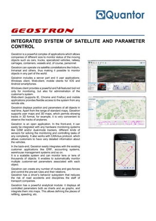
  • 1. Geostron INTEGRATED SYSTEM OF SATELLITE AND PARAMETER CONTROL Geostron is a powerful complex of applications which allows companies of different size to monitor status of the moving objects such as cars, trucks, specialized vehicles, railway carriages, containers, vessels and, of course, personnel. Geostron can operate via satellite constellations like Iridium, Inmarsat and others, thus making it possible to monitor objects in any part of the world. Geostron includes a server part and 4 user applications: Windows client, Web-client, mobile clients for IOS and Android smartphones. Windows client provides a powerful and full-featured tool not only for monitoring, but also for administration of the customer’s system. Web-client (supports IE, Chrome and Firefox) and mobile applications provides flexible access to the system from any remote site. Geostron displays position and parameters of all objects in real time. Apart from the range of standard maps, Geostron supports user maps and 3D maps, which permits showing tracks in 3D format, for example, it is very convenient to observe the tracks of airplanes. Geostron is an open application. In the front-end, it can easily be integrated with any hardware monitoring systems like GSM and/or dual-mode trackers, different kinds of sensors for solving the monitoring and controlling tasks of any complexity. It also works with CAN-bus protocol, which allows customers to have very detailed information about the vehicles. In the back-end, Geostron easily integrates with the existing customer applications like ERP, accounting systems, warehouse management systems and so on. It is a scalable system and can monitor tens or tens of thousands of objects. It enables to automatically monitor multiple customer-set parameters associated with each object. Geostron can create any number of routes and geo-fences and control the pre-set rules and their relations. Geostron has a driver’s behavior subsystem that reduces the risk of road accidents and disciplines the staff of transport companies. Geostron has a powerful analytical module: it displays all controlled parameters both as charts and as graphs, and integrate them into maps. This allows defining the places of refilling, speeding, etc.
  • 2. System Features  Simplicity and convenience: all apps and elements of the system have understandable structure  Integrativity: interaction with ERP systems, using equipment of various manufacturers, creating own sensors and calibration within the applications  Global coverage: integration into space communication systems like Iridium, InmarSat, alarm events form remote areas  Maps: universal mapping, custom 3D maps, multiple maps simultaneous use, synchronization between them  Flexible reports system: personal and group reports, parking addresses, calculated and fact parameters  Call center: possibility to get in touch with the driver from system applications via SIP telephoning, creating conferences Technical characteristics Capacity and efficiency Routes  Specified generator  Creating a route with the help of geographic coordinates  With the help of two points on the map  Names of locations  Use of existing tracks  Correction via Drag in Drop method  Variable value of deviation marker  Route legend generator Geo-fences  Specialized generator  3 types of geo-fences  A number of settable conditions for control  Alarm and delayed vents system  Sound indication Parameters and events control system  Telemetry panel to control sensor values  Digital display of values and active graphs  System of incoming parameters limitations  Automatic system of notifications from controlled values events  Three windows mode: graph, map, tabled data  Event reports generator  Superposition of graphs of several parameters for detailed observation of events Cartography  3D maps with active tracks  Simultaneous use of two types of maps for convenient monitoring with synchronization function  User maps with a plug-in for superposition of specialized maps with coordinates reference  Construction of 3D tracks for flying objects Efficiency  Increasing efficiency of use of vehicles and logistic operations  Reducing losses connected with fuel theft, unplanned trips, misuse, outages  Reducing cost of maintenance, increasing the time of service of vehicles  Increasing safety of vehicles, drivers and cargo  Statistics, reports and effective planning for managing staff of all levels More information at: www.geostron.com Geostron Avtozavodsky pr., 1, Geostron Rev. 2.3.3/03.15 Naberezhnye Chelny, Russia © Quantor Ltd.