
Recommended
Recommended
More Related Content
Similar to Geological Field Work Report.pdf
Similar to Geological Field Work Report.pdf (20)
Recently uploaded
Recently uploaded (20)
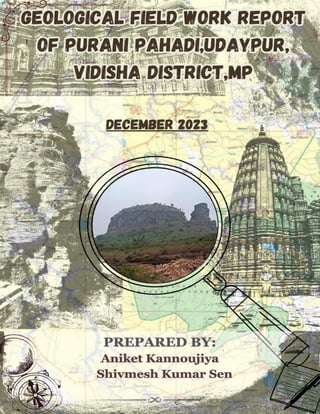
Geological Field Work Report.pdf
- 1. 1
- 2. ACKNOWLEDGEMENT We would like to express our sincere gratitude to Shri Madan Mohan Upadhyay, the state convener of INTACH Bhopal Chapter, for giving us the opportunity to be part of this project and do the geological field work on Purani Pahadi, Udaypur, Vidisha District. He has been a source of inspiration and guidance for us, as he is an eminent scholar of ancient history and culture. I would also like to thank Dr. R S Raghuwanshi, the head of department of geology at Govt. Motilal Vigyan Mahavidhyalaya, Bhopal, for his support and supervision throughout the project. He also provided us with the necessary equipment and instruments for the field work. The faculties of the department too helped us to develop our skills and knowledge in geology and to understand the concepts and methods of field work. We are grateful to Mr. Nilesh Bhargav, the outsourcing guard, for his assistance and cooperation during the field work. He accompanied me and my project partner throughout the field work and helped us in every possible way, such as arranging lunch, providing transportation, and treating us like young brothers. He also introduced us to the local people and helped us to communicate with them. We would like to thank the local people of Udaypur, Vidisha District, for their hospitality and kindness. They welcomed us warmly and shared their knowledge and stories about the place. They also allowed us to access their lands and properties for the field work. We would also like to thank Mr. Pankaj Wankhade, the mining inspector, for his help and advice before and during the field work. He helped us to know the area and its geological features and history. He also helped us to solve the problems and challenges that we faced during the field work. We feel lucky to be a part of this project, and we hope to keep in touch with the people with whom we worked, and learn from them in the future as well.
- 3. INDEX S.No Content Page No 1. Introduction 1 2. Geomorphology 8 3. Objective & Scope of the study 11 4. Methodology 13 5. Geology 17 6. Geomorphology 26 7. Geological Structures 33 8. Conclusion 51 9. References 52
- 4. LIST OF FIGURES S.No. Content Page No 1. Neelkantheshwar Temple 2 2. Ganesha Rock-cut Sculpture 4 3. Saptamatrika Rock-cut Sculpture 4 4. Tirthankara Sculpture 5 5. Dharanendra Sculpture 6 6. Gomukha Sculpture 6 7. Weathered Jain Sculpture 7 8. Toposheet Map of Udaypur 8 9. Base Map of Udaypur 11 10. Satellite Image of Purani Pahadi 12 11. Geological Hammer 14 12. Brunton Compass 15 13. Lithology Map of Udaypur 20 14. Sandstone with varied beds 22 15. Flagstone Sample 23 16. Exposed beds of Flagstone 24 17. Geomorphology Map of Udaypur 26 18. Slope Map of Udaipur 28 19. Landform Map of Udaypur 31 20. Drainage Map of Udaypur 32 21. Weathering and Erosional Structure 33 22. Thick bed 35 23. Choti Pahadi (Purani Pahadi) 36 24. Plan view of Cross Bedding 38 25. The terminology and defining characteristics of cross bedding 39 26. Trough bedding 40 27. Gradational Bedding 41 28. Sand movement in flumes under unidirectional flow conditions 42 29. Symmetric Ripple Marks 43 30. Ripple Mark under thick bed 44 31. Asymmetric Ripple Marks 45
- 5. 32. Mud Cracks 46 33. Cave 1 47 34. Cave 2 48 35. Natural Arch 49
- 6. LIST OF TABLES S.No Title Page No. 1. Population of Udaypur 1 2. Lithostratigraphy of Vindhyan Supergroup 18 3. Lithostratigraphic Succession of the Rewa Group 19 4. Geological Succession with their Geological age 25 5. Slope Classification 27 6. Earthquake Zones with regions and effect 29 7. Scale of Stratification of thickness 37
- 7. GEOLOGICAL FIELD WORK REPORT | 1 1. INTRODUCTION Udaypur is a village near Ganj Basoda in the Vidisha district of Madhya Pradesh, India. It is famous for its well-preserved Shiva temple, which is a monument of national importance protected by the Archaeological Survey of India. It covers an area of approximately 41.907 square kilometers. Udaypur is located 15 kilometers from Ganj Basoda, providing access to additional amenities and services. The Udaypur area lies between coordinate ranging from 78°2'E 23°55' N to 78°8'E 23°48'N. Udaypur is surrounded by Bareth, Muradpur, Pathari (Badoh) and Bawli villages. According to the 2011 census, the population of Udaypur is 6,383 people. Out of this, the male population is 3,405 and the female population is 2,978. The literacy rate of Udaipur village is 54.28%, out of which 60.70% males and 46.94% females are literate. There are about 1,247 houses in Udaipur village. Table 1: Population of Udaipur 1.1 HISTORY ➢ Udaypur is a town in the Vidisha district of Madhya Pradesh, near Ganj Basoda. It is the site of a well-preserved Śiva temple, a monument of national importance protected by the Archaeological Survey of India ➢ Udaypur’s history dates back to at least the ninth century, but it became prominent and got its name under the Paramara king Udayaditya (c. 1060-87). He was a successor of the legendary king Raja Bhoj, who is said to have ruled from Udaypur and built the Shiva temple ➢ The Shiva temple, also known as the Nilakanthesvara, was built in the second half of the eleventh century and is the only surviving royal temple of the Paramara kings. It has a complex Saiva iconography and a spire that belongs to the bhumija style of architecture. During the field trip, we met the people in the village and learned about the history of Udaypur Village. According to the popular legend related to Udaypur Village, which the villagers told us, that: - PARTICULARS TOTAL MALE FEMALE Total Population 6,383 3,405 2,978 Literate Population 3,465 2,067 1,398 Illiterate Population 2,918 1,338 1,580
- 8. GEOLOGICAL FIELD WORK REPORT | 2 The palace in Udaipur village and the famous Neelkantheshwar temple there was built by King Udayaditya, King Uday Aditya belongs to the Paramara dynasty and he was a resident of Ujjain. Fig1. Neelkantheshwar Temple Once King Udayaditya came from Ujjain to play hunting in Udaipur with his queen, and there is a place named Barakhambi in Udaipur, where he rested at night. Suddenly, there was a fire in the forest, the king's companions, soldiers and ministers were trying to extinguish the fire, at this time a snake burning in the fire came and said to King Udayaditya, 'Listen, sahiban, keep me in your mouth so that my jealousy will calm down. Seeing the condition of the snake that the creature is in trouble, the king took pity on him and he kept the snake in his mouth, but the snake went into the stomach of the king, due to which the king's stomach started growing, and the king's health deteriorated. Due to which the queen became upset and sad, at the same time where the king and queen were resting, it was a treasure in Barakhambi, in which also a snake lived. Seeing this condition of the king, the snake of the treasure said, 'Listen, sahiban, the king gave peace, but if the snake betrayed, then I tell the remedy for its death. ' If you mix strong chillies in whey and give it to the king, then the snake will melt and come out through the feces, the queen noted. Hearing this talk of the treasure snake, the stomach snake said, 'Listen, sahiban, he has told the remedy for my death, so I will tell the remedy for his death. If you heat the oil and pour it on it, it will kill and you can take out the treasure. The Queen noted both things.
- 9. GEOLOGICAL FIELD WORK REPORT | 3 He asked for whey from Amera village near Udaipur and mixed strong chillies and gave it to the king, so that the snake got out and the king became healthy. Then he heated the oil and poured it on the snake of the treasure, which killed the snake and the treasure was found by the king queen. From the same treasure, King Udayaditya built the palace and the Neelkantheshwar temple. It is also said that the entire treasure was not used and the remaining treasure is still under Barakhambi. During the Mughal period, there was an invasion here, due to which the temple and palace were destroyed but could not be completely destroyed because Hinglaj Mata appeared from the Hinglaj Mata temple located in Udaipur village and helped the king. The special feature of Hinglaj Mata temple is that the idol installed in it changes three forms during the day, in the morning it resembles a child, in the afternoon it resembles a puberty form, and in the evening, it depicts an aged form. The hill set for our Geological Survey is called Purani Pahadi. On that hill, there is a remnant of fort which might be there during the time of King Udayaditya, but at present it is completely destroyed. 1.2 ROCK-CUT SCULPTURES Rock-cut sculpture, which is a type of architecture that is created by carving out structures from solid rock. We have found the sculptures on our field area i.e. Purani Pahadi. We found 3 sculptures spot. I. Ganesha and Saptamatrika Sculpture. The sculpture found in the northern part of Chhoti Pahadi (Purani Pahadi). It is of the Hindu deity Ganesha, who is widely revered as the remover of obstacles, the patron of arts and sciences, and the deva of intellect and wisdom. Ganesha is easily recognized by his elephant head and human body, which represent the soul and the physical world. He is also honoured as the god of beginnings and is invoked at the start of rites and ceremonies. Another sculpture found on the left of the Ganesha is Saptamatrika, (Sanskrit: “Seven Mothers”) in Hinduism. It is having a group of seven mother-goddesses, each of whom is the shakti, or female counterpart, of a god. They are Brahmani (wife of Brahma), Maheshvari (wife of Shiva), Kaumari (wife of Kumara), Vaishnavi (wife of Vishnu), Varahi (wife of Varaha, or the boar, an avatar [incarnation] of Vishnu), Indrani (wife of Indra), and Chamunda, or Yami (wife of Yama). One text, the Varaha-purana, states that they number eight, including Yogeshvari, created out of the flame from Shiva’s mouth.
- 10. GEOLOGICAL FIELD WORK REPORT | 4 Fig 2 .Ganesha Rock Cut Sculpture. Size-41cm by 29 cm. Fig 3. Saptamatrika Rock-cut Sculpture. Size- 204cm by 70cm.
- 11. GEOLOGICAL FIELD WORK REPORT | 5 II. Jain Rock-cut Sculptures The Jain sculpture in the center of the image is of a tirthankara, a spiritual teacher who has attained liberation from the cycle of rebirth. The tirthankara is seated in a yogic posture on a throne, with a pointed headdress. The two smaller sculptures on either side of the tirthankara are yakshas, nature-spirit deities who serve as guardians and protectors. Fig 4 .Tirthankara Sculpture. Size of Centre Sculpture-80cm by 75cm. The yaksha on the left is Dharanendra, the king of the nagas (serpents) who protected the twenty-third tirthankara, Parshvanatha, from a storm. He is depicted as a standing figure with a pointed headdress and a snake hood. The yaksha on the right is Gomukha, the elephant-headed
- 12. GEOLOGICAL FIELD WORK REPORT | 6 deity who is associated with the twenty-second tirthankara, Neminatha. He is depicted as a seated figure with a pointed headdress and an elephant trunk Fig 5. Dharanendra Sculpture. Size-40cm by 30cm. Fig 6. Gomukha Sculpture. Size-35 cm by 23 cm.
- 13. GEOLOGICAL FIELD WORK REPORT | 7 III. Weathered Jain Sculpture The sculpture found on the northeastern part side of the Badi Pahadi (Purani Pahadi). This Jain sculpture is of a tirthankara, a spiritual teacher who has attained liberation from the cycle of rebirth. This sculpture is showing the high degree of weathering. Fig 7. Weathered Jain Sculpture. Size-65 cm by 25 cm.
- 14. GEOLOGICAL FIELD WORK REPORT | 8 2. GEOGRAPHY Geography is the science of the earth’s surface, its environment, and the human activities that take place on it. Geography involves the study of both the physical and the human aspects of the world, and how they interact and influence each other. 2.1 PHYSIOGRAPHY Fig 8. Toposheet map of Udaypur The area lies between coordinate ranging from 78°2'E 23°55' N and 78°8'E 23°48'N. The area falls in the survey of India Toposheet number 55I/1. The elevation ranges in the area varies from 340 to 480m amsl. It has an average elevation of 410 meters.
- 15. GEOLOGICAL FIELD WORK REPORT | 9 2.2 CLIMATE AND RAINFALL I. Rainfall Based on the information from the nearby places, it can be estimated that the average rainfall of Udaipur village is around 800 mm per year, which is the same as the average rainfall of the semi-arid agro-climatic zone of Madhya Pradesh, where Udaipur village is located. The rainfall distribution is uneven and erratic, and the area often faces droughts and floods. The rainfall is influenced by the south-west monsoon winds, which bring moisture from the Arabian Sea and the Bay of Bengal. II. Temperature The climate of Vidisha district characterized by a hot summer and general dryness except during the southwest monsoon season. The year may be divided into four seasons. The cold season, December to February is followed by the hot season from March to middle of June. The period from the middle of June to September is monsoon season. October and November form the post-monsoon or transition period. The January is the coldest month of the year. The individual day temperature comes as low as 1 or2°C. From March onwards, the temperature starts rising and maximum temperature is observed during the month of May. On the arrival of monsoon, the weather becomes pleasant. In October, on the retreating of monsoon the temperature rises lightly during the day time and nights become pleasant. III. Humidity and wind The driest part of the year is the summer season, when relative humidity is less than 39%. April is the driest month of the year. The wind velocity is higher during the pre-monsoon period as compared to post monsoon period. 2.3 SOIL COVER The higher elevations i.e. the hilly regions have a cover of murum which is made up of small rounded pieces of weathered trap. The Vindhyans has a thin cover of sandy loams,alluvium is derived from hills slopes by numerous streams and water courses. Sandy loams finds in this area. 2.4 AGRICULTURE
- 16. GEOLOGICAL FIELD WORK REPORT | 10 Udaypur village produces soybean, pigeon pea and maize in Kharif and wheat, gram and lentil in Rabi season. The Kharif area is 90% rain fed and Rabi area is 34% rainfed. 2.5 RIVER AND WATER BODY It lies in the Betwa river basin. north west of the village lies the Keptan river which is use for irrigation and domestic purposes. The village is also depended on lakes and ponds which usually dried during the summer season.
- 17. GEOLOGICAL FIELD WORK REPORT | 11 3. OBJECTIVE & SCOPE OF THE STUDY 3.1 OBJECTIVE The objective of this field work is to investigate the geology, stratigraphy, landforms, composition, and history of the Purani Pahadi, using various methods and techniques, such as geological mapping, sampling, analysis, and interpretation. The field work aims to identify and characterize the different rock units, structures, and processes that have shaped the area over time, and to understand their spatial and temporal relationships. The field work also seeks to evaluate the natural resources, hazards, and environmental issues associated with the area, and to provide recommendations for further research and exploration. Fig 9. Base Map of Udaypur
- 18. GEOLOGICAL FIELD WORK REPORT | 12 3.2 SCOPE OF THE STUDY To conduct a geological field work in the Purani Pahadi, Udaypur which is located in Vidisha district near Ganj Basoda. The area is of interest because it has historical as well as geological features and properties, such as leftover fort and caves. The study aims to investigate the geology, stratigraphy, landforms, composition, and history of the area, using various methods and techniques, such as geological mapping, sampling, analysis, and interpretation. The study will also evaluate the natural resources, hazards, and environmental issues associated with the area, and provide recommendations for further research and exploration. Source-Google Earth Fig 10. Satellite image of Purani Pahadi, Udaypur
- 19. GEOLOGICAL FIELD WORK REPORT | 13 4. METHODOLOGY The systematic and logical procedures and techniques that geologists use to collect, analyze, and interpret data and information about the earth’s surface, structure, composition, and history. The methodology for geological field work can vary depending on the purpose, scope, and scale of the study, but generally it involves the following steps: ✓ Planning and preparation: This step involves defining the research question or problem, reviewing the literature and background information, selecting the study area and site, designing the sampling and mapping strategy, obtaining the necessary equipment and permissions, and ensuring the safety and ethics of the field work. ✓ Data collection: This step involves conducting the field work, which may include observing, measuring, recording, and sampling the geological features and properties of the area, such as rocks, minerals, fossils, soils, water, landforms, structures, etc. The data collection methods and tools may include geological mapping, sampling, analysis, and interpretation, using a geological hammer, a Brunton compass, a lens, a meter tape, a field notebook, a chisel, and other instruments and tests. ✓ Data analysis: This step involves processing and examining the data collected in the field, using various techniques and software, such as microscopy, spectroscopy, X-ray diffraction, geochronology, stratigraphic correlation, structural analysis, etc. The data analysis aims to identify and characterize the different geological units, processes, and events that have shaped the area over time, and to understand their spatial and temporal relationships. ✓ Data interpretation: This step involves integrating and explaining the data and results, using various methods and models, such as geological maps, cross-sections, diagrams, charts, tables, etc. The data interpretation aims to answer the research question or problem, and to evaluate the natural resources, hazards, and environmental issues associated with the area. ✓ Data presentation and communication: This step involves summarizing and highlighting the main findings and conclusions of the study, and providing recommendations for further research and exploration. The data presentation and communication may include a geological report, a geological database, a geological presentation, and a geological publication, using various formats and media, such as text, images, graphs, maps, etc.
- 20. GEOLOGICAL FIELD WORK REPORT | 14 Description of the Geological tools used in the field a) Field Notebook: A field notebook is a special type of notebook that has a hard cover and water-resistant paper. It is used to record the observations, interpretations, sketches, and measurements that geologists make in the field. b) Geological Hammer: geological hammer is a special type of hammer that has a flat head and a pointed end. It is used to break rocks, collect samples, and create fresh surfaces to examine the rock and the minerals within it. A geological hammer is also known as a rock hammer or a rock pick. Fig 11. Geological Hammer.
- 21. GEOLOGICAL FIELD WORK REPORT | 15 c) Brunton Compass: A Brunton compass is a specialized instrument that allows geologists to make accurate measurements of angles and directions in the field. It is also known as a Brunton pocket transit. It has a compass card, a compass needle, a clinometer scale, a clinometer level, a bull’s eye level, a vernier, a mirror, and a sighting arm. A Brunton compass can be used to determine the magnetic declination, measure the attitude of planes and lines, find the bearing of a line between two points, and solve the two-point problem. Fig 12. Brunton Compass d) Meter tape: A meter tape is a flexible measuring device that can be used to measure the length, width, height, and thickness of rocks, minerals, fossils, and other features in the field. A meter tape can also be used to measure the distance and direction between two points, the strike and dip of a plane, the
- 22. GEOLOGICAL FIELD WORK REPORT | 16 plunge and trend of a line, and the area and volume of a body. A meter tape is also known as a measuring tape or a tape measure. e) Lens: A lens is a simple magnifying glass that helps geologists to observe the details of rocks and minerals, such as their color, texture, shape, luster, cleavage, fracture, and crystal form. A lens can also be used to identify some minerals by their optical properties, such as birefringence, pleochroism, and interference colors. A lens is also known as a hand lens or a loupe f) Chisels: A chisel is a metal tool that has a sharp edge and a flat end. It is used to break rocks, collect samples, and create fresh surfaces to examine the rock and the minerals within it. A chisel should be used carefully and safely, as it can cause injury or damage to the rock or the user.
- 23. GEOLOGICAL FIELD WORK REPORT | 17 5. GEOLOGY Geologically, Purani Pahadi is totally made up of Upper Rewa sandstone of Rewa group. The Upper Rewa Sandstone Formation of the Rewa Group in the Vindhyan basin is composed mainly of medium to very fine grained, iron pigmented arenaceous rocks variously interpreted as fluvial, marine or continental deposits. They are reddish and brownish color due to weathering and presence of iron oxide. 5.1 VINDHYAN SUPERGROUP The Vindhyan basin is the spectacular, sickle shaped largest single Proterozoic basin in the Indian Peninsular shield situated on the Bundelkhand craton (Figs. 4.1 and 4.6). The Vindhyan Supergroup is a large sequence of sedimentary rocks that are Proterozoic in age, spanning from about 1.7 billion years ago to about 650 million years ago . The ENE trending Vindhyan basin spreads over the parts of Rajasthan, Madhya Pradesh, Uttar Pradesh and Bihar extending from Sasaram in Bihar to Chittaurgarh in Rajasthan. Vindhyan sediments, spreading over an area of 100,000 sq. km of which about 60,000 sq. km is exposed for direct observation and rest is covered by Deccan Traps in the south-west and Indo-Gangetic alluvium towards the north. The basin is separated from Aravalli-Delhi orogenic belt by westerly dipping Great Boundary Fault Zone (GBFZ) in the west. The Vindhyan basin has been divided into three sub-basins (from west to east) Rajasthan, Bundelkhand and Son valley sector of which the latter two are larger. The Vindhyan succession in the Bundelkhand sector is dominated by carbonates while siliciclastics (sandstones and shales) and carbonates are equally prevalent in the Son valley and Rajasthan sectors. The first Director of Geological Survey of India, Thomas Oldham in 1856 introduced the term ‘Vindhyan’ for this Supergroup. The name ‘Vindhyan’ is derived from the great ‘Vindhyan Mountains’ of Central India. The Vindhyan Supergroup consists of about 4500m thick sedimentary pile comprising a sequence of sandstone and shale in almost equal proportion with subordinate carbonates, in the lower part. Vindhyan rocks show the excellent preservation of sedimentary structures. 5.1.1 Stratigraphic Classification The studies on Vindhyan basin commenced from the work of D.H. Williams in 1848. Three-fold division of the supergroup: Kaimur, Rewa and Bhander was proposed by T. Oldham in 1856. Lower Vindhyan was designated as Semri by F.R. Mallet in 1869.
- 24. GEOLOGICAL FIELD WORK REPORT | 18 Table 2: Lithostratigraphy of Vindhyan Supergroup VINDHYAN SUPERGROUP GROUP FORMATION ALTERNATIVE NAMES Bhander Group (1300-1500m) ------------------- Rewa Group (100-300m) ------------------- Kaimur Group (400m) ------------------- Semri Group (3000-4000m) ------------------- Maiher Sst. Sirbu Sh. Bundi Hill sst. Lakheri Lst. Ganugarh Sh. --------------------------- Govindgarh Sst. Drummondganj Sst. Jhiri Sh. Asan Sst. Panna Sh. --------------------------- Dhandraul Quartzite Mangesar Formation Bijaigarh Shale Markundi Sandstone Ghurma Shale Sasaram Sst. --------------------------- Suket Sh. Rohtas Lst. Chorhat Sst. Bargawan Lst. Kheinjua Sh. Chopan Porcellanite Kajrahat Lst. Arangi Sh. Deoland Sst. --------------------------- (Upper Bhander Sst.: Divided into Bhavpura Sh., Balwan Lst., Shikaoda Sst.) (Lower Bhander Sst.) (Bhander Lst., Nagod Lst.) (Simrawal Sh.) ----Discontinuity/ Gradational Contact--------------- (Upper Rewa Sst., Gahadra Sst.) (Variegated Sh.) (Lower Rewa SSt., Itwa Sst., Kanar Sst.) ----Normal Contact/Facies Change------------------- (Upper Kaimur Sst., Scarp Sst.) (Ghaghar Sst.) (Susnai Breccia) (Lower Kaimur Sst.) ---Unconformity/ Normal contact-------------------- (Baghwar Sh.) (Nimbahera Lst.,: Divided into Bari Sh., Jiran Sst. And Khori Malan Cong.) (Glauconite Bed, Rampur Sst., Basuhari sst., Tirohan Lst.) (Salkhan Lst., Fawn Lst., Chorhat Lst., Tirohan Lst.) (Olive Sh., Koldaha Sh., Binota Sh.) (Deonar Porcellanite) (Kuteshwar Lst., Bhagwanpura Lst., Tirohan Lst., Lohar Dolomite) (Khardeola Sst., Pandwafall Sst.) ---Angular Unconformity/ Non-conformity---------- Granites and Supracrustals Sst.- Sandstone; Sh.- Shale; Lst.- Limestone; Cong.- Conglomerate .
- 25. GEOLOGICAL FIELD WORK REPORT | 19 Vindhyan Supergroup has been divided into four groups by Auden in 1933 as follows in chronological order: Bhander Group Rewa Group Kaimur Group Semri Group The common terms in usage are the Lower Vindhyan (for the Semri Group) and the Upper Vindhyans (for Kaimur, Rewa and Bhander groups). The general stratigraphic scheme of the Vindhyan Supergroup is summarised in Table. 5.1.2 Lithology Rewa Group: This name is derived from the then Rewa State. This group is composed chiefly of sandstones and shales. It conformably overlies the Kaimur Group. It has been subdivided by Krishnan (1968) into four different lithostratigraphic units. Sastry and Moitra (1984) have redesignated the Lower Rewa Sandstone and the Upper Rewa Sandstone as the Asan Sandstone and the Govindgarh Sandstone respectively. Table-6 gives the comparative lithostratigraphic successions of the Rewa Group in Son Valley and Chambal Valley. Table 3: Lithostratigraphic Succession of the Rewa Group. GROUP SON VALLEY CHAMBAL VALLEY (After prasad,1984) After Krishnan,1968 Sastry and Moitra,1984 REWA GROUP Upper Rewa Sandstone Govindgarh Sandstone Govindgarh Sandstone Jhiri Shale Jhiri Shale Jhiri Shale Lower Rewa Sandstone Asan Sandstone Indergarh Sandstone Panna Shale Panna Shale Panna Shale I. Jhiri Shale It is made up of red, reddish brown to greenish yellow shales and minor fine and medium grained sandstone. The shale dominated facies shows lenticular bedding. The sand-dominated horizons are characterized by flaser bedding. Rai et al. (1997) have recorded Chuaria –Tawuia association from this horizon.
- 26. GEOLOGICAL FIELD WORK REPORT | 20 Fig 13. Lithology Map of Udaypur II. Govindgarh Sandstone (Upper Rewa Sandstone) It conformably overlies the Jhiri Shale and forms an escarpment facing south, close to Govindgarh in Rewa district, Madhya Pradesh. The Upper Rewa Sandstone has been redesignated as the Govindgarh Sandstone by Sastry and Moitra (1984). Based on the study in the the Drummondganj area, Chakraborty and Choudhuri (1990) have further divided this unit into Drummondganj Sandstone and Govindgarh Sandstone. The thickness of the Govindgarh Sandstone varies from ≈100-250 m. It comprises pink, light pink with light yellowish brown and yellowish white fine to medium-grained massive sandstone. It shows profuse development of trough and planar mega cross-bedding.
- 27. GEOLOGICAL FIELD WORK REPORT | 21 Other sedimentary structures commonly associated with this unit include parting lineation, ripple marks and clay-gals. At places due to increase in iron content, a purple brown colour is imparted to the sandstone with effect of laterization. In the Panna township, this horizon has yielded diamonds in the upper part in a pebbly to cobbly ortho-conglomerate horizon.The basal Panna Shale, without any basal conglomerate, indicates continuity of deposition from the Kaimur Group. Panna Shale and Asan Sandstone consisting of red shales, limestones, barytes and glauconitic siltstones indicate a lagoonal environment. This is overlain by the Jhiri Shale by a gradational contact and is separated from the Asan Sandstone by a diamondiferous conglomerate at Panna. Red shale, with glauconitic siltstones indicate lagoonal, lacustrine or offshore environment. The overlying Drummondganj Sandstone is deposited in shore face environment. This is overlain by the Govindgarh Sandstone which is poorly sorted and texturally immature, indicating either fluvial, deltaic or near shore muddy tidal flat environment. 5.1.3 Rocks Found I. Sandstone Sandstones are all those medium-grained sedimentary rocks that comprise more than 50% sand-size (0.063–2mm) grains.Iron oxide can give a reddish or brownish hue to the rocks, especially if they are oxidized or altered by water or other fluids. Composition Sandstones can include almost any preexisting mineral or rock fragment but, due to removal of unstable grains by the very efficient agents of chemical and physical weathering, the typical composition is much more restricted. The principal components of most siliciclastic sandstones are quartz grains, feldspar grains and rock fragments. Other components can include micas, clay minerals, biogenic fragments (calcareous, siliceous and carbonaceous), and over 100 species of heavy minerals (specific gravity >2.9).
- 28. GEOLOGICAL FIELD WORK REPORT | 22 Fig 14. Sandstone with thick and thin beds. These types of formations are present all over the Purani Pahadi. II. Flagstone Flagstone is a type of sedimentary rock that is split into layers along bedding planes. It is usually used for paving slabs, walkways, patios, flooring, fences and roofing. It may also be used for memorials, headstones, facades and other construction. The sediment must be deposited in layers or strata that are parallel or nearly parallel to the surface of the Earth. These layers form the bedding planes that allow flagstone to split easily.
- 29. GEOLOGICAL FIELD WORK REPORT | 23 Fig 15. Flagstone sample. Size reference Indian 10rupee coin Flagstone can be found in places where there are bedded sedimentary rocks with fissile bedding planes. A fissile bedding plane is a type of bedding plane that is thin and easily split into smaller units. These rocks are formed by the accumulation and cementation of sand or other particles in various environments, such as deserts, riverbeds, or coastal areas. Flagstone can have different colors depending on the mineral composition and impurities, ranging from white or light gray to red, brown, or even green. Flagstone is composed mainly of sand-sized mineral particles or rock fragments. It is formed by the compaction and cementation of sand in various environments, such as deserts, riverbeds, or coastal areas.
- 30. GEOLOGICAL FIELD WORK REPORT | 24 Fig 16. Area represents the base of the Purani Pahadi. Thick beds of Sandstone and Flagstone are exposed here. 5.2 UNIDIFFERENTIAL FLUVIAL/ ALLUVIAL SEDIMENTS, QUATERNARY: Unidifferential fluvial/ alluvial sediments are sediments that are deposited by different agents of transport, such as rivers, or waves, in different environments, such as floodplains, deltas, or beaches. The Quaternary is the most recent geological period, spanning from about 2.6 million years ago to the present day. The unidifferential fluvial/ alluvial sediments of the Quaternary overlie the Vindhyan rocks unconformably. These sediments are mainly composed of sand, silt, clay and gravel, and reflect the climatic and tectonic changes that occurred during the Quaternary. Pediments surrounding the Purani Pahadi have sandy loams and alluvium.
- 31. GEOLOGICAL FIELD WORK REPORT | 25 Table 4: Geological succession with their geological age GEOLOGICAL SUCCESSION GEOLOGICAL TIME Quaternary Deposits Quaternary Period Basalt (Deccan Trap) End of the Cretaceous Period Upper Rewa Sandstone (Vindhyan Supergroup) Upper Proterozoic Eon Jhiri Shale (Vindhyan Supergroup) Upper Proterozoic Eon
- 32. GEOLOGICAL FIELD WORK REPORT | 26 6. GEOMORPHOLOGY Maximum part of Udaypur Village is covered by the Sandstone and quaternary deposits and most of the land forms in the area is the landforms of these rocks. The geomorphological features of the area have been identified in the Landsat satellite image and demarcated using the GIS platform. Purani Pahadi shows the Butte formation which is very small, steep-sided, flat-topped plateau. Fig 17. Geomorphology Map of Udaypur
- 33. GEOLOGICAL FIELD WORK REPORT | 27 6.1 SLOPE The slope of Udaypur Village ranges from moderate slope to strong slope. The slope of the block area is divided into (degree) basis in to (seven) categories. The major Portion of the slope area falls under the moderately gentle slope region. The slope of the Purani Pahadi comes under moderate to strong slope. Table 5: Slope Classification S NO SLOPE CLASS (DEGREE) NATURE OF SLOPE 1 < 0.5 Flat 2 0.5 to 1 Nearly Flat 3 1 to 3 Gentle slope 4 3 to 5 Moderately Gentle Slope 5 5 to 10 Moderate Slope 6 10 to 30 Strong Slope 7 > 30 Very Strong Slope
- 34. GEOLOGICAL FIELD WORK REPORT | 28 Fig 18. Slope Map of Udaypur 6.2 EARTHQUAKE ZONES Earthquake zones are the areas that are classified according to the level of seismic activity or the risk of earthquakes. Earthquake zones help in planning, designing, and constructing buildings and infrastructure that can withstand or minimize the damage caused by earthquakes. Udaypur village comes under the Zone 2 i.e. this area has a very low level of seismic hazard.
- 35. GEOLOGICAL FIELD WORK REPORT | 29 Table 6: Earthquake Zones with regions and effect ZONE DESCRIPTION Zone 5 This zone includes areas that are highly susceptible to earthquakes and includes parts of the northwest, northeast, and the Andaman and Nicobar Islands. Buildings in this zone are required to be designed and constructed to withstand the highest level of seismic activity Zone 4 This zone includes areas that are moderately susceptible to earthquakes and includes parts of the Himalayan region, the western and eastern coasts, and parts of the central and southern regions of the country. Zone 3 This zone includes areas that have a low to moderate level of seismic hazard and includes parts of the central and southern regions of the country. Zone 2 This zone includes areas that have a very low level of seismic hazard and includes parts of the northeastern region of the country 6.3 GEOLOGICAL LANDFORMS Geological landforms are natural features that shape the Earth’s surface. They are the result of various geological processes and can be found across the planet, encompassing a wide range of shapes, sizes, and formations. Landforms provide valuable insights into the Earth’s history and are crucial in understanding the dynamic processes that have shaped our planet over millions of years. Some of the main factors that influence landform development are: ✓ Tectonic activity: Landforms are significantly influenced by tectonic forces, which result from the movement and interaction of Earth’s tectonic plates. Tectonic processes like plate collisions, subduction zones, and faulting can give rise to landforms such as mountains, rift valleys, and volcanic features. ✓ Geological composition: The underlying geological composition of an area plays a crucial role in landform development. Different types of rocks and minerals have varying resistance to erosion, which can lead to the formation of distinct landforms. For
- 36. GEOLOGICAL FIELD WORK REPORT | 30 example, resistant rocks like granite may form rugged mountain ranges, while softer rocks like sandstone are more prone to erosion and can create unique formations such as arches or hoodoos. ✓ Erosion and weathering: Erosion and weathering processes shape landforms over time. Water, wind, ice, and gravity contribute to the erosion and transportation of rocks and sediments. Rivers can carve out valleys and canyons, glaciers can sculpt mountains and valleys, wind can shape sand dunes, and coastal erosion can create cliffs and beaches. Weathering, which involves the breakdown of rocks and minerals, can also contribute to the formation of specific landforms. ✓ Climate and weather: Climate and weather patterns influence landforms by affecting erosion rates, sediment transport, and deposition Sedimentary rocks that remain more or less horizontal once the sea has retreated or after they have been uplifted form characteristic landforms. Purani Pahadi shows the Butte landform. A mesa or table is a small plateau, but there is no fine dividing line between a mesa and a plateau. A butte is a very small plateau, and a mesa becomes a butte when the maximum diameter of its flat top is less than its height above the encircling plain. When eventually the caprock is eroded away, a butte may become an isolated tower, a jagged peak, or a rounded hill, depending on the caprock thickness. Cuesta Ridge formed in gently dipping strata with an asymmetrical cross-section of escarpment and dip-slope. Cuestas form in beds dipping gently, perhaps up to 5°. A Pediment is a gently sloping landform that develops at the foot of a mountain or hill, where a thin layer of debris covers the underlying bedrock. A Pediplain is a broad, flat landform that covers a large area, where several pediments have merged together.
- 37. GEOLOGICAL FIELD WORK REPORT | 31 Fig 19. Landform Map of Udaypur 6.4 DRAINAGE PATTERN A river system can be considered as a network in which nodes (stream tips and stream junctions) are joined by links (streams). Stream order is used to denote the hierarchical relationship between stream segments and allows drainage basins to be classified according to size. Stream order is a basic property of stream net - works because it relates to the relative discharge of a channel segment.
- 38. GEOLOGICAL FIELD WORK REPORT | 32 Fig 20. Drainage Map of Udaypur In Strahler’s ordering system, a stream segment with no tributaries that flows from the stream source is denoted as a first-order segment. A second-order segment is created by joining two first-order segments, a third-order segment by joining two second-order segments, and so on.
- 39. GEOLOGICAL FIELD WORK REPORT | 33 7. GEOLOGICAL STRUCTURES Geological structures are variations in the properties of the Earth’s crust that can tell us about its history and processes. There are three main types of geological structures: igneous, sedimentary, and metamorphic. As Purani Pahadi is made up of sedimentary terrain and maximum area of Udaypur is having sedimentary structures. So, our report focuses on the sedimentary structures only. Sedimentary structures are formed when sediments accumulate and undergo compaction or cementation. They include sedimentary basins, which are large depressions filled with sediments; sedimentary layers or strata, which are horizontal or inclined sequences of sediments; sedimentary features, such as cross-bedding, ripple marks, sand dunes, and fossils. Some examples of sedimentary structures are alluvial fans, deltaic plain deposits, sandstone formations, shale layers, coal seams, and limestone caves. Fig 21. This structure may be form by the weathering and erosion activity during the fluvial and aeolian activity. This structure is secondary type, which is formed after the deposition. Hammer 35 cm. Sedimentary structures are large-scale features of sedimentary rocks that are best studied in the field, formed from aggregates of grains and generated by a variety of sedimentary processes. They occur abundantly in siliciclastic sedimentary rocks and also occur in non-siliciclastic
- 40. GEOLOGICAL FIELD WORK REPORT | 34 sedimentary rocks. Whereas "sedimentary texture" applies mainly to the properties of individual sediment grains. Significance of sedimentary structures 1) Reflect environmental conditions that prevailed at or very shortly after the time of deposition, as a tool for interpreting ancient depositional environments (sediment transport mechanisms, paleocurrent flow directions, relative water depths, and relative current velocities). 2) To identify the tops and bottoms of beds and thus to determine if sedimentary successions are in the right depositional stratigraphic order or not. Classification of sedimentary structures are described below. 7.1 PREDEPOSITIONAL (INTERBEDED) STRUCTURES (EROSIONAL) It occurs on surfaces between beds, before the deposition of the overlying bed by erosional processes. These are called sole marks (bottom structures). The convex structures on the upper bed are termed "casts." The concave hollows in the underlying bed are termed "molds". 7.2 SYN-DEPOSITIONAL (INTRA-BEDED) STRUCTURES (DEPOSITIONAL): They are constructional structures that are formed during depositional activities, thus they are present within sedimentary beds. I. Beds: Beds are tabular or lenticular layer of sedimentary rock that can be distinguished from strata above and below by difference in color, composition and texture. Bedding (Bed) is thicker than 1 cm whereas lamination (Lamina) is thinner than 1 cm. Bedding is composed of beds; lamination is composed of lamina. II. Bedding planes or bedding surfaces: Bedding planes are primary surface in a sedimentary rock separating the upper and lower surfaces of beds, which represent period of nondeposition, erosion, or changes in composition (reflect changes in depositional conditions). Some bedding surfaces may be post-depositional features formed by diagenetic processes.
- 41. GEOLOGICAL FIELD WORK REPORT | 35 Fig 22. Thick bed of thickness more than 60cm. This cross section belongs to the base of the Purani Pahadi. In sandstones massive bedding is rare. It is most frequently seen in very well-sorted sands, where sedimentary structures cannot be delineated by textural variations. Purani Pahadi is full of beds with planar bedding. III. Flat-bedding (planar bedding): Flat-bedding is planar beds that are deposited horizontally parallel to the bedding plane surfaces. It occurs in sand-size sediments (terrigenous and carbonate) in diverse sedimentary environments (fluvial channels, beaches, delta fronts and Aeolian sand sheets). Internal, bedding surfaces may show parting-lineations in which sand grains are arranged with the long axes parallel to the flow direction. It is attributed to sedimentation from a planar bed form under shooting flow or a transitional flow regime with a Froude number of approximately 1.
- 42. GEOLOGICAL FIELD WORK REPORT | 36 Fig 23. This is the image of Choti Pahadi (Purani Pahadi) showing the thick bed (more than 60- 100 cm) at the bottom and thin bed found towards the top of it.
- 43. GEOLOGICAL FIELD WORK REPORT | 37 Table 7: Scale of Stratification of Thickness. (Source: Inzram, 1954). THICKNESS(CM) TERMINOLOGY >100 Very Thickly Bedded 30-100 Thickly Bedded 10-30 Moderately bedded 3-10 Thinly Bedded 1-3 Very thinly bedded 0.3-1 Thickly laminated IV. Cross-bedding: It is one of the most common and most important of all sedimentary structures (the most important paleocurrent indicators). Cross-bedding, consists of inclined dipping bedding, bounded by sub-horizontal surfaces. • It is ubiquitous in traction current deposits in diverse environments. • Individual beds range in thickness from a few tens of centimeters to a meter or more. • It is used to determine current flow directions in ancient rocks (very excellent paleocurrent indicators). • Each of cross bedded units (Isolated cross-bed) is termed a set. Vertically contiguous sets are termed cosets. The inclined bedding is referred to as a foreset. Foresets may grade down with decreasing dip angle into a bottomset or topset.
- 44. GEOLOGICAL FIELD WORK REPORT | 38 Fig 24. Plan view of Cross Bedding. This Picture is taken from the area between badi Pahadi and choti Pahadi. Direction of flow towards the pen cap. Pen 14.5 cm. Cross-beds are divided on the basis of: 1. Overall geometry (foresets shape). 2. The nature of the bounding surfaces of the cross-bedded units. They are divided into: A. Tabular cross-bedding It consists of cross-bedded units bounded above and below by planar bounding surfaces. The foreset laminae are also commonly planar, but are curved at the basal surface.
- 45. GEOLOGICAL FIELD WORK REPORT | 39 Fig 25. The terminology and defining characteristics of cross-bedding B. Trough cross-bedding It consists of cross-bedded units having upward concave foreset lie within erosion scours which are elongated parallel to current flow, closed up current and truncated down current by further troughs. C. Gradational cross bedding It shows a gradual change in grain size from the bottom to the top of each set. It is usually formed by the migration of ripples or dunes in a unidirectional flow, such as a river or a wind. The coarser grains are deposited first at the base of the lee slope, and the finer grains are carried farther up the slope by the flow. Gradational cross bedding is a common feature of fluvial and aeolian deposits, and it can also be found in some turbidites.
- 46. GEOLOGICAL FIELD WORK REPORT | 40 Fig 26. Trough bedding. Hammer 35 cm. Formation of cross bedding: Formed mainly by the migration of the crested dunes and mega-ripples • Migration of dune during lower flow regime conditions. • Migration of anti-dunes in upper flow regime conditions to deposit upcurrent dipping cross- beds. • In river channels (braided type) a single set of cross-bedded strata deposited in the steep side of obstacles. • Channel may be infilled by cross-bedding paralleling the channel margin
- 47. GEOLOGICAL FIELD WORK REPORT | 41 Fig 27. Gradational Bedding. Forearm- 45 cm V. Ripples: Ripples are small-scale alternating ridges and troughs formed on the surface of sediment layer by moving water or wind. They are generated under low flow regime condition (F<1). Types of ripples: a. Symmetrical Ripples (wave or oscillation ripples) form in shallow water by wave action under oscillatory (bimodal current) flow and tend to be nearly symmetrical in shape and have fairly straight crests. This ripple marks indicate the shallow sea in the palaeo-environment.
- 48. GEOLOGICAL FIELD WORK REPORT | 42 Fig 28. Bed Form, Flow Power and Grain size. The diagram is based on sand movement in flumes under unidirectional flow conditions. b) Asymmetrical ripples (current ripples) formed by wind or water flowing in one direction (unidirectional current). They are asymmetrical in shape, and the steep or lee side faces downstream in the direction of current flow. When ripples migrate on unconsolidated non-cohesive sediment with simultaneous upward growth forming climbing ripples with cross lamination. This ripple marks indicate the fluvial action of water in the palaeo-environment.
- 49. GEOLOGICAL FIELD WORK REPORT | 43 Fig 29. Symmetric Ripple mark or Oscillation ripples. Shape of the crest is straight and sinous. Pen 14.5cm
- 50. GEOLOGICAL FIELD WORK REPORT | 44 Fig 30. Ripple mark found under the thick bed or Lower bedding plane of the thick bed. Exposed length – 45 cm In the plan view, the crests of current ripples have a variety of shapes: straight, sinuous, catenary, linguoid, and lunate. The plan-view shape of ripples is apparently related to water depth and velocity.
- 51. GEOLOGICAL FIELD WORK REPORT | 45 Fig 31. Asymmetrical Ripple marks. This found near the Weathered Jain Sculpture. Arrow shows the flow direction. Pen 14.5cm. 7.3POST DEPOSITIONAL STRUCTURES (DEFORMATIONAL) These are deformational structures, that disturb and disrupt pre- and syn-depositional structures (inter- and intra-bed structures). They develop during, or shortly after deposition of unconsolidated sediments. They indicate slumping or compression of layers before complete lithification. 7.4MISCELLANEOUS STRUCTURES There are sedimentary structures of diverse origin that are not fit conveniently into a simple classification. These include shrinkage cracks (Mud cracks and Syneresis cracks), Caves and Natural Arcs are also found on the Purani Pahadi.
- 52. GEOLOGICAL FIELD WORK REPORT | 46 a. Desiccation cracks (Mud cracks) These are downward-tapering cracks in mud, which are infilled by sand and displaying polygonal pattern in plain view. The area between the cracks is commonly curved upward into a concave shape. ✓ They form subaerially when mud exposed to air is dewatered, shrinks and leaves a crack. ✓ They are commonly preserved on the tops of bedding surfaces as positive-relief fillings of the original cracks. ✓ They are good indicator of subaerial exposure and may be associated with raindrops or ripple marks, and vertebrate tracks. ✓ They occur in both siliciclastic and carbonate mud (in estuarine, lagoonal, tidal flat, river floodplain, Playa Lake, and other environments), where muddy sediment is exposed to air. Fig 32. – Mud cracks. Pen 14.5 cm.
- 53. GEOLOGICAL FIELD WORK REPORT | 47 Mud-cracks are commonly preserved on the tops of bedding surfaces as positive-relief. fillings of the original cracks (Fig. 41). Mud-cracks occur in estuarine, lagoonal, tidal-flat, river floodplain, playa lake, and other environments where muddy sediment is intermittently exposed and allowed to dry. b) Caves It is an Erosional Caves that are carved out by a stream of water that carries sand and gravel. The water erodes the weaker portions of the rock, creating hollows or tunnels. Caves are important in archaeology because they can provide valuable information about the past human societies and cultures. Fig 33. This cave found West part of the Badi Pahadi (Purani Pahadi). The large entrance to the cave indicates a high probability of a way to the other side of the Pahadi. Caves can also preserve plant and mineral remains, such as seeds, pollen, charcoal, shells, and crystals, that indicate the environmental and climatic conditions, as well as the natural resources and activities, of different regions and periods.
- 54. GEOLOGICAL FIELD WORK REPORT | 48 Fig 34. Another Cave found in the eastern face of the Pahadi near Natural Arch. It has a quite small entrance, but there is also the chance of connectivity to the previous cave or to the other side. c) Natural Arch
- 55. GEOLOGICAL FIELD WORK REPORT | 49 Natural arches are formed in sandstone by a combination of erosion and stress. Erosion removes the weaker or less resistant portions of the rock, such as the grains or the cement, by the action of water, wind, or temperature variations. Stress redistributes the weight of the remaining rock, causing the grains to interlock and resist further erosion. Fig 35. Natural Arch found in the eastern face of the Badi Pahadi. The interlocking grains form impervious networks that support the arch span. The shape and size of the arch depend on the direction and magnitude of the stress, as well as the initial
- 56. GEOLOGICAL FIELD WORK REPORT | 50 fractures or joints in the rock. The stress distribution, which involved the redistribution of the weight of the remaining rock, causing the grains to interlock and resist further erosion. The interlocking grains formed impervious networks that supported the arch span.
- 57. GEOLOGICAL FIELD WORK REPORT | 51 8. CONCLUSION The aim of this study was to investigate the sedimentary structures, geomorphology, and cultural heritage of the Purani Pahadi, Udaypur Village, Vidisha district, Madhya Pradesh. The field work revealed the presence of ripple marks, cross bedding, mud cracks, thick and thin beds, caves, and natural arches in the succession of the Badi Pahadi. These indicating various depositional environments and processes due to the activity of the fluvial, marine or shallow sea. The field work revealed the area belongs to Govindgarh Sandstone of Upper Rewa Group. The field work also documented the rock-cut sculptures of Ganesha, Saptamatrika and Jain, and the history of the village, reflecting the cultural and religious diversity of the region. The findings of this study contribute to the understanding of the sedimentary history, geomorphology, and geology of the Purani Pahadi. The findings also demonstrate the importance of preserving the natural and cultural heritage of Purani Pahadi, which is threatened by mining and environmental degradation. The field work was limited by the time, access, and equipment available. Some of the sedimentary structures and rock-cut sculptures were partially eroded or covered by vegetation, making them difficult to identify and measure. The field work also faced some ethical issues, such as respecting the religious and cultural sensitivities of the area. Future research on the Purani Pahadi could include more detailed analysis of the sedimentary structures, geochemistry as well as geophysical and geotechnical surveys, to better understand the depositional history, geomorphology, and geology of the area. Future action on Purani Pahadi could include more conservation and education efforts, to protect and promote the natural and cultural heritage of the area.
- 58. GEOLOGICAL FIELD WORK REPORT | 52 9. REFERENCES ✓ Data collected during the field visit ✓ Sketches drawn and photo taken in the field ✓ Sengupta S.M. (2007) Introduction to Sedimentology. CBS Publishers and Distributors Pvt. Ltd. New Delhi ✓ Stow Dorrik A.V. (2006) Sedimentary Rocks in the Field, A Color Guide. Academic Press ✓ Fundamental of Geomorphology -Richard John Huggett 3rd Edition ✓ Seismic Zones of India, Map, Types of Seismic Zones (studyiq.com) ✓ CGWB- Aquifer Mapping and Management of Ground Water Resources- Vidisha District ✓ PSI - Field Guide Vindhyan Basin, Son Valley Area, Central India S. Kumar ✓ villageinfo.in ✓ BMTPC-Vulnerability Atlas of India ✓ Wikipedia