G n U magazine coverage of NBSS&LUP
•
0 likes•392 views

The 3-day GIS training seminar in Nagpur, India from October 16-18, 2011 trained 55 secondary school and college teachers in GIS, GPS, and remote sensing technologies. The training covered fundamentals of GIS concepts and software, GPS use and remote sensing. Teachers learned about map types, scales and elements. Hands-on training with open source QGIS used data from Andhra Pradesh. Field work with GPS was conducted at Putala Lake. The seminar aimed to build technical capacity for teachers and was supported by government organizations.

More Related Content
Similar to G n U magazine coverage of NBSS&LUP
Similar to G n U magazine coverage of NBSS&LUP (20)
More from Nirmal Kumar
More from Nirmal Kumar (11)
Recently uploaded
Recently uploaded (20)
G n U magazine coverage of NBSS&LUP
- 1. , E I -
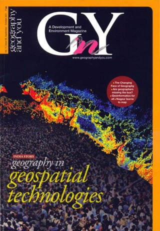
- 3. Nagpur learns to map A three day National Level Data Users' Seminar and GIS Training for 55 senior secondary school and junior college teachers from the Vidharba region of India held in Nagpur, from 16 to 18 of October 2011 , turned into a memorable event for all. - Staff Report er The Data Users' Seminar cum Training women at every level. She added that the Programme in Nagpur during 16-18 three days' training cum seminar programme October 2011, was one that turned teachers will provide an interactive platform for the from around the region into students for participants, especially women , to learn three days. The teachers from Kendriya and come forward in this exciting world. Dr Vidyalayas, well known public schools and Smita Sengupta, Senior Scientist , Indian government and junior colleges in Vidharba Institute of Technology (liT) Bombay, Dr G P were trained in geographic information Obi Reddy, Senior Scientist and In-charge system (GIS), global positioning system GIS Section, NBSS & LUP and Shri Vikas (GPS) and remote sensing technologies that Dabadhe, Project Officer, Maharashtra are today a part of the school curriculum. Energy Development Agency (M EDA) were Inaugurating the event, Dr Dipak Sarkar, other speakers at the inaugural session. Director, National Bureau of Soil Survey and Among those who prominently participated Land Use Planning (NBSS & LUP) laid stress in the sessions included Shri M K Jaiswal, on the importance of the technical training Assistant Professor, Kavikulguru Institute for capacity building for school teachers. of Technology and Science, Nagpur Prof Saraswati Raju , Centre for the Study of and Dr Rahul V Ralegaonkar, Assistant Regional Development, Jawaharlal Nehru Professor. Visvesvaraya National Institute of University (JNU), a resource person for the Technology, Nagpur. event, pointed out how the field of Science The teachers were trained in the and Technology systematically has fewer fundamentals of GIS and concepts of 24 . SEPTEMBER ' OCTOBER 2011 · GEOGRAPHY AND YOU
- 4. DATA U S ERS' WORKSHOP map were covered in a series of lectures spanning the three days. The basic introduction to maps and cartography included evolution of mapping in India, definition and type of map representations and its basic elements. Cadastral, topographical, and atlas maps; digital elevation model (OEM); scales, elements sensitive to context and those used selectively to assist effective communication were also included in the course curriculum. In the following days discussions were conducted on hardware and software, proprietary vs open source and study through Internet. Open source GIS was also taught and available software was highlighted through Open Geospatial Consortium, Mapnik, FDO, Map Guide Open Source, UMN Mapserver, GRASS, QGIS, OSSIM, TerraLlb, PostGIS, GeoServer, degree, JUMP/OpenJUMP/ Kosma and uDig. Hands on lab training was imparted on QGIS with the help of data for the district of Prakasam in Andhra Pradesh. Global positioning system (GPS) was also discussed and field work undertaken at Putala Lake, Nagpur. Knowledge about space, user and control segment, several types of GPS- portable, pocket, in-dash, fitness and cycling, motor cycle, marine- was imparted. During remote sensing session , the participants were taught the fundamentals of the subject, including types of resolutions, techniques such as aerial photography, etc. and about the types of classification such as supervised and unsupervised. The seminar and training programme was organised by Learning in Geography, Humanities, Technology and Science (LIGHTS) Research Foundation, an NGO, and supported by the Natural Resources and Data Management System (NRDMS), Department of Science and Technology (DST), Government of India; Oil and Natural Gas Corporation (ONGC) and Ministry of New and Renewable Energy (MNRE), Government of India. tI!1 GEOGRAI'HYAN O YOU· SEPTEMBER · OCTOBER 2011 .2 5
- 5. • - ,. ~ ~. .~ , .. i ' .' , . ~ . • " • • _l Free GIS Training Senior secondary Teachers Register Now Training commences 15 December onwards O'gil nls,d by Suppor.ld by I -- THE SPATIAL SUPPORT FOil LOCAL LEVEl PLANNING Department of Science & Technology LIGHTS, Research Foundation Last date of registration for all cities 15 of December 2011. Send enquiries to Iights2003@gmail.comforregistrationguidance.