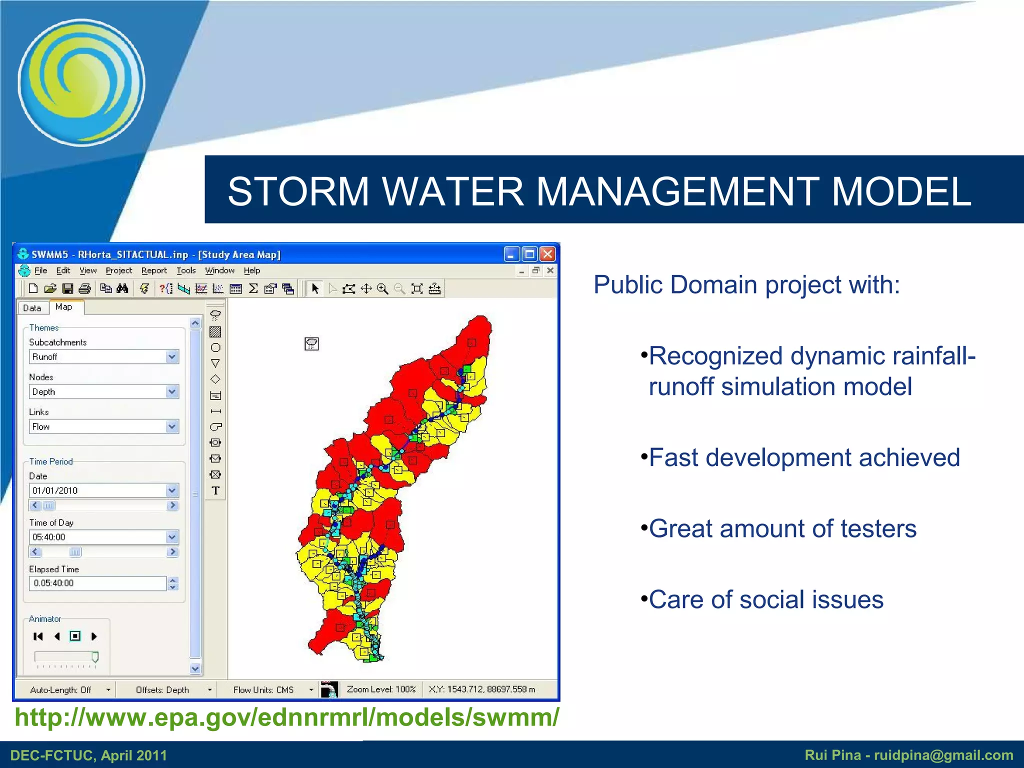
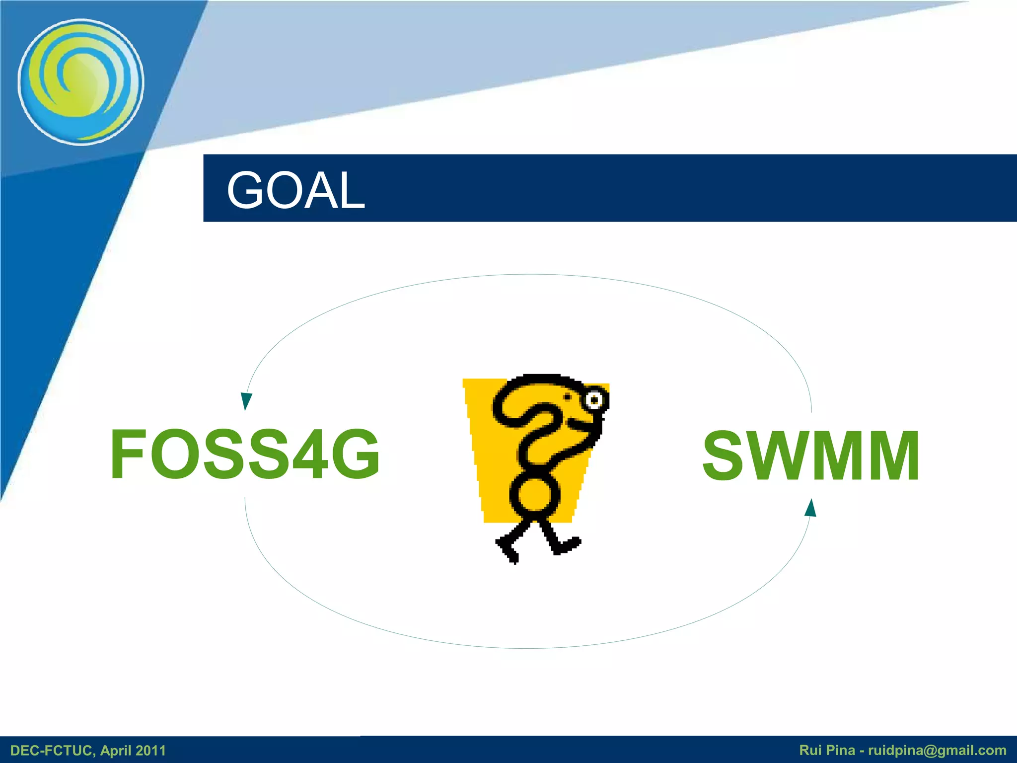
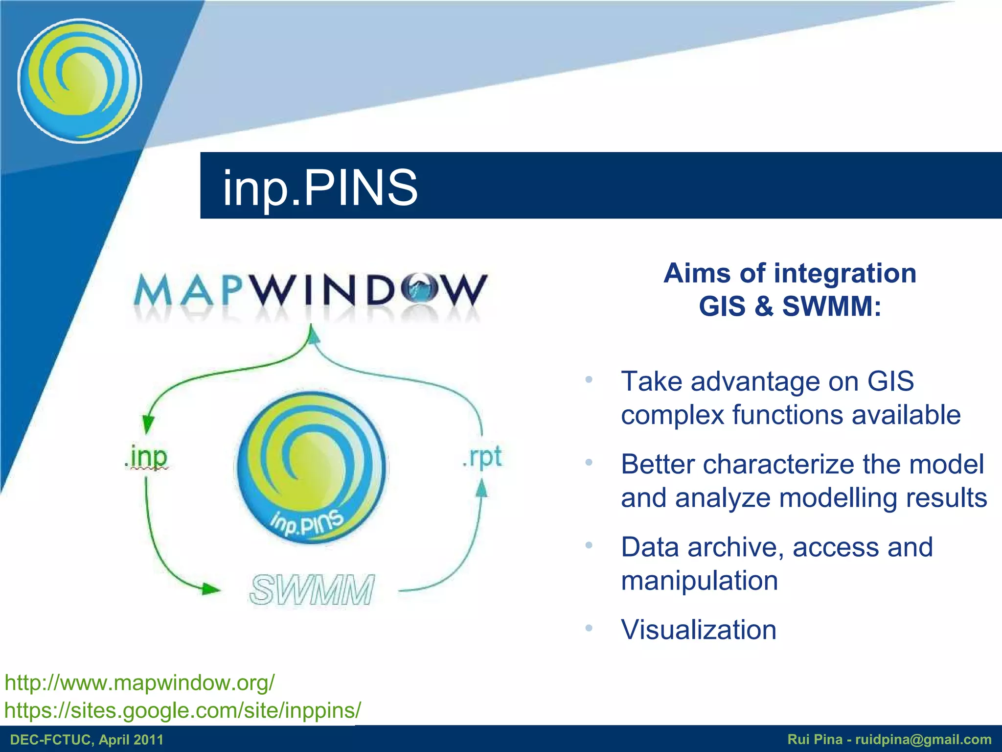
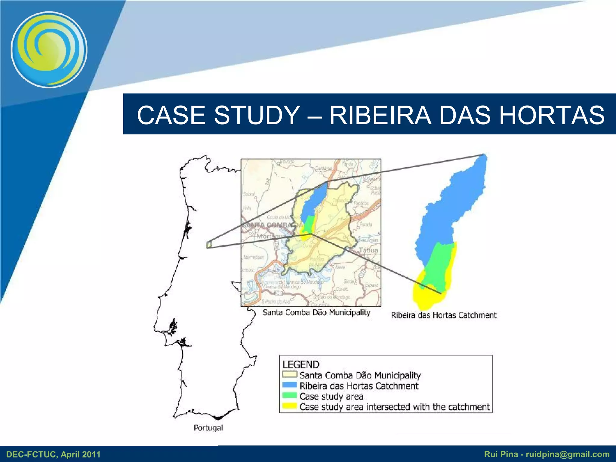
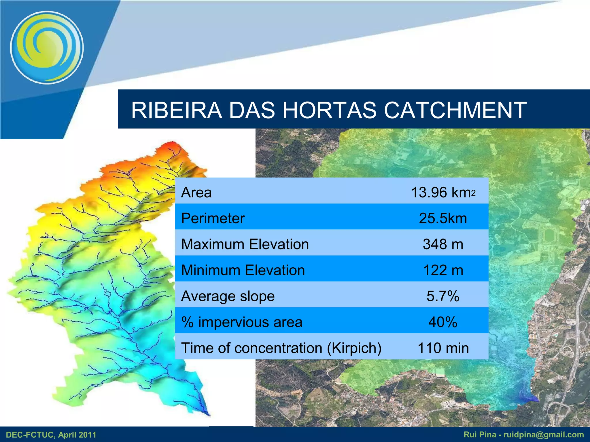
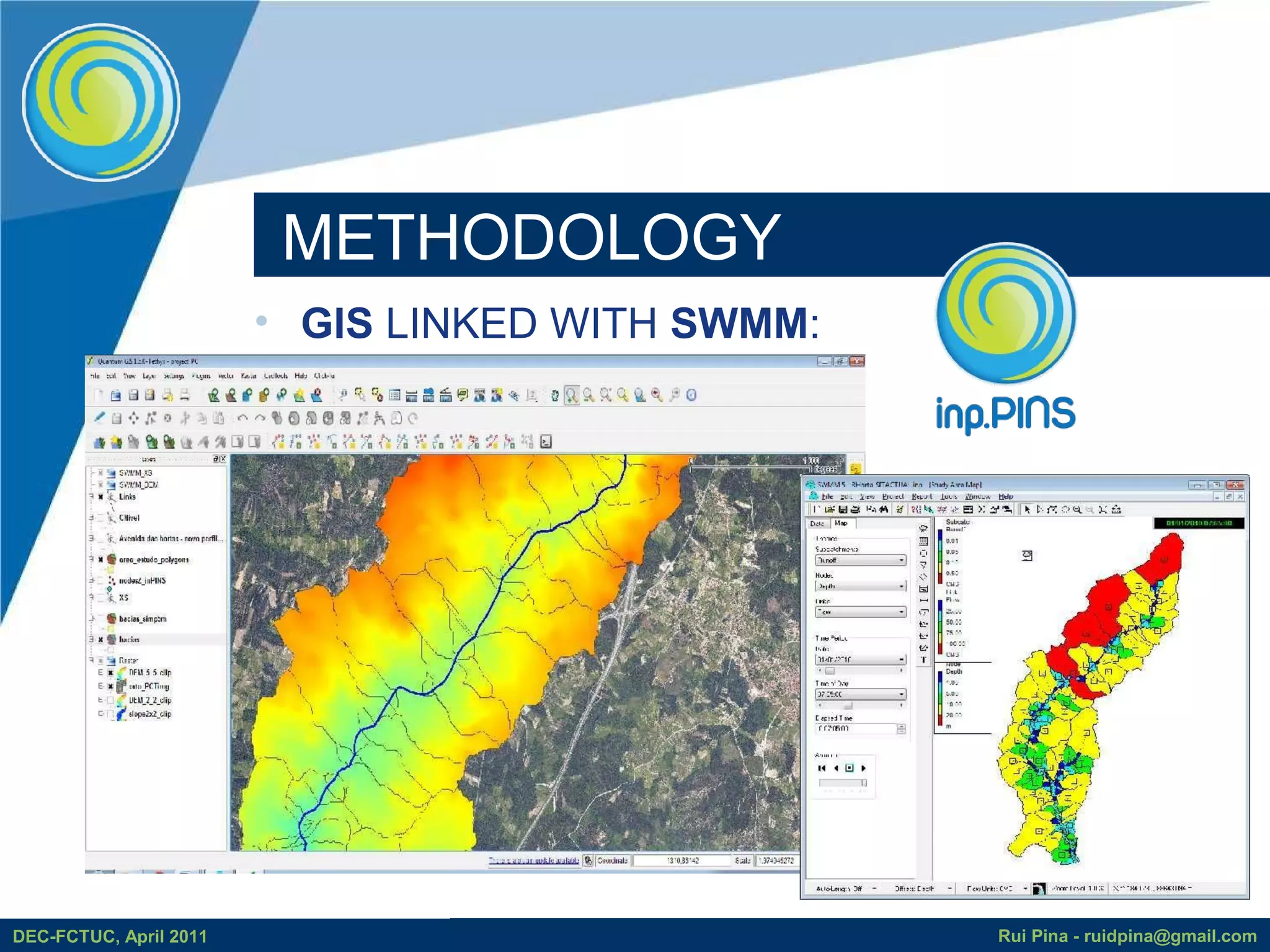
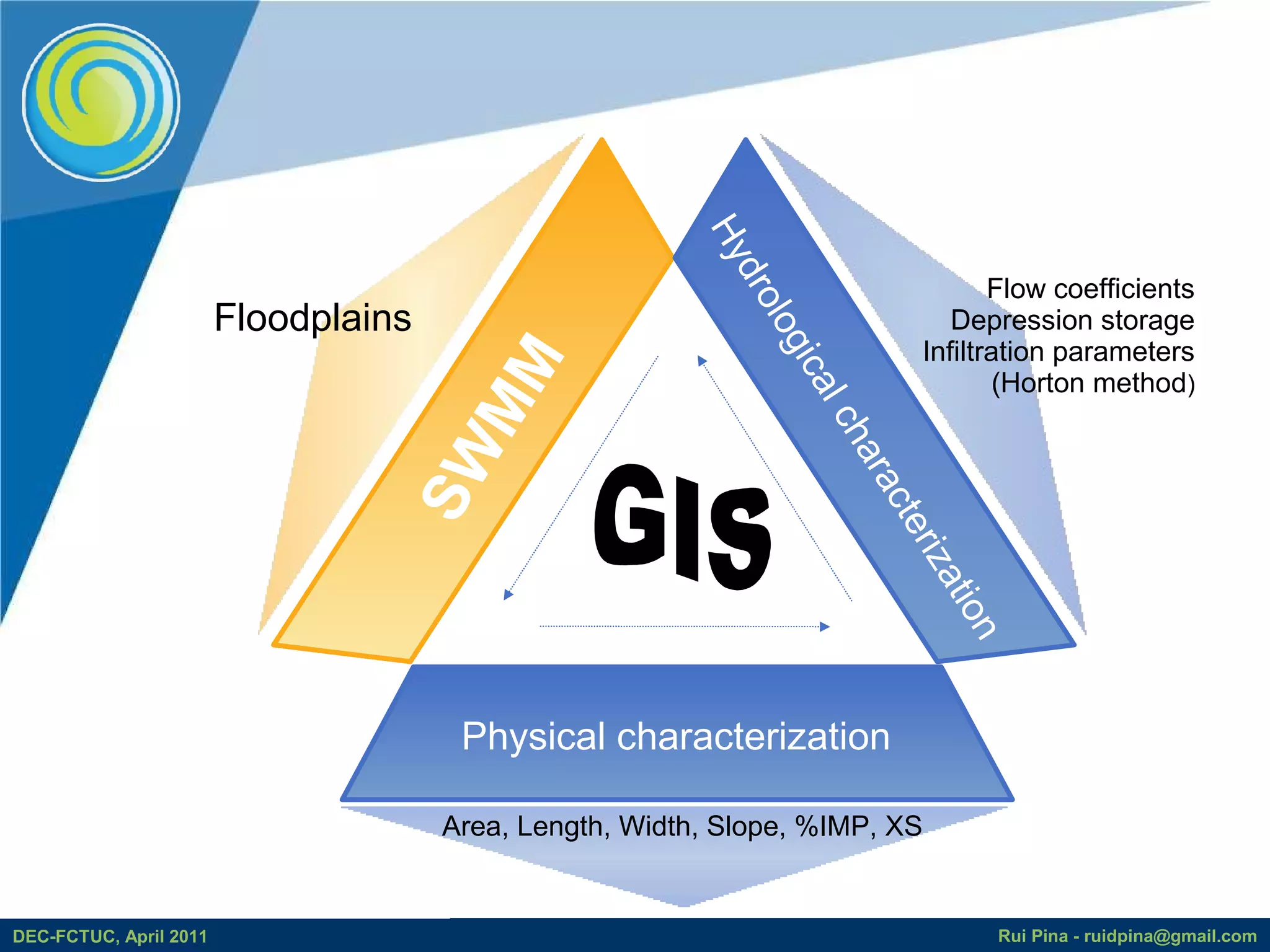
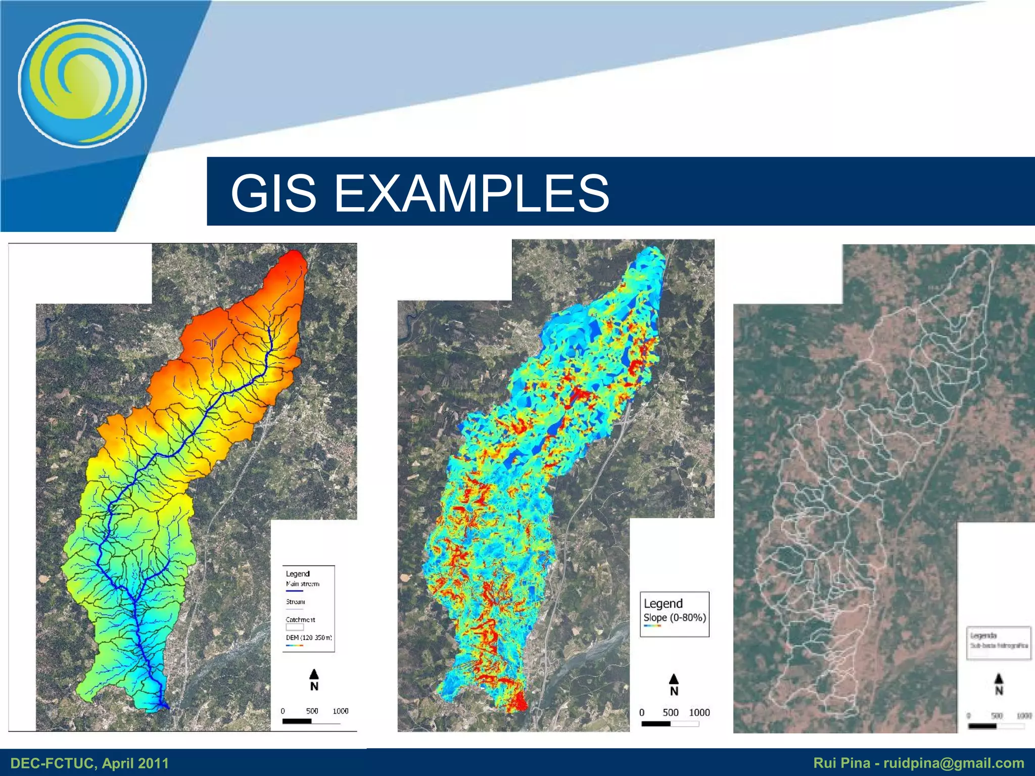
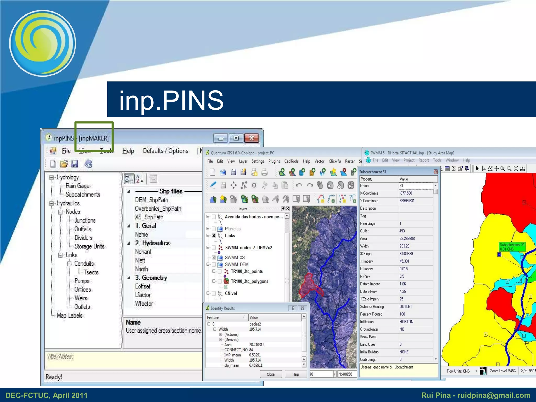
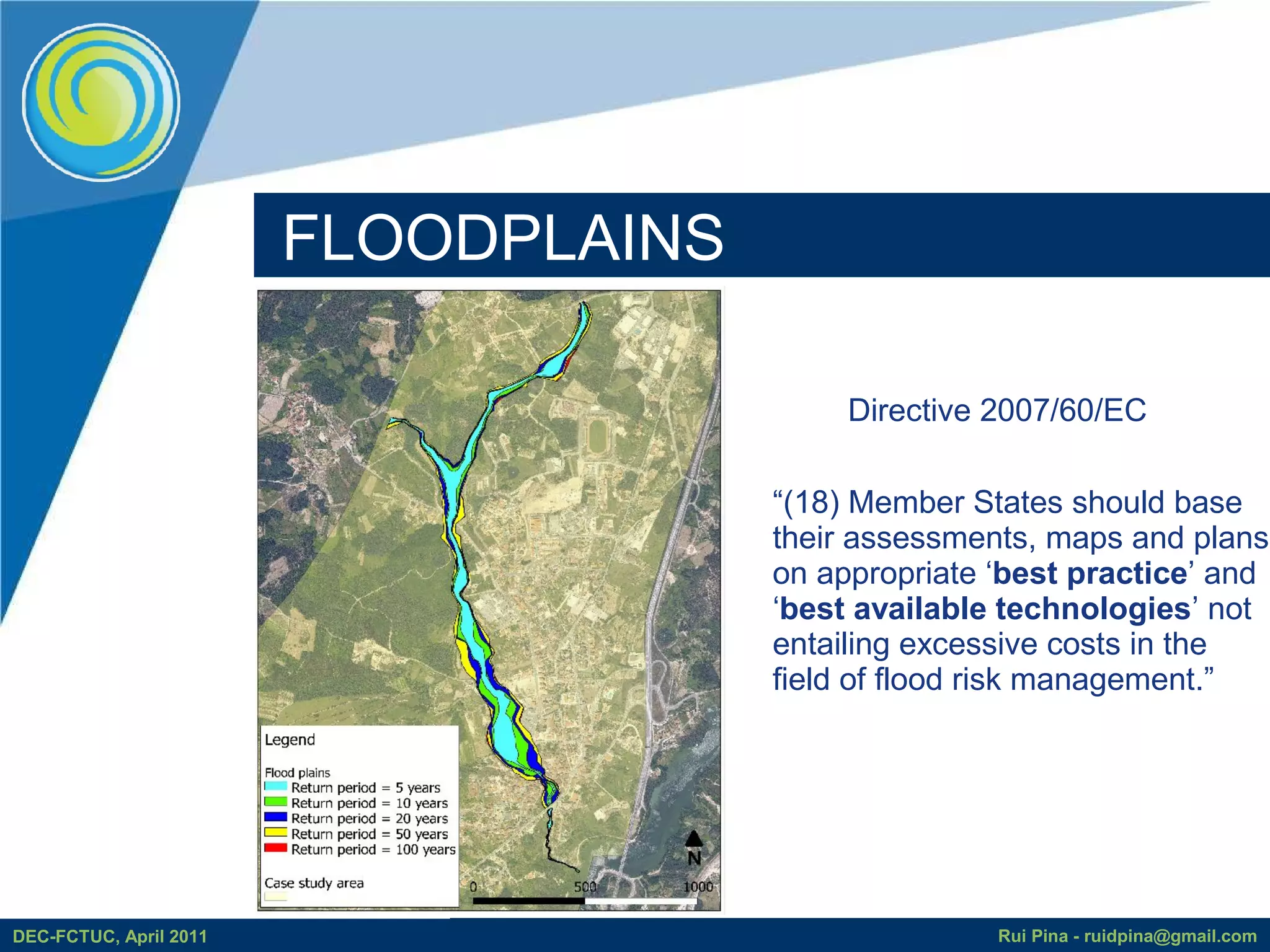
FLOOD PLAIN DELINEATION
           WITH FREE AND OPEN SOURCE
                   SOFTWARE

                             Rui D. PINA
                         ruidpina@gmail.com

                        Prof. Alfeu Sá Marques

DEC-FCTUC, April 2011                            Rui Pina - ruidpina@gmail.com
WHAT IS FREE AND OPEN SOURCE SOFTWARE (FOSS)?


 Users' freedom: run, copy, distribute, study, change and improve the software.
DEC-FCTUC, April 2011                                          Rui Pina - ruidpina@gmail.com
WHAT IS FOSS?

                 “It is a gift culture, where the basics are
                 taken care of and social status is gained
                 by giving things away, rather than
                 accumulating.” (Harvey and Han, 2002)


DEC-FCTUC, April 2011                                Rui Pina - ruidpina@gmail.com
FOSS4G


                          http://www.osgeo.org/


DEC-FCTUC, April 2011                             Rui Pina - ruidpina@gmail.com
STORM WATER MANAGEMENT MODEL

                                           Public Domain project with:

                                               •Recognized dynamic rainfall-
                                                runoff simulation model

                                               •Fast development achieved

                                               •Great amount of testers

                                               •Care of social issues


http://www.epa.gov/ednnrmrl/models/swmm/
DEC-FCTUC, April 2011                                        Rui Pina - ruidpina@gmail.com
GOAL


             FOSS4G            SWMM


DEC-FCTUC, April 2011           Rui Pina - ruidpina@gmail.com
inp.PINS
                                               Aims of integration
                                                 GIS & SWMM:

                                         • Take advantage on GIS
                                           complex functions available
                                         • Better characterize the model
                                           and analyze modelling results
                                         • Data archive, access and
                                           manipulation
                                         • Visualization
http://www.mapwindow.org/
https://sites.google.com/site/inppins/
DEC-FCTUC, April 2011                                      Rui Pina - ruidpina@gmail.com
CASE STUDY – RIBEIRA DAS HORTAS


DEC-FCTUC, April 2011                         Rui Pina - ruidpina@gmail.com
RIBEIRA DAS HORTAS CATCHMENT


                           Area                              13.96 km2
                           Perimeter                          25.5km
                           Maximum Elevation                  348 m
                           Minimum Elevation                  122 m
                           Average slope                       5.7%
                           % impervious area                   40%
                           Time of concentration (Kirpich)   110 min


DEC-FCTUC, April 2011                                                 Rui Pina - ruidpina@gmail.com
METHODOLOGY
                        • GIS LINKED WITH SWMM:


DEC-FCTUC, April 2011                             Rui Pina - ruidpina@gmail.com
Hy
                                                           dro
                                                                                     Flow coefficients
                        Floodplains                                              Depression storage


                                                             lo g
                                                                              Infiltration parameters


                                    MM


                                                                 ica
                                                                                      (Horton method)


                                                                    lc
                                                                      ha
                                  SW


                                                                        rac
                                                                        ter
                                                                           i
                                                                          za
                                                                             ti on
                                       Physical characterization

                                      Area, Length, Width, Slope, %IMP, XS


DEC-FCTUC, April 2011                                                               Rui Pina - ruidpina@gmail.com
GIS EXAMPLES


DEC-FCTUC, April 2011                  Rui Pina - ruidpina@gmail.com
inp.PINS


DEC-FCTUC, April 2011              Rui Pina - ruidpina@gmail.com
inp.PINS


DEC-FCTUC, April 2011              Rui Pina - ruidpina@gmail.com
FLOODPLAINS

                                           Directive 2007/60/EC

                                      “(18) Member States should base
                                      their assessments, maps and plans
                                      on appropriate ‘best practice’ and
                                      ‘best available technologies’ not
                                      entailing excessive costs in the
                                      field of flood risk management.”


DEC-FCTUC, April 2011                                Rui Pina - ruidpina@gmail.com
inp.PINS with 6 months worldwilde


                                                 https://sites.google.com/site/inppins/

                                 > 300 downloads from http://www.mapwindow.org/
DEC-FCTUC, April 2011                                           Rui Pina - ruidpina@gmail.com
CONCLUSIONS

                 • inp.PINS – interoperability between GIS & SWMM
                 • FOSS advantages:
                        – Reduced costs
                        – Tools adapted to users' needs
                        – Standards: interoperability

                 • FUTURE WORK: EPANET
                 • LIMITATIONS:
                        – Dependent on EPA software developments


DEC-FCTUC, April 2011                                         Rui Pina - ruidpina@gmail.com

FLOODS&FOSS

  • 1.
    FLOOD PLAIN DELINEATION WITH FREE AND OPEN SOURCE SOFTWARE Rui D. PINA ruidpina@gmail.com Prof. Alfeu Sá Marques DEC-FCTUC, April 2011 Rui Pina - ruidpina@gmail.com
  • 2.
    WHAT IS FREEAND OPEN SOURCE SOFTWARE (FOSS)? Users' freedom: run, copy, distribute, study, change and improve the software. DEC-FCTUC, April 2011 Rui Pina - ruidpina@gmail.com
  • 3.
    WHAT IS FOSS? “It is a gift culture, where the basics are taken care of and social status is gained by giving things away, rather than accumulating.” (Harvey and Han, 2002) DEC-FCTUC, April 2011 Rui Pina - ruidpina@gmail.com
  • 4.
    FOSS4G http://www.osgeo.org/ DEC-FCTUC, April 2011 Rui Pina - ruidpina@gmail.com
  • 5.
    STORM WATER MANAGEMENTMODEL Public Domain project with: •Recognized dynamic rainfall- runoff simulation model •Fast development achieved •Great amount of testers •Care of social issues http://www.epa.gov/ednnrmrl/models/swmm/ DEC-FCTUC, April 2011 Rui Pina - ruidpina@gmail.com
  • 6.
    GOAL FOSS4G SWMM DEC-FCTUC, April 2011 Rui Pina - ruidpina@gmail.com
  • 7.
    inp.PINS Aims of integration GIS & SWMM: • Take advantage on GIS complex functions available • Better characterize the model and analyze modelling results • Data archive, access and manipulation • Visualization http://www.mapwindow.org/ https://sites.google.com/site/inppins/ DEC-FCTUC, April 2011 Rui Pina - ruidpina@gmail.com
  • 8.
    CASE STUDY –RIBEIRA DAS HORTAS DEC-FCTUC, April 2011 Rui Pina - ruidpina@gmail.com
  • 9.
    RIBEIRA DAS HORTASCATCHMENT Area 13.96 km2 Perimeter 25.5km Maximum Elevation 348 m Minimum Elevation 122 m Average slope 5.7% % impervious area 40% Time of concentration (Kirpich) 110 min DEC-FCTUC, April 2011 Rui Pina - ruidpina@gmail.com
  • 10.
    METHODOLOGY • GIS LINKED WITH SWMM: DEC-FCTUC, April 2011 Rui Pina - ruidpina@gmail.com
  • 11.
    Hy dro Flow coefficients Floodplains Depression storage lo g Infiltration parameters MM ica (Horton method) lc ha SW rac ter i za ti on Physical characterization Area, Length, Width, Slope, %IMP, XS DEC-FCTUC, April 2011 Rui Pina - ruidpina@gmail.com
  • 12.
    GIS EXAMPLES DEC-FCTUC, April2011 Rui Pina - ruidpina@gmail.com
  • 13.
    inp.PINS DEC-FCTUC, April 2011 Rui Pina - ruidpina@gmail.com
  • 14.
    inp.PINS DEC-FCTUC, April 2011 Rui Pina - ruidpina@gmail.com
  • 15.
    FLOODPLAINS Directive 2007/60/EC “(18) Member States should base their assessments, maps and plans on appropriate ‘best practice’ and ‘best available technologies’ not entailing excessive costs in the field of flood risk management.” DEC-FCTUC, April 2011 Rui Pina - ruidpina@gmail.com
  • 16.
    inp.PINS with 6months worldwilde https://sites.google.com/site/inppins/ > 300 downloads from http://www.mapwindow.org/ DEC-FCTUC, April 2011 Rui Pina - ruidpina@gmail.com
  • 17.
    CONCLUSIONS • inp.PINS – interoperability between GIS & SWMM • FOSS advantages: – Reduced costs – Tools adapted to users' needs – Standards: interoperability • FUTURE WORK: EPANET • LIMITATIONS: – Dependent on EPA software developments DEC-FCTUC, April 2011 Rui Pina - ruidpina@gmail.com