SlideShare a Scribd company logo
 
Golden State Warriors Event
Center
Draft Environmental Impact Report
City & County of San Francisco
December 2014
  2	
  
Golden State Warriors Event Center
Draft Environmental Impact Report
December 2014
Prepared for:
County of San Francisco
Office of Community Investment and Infrastructure
One South Van Ness Avenue San Francisco, CA 94103
Prepared by:
Planning Department, City and County of San Francisco Environmental
Planning Division
1650 Mission Street, Suite 400
San Francisco, CA 94103
Deputy Environmental Review Officer: Matt Richards
Environmental Planner: Kelly Lewis
Environmental Planner: Blake Lecroy
  3	
  
Table of Contents
1.0 Introduction……………………………………………. 4
2.0 Project Description…………………………………… 6
2.1 Project Location……………………………… 8
2.2 Project Characteristics………………………. 9
3.0 Environmental Setting, Impacts, & Mitigation
Measures……………………………………………………12
3.1 Aesthetics
3.1.1 Environmental Setting
3.1.2 Thresholds of Significance
3.1.3 Environmental Impacts
3.1.4 Cumulative Impacts
3.1.5 Mitigation Measures
3.2 Wildcard……………………………………… 28
3.2.1 Hydrology
3.2.2 Biological Resources
3.2.3 Hazards & Hazardous Wastes
4.0 Alternatives Analysis……………………………….. 67
5.0 Other CEQA considerations………………………. 68
6.0 References………………………………………….. 70
7.0 Organization Consultation…………………………. 70
7.1 List of Preparers……………………………. 70
  4	
  
Introduction:
In accordance with CEQA guidelines 15063(b)(1)(C) and 15168(d)(1) this section of the EIR
provides a description of the project, identification of significant effects and proposed alternatives
that would lessen or reverse those effects, areas of controversy, and issues to be resolved
including the choice among alternatives and how to mitigate these effects.
Summary:
GSW Arena LLC, an affiliate of Golden State Warriors, LLC, which owns and operates the Golden
State Warriors National Basketball Association (NBA) team, proposes to construct a multi-purpose
event center and a variety of mixed uses, including office, retail, open space and structured parking
on an approximately 11-acre site (Blocks 29-32) within the Mission Bay South Redevelopment
Plan Area of San Francisco. The project site is bordered by South Street on the north, Third Street
on the west, 16th Street on the south, and by the future planned realigned Terry A. François
Boulevard on the east. The proposed event center would host the Golden State Warriors
basketball team during the NBA season, as well as provide a year-round venue for a variety of
other uses, including concerts, family shows, other sporting events, cultural events, conferences
and conventions. GSW has entered into an agreement to purchase the project site from the current
site owner, an affiliate of salesforce.com. The project is subject to review under the California
Environmental Quality Act (CEQA) and a number of local and state approvals.
Areas of Controversy/Issues to be Resolved:
According to the CEQA guidelines 15063(b)(1)(C) and 15168(d)(1) this section of the EIR is to
identify potential areas of controversy and issues to be resolved by the decision making body.
Generally these include those areas where a significant unavoidable impact has been identified, as
well as issue areas where concerns have been raised, primarily through the notice of preparation
process, indication of a level of controversy. For the GSW Arena there would be significant effects
on hazardous materials, population, air quality, traffic, aesthetics, hydrology, biological resources,
traffic/circulation and public utilities.
Classification of Impacts:
Potential environmental impacts for the proposed project have been classified in the EIR in the
following five categories:
- No new or more severe environmental impact
- Could have new substantial environmental impacts. A mitigated negative
declaration would be prepared.
- May have new substantial impact or more severe impact than expected. EIR will
be prepared.
- Will have new substantial effect or severe effect on the environment unless
mitigated.
  5	
  
- Although the project will have environmental effect, all effects have been mitigated
and no further environmental documentation is required.
Alternatives:
The alternatives for the Golden State Warriors arena is limited to a change of location and not
design. The GSW arena is set to be constructed within the Mission Bay South Redevelopment
area (Blocks 29-32). There are six possible alternate locations each with its own characteristics
and each would need its own initial study. One valid alternative would be the construction of the
stadium at candlestick point where a retired football stadium already exists. The plot of land
already has the traffic capacity, parking capacity, public utility availability, and space.
  6	
  
2.0 PROJECT DESCRIPTION
Overview
GSW Arena LLC (GSW), an affiliate of Golden State Warriors, LLC, which owns and operates the
Golden State Warriors National Basketball Association (NBA) team, proposes to construct a multi-
purpose event center and a variety of mixed uses, including office, retail, open space and
structured parking on an approximately 11-acre site (Blocks 29-32) within the Mission Bay South
Redevelopment Plan Area of San Francisco (see Figure 1 for aerial photograph and Figure 2 for
existing roadway network in Mission Bay). The project site is bounded by South Street on the
north, Third Street on the west, 16th Street on the south, and by the future planned realigned Terry
A. François Boulevard on the east. The proposed event center would host the Golden State
Warriors basketball team during the NBA season, as well as provide a year-round venue for a
variety of other uses, including concerts, family shows, other sporting events, cultural events,
conferences and conventions. GSW has entered into an agreement to purchase the project site
from the current site owner, an affiliate of salesforce.com. The project is subject to review under
the California Environmental Quality Act (CEQA) and a number of local and state approvals.
Development is allowed within the Mission Bay South Redevelopment Plan Area, including Blocks
29-32, consistent with the land use program and subject to the development controls of the
Mission Bay South Redevelopment Plan, Mission Bay South Design for Development, and other
related documents (see Background, below). No amendment to the South Plan would be required,
although the proposed project at Blocks 29-32 would require certain amendments and/or variations
to other documents.
The Mission Bay Final Subsequent Environmental Impact Report (Mission Bay FSEIR), certified in
September 1998, is a program EIR under CEQA Guidelines 15168 and a redevelopment plan EIR
under CEQA Guidelines 15180 (see Background, below). The Mission Bay FSEIR analyzed the
environmental impacts associated with the development program proposed for the entire plan area,
including the program under the Mission Bay South Redevelopment Plan, which includes Blocks
29-32. Thus, under CEQA, the proposed project at Blocks 29-32 is considered a subsequent
activity under the Mission Bay South Redevelopment program, and this Initial Study evaluates the
environmental effects of the proposed project relative to the certified Mission Bay FSEIR.
This Initial Study is prepared in accordance with the CEQA Guidelines Section 15063, which
provides for preparation of an initial study to determine if a project may have a significant effect on
the environment, and with CEQA Guidelines Section 15168(c), which provides for subsequent
activities in a program to be examined in the light of a previously certified program EIR. The City’s
Office of Community Investment and Infrastructure (OCII) is the CEQA lead agency for this project,
and has entered into an agreement with the San Francisco Planning Department, Environmental
Planning Division, to assist in the preparation of the related environmental review documents.
  7	
  
2.1 PROJECT LOCATION
SOURCE: Google Maps, ESA, 2014
  8	
  
Figure 1
Aerial Photograph of Mission Bay
SOURCE: ESA, 2014
Figure 2
  9	
  
Existing Roadway Network in Mission Bay
2.2 Project Characteristics
Proposed Facilities
Development Plan Overview
Under the project, Blocks 29-32 would be developed with a multi-purpose event center and a
variety of mixed uses, including office, retail, open space and structured parking on the
approximately 11-acre site. Figure 4 presents the conceptual project site plan, illustrating primary
project features and associated building heights.8 Table 1 provides a summary overview of the key
characteristics of the project facilities.
The proposed roughly circular-shaped event center building would be located in the central-east
portion of the site. The event center building would be approximately 135 feet at its roof peak, and
would include multiple levels of varying elevations. The event center would include a wide variety
of facilities, including spectator seating and suites, restaurants/bars and clubs, meeting rooms;
spectator support facilities such as food service/kitchens, concessions, merchandising and
restrooms; Golden State Warriors management offices and practice facility; media support
facilities, and event center operations such as loading, staging and marshaling areas,
mechanical/electrical/ plumbing space and storage and maintenance facilities. Two office and retail
buildings would be located on the west side of the project site, at the corner of Third Street and
South Street (northwest corner of site) and at the corner of Third Street and 16th Street (site
southwest corner). The two office and retail buildings would each consist of 11 stories (160 feet
tall); each office and retail building would consist of a podium ground level plus 5 podium levels (90
feet tall), with a 5-story (70-foot) tower (with smaller floorplate than the podium) above. These
buildings could serve a variety of office and/or research and development uses. Retail uses would
occupy several areas of the site, including the lower floor(s) of the two office and retail buildings,
within or adjacent to certain plaza-facing areas of the event center (including in the 38-foot high
“gate house” building located along Third Street), and 41-foot high retail building along Terry A.
François Boulevard and South Street.
Three levels of enclosed on-site parking (two below grade, and one at street level) providing 950
parking spaces would be located below the office and retail buildings and plaza areas. (See also
Off-site Parking Facilities, below.) Approximately 3.2 acres of open space would be located on-
site, including a proposed Third Street Plaza (elevated at approximately 8 feet above Third Street)
on the west side of the project site between the event center and Third Street, and a proposed
ground-level Southeast Plaza in the southeastern corner of the site.9 These plazas would be
connected by a pedestrian ramp wrapping around the exterior of the north and eastern-sides of the
event center, and an outdoor covered passageway, or atrium, wrapping around the southwest
portion of the event center.
  10	
  
While the project would not be subject to the City’s Standards for Bird-Safe Buildings, the project
sponsor proposes to incorporate bird-safe measures that would reduce the potential effects of the
project on birds.
Vehicular Access and Circulation
All vehicular ingress/egress for the garage would occur at 16th Street (at Illinois Street) or South
Street (at Bridgeview Way). The 16th Street driveway would serve as the primary vehicular access
point for autos to the parking garage, and the sole access point for trucks to the below-grade
loading docks. Most proposed loading and service areas would be located on the lower level, while
one loading slip would be provided at grade (concealed from view beneath the pedestrian path) to
serve retail located at the site’s northeastern corner. A total of 13 truck docks would be provided to
serve the event center and office and retail uses. The South Street driveway would provide a
secondary access for autos to the garage and small delivery trucks for retail located at the site’s
northeastern corner. (See also Proposed Operations, below, for a description of the proposed
Transportation Management Plan that the sponsor would implement as part of the project.)
Pedestrian and Bicycle Access
The primary pedestrian access to the event center for large attendance events would be via the
Third Street Plaza. The Southeast Plaza would serve as a primary pedestrian access for smaller-
attendance events, and as a secondary access point for large-attendance events. Pedestrian
access to the two office and retail buildings would be available on South and 16th Streets and from
the Third Street plaza, with additional access to ground-floor retail uses within those buildings
available via South and Third Streets. The retail buildings in the northeast corner of the site would
be accessed directly via Terry A. François Boulevard and South Street. New sidewalks would be
constructed along the perimeter of the project site.
Bike storage rooms would be located in each of the proposed office and retail buildings. Bike
parking and storage racks would also be available at various locations along the perimeter of the
project site, with bike valet service in proximity to the site and temporary bike corrals located within
the plaza areas to serve patrons as needed.
Infrastructure Improvements
The project proposes all new utility infrastructure facilities on-site, including water supply (low- and
high-pressure water lines and recycled water lines); wastewater collection; storm drainage;
electrical/gas, and communications. Infrastructure and utilities within adjacent streets that serve the
project site are provided by the master developer, FOCIL-MB, LLC, as part of the Mission Bay
South Infrastructure Plan.
  11	
  
Off-Site Parking Facilities
As part of the project, the sponsor has acquired 132 existing off-site parking spaces in the 450
South Street parking garage, accessed from South Street and Bridgeview Way directly north of the
project site, to provide additional parking to serve the project.
Sustainability
The proposed development would be subject to a number of sustainability requirements, including
the California CalGreen Code, City of San Francisco Green Building Code, Design for
Development for the Mission Bay South Area, and the 2012 NBA Arena Design Standards –
Sustainability Requirements. The project would be designed to Leadership in Energy and
Environmental Design (LEED®) Gold standards using a campus approach, whereby each
individual proposed structure as well as the overall site would qualify for individual Gold ratings.10
This would be achieved through incorporation of a variety of design features and implementation of
practices during construction and operation to provide energy and water conservation and
efficiency, encourage alternative transportation, promote a healthy indoor environment, minimize
waste, and maximize recycling opportunities.
South Plan Improvements Planned in the Vicinity of the Project Site: Terry A. François Boulevard
Realignment and Public Access Improvements at Bayfront Park
Pursuant to the Mission Bay Plan and not part of the proposed project, development of Blocks 29-
32 would trigger the realignment of Terry A. François Boulevard to extend adjacent to the east side
of Blocks 29-32, and the construction of public access improvements at Bayfront Park east of this
realigned roadway. The realigned Terry A. François Boulevard would contain four travel lanes (two
northbound and two southbound) plus two parking lanes; and - on the east side of the roadway – a
two-way cycletrack (bike path) separated from the roadway by a raised buffer.
Following realignment of Terry A. François Boulevard, Bayfront Park would be improved and
expanded to 5.5 acres, encompassing an area roughly south of Pier 54, north of 16th Street, east
of Terry A. François Boulevard, and west of the Bay shoreline. Both the realignment of Terry A.
François Boulevard and Bayfront Park public access improvements would be implemented by the
master developer, FOCIL-MB, LLC, prior to occupancy of buildings at the project site.
There are no applicable adopted habitat conservation plans, natural community conservation
plans, or other approved habitat conservation plans that apply to the project site. Therefore,
criterion E.13(f) does not apply to the proposed project, and this topic is not discussed further in
this Initial Study or in the SEIR.
  12	
  
mixed- use residential, or employment center project on an infill site located within a transit priority
area shall not be considered significant impacts on the environment.” Accordingly, aesthetics and
3.0 Setting, Impacts Mitigations
3.1.1 Aesthetics
parking are no longer to be considered in determining if a project has the potential to result in
significant environmental effects for projects that meet the following three criteria:
1 · The project is in a transit priority area;19 and
2 · The project is on an infill site;20 and
3 · The project is residential, mixed-use residential, or an employment center.21
The proposed project meets each of the above three criteria because it (1) is located in
proximity to several transit routes; (2) is located on an infill site that has previously been
developed with industrial and commercial uses and is surrounded by areas of either
recently completed or planned urban development; and (3) would be an employment
center supporting a range of commercial uses, located in proximity to several transit
routes, and in an urban area on a site already developed and zoned for commercial uses
with a floor area ration (FAR) greater than 0.75.22 Thus, this Initial Study and the SEIR do
not consider aesthetics (or parking) in determining the significance of project impacts
under CEQA.
Nevertheless, Public Resources Code Section 21099(d)(2)(A) states: “This subdivision
does not affect, change, or modify the authority of a lead agency to consider aesthetic
impacts pursuant to local design review ordinances or other discretionary powers provided
by other laws or policies.” Consequently, all applicable City urban design standards and
  13	
  
guidelines governing the project site and proposed project, including the Mission Bay
South Redevelopment Plan, Mission Bay South Design for Development, and Mission Bay
South Signage Plan would apply to the proposed project. Furthermore, the project would
be subject to all applicable design review approvals, including Major Phase approval by
OCII, and Schematic Designs for each building and private open spaces, which would
consider relevant design and aesthetic issues.
Public Resources Code Section 21099(d)(2)(B) states: “For the purposes of this
subdivision, aesthetic impacts do not include impacts on historical or cultural resources.”
Please refer to Cultural Resources, below, for an assessment of potential project impacts
on historic and cultural resources. Environmental effects of lighting on birds are addressed
under Biological Resources.
	
  
Summary of Land Use Impacts in Mission Bay FSEIR
The land use significance criteria were addressed in the Mission Bay FSEIR in the Land Use
section; the Plans, Policies, and Permits section; and the Initial Study Land Use section. Relevant
information from these sections is summarized below.
The Mission Bay FSEIR Land Use setting section characterized existing land uses present within
and near the Mission Bay plan area at that time. The Mission Bay FSEIR indicated the land uses
within Blocks 29-32 at the time of preparation of the FSEIR consisted of industrial and commercial
uses, parking facilities and vacant land (see Hazards and Hazardous Materials, below, for a
discussion of known historical land uses within Blocks 29-32, and additional detail on specific land
uses that existed at the time of preparation of the Mission Bay FSEIR).
While the Mission Bay FSEIR provided CEQA environmental analysis for the entire Mission Bay
program, it divided the plan area into subareas to facilitate the analysis. Block 29-32 was located
within the East Subarea (the area bounded by existing Terry François Blvd, Mariposa Street, Third
Street, and Mission Bay Boulevard South). Development of this subarea was assumed to include
commercial industrial and office; entertainment-oriented, neighborhood- and City-serving retail;
and public open space land uses. Buildings in the subarea would be allowable up to 90 feet in
height, with 7 percent of the developable area allowable up to 160 feet high (along Third Street).
Buildings along the future realigned Terry A. François Boulevard would be restricted to 90 feet in
height.
  14	
  
The Mission Bay FSEIR Initial Study Land Use section determined that the Mission Bay plan area
was a largely underutilized industrial area with no established residential community; this was the
basis for the Mission Bay FSEIR finding that the Mission Bay plan would not physically disrupt or
divide an established community.
The Mission Bay FSEIR Plans, Policies and Permits section compared the Mission Bay plan and
its implementing plans to other City plans, policies and regulations. The Mission Bay FSEIR
indicated that the Mission Bay Redevelopment Plans and Design for Development documents
would constitute the regulatory land use framework for the Mission Bay plan area, and would
supersede the City’s Planning Code (except where indicated in those implementing documents),
and furthermore, the Redevelopment Plans would be required to be found consistent with the City
General Plan prior to adoption. The Mission Bay FSEIR also acknowledged that certain
development activities proposed within the Mission Bay plan area would be subject to applicable
regional, State and/or federal permitting authority. The Mission Bay FSEIR analyzed the physical
environmental impacts of potential policy conflicts for specific environmental topics, such as
transportation and noise, in the respective sections of the FSEIR.
The Mission Bay FSEIR Land Use impacts section indicated that the Mission Bay project would
result in a substantial change in the type and intensification in land uses in the Mission Bay plan
area, involving demolition of most existing buildings and displacement of existing uses within the
Mission Bay plan area, and development of the proposed mixed-use land use program over the
build-out period. The Mission Bay FSEIR reported that the Mission Bay plan would continue the
trend that was occurring in other nearby areas of the City (e.g., South of Market) of redeveloping
former industrial areas into residential and commercial neighborhoods. The Mission Bay FSEIR
reported that the commercial industrial/retail uses proposed within the East Subarea of the Mission
Bay plan area, which includes Blocks 29-32, would be compatible with the medical research and
instructional uses proposed within the adjacent proposed UCSF campus subarea (located west of
the Blocks 29-32 across Third Street).
The Mission Bay FSEIR also acknowledged that construction activities associated with
development of the proposed uses within the Mission Bay plan area would create construction-
related effects (e.g., dust, noise, traffic) that may be noticeable and annoying to new residents
  15	
  
within the Mission Bay plan area, however, with implementation of mitigation measures identified in
the respective sections of the Mission Bay FSEIR, those effects would be mitigated to a less-
than-significant level. These factors provided the basis for the Mission Bay FSEIR finding that the
Mission Bay plan would not have a significant impact upon the existing character of the vicinity.
In summary, the Mission Bay FSEIR identified no significant impacts on land use from the Mission
Bay plan, and accordingly, did not require any mitigation measures related to land use effects.
Project Impacts
For those topics determined in this Initial Study to be focused out from further analysis in the SEIR,
this analysis first summarizes how these topics were addressed in the Mission Bay FSEIR as it
related to Blocks 29-32, including identifying any applicable mitigation measures from the Mission
Bay FSEIR and conclusions reached regarding significance of effects. Second, the Initial Study
analyzes the impacts of the proposed project to determine: (1) if the proposed project,
circumstances under which the project is undertaken, or new information(which could not have
been ascertained at the time of the preparation of the Mission Bay FSEIR) would lead to new or
more severe significant environmental effects from what was identified in the Mission Bay FSEIR;
(2) if newly feasible or different mitigation measures or alternatives are available that would
substantially reduce one or more significant effects of the project; and (3) if the mitigation
measures identified in the Mission Bay FSEIR and/or newly added mitigation measures would
reduce impacts to a less-than-significant level. The impact evaluation presents the significance
determination for each impact and includes the detailed description of all mitigation measures
applicable to the proposed project, whether it is the same as that specified in the Mission Bay
FSEIR or an updated mitigation measure.
For those topics to be analyzed in detail in the SEIR, this Initial Study provides the checklist
response identifying the potential for new significant impacts or substantially more severe impacts
than those identified in the Mission Bay FSEIR. However, the summary of the Mission Bay FSEIR
and the detailed analysis of the proposed project are deferred for discussion in the SEIR.
For the purposes of this Initial Study, the checklist questions in Appendix G have been modified to
reflect the fact that the proposed project is a subsequent activity under the Mission Bay South
Redevelopment program and that this analysis is being tiered from the certified Mission Bay FSEIR
as a program EIR, consistent with CEQA Guidelines 15168(c). The four revised checklist questions
used in this Initial Study are described below.
1. Would the project result in potentially significant effects not identified in the prior EIR? This
question examines whether or not the proposed project would result in new significant or potentially
significant environmental effects that were not identified in the Mission Bay FSEIR. This could
include significant effects that are due to:
1 · Project-specific features of the proposed event center and mixed-use development.
2 · Substantial changes with respect to the circumstances under which the project would be
undertaken, such as real estate development trends in the surrounding area or major
  16	
  
projects that were previously unanticipated.
3 · New information of substantial importance which was not known and could not have
been known at the time the Mission Bay FSEIR was certified, such as newly available
information related to climate change or sea level rise.
If the analysis identifies a new significant or potentially significant impact, this Initial Study
then determines if either previously identified mitigation measures or newly identified
mitigation measures would reduce the impact to less than significant. In this event, the
mitigation measures are presented in this Initial Study and no further analysis is required.
On the other hand, if a new significant or potentially significant impact is identified and/or
further analysis is necessary to
determine if mitigation measures are available to reduce the impacts to less than
significant, then this issue will be addressed in further detail in the SEIR.
1. Would the project result in a potentially substantial increase in severity of a significant
impact identified in the prior EIR? This question examines whether or not the proposed
project would result in substantially more severe environmental effects than what was
identified in the Mission Bay FSEIR. This increase in severity of a significant effect could
be due to:
1 · Project-specific features of the proposed event center and mixed-use
development.
2 · Substantial changes with respect to the circumstances under which the project
would be undertaken, such as real estate development trends in the surrounding
area or major projects that were previously unanticipated.
3 · New information of substantial importance which was not known and could not
have been known at the time the Mission Bay FSEIR was certified, such as newly
available information related to climate change or sea level rise.
If the project would result in an increase in severity of a previously identified
significant impact, this Initial Study then determines if either previously identified
mitigation measures or newly identified mitigation measures would reduce the
more severe impact to less than significant. In this event, the mitigation measures
are presented in this Initial Study and no further analysis is required. On the other
hand, if a more severe significant impact is identified and/or further analysis is
necessary to determine if mitigation measures are available to reduce the impacts
to less than significant, then this issue will be addressed in further detail in the
SEIR.
2. Does the project sponsor decline to adopt a feasible mitigation measure or alternative?
This question addresses the case in which the Initial Study identifies a new significant
impact or a substantial increase in severity of a significant impact but the project sponsor
  17	
  
has declined to adopt a feasible mitigation measure or alternative. In the event of such
cases, if any, the issue will be addressed in further detail in the SEIR.
3. Would the project result in no new or more severe significant effects? This question
addresses several possible scenarios for certain topics which the Initial Study provides the
complete analysis and no further analysis is necessary in the SEIR. These scenarios
include the following:
1 · The Mission Bay FSEIR identified a significant impact, and the proposed project
would result in the same significant impact. In addition, the same mitigation
measure identified in the Mission Bay FSEIR would reduce the impact to a less-
than-significant level. In this case, the previous mitigation measure as applicable
to the proposed project is presented in this Initial Study.
2 · The Mission Bay FSEIR identified a significant impact and the proposed project
would result in the same significant impact. However, a new or revised mitigation
measure is recommended to reduce the impact to a less-than-significant level,
and this new measure would replace the previously identified mitigation measure.
In this case, only the new mitigation measure is presented in this Initial Study, and
the reader is referred to the Mission Bay FSEIR for the original mitigation
measure.
3 · The Mission Bay FSEIR identified a significant impact and the proposed project
would result in the same impact. However, under the current approach to analysis,
the impact would be considered less-than-significant due to implementation of
actions required to comply with applicable regulations (e.g., hazardous materials
regulations). In this case, the revised analysis would supersede the analysis in the
Mission Bay FSEIR, and with compliance with applicable regulations, no mitigation
measures are required and none are presented in this Initial Study. The reader is
referred to the Mission Bay FSEIR for the original mitigation measure(s).
1 · The Mission Bay FSEIR identified either no impact or a less-than-significant impact,
and the proposed project would also result in no impact or a less-than-significant impact.
In this case, no mitigation measures are required and none are presented either in the
FSEIR or this Initial Study.
2 · The Mission Bay FSEIR did not address an environmental topic under the Planning
Department’s current CEQA Initial Study checklist, and the proposed project would result
in a significant impact that could be reduced to less than significant with implementation of
a feasible mitigation measure. In this case, the new mitigation measure is presented in this
Initial Study.
  18	
  
3 · The Mission Bay FSEIR did not address an environmental topic under the current
Planning Department CEQA Initial Study checklist, but the proposed project would result in
either no impact or a less than significant impact. In this case, no mitigation measures are
required and none are presented.
4 · In a few instances, the discussion of why the project is not expected to result in any new
or more significant effects is deferred to the SEIR, either as part of a larger discussion
(such as Transportation) or for public disclosure.
Cumulative Impacts
Similar to the project impacts, cumulative impacts are analyzed by responding to the same four
revised checklist questions but with regard to the potential for the proposed project to contribute to
new significant cumulative impacts or substantially more severe cumulative impacts than those
identified in the Mission Bay FSEIR. The Mission Bay FSEIR used the year 2015 for the analysis of
the full buildout of the Mission Bay plan as well as for the cumulative impacts analysis, and
cumulative impacts were assessed on the basis of regional population and employment projections
for the year 2015 as determined by the Association of Bay Area Governments.
A cumulative impact is determined to be significant if the project in combination with other planned,
proposed, or probable future conditions in the project vicinity would result in environmental effects
that exceed the significance criteria listed in the San Francisco Planning Department’s Initial Study
Checklist when compared to existing conditions. In addition, the analysis must indicate that the
projectʹs incremental effect would be a ʺcumulatively considerableʺ contribution to the significant
impact. In this Initial Study, the cumulative impact analysis identifies if the proposed project would
contribute to a new significant cumulative impact or if a previously-identified cumulative impact
would be substantially more severe under the proposed project.
Cumulative impacts for each resource area are analyzed with respect to the appropriate
geographic scope for that topic and either (1) a list of past, present, and probable future projects
that in combination with the proposed project could contribute to cumulative impacts, or (2) a
summary of projections contained in general plan or related planning document (CEQA Guidelines
Section 15130(b)(1)). Which of the two methods used varies from topic to topic.
For topics using the list approach, in addition to those projects considered in the Mission Bay
FSEIR cumulative analysis, the projects/programs listed below were not anticipated in the Mission
Bay FSEIR and are considered in the cumulative impact analysis.
1 · University of California at San Francisco (UCSF), 2014 Long Range Development
Plan (LRDP), Mission Bay Campus. UCSF is updating its LRDP to guide future campus
growth and development over the next 20 years. The 2014 LRDP updates information that
was assumed in the Mission Bay FSEIR. The existing 60.2-acre UCSF Mission Bay
campus site is located adjacent to Blocks 29-32, generally bounded by Mission Bay
Boulevard South to the north, Owens Street to the west, Mariposa Street to the south, and
Illinois and Third Streets to the east. Under the 2014 LRDP, the development capacity for
  19	
  
the North Campus is proposed to increase from 2,650,000 to 3,641,800 gsf. The 2014
LRDP proposes to increase the square footage of the North Campus by 1,450,300 gsf,
which includes 458,500 gsf of existing remaining entitlement from the 1996 LRDP, plus
991,800 gsf of new entitlement. On the South Campus, construction of a 124,500-gsf
cancer outpatient building is anticipated prior to 2035, which will complete Phase 1 of the
UCSF Medical Center at Mission Bay. This will bring the total space for Phase 1 to
993,500 gsf. Phase 2 facilities will be located on the west side of the South Campus,
across the Fourth Street Public Plaza. Phase 2 Medical Center at Mission Bay is planned
for after 2035 as a 261-bed hospital with additional outpatient space, totaling 793,500 gsf.
Development of the East Campus would accommodate 500,000 gsf. As a result, the total
anticipated development through 2035 with the proposed expansion of the Mission Bay
campus site (North, South, and East campuses) would be 5,135,200 gsf.
2 · Eastern Neighborhoods Program. The Eastern Neighborhoods Program included
changes in zoning controls and General Plan amendments for an approximately 2,200-
acre area on the eastern side of the City. It is intended to encourage new housing while
preserving sufficient land for light industrial and service industry (referred to collectively as
“Production, Distribution, and Repair,” or “PDR,” uses) in four neighborhoods: the
Mission, Showplace Square/Potrero Hill, the Central Waterfront, and the eastern portion of
the South of Market (“East SoMa”). In conjunction with the rezoning, the General Plan was
amended to include Area Plans for the neighborhoods (including revisions to the existing
Central Waterfront and South of Market Area Plans). A key goal of the rezoning process
was to encourage the creation of cohesive neighborhoods, particularly where new housing
is being encouraged. The plans also propose public benefits and other implementation
programs, particularly the creation of affordable housing. The program introduced new
zoning districts, including districts that permit at least some PDR uses in combination with
commercial uses, districts mixing residential and commercial uses, and areas where only
PDR uses would be permitted, with residential use prohibited to alleviate development
pressure on PDR uses. The Showplace Square/Potrero Hill Area Plan is located
immediately to the west of the Mission Bay Plan (across Interstate 280), the Central
Waterfront Area Plan is located immediately to the south of the Mission Bay plan area
(south of Mariposa Street), and the East SoMa Area Plan is located immediately to the
north (across China Basin and east of Fourth Street). Projects pursuant to the Eastern
Neighborhoods Program are currently under construction, including several residential and
mixed-used developments south of Mariposa Street.
3 · Seawall Lot 337 and Pier 48 Mixed-Use Project (Mission Rock). This possible future
project is located about one-third mile north of Blocks 29-32 on the northeast side of the
Mission Bay South Plan area. The project would include a mixed-use, multi-phase
waterfront development on Seawall Lot 337, rehabilitation and reuse of Pier 48, and
construction of approximately 5.4 acres of net new open space, for a total of 8 acres of
open space on the site. Overall, the project would involve construction of up to
approximately 3.7 million gsf of residential, commercial, and retail uses, and a public
parking garage on the Project Site. Both Seawall Lot 337 and Pier 48 are owned by the
Port of San Francisco. The project is currently in the environmental review phase.
  20	
  
· Pier 70 Mixed-Use Development: This possible future project is located just under one-half
mile south of Blocks 29-32, on 35 acres located south of 20th Street and east of Illinois Street.
This project proposes up to approximately 3,040,000 gsf (excluding parking) of above-grade
construction in new buildings, and improvements to historic buildings. The project allows for a
flexible land use program, including a maximum residential-use and maximum commercial-use
scenarios for the Pier 70 Special Use District. Option 1 - maximum residential scenario, would
consist of approximately 2,000 dwelling units within 1,605,000 gsf, including up to 904,000 gsf of
commercial and office space, plus up to 365,700 gsf of manufacturing, local retail, creative uses
and arts which is designated as an “Innovative Industries Zone.” Option 2 - maximum office
scenario, would consist of approximately 1,052 dwelling units within approximately 903,616 gsf,
including up to approximately 1,810,000 gsf of commercial and office space, plus up to 327,700 gsf
of manufacturing, local retail, creative uses and arts which is designated as an “Innovative
Industries Zone.”
MITIGATION MEASURES
This section lists the mitigation measures identified in this Initial Study. Implementation of these
measures would mitigate significant project environmental impacts, and/or considerable project
contribution to cumulative environmental impacts such that all corresponding impacts would be
reduced to less than significant. The listed mitigation measures include those measures originally
identified in the Mission Bay FSEIR that are applicable to the proposed project, as well as certain
new mitigation measures identified in this Initial Study to reduce potential impacts to less than
significant. Mitigation measures are numbered to correspond to the Initial Study impact number,
with a cross reference to the impact numbering system from the Mission Bay FSEIR where
appropriate.
It should also be noted that certain mitigation measures identified in the Mission Bay FSEIR are no
longer applicable to the proposed project, as described in Section E above; those measures are
not listed in this section. For those topics and impact areas to be analyzed in the SEIR, additional
mitigation measures will be identified in the SEIR as needed.
Mitigation Measure M-CP-2a: Archaeological Testing, Monitoring and/or Data Recovery
Program
Based on a reasonable presumption that archaeological resources may be present within the
project site, the following measures shall be undertaken to avoid any potentially significant adverse
  21	
  
effect from the proposed project on buried or submerged historical resources. The project sponsor
shall retain the services of an archaeological consultant approved by OCII or its designated
representative such as those from the rotational Department Qualified Archaeological Consultants
List (QACL) maintained by the Planning Department archaeologist. The project sponsor shall
contact the Department archaeologist to obtain the names and contact information for the next
three archaeological consultants on the QACL. The archaeological consultant shall undertake an
archaeological testing program as specified herein. In addition, the consultant shall be available to
conduct an archaeological monitoring and/or data recovery program if required pursuant to this
measure. The archaeological consultant’s work shall be conducted in accordance with this
measure at the direction of OCII or its designated representative. All plans and reports prepared by
the consultant as specified herein shall be submitted first and directly to OCII or its designated
representative for review and comment, and shall be considered draft reports subject to revision
until final approval by OCII or its designated representative. Archaeological monitoring and/or data
recovery programs required by this measure could suspend construction of the project for up to a
maximum of four weeks. At the direction of the OCII or its designated representative, the
suspension of construction can be extended beyond four weeks only if such a suspension is the
only feasible means to reduce to a less than significant level potential effects on a significant
archaeological resource as defined in CEQA Guidelines Sect. 15064.5 (a)(c).
Consultation with Descendant Communities: On discovery of an archaeological site78 associated
with descendant Native Americans, the Overseas Chinese, or other descendant group an
appropriate representative79 of the descendant group and OCII or its designated representative
shall be contacted. The representative of the descendant group shall be given the opportunity to
monitor archaeological field investigations of the site and to consult with OCII or its designated
representative regarding appropriate archaeological treatment of the site, of recovered data from
the site, and, if applicable, any interpretative treatment of the associated archeological site. A copy
of the Final Archaeological Resources Report shall be provided to the representative of the
descendant group.
Archaeological Testing Program.
The archaeological consultant shall prepare and submit to OCII or its designated representative
for review and approval an archaeological testing plan (ATP). The archaeological testing program
shall be conducted in accordance with the approved ATP. The ATP shall identify the property types
of the expected archaeological resource(s) that potentially could be adversely affected by the
proposed project, the testing method to be used, and the locations recommended for testing. The
purpose of the archaeological testing program will be to determine to the extent possible the
presence or absence of archaeological resources and to identify and to evaluate whether any
archaeological resource encountered on the site constitutes an historical resource under CEQA.
At the completion of the archaeological testing program, the archaeological consultant shall submit
a written report of the findings to OCII or its designated representative. If based on the
archaeological testing program the archaeological consultant finds that significant archaeological
resources may be present, OCII or its designated representative in consultation with the
archaeological consultant shall determine if additional measures are warranted. Additional
measures that may be undertaken include additional archaeological testing, archaeological
  22	
  
monitoring, and/or an archaeological data recovery program. No archaeological data recovery shall
be undertaken without the prior approval of OCII or its designated representative. If OCII or its
designated representative determines that a significant archaeological resource is present and that
the resource could be adversely affected by the proposed project, at the discretion of the project
sponsor either:
A. The proposed project shall be re-designed so as to avoid any adverse effect on the
significant archaeological resource; or
B. A data recovery program shall be implemented, unless OCII or its designated
representative determines that the archaeological resource is of greater interpretive than
research significance and that interpretive use of the resource is feasible.
Archaeological Monitoring Program. If OCII or its designated representative in consultation with the
archaeological consultant determines that an archaeological monitoring program shall be
implemented the archaeological monitoring program shall minimally include the following
provisions:
3 · The archaeological consultant, project sponsor, and OCII or its designated
representative shall meet and consult on the scope of the AMP reasonably prior to any
project-related soils disturbing activities commencing. OCII or its designated
representative in consultation with the archaeological consultant shall determine what
project activities shall be archaeologically monitored. In most cases, any soils- disturbing
activities, such as demolition, foundation removal, excavation, grading, utilities installation,
foundation work, driving of piles (foundation, shoring, etc.), site remediation, etc., shall
require archaeological monitoring because of the risk these activities pose to potential
archaeological resources and to their depositional context;
4 · The archeological consultant shall advise all project contractors to be on the alert for
evidence of the presence of the expected resource(s), of how to identify the evidence of
the expected resource(s), and of the appropriate protocol in the event of apparent
discovery of an archaeological resource;
5 · The archaeological monitor(s) shall be present on the project site according to a
schedule agreed upon by the archaeological consultant and OCII or its designated
representative until OCII or its designated representative has, in consultation with project
archaeological consultant, determined that project construction activities could have no
effects on significant archaeological deposits;
6 · The archaeological monitor shall record and be authorized to collect soil samples and
artifactual/ecofactual material as warranted for analysis;
  23	
  
7 · If an intact archaeological deposit is encountered, all soils-disturbing activities in the
vicinity of the deposit shall cease. The archaeological monitor shall be empowered to
temporarily redirect demolition/excavation/pile driving/ construction activities and
equipment until the deposit is evaluated. If in the case of pile driving activity (foundation,
shoring, etc.), the archaeological monitor has cause to believe that the pile driving activity
may affect an archaeological resource, the pile driving activity shall be terminated until an
appropriate evaluation of the resource has been made in consultation with OCII or its
designated representative. The archaeological consultant shall immediately notify the OCII
or its designated representative of the encountered archaeological deposit. The
archaeological consultant shall make a reasonable effort to assess the identity, integrity,
and significance of the encountered archaeological deposit, and present the findings of this
assessment to OCII or its designated representative.
Whether or not significant archaeological resources are encountered, the archaeological
consultant shall submit a written report of the findings of the monitoring program to the
OCII or its designated representative.
Archaeological Data Recovery Program.
The archaeological data recovery program shall be conducted in accord with an archaeological
data recovery plan (ADRP). The archaeological consultant, project sponsor, and OCII or its
designated representative shall meet and consult on the scope of the ADRP prior to preparation of
a draft ADRP. The archaeological consultant shall submit a draft ADRP to OCII or its designated
representative. The ADRP shall identify how the proposed data recovery program will preserve the
significant information the archaeological resource is expected to contain. That is, the ADRP will
identify what scientific/historical research questions are applicable to the expected resource, what
data classes the resource is expected to possess, and how the expected data classes would
address the applicable research questions. Data recovery, in general, should be limited to the
portions of the historical property that could be adversely affected by the proposed project.
Destructive data recovery methods shall not be applied to portions of the archaeological resources
if nondestructive methods are practical.
The scope of the ADRP shall include the following elements:
1 · Field Methods and Procedures. Descriptions of proposed field strategies, procedures,
and operations.
2 · Cataloguing and Laboratory Analysis. Description of selected cataloguing system and
artifact analysis procedures.
3 · Discard and Deaccession Policy. Description of and rationale for field and post-field
discard and deaccession policies.
  24	
  
4 · Interpretive Program. Consideration of an on-site/off-site public interpretive program
during the course of the archaeological data recovery program.
5 · Security Measures. Recommended security measures to protect the archaeological
resource from vandalism, looting, and non-intentionally damaging activities.
6 · Final Report. Description of proposed report format and distribution of results.
7 · Curation. Description of the procedures and recommendations for the curation of any
recovered data having potential research value, identification of appropriate curation
facilities, and a summary of the accession policies of the curation facilities.
Human Remains and Associated or Unassociated Funerary Objects. The treatment of
human remains and of associated or unassociated funerary objects discovered during any
soils disturbing activity shall comply with applicable State and Federal laws. This shall
include immediate notification of the Coroner of the City and County of San Francisco and
in the event of the Coroner’s determination that the human remains are Native American
remains, notification of the California State Native American Heritage Commission (NAHC)
who shall appoint a Most Likely Descendant (MLD) (Pub. Res. Code Sec. 5097.98). The
archaeological consultant, project sponsor, OCII or its designated representative, and MLD
shall make all reasonable efforts to develop an agreement for the treatment of, with
appropriate dignity, human remains and associated or unassociated funerary objects
(CEQA Guidelines. Sec. 15064.5(d)). The agreement should take into consideration the
appropriate excavation, removal, recordation, analysis, custodianship, curation, and final
disposition of the human remains and associated or unassociated funerary objects.
Final Archaeological Resources Report. The archeological consultant shall submit a
Draft Final Archaeological Resources Report (FARR) to OCII or its designated
representative that evaluates the historical significance of any discovered archaeological
resource and describes the archaeological and historical research methods employed in
the archaeological testing/monitoring/data recovery program(s) undertaken. Information
that may put at risk any archaeological resource shall be provided in a separate removable
insert within the final report.
Once approved by OCII or its designated representative, copies of the FARR shall be
distributed as follows: California Archaeological Site Survey Northwest Information Center
(NWIC) shall receive one (1) copy and OCII or its designated representative shall receive a
copy of the transmittal of the FARR to the NWIC. As requested by OCII, the Environmental
Planning division of the Planning Department shall receive one bound, one unbound and
one unlocked, searchable PDF copy on CD of the FARR along with copies of any formal
site recordation forms (CA DPR 523 series) and/or documentation for nomination to the
National Register of Historic Places/California Register of Historical Resources. In
instances of high public interest in or the high interpretive value of the resource, OCII or its
designated representative may require a different final report content, format, and
distribution than that presented above.
  25	
  
Mitigation Measure M-CP-2b: Accidental Discovery of Archaeological Resources
(Implementing FSEIR Mitigation D.6)
The following mitigation measure is required to avoid any potential adverse effect from the
proposed project on accidentally discovered buried or submerged historical resources as defined in
CEQA Guidelines Section 15064.5(a)(c). The project sponsor shall distribute the Planning
Department archaeological resource “ALERT” sheet to the project prime contractor; to any project
subcontractor (including demolition, excavation, grading, foundation, pile driving, etc. firms); or
utilities firm involved in soils disturbing activities within the project site. Prior to any soils disturbing
activities being undertaken each contractor is responsible for ensuring that the “ALERT” sheet is
circulated to all field personnel, including machine operators, field crew, pile drivers, supervisory
personnel, etc. The project sponsor shall provide OCII officer or its designated representative with
a signed affidavit from the responsible parties (prime contractor, subcontractor(s), and utilities firm)
confirming that all field personnel have received copies of the Alert Sheet.
Should any indication of an archaeological resource be encountered during any soils disturbing
activity of the project, the project Head Foreman and/or project sponsor shall immediately notify
OCII officer or its designated representative and shall immediately suspend any soils disturbing
activities in the vicinity of the discovery until OCII officer or its designated representative has
determined what additional measures should be undertaken.
If OCII officer or its designated representative determines that an archaeological resource may be
present within the project site, the project sponsor shall retain the services of an archaeological
consultant from the pool of qualified archaeological consultants maintained by the Planning
Department archaeologist. The archaeological consultant shall advise OCII officer or its designated
representative as to whether the discovery is an archaeological resource, retains sufficient
integrity, and is of potential scientific/historical/cultural significance. If an archaeological resource is
present, the archaeological consultant shall identify and evaluate the archaeological resource. The
archaeological consultant shall make a recommendation as to what action, if any, is warranted.
Based on this information, OCII officer or its designated representative may require, if warranted,
specific additional measures to be implemented by the project sponsor.
Measures might include: preservation in situ of the archaeological resource; an archaeological
monitoring program; or an archaeological testing program. If an archaeological monitoring program
or archaeological testing program is required, it shall be consistent with the Environmental
Planning (EP) division guidelines for such programs. OCII officer or its designated representative
may also require that the project sponsor immediately implement a site security program if the
archaeological resource is at risk from vandalism, looting, or other damaging actions.
The project archaeological consultant shall submit a Final Archaeological Resources Report
(FARR) to OCII officer or its designated representative that evaluates the historical significance of
any discovered archaeological resource and describing the archaeological and historical research
methods employed in the archaeological monitoring/data recovery program(s) undertaken.
Information that may put at risk any archaeological resource shall be provided in a separate
removable insert within the final report.
  26	
  
Copies of the Draft FARR shall be sent to OCII officer or its designated representative for review
and approval. Once approved by OCII officer or its designated representative, copies of the FARR
shall be distributed as follows: California Archaeological Site Survey Northwest Information Center
(NWIC) shall receive one (1) copy and OCII officer or its designated representative shall receive a
copy of the transmittal of the FARR to the NWIC. OCII and the Environmental Planning division of
the Planning Department shall each receive one bound copy, one unbound copy and one
unlocked, searchable PDF copy on CD three copies of the FARR along with copies of any formal
site recordation forms (CA DPR 523 series) and/or documentation for nomination to the National
Register of Historic Places/California Register of Historical Resources. In instances of high public
interest or interpretive value, OCII officer or its designated representative may require a different
final report content, format, and distribution than that presented above.
Mitigation Measure M-BI-4a: Preconstruction Surveys for Nesting Birds
To the extent practicable, vegetation removal and grading of the site in advance of new site
construction shall be performed between September 1 and January 31 in order to avoid breeding
and nesting season for birds. If these activities cannot be performed during this period, a
preconstruction survey of onsite vegetation for nesting birds shall be conducted by a qualified
biologist.
In coordination with the OCII or its designated representative, pre-construction surveys of onsite
vegetation shall be performed during bird breeding season (February 1 – August 31) no more than
14 days prior to vegetation removal, grading, or initiation of construction in order to locate any
active passerine nests within 250 feet of the project site and any active raptor nests within 500 feet
of the project site. Surveys shall be performed in accessible areas within 500 feet of the project site
and include suitable habitat within line of sight as access is available. If active nests are found on
either the project site or within the 500-foot survey buffer surrounding the project site, no-work
buffer zones shall be established around the nests. Buffer distances will consider physical and
visual barriers between the active nest and project activities, existing noise sources and
disturbance, as well as sensitivity of the bird species to disturbance. Modification of standard buffer
distances, 250 feet for active passerine nests and 500 feet for active raptor nests, will be
determined by a qualified biologist in consultation with the California Department of Fish and
Wildlife (CDFW). No vegetation removal or ground-disturbing activities including grading or new
construction shall occur within a buffer zone until young have fledged or the nest is otherwise
abandoned as determined by the qualified biologist.
If construction work during the nesting season stops for 14 days or more and then resumes, then
nesting bird surveys shall be repeated, to ensure that no new birds have begun nesting in the area.
Mitigation Measure M-BI-4b: Bird Safe Building Practices
The project sponsor shall design and implement the project consistent with the San Francisco
Standards for Bird-Safe Buildings and Planning Code Section 139, as approved by OCII. OCII
shall consult with the Planning Department and the Zoning Administrator concerning project
consistency with Planning Code Section 139.
Mitigation Measure M-HZ-1a. Guidelines for Handling Biohazardous Materials
  27	
  
Mission Bay FSEIR Mitigation Measure I.1. Require businesses that handle biohazardous
materials and do not receive federal funding to certify that they follow the guidelines published by
the National Research Council and the United States Department of Health and Human Services
Public Health Service, National Institutes of Health, and Centers for Disease Control, as set forth in
Biosafety in Microbiological and Biomedical Laboratories, Guidelines for Research Involving
Recombinant DNA Molecules (NIH Guidelines), and Guide for the Care and Use of Laboratory
Animals, or their successors, as applicable.
Mission Bay FSEIR Mitigation Measure I.2. Require businesses handling biohazardous materials
to certify that they use high efficiency particulate air (HEPA) filters or substantially equivalent
devices on all exhaust from Biosafety Level 3 laboratories unless they demonstrate that exhaust
from their Biosafety Level 3 laboratories would not pose substantial health or safety hazards to the
public or the environment. Require such businesses to certify that they inspect or monitor the filters
regularly to ensure proper functioning.
Mission Bay FSEIR Mitigation Measure I.3. Require businesses handling biohazardous materials
to certify that they do not handle or use biohazardous materials requiring Biosafety Level 4
containment (i.e., dangerous or exotic materials that pose high risks of life-threatening diseases or
aerosol-transmitted infections, or unknown risks of transmission) in the Project Area.
Mitigation Measure M-HZ-1b: Geologic Investigation and Dust Mitigation Plan for Naturally
Occurring Asbestos
The project sponsor shall conduct a geologic investigation in accordance with the guidelines of the
California Geologic Survey80 to determine the naturally occurring asbestos content of fill materials
to be excavated at the project site. If the investigation determines that the naturally occurring
asbestos content of the fill materials is 0.25 percent or greater, the project sponsor or its
construction contractor shall submit the appropriate notification forms and prepare an asbestos
dust mitigation plan in accordance with the Asbestos ATCM. The plan shall specify measures that
will be taken to ensure that no visible dust crosses the property boundary during construction. The
plan must specify the following measures:
1 · Prevent and control visible track-out from the property
2 · Ensure adequate wetting or covering of active storage piles
3 · Control disturbed surface areas and storage piles that would remain inactive for 7 days
4 · Control traffic on on-site unpaved roads, parking lots, and staging areas, including a
maximum vehicle speed of 15 miles per hour
5 · Control earthmoving activities
  28	
  
6 · Control offsite transport of dust emissions that contain naturally-occurring asbestos-
containing materials
· Stabilize disturbed areas following construction
Mitigation Measure M-HZ-2: RMP Provisions for Child Care Facilities
Mission Bay FSEIR Mitigation Measure J.2. Carry out a site-specific risk evaluation for each site
in a non-residential area proposed to be used for a public school or child care facility; submit to
RWQCB for review and approval. If cancer risks exceed 1 x 10⁻⁵ and/or noncancer risk exceeds a
Hazard Index of 1, carry out remediation designed to reduce risks to meet these standards or
select another site that is shown to meet these standards.
The Mission Bay FSEIR did not specifically address potential impacts of the Mission Bay plan
related to placing housing within a 100-year flood hazard area. However, the project would not
include any housing or residential uses. Therefore, criterion E.15(g) does not apply to the proposed
project. In addition, the project site is not located in the vicinity of a levee or dam, so criterion
E.15(i) with respect to failure of a levee or dam is not applicable to this project. Similarly, the
project site is not located on or near slopes that could be subject to mudflow, so criterion E.15(j)
with respect to mudflow is not applicable to this project. Thus, these topics are not discussed
further in this Initial Study or in the SEIR.
3.2.1 Summary of Hydrology and Water Quality Impacts in Mission
Bay FSEIR
The Mission Bay FSEIR addressed potential effect on hydrology and water quality in the Hydrology
and Water Quality, Community Services and Utilities, Initial Study Water, and Seismicity sections.
Relevant information from these sections is summarized below.
  29	
  
The Mission Bay FSEIR Hydrology and Water Quality setting section characterized existing
drainage patterns and municipal sewer treatment facilities serving the Mission Bay plan area at that
time. The Mission Bay FSEIR reported that the Mission Bay plan area was located in the City’s
Bayside drainage basin, in which combined stormwater and sanitary sewage was collected, then
conveyed to and treated at the Southeast Water Pollution Control Plant (SEWPCP) near Islais
Creek. At that time, the Mission Bay plan area was located in four sub basins, with the project site
draining to two of the sub basins. The north and east portions of the Blocks 29 32 site were located
in the Bay sub basin which drained directly to the Bay, and the balance of Blocks 29-32 site was
located within the Mariposa sub-basin portion of the Bayside drainage basin. Stormwater collected
in the Mariposa sub-basin was directed to the Mariposa pump station, and from there, to the
SEWPCP. Stormwater occurring within the Bay sub-basin at that time drained directly to the Bay,
and not the combined sewer system.
  30	
  
As reported in the Mission Bay FSEIR, the annual average dry weather flows at the SEWPCP at
that time were estimated at 67 mgd. During wet weather, the SEWPCP could treat up to 150 mgd
to a secondary level, and an additional 100 mgd to a primary level.58 In addition, up to an
additional 150 mgd of wet weather flows received primary treatment at the North Point Water
Pollution Control Plant, increasing total wet weather treatment capacity for the Bayside drainage
basin to 400 mgd. As also reported in the Mission Bay FSEIR, if rainfall exceeded the total capacity
of the SEWPCP, the North Point facility, and storage/transport facilities, then excess flows are
directed to sewer discharge structures located along the City’s bayside. These flows receive flow-
through treatment (similar to primary treatment) and are discharged to the Bay under the Cityʹs
National Pollutant Discharge Elimination System (NPDES) permit issued by the Regional Water
Quality Control Board (RWQCB).
Mission Bay Plan Area Drainage Plan
The Mission Bay FSEIR Hydrology and Water Quality impacts section described the proposed
Mission Bay plan’s drainage plan, which proposed a new separate storm sewer system for a
portion of the Mission Bay plan area. Under the Mission Bay plan, stormwater within the Bay sub-
basin (which included the eastern portion of Blocks 29-32 under 1998 conditions) would drain into
new infrastructure and no longer directly to the Bay. The Mission Bay plan proposed a reconfigured
Central/Bay sub-basin (that would include the northern portion of the Blocks 29-32 site) that
would be served by separate sewer and storm drain systems. The sanitary-only sewers from the
Central/Bay sub-basin would connect to the existing combined sewer system for treatment at the
SEWCP. The separate storm drainage system proposed within the Central/Bay sub-basin would
divert an initial portion of the stormwater flow (approximately 80 percent of the average annual
flow) to the City’s combined system for treatment. Stormwater volumes greater than the initial
flows and up to a 5-year storm would be discharged directly to four new stormwater outfalls (two to
China Basin Channel and two to the Bay). Volumes greater than a 5-year event would pond or
flow overland to the Bay. The Mission Bay plan also proposed a reconfigured Mariposa sub-basin
(that would include the southern portion Blocks 29-32), and would be served by the City’s existing
combined sewer system.
Project Operational Effects on Water Quality
The Mission Bay FSEIR indicated that the Mission Bay plan would contribute pollutants to the Bay
through 1) the discharge to municipal wastewater effluent from the SEWPCP, 2) the discharge of
treated combined sewer overflows (CSOs) (these events are now referred to as combined sewer
discharges or CSDs), and 3) the discharge of untreated stormwater, as described below.
Mission Bay Plan Effects of Volume and Quality of Municipal Wastewater Effluent
The Mission Bay FSEIR estimated that the Mission Bay plan would generate municipal wastewater
and increase the total effluent from the SEWPCP by about 3 percent, and result in an approximate
3 percent increase in the pollutant loading to the Bay from municipal wastewater effluent. The
Mission Bay FSEIR reported that the quality of municipal wastewater from the Mission Bay plan
area would not differ substantially from the quality of other City wastewater flowing to the
  31	
  
SEWPCP, and would not materially change the concentrations of pollutants in the effluent. The
Mission Bay FSEIR determined that the effluent increases would be well within the City’s treatment
plant capacity, and would not cause a violation of the City’s National Pollutant Discharge
Elimination System (NPDES) permit requirements regarding its discharge from the SEWPCP. The
Mission Bay FSEIR also determined that the plan pollutant concentrations were within water quality
screening values, including Water Quality Objectives adopted by the RWQCB. Given these factors,
the Mission Bay FSEIR concluded that Mission Bay plan effects of municipal wastewater effluent
on water quality would be less than significant.
Mission Bay Plan Effects of Volume and Quality of Combined Sewer Discharges
The Mission Bay FSEIR estimated that the Mission Bay plan would increase the average annual
volume of CSDs (formerly referred to as combined sewer overflows, or CSOs) by approximately
0.2 percent, and increase the duration of each overflow event by a few minutes. The Mission Bay
FSEIR reported that the Mission Bay plan would not change the concentrations of pollutants in the
treated CSDs. In addition, this slight increase in CSD volumes and duration would not cause a
violation of the City’s NPDES permit requirements for the CSDs, and thus, would not adversely
affect existing near-shore aquatic biota or water-contact recreation in the Bay. Given these
factors, the Mission Bay FSEIR concluded that Mission Bay plan effects of CSDs on water quality
would be less than significant.
Mission Bay Plan Effects of Volume and Quality of Direct Stormwater Discharge
The Mission Bay FSEIR reported that the Mission Bay plan would increase the volume of
stormwater directly discharged to the Bay by approximately 2 percent and would also change the
concentration of pollutants in the stormwater discharge due to the intensification of land uses
proposed in the Mission Bay plan area. However, the FSEIR concluded that any potential increase
in pollutants would be very small relative to those associated with municipal wastewater and
treated CSDs. The Mission Bay FSEIR determined that this increase in volumes and change in
pollutant concentrations would not adversely affect existing aquatic biota in the Bay. Given these
factors, the Mission Bay FSEIR concluded that Mission Bay plan effects of direct stormwater
discharge on water quality would be less than significant.
Mission Bay Plan Effects of Sediment Quality
The Mission Bay FSEIR reported that the RWQCB identified China Basin Channel and Islais Creek
as candidate toxic hot spots for sediment quality. The Mission Bay FSEIR indicated the Mission
Bay plan would slightly decrease volumes of CSDs to China Basin Channel, however would
increase flows elsewhere, most notably to Islais Creek. The Mission Bay FSEIR indicated that
increased volumes of CSDs to Islais Creek with the Mission Bay plan would cause a corresponding
increase in sediment deposition at that location. The Mission Bay FSEIR determined that the plan
would not, however, measurably change the physical or chemical composition of the sediment
layer, nor affect any determination by the RWQCB to designate China Basin Channel or Islais
Creek as toxic hot spots. Given these factors, the Mission Bay FSEIR concluded that Mission Bay
plan effects on sediment quality in Islais Creek and China Basin Channel would be less than
significant.
  32	
  
Mission Bay Plan Contribution to Cumulative Effects
The FSEIR reported that there were no significant cumulative impacts identified from the estimated
increased volume and pollutant load of treated municipal wastewater effluent, treated CSDs, and
direct stormwater discharges, because there would not be substantial degradation in water quality
of the Bay or near-shore waters, no toxic effect on aquatic biota, and no substantial change
sediment quality or beneficial uses.
However, the FSEIR determined that due to the lack of conclusive evidence refuting a causal
relationship between treated CSDs, stormwater discharges, and sediment quality, the Mission Bay
plan could contribute to a potentially significant cumulative impact on near-shore waters of the Bay
from multiple sources of CSDs and direct stormwater discharges to China Basin Channel. The
FSEIR concluded that the estimated plan contribution (0.2 percent) to the potential cumulative
increase (11 percent) in Bayside CSD volumes, and the contribution of plan-related stormwater
discharges to possible cumulative impacts would be reduced to less than significant with the
implementation of Mitigation Measures K.3 and K.4 regarding CSD volumes and alternative
treatment technologies.
Mission Bay Phased Development Effects on Water Quality from Stormwater
The Mission Bay FSEIR discussed U.S. EPA Phase II stormwater regulations that had been
proposed but not finalized at the time of preparation of the FSEIR. These proposed regulations
would require the City to develop and implement a stormwater management program to reduce the
discharge of pollutants to the maximum extent practicable and protect water quality. The Mission
Bay FSEIR indicated that the lack of adopted regulatory requirements for a stormwater
management program that addressed Mission Bay stormwater quality, and a failure to implement
other BMPs to minimize stormwater pollution, could potentially conflict with the intent of the
proposed stormwater permit requirements and result in a significant impact.
Mitigation Measure M.5 in the Mission Bay FSEIR Community Services and Utilities section (see
Utilities and Services section in this Initial Study, above) required conveying all stormwater runoff
from newly developed areas in the Bay Basin to the combined sewer system prior to completion of
the initial-flow diversion system. Mitigation Measure K.5 in the Mission Bay FSEIR Hydrology and
Water Quality section identified implementation of an individual stormwater management program
that utilizes BMPs for Mission Bay until the Phase II regulations become final and Mission Bay is
included in the City’s stormwater management program. The FSEIR also identified Mitigation
Measure K.2 in the Mission Bay FSEIR Hydrology and Water Quality section that required
mandatory participation in the City’s existing Water Pollution Prevention Program.
Mission Bay Plan Construction Effects on Water Quality
The Mission Bay FSEIR Hydrology and Water Quality section reported that construction activities
would cause ground disturbance that would result in the potential for erosion, and potential for
construction sedimentation and other pollutants in China Basin Channel and the Bay. The Mission
Bay FSEIR indicated that construction activities proposed under the plan would be required to
comply with the NPDES General Construction Activity Storm Water Permit, as administered by the
RWQCB, which requires preparation and implementation of a Storm Water Pollution and
  33	
  
Prevention Plan (SWPPP). The Mission Bay FSEIR also identified a number of best management
practices (BMPs) that should be incorporated into the SWPPP as part of the plan, and included
implementation of these BMPs as Mitigation Measures K.1a through K.1i. Regarding discharges of
groundwater produced during construction-related dewatering, the FSEIR concluded that water
quality effects related to these discharges would not be significant because the discharge would
need to comply with the requirements of the City’s Industrial Waste Ordinance, adopted in 1992.
Based on these factors, the Mission Bay FSEIR concluded that construction-related impacts to
water quality would be less than significant.
Mission Bay Plan Effects on Flooding
The Mission Bay FSEIR Initial Study Water section summarized relevant information from the 1990
Mission Bay FEIR regarding the issue of potential flooding. The 1990 Mission Bay FEIR indicated
the existing elevation of the Mission Bay plan area ranged from approximately +6.0 to -2.0 feet
San Francisco City Datum (SFD).59 Groundwater in the Mission Bay plan area was reported at 3.5
to 9 feet below ground surface, and contiguous with the mean sea level in the adjacent Bay. As
referenced in the Mission Bay FSEIR Initial Study, the 1990 Mission Bay FEIR determined that
proposed structures or roadways in Mission Bay placed at elevations at or below -2.0 feet SFD,
after settling on the site, could be subject to tidal flooding during a 100-year flood event, and that if
sea level were to rise, groundwater levels in Mission Bay could rise similarly.
The Mission Bay FSEIR Initial Study included Mitigation Measures K.6a through K.6f, adapted from
the 1990 Mission Bay FEIR that required structures in the Mission Bay area to be designed and
located in a way to protect low-lying shoreline areas from the dangers of tidal flooding, including
consideration of a rise in relative sea level. The mitigation specified that to address effects of sea
level rise, specific flood protection and engineering and building analyses must be conducted by a
licensed engineer where structures are proposed below an elevation of -1.0 foot SFD. Potential
measures identified by the mitigation included setback from the water’s edge, installation of
seawalls, dikes and/or berms during construction of infrastructure; reducing the amount of
excavation for utilities or basements; and use of fill to raise the grade of public open spaces. With
implementation of these mitigation measures, the Mission Bay FSEIR determined that plan effects
related to flooding and sea level rise would be less than significant.
Mission Bay Plan Effects on Groundwater Depletion and Recharge
The Mission Bay FSEIR Initial Study Water section determined that the Mission Bay plan would
have a less than significant impact on depletion of groundwater resources and groundwater
recharge, primarily because the plan does not propose to extract groundwater. The FSEIR Initial
Study indicated that the Mission Bay plan would supply non-potable water uses by either recycled
water, groundwater, or potentially a blend of imported groundwater and recycled water. However,
the effects of groundwater extraction for this purpose were analyzed in a separate environmental
review document for the recycled water project, which determined that the recycled water project
would not adversely affect groundwater resources or groundwater recharge.
The Mission Bay FSEIR Initial Study also determined that groundwater dewatering during
construction would be subject to approval either by the City for discharge to the sewer system or at
  34	
  
an off-site disposal facility. Therefore, impacts on groundwater depletion and recharge were
determined to be less than significant.
Mission Bay Plan Effects Related to Tsunami and Seiche
The Mission Bay FSEIR Seismicity impact section estimated that based on evaluations conducted
by the U.S. Army Corps of Engineers, the plan area would be subject to as much as 4.7 feet of
wave run-up during the 100-year tsunami event, and 7.8 feet of wave run-up during the 500-
year tsunami event. Based on this, the maximum flooding level would be -1 feet SFD for the 100-
year event and 2 feet SFD for the 500-year event. The FSEIR stated that the U.S. Army Corps of
Engineers model estimated the height of ʺworst caseʺ flooding during extreme high tide crest
conditions, which occur about 30 times each year, and last for less than 2 hours each time and the
likelihood of a 100-year tsunami occurring within that window is less than one hundredth of one
percent. Thus, even during these rare events, only the lowest portions of the plan area would be
inundated as a result of a tsunami. Given the fact that the likelihood of such events is less than one
hundredth of one percent, the FSEIR determined that impacts would be less than significant.
Impact Evaluation
Water Quality
Impact HY-1: The project would not violate water quality standards or otherwise
substantially degrade water quality with respect to construction activities, including
construction dewatering. (Less than Significant)
The project would not result in water quality impacts as a result of construction-related stormwater
discharges, including construction-related dewatering because these discharges would be
required to be managed in accordance with existing San Francisco regulations, described below.
Water Quality Effects of Construction Activities
During construction, stormwater from the project site would drain to a separate storm drainage
system that includes existing storm drain lines located along South Street, Third Street, and 16th
Street (which have been built subsequent to the FSEIR consistent with the Mission Bay South
Infrastructure Plan). As described above for the Mission Bay FSEIR, stormwater discharges during
construction would require NPDES coverage under the General Construction Activity Storm Water
Permit, as administered by the RWQCB. At the time the FSEIR was prepared, this general permit
required preparation and implementation of a Storm Water Pollution and Prevention Plan
(SWPPP), but did not include specific BMPs to be implemented to avoid water quality effects
associated with construction-related stormwater discharges. To address this, the Mission Bay
FSEIR also identified a number of best management practices (BMPs) that should be incorporated
into the SWPPP as part of the plan, and included as Mitigation Measures K.1a through K.1i.
However, the State Water Resources Control Board subsequently adopted the General Permit for
Storm Water Discharges Associated with Construction and Land Disturbance Activities, Order No.
2009-0009-DWQ (Construction General Stormwater Permit) in 2009 and this permit supersedes
the permit in effect at the time of FSEIR publication. Construction activities subject to this permit
  35	
  
include ground disturbance such as clearing, grading, and excavating, as well as soil stockpiling.
Under the Construction General Stormwater Permit, construction projects are characterized by the
level of risk to water quality. This is determined using a combination of the sediment risk of the
project and the receiving water quality risk. Projects can be characterized as Level 1, Level 2, or
Level 3, and the minimum Best Management Practices (BMPs) and monitoring that must be
implemented during construction are based on the risk level. The BMPs are designed to prevent
pollutants from coming in contact with stormwater and to keep all products of erosion and
stormwater pollutants from moving offsite into receiving waters. They are specified in a SWPPP
that must be prepared by a Qualified SWPPP Developer (QSD) and submitted to the San
Francisco RWQCB before construction begins.
For construction activities characterized as Level 1, the Construction General Stormwater Permit
specifies minimum BMPs to be implemented that address good housekeeping practices (including
those for managing hazardous materials used during construction, non-stormwater management,
erosion and sediment control, and run-on and runoff control. A qualified professional must inspect
the required BMPs weekly when there is no rain and daily during a qualifying rainstorm. For
construction activities characterized as Level 2 and 3, the minimum requirements identified for
Level 1 apply, as well as some more stringent requirements. For instance, erosion controls must be
implemented in conjunction with sediment controls in active construction areas, and linear
sediment controls must be used along slopes. In addition, a QSD must prepare a rain event action
plan for Level 2 and 3 construction activities. This plan would identify the designated site
stormwater manager, the provider of erosion and sediment controls, and the stormwater sampling
agent, as well as the trades active at the site during all construction phases. The plan would
include suggested actions for each construction phase.
Compliance with the current General Construction NPDES Permit would ensure that construction-
related stormwater discharges would not violate water quality standards or otherwise substantially
degrade water quality. Therefore, this impact would be less than significant with implementation of
regulatory requirements and FSEIR Mitigation Measures K.1a through K.1i. would be superseded
by the specified regulatory requirements. No new mitigation measures are required, and the project
would not result in any new significant impacts or substantially more severe impacts on water
quality from construction activities than were disclosed in the Mission Bay FSEIR.
Water Quality Effects of Groundwater Dewatering
As noted in the Geology and Soils section of this Initial Study, the groundwater level at the project
site is about 61⁄2 to 7 feet below ground surface. Given that the estimated depth of excavation on
the site would be up to 30 feet below San Francisco datum deep, construction-related
groundwater dewatering would likely be required. However, the sponsor indicates that the project
would be designed such that permanent dewatering would not be required.
As discussed above, the Mission Bay FSEIR Initial Study concluded that water quality impacts
associated with discharge of groundwater during construction-related dewatering would be less
than significant with implementation of the City’s Industrial Waste Ordinance, adopted in 1992.
This ordinance is found in Article 4.1 of the Public Works Code, as supplemented by Order No.
158170, which regulates the quantity and quality of discharges to the combined sewer system. In
accordance with Article 4.1 and Order No. 158170, the discharge permit would contain appropriate
  36	
  
discharge standards and may require installation of meters to measure the volume of the
discharge. Although the groundwater could contain contaminants related to past site activities, as
discussed in, the Hazards and Hazardous Materials section of this Initial Study, as well as
sediment and suspended solids, the groundwater would be treated as necessary to meet permit
requirements prior to discharge.
With discharge to the combined sewer system in accordance with regulatory requirements, water
quality impacts related to a violation of water quality standards or degradation of water quality due
to discharge of groundwater produced during construction-related dewatering would be less than
significant.
The FSEIR did not address water quality impacts associated with discharge of groundwater
produced during long-term dewatering once the development projects were constructed. However,
the sponsor indicates that no long-term dewatering of the project site is proposed during operation
of the project. Therefore, the project would not result in any new significant impacts or substantially
more severe impacts on water quality from dewatering activities than previously identified in the
FSEIR.
Groundwater
Impact HY-2: The project would not substantially deplete groundwater supplies or interfere
substantially with groundwater recharge such that there would be a net deficit in aquifer
volume or a lowering of the local groundwater table level. (Less than Significant)
As discussed above, the Initial Study for the Mission Bay FSEIR stated that non-potable water
supply for development projects within the plan area would use recycled water that would
potentially be a blend of imported groundwater and recycled water. As stated in the Initial Study for
the Mission Bay FSEIR, the effects of groundwater extraction for this purpose were analyzed in a
separate environmental review document for the recycled water project which determined that the
recycled water project would not adversely affect groundwater resources or groundwater recharge.
However, the San Francisco Public Utilities Commission (SFPUC) has not yet constructed the
planned recycled water system for the eastside of the City, and currently, does not intend to blend
groundwater with recycled water. Although the project would be required to install dual plumbing
for use of recycled water in accordance with the Recycled Water Ordinance found in Article 22 of
the San Francisco Public Works Code, the project would not use recycled water until it becomes
available.
Further, implementation of the project would not result in depletion of groundwater resources
because, other than potential pumping of groundwater during construction dewatering, the project
would not involve the use or extraction of groundwater. Rather, potable water for the project would
be provided by the SFPUC regional water system. If and when a supply of recycled water becomes
available through the Eastside Recycled Water Project,60 the project would also use recycled
water for non-potable uses. Although groundwater dewatering could be required during
construction of the project, this dewatering would not deplete groundwater resources because the
Downtown San Francisco Groundwater Basin is not used as a drinking water supply and there are
no plans for development of this basin for groundwater production.
  37	
  
Project implementation would not interfere with groundwater recharge because although the
project would replace the great majority of the currently unpaved portions of the site with
impervious surfaces, the new impervious surfaces comprise a negligible portion of the total area of
the Downtown Groundwater basin. Impacts related to depletion of groundwater resources and
interference with groundwater recharge would be less than significant because the project would
not include groundwater pumping other than for dewatering, the Downtown San Francisco
Groundwater Basin is not used as a potable water supply, there are no plans for development of
the basin for groundwater production, and there would be only a minor increase in impervious
surfaces. Therefore, the projectʹs impacts on groundwater supplies and recharge would be less
than significant, and the project would not result in any new significant impacts or substantially
more severe impacts from those previously identified in the FSEIR.
Drainage Patterns
Impact HY-3: The project would not alter the existing drainage pattern of the area in a
manner that would result in substantial erosion, siltation, or flooding on- or off-site, and
the project would not substantially increase the rate or amount of surface runoff that would
result in flooding on- or off-site. (Less than Significant)
The project site does not include any existing streams or water courses that could be altered or
diverted. Therefore, the project would have no impact related to alteration of drainage patterns by
altering the course of a stream in a manner that would cause erosion or flooding on or off-site.
At the time of preparation of the Mission Bay FSEIR, drainage at the project site was directed
either to the combined sewer system in the Central sub-basin or Mariposa sub-basin or directly to
the Bay. Since that time, a separate storm drainage system has been constructed along South
Street, Third Street, and 16th Street, as part of implementation of the Mission Bay South
Infrastructure Plan, so that portions of the site previously draining directly to the Bay now drain to a
separate storm drain system. The remainder of the site continues to drain to the combined sewer
system.
Under the proposed project, the stormwater would be routed to a separate storm sewer system.
Construction of the on-site project components would be required to comply with applicable
stormwater design guidelines, which would ensure that no substantial erosion or siltation on-or
off-site would occur.
Currently, the project site is comprised of open ground and paved areas. Once constructed, the
project would change the quantity of stormwater runoff from the site. However, in accordance with
the Stormwater Design Guidelines, stormwater controls would be designed to treat 90 percent of
the annual stormwater runoff to the separate storm sewer system. Compliance with these design
guidelines would ensure that no on- or off-site flooding would occur.
Therefore, neither alteration of existing drainage patterns at the project site nor changes in
stormwater runoff volumes would result in substantial erosion, siltation, or flooding on- or off-site,
and this impact would be less than significant. The project would not result in any new significant
impacts or substantially more severe impacts related to alteration of drainage patterns from those
previously identified in the FSEIR, and no new mitigation measures would be required.
  38	
  
Flooding
Impact HY-4: The project would not expose people, housing, or structures, to substantial
risk of loss due to existing flooding risks and would not redirect or impede flood flows.
(Less than Significant)
As discussed above, the Mission Bay FSEIR concluded that structures and roadways placed at
elevations at or below -2.0 feet SFD could be subject to tidal flooding during a 100-year flood
event and specified mitigation measures to address flooding issues. Elevations at the project site
range from approximately -1 foot SFD to +3 feet SFD,61 therefore the project site would not be
subject to tidal flooding during 100-year flood event. In addition, since publication of the FSEIR,
the CCSF published interim flood maps in 2008 that show 100-year flooding zones within the City
and County of San Francisco and the project site is not located within an identified 100-year flood
zone.62
Also subsequent to publication of the FSEIR in 1998, the SFPUC has specifically identified
potential flooding hazards related to the depth of sewer lines relative to properties they serve. The
SFPUC identified a potential flood zone south of Market Street but the proposed project is not
within this zone.63 However, the proposed project site is within an area located on fill, and the
SFPUC notes that subsidence in areas located on fill or Bay Mud could subside to a point where
the sewers do not drain freely during a storm (and sometimes during dry weather), and the
resulting sewer backups could result in localized flooding. Accordingly, the project sponsor would
be referred to the SFPUC at the beginning of the building permit process to determine whether the
project would result in ground level flooding during storms. If so, the applicant would be required to
comply with SFPUC requirements for projects in flood-prone zones as part of the permit approval
process. These measures could include providing a pump station for the sewage flow, raising the
elevation of entryways, providing special sidewalk construction, and constructing deep gutters,
among others.
Therefore, impacts associated with exposure of people or structures to substantial risk of loss due
to existing flooding risks and impedance of flood flows would be less than significant. Because the
project would result in less than significant impacts related to flooding based on current flood
hazard mapping by the CCSF and would be subject to SFPUC requirements for projects in flood
zones that could result from sewer backups as part of the permit approval process (if needed), the
project would result in less severe flooding impacts than those analyzed in the FSEIR. Therefore,
compliance with SFPUC requirements for project in flood zones would obviate the need for
Mitigation Measures K.6a through K.6f to mitigate existing flooding hazards, and these measures
previously identified in the Mission Bay FSEIR would not be necessary to reduce this impact to a
less than significant level. As stated below, potential future flood risks due to projected sea level
rise and the applicability of these mitigation measures related to flooding as a result of sea level
rise will be addressed in the SEIR.
Inundation by Seiche or Tsunami
Impact HY-5: The project would not expose people or structures to a significant risk of
loss, injury or death involving inundation by seiche or tsunami. (Less than Significant)
Final EIR
Final EIR
Final EIR
Final EIR
Final EIR
Final EIR
Final EIR
Final EIR
Final EIR
Final EIR
Final EIR
Final EIR
Final EIR
Final EIR
Final EIR
Final EIR
Final EIR
Final EIR
Final EIR
Final EIR
Final EIR
Final EIR
Final EIR
Final EIR
Final EIR
Final EIR
Final EIR
Final EIR
Final EIR
Final EIR
Final EIR
Final EIR
Final EIR

More Related Content

What's hot

Historic District Overlay Ordinance
Historic District Overlay OrdinanceHistoric District Overlay Ordinance
Historic District Overlay OrdinanceJonathan Brown
 
Titusville FL Talking Points January 2017
Titusville FL Talking Points   January 2017Titusville FL Talking Points   January 2017
Titusville FL Talking Points January 2017
Edyie McCall
 
City Council January 3, 2012 Agenda Packet
City Council January 3, 2012 Agenda PacketCity Council January 3, 2012 Agenda Packet
City Council January 3, 2012 Agenda PacketCity of San Angelo Texas
 
CEQA Exemption
CEQA ExemptionCEQA Exemption
CEQA Exemption
k_elong
 
City Council September 20, 2011 Agenda Packet
City Council September 20, 2011 Agenda PacketCity Council September 20, 2011 Agenda Packet
City Council September 20, 2011 Agenda PacketCity of San Angelo Texas
 
City Council October 18, 2011 Agenda Packet
City Council October 18, 2011 Agenda PacketCity Council October 18, 2011 Agenda Packet
City Council October 18, 2011 Agenda PacketCity of San Angelo Texas
 
2_North Reserve Scott Street Master Plan Executive Summary
2_North Reserve Scott Street Master Plan Executive Summary2_North Reserve Scott Street Master Plan Executive Summary
2_North Reserve Scott Street Master Plan Executive SummaryJeremy Keene
 
March 20, 2012 City Council Agenda Packet w/Addendum
March 20, 2012 City Council Agenda Packet w/AddendumMarch 20, 2012 City Council Agenda Packet w/Addendum
March 20, 2012 City Council Agenda Packet w/AddendumCity of San Angelo Texas
 
Brian Hauff Resume - 2015
Brian Hauff Resume - 2015Brian Hauff Resume - 2015
Brian Hauff Resume - 2015Brian Hauff
 
1/19/16 Shakopee City Council Agenda
1/19/16 Shakopee City Council Agenda1/19/16 Shakopee City Council Agenda
1/19/16 Shakopee City Council Agenda
uniquelyshakopeenews
 
Ici final pdf
Ici final  pdfIci final  pdf
Ici final pdf
Puisan Lim
 

What's hot (19)

February 5, 2013 Agenda Packet
February 5, 2013 Agenda PacketFebruary 5, 2013 Agenda Packet
February 5, 2013 Agenda Packet
 
Historic District Overlay Ordinance
Historic District Overlay OrdinanceHistoric District Overlay Ordinance
Historic District Overlay Ordinance
 
November 6, 2012 Agenda Packet
November 6, 2012 Agenda PacketNovember 6, 2012 Agenda Packet
November 6, 2012 Agenda Packet
 
draftstadiumeir
draftstadiumeirdraftstadiumeir
draftstadiumeir
 
Agenda Packet March 6, 2012
Agenda Packet March 6, 2012Agenda Packet March 6, 2012
Agenda Packet March 6, 2012
 
Titusville FL Talking Points January 2017
Titusville FL Talking Points   January 2017Titusville FL Talking Points   January 2017
Titusville FL Talking Points January 2017
 
City Council January 3, 2012 Agenda Packet
City Council January 3, 2012 Agenda PacketCity Council January 3, 2012 Agenda Packet
City Council January 3, 2012 Agenda Packet
 
August 20, 2013 Agenda packet
August 20, 2013 Agenda packetAugust 20, 2013 Agenda packet
August 20, 2013 Agenda packet
 
CEQA Exemption
CEQA ExemptionCEQA Exemption
CEQA Exemption
 
Portfolio-2015-02-20-15
Portfolio-2015-02-20-15Portfolio-2015-02-20-15
Portfolio-2015-02-20-15
 
City Council September 20, 2011 Agenda Packet
City Council September 20, 2011 Agenda PacketCity Council September 20, 2011 Agenda Packet
City Council September 20, 2011 Agenda Packet
 
June 18, 2013 Agenda packet
June 18, 2013 Agenda packetJune 18, 2013 Agenda packet
June 18, 2013 Agenda packet
 
City Council October 18, 2011 Agenda Packet
City Council October 18, 2011 Agenda PacketCity Council October 18, 2011 Agenda Packet
City Council October 18, 2011 Agenda Packet
 
November 20, 2012 Agenda Packet
November 20, 2012 Agenda PacketNovember 20, 2012 Agenda Packet
November 20, 2012 Agenda Packet
 
2_North Reserve Scott Street Master Plan Executive Summary
2_North Reserve Scott Street Master Plan Executive Summary2_North Reserve Scott Street Master Plan Executive Summary
2_North Reserve Scott Street Master Plan Executive Summary
 
March 20, 2012 City Council Agenda Packet w/Addendum
March 20, 2012 City Council Agenda Packet w/AddendumMarch 20, 2012 City Council Agenda Packet w/Addendum
March 20, 2012 City Council Agenda Packet w/Addendum
 
Brian Hauff Resume - 2015
Brian Hauff Resume - 2015Brian Hauff Resume - 2015
Brian Hauff Resume - 2015
 
1/19/16 Shakopee City Council Agenda
1/19/16 Shakopee City Council Agenda1/19/16 Shakopee City Council Agenda
1/19/16 Shakopee City Council Agenda
 
Ici final pdf
Ici final  pdfIci final  pdf
Ici final pdf
 

Similar to Final EIR

SFPUC PEA_LandUseRec&AgPgs1-9
SFPUC PEA_LandUseRec&AgPgs1-9SFPUC PEA_LandUseRec&AgPgs1-9
SFPUC PEA_LandUseRec&AgPgs1-9Andrew Ackerman
 
Two Fulton Market District Projects Approved!
Two Fulton Market District Projects Approved!Two Fulton Market District Projects Approved!
Two Fulton Market District Projects Approved!
West Central Association
 
Recommendations for Green Roof Planning, Jackson Square Redevelopment Initiative
Recommendations for Green Roof Planning, Jackson Square Redevelopment InitiativeRecommendations for Green Roof Planning, Jackson Square Redevelopment Initiative
Recommendations for Green Roof Planning, Jackson Square Redevelopment Initiative
Flanna489y
 
ZON2006-00040 Princeton-Smith
ZON2006-00040 Princeton-SmithZON2006-00040 Princeton-Smith
ZON2006-00040 Princeton-SmithSeann Smith, AICP
 
15P-031 - CC Staff Report (2)
15P-031 - CC Staff Report (2)15P-031 - CC Staff Report (2)
15P-031 - CC Staff Report (2)GalvestonPlanning
 
BURLINGTON SITE PLAN REPORT
BURLINGTON SITE PLAN REPORTBURLINGTON SITE PLAN REPORT
BURLINGTON SITE PLAN REPORTYuri Langlois
 
Heal The Bay - Draft Environmental Impact Report Comments - Hermosa Beach Oil...
Heal The Bay - Draft Environmental Impact Report Comments - Hermosa Beach Oil...Heal The Bay - Draft Environmental Impact Report Comments - Hermosa Beach Oil...
Heal The Bay - Draft Environmental Impact Report Comments - Hermosa Beach Oil...StopHermosaBeachOil
 
Nuprecon - Presentation I gave at Camp Dresser McKee
Nuprecon - Presentation I gave at Camp Dresser McKeeNuprecon - Presentation I gave at Camp Dresser McKee
Nuprecon - Presentation I gave at Camp Dresser McKee
dignagni
 
6541_Submission_Materials_Sep2016.pdf
6541_Submission_Materials_Sep2016.pdf6541_Submission_Materials_Sep2016.pdf
6541_Submission_Materials_Sep2016.pdf
LongJidin1
 
POLS3801 Internship.docx
POLS3801 Internship.docxPOLS3801 Internship.docx
POLS3801 Internship.docx
write5
 
1 hudson yards project (peter wertheim)
1   hudson yards project (peter wertheim)1   hudson yards project (peter wertheim)
1 hudson yards project (peter wertheim)www.theurbanvision.com
 
Logan Triangle Community Design Charrette
Logan Triangle Community Design Charrette Logan Triangle Community Design Charrette
Logan Triangle Community Design Charrette
Paul Vernon
 
Final DCP
Final DCPFinal DCP
Final DCP
ejjeff
 

Similar to Final EIR (20)

City Council May 14, 2013 Agenda packet
City Council May 14, 2013 Agenda packetCity Council May 14, 2013 Agenda packet
City Council May 14, 2013 Agenda packet
 
November 5, 2013 Agenda packet
November 5, 2013 Agenda packetNovember 5, 2013 Agenda packet
November 5, 2013 Agenda packet
 
SFPUC PEA_LandUseRec&AgPgs1-9
SFPUC PEA_LandUseRec&AgPgs1-9SFPUC PEA_LandUseRec&AgPgs1-9
SFPUC PEA_LandUseRec&AgPgs1-9
 
Two Fulton Market District Projects Approved!
Two Fulton Market District Projects Approved!Two Fulton Market District Projects Approved!
Two Fulton Market District Projects Approved!
 
Recommendations for Green Roof Planning, Jackson Square Redevelopment Initiative
Recommendations for Green Roof Planning, Jackson Square Redevelopment InitiativeRecommendations for Green Roof Planning, Jackson Square Redevelopment Initiative
Recommendations for Green Roof Planning, Jackson Square Redevelopment Initiative
 
ZON2006-00040 Princeton-Smith
ZON2006-00040 Princeton-SmithZON2006-00040 Princeton-Smith
ZON2006-00040 Princeton-Smith
 
15P-031 - CC Staff Report (2)
15P-031 - CC Staff Report (2)15P-031 - CC Staff Report (2)
15P-031 - CC Staff Report (2)
 
September 17, 2013 Agenda packet
September 17, 2013 Agenda packetSeptember 17, 2013 Agenda packet
September 17, 2013 Agenda packet
 
BURLINGTON SITE PLAN REPORT
BURLINGTON SITE PLAN REPORTBURLINGTON SITE PLAN REPORT
BURLINGTON SITE PLAN REPORT
 
Heal The Bay - Draft Environmental Impact Report Comments - Hermosa Beach Oil...
Heal The Bay - Draft Environmental Impact Report Comments - Hermosa Beach Oil...Heal The Bay - Draft Environmental Impact Report Comments - Hermosa Beach Oil...
Heal The Bay - Draft Environmental Impact Report Comments - Hermosa Beach Oil...
 
August 6, 2013 Agenda Packet
August 6, 2013 Agenda PacketAugust 6, 2013 Agenda Packet
August 6, 2013 Agenda Packet
 
Nuprecon - Presentation I gave at Camp Dresser McKee
Nuprecon - Presentation I gave at Camp Dresser McKeeNuprecon - Presentation I gave at Camp Dresser McKee
Nuprecon - Presentation I gave at Camp Dresser McKee
 
6541_Submission_Materials_Sep2016.pdf
6541_Submission_Materials_Sep2016.pdf6541_Submission_Materials_Sep2016.pdf
6541_Submission_Materials_Sep2016.pdf
 
July 16, 2013 Agenda packet
July 16, 2013 Agenda packetJuly 16, 2013 Agenda packet
July 16, 2013 Agenda packet
 
POLS3801 Internship.docx
POLS3801 Internship.docxPOLS3801 Internship.docx
POLS3801 Internship.docx
 
1 hudson yards project (peter wertheim)
1   hudson yards project (peter wertheim)1   hudson yards project (peter wertheim)
1 hudson yards project (peter wertheim)
 
Logan Triangle Community Design Charrette
Logan Triangle Community Design Charrette Logan Triangle Community Design Charrette
Logan Triangle Community Design Charrette
 
Mineral resource overlay increase 2006-ordinance-06-816
Mineral resource overlay increase 2006-ordinance-06-816Mineral resource overlay increase 2006-ordinance-06-816
Mineral resource overlay increase 2006-ordinance-06-816
 
Mineral resource overlay increase 2006-ordinance-06-816
Mineral resource overlay increase 2006-ordinance-06-816Mineral resource overlay increase 2006-ordinance-06-816
Mineral resource overlay increase 2006-ordinance-06-816
 
Final DCP
Final DCPFinal DCP
Final DCP
 

Final EIR

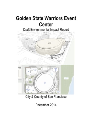
  • 1.   Golden State Warriors Event Center Draft Environmental Impact Report City & County of San Francisco December 2014
  • 2.   2   Golden State Warriors Event Center Draft Environmental Impact Report December 2014 Prepared for: County of San Francisco Office of Community Investment and Infrastructure One South Van Ness Avenue San Francisco, CA 94103 Prepared by: Planning Department, City and County of San Francisco Environmental Planning Division 1650 Mission Street, Suite 400 San Francisco, CA 94103 Deputy Environmental Review Officer: Matt Richards Environmental Planner: Kelly Lewis Environmental Planner: Blake Lecroy
  • 3.   3   Table of Contents 1.0 Introduction……………………………………………. 4 2.0 Project Description…………………………………… 6 2.1 Project Location……………………………… 8 2.2 Project Characteristics………………………. 9 3.0 Environmental Setting, Impacts, & Mitigation Measures……………………………………………………12 3.1 Aesthetics 3.1.1 Environmental Setting 3.1.2 Thresholds of Significance 3.1.3 Environmental Impacts 3.1.4 Cumulative Impacts 3.1.5 Mitigation Measures 3.2 Wildcard……………………………………… 28 3.2.1 Hydrology 3.2.2 Biological Resources 3.2.3 Hazards & Hazardous Wastes 4.0 Alternatives Analysis……………………………….. 67 5.0 Other CEQA considerations………………………. 68 6.0 References………………………………………….. 70 7.0 Organization Consultation…………………………. 70 7.1 List of Preparers……………………………. 70
  • 4.   4   Introduction: In accordance with CEQA guidelines 15063(b)(1)(C) and 15168(d)(1) this section of the EIR provides a description of the project, identification of significant effects and proposed alternatives that would lessen or reverse those effects, areas of controversy, and issues to be resolved including the choice among alternatives and how to mitigate these effects. Summary: GSW Arena LLC, an affiliate of Golden State Warriors, LLC, which owns and operates the Golden State Warriors National Basketball Association (NBA) team, proposes to construct a multi-purpose event center and a variety of mixed uses, including office, retail, open space and structured parking on an approximately 11-acre site (Blocks 29-32) within the Mission Bay South Redevelopment Plan Area of San Francisco. The project site is bordered by South Street on the north, Third Street on the west, 16th Street on the south, and by the future planned realigned Terry A. François Boulevard on the east. The proposed event center would host the Golden State Warriors basketball team during the NBA season, as well as provide a year-round venue for a variety of other uses, including concerts, family shows, other sporting events, cultural events, conferences and conventions. GSW has entered into an agreement to purchase the project site from the current site owner, an affiliate of salesforce.com. The project is subject to review under the California Environmental Quality Act (CEQA) and a number of local and state approvals. Areas of Controversy/Issues to be Resolved: According to the CEQA guidelines 15063(b)(1)(C) and 15168(d)(1) this section of the EIR is to identify potential areas of controversy and issues to be resolved by the decision making body. Generally these include those areas where a significant unavoidable impact has been identified, as well as issue areas where concerns have been raised, primarily through the notice of preparation process, indication of a level of controversy. For the GSW Arena there would be significant effects on hazardous materials, population, air quality, traffic, aesthetics, hydrology, biological resources, traffic/circulation and public utilities. Classification of Impacts: Potential environmental impacts for the proposed project have been classified in the EIR in the following five categories: - No new or more severe environmental impact - Could have new substantial environmental impacts. A mitigated negative declaration would be prepared. - May have new substantial impact or more severe impact than expected. EIR will be prepared. - Will have new substantial effect or severe effect on the environment unless mitigated.
  • 5.   5   - Although the project will have environmental effect, all effects have been mitigated and no further environmental documentation is required. Alternatives: The alternatives for the Golden State Warriors arena is limited to a change of location and not design. The GSW arena is set to be constructed within the Mission Bay South Redevelopment area (Blocks 29-32). There are six possible alternate locations each with its own characteristics and each would need its own initial study. One valid alternative would be the construction of the stadium at candlestick point where a retired football stadium already exists. The plot of land already has the traffic capacity, parking capacity, public utility availability, and space.
  • 6.   6   2.0 PROJECT DESCRIPTION Overview GSW Arena LLC (GSW), an affiliate of Golden State Warriors, LLC, which owns and operates the Golden State Warriors National Basketball Association (NBA) team, proposes to construct a multi- purpose event center and a variety of mixed uses, including office, retail, open space and structured parking on an approximately 11-acre site (Blocks 29-32) within the Mission Bay South Redevelopment Plan Area of San Francisco (see Figure 1 for aerial photograph and Figure 2 for existing roadway network in Mission Bay). The project site is bounded by South Street on the north, Third Street on the west, 16th Street on the south, and by the future planned realigned Terry A. François Boulevard on the east. The proposed event center would host the Golden State Warriors basketball team during the NBA season, as well as provide a year-round venue for a variety of other uses, including concerts, family shows, other sporting events, cultural events, conferences and conventions. GSW has entered into an agreement to purchase the project site from the current site owner, an affiliate of salesforce.com. The project is subject to review under the California Environmental Quality Act (CEQA) and a number of local and state approvals. Development is allowed within the Mission Bay South Redevelopment Plan Area, including Blocks 29-32, consistent with the land use program and subject to the development controls of the Mission Bay South Redevelopment Plan, Mission Bay South Design for Development, and other related documents (see Background, below). No amendment to the South Plan would be required, although the proposed project at Blocks 29-32 would require certain amendments and/or variations to other documents. The Mission Bay Final Subsequent Environmental Impact Report (Mission Bay FSEIR), certified in September 1998, is a program EIR under CEQA Guidelines 15168 and a redevelopment plan EIR under CEQA Guidelines 15180 (see Background, below). The Mission Bay FSEIR analyzed the environmental impacts associated with the development program proposed for the entire plan area, including the program under the Mission Bay South Redevelopment Plan, which includes Blocks 29-32. Thus, under CEQA, the proposed project at Blocks 29-32 is considered a subsequent activity under the Mission Bay South Redevelopment program, and this Initial Study evaluates the environmental effects of the proposed project relative to the certified Mission Bay FSEIR. This Initial Study is prepared in accordance with the CEQA Guidelines Section 15063, which provides for preparation of an initial study to determine if a project may have a significant effect on the environment, and with CEQA Guidelines Section 15168(c), which provides for subsequent activities in a program to be examined in the light of a previously certified program EIR. The City’s Office of Community Investment and Infrastructure (OCII) is the CEQA lead agency for this project, and has entered into an agreement with the San Francisco Planning Department, Environmental Planning Division, to assist in the preparation of the related environmental review documents.
  • 7.   7   2.1 PROJECT LOCATION SOURCE: Google Maps, ESA, 2014
  • 8.   8   Figure 1 Aerial Photograph of Mission Bay SOURCE: ESA, 2014 Figure 2
  • 9.   9   Existing Roadway Network in Mission Bay 2.2 Project Characteristics Proposed Facilities Development Plan Overview Under the project, Blocks 29-32 would be developed with a multi-purpose event center and a variety of mixed uses, including office, retail, open space and structured parking on the approximately 11-acre site. Figure 4 presents the conceptual project site plan, illustrating primary project features and associated building heights.8 Table 1 provides a summary overview of the key characteristics of the project facilities. The proposed roughly circular-shaped event center building would be located in the central-east portion of the site. The event center building would be approximately 135 feet at its roof peak, and would include multiple levels of varying elevations. The event center would include a wide variety of facilities, including spectator seating and suites, restaurants/bars and clubs, meeting rooms; spectator support facilities such as food service/kitchens, concessions, merchandising and restrooms; Golden State Warriors management offices and practice facility; media support facilities, and event center operations such as loading, staging and marshaling areas, mechanical/electrical/ plumbing space and storage and maintenance facilities. Two office and retail buildings would be located on the west side of the project site, at the corner of Third Street and South Street (northwest corner of site) and at the corner of Third Street and 16th Street (site southwest corner). The two office and retail buildings would each consist of 11 stories (160 feet tall); each office and retail building would consist of a podium ground level plus 5 podium levels (90 feet tall), with a 5-story (70-foot) tower (with smaller floorplate than the podium) above. These buildings could serve a variety of office and/or research and development uses. Retail uses would occupy several areas of the site, including the lower floor(s) of the two office and retail buildings, within or adjacent to certain plaza-facing areas of the event center (including in the 38-foot high “gate house” building located along Third Street), and 41-foot high retail building along Terry A. François Boulevard and South Street. Three levels of enclosed on-site parking (two below grade, and one at street level) providing 950 parking spaces would be located below the office and retail buildings and plaza areas. (See also Off-site Parking Facilities, below.) Approximately 3.2 acres of open space would be located on- site, including a proposed Third Street Plaza (elevated at approximately 8 feet above Third Street) on the west side of the project site between the event center and Third Street, and a proposed ground-level Southeast Plaza in the southeastern corner of the site.9 These plazas would be connected by a pedestrian ramp wrapping around the exterior of the north and eastern-sides of the event center, and an outdoor covered passageway, or atrium, wrapping around the southwest portion of the event center.
  • 10.   10   While the project would not be subject to the City’s Standards for Bird-Safe Buildings, the project sponsor proposes to incorporate bird-safe measures that would reduce the potential effects of the project on birds. Vehicular Access and Circulation All vehicular ingress/egress for the garage would occur at 16th Street (at Illinois Street) or South Street (at Bridgeview Way). The 16th Street driveway would serve as the primary vehicular access point for autos to the parking garage, and the sole access point for trucks to the below-grade loading docks. Most proposed loading and service areas would be located on the lower level, while one loading slip would be provided at grade (concealed from view beneath the pedestrian path) to serve retail located at the site’s northeastern corner. A total of 13 truck docks would be provided to serve the event center and office and retail uses. The South Street driveway would provide a secondary access for autos to the garage and small delivery trucks for retail located at the site’s northeastern corner. (See also Proposed Operations, below, for a description of the proposed Transportation Management Plan that the sponsor would implement as part of the project.) Pedestrian and Bicycle Access The primary pedestrian access to the event center for large attendance events would be via the Third Street Plaza. The Southeast Plaza would serve as a primary pedestrian access for smaller- attendance events, and as a secondary access point for large-attendance events. Pedestrian access to the two office and retail buildings would be available on South and 16th Streets and from the Third Street plaza, with additional access to ground-floor retail uses within those buildings available via South and Third Streets. The retail buildings in the northeast corner of the site would be accessed directly via Terry A. François Boulevard and South Street. New sidewalks would be constructed along the perimeter of the project site. Bike storage rooms would be located in each of the proposed office and retail buildings. Bike parking and storage racks would also be available at various locations along the perimeter of the project site, with bike valet service in proximity to the site and temporary bike corrals located within the plaza areas to serve patrons as needed. Infrastructure Improvements The project proposes all new utility infrastructure facilities on-site, including water supply (low- and high-pressure water lines and recycled water lines); wastewater collection; storm drainage; electrical/gas, and communications. Infrastructure and utilities within adjacent streets that serve the project site are provided by the master developer, FOCIL-MB, LLC, as part of the Mission Bay South Infrastructure Plan.
  • 11.   11   Off-Site Parking Facilities As part of the project, the sponsor has acquired 132 existing off-site parking spaces in the 450 South Street parking garage, accessed from South Street and Bridgeview Way directly north of the project site, to provide additional parking to serve the project. Sustainability The proposed development would be subject to a number of sustainability requirements, including the California CalGreen Code, City of San Francisco Green Building Code, Design for Development for the Mission Bay South Area, and the 2012 NBA Arena Design Standards – Sustainability Requirements. The project would be designed to Leadership in Energy and Environmental Design (LEED®) Gold standards using a campus approach, whereby each individual proposed structure as well as the overall site would qualify for individual Gold ratings.10 This would be achieved through incorporation of a variety of design features and implementation of practices during construction and operation to provide energy and water conservation and efficiency, encourage alternative transportation, promote a healthy indoor environment, minimize waste, and maximize recycling opportunities. South Plan Improvements Planned in the Vicinity of the Project Site: Terry A. François Boulevard Realignment and Public Access Improvements at Bayfront Park Pursuant to the Mission Bay Plan and not part of the proposed project, development of Blocks 29- 32 would trigger the realignment of Terry A. François Boulevard to extend adjacent to the east side of Blocks 29-32, and the construction of public access improvements at Bayfront Park east of this realigned roadway. The realigned Terry A. François Boulevard would contain four travel lanes (two northbound and two southbound) plus two parking lanes; and - on the east side of the roadway – a two-way cycletrack (bike path) separated from the roadway by a raised buffer. Following realignment of Terry A. François Boulevard, Bayfront Park would be improved and expanded to 5.5 acres, encompassing an area roughly south of Pier 54, north of 16th Street, east of Terry A. François Boulevard, and west of the Bay shoreline. Both the realignment of Terry A. François Boulevard and Bayfront Park public access improvements would be implemented by the master developer, FOCIL-MB, LLC, prior to occupancy of buildings at the project site. There are no applicable adopted habitat conservation plans, natural community conservation plans, or other approved habitat conservation plans that apply to the project site. Therefore, criterion E.13(f) does not apply to the proposed project, and this topic is not discussed further in this Initial Study or in the SEIR.
  • 12.   12   mixed- use residential, or employment center project on an infill site located within a transit priority area shall not be considered significant impacts on the environment.” Accordingly, aesthetics and 3.0 Setting, Impacts Mitigations 3.1.1 Aesthetics parking are no longer to be considered in determining if a project has the potential to result in significant environmental effects for projects that meet the following three criteria: 1 · The project is in a transit priority area;19 and 2 · The project is on an infill site;20 and 3 · The project is residential, mixed-use residential, or an employment center.21 The proposed project meets each of the above three criteria because it (1) is located in proximity to several transit routes; (2) is located on an infill site that has previously been developed with industrial and commercial uses and is surrounded by areas of either recently completed or planned urban development; and (3) would be an employment center supporting a range of commercial uses, located in proximity to several transit routes, and in an urban area on a site already developed and zoned for commercial uses with a floor area ration (FAR) greater than 0.75.22 Thus, this Initial Study and the SEIR do not consider aesthetics (or parking) in determining the significance of project impacts under CEQA. Nevertheless, Public Resources Code Section 21099(d)(2)(A) states: “This subdivision does not affect, change, or modify the authority of a lead agency to consider aesthetic impacts pursuant to local design review ordinances or other discretionary powers provided by other laws or policies.” Consequently, all applicable City urban design standards and
  • 13.   13   guidelines governing the project site and proposed project, including the Mission Bay South Redevelopment Plan, Mission Bay South Design for Development, and Mission Bay South Signage Plan would apply to the proposed project. Furthermore, the project would be subject to all applicable design review approvals, including Major Phase approval by OCII, and Schematic Designs for each building and private open spaces, which would consider relevant design and aesthetic issues. Public Resources Code Section 21099(d)(2)(B) states: “For the purposes of this subdivision, aesthetic impacts do not include impacts on historical or cultural resources.” Please refer to Cultural Resources, below, for an assessment of potential project impacts on historic and cultural resources. Environmental effects of lighting on birds are addressed under Biological Resources.   Summary of Land Use Impacts in Mission Bay FSEIR The land use significance criteria were addressed in the Mission Bay FSEIR in the Land Use section; the Plans, Policies, and Permits section; and the Initial Study Land Use section. Relevant information from these sections is summarized below. The Mission Bay FSEIR Land Use setting section characterized existing land uses present within and near the Mission Bay plan area at that time. The Mission Bay FSEIR indicated the land uses within Blocks 29-32 at the time of preparation of the FSEIR consisted of industrial and commercial uses, parking facilities and vacant land (see Hazards and Hazardous Materials, below, for a discussion of known historical land uses within Blocks 29-32, and additional detail on specific land uses that existed at the time of preparation of the Mission Bay FSEIR). While the Mission Bay FSEIR provided CEQA environmental analysis for the entire Mission Bay program, it divided the plan area into subareas to facilitate the analysis. Block 29-32 was located within the East Subarea (the area bounded by existing Terry François Blvd, Mariposa Street, Third Street, and Mission Bay Boulevard South). Development of this subarea was assumed to include commercial industrial and office; entertainment-oriented, neighborhood- and City-serving retail; and public open space land uses. Buildings in the subarea would be allowable up to 90 feet in height, with 7 percent of the developable area allowable up to 160 feet high (along Third Street). Buildings along the future realigned Terry A. François Boulevard would be restricted to 90 feet in height.
  • 14.   14   The Mission Bay FSEIR Initial Study Land Use section determined that the Mission Bay plan area was a largely underutilized industrial area with no established residential community; this was the basis for the Mission Bay FSEIR finding that the Mission Bay plan would not physically disrupt or divide an established community. The Mission Bay FSEIR Plans, Policies and Permits section compared the Mission Bay plan and its implementing plans to other City plans, policies and regulations. The Mission Bay FSEIR indicated that the Mission Bay Redevelopment Plans and Design for Development documents would constitute the regulatory land use framework for the Mission Bay plan area, and would supersede the City’s Planning Code (except where indicated in those implementing documents), and furthermore, the Redevelopment Plans would be required to be found consistent with the City General Plan prior to adoption. The Mission Bay FSEIR also acknowledged that certain development activities proposed within the Mission Bay plan area would be subject to applicable regional, State and/or federal permitting authority. The Mission Bay FSEIR analyzed the physical environmental impacts of potential policy conflicts for specific environmental topics, such as transportation and noise, in the respective sections of the FSEIR. The Mission Bay FSEIR Land Use impacts section indicated that the Mission Bay project would result in a substantial change in the type and intensification in land uses in the Mission Bay plan area, involving demolition of most existing buildings and displacement of existing uses within the Mission Bay plan area, and development of the proposed mixed-use land use program over the build-out period. The Mission Bay FSEIR reported that the Mission Bay plan would continue the trend that was occurring in other nearby areas of the City (e.g., South of Market) of redeveloping former industrial areas into residential and commercial neighborhoods. The Mission Bay FSEIR reported that the commercial industrial/retail uses proposed within the East Subarea of the Mission Bay plan area, which includes Blocks 29-32, would be compatible with the medical research and instructional uses proposed within the adjacent proposed UCSF campus subarea (located west of the Blocks 29-32 across Third Street). The Mission Bay FSEIR also acknowledged that construction activities associated with development of the proposed uses within the Mission Bay plan area would create construction- related effects (e.g., dust, noise, traffic) that may be noticeable and annoying to new residents
  • 15.   15   within the Mission Bay plan area, however, with implementation of mitigation measures identified in the respective sections of the Mission Bay FSEIR, those effects would be mitigated to a less- than-significant level. These factors provided the basis for the Mission Bay FSEIR finding that the Mission Bay plan would not have a significant impact upon the existing character of the vicinity. In summary, the Mission Bay FSEIR identified no significant impacts on land use from the Mission Bay plan, and accordingly, did not require any mitigation measures related to land use effects. Project Impacts For those topics determined in this Initial Study to be focused out from further analysis in the SEIR, this analysis first summarizes how these topics were addressed in the Mission Bay FSEIR as it related to Blocks 29-32, including identifying any applicable mitigation measures from the Mission Bay FSEIR and conclusions reached regarding significance of effects. Second, the Initial Study analyzes the impacts of the proposed project to determine: (1) if the proposed project, circumstances under which the project is undertaken, or new information(which could not have been ascertained at the time of the preparation of the Mission Bay FSEIR) would lead to new or more severe significant environmental effects from what was identified in the Mission Bay FSEIR; (2) if newly feasible or different mitigation measures or alternatives are available that would substantially reduce one or more significant effects of the project; and (3) if the mitigation measures identified in the Mission Bay FSEIR and/or newly added mitigation measures would reduce impacts to a less-than-significant level. The impact evaluation presents the significance determination for each impact and includes the detailed description of all mitigation measures applicable to the proposed project, whether it is the same as that specified in the Mission Bay FSEIR or an updated mitigation measure. For those topics to be analyzed in detail in the SEIR, this Initial Study provides the checklist response identifying the potential for new significant impacts or substantially more severe impacts than those identified in the Mission Bay FSEIR. However, the summary of the Mission Bay FSEIR and the detailed analysis of the proposed project are deferred for discussion in the SEIR. For the purposes of this Initial Study, the checklist questions in Appendix G have been modified to reflect the fact that the proposed project is a subsequent activity under the Mission Bay South Redevelopment program and that this analysis is being tiered from the certified Mission Bay FSEIR as a program EIR, consistent with CEQA Guidelines 15168(c). The four revised checklist questions used in this Initial Study are described below. 1. Would the project result in potentially significant effects not identified in the prior EIR? This question examines whether or not the proposed project would result in new significant or potentially significant environmental effects that were not identified in the Mission Bay FSEIR. This could include significant effects that are due to: 1 · Project-specific features of the proposed event center and mixed-use development. 2 · Substantial changes with respect to the circumstances under which the project would be undertaken, such as real estate development trends in the surrounding area or major
  • 16.   16   projects that were previously unanticipated. 3 · New information of substantial importance which was not known and could not have been known at the time the Mission Bay FSEIR was certified, such as newly available information related to climate change or sea level rise. If the analysis identifies a new significant or potentially significant impact, this Initial Study then determines if either previously identified mitigation measures or newly identified mitigation measures would reduce the impact to less than significant. In this event, the mitigation measures are presented in this Initial Study and no further analysis is required. On the other hand, if a new significant or potentially significant impact is identified and/or further analysis is necessary to determine if mitigation measures are available to reduce the impacts to less than significant, then this issue will be addressed in further detail in the SEIR. 1. Would the project result in a potentially substantial increase in severity of a significant impact identified in the prior EIR? This question examines whether or not the proposed project would result in substantially more severe environmental effects than what was identified in the Mission Bay FSEIR. This increase in severity of a significant effect could be due to: 1 · Project-specific features of the proposed event center and mixed-use development. 2 · Substantial changes with respect to the circumstances under which the project would be undertaken, such as real estate development trends in the surrounding area or major projects that were previously unanticipated. 3 · New information of substantial importance which was not known and could not have been known at the time the Mission Bay FSEIR was certified, such as newly available information related to climate change or sea level rise. If the project would result in an increase in severity of a previously identified significant impact, this Initial Study then determines if either previously identified mitigation measures or newly identified mitigation measures would reduce the more severe impact to less than significant. In this event, the mitigation measures are presented in this Initial Study and no further analysis is required. On the other hand, if a more severe significant impact is identified and/or further analysis is necessary to determine if mitigation measures are available to reduce the impacts to less than significant, then this issue will be addressed in further detail in the SEIR. 2. Does the project sponsor decline to adopt a feasible mitigation measure or alternative? This question addresses the case in which the Initial Study identifies a new significant impact or a substantial increase in severity of a significant impact but the project sponsor
  • 17.   17   has declined to adopt a feasible mitigation measure or alternative. In the event of such cases, if any, the issue will be addressed in further detail in the SEIR. 3. Would the project result in no new or more severe significant effects? This question addresses several possible scenarios for certain topics which the Initial Study provides the complete analysis and no further analysis is necessary in the SEIR. These scenarios include the following: 1 · The Mission Bay FSEIR identified a significant impact, and the proposed project would result in the same significant impact. In addition, the same mitigation measure identified in the Mission Bay FSEIR would reduce the impact to a less- than-significant level. In this case, the previous mitigation measure as applicable to the proposed project is presented in this Initial Study. 2 · The Mission Bay FSEIR identified a significant impact and the proposed project would result in the same significant impact. However, a new or revised mitigation measure is recommended to reduce the impact to a less-than-significant level, and this new measure would replace the previously identified mitigation measure. In this case, only the new mitigation measure is presented in this Initial Study, and the reader is referred to the Mission Bay FSEIR for the original mitigation measure. 3 · The Mission Bay FSEIR identified a significant impact and the proposed project would result in the same impact. However, under the current approach to analysis, the impact would be considered less-than-significant due to implementation of actions required to comply with applicable regulations (e.g., hazardous materials regulations). In this case, the revised analysis would supersede the analysis in the Mission Bay FSEIR, and with compliance with applicable regulations, no mitigation measures are required and none are presented in this Initial Study. The reader is referred to the Mission Bay FSEIR for the original mitigation measure(s). 1 · The Mission Bay FSEIR identified either no impact or a less-than-significant impact, and the proposed project would also result in no impact or a less-than-significant impact. In this case, no mitigation measures are required and none are presented either in the FSEIR or this Initial Study. 2 · The Mission Bay FSEIR did not address an environmental topic under the Planning Department’s current CEQA Initial Study checklist, and the proposed project would result in a significant impact that could be reduced to less than significant with implementation of a feasible mitigation measure. In this case, the new mitigation measure is presented in this Initial Study.
  • 18.   18   3 · The Mission Bay FSEIR did not address an environmental topic under the current Planning Department CEQA Initial Study checklist, but the proposed project would result in either no impact or a less than significant impact. In this case, no mitigation measures are required and none are presented. 4 · In a few instances, the discussion of why the project is not expected to result in any new or more significant effects is deferred to the SEIR, either as part of a larger discussion (such as Transportation) or for public disclosure. Cumulative Impacts Similar to the project impacts, cumulative impacts are analyzed by responding to the same four revised checklist questions but with regard to the potential for the proposed project to contribute to new significant cumulative impacts or substantially more severe cumulative impacts than those identified in the Mission Bay FSEIR. The Mission Bay FSEIR used the year 2015 for the analysis of the full buildout of the Mission Bay plan as well as for the cumulative impacts analysis, and cumulative impacts were assessed on the basis of regional population and employment projections for the year 2015 as determined by the Association of Bay Area Governments. A cumulative impact is determined to be significant if the project in combination with other planned, proposed, or probable future conditions in the project vicinity would result in environmental effects that exceed the significance criteria listed in the San Francisco Planning Department’s Initial Study Checklist when compared to existing conditions. In addition, the analysis must indicate that the projectʹs incremental effect would be a ʺcumulatively considerableʺ contribution to the significant impact. In this Initial Study, the cumulative impact analysis identifies if the proposed project would contribute to a new significant cumulative impact or if a previously-identified cumulative impact would be substantially more severe under the proposed project. Cumulative impacts for each resource area are analyzed with respect to the appropriate geographic scope for that topic and either (1) a list of past, present, and probable future projects that in combination with the proposed project could contribute to cumulative impacts, or (2) a summary of projections contained in general plan or related planning document (CEQA Guidelines Section 15130(b)(1)). Which of the two methods used varies from topic to topic. For topics using the list approach, in addition to those projects considered in the Mission Bay FSEIR cumulative analysis, the projects/programs listed below were not anticipated in the Mission Bay FSEIR and are considered in the cumulative impact analysis. 1 · University of California at San Francisco (UCSF), 2014 Long Range Development Plan (LRDP), Mission Bay Campus. UCSF is updating its LRDP to guide future campus growth and development over the next 20 years. The 2014 LRDP updates information that was assumed in the Mission Bay FSEIR. The existing 60.2-acre UCSF Mission Bay campus site is located adjacent to Blocks 29-32, generally bounded by Mission Bay Boulevard South to the north, Owens Street to the west, Mariposa Street to the south, and Illinois and Third Streets to the east. Under the 2014 LRDP, the development capacity for
  • 19.   19   the North Campus is proposed to increase from 2,650,000 to 3,641,800 gsf. The 2014 LRDP proposes to increase the square footage of the North Campus by 1,450,300 gsf, which includes 458,500 gsf of existing remaining entitlement from the 1996 LRDP, plus 991,800 gsf of new entitlement. On the South Campus, construction of a 124,500-gsf cancer outpatient building is anticipated prior to 2035, which will complete Phase 1 of the UCSF Medical Center at Mission Bay. This will bring the total space for Phase 1 to 993,500 gsf. Phase 2 facilities will be located on the west side of the South Campus, across the Fourth Street Public Plaza. Phase 2 Medical Center at Mission Bay is planned for after 2035 as a 261-bed hospital with additional outpatient space, totaling 793,500 gsf. Development of the East Campus would accommodate 500,000 gsf. As a result, the total anticipated development through 2035 with the proposed expansion of the Mission Bay campus site (North, South, and East campuses) would be 5,135,200 gsf. 2 · Eastern Neighborhoods Program. The Eastern Neighborhoods Program included changes in zoning controls and General Plan amendments for an approximately 2,200- acre area on the eastern side of the City. It is intended to encourage new housing while preserving sufficient land for light industrial and service industry (referred to collectively as “Production, Distribution, and Repair,” or “PDR,” uses) in four neighborhoods: the Mission, Showplace Square/Potrero Hill, the Central Waterfront, and the eastern portion of the South of Market (“East SoMa”). In conjunction with the rezoning, the General Plan was amended to include Area Plans for the neighborhoods (including revisions to the existing Central Waterfront and South of Market Area Plans). A key goal of the rezoning process was to encourage the creation of cohesive neighborhoods, particularly where new housing is being encouraged. The plans also propose public benefits and other implementation programs, particularly the creation of affordable housing. The program introduced new zoning districts, including districts that permit at least some PDR uses in combination with commercial uses, districts mixing residential and commercial uses, and areas where only PDR uses would be permitted, with residential use prohibited to alleviate development pressure on PDR uses. The Showplace Square/Potrero Hill Area Plan is located immediately to the west of the Mission Bay Plan (across Interstate 280), the Central Waterfront Area Plan is located immediately to the south of the Mission Bay plan area (south of Mariposa Street), and the East SoMa Area Plan is located immediately to the north (across China Basin and east of Fourth Street). Projects pursuant to the Eastern Neighborhoods Program are currently under construction, including several residential and mixed-used developments south of Mariposa Street. 3 · Seawall Lot 337 and Pier 48 Mixed-Use Project (Mission Rock). This possible future project is located about one-third mile north of Blocks 29-32 on the northeast side of the Mission Bay South Plan area. The project would include a mixed-use, multi-phase waterfront development on Seawall Lot 337, rehabilitation and reuse of Pier 48, and construction of approximately 5.4 acres of net new open space, for a total of 8 acres of open space on the site. Overall, the project would involve construction of up to approximately 3.7 million gsf of residential, commercial, and retail uses, and a public parking garage on the Project Site. Both Seawall Lot 337 and Pier 48 are owned by the Port of San Francisco. The project is currently in the environmental review phase.
  • 20.   20   · Pier 70 Mixed-Use Development: This possible future project is located just under one-half mile south of Blocks 29-32, on 35 acres located south of 20th Street and east of Illinois Street. This project proposes up to approximately 3,040,000 gsf (excluding parking) of above-grade construction in new buildings, and improvements to historic buildings. The project allows for a flexible land use program, including a maximum residential-use and maximum commercial-use scenarios for the Pier 70 Special Use District. Option 1 - maximum residential scenario, would consist of approximately 2,000 dwelling units within 1,605,000 gsf, including up to 904,000 gsf of commercial and office space, plus up to 365,700 gsf of manufacturing, local retail, creative uses and arts which is designated as an “Innovative Industries Zone.” Option 2 - maximum office scenario, would consist of approximately 1,052 dwelling units within approximately 903,616 gsf, including up to approximately 1,810,000 gsf of commercial and office space, plus up to 327,700 gsf of manufacturing, local retail, creative uses and arts which is designated as an “Innovative Industries Zone.” MITIGATION MEASURES This section lists the mitigation measures identified in this Initial Study. Implementation of these measures would mitigate significant project environmental impacts, and/or considerable project contribution to cumulative environmental impacts such that all corresponding impacts would be reduced to less than significant. The listed mitigation measures include those measures originally identified in the Mission Bay FSEIR that are applicable to the proposed project, as well as certain new mitigation measures identified in this Initial Study to reduce potential impacts to less than significant. Mitigation measures are numbered to correspond to the Initial Study impact number, with a cross reference to the impact numbering system from the Mission Bay FSEIR where appropriate. It should also be noted that certain mitigation measures identified in the Mission Bay FSEIR are no longer applicable to the proposed project, as described in Section E above; those measures are not listed in this section. For those topics and impact areas to be analyzed in the SEIR, additional mitigation measures will be identified in the SEIR as needed. Mitigation Measure M-CP-2a: Archaeological Testing, Monitoring and/or Data Recovery Program Based on a reasonable presumption that archaeological resources may be present within the project site, the following measures shall be undertaken to avoid any potentially significant adverse
  • 21.   21   effect from the proposed project on buried or submerged historical resources. The project sponsor shall retain the services of an archaeological consultant approved by OCII or its designated representative such as those from the rotational Department Qualified Archaeological Consultants List (QACL) maintained by the Planning Department archaeologist. The project sponsor shall contact the Department archaeologist to obtain the names and contact information for the next three archaeological consultants on the QACL. The archaeological consultant shall undertake an archaeological testing program as specified herein. In addition, the consultant shall be available to conduct an archaeological monitoring and/or data recovery program if required pursuant to this measure. The archaeological consultant’s work shall be conducted in accordance with this measure at the direction of OCII or its designated representative. All plans and reports prepared by the consultant as specified herein shall be submitted first and directly to OCII or its designated representative for review and comment, and shall be considered draft reports subject to revision until final approval by OCII or its designated representative. Archaeological monitoring and/or data recovery programs required by this measure could suspend construction of the project for up to a maximum of four weeks. At the direction of the OCII or its designated representative, the suspension of construction can be extended beyond four weeks only if such a suspension is the only feasible means to reduce to a less than significant level potential effects on a significant archaeological resource as defined in CEQA Guidelines Sect. 15064.5 (a)(c). Consultation with Descendant Communities: On discovery of an archaeological site78 associated with descendant Native Americans, the Overseas Chinese, or other descendant group an appropriate representative79 of the descendant group and OCII or its designated representative shall be contacted. The representative of the descendant group shall be given the opportunity to monitor archaeological field investigations of the site and to consult with OCII or its designated representative regarding appropriate archaeological treatment of the site, of recovered data from the site, and, if applicable, any interpretative treatment of the associated archeological site. A copy of the Final Archaeological Resources Report shall be provided to the representative of the descendant group. Archaeological Testing Program. The archaeological consultant shall prepare and submit to OCII or its designated representative for review and approval an archaeological testing plan (ATP). The archaeological testing program shall be conducted in accordance with the approved ATP. The ATP shall identify the property types of the expected archaeological resource(s) that potentially could be adversely affected by the proposed project, the testing method to be used, and the locations recommended for testing. The purpose of the archaeological testing program will be to determine to the extent possible the presence or absence of archaeological resources and to identify and to evaluate whether any archaeological resource encountered on the site constitutes an historical resource under CEQA. At the completion of the archaeological testing program, the archaeological consultant shall submit a written report of the findings to OCII or its designated representative. If based on the archaeological testing program the archaeological consultant finds that significant archaeological resources may be present, OCII or its designated representative in consultation with the archaeological consultant shall determine if additional measures are warranted. Additional measures that may be undertaken include additional archaeological testing, archaeological
  • 22.   22   monitoring, and/or an archaeological data recovery program. No archaeological data recovery shall be undertaken without the prior approval of OCII or its designated representative. If OCII or its designated representative determines that a significant archaeological resource is present and that the resource could be adversely affected by the proposed project, at the discretion of the project sponsor either: A. The proposed project shall be re-designed so as to avoid any adverse effect on the significant archaeological resource; or B. A data recovery program shall be implemented, unless OCII or its designated representative determines that the archaeological resource is of greater interpretive than research significance and that interpretive use of the resource is feasible. Archaeological Monitoring Program. If OCII or its designated representative in consultation with the archaeological consultant determines that an archaeological monitoring program shall be implemented the archaeological monitoring program shall minimally include the following provisions: 3 · The archaeological consultant, project sponsor, and OCII or its designated representative shall meet and consult on the scope of the AMP reasonably prior to any project-related soils disturbing activities commencing. OCII or its designated representative in consultation with the archaeological consultant shall determine what project activities shall be archaeologically monitored. In most cases, any soils- disturbing activities, such as demolition, foundation removal, excavation, grading, utilities installation, foundation work, driving of piles (foundation, shoring, etc.), site remediation, etc., shall require archaeological monitoring because of the risk these activities pose to potential archaeological resources and to their depositional context; 4 · The archeological consultant shall advise all project contractors to be on the alert for evidence of the presence of the expected resource(s), of how to identify the evidence of the expected resource(s), and of the appropriate protocol in the event of apparent discovery of an archaeological resource; 5 · The archaeological monitor(s) shall be present on the project site according to a schedule agreed upon by the archaeological consultant and OCII or its designated representative until OCII or its designated representative has, in consultation with project archaeological consultant, determined that project construction activities could have no effects on significant archaeological deposits; 6 · The archaeological monitor shall record and be authorized to collect soil samples and artifactual/ecofactual material as warranted for analysis;
  • 23.   23   7 · If an intact archaeological deposit is encountered, all soils-disturbing activities in the vicinity of the deposit shall cease. The archaeological monitor shall be empowered to temporarily redirect demolition/excavation/pile driving/ construction activities and equipment until the deposit is evaluated. If in the case of pile driving activity (foundation, shoring, etc.), the archaeological monitor has cause to believe that the pile driving activity may affect an archaeological resource, the pile driving activity shall be terminated until an appropriate evaluation of the resource has been made in consultation with OCII or its designated representative. The archaeological consultant shall immediately notify the OCII or its designated representative of the encountered archaeological deposit. The archaeological consultant shall make a reasonable effort to assess the identity, integrity, and significance of the encountered archaeological deposit, and present the findings of this assessment to OCII or its designated representative. Whether or not significant archaeological resources are encountered, the archaeological consultant shall submit a written report of the findings of the monitoring program to the OCII or its designated representative. Archaeological Data Recovery Program. The archaeological data recovery program shall be conducted in accord with an archaeological data recovery plan (ADRP). The archaeological consultant, project sponsor, and OCII or its designated representative shall meet and consult on the scope of the ADRP prior to preparation of a draft ADRP. The archaeological consultant shall submit a draft ADRP to OCII or its designated representative. The ADRP shall identify how the proposed data recovery program will preserve the significant information the archaeological resource is expected to contain. That is, the ADRP will identify what scientific/historical research questions are applicable to the expected resource, what data classes the resource is expected to possess, and how the expected data classes would address the applicable research questions. Data recovery, in general, should be limited to the portions of the historical property that could be adversely affected by the proposed project. Destructive data recovery methods shall not be applied to portions of the archaeological resources if nondestructive methods are practical. The scope of the ADRP shall include the following elements: 1 · Field Methods and Procedures. Descriptions of proposed field strategies, procedures, and operations. 2 · Cataloguing and Laboratory Analysis. Description of selected cataloguing system and artifact analysis procedures. 3 · Discard and Deaccession Policy. Description of and rationale for field and post-field discard and deaccession policies.
  • 24.   24   4 · Interpretive Program. Consideration of an on-site/off-site public interpretive program during the course of the archaeological data recovery program. 5 · Security Measures. Recommended security measures to protect the archaeological resource from vandalism, looting, and non-intentionally damaging activities. 6 · Final Report. Description of proposed report format and distribution of results. 7 · Curation. Description of the procedures and recommendations for the curation of any recovered data having potential research value, identification of appropriate curation facilities, and a summary of the accession policies of the curation facilities. Human Remains and Associated or Unassociated Funerary Objects. The treatment of human remains and of associated or unassociated funerary objects discovered during any soils disturbing activity shall comply with applicable State and Federal laws. This shall include immediate notification of the Coroner of the City and County of San Francisco and in the event of the Coroner’s determination that the human remains are Native American remains, notification of the California State Native American Heritage Commission (NAHC) who shall appoint a Most Likely Descendant (MLD) (Pub. Res. Code Sec. 5097.98). The archaeological consultant, project sponsor, OCII or its designated representative, and MLD shall make all reasonable efforts to develop an agreement for the treatment of, with appropriate dignity, human remains and associated or unassociated funerary objects (CEQA Guidelines. Sec. 15064.5(d)). The agreement should take into consideration the appropriate excavation, removal, recordation, analysis, custodianship, curation, and final disposition of the human remains and associated or unassociated funerary objects. Final Archaeological Resources Report. The archeological consultant shall submit a Draft Final Archaeological Resources Report (FARR) to OCII or its designated representative that evaluates the historical significance of any discovered archaeological resource and describes the archaeological and historical research methods employed in the archaeological testing/monitoring/data recovery program(s) undertaken. Information that may put at risk any archaeological resource shall be provided in a separate removable insert within the final report. Once approved by OCII or its designated representative, copies of the FARR shall be distributed as follows: California Archaeological Site Survey Northwest Information Center (NWIC) shall receive one (1) copy and OCII or its designated representative shall receive a copy of the transmittal of the FARR to the NWIC. As requested by OCII, the Environmental Planning division of the Planning Department shall receive one bound, one unbound and one unlocked, searchable PDF copy on CD of the FARR along with copies of any formal site recordation forms (CA DPR 523 series) and/or documentation for nomination to the National Register of Historic Places/California Register of Historical Resources. In instances of high public interest in or the high interpretive value of the resource, OCII or its designated representative may require a different final report content, format, and distribution than that presented above.
  • 25.   25   Mitigation Measure M-CP-2b: Accidental Discovery of Archaeological Resources (Implementing FSEIR Mitigation D.6) The following mitigation measure is required to avoid any potential adverse effect from the proposed project on accidentally discovered buried or submerged historical resources as defined in CEQA Guidelines Section 15064.5(a)(c). The project sponsor shall distribute the Planning Department archaeological resource “ALERT” sheet to the project prime contractor; to any project subcontractor (including demolition, excavation, grading, foundation, pile driving, etc. firms); or utilities firm involved in soils disturbing activities within the project site. Prior to any soils disturbing activities being undertaken each contractor is responsible for ensuring that the “ALERT” sheet is circulated to all field personnel, including machine operators, field crew, pile drivers, supervisory personnel, etc. The project sponsor shall provide OCII officer or its designated representative with a signed affidavit from the responsible parties (prime contractor, subcontractor(s), and utilities firm) confirming that all field personnel have received copies of the Alert Sheet. Should any indication of an archaeological resource be encountered during any soils disturbing activity of the project, the project Head Foreman and/or project sponsor shall immediately notify OCII officer or its designated representative and shall immediately suspend any soils disturbing activities in the vicinity of the discovery until OCII officer or its designated representative has determined what additional measures should be undertaken. If OCII officer or its designated representative determines that an archaeological resource may be present within the project site, the project sponsor shall retain the services of an archaeological consultant from the pool of qualified archaeological consultants maintained by the Planning Department archaeologist. The archaeological consultant shall advise OCII officer or its designated representative as to whether the discovery is an archaeological resource, retains sufficient integrity, and is of potential scientific/historical/cultural significance. If an archaeological resource is present, the archaeological consultant shall identify and evaluate the archaeological resource. The archaeological consultant shall make a recommendation as to what action, if any, is warranted. Based on this information, OCII officer or its designated representative may require, if warranted, specific additional measures to be implemented by the project sponsor. Measures might include: preservation in situ of the archaeological resource; an archaeological monitoring program; or an archaeological testing program. If an archaeological monitoring program or archaeological testing program is required, it shall be consistent with the Environmental Planning (EP) division guidelines for such programs. OCII officer or its designated representative may also require that the project sponsor immediately implement a site security program if the archaeological resource is at risk from vandalism, looting, or other damaging actions. The project archaeological consultant shall submit a Final Archaeological Resources Report (FARR) to OCII officer or its designated representative that evaluates the historical significance of any discovered archaeological resource and describing the archaeological and historical research methods employed in the archaeological monitoring/data recovery program(s) undertaken. Information that may put at risk any archaeological resource shall be provided in a separate removable insert within the final report.
  • 26.   26   Copies of the Draft FARR shall be sent to OCII officer or its designated representative for review and approval. Once approved by OCII officer or its designated representative, copies of the FARR shall be distributed as follows: California Archaeological Site Survey Northwest Information Center (NWIC) shall receive one (1) copy and OCII officer or its designated representative shall receive a copy of the transmittal of the FARR to the NWIC. OCII and the Environmental Planning division of the Planning Department shall each receive one bound copy, one unbound copy and one unlocked, searchable PDF copy on CD three copies of the FARR along with copies of any formal site recordation forms (CA DPR 523 series) and/or documentation for nomination to the National Register of Historic Places/California Register of Historical Resources. In instances of high public interest or interpretive value, OCII officer or its designated representative may require a different final report content, format, and distribution than that presented above. Mitigation Measure M-BI-4a: Preconstruction Surveys for Nesting Birds To the extent practicable, vegetation removal and grading of the site in advance of new site construction shall be performed between September 1 and January 31 in order to avoid breeding and nesting season for birds. If these activities cannot be performed during this period, a preconstruction survey of onsite vegetation for nesting birds shall be conducted by a qualified biologist. In coordination with the OCII or its designated representative, pre-construction surveys of onsite vegetation shall be performed during bird breeding season (February 1 – August 31) no more than 14 days prior to vegetation removal, grading, or initiation of construction in order to locate any active passerine nests within 250 feet of the project site and any active raptor nests within 500 feet of the project site. Surveys shall be performed in accessible areas within 500 feet of the project site and include suitable habitat within line of sight as access is available. If active nests are found on either the project site or within the 500-foot survey buffer surrounding the project site, no-work buffer zones shall be established around the nests. Buffer distances will consider physical and visual barriers between the active nest and project activities, existing noise sources and disturbance, as well as sensitivity of the bird species to disturbance. Modification of standard buffer distances, 250 feet for active passerine nests and 500 feet for active raptor nests, will be determined by a qualified biologist in consultation with the California Department of Fish and Wildlife (CDFW). No vegetation removal or ground-disturbing activities including grading or new construction shall occur within a buffer zone until young have fledged or the nest is otherwise abandoned as determined by the qualified biologist. If construction work during the nesting season stops for 14 days or more and then resumes, then nesting bird surveys shall be repeated, to ensure that no new birds have begun nesting in the area. Mitigation Measure M-BI-4b: Bird Safe Building Practices The project sponsor shall design and implement the project consistent with the San Francisco Standards for Bird-Safe Buildings and Planning Code Section 139, as approved by OCII. OCII shall consult with the Planning Department and the Zoning Administrator concerning project consistency with Planning Code Section 139. Mitigation Measure M-HZ-1a. Guidelines for Handling Biohazardous Materials
  • 27.   27   Mission Bay FSEIR Mitigation Measure I.1. Require businesses that handle biohazardous materials and do not receive federal funding to certify that they follow the guidelines published by the National Research Council and the United States Department of Health and Human Services Public Health Service, National Institutes of Health, and Centers for Disease Control, as set forth in Biosafety in Microbiological and Biomedical Laboratories, Guidelines for Research Involving Recombinant DNA Molecules (NIH Guidelines), and Guide for the Care and Use of Laboratory Animals, or their successors, as applicable. Mission Bay FSEIR Mitigation Measure I.2. Require businesses handling biohazardous materials to certify that they use high efficiency particulate air (HEPA) filters or substantially equivalent devices on all exhaust from Biosafety Level 3 laboratories unless they demonstrate that exhaust from their Biosafety Level 3 laboratories would not pose substantial health or safety hazards to the public or the environment. Require such businesses to certify that they inspect or monitor the filters regularly to ensure proper functioning. Mission Bay FSEIR Mitigation Measure I.3. Require businesses handling biohazardous materials to certify that they do not handle or use biohazardous materials requiring Biosafety Level 4 containment (i.e., dangerous or exotic materials that pose high risks of life-threatening diseases or aerosol-transmitted infections, or unknown risks of transmission) in the Project Area. Mitigation Measure M-HZ-1b: Geologic Investigation and Dust Mitigation Plan for Naturally Occurring Asbestos The project sponsor shall conduct a geologic investigation in accordance with the guidelines of the California Geologic Survey80 to determine the naturally occurring asbestos content of fill materials to be excavated at the project site. If the investigation determines that the naturally occurring asbestos content of the fill materials is 0.25 percent or greater, the project sponsor or its construction contractor shall submit the appropriate notification forms and prepare an asbestos dust mitigation plan in accordance with the Asbestos ATCM. The plan shall specify measures that will be taken to ensure that no visible dust crosses the property boundary during construction. The plan must specify the following measures: 1 · Prevent and control visible track-out from the property 2 · Ensure adequate wetting or covering of active storage piles 3 · Control disturbed surface areas and storage piles that would remain inactive for 7 days 4 · Control traffic on on-site unpaved roads, parking lots, and staging areas, including a maximum vehicle speed of 15 miles per hour 5 · Control earthmoving activities
  • 28.   28   6 · Control offsite transport of dust emissions that contain naturally-occurring asbestos- containing materials · Stabilize disturbed areas following construction Mitigation Measure M-HZ-2: RMP Provisions for Child Care Facilities Mission Bay FSEIR Mitigation Measure J.2. Carry out a site-specific risk evaluation for each site in a non-residential area proposed to be used for a public school or child care facility; submit to RWQCB for review and approval. If cancer risks exceed 1 x 10⁻⁵ and/or noncancer risk exceeds a Hazard Index of 1, carry out remediation designed to reduce risks to meet these standards or select another site that is shown to meet these standards. The Mission Bay FSEIR did not specifically address potential impacts of the Mission Bay plan related to placing housing within a 100-year flood hazard area. However, the project would not include any housing or residential uses. Therefore, criterion E.15(g) does not apply to the proposed project. In addition, the project site is not located in the vicinity of a levee or dam, so criterion E.15(i) with respect to failure of a levee or dam is not applicable to this project. Similarly, the project site is not located on or near slopes that could be subject to mudflow, so criterion E.15(j) with respect to mudflow is not applicable to this project. Thus, these topics are not discussed further in this Initial Study or in the SEIR. 3.2.1 Summary of Hydrology and Water Quality Impacts in Mission Bay FSEIR The Mission Bay FSEIR addressed potential effect on hydrology and water quality in the Hydrology and Water Quality, Community Services and Utilities, Initial Study Water, and Seismicity sections. Relevant information from these sections is summarized below.
  • 29.   29   The Mission Bay FSEIR Hydrology and Water Quality setting section characterized existing drainage patterns and municipal sewer treatment facilities serving the Mission Bay plan area at that time. The Mission Bay FSEIR reported that the Mission Bay plan area was located in the City’s Bayside drainage basin, in which combined stormwater and sanitary sewage was collected, then conveyed to and treated at the Southeast Water Pollution Control Plant (SEWPCP) near Islais Creek. At that time, the Mission Bay plan area was located in four sub basins, with the project site draining to two of the sub basins. The north and east portions of the Blocks 29 32 site were located in the Bay sub basin which drained directly to the Bay, and the balance of Blocks 29-32 site was located within the Mariposa sub-basin portion of the Bayside drainage basin. Stormwater collected in the Mariposa sub-basin was directed to the Mariposa pump station, and from there, to the SEWPCP. Stormwater occurring within the Bay sub-basin at that time drained directly to the Bay, and not the combined sewer system.
  • 30.   30   As reported in the Mission Bay FSEIR, the annual average dry weather flows at the SEWPCP at that time were estimated at 67 mgd. During wet weather, the SEWPCP could treat up to 150 mgd to a secondary level, and an additional 100 mgd to a primary level.58 In addition, up to an additional 150 mgd of wet weather flows received primary treatment at the North Point Water Pollution Control Plant, increasing total wet weather treatment capacity for the Bayside drainage basin to 400 mgd. As also reported in the Mission Bay FSEIR, if rainfall exceeded the total capacity of the SEWPCP, the North Point facility, and storage/transport facilities, then excess flows are directed to sewer discharge structures located along the City’s bayside. These flows receive flow- through treatment (similar to primary treatment) and are discharged to the Bay under the Cityʹs National Pollutant Discharge Elimination System (NPDES) permit issued by the Regional Water Quality Control Board (RWQCB). Mission Bay Plan Area Drainage Plan The Mission Bay FSEIR Hydrology and Water Quality impacts section described the proposed Mission Bay plan’s drainage plan, which proposed a new separate storm sewer system for a portion of the Mission Bay plan area. Under the Mission Bay plan, stormwater within the Bay sub- basin (which included the eastern portion of Blocks 29-32 under 1998 conditions) would drain into new infrastructure and no longer directly to the Bay. The Mission Bay plan proposed a reconfigured Central/Bay sub-basin (that would include the northern portion of the Blocks 29-32 site) that would be served by separate sewer and storm drain systems. The sanitary-only sewers from the Central/Bay sub-basin would connect to the existing combined sewer system for treatment at the SEWCP. The separate storm drainage system proposed within the Central/Bay sub-basin would divert an initial portion of the stormwater flow (approximately 80 percent of the average annual flow) to the City’s combined system for treatment. Stormwater volumes greater than the initial flows and up to a 5-year storm would be discharged directly to four new stormwater outfalls (two to China Basin Channel and two to the Bay). Volumes greater than a 5-year event would pond or flow overland to the Bay. The Mission Bay plan also proposed a reconfigured Mariposa sub-basin (that would include the southern portion Blocks 29-32), and would be served by the City’s existing combined sewer system. Project Operational Effects on Water Quality The Mission Bay FSEIR indicated that the Mission Bay plan would contribute pollutants to the Bay through 1) the discharge to municipal wastewater effluent from the SEWPCP, 2) the discharge of treated combined sewer overflows (CSOs) (these events are now referred to as combined sewer discharges or CSDs), and 3) the discharge of untreated stormwater, as described below. Mission Bay Plan Effects of Volume and Quality of Municipal Wastewater Effluent The Mission Bay FSEIR estimated that the Mission Bay plan would generate municipal wastewater and increase the total effluent from the SEWPCP by about 3 percent, and result in an approximate 3 percent increase in the pollutant loading to the Bay from municipal wastewater effluent. The Mission Bay FSEIR reported that the quality of municipal wastewater from the Mission Bay plan area would not differ substantially from the quality of other City wastewater flowing to the
  • 31.   31   SEWPCP, and would not materially change the concentrations of pollutants in the effluent. The Mission Bay FSEIR determined that the effluent increases would be well within the City’s treatment plant capacity, and would not cause a violation of the City’s National Pollutant Discharge Elimination System (NPDES) permit requirements regarding its discharge from the SEWPCP. The Mission Bay FSEIR also determined that the plan pollutant concentrations were within water quality screening values, including Water Quality Objectives adopted by the RWQCB. Given these factors, the Mission Bay FSEIR concluded that Mission Bay plan effects of municipal wastewater effluent on water quality would be less than significant. Mission Bay Plan Effects of Volume and Quality of Combined Sewer Discharges The Mission Bay FSEIR estimated that the Mission Bay plan would increase the average annual volume of CSDs (formerly referred to as combined sewer overflows, or CSOs) by approximately 0.2 percent, and increase the duration of each overflow event by a few minutes. The Mission Bay FSEIR reported that the Mission Bay plan would not change the concentrations of pollutants in the treated CSDs. In addition, this slight increase in CSD volumes and duration would not cause a violation of the City’s NPDES permit requirements for the CSDs, and thus, would not adversely affect existing near-shore aquatic biota or water-contact recreation in the Bay. Given these factors, the Mission Bay FSEIR concluded that Mission Bay plan effects of CSDs on water quality would be less than significant. Mission Bay Plan Effects of Volume and Quality of Direct Stormwater Discharge The Mission Bay FSEIR reported that the Mission Bay plan would increase the volume of stormwater directly discharged to the Bay by approximately 2 percent and would also change the concentration of pollutants in the stormwater discharge due to the intensification of land uses proposed in the Mission Bay plan area. However, the FSEIR concluded that any potential increase in pollutants would be very small relative to those associated with municipal wastewater and treated CSDs. The Mission Bay FSEIR determined that this increase in volumes and change in pollutant concentrations would not adversely affect existing aquatic biota in the Bay. Given these factors, the Mission Bay FSEIR concluded that Mission Bay plan effects of direct stormwater discharge on water quality would be less than significant. Mission Bay Plan Effects of Sediment Quality The Mission Bay FSEIR reported that the RWQCB identified China Basin Channel and Islais Creek as candidate toxic hot spots for sediment quality. The Mission Bay FSEIR indicated the Mission Bay plan would slightly decrease volumes of CSDs to China Basin Channel, however would increase flows elsewhere, most notably to Islais Creek. The Mission Bay FSEIR indicated that increased volumes of CSDs to Islais Creek with the Mission Bay plan would cause a corresponding increase in sediment deposition at that location. The Mission Bay FSEIR determined that the plan would not, however, measurably change the physical or chemical composition of the sediment layer, nor affect any determination by the RWQCB to designate China Basin Channel or Islais Creek as toxic hot spots. Given these factors, the Mission Bay FSEIR concluded that Mission Bay plan effects on sediment quality in Islais Creek and China Basin Channel would be less than significant.
  • 32.   32   Mission Bay Plan Contribution to Cumulative Effects The FSEIR reported that there were no significant cumulative impacts identified from the estimated increased volume and pollutant load of treated municipal wastewater effluent, treated CSDs, and direct stormwater discharges, because there would not be substantial degradation in water quality of the Bay or near-shore waters, no toxic effect on aquatic biota, and no substantial change sediment quality or beneficial uses. However, the FSEIR determined that due to the lack of conclusive evidence refuting a causal relationship between treated CSDs, stormwater discharges, and sediment quality, the Mission Bay plan could contribute to a potentially significant cumulative impact on near-shore waters of the Bay from multiple sources of CSDs and direct stormwater discharges to China Basin Channel. The FSEIR concluded that the estimated plan contribution (0.2 percent) to the potential cumulative increase (11 percent) in Bayside CSD volumes, and the contribution of plan-related stormwater discharges to possible cumulative impacts would be reduced to less than significant with the implementation of Mitigation Measures K.3 and K.4 regarding CSD volumes and alternative treatment technologies. Mission Bay Phased Development Effects on Water Quality from Stormwater The Mission Bay FSEIR discussed U.S. EPA Phase II stormwater regulations that had been proposed but not finalized at the time of preparation of the FSEIR. These proposed regulations would require the City to develop and implement a stormwater management program to reduce the discharge of pollutants to the maximum extent practicable and protect water quality. The Mission Bay FSEIR indicated that the lack of adopted regulatory requirements for a stormwater management program that addressed Mission Bay stormwater quality, and a failure to implement other BMPs to minimize stormwater pollution, could potentially conflict with the intent of the proposed stormwater permit requirements and result in a significant impact. Mitigation Measure M.5 in the Mission Bay FSEIR Community Services and Utilities section (see Utilities and Services section in this Initial Study, above) required conveying all stormwater runoff from newly developed areas in the Bay Basin to the combined sewer system prior to completion of the initial-flow diversion system. Mitigation Measure K.5 in the Mission Bay FSEIR Hydrology and Water Quality section identified implementation of an individual stormwater management program that utilizes BMPs for Mission Bay until the Phase II regulations become final and Mission Bay is included in the City’s stormwater management program. The FSEIR also identified Mitigation Measure K.2 in the Mission Bay FSEIR Hydrology and Water Quality section that required mandatory participation in the City’s existing Water Pollution Prevention Program. Mission Bay Plan Construction Effects on Water Quality The Mission Bay FSEIR Hydrology and Water Quality section reported that construction activities would cause ground disturbance that would result in the potential for erosion, and potential for construction sedimentation and other pollutants in China Basin Channel and the Bay. The Mission Bay FSEIR indicated that construction activities proposed under the plan would be required to comply with the NPDES General Construction Activity Storm Water Permit, as administered by the RWQCB, which requires preparation and implementation of a Storm Water Pollution and
  • 33.   33   Prevention Plan (SWPPP). The Mission Bay FSEIR also identified a number of best management practices (BMPs) that should be incorporated into the SWPPP as part of the plan, and included implementation of these BMPs as Mitigation Measures K.1a through K.1i. Regarding discharges of groundwater produced during construction-related dewatering, the FSEIR concluded that water quality effects related to these discharges would not be significant because the discharge would need to comply with the requirements of the City’s Industrial Waste Ordinance, adopted in 1992. Based on these factors, the Mission Bay FSEIR concluded that construction-related impacts to water quality would be less than significant. Mission Bay Plan Effects on Flooding The Mission Bay FSEIR Initial Study Water section summarized relevant information from the 1990 Mission Bay FEIR regarding the issue of potential flooding. The 1990 Mission Bay FEIR indicated the existing elevation of the Mission Bay plan area ranged from approximately +6.0 to -2.0 feet San Francisco City Datum (SFD).59 Groundwater in the Mission Bay plan area was reported at 3.5 to 9 feet below ground surface, and contiguous with the mean sea level in the adjacent Bay. As referenced in the Mission Bay FSEIR Initial Study, the 1990 Mission Bay FEIR determined that proposed structures or roadways in Mission Bay placed at elevations at or below -2.0 feet SFD, after settling on the site, could be subject to tidal flooding during a 100-year flood event, and that if sea level were to rise, groundwater levels in Mission Bay could rise similarly. The Mission Bay FSEIR Initial Study included Mitigation Measures K.6a through K.6f, adapted from the 1990 Mission Bay FEIR that required structures in the Mission Bay area to be designed and located in a way to protect low-lying shoreline areas from the dangers of tidal flooding, including consideration of a rise in relative sea level. The mitigation specified that to address effects of sea level rise, specific flood protection and engineering and building analyses must be conducted by a licensed engineer where structures are proposed below an elevation of -1.0 foot SFD. Potential measures identified by the mitigation included setback from the water’s edge, installation of seawalls, dikes and/or berms during construction of infrastructure; reducing the amount of excavation for utilities or basements; and use of fill to raise the grade of public open spaces. With implementation of these mitigation measures, the Mission Bay FSEIR determined that plan effects related to flooding and sea level rise would be less than significant. Mission Bay Plan Effects on Groundwater Depletion and Recharge The Mission Bay FSEIR Initial Study Water section determined that the Mission Bay plan would have a less than significant impact on depletion of groundwater resources and groundwater recharge, primarily because the plan does not propose to extract groundwater. The FSEIR Initial Study indicated that the Mission Bay plan would supply non-potable water uses by either recycled water, groundwater, or potentially a blend of imported groundwater and recycled water. However, the effects of groundwater extraction for this purpose were analyzed in a separate environmental review document for the recycled water project, which determined that the recycled water project would not adversely affect groundwater resources or groundwater recharge. The Mission Bay FSEIR Initial Study also determined that groundwater dewatering during construction would be subject to approval either by the City for discharge to the sewer system or at
  • 34.   34   an off-site disposal facility. Therefore, impacts on groundwater depletion and recharge were determined to be less than significant. Mission Bay Plan Effects Related to Tsunami and Seiche The Mission Bay FSEIR Seismicity impact section estimated that based on evaluations conducted by the U.S. Army Corps of Engineers, the plan area would be subject to as much as 4.7 feet of wave run-up during the 100-year tsunami event, and 7.8 feet of wave run-up during the 500- year tsunami event. Based on this, the maximum flooding level would be -1 feet SFD for the 100- year event and 2 feet SFD for the 500-year event. The FSEIR stated that the U.S. Army Corps of Engineers model estimated the height of ʺworst caseʺ flooding during extreme high tide crest conditions, which occur about 30 times each year, and last for less than 2 hours each time and the likelihood of a 100-year tsunami occurring within that window is less than one hundredth of one percent. Thus, even during these rare events, only the lowest portions of the plan area would be inundated as a result of a tsunami. Given the fact that the likelihood of such events is less than one hundredth of one percent, the FSEIR determined that impacts would be less than significant. Impact Evaluation Water Quality Impact HY-1: The project would not violate water quality standards or otherwise substantially degrade water quality with respect to construction activities, including construction dewatering. (Less than Significant) The project would not result in water quality impacts as a result of construction-related stormwater discharges, including construction-related dewatering because these discharges would be required to be managed in accordance with existing San Francisco regulations, described below. Water Quality Effects of Construction Activities During construction, stormwater from the project site would drain to a separate storm drainage system that includes existing storm drain lines located along South Street, Third Street, and 16th Street (which have been built subsequent to the FSEIR consistent with the Mission Bay South Infrastructure Plan). As described above for the Mission Bay FSEIR, stormwater discharges during construction would require NPDES coverage under the General Construction Activity Storm Water Permit, as administered by the RWQCB. At the time the FSEIR was prepared, this general permit required preparation and implementation of a Storm Water Pollution and Prevention Plan (SWPPP), but did not include specific BMPs to be implemented to avoid water quality effects associated with construction-related stormwater discharges. To address this, the Mission Bay FSEIR also identified a number of best management practices (BMPs) that should be incorporated into the SWPPP as part of the plan, and included as Mitigation Measures K.1a through K.1i. However, the State Water Resources Control Board subsequently adopted the General Permit for Storm Water Discharges Associated with Construction and Land Disturbance Activities, Order No. 2009-0009-DWQ (Construction General Stormwater Permit) in 2009 and this permit supersedes the permit in effect at the time of FSEIR publication. Construction activities subject to this permit
  • 35.   35   include ground disturbance such as clearing, grading, and excavating, as well as soil stockpiling. Under the Construction General Stormwater Permit, construction projects are characterized by the level of risk to water quality. This is determined using a combination of the sediment risk of the project and the receiving water quality risk. Projects can be characterized as Level 1, Level 2, or Level 3, and the minimum Best Management Practices (BMPs) and monitoring that must be implemented during construction are based on the risk level. The BMPs are designed to prevent pollutants from coming in contact with stormwater and to keep all products of erosion and stormwater pollutants from moving offsite into receiving waters. They are specified in a SWPPP that must be prepared by a Qualified SWPPP Developer (QSD) and submitted to the San Francisco RWQCB before construction begins. For construction activities characterized as Level 1, the Construction General Stormwater Permit specifies minimum BMPs to be implemented that address good housekeeping practices (including those for managing hazardous materials used during construction, non-stormwater management, erosion and sediment control, and run-on and runoff control. A qualified professional must inspect the required BMPs weekly when there is no rain and daily during a qualifying rainstorm. For construction activities characterized as Level 2 and 3, the minimum requirements identified for Level 1 apply, as well as some more stringent requirements. For instance, erosion controls must be implemented in conjunction with sediment controls in active construction areas, and linear sediment controls must be used along slopes. In addition, a QSD must prepare a rain event action plan for Level 2 and 3 construction activities. This plan would identify the designated site stormwater manager, the provider of erosion and sediment controls, and the stormwater sampling agent, as well as the trades active at the site during all construction phases. The plan would include suggested actions for each construction phase. Compliance with the current General Construction NPDES Permit would ensure that construction- related stormwater discharges would not violate water quality standards or otherwise substantially degrade water quality. Therefore, this impact would be less than significant with implementation of regulatory requirements and FSEIR Mitigation Measures K.1a through K.1i. would be superseded by the specified regulatory requirements. No new mitigation measures are required, and the project would not result in any new significant impacts or substantially more severe impacts on water quality from construction activities than were disclosed in the Mission Bay FSEIR. Water Quality Effects of Groundwater Dewatering As noted in the Geology and Soils section of this Initial Study, the groundwater level at the project site is about 61⁄2 to 7 feet below ground surface. Given that the estimated depth of excavation on the site would be up to 30 feet below San Francisco datum deep, construction-related groundwater dewatering would likely be required. However, the sponsor indicates that the project would be designed such that permanent dewatering would not be required. As discussed above, the Mission Bay FSEIR Initial Study concluded that water quality impacts associated with discharge of groundwater during construction-related dewatering would be less than significant with implementation of the City’s Industrial Waste Ordinance, adopted in 1992. This ordinance is found in Article 4.1 of the Public Works Code, as supplemented by Order No. 158170, which regulates the quantity and quality of discharges to the combined sewer system. In accordance with Article 4.1 and Order No. 158170, the discharge permit would contain appropriate
  • 36.   36   discharge standards and may require installation of meters to measure the volume of the discharge. Although the groundwater could contain contaminants related to past site activities, as discussed in, the Hazards and Hazardous Materials section of this Initial Study, as well as sediment and suspended solids, the groundwater would be treated as necessary to meet permit requirements prior to discharge. With discharge to the combined sewer system in accordance with regulatory requirements, water quality impacts related to a violation of water quality standards or degradation of water quality due to discharge of groundwater produced during construction-related dewatering would be less than significant. The FSEIR did not address water quality impacts associated with discharge of groundwater produced during long-term dewatering once the development projects were constructed. However, the sponsor indicates that no long-term dewatering of the project site is proposed during operation of the project. Therefore, the project would not result in any new significant impacts or substantially more severe impacts on water quality from dewatering activities than previously identified in the FSEIR. Groundwater Impact HY-2: The project would not substantially deplete groundwater supplies or interfere substantially with groundwater recharge such that there would be a net deficit in aquifer volume or a lowering of the local groundwater table level. (Less than Significant) As discussed above, the Initial Study for the Mission Bay FSEIR stated that non-potable water supply for development projects within the plan area would use recycled water that would potentially be a blend of imported groundwater and recycled water. As stated in the Initial Study for the Mission Bay FSEIR, the effects of groundwater extraction for this purpose were analyzed in a separate environmental review document for the recycled water project which determined that the recycled water project would not adversely affect groundwater resources or groundwater recharge. However, the San Francisco Public Utilities Commission (SFPUC) has not yet constructed the planned recycled water system for the eastside of the City, and currently, does not intend to blend groundwater with recycled water. Although the project would be required to install dual plumbing for use of recycled water in accordance with the Recycled Water Ordinance found in Article 22 of the San Francisco Public Works Code, the project would not use recycled water until it becomes available. Further, implementation of the project would not result in depletion of groundwater resources because, other than potential pumping of groundwater during construction dewatering, the project would not involve the use or extraction of groundwater. Rather, potable water for the project would be provided by the SFPUC regional water system. If and when a supply of recycled water becomes available through the Eastside Recycled Water Project,60 the project would also use recycled water for non-potable uses. Although groundwater dewatering could be required during construction of the project, this dewatering would not deplete groundwater resources because the Downtown San Francisco Groundwater Basin is not used as a drinking water supply and there are no plans for development of this basin for groundwater production.
  • 37.   37   Project implementation would not interfere with groundwater recharge because although the project would replace the great majority of the currently unpaved portions of the site with impervious surfaces, the new impervious surfaces comprise a negligible portion of the total area of the Downtown Groundwater basin. Impacts related to depletion of groundwater resources and interference with groundwater recharge would be less than significant because the project would not include groundwater pumping other than for dewatering, the Downtown San Francisco Groundwater Basin is not used as a potable water supply, there are no plans for development of the basin for groundwater production, and there would be only a minor increase in impervious surfaces. Therefore, the projectʹs impacts on groundwater supplies and recharge would be less than significant, and the project would not result in any new significant impacts or substantially more severe impacts from those previously identified in the FSEIR. Drainage Patterns Impact HY-3: The project would not alter the existing drainage pattern of the area in a manner that would result in substantial erosion, siltation, or flooding on- or off-site, and the project would not substantially increase the rate or amount of surface runoff that would result in flooding on- or off-site. (Less than Significant) The project site does not include any existing streams or water courses that could be altered or diverted. Therefore, the project would have no impact related to alteration of drainage patterns by altering the course of a stream in a manner that would cause erosion or flooding on or off-site. At the time of preparation of the Mission Bay FSEIR, drainage at the project site was directed either to the combined sewer system in the Central sub-basin or Mariposa sub-basin or directly to the Bay. Since that time, a separate storm drainage system has been constructed along South Street, Third Street, and 16th Street, as part of implementation of the Mission Bay South Infrastructure Plan, so that portions of the site previously draining directly to the Bay now drain to a separate storm drain system. The remainder of the site continues to drain to the combined sewer system. Under the proposed project, the stormwater would be routed to a separate storm sewer system. Construction of the on-site project components would be required to comply with applicable stormwater design guidelines, which would ensure that no substantial erosion or siltation on-or off-site would occur. Currently, the project site is comprised of open ground and paved areas. Once constructed, the project would change the quantity of stormwater runoff from the site. However, in accordance with the Stormwater Design Guidelines, stormwater controls would be designed to treat 90 percent of the annual stormwater runoff to the separate storm sewer system. Compliance with these design guidelines would ensure that no on- or off-site flooding would occur. Therefore, neither alteration of existing drainage patterns at the project site nor changes in stormwater runoff volumes would result in substantial erosion, siltation, or flooding on- or off-site, and this impact would be less than significant. The project would not result in any new significant impacts or substantially more severe impacts related to alteration of drainage patterns from those previously identified in the FSEIR, and no new mitigation measures would be required.
  • 38.   38   Flooding Impact HY-4: The project would not expose people, housing, or structures, to substantial risk of loss due to existing flooding risks and would not redirect or impede flood flows. (Less than Significant) As discussed above, the Mission Bay FSEIR concluded that structures and roadways placed at elevations at or below -2.0 feet SFD could be subject to tidal flooding during a 100-year flood event and specified mitigation measures to address flooding issues. Elevations at the project site range from approximately -1 foot SFD to +3 feet SFD,61 therefore the project site would not be subject to tidal flooding during 100-year flood event. In addition, since publication of the FSEIR, the CCSF published interim flood maps in 2008 that show 100-year flooding zones within the City and County of San Francisco and the project site is not located within an identified 100-year flood zone.62 Also subsequent to publication of the FSEIR in 1998, the SFPUC has specifically identified potential flooding hazards related to the depth of sewer lines relative to properties they serve. The SFPUC identified a potential flood zone south of Market Street but the proposed project is not within this zone.63 However, the proposed project site is within an area located on fill, and the SFPUC notes that subsidence in areas located on fill or Bay Mud could subside to a point where the sewers do not drain freely during a storm (and sometimes during dry weather), and the resulting sewer backups could result in localized flooding. Accordingly, the project sponsor would be referred to the SFPUC at the beginning of the building permit process to determine whether the project would result in ground level flooding during storms. If so, the applicant would be required to comply with SFPUC requirements for projects in flood-prone zones as part of the permit approval process. These measures could include providing a pump station for the sewage flow, raising the elevation of entryways, providing special sidewalk construction, and constructing deep gutters, among others. Therefore, impacts associated with exposure of people or structures to substantial risk of loss due to existing flooding risks and impedance of flood flows would be less than significant. Because the project would result in less than significant impacts related to flooding based on current flood hazard mapping by the CCSF and would be subject to SFPUC requirements for projects in flood zones that could result from sewer backups as part of the permit approval process (if needed), the project would result in less severe flooding impacts than those analyzed in the FSEIR. Therefore, compliance with SFPUC requirements for project in flood zones would obviate the need for Mitigation Measures K.6a through K.6f to mitigate existing flooding hazards, and these measures previously identified in the Mission Bay FSEIR would not be necessary to reduce this impact to a less than significant level. As stated below, potential future flood risks due to projected sea level rise and the applicability of these mitigation measures related to flooding as a result of sea level rise will be addressed in the SEIR. Inundation by Seiche or Tsunami Impact HY-5: The project would not expose people or structures to a significant risk of loss, injury or death involving inundation by seiche or tsunami. (Less than Significant)