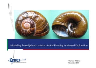
2. • Wildlife Permit secures future of mine and Powelliphanta snail
population - 12/04/2006
• Snail relocation and mining at Stockton has all the necessary
consents - 16/10/2006
• Native snails confined to fridge - 06/05/2010
Background
ESRI Asia Pacific User Conference 2012
• Native snails confined to fridge - 06/05/2010
• A fridge from the Department of Conservation Kills Eight Hundred
Snails - 16/11/2011 Kath Walker – Department of Conservation
3. Types of Spatial Modelling
• Illustrated maps
• Single layer modelling
• Multi-variable models
• Weights of evidence
• Fuzzy logic
ESRI Asia Pacific User Conference 2012ESRI Asia Pacific User Conference 2012
• Fuzzy logic
• Neural networks
4. • Mineral Exploration
• Gold prospectivity models in New Zealand, Papua New Guinea Queensland
and Turkey
• VMS Copper in Oman, Granite-related Gold in Australia, IOCG in Africa
• New modelling projects in New Zealand, Australia, Argentina and off-shore
• Energy
Modelling Successes
ESRI Asia Pacific User Conference 2012ESRI Asia Pacific User Conference 2012
• Geothermal modelling in the Northern Territory of Australia
• Wind Energy Potential in New Zealand, Australia and Argentina.
• Agricultural and Environmental
• New Zealand wide & Hawke’s Bay region grape growth potential
• South Island Alpine Gecko habitat modelling for New Zealand Department of
Conservation
5. Weights of Evidence Modelling (WoE)
• Developed from medical industry for use in mineral exploration –
Graham Bonham-Carter at Geological Survey of Canada
• Prediction of a “disease” given a list of “symptoms”
• Applied to different types of industries
• WoE is a probability based method – Bayesian statistical approach
ESRI Asia Pacific User Conference 2012ESRI Asia Pacific User Conference 2012
6. Why Weight of Evidence Predictive Modelling?
• Training data
• Powelliphanta knowledge
ESRI Asia Pacific User Conference 2012ESRI Asia Pacific User Conference 2012
7. Weights of Evidence Modelling Method
• Develop binary or multiclass
predictive maps of data
relevant to the habitat being
modelled
• Use training data to test
predictive maps for spatial
correlation
ESRI Asia Pacific User Conference 2012ESRI Asia Pacific User Conference 2012
Maps Combined usingMaps Combined using
Weight of EvidenceWeight of Evidence
TechniqueTechnique
Model of SnailModel of Snail
Habitats or PotentialHabitats or Potential
Relocation SitesRelocation Sites
correlation
• Combine selective predictive
maps together using weights of
evidence operators to produce
a map of probabilities
(Probability Map).
8. Favourability and Conditional Probability
∗∗∗∗∗∗∗∗
∗∗∗∗∗∗∗∗
∗∗∗∗∗∗∗∗
∗∗∗∗∗∗∗∗
∗∗∗∗∗∗∗∗
∗∗∗∗∗∗∗∗
∗∗∗∗∗∗∗∗
∗∗∗∗∗∗∗∗
∗∗∗∗∗∗∗∗∗∗∗∗∗∗∗∗
100km100km100km100km100km100km100km100km
100km100km100km100km100km100km100km100km
a = total study area (e.g. 10,000 km)
A = Unit Cell = 1 km2 cell
N(D) = number of deposits
P(D) = prior probability
N(T) = total area of study region
N(B) = area of binary theme
N(B) = area of binary theme not present
N(T) = N(B) + N(B) (as long as no missing data)
ESRI Asia Pacific User Conference 2012ESRI Asia Pacific User Conference 2012
∗∗∗∗∗∗∗∗
_
)|(
)|(
ln
DBP
DBP
W =+ __
_
)|(
)|(
ln
DBP
DBP
W =−
)(/)(
)(/)(
ln
TNBN
DNDBN
W
∩
=+
)(/)(
)(/)(
ln _
_
TNBN
DNDBN
W
∩
=−
)(
1
)(
1
BNDBN
Ws +
∩
=+
)(
1
)(
1
__
BNDBN
Ws +
∩
=−
)()( −++= WsWsCs)()( −−+= WWC CsCStudC /=
From: Bonham-Carter, G.F. (1994)
“Geographic information systems for geoscientists”.
Whenunitcellinf.small
9. Good Spatial Correlation
W+ = 3.0 | W- = -1.2 | C = 4.2
Poor Spatial Correlation
Non-theme area
Mapped predictive area
Correlation of Themes
ESRI Asia Pacific User Conference 2012
W+ = 0.15 | W- = -0.44 | C = 0.59
No Spatial Correlation
W+ = 0 | W- = 0 | C = 0
Snail Locations
Mapped predictive area
e.g. Rainfall
10. Important Spatial Indicators
W+ = natural log
Proportion of deposits on theme
Proportion of total area occupied by theme
W- = natural log
Proportion of deposits not on theme
Proportion of total area not occupied by theme
ESRI Asia Pacific User Conference 2012ESRI Asia Pacific User Conference 2012
W+ > 0 indicates positive association with theme
W- < 0 indicates negative association with non-theme
C > 3.0 Strong correlation
C 1.0 – 3.0 Moderate correlation
C < 1.0 Weak to poor correlation
11. The Powelliphanta Snail Model Parameters
• Study Area = South Island
• Study area grid = 200m
• Powelliphanta Training points = 22
• Unit cell – 25km²
• PP = 0.00364
ESRI Asia Pacific User Conference 2012ESRI Asia Pacific User Conference 2012
• PP = 0.00364
12. Training Points
• WoE requires training data to test correlation
• 22 point training data set
• Locations of five taxa
• Powelliphanta “Kirwans”
• Powelliphanta Victoria/Brunner Ranges
ESRI Asia Pacific User Conference 2012ESRI Asia Pacific User Conference 2012
• Powelliphanta Victoria/Brunner Ranges
• Powelliphanta “patrickensis”
• Powelliphanta gagei
• Powelliphanta rossiana rossiana
13. Layers Tested
• Total layers tested 42
• Climate
• Soil
• Vegetation
• Location features
ESRI Asia Pacific User Conference 2012ESRI Asia Pacific User Conference 2012
• Location features
14. Spatial Correlations
• Forty-two layers were tested for spatial correlation
• Habitat of Powelliphanta snails is spatial associated with
climate, soil and geographic themes
• Eight layers used in final model
ESRI Asia Pacific User Conference 2012ESRI Asia Pacific User Conference 2012
15. October 9am Vapour Pressure Deficit
• 0 - 0.14kPa
• Spatial Correlation - 4.88
ESRI Asia Pacific User Conference 2012ESRI Asia Pacific User Conference 2012
16. Mean Monthly Rainfall
• Snails cease to move and feed in dry conditions
• 191mm – 650mm rainfall
• Spatial Correlation – 4.18
ESRI Asia Pacific User Conference 2012ESRI Asia Pacific User Conference 2012
17. Mean Average Daily Temperature
• Snails do not thrive in hot conditions
• 5 - 9°C
• Spatial Correlation – 3.33
ESRI Asia Pacific User Conference 2012ESRI Asia Pacific User Conference 2012
18. Elevation
• Elevation between 740 - 1300m
• Spatial Correlation -2.36
ESRI Asia Pacific User Conference 2012ESRI Asia Pacific User Conference 2012
19. Soil Type
• Steepland Soil
• Spatial Correlation – 2.36
ESRI Asia Pacific User Conference 2012ESRI Asia Pacific User Conference 2012
20. Acid Soluble Phosphorus
• 0-7mg per 100g soil
• Spatial Correlation – 2.11
ESRI Asia Pacific User Conference 2012ESRI Asia Pacific User Conference 2012
21. Types of Tussock
• Some species live under skirts of tussock
• Types of tussock
• Alpine snow
• Sub Alpine snow
• Tall red
ESRI Asia Pacific User Conference 2012ESRI Asia Pacific User Conference 2012
• Tall red
• Spatial Correlation – 1.96
22. Soil pH
• Soil pH of 4.5 – 5.7
• Spatial Correlation – 1.25
ESRI Asia Pacific User Conference 2012ESRI Asia Pacific User Conference 2012
23. Final Predictive Map
• Identified areas both known
and unknown for snail
habitats
ESRI Asia Pacific User Conference 2012ESRI Asia Pacific User Conference 2012
24. Conclusions
• Higher resolution data
• Smaller study area
• Model individual taxa
• Incorporate predator and food source layers
ESRI Asia Pacific User Conference 2012ESRI Asia Pacific User Conference 2012
25. Acknowledgements
• Greg Partington & Michelle Stokes - Kenex Pty Ltd (Australia)
• Fred Overmars – Sustainability Solutions Ltd
ESRI Asia Pacific User Conference 2012ESRI Asia Pacific User Conference 2012