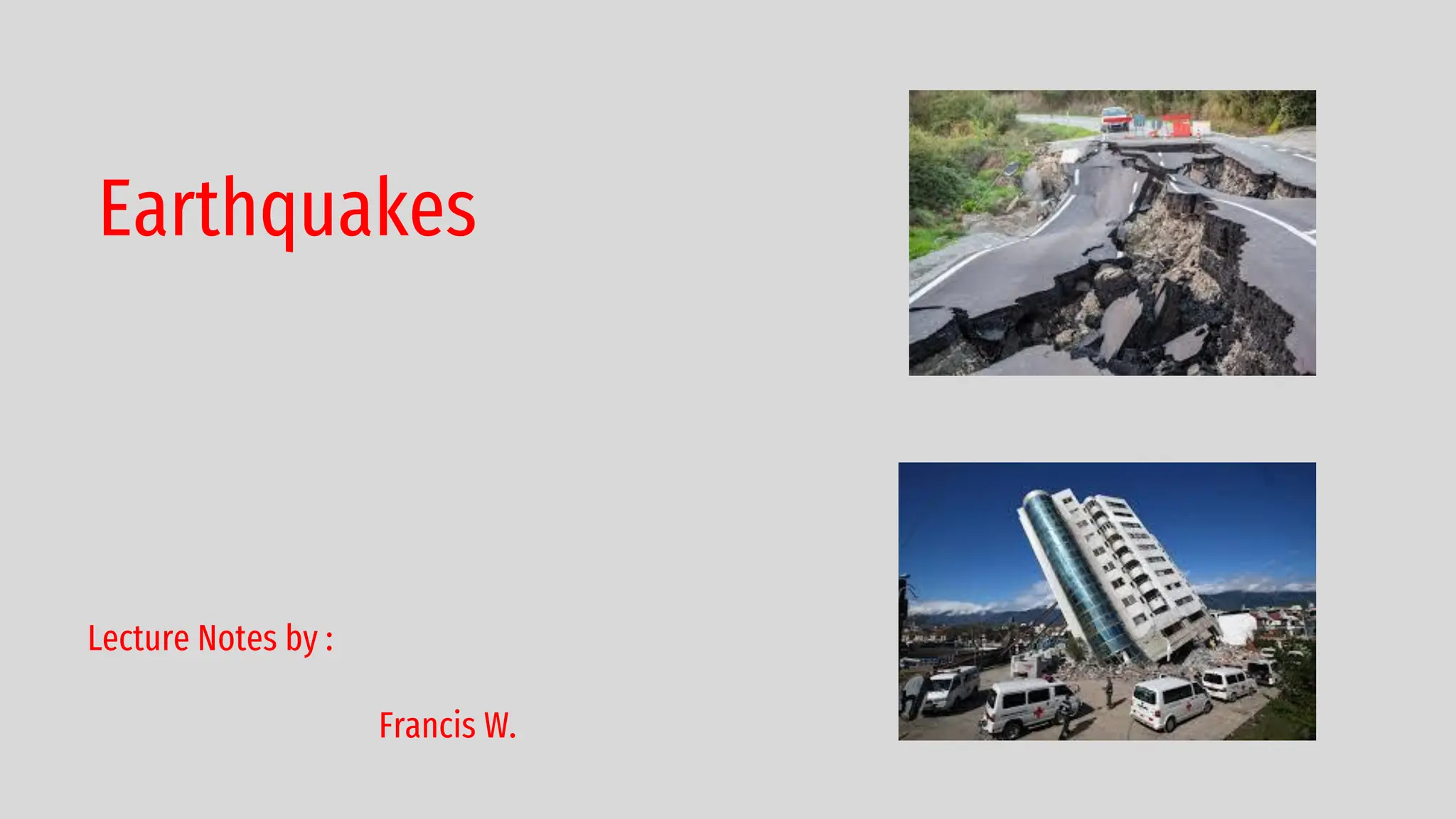
what is earthquake?
An Earthquake is sudden motion or trembling of the earth,
caused by the abrupt release of energy that is stored in rocks.
The term earthquake refers to any event, natural or artificial,
that causes seismic waves.
An Earthquake is a natural vibration of the ground (or the
Earth’s Crust) produced by forces called earth quake forces
or seismic forces.
The scientific study of earthquakes is called Seismology.
Seismic waves are recorded on instruments called
seismographs.
The time, locations, and magnitude of an earthquake can be
determined from the data recorded by seismograph stations.
3.
what is earthquake?
Earthquakes are natural
disasters that have been
affecting the world for
millions of years. They are
caused by the movement of
tectonic plates, which make
up the Earth's crust.
4.
what is earthquake?
Earthquakes can range from
being barely noticeable to
extremely powerful and
destructive. In this article,
we will delve into the details
of earthquakes, including
what causes them, how they
are measured, and what can
be done to prepare for and
reduce the impact of
earthquakes.
5.
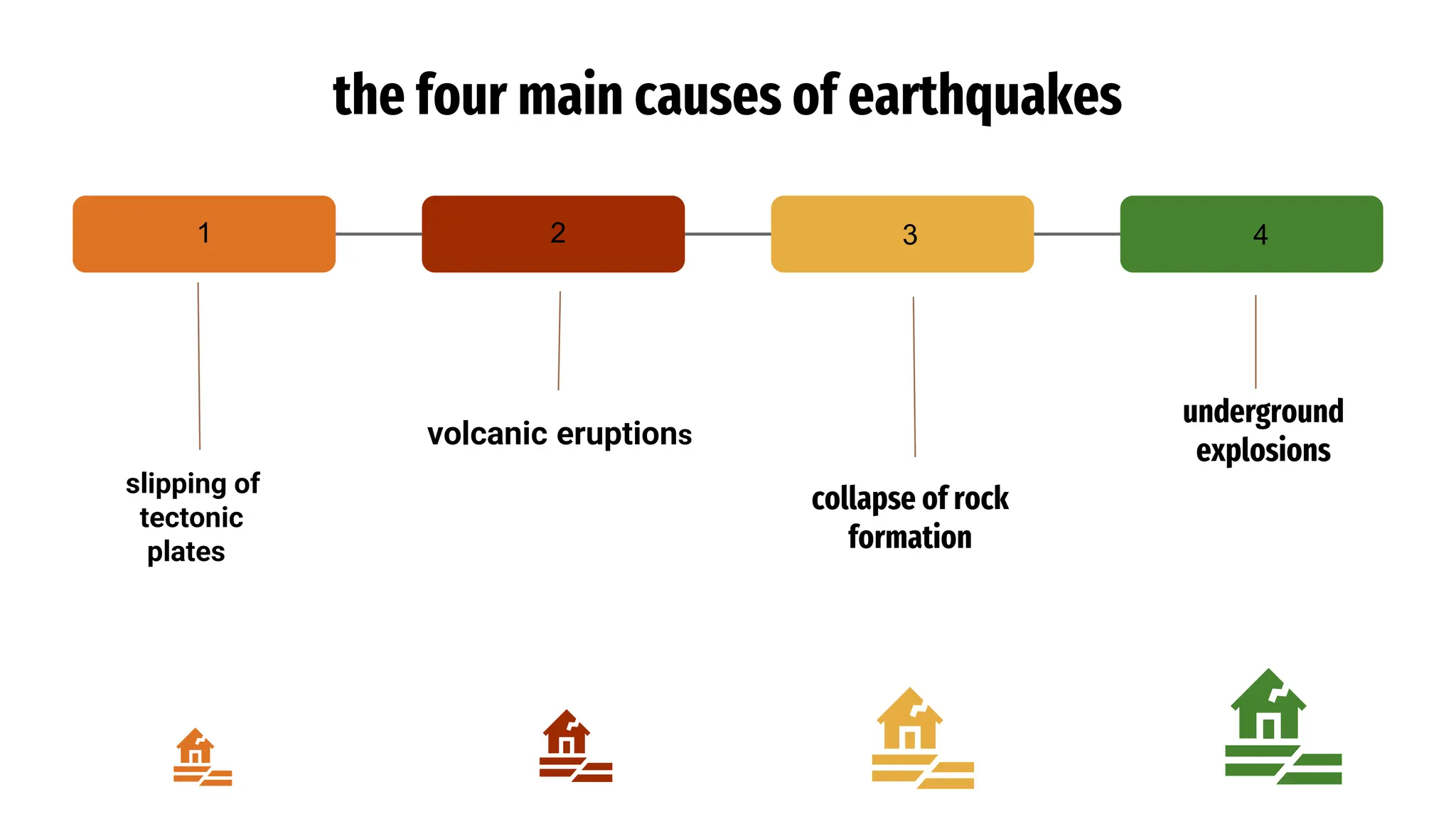
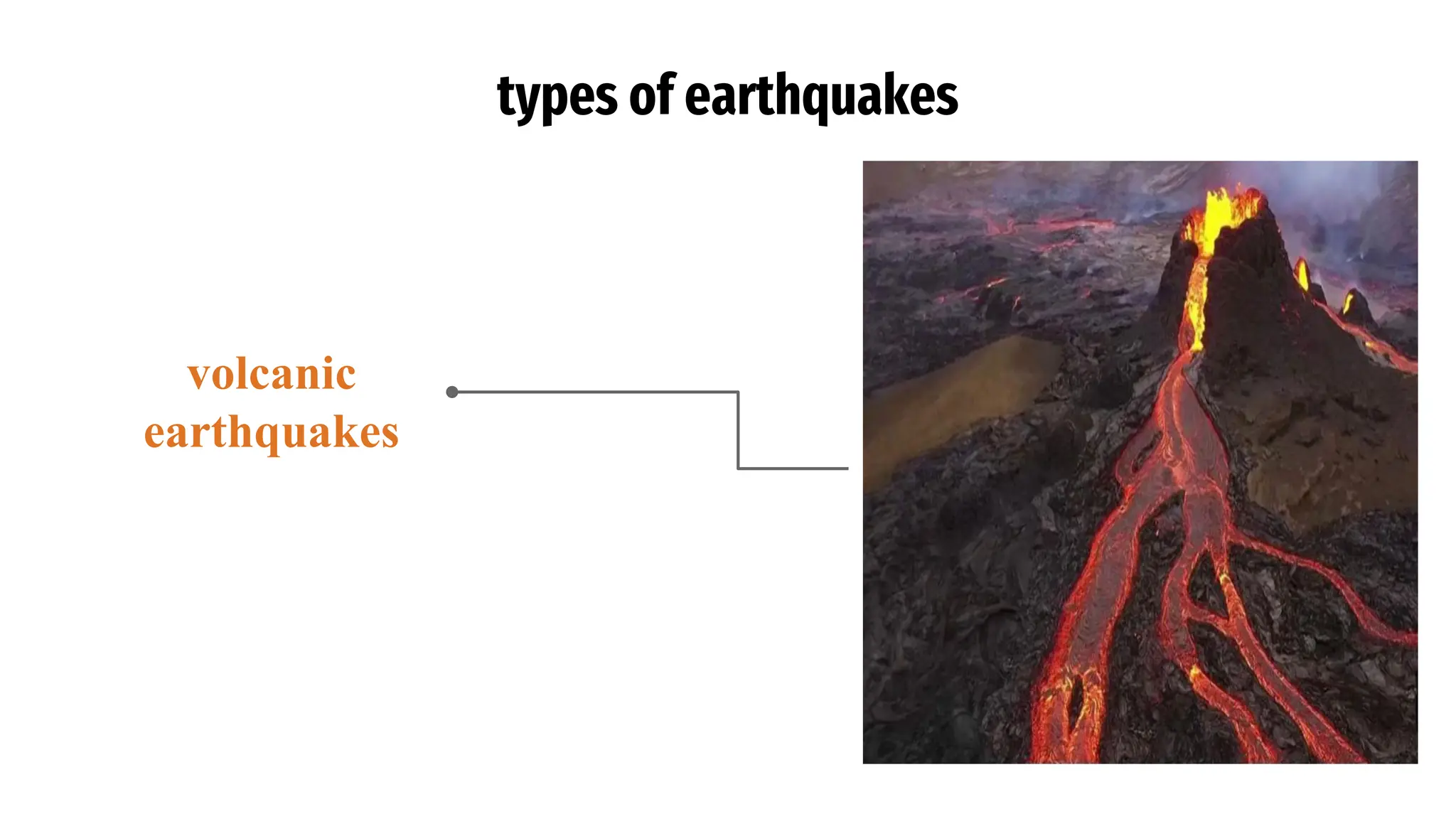
the four maincauses of earthquakes
collapse of rock
formation
underground
explosions
slipping of
tectonic
plates
2
1 3 4
volcanic eruptions
6.
what causes earthquakes??
Earthquakesoccur when
two tectonic plates grind
against each other,
causing a release of
energy in the form of
seismic waves. This
energy can cause the
ground to shake, which
is what we experience as
an earthquake.
Hot tectonic plates are
huge sections of the
Earth's crust that move
slowly over time, often
colliding with each other
at their edges (plate
margins). When two
plates collide, the edge
of one plate can get stuck
and build up pressure
until it finally gives way,
releasing the energy in
the form of an
earthquake.
7.
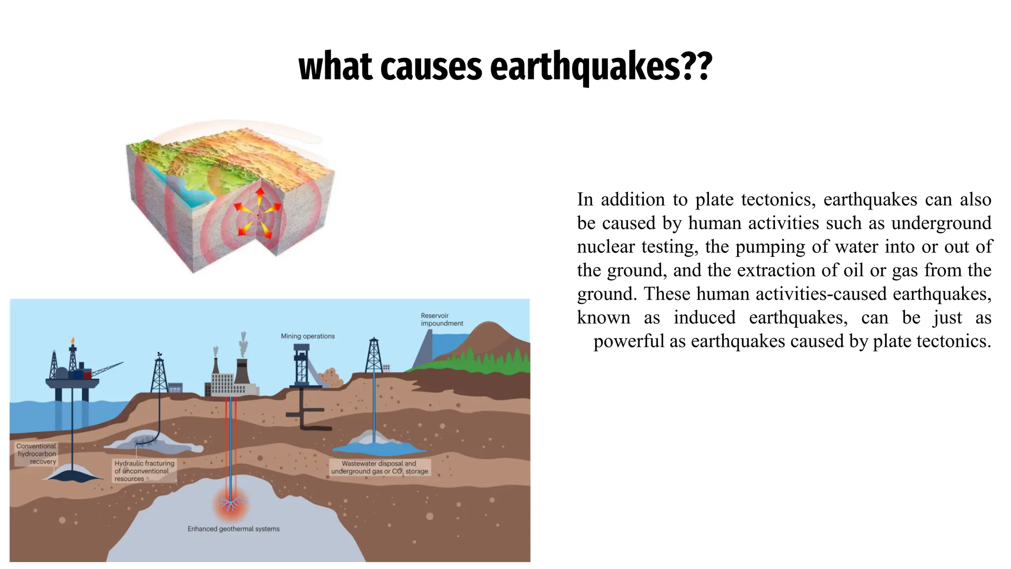
what causes earthquakes??
Inaddition to plate tectonics, earthquakes can also
be caused by human activities such as underground
nuclear testing, the pumping of water into or out of
the ground, and the extraction of oil or gas from the
ground. These human activities-caused earthquakes,
known as induced earthquakes, can be just as
powerful as earthquakes caused by plate tectonics.
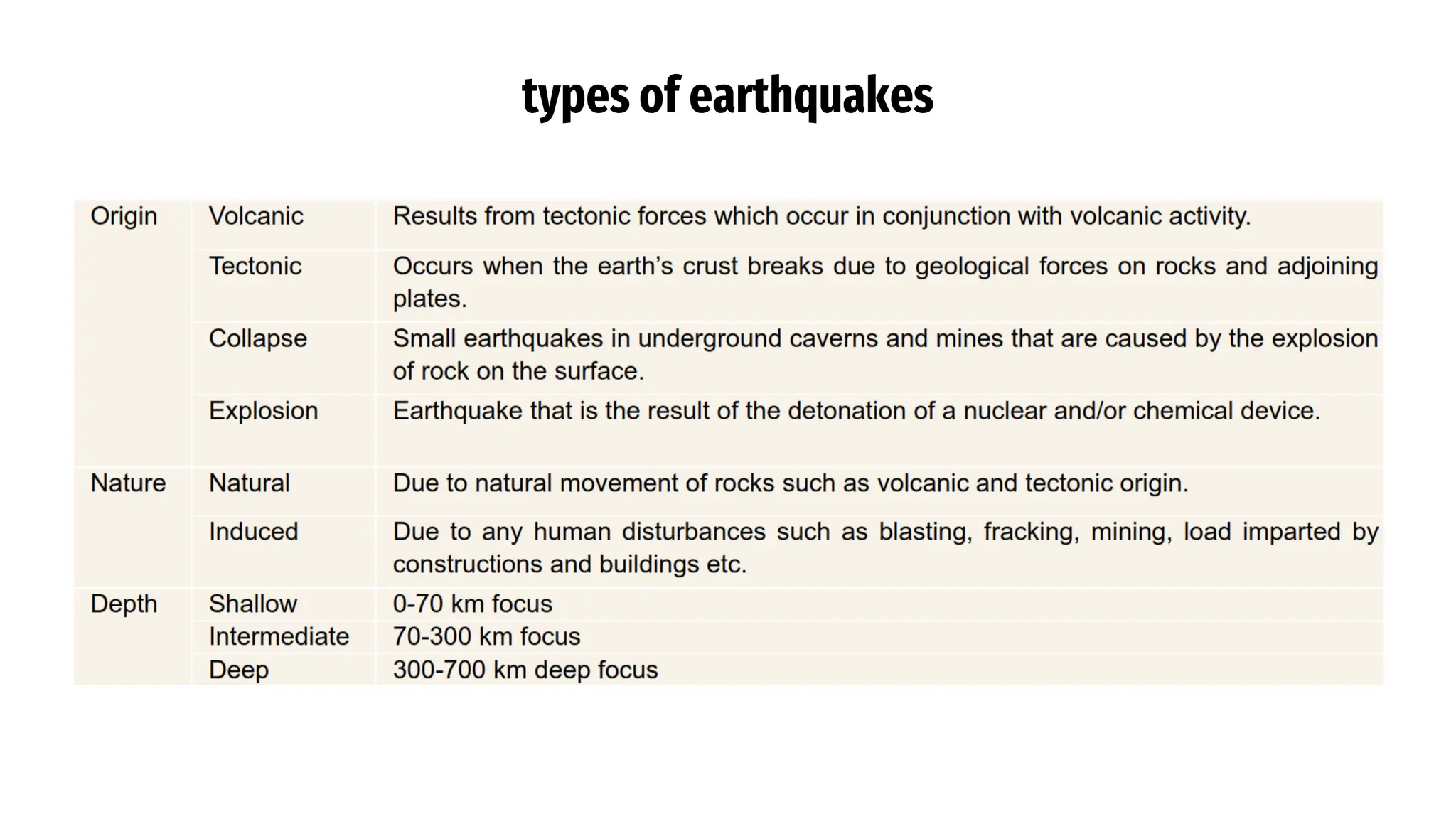
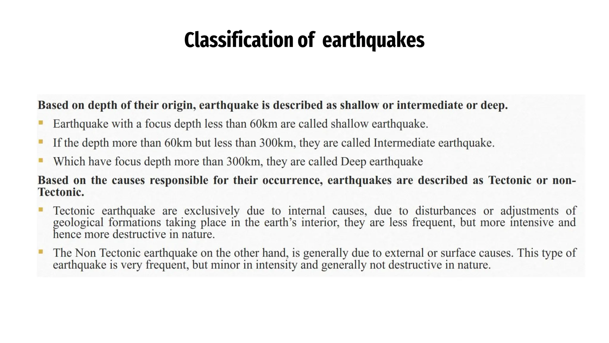
types of earthquakes
Thereare many different types of earthquakes: tectonic,
volcanic, and explosion. The type of earthquake depends
on the region where it occurs and the geological make-up
of that region.
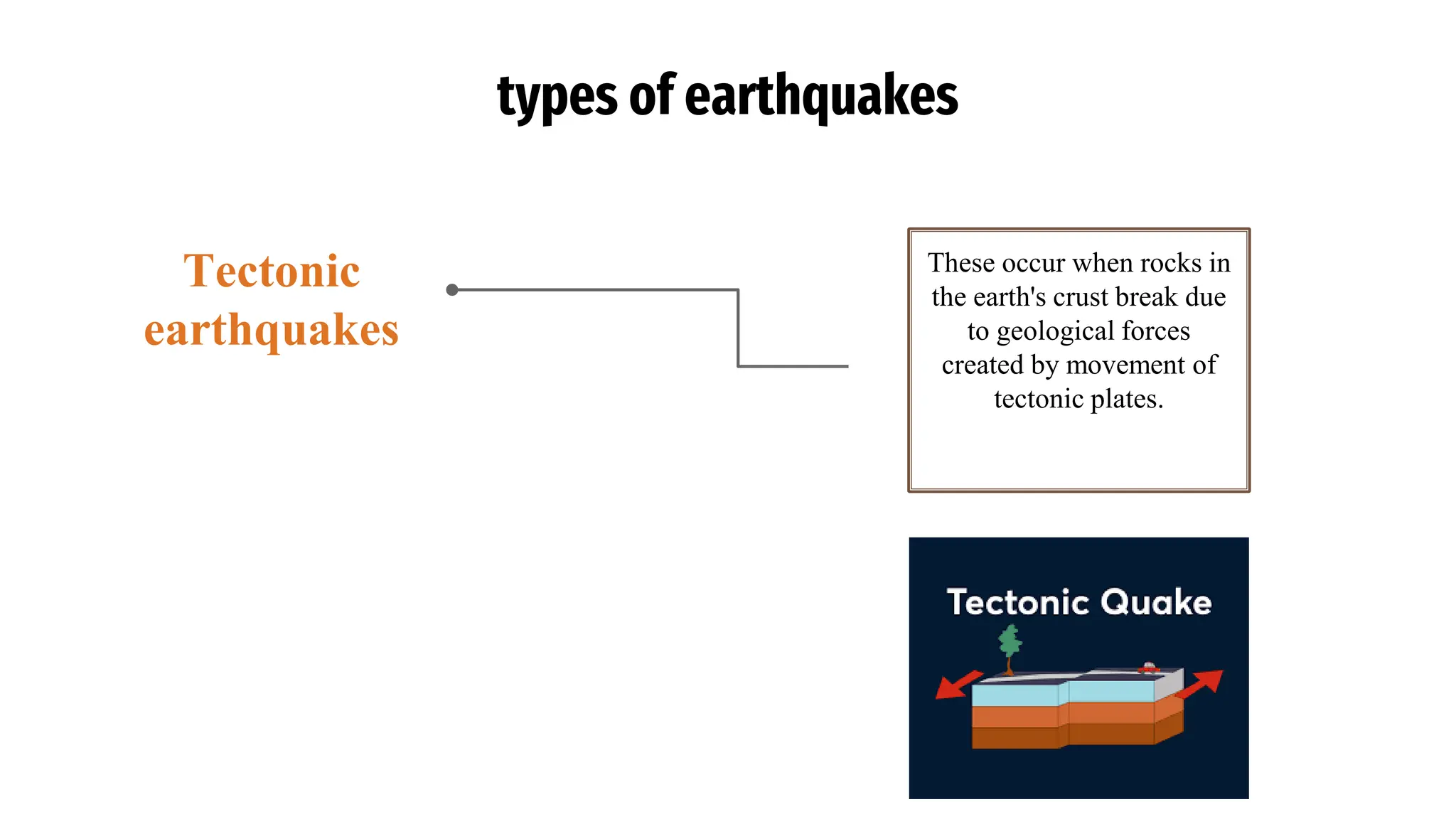
types of earthquakes
Theseoccur when rocks in
the earth's crust break due
to geological forces
created by movement of
tectonic plates.
Tectonic
earthquakes
Seismic waves
• Seismicwaves are waves of energy that travel through the Earth's layers, and are a result of earthquakes,
volcanic eruptions, magma movement, large landslides and large man-made explosions that give out low-
frequency acoustic energy.
• Seismic waves are studied by geophysicists called seismologists.
• Seismic wave fields are recorded by a seismometer, hydrophone (in water), or accelerometer.
• The propagation velocity of the waves depends on density and elasticity of the medium.
• Velocity tends to increase with depth and ranges from approximately 2 to 8 km/s in the Earth's crust, up to
13 km/s in the deep mantle.
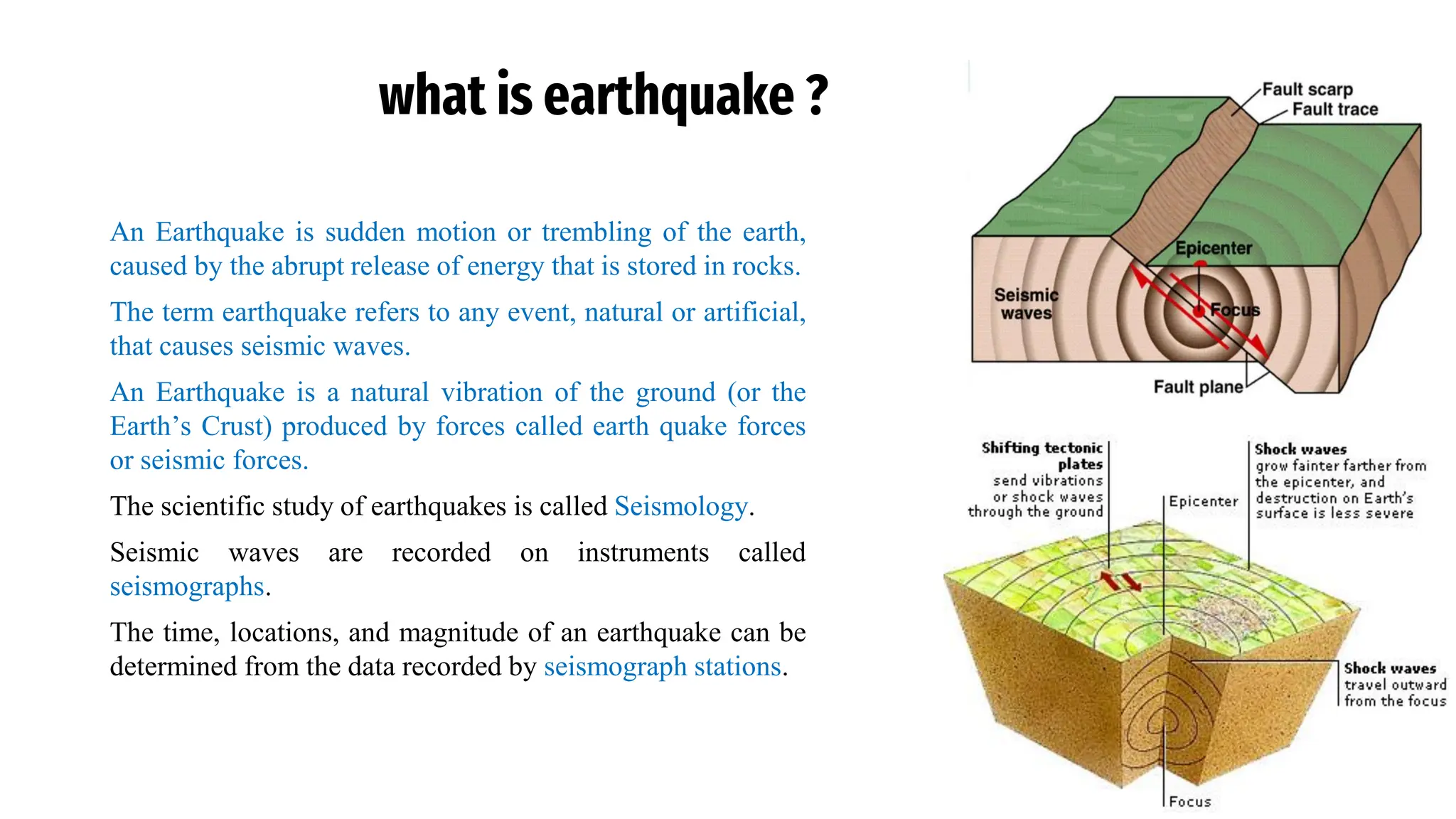
Anatomy of anEarthquake
• Although the ground beneath us seems solid, it’s actually in constant motion. We usually don’t see it, but
we can experience it through earthquakes.
• Earth's crust is broken up into irregular pieces called tectonic plates. There are seven major plates and
many smaller ones, all moving in relation to each other. The lithosphere refers to the crust and upper
mantle that make up these plates.
• As tectonic plates move past each other along fault zones, they sometimes get stuck. Pressure builds, and
when the plates finally give and slip, energy is released as seismic waves, causing the ground to shake.
This is an earthquake.
• The focus is the place inside Earth’s crust where an earthquake originates.
• The point on the Earth’s surface directly above the focus is the epicenter.
• When energy is released at the focus, seismic waves travel outward from that point in all directions.
• There are different types of seismic waves, each one traveling at varying speeds and motions. It's these
waves that you feel during an earthquake.
24.
Anatomy of anEarthquake
▪ Fault: A fracture in the rocks that make up the Earth’s crust
▪ Focus (Hypocenter): The point within the Earth where an earthquake rupture starts
▪ Epicenter: The point at the surface of the Earth above the focus
▪ Plates: Massive rocks that make up the outer layer of the Earth’s surface and whose movement along
faults triggers earthquakes
▪ Seismic waves: Waves that transmit the energy released by an earthquake
25.
Types of seismicwaves
Among the many types of seismic waves, one can make a broad distinction between body waves and surface waves.
o Body waves are seismic waves that travel through the Earth’s interior spreading outwards from the focus
in all directions
o Surface waves travel across the surface. Surface waves decay more slowly with distance than do body
waves, which travel in three dimensions. Surface waves causes more property damage than body waves
because surface waves produce more movement and travel more slowly, so they take longer to pass e.g.
Body Waves
▪ P or primary waves
▪ S or secondary waves
Surface Waves or L (long) waves
▪ The Love waves
▪ The Rayleigh waves
26.
Body waves
P (PrimaryWaves)
o Push and Pull waves.
o Fastest of seismic waves.
o And are longitudinal in character i.e. particles vibrate in
the direction of propagation.
o Travels faster in rigid rocks. These are longitudinal waves
having short wavelength
o They travel very faster and reach seismic station first
o Their velocity is 1.7 times greater than s-waves
o They pass through solid, liquid, gaseous medium.
o Typical values for P-wave velocity in earthquakes are in
the range 5 to 8 km/s.
A compressional (or longitudinal) wave in which rock
vibrates back and forth parallel to the directions of wave
propagation.
27.
Body waves
S (secondaryWaves)
• Shear waves
• These waves are transverse in character like light
i.e. particles vibrate at right angles to direction of
propagation.
• S waves do not propagate through liquids
• They travel only in solid medium.
• Velocity tends to increase with depth and ranges
from approximately 2 to 8 km/s in the Earth's crust,
up to 13 km/s in the deep mantle.
These are waves that travel in directions at right angles
(i.e. transverse) to the directions of propagation of the wave.
28.
Surface waves
Rayleigh Waves
•Displacement of particle is of complex nature.
• Partly being in the direction of propagation and
partly perpendicular to direction of propagation.
• Tend to distort horizontal surface into a zig zag
shape.
29.
Surface waves
Love waves
▪Displacement of particle is practically horizontal
i.e. in direction of propagation.
▪ Love waves create rupture (breaking) or shearing.
▪ It moves the ground from side to side in a
horizontal plane but at right angles to the direction
of propagation.
▪ The horizontal shaking of Love waves is
particularly damaging to the foundations of
structures.
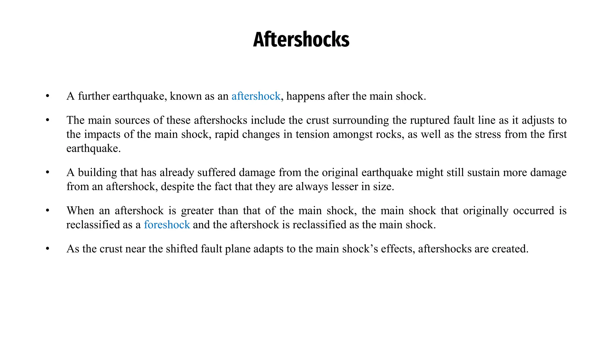
Aftershocks
• A furtherearthquake, known as an aftershock, happens after the main shock.
• The main sources of these aftershocks include the crust surrounding the ruptured fault line as it adjusts to
the impacts of the main shock, rapid changes in tension amongst rocks, as well as the stress from the first
earthquake.
• A building that has already suffered damage from the original earthquake might still sustain more damage
from an aftershock, despite the fact that they are always lesser in size.
• When an aftershock is greater than that of the main shock, the main shock that originally occurred is
reclassified as a foreshock and the aftershock is reclassified as the main shock.
• As the crust near the shifted fault plane adapts to the main shock’s effects, aftershocks are created.
34.
Earthquake swarms
• Anearthquake swarm is a seismic event where numerous
earthquakes occur in a local area over an extended period
without a clear pattern of a mainshock and aftershocks,
often involving multiple quakes of similar magnitude.
• In so-called 'earthquake swarms', numerous earthquakes
occur locally over an extended period without a clear
sequence of foreshocks, main quakes and aftershocks.
35.
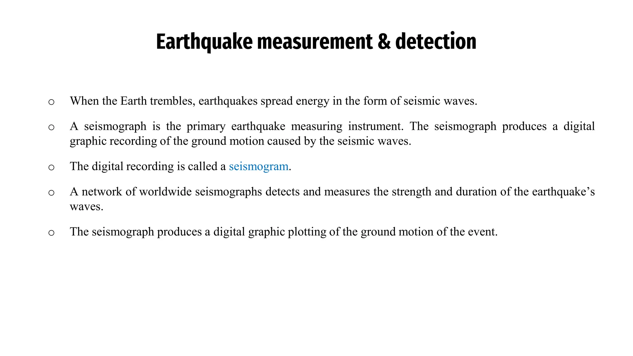
Earthquake measurement &detection
o When the Earth trembles, earthquakes spread energy in the form of seismic waves.
o A seismograph is the primary earthquake measuring instrument. The seismograph produces a digital
graphic recording of the ground motion caused by the seismic waves.
o The digital recording is called a seismogram.
o A network of worldwide seismographs detects and measures the strength and duration of the earthquake’s
waves.
o The seismograph produces a digital graphic plotting of the ground motion of the event.
36.
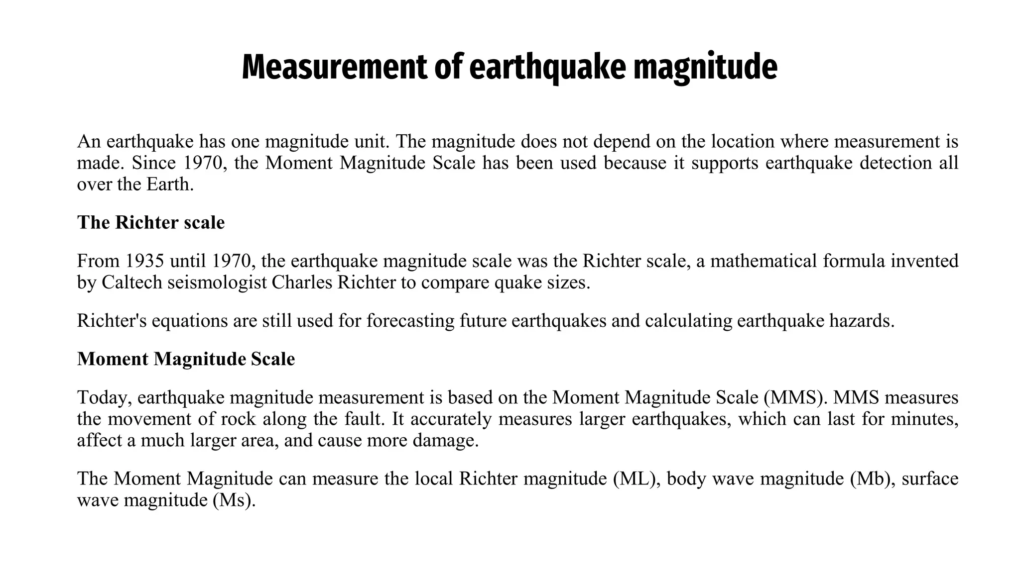
Measurement of earthquakemagnitude
An earthquake has one magnitude unit. The magnitude does not depend on the location where measurement is
made. Since 1970, the Moment Magnitude Scale has been used because it supports earthquake detection all
over the Earth.
The Richter scale
From 1935 until 1970, the earthquake magnitude scale was the Richter scale, a mathematical formula invented
by Caltech seismologist Charles Richter to compare quake sizes.
Richter's equations are still used for forecasting future earthquakes and calculating earthquake hazards.
Moment Magnitude Scale
Today, earthquake magnitude measurement is based on the Moment Magnitude Scale (MMS). MMS measures
the movement of rock along the fault. It accurately measures larger earthquakes, which can last for minutes,
affect a much larger area, and cause more damage.
The Moment Magnitude can measure the local Richter magnitude (ML), body wave magnitude (Mb), surface
wave magnitude (Ms).
37.
Measurement of earthquakemagnitude
Earthquake Magnitude Classes
• Earthquakes are classified into categories based on their magnitude, ranging from minor to great.
• These categories, known as magnitude classes, serve as a standard for measuring earthquake intensity.
• The classification begins with 'minor', referring to earthquakes with magnitudes between 3.0 and 3.9,
where the shaking is typically noticeable but rarely causes damage. It ends with 'great', which describes
earthquakes with magnitudes exceeding 8.0, often resulting in significant destruction and widespread
impact.
• This system provides a clear framework for understanding the severity of earthquakes and their potential
effects.
38.
Richeter Scale
• TheRichter magnitude scale (also Richter scale) assigns a magnitude number to quantify the energy
released by an earthquake.
• The Richter scale, developed in the 1930s, is a base-10 logarithmic scale, which defines magnitude as the
logarithm of the ratio of the amplitude of the seismic waves to an arbitrary, minor amplitude.
• In 1935, the seismologists Charles Francis Richter and Beno Gutenberg, of the California Institute of
Technology, developed the (future) Richter magnitude scale, specifically for measuring earthquakes in a
given area of study.
• The Richter scale was succeeded in the 1970s by the Moment Magnitude Scale (MMS). This is now the
scale used by the United States Geological Survey to estimate magnitudes for all modern large
earthquakes.
• An Earthquake of magnitude 5 may cause damage within radius of 8km, but that of magnitude 7 may
cause damage in a radius of 80km, and that of 8 over a radius of 250km.
39.
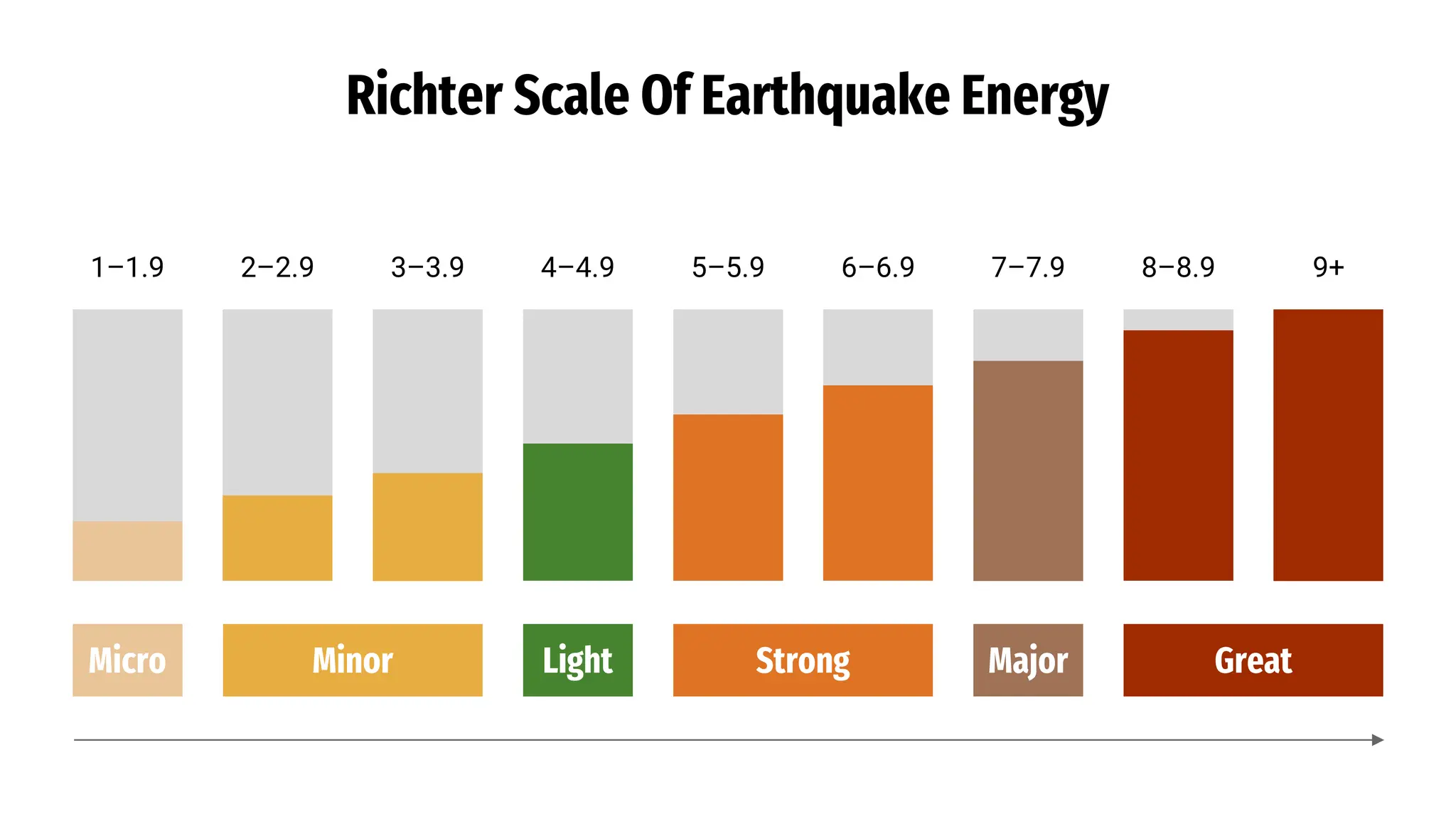
Richter Scale OfEarthquake Energy
great
8 ≥
major
7-7.9
strong
6-6.9
moderate
5-5.9
light
4-4.9
minor
3-3.9
40.
Richter Scale OfEarthquake Energy
1–1.9 2–2.9 3–3.9 4–4.9 5–5.9 6–6.9 7–7.9 8–8.9 9+
Micro Minor Light Strong Major Great
43.
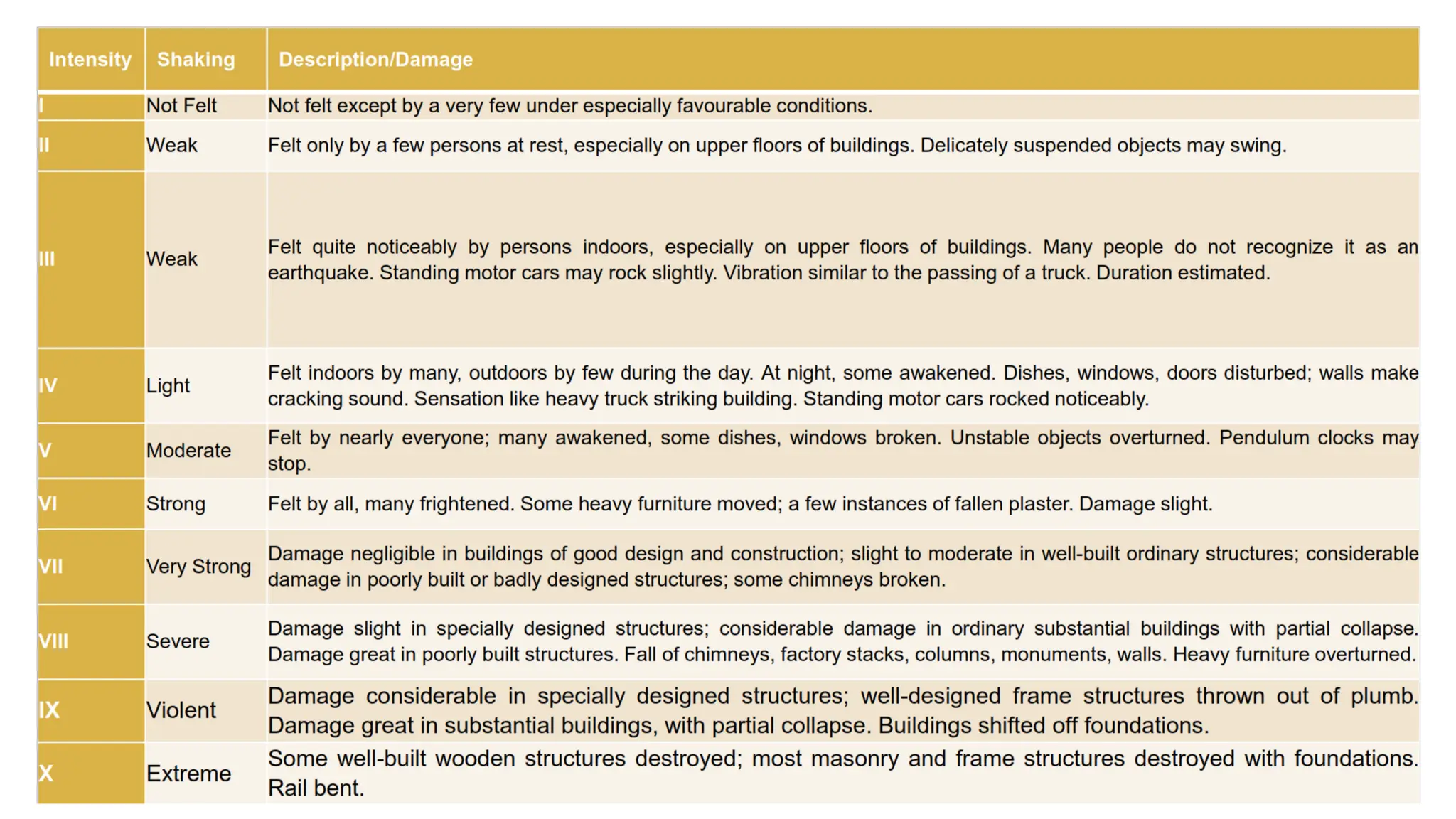
Measurement Of EarthquakeIntensity
• A second way earthquakes are measured is by their intensity.
• Earthquake Intensity measurement is an on-the-ground description.
• The measurement explains the severity of earthquake shaking and its effects on people and their environment.
• Intensity measurements will differ depending on each location’s nearness to the epicenter.
• There can be multiple intensity measurements as opposed to one magnitude measurement.
The Modified Mercalli Scale
Based on Giuseppe Mercalli's Mercalli intensity scale of 1902, the modified 1931 scale is composed of increasing
levels of intensity that range from observable quake impacts from light shaking to catastrophic destruction. Intensity is
reported by Roman numerals.
An earthquake intensity scale consists of a series of key responses that includes people awakening, movement of
furniture, damage to chimneys and total destruction.
45.
Earthquake intensity vs.magnitude
Intensity: Is a measure of the amount of earth shaking that happens at a given location in an earthquake.
Magnitude: Is a measure of the size of the seismic waves or the amount of energy released at the source of the
earthquake.
The Richter scale and the Moment Magnitude scale both measure earthquake’s magnitude.
The Modified Mercalli Scale is based on earthquake intensity.
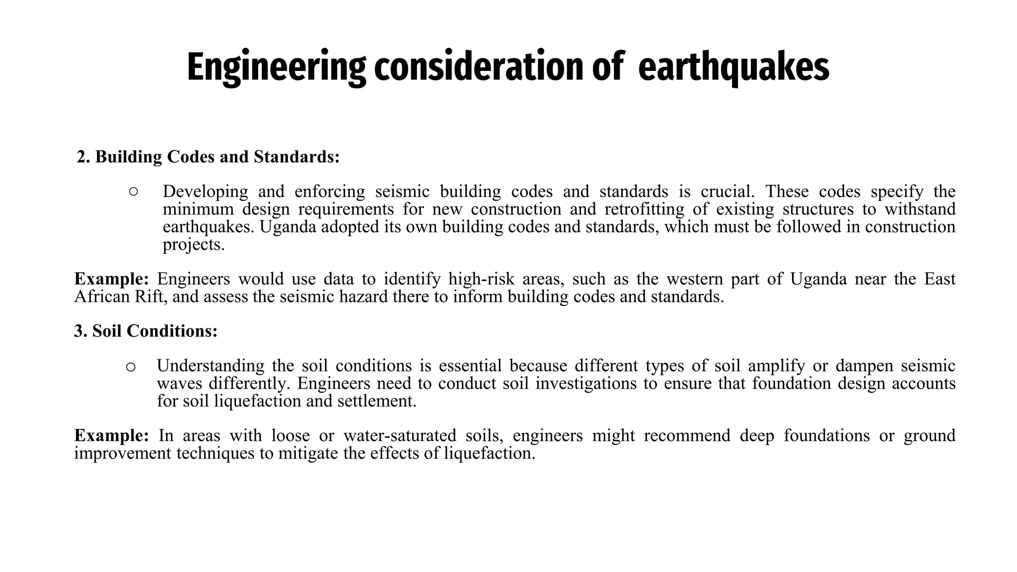
Engineering consideration ofearthquakes
Engineering considerations for earthquakes in Uganda, like in any seismically active region, are crucial to ensure the
safety and resilience of infrastructure and communities. Uganda is located within the East African Rift System, making
it susceptible to seismic activity.
Key engineering considerations:
1. Seismic Hazard Assessment:
○ The first step is to assess the seismic hazard of the region. Engineers must analyze historical earthquake
data, fault lines, and geological conditions to understand the potential magnitude and frequency of
earthquakes in different areas of Uganda. This information helps determine the level of seismic design
criteria for structures.
Example: Engineers would use data to identify high-risk areas, such as the western part of Uganda near the East
African Rift, and assess the seismic hazard there to inform building codes and standards.
50.
Engineering consideration ofearthquakes
2. Building Codes and Standards:
○ Developing and enforcing seismic building codes and standards is crucial. These codes specify the
minimum design requirements for new construction and retrofitting of existing structures to withstand
earthquakes. Uganda adopted its own building codes and standards, which must be followed in construction
projects.
Example: Engineers would use data to identify high-risk areas, such as the western part of Uganda near the East
African Rift, and assess the seismic hazard there to inform building codes and standards.
3. Soil Conditions:
o Understanding the soil conditions is essential because different types of soil amplify or dampen seismic
waves differently. Engineers need to conduct soil investigations to ensure that foundation design accounts
for soil liquefaction and settlement.
Example: In areas with loose or water-saturated soils, engineers might recommend deep foundations or ground
improvement techniques to mitigate the effects of liquefaction.
51.
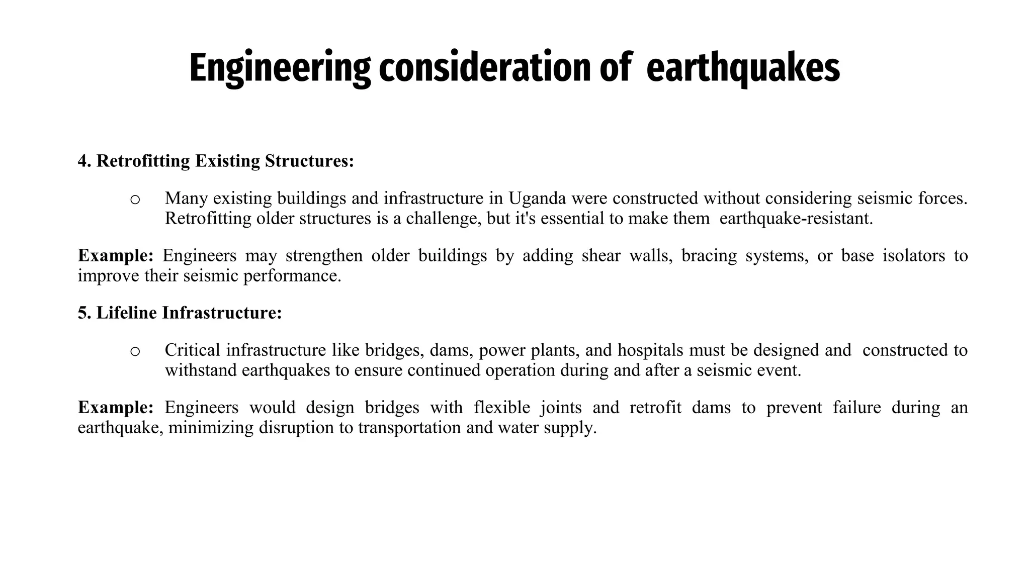
Engineering consideration ofearthquakes
4. Retrofitting Existing Structures:
o Many existing buildings and infrastructure in Uganda were constructed without considering seismic forces.
Retrofitting older structures is a challenge, but it's essential to make them earthquake-resistant.
Example: Engineers may strengthen older buildings by adding shear walls, bracing systems, or base isolators to
improve their seismic performance.
5. Lifeline Infrastructure:
o Critical infrastructure like bridges, dams, power plants, and hospitals must be designed and constructed to
withstand earthquakes to ensure continued operation during and after a seismic event.
Example: Engineers would design bridges with flexible joints and retrofit dams to prevent failure during an
earthquake, minimizing disruption to transportation and water supply.
52.
Engineering consideration ofearthquakes
6. Public Awareness and Education:
o Public awareness and education programs are crucial to inform residents about earthquake risks and safety
measures. This includes educating people about evacuation plans, emergency kits, and safe building
practices.
Example: Local authorities and engineers might organize workshops and drills to educate the public on earthquake
preparedness and response.
7. Emergency Response Plans:
o Engineers play a role in developing emergency response plans with local authorities. These plans should
include procedures for evacuations, search and rescue operations, and medical assistance.
Example: Engineers may assist in identifying safe assembly areas and routes for evacuations in earthquake-prone
regions.
53.
Devastating Effects ofEarthquakes
Damage to buildings
Damage to infrastructure
Landslides and Rocks slides
Earthquakes can trigger tsunamis
Leads to liquefaction
Can result in floods
Safety tips whenearthquake occurs
02
Cover
If there is no shelter nearby, get down near an
interior wall or next to low-lying furniture that won’t
fall on you, and cover your head and neck with your
arms and hands.
01
Drop
DROP down onto your hands and knees before the earthquake
knocks you down. This position protects you from falling but
allows you to still move if necessary.
Hold On
until the shaking stops. Be
prepared to move with your
shelter if the shaking shifts it
around.
03
63.
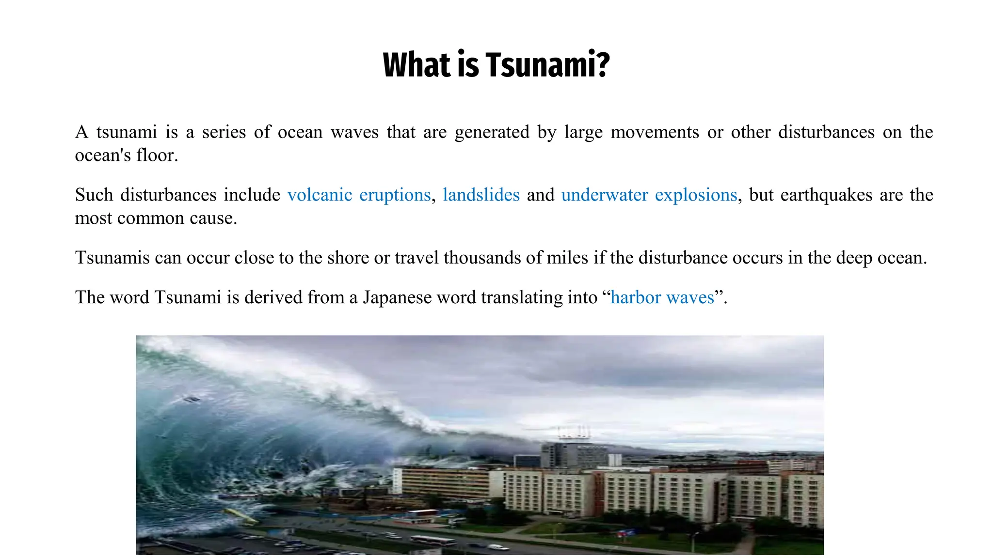
What is Tsunami?
Atsunami is a series of ocean waves that are generated by large movements or other disturbances on the
ocean's floor.
Such disturbances include volcanic eruptions, landslides and underwater explosions, but earthquakes are the
most common cause.
Tsunamis can occur close to the shore or travel thousands of miles if the disturbance occurs in the deep ocean.
The word Tsunami is derived from a Japanese word translating into “harbor waves”.
66.
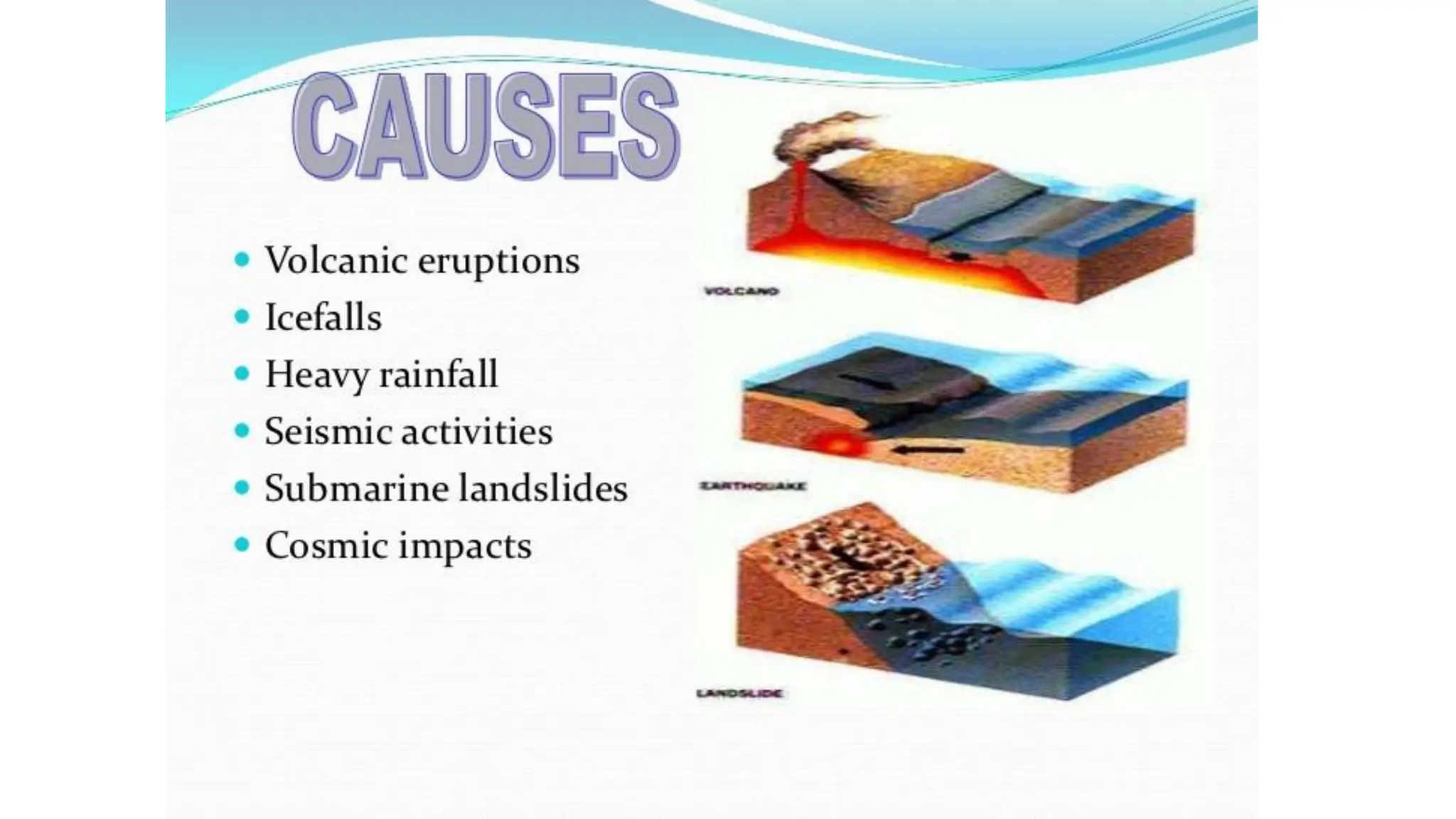
Causes of Tsunami
Tsunamisare caused by powerful underwater earthquakes, volcanic eruptions, or landslides.
When these events occur underwater, a significant amount of energy is released, generating enormous
waves.
Certain parts of the ocean frequently experience earthquakes due to the movement of tectonic plates.
Most earthquakes happen near plate boundaries, where plates move over, along, or away from each other.
Tsunamis can push vast quantities of water to the surface.
The Pacific Ocean is particularly prone to tsunamis because of its high level of undersea geological
activity.
In the case of a volcanic eruption, the ocean floor may rapidly rise several hundred feet. This upward
movement displaces large volumes of water, creating massive waves.
67.
Causes of Tsunami
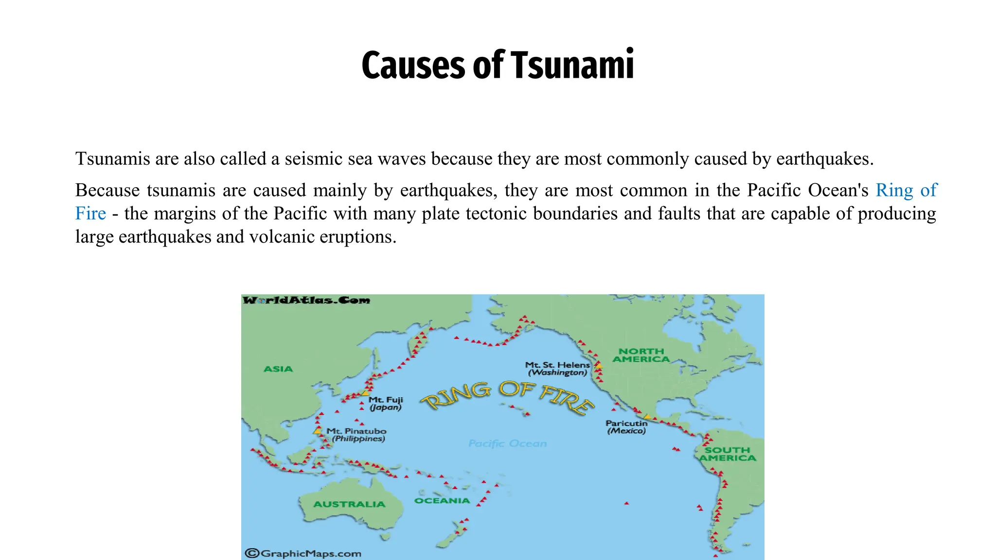
Tsunamisare also called a seismic sea waves because they are most commonly caused by earthquakes.
Because tsunamis are caused mainly by earthquakes, they are most common in the Pacific Ocean's Ring of
Fire - the margins of the Pacific with many plate tectonic boundaries and faults that are capable of producing
large earthquakes and volcanic eruptions.
68.
Causes of Tsunami
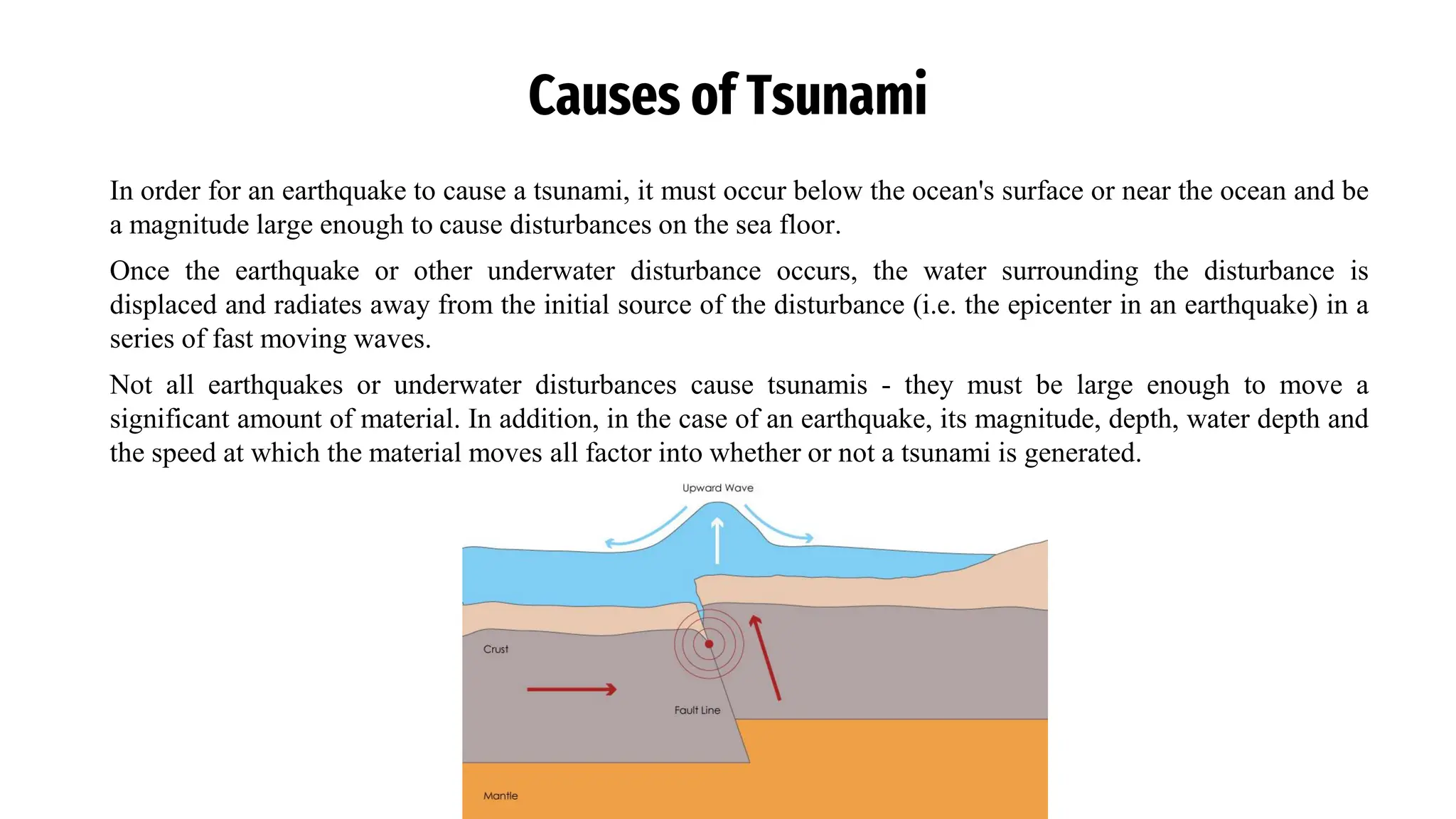
Inorder for an earthquake to cause a tsunami, it must occur below the ocean's surface or near the ocean and be
a magnitude large enough to cause disturbances on the sea floor.
Once the earthquake or other underwater disturbance occurs, the water surrounding the disturbance is
displaced and radiates away from the initial source of the disturbance (i.e. the epicenter in an earthquake) in a
series of fast moving waves.
Not all earthquakes or underwater disturbances cause tsunamis - they must be large enough to move a
significant amount of material. In addition, in the case of an earthquake, its magnitude, depth, water depth and
the speed at which the material moves all factor into whether or not a tsunami is generated.
69.
Movement of Tsunami
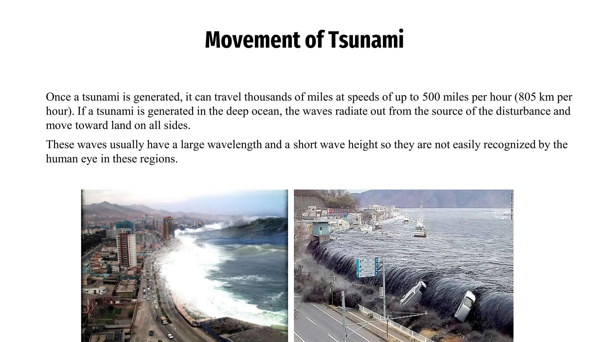
Oncea tsunami is generated, it can travel thousands of miles at speeds of up to 500 miles per hour (805 km per
hour). If a tsunami is generated in the deep ocean, the waves radiate out from the source of the disturbance and
move toward land on all sides.
These waves usually have a large wavelength and a short wave height so they are not easily recognized by the
human eye in these regions.
70.
Movement of Tsunami
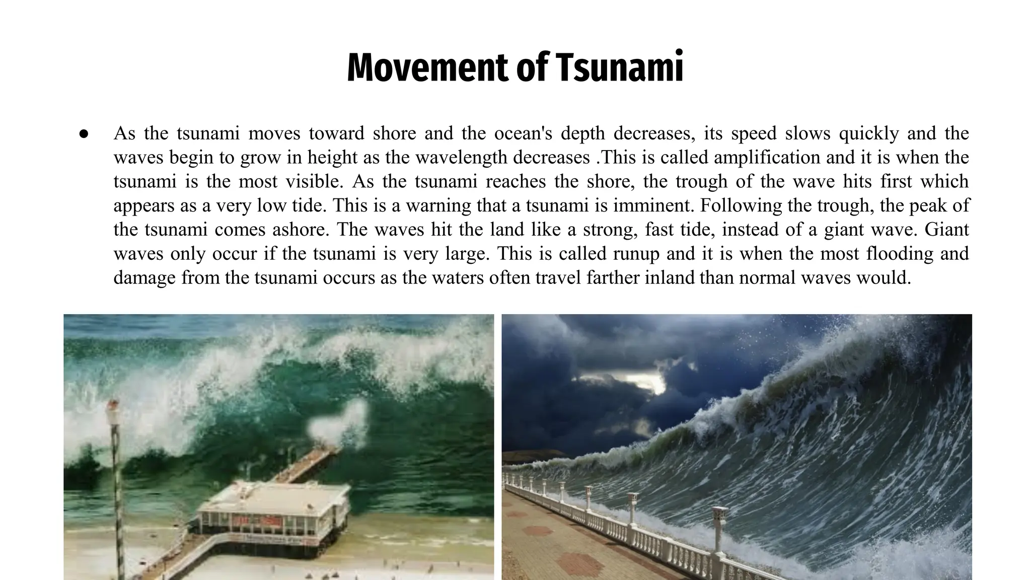
●As the tsunami moves toward shore and the ocean's depth decreases, its speed slows quickly and the
waves begin to grow in height as the wavelength decreases .This is called amplification and it is when the
tsunami is the most visible. As the tsunami reaches the shore, the trough of the wave hits first which
appears as a very low tide. This is a warning that a tsunami is imminent. Following the trough, the peak of
the tsunami comes ashore. The waves hit the land like a strong, fast tide, instead of a giant wave. Giant
waves only occur if the tsunami is very large. This is called runup and it is when the most flooding and
damage from the tsunami occurs as the waters often travel farther inland than normal waves would.
71.
Assignment
a) Discuss thecauses and effects of earthquakes.
b) Referencing a notable historical earthquake event in East Africa, that is the 1966 Toro earthquake, or the
1966 Rwenzori earthquake, that occurred on March 20 at 01:42 UTC (04:42 Uganda local time). The
earthquake was located near the border between Uganda and the Democratic Republic of the Congo
(DRC), to the south of Lake Albert. The earthquake had a magnitude of Mw 6.8 and a maximum
perceived intensity of VIII (Severe) on the Mercalli intensity scale.
Discuss its impact on the region, both geologically and in terms of infrastructure.