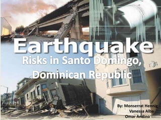
This document discusses earthquake risk in Santo Domingo, Dominican Republic. It notes that the population of Santo Domingo is approximately 2 million people, and the Septentrional fault zone that runs near the city has likely accumulated strain sufficient to produce a major earthquake in over 800 years. However, the city is ill-prepared for such an earthquake as the building codes are outdated, most homes are not built to withstand seismic activity, and many residents are unaware of proper earthquake safety procedures. The document calls for Dominican officials and construction companies to improve building codes and prepare residents for earthquakes to make Santo Domingo safer.
Presentation by Pierre Beland of Humanitarian OpenStreetMap Team on joint Crisis Informatics workshop organized by Kathmandu Living Labs, Harvard Humanitarian Initiative and University of Colorado Boulder to draw lessons from Nepal Earthquake 2015.
Presentation by Pierre Beland of Humanitarian OpenStreetMap Team on joint Crisis Informatics workshop organized by Kathmandu Living Labs, Harvard Humanitarian Initiative and University of Colorado Boulder to draw lessons from Nepal Earthquake 2015.
Earthquake Safety Week 2017 from 15-21 January 2017
Bihar State Disaster Management Authority has announced Earthquake Safety Week.
Bihar is located in the high seismic zone that falls on the boundary of the tectonic plate joining the Himalayan tectonic plate near the Bihar-Nepal Border and has six sub-surface fault lines moving towards the Gangetic planes in four directions. Of the 38 districts of Bihar, 8 districts fall in seismic zone V of which 2 districts (Madhubani and Supaul) fall entirely in seismic zone V while 24 districts fall in seismic zone IV and 6 districts in seismic zone III with most districts falling under multiple seismic zones (i.e. either seismic zone V & IV or seismic zone IV & III). The state has in the past experienced major earthquakes; the worst was the 1934 earthquake in which more than 10,000 people lost their lives, followed by 1988 earthquake and recent earthquake was the Sikkim earthquake in September 2011.
The new and growing urban centres in the state where building codes and control mechanisms are not enforced, earthquake remains a major threat to cities. This could result in social infrastructures such as schools and hospitals that are not built to be earthquake resistant could lead to serve damage and loss of lives as well.
The 2016 Ecuador earthquake occurred on April 16 at 18:58:37 ECT with a moment magnitude of 7.8 and a maximum Mercalli intensity of VIII (Severe). The very large thrust earthquake was centered approximately 27 km (17 mi) from the towns of Muisne and Pedernales in a sparsely populated part of the country, and 170 km (110 mi) from the capital Quito, where it was felt strongly. Regions of Manta, Pedernales and Portoviejo accounted for over 75 percent of total casualties.[6] Manta's central commercial shopping district Tarqui, was completely destroyed. Widespread damage was caused across Manabi province, with structures hundreds of kilometres from the epicenter collapsing. At least 659 people were killed and 27,732 people injured. President Rafael Correa declared a state of emergency; 13,500 military personnel and police officers were dispatched for recovery operations.
The wise also learn from all global earthquake disasters. Examples of historic emergency response situations. Preparedness and emergency response are essential pillars of global earthquake disaster resilience. Every time an earthquake disaster occurs, we have new knowledge to add to our “books of knowledge” for the next steps: post-disaster recovery. Presentation courtesy of Dr. Walter Hays, Global Alliance for Disaster Reduction
Running head PBAD201-1303B-03 P4IPP4IP .docxjoellemurphey
Running head: PBAD201-1303B-03 P4IP
P4IP 2
PBAD201-1303B-03 P4IP
Colorado Technical University
Instructor: Professor Knetzger
Connie Hutson
15 September 2013
PBAD201-1303B-03 P43IP
Colorado Technical University
Instructor: Professor Knetzger
Connie Hutson
15 September 2013
Earthquake Preparedness
Every disaster has different effects. It can cause permanent damage or temporary inconvenience. This research paper seeks to illustrate how to avoid terrible outcomes of unexpected earthquakes. Every disaster, if prepared for can cause less damage. An earthquake is one natural disaster that has a high rate of damage in its after effects. It is known as the abrupt and fast shaking of the ground caused as rock breaks and shifts due to the strain that has accumulated over a long period (Walker 2008). Earthquakes are one of the major disasters not anticipated, and they end up causing irreparable damage. This paper will use a sample of the San Francisco Bay area. It has a population size of 7,150,739 people as at the census taken in 2010. The Bay Area sits at border where a couple of the earth’s biggest tectonic plates intersect and pass each other. Sometimes, the boundary faults may break. Then the North American plate hurls at the Pacific Plates. This is when an earthquake occurs.
The area has had a number of earthquakes, a trend that scientists cannot take to be random. Some of the earthquakes have a magnitude of 6 and even higher. There is a high frequency of earthquakes. It is estimated that there is a 50% probability that in the next thirty years there will be more occurrences of the same magnitude. Ranging from 1836 to 1911, there was an alarming 18 earthquakes. The Earthquake that occurred in 1906 caused a great strain. This is believed to be the reason for the reduction in earthquakes since only one followed that. The Loma Prieta earthquake had a magnitude of 7.1. It occurred after 1979 (Walker 2008).
Factors that make this area suitable for my proposal are the population of bay area is considerably high, and a great number of people will be affected by an earthquake should it occur. The reason for this is that the area is strategically located between two tectonic plates, making it prone to earthquake occurrence. In addition to this, the continual damage proves that the area needs to take up measures to keep it free from more damage. It could gain from learning about disaster preparedness. These strategies would eliminate the greater risks by foreseeing them and training the residents. From studies carried out bay area is prone to the occurrence of earthquake especially in the future due to the factors mentioned above. Furthermore, only a few individual poses the disaster management skills, which increases fears and further affect the area economic ...
Running head DISASTER OF PORT-AU-PRINCE1DISASTER OF PORT-A.docxsusanschei
Running head: DISASTER OF PORT-AU-PRINCE 1
DISASTER OF PORT-AU-PRINCE 2
DISASTER OF PORT-AU-PRINCE
Summary of the Event
Port-Au-Prince is the capital city of Haiti located at coordinates 18°32′N 72°20′W. Haiti is an island nation in the Caribbean. The city is located by the sea on the Gulf of Gonave, a deep natural harbor. The city is ringed with hills. The island of Haiti overlies a fault line in the earth’s crust, the Enriquillo-Plantain Garden fault system (Marley, 2005).
Haiti is a 3rd World Country and consequently, the city is a third world city. It has a population of 1,897,846 souls within its boundaries. For a country to be defined as a third world country, it must fulfill at least two of the following three conditions, first, its main source of income is mainly from agricultural or mining activities. Secondly, its education, health and infrastructure sectors must be poorly developed as indicated by high levels of mortality, low life expectancy and high illiteracy levels among the population. Thirdly the per capita income of the population should be less than $1000 per annum. Using this criterion, Port-au-Prince qualifies as a third world city. The main driver of the economy of Port-au-Prince is the export of coffee and sugar thus agriculture is the main driver of the economy of the City. Secondly, the city has only two operational hospitals, which operate at low efficiency. The city has a number of highways but they are poorly maintained and only see limited use. The infant mortality rate is 55 deaths per 1000 live births, a very high number compared to only 6 per 1000 births in other countries. The GDP per capita for the city is $851 per annum. Therefore, port au prince fulfils all three criteria and is therefore classified as a third world country (Tobin, 2013).
The natural hazards that could affect Port-au-Price include Earthquakes, Tsunamis, hurricanes, Landslides, Floods and wild fires (Wade, 2010).
On 12 January 2010 4:53 pm, a 7.0 magnitude earthquake struck Port-au-Prince and it wrecked the city. Several buildings were lost including a number of government buildings such as the legislative palace which housed parliament, the palace of Justice which housed the Supreme Court, the presidential palace, several ministerial buildings, the city’s main hospital , the sea port, and the airport. The death toll was estimated to be about 160,000 people with official government records reporting as high as 220,000 deaths. The government estimated that 250,000 residences were destroyed, 30,000 commercial buildings were brought down, and an estimated 3,000,000 people were affected as a result of the quake (ABC News, 2010).
Roles of Response Agencies
As a result of the 2010 earthquake, Port-au-Prince is in a precarious position with respect to any Natural disaster. Already, the damage that an earthquake can do to the city has already materialized. The whole city, and indeed the country was brought ...
"Impact of front-end architecture on development cost", Viktor TurskyiFwdays
I have heard many times that architecture is not important for the front-end. Also, many times I have seen how developers implement features on the front-end just following the standard rules for a framework and think that this is enough to successfully launch the project, and then the project fails. How to prevent this and what approach to choose? I have launched dozens of complex projects and during the talk we will analyze which approaches have worked for me and which have not.
Smart TV Buyer Insights Survey 2024 by 91mobiles.pdf91mobiles
91mobiles recently conducted a Smart TV Buyer Insights Survey in which we asked over 3,000 respondents about the TV they own, aspects they look at on a new TV, and their TV buying preferences.
LF Energy Webinar: Electrical Grid Modelling and Simulation Through PowSyBl -...DanBrown980551
Do you want to learn how to model and simulate an electrical network from scratch in under an hour?
Then welcome to this PowSyBl workshop, hosted by Rte, the French Transmission System Operator (TSO)!
During the webinar, you will discover the PowSyBl ecosystem as well as handle and study an electrical network through an interactive Python notebook.
PowSyBl is an open source project hosted by LF Energy, which offers a comprehensive set of features for electrical grid modelling and simulation. Among other advanced features, PowSyBl provides:
- A fully editable and extendable library for grid component modelling;
- Visualization tools to display your network;
- Grid simulation tools, such as power flows, security analyses (with or without remedial actions) and sensitivity analyses;
The framework is mostly written in Java, with a Python binding so that Python developers can access PowSyBl functionalities as well.
What you will learn during the webinar:
- For beginners: discover PowSyBl's functionalities through a quick general presentation and the notebook, without needing any expert coding skills;
- For advanced developers: master the skills to efficiently apply PowSyBl functionalities to your real-world scenarios.
Kubernetes & AI - Beauty and the Beast !?! @KCD Istanbul 2024Tobias Schneck
As AI technology is pushing into IT I was wondering myself, as an “infrastructure container kubernetes guy”, how get this fancy AI technology get managed from an infrastructure operational view? Is it possible to apply our lovely cloud native principals as well? What benefit’s both technologies could bring to each other?
Let me take this questions and provide you a short journey through existing deployment models and use cases for AI software. On practical examples, we discuss what cloud/on-premise strategy we may need for applying it to our own infrastructure to get it to work from an enterprise perspective. I want to give an overview about infrastructure requirements and technologies, what could be beneficial or limiting your AI use cases in an enterprise environment. An interactive Demo will give you some insides, what approaches I got already working for real.
Essentials of Automations: Optimizing FME Workflows with ParametersSafe Software
Are you looking to streamline your workflows and boost your projects’ efficiency? Do you find yourself searching for ways to add flexibility and control over your FME workflows? If so, you’re in the right place.
Join us for an insightful dive into the world of FME parameters, a critical element in optimizing workflow efficiency. This webinar marks the beginning of our three-part “Essentials of Automation” series. This first webinar is designed to equip you with the knowledge and skills to utilize parameters effectively: enhancing the flexibility, maintainability, and user control of your FME projects.
Here’s what you’ll gain:
- Essentials of FME Parameters: Understand the pivotal role of parameters, including Reader/Writer, Transformer, User, and FME Flow categories. Discover how they are the key to unlocking automation and optimization within your workflows.
- Practical Applications in FME Form: Delve into key user parameter types including choice, connections, and file URLs. Allow users to control how a workflow runs, making your workflows more reusable. Learn to import values and deliver the best user experience for your workflows while enhancing accuracy.
- Optimization Strategies in FME Flow: Explore the creation and strategic deployment of parameters in FME Flow, including the use of deployment and geometry parameters, to maximize workflow efficiency.
- Pro Tips for Success: Gain insights on parameterizing connections and leveraging new features like Conditional Visibility for clarity and simplicity.
We’ll wrap up with a glimpse into future webinars, followed by a Q&A session to address your specific questions surrounding this topic.
Don’t miss this opportunity to elevate your FME expertise and drive your projects to new heights of efficiency.
Software Delivery At the Speed of AI: Inflectra Invests In AI-Powered QualityInflectra
In this insightful webinar, Inflectra explores how artificial intelligence (AI) is transforming software development and testing. Discover how AI-powered tools are revolutionizing every stage of the software development lifecycle (SDLC), from design and prototyping to testing, deployment, and monitoring.
Learn about:
• The Future of Testing: How AI is shifting testing towards verification, analysis, and higher-level skills, while reducing repetitive tasks.
• Test Automation: How AI-powered test case generation, optimization, and self-healing tests are making testing more efficient and effective.
• Visual Testing: Explore the emerging capabilities of AI in visual testing and how it's set to revolutionize UI verification.
• Inflectra's AI Solutions: See demonstrations of Inflectra's cutting-edge AI tools like the ChatGPT plugin and Azure Open AI platform, designed to streamline your testing process.
Whether you're a developer, tester, or QA professional, this webinar will give you valuable insights into how AI is shaping the future of software delivery.
Slack (or Teams) Automation for Bonterra Impact Management (fka Social Soluti...Jeffrey Haguewood
Sidekick Solutions uses Bonterra Impact Management (fka Social Solutions Apricot) and automation solutions to integrate data for business workflows.
We believe integration and automation are essential to user experience and the promise of efficient work through technology. Automation is the critical ingredient to realizing that full vision. We develop integration products and services for Bonterra Case Management software to support the deployment of automations for a variety of use cases.
This video focuses on the notifications, alerts, and approval requests using Slack for Bonterra Impact Management. The solutions covered in this webinar can also be deployed for Microsoft Teams.
Interested in deploying notification automations for Bonterra Impact Management? Contact us at sales@sidekicksolutionsllc.com to discuss next steps.
JMeter webinar - integration with InfluxDB and GrafanaRTTS
Watch this recorded webinar about real-time monitoring of application performance. See how to integrate Apache JMeter, the open-source leader in performance testing, with InfluxDB, the open-source time-series database, and Grafana, the open-source analytics and visualization application.
In this webinar, we will review the benefits of leveraging InfluxDB and Grafana when executing load tests and demonstrate how these tools are used to visualize performance metrics.
Length: 30 minutes
Session Overview
-------------------------------------------
During this webinar, we will cover the following topics while demonstrating the integrations of JMeter, InfluxDB and Grafana:
- What out-of-the-box solutions are available for real-time monitoring JMeter tests?
- What are the benefits of integrating InfluxDB and Grafana into the load testing stack?
- Which features are provided by Grafana?
- Demonstration of InfluxDB and Grafana using a practice web application
To view the webinar recording, go to:
https://www.rttsweb.com/jmeter-integration-webinar
The Art of the Pitch: WordPress Relationships and SalesLaura Byrne
Clients don’t know what they don’t know. What web solutions are right for them? How does WordPress come into the picture? How do you make sure you understand scope and timeline? What do you do if sometime changes?
All these questions and more will be explored as we talk about matching clients’ needs with what your agency offers without pulling teeth or pulling your hair out. Practical tips, and strategies for successful relationship building that leads to closing the deal.
Transcript: Selling digital books in 2024: Insights from industry leaders - T...BookNet Canada
The publishing industry has been selling digital audiobooks and ebooks for over a decade and has found its groove. What’s changed? What has stayed the same? Where do we go from here? Join a group of leading sales peers from across the industry for a conversation about the lessons learned since the popularization of digital books, best practices, digital book supply chain management, and more.
Link to video recording: https://bnctechforum.ca/sessions/selling-digital-books-in-2024-insights-from-industry-leaders/
Presented by BookNet Canada on May 28, 2024, with support from the Department of Canadian Heritage.
3. • In Santo Domingo there is approximately 1 fire
station every 9 square km.
• There is approximately 1 hospital every 8
square km.
• There is approximately 1 police
station every 10 square km.
4. The increased
construction in the
city of Santo
Domingo has highly
impacted the cities
earthquake risks.
Here we have
provided some steps
the Dominican
government and
construction
companies should
take to increase
earthquake safety.
http://www.calstatela.edu/dept/geology/HomeConstruction/BrickA
ptCollapse(2).jpg
5. The Septentrional fault zone (SFZ) is the major
North American-Caribbean plate boundary fault
at the longitude of the eastern Hispaniola.
Three excavations have been made, two near
Tenares, and one at the Rio Licey site. These
excavations gave evidence for the occurrence of
earlier prehistoric earthquakes.
Dates with the these events suggest that it
occurred post-A.D. 30, giving a recurrence
interval of 800–1200 years. These studies indicate
that the SFZ has likely accumulated elastic strain
sufficient to form a major earthquake during the
more than 800 years since it lasthappenedand
should be considered likely to produce a
destructive future earthquake in the city of Santo
Domingo!
6. Is the city of Santo
Domingo really ready for
a major earthquake to
occur?
Are we safe?!
7. • The answer is NO!
Our survey results show that40%of the Dominicans we surveyed
don’t know what to do during an earthquake and that 98% of
them have never participated in an earthquake drill. Many
Dominicans think their house is constructed to survive an
earthquake, but that is not true because the building codes in
the DR are out of date.
http://www.tyleringram.com/wp-content/uploads/2008/03/housing.jpg
Most houses in the Dominican Republic are not made to
resist earthquakes.
8. “The Code is indeed a very outdated document. The
need for a modern Code is evident. It is expected
that the work currently in progress will fulfill this
acute need within a short period of time.” - Jorge
Gutiérrez.
The building codes in this country are definitely not
ready for an earthquake.
9. We should take examples from
more developed countries to
improve our earthquake safety!
For example: Taipei, Taiwan, Seattle,
Vancouver, and San Francisco.
10. In San Francisco they
In Taipei they have buildings that are recommend an emergency
specifically engineered to prevent swaying plan in every house,
when an earthquake occurs like Taipei 101. especially for children.
11. Let’s do something
about this now and
make Santo Domingo a
safer place to live!