DRONES THE NEW WEAPON OF CHOICE - ALSO FOR HACKERS
•
3 likes•466 views

My talk will be about drone threats in general and how you can assess drone based threats. I will show the comprehensive threat assessment methodology and the countermeasures you can take against the drone threat. The threat assessment is based on a catalog of about 140 items. Particularly interesting will be looking at the drone threats in relation to: Planting payload at specific locations (i.e. hacking equipment transported to target location for instance) Tampering communication equipment with the help of drones Insider threat communicate with an insider with the help of a drone Hacking the communication of a drone Privacy violations etc.

Recommended
Recommended
More Related Content
What's hot
What's hot (20)
Similar to DRONES THE NEW WEAPON OF CHOICE - ALSO FOR HACKERS
Similar to DRONES THE NEW WEAPON OF CHOICE - ALSO FOR HACKERS (20)
More from Reputelligence
More from Reputelligence (20)
Recently uploaded
Recently uploaded (20)
DRONES THE NEW WEAPON OF CHOICE - ALSO FOR HACKERS
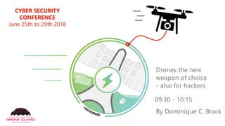
- 1. CYBER SECURITY CONFERENCE June 25th to 29th 2018 Drones the new weapon of choice - also for hackers 09:30 - 10:15 By Dominique C. Brack
- 2. About me… Info Sec Enthusiast
- 5. My frame of mind… I am playing defence To be good at defence you need to know the attack capabilities as well.
- 6. Business/ Consulting Perspective Cyber/ Security Perspective Critical Infrastructure Perspective My Goals for this talk Knowing how to assess risk and select appropriate countermeasures for your critical infrastructure. Know the CBRNNE threats. Identify areas of weak defence. Knowing what implications drones will have on you. Knowing the relevant attack vectors for your context (Bank, Factory, Datacenter, City Planer etc.). Developing drone based business/ consulting skills.To be able to define drone based services (audit, testing, sensors, etc.)
- 7. How did the drones topic find me? Critical infrastructure provider was looking for solutions. eHealth provider (hospital) asked about risk mangement. Government asked specifically about drone capabilities. And maybe you in the future
- 8. Your worst enemy handling drone risks is called Innovation
- 9. Why are drones an Infosec topic? And why this is definitely the right place for it. Infosec as in Information security and not just IT security.
- 10. Drones an Infosec topic YES! ▪ Drones are the worst flying IoT device you can imagine ▪ To successfully working drone based risks Cybersecurity must join Physical Security "CyPhys" or "Phycy" ?
- 11. About Drones UAV's RPAS ▪ 0-100 Km/h: 3 seconds ▪ Stopping distance: 5m ▪ Max. speed: up to 185 Km/h ▪ Altitude (DJI Phantom4): 3'799Meters ▪ Flight times: up 45 minutes or more ▪ Payload: up to a person ▪ Reach: with 5G or GSM worldwide ▪ Costs 100$ - 20'000$ or more ▪ GPS, GALILEO and GLONASS 2.4 GHz (2400-2483.5 MHz), 5.8 GHz (5725-5875 MHz) Beyond Visual Line of Sight (BVLOS),Visual Line of Sight (VLOS), First Person View (FPV), Some Drone Basics
- 12. Regulation ▪ https://www.easa.europa.eu/easa-and- you/civil-drones-rpas ▪ https://www.geoportail.gouv.fr/donnees/ restrictions-pour-drones-de-loisir ▪ https://www.federation-drone.org/les- drones-dans-le-secteur-civil/la- reglementation-francaise/ ▪ https://www.les- drones.com/reglementation/ Regulation never stopped actual criminals, terrorists or ill advised people. You need to build you defence capabilities yourself.
- 13. Paris Geomap
- 15. Fear Uncertainty Doubt Circus Low maturity topic Innovation topic Start-up mentalityThis means you have to test & verify all the way!
- 16. Why Testing ? Some product promises are like unicorns walking over rainbows (test &verify).
- 17. Drone Risk Methodology and Strategy Development Collection of drone based incidents and verification of plausibility based on reputation of source. Based on experience the development of the Drone Threat Catalogue including the categories. Definition of the Drone Threats and Drone Countermeasures based on current technology. Governance: building a Threat Radar
- 19. Highlightsfrom theCatalogue (140Risks) Espionage (Spying) Shoulder Surfing through Windows/ Rooftops Eavesdropping with Drone Mounted Laser microphone Privacy Intrusion Behavioral/ Habitual Analysis Sexual Preferences Health Condition/ Status Computer Systems Hacking (Intrusion) Hacking of a Person's Medical Equipment Kinetic (Just the Drone) Destroy the one in 10Years Flowering (Amorphophallus titanum) Chasing Animals to exhaustion Economic Create disproportionate reputational damage (Political) Constant provocations (restricted no fly zones) requiring constant attention Intrusion/ Trespassing Evidence & Crimescene Destruction/ Tampering/ Alteration Theft:Tangible items i.e. plans, maps, jewelry, art objects (statues), Laptops, Mobile Phones etc. Abductions: Children or pets
- 20. 11 Drone Attack Vectors Drone Threats Payload Attacks Comp. Sys. Hacking Kinetic Attacks Privacy IntrusionSignal Hacking Espionage (Spying) EconomicCivil Disobedience Insider Threat SurveillanceIntrusion/ Tresp. > Icons copyright © Reputelligence 2017
- 21. 6 CBRNNE Threats CBRNNEThreats (Payload Subgroup Defencespecific) Chemical Biological Radiological Nuclear Narcotics Explosives > Icons copyright © Reputelligence 2017
- 22. Geofencing Collision Payload Catching Predator BirdMissile Projectiles Jamming No-fly zones EMP Shutters 12 Drone Countermeasures DroneThreatsCountermeasures Cyber > Icons copyright © Reputelligence 2017
- 23. Threat Radar The Drone Guard drone threat radar is a management tool for assessing specific risks.The radar presents a current view on the specific risks and the expected future development of the specified risks if no actions are taken. It helps to prioritise and agree on the development of risks.The sectors are actors from where the specified risk will most likely arise. Each threat on the radar is explained in detail.
- 24. ▪ Drone Guard Threat Radar 07-2017 ▪ 11 Identified threat groups (detailed description available) ▪ 5 defined sectors (actors) ▪ Presentation for selected groups possible ▪ Strictly internal
- 25. Some Payload Examples For testing purposes we mounted a DJI Phantom 2 with a payload device. The device can be remotely dropped. It can be filled with anything you want. You can also drop memory sticks, fake access points, tracking devices etc.
- 27. Movie time!
- 29. Primary/ Secondary Primary Risks are the risks directly caused by the drone like physical damages to facilities, injuries to spectators and athletes. Secondary Risks are the risks caused by a drone like mass panic, damages to the reputation, liability and copyright issues, cancellation and delay of activity and political implications.
- 30. Drone Threats Countermeasures Assessment What works best?
- 31. The5 Assessment Criteria's ▪Effectiveness ▪Safety & Risk ▪Public acceptance ▪Legality ▪Costs
- 32. GeofencingCollisionPayloadCatchingPredatorMissile Projectiles Jamming No-fly zonesEMP Shutters Effectiveness Safety Public Acceptance Legality Costs … Cyber 1-10 (most) 1-10 (best) 1-10 (most) Regulated – non-regulated 1-10 (highest) 10 7 8 9 7 5 6 7 8 2 2 6 8 reach automatism reach 5 Limited reach 8 collateral 8 Agility, speed 7 injuries hit rate 4 reach 3 hit rate reach 7 hit rate 5 If not tampered 9 organizational 2 policies 9 collateral 2 Less collateral 4 GPS, Galileo 9 application 5 7 6 collateral 3 8 collateral 3 GPS 8 GPS, FIrmware 8 6 Not appropriate 2 dangerous 3 Widely accepted 9 damages 5 Friendly, injuries 8 7 3 Less destructive 8 6 9 8 7 Cracking WPA legitimization asymmetric overshooting GLONASS Crash landing Sec. landing Crash landingtarget aquis. Remote ctrl Vendor controlled Limiterd scope disproportional Eco. nonsense Destruction of property Non threatening to public Destruction of property Destruction of property Destruction of property Regulated -Defence -Military Private/ Gov: Regulated Others: non- regulated Fobidden by FCC fcc.gov/general/j ammer- enforcement Non- regulated - Appropriate- ness of counter- measures Non-regulated Non- regulated - Appropriate- ness of counter- measures Non- regulated - Appropriate- ness of counter- measures Data protection act Non- regulated - Appropriate- ness of counter- measures Regulated https://www.bakom.admin.ch/bakom/en/homepage/equipments-and-installations/particular-equipment/jammers.html Regulated -DJI etc. - Firmware - SW updates - Flight ctrls. Non- regulated - - Private policies 22 19 34 27 29 22 15 30 24 28 20 28 A AIA AA A A A AI PI PIA
- 33. Effectiveness Safety Public Acceptance Legality Costs … 1-10 (most) 1-10 (best) 1-10 (most) Regulated – non-regulated 1-10 (highest) Jamming 8 Limited reach 8 GPS, Galileo 9 Widely accepted 9 GLONASS Fobidden by FCC fcc.gov/general/j ammer- enforcement 34 A Predator 7 Agility, speed 7 injuries 7 Friendly, injuries 8 Sec. landing Non threatening to public Non-regulated 29 A Cyber 7 reach 7 8 Less destructive 8 Cracking WPA Remote ctrl Data protection act 30 A Geofencing 2 If not tampered 9 GPS 8 9 Regulated 28 PI Shutters 6 policies 9 6 7 Limiterd scope Non- regulated - - Private policies 28 AI EMP 9 collateral 8 application 5 damages 5 Crash landing Destruction of property Non- regulated - Appropriate- ness of counter- measures 27 A
- 34. What's left? ▪A two step approach is recommended: 1.) Detection, Recording and Triangulation (Forensic Grade) 2.) Active Defence Mechanism's, Take Down and Block Starting GeofencingShuttersCyber Today Regulation changes quite regularly check back often.
- 35. Drone Detection is not Drone Defence!
- 36. Data collection with drone detection sensors installed in our locations (over IoT cloud). Example Manual Forensic
- 37. Detection Log Forensic sound, court admissible log file of drone detected.
- 38. The Photo A particular press photo caught the attention… The city is a no-fly zone.This photo was suspect in regards to the angle taken and the person looking up.
- 39. With the help of google Street view the place the photo was taken could be investigated. Correlation of the drone detection log and the picture from the press leads to a high likelihood that the photo was taken by a DJI Mavic Pro. OSINT To be affirmative the drone should be seized and the pictures EXIF'd.
- 40. Testing is Dangerous and expensive Lucky it was not my wife's car…
- 41. Beware! Fish gills… There is such a thing as a typical drone injury… You may look away
- 42. Upping safety!
- 43. Never! Ever! Do! This! No 10 finger typing anymore…
- 45. Movie time!
- 47. The End