Doug Wilson - GOOS Regional Alliance for the IOCARIBE Region
•Download as PPSX, PDF•
0 likes•271 views

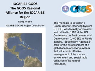
The mandate to establish a Global Ocean Observing System (GOOS) was formally articulated and ratified in 1992 at the UN Conference on Environment and Development (UNCED) in Rio de Janeiro. Specifically, Agenda 21 calls for the establishment of a global ocean observing system that will enable effective management of the marine environment and sustainable utilization of its natural resources.

Recommended
More Related Content
What's hot
What's hot (20)
Similar to Doug Wilson - GOOS Regional Alliance for the IOCARIBE Region
Similar to Doug Wilson - GOOS Regional Alliance for the IOCARIBE Region (20)
More from Iwl Pcu
More from Iwl Pcu (20)
Doug Wilson - GOOS Regional Alliance for the IOCARIBE Region
- 1. The mandate to establish a Global Ocean Observing System (GOOS) was formally articulated and ratified in 1992 at the UN Conference on Environment and Development (UNCED) in Rio de Janeiro. Specifically, Agenda 21 calls for the establishment of a global ocean observing system that will enable effective management of the marine environment and sustainable utilization of its natural resources. IOCARIBE-GOOS The GOOS Regional Alliance for the IOCARIBE Region Doug Wilson IOCARIBE-GOOS Project Coordinator
- 2. GOOS is a permanent global system for observations, modelling and analysis of marine and ocean variables to support operational ocean services worldwide. GOOS provides accurate descriptions of the present state of the oceans, including living resources; continuous forecasts of the future conditions of the sea for as far ahead as possible, and the basis for forecasts of climate change. GOOS is a system of programmes, each of which is working on different and complementary aspects of establishing an operational ocean observation capability for all of the world's nations. UN sponsorship and UNESCO assemblies assure that international cooperation is always the first priority of the Global Ocean Observing System. GOOS is the oceanographic component of GEOSS, the Global Earth Observing System of Systems .
- 3. A Global Coastal Network is to be developed through the establishment and networking of GOOS Regional Alliances, National GOOS programs, and existing global programs -Implementation plan for Coastal Module of GOOS
- 4. IOCARIBE-GOOS was established in 1999 at IOCARIBE VI, led by an ad hoc Group of Experts. The first task of the group was to produce a Strategic Plan (The Case for IOCARIBE-GOOS, GOOS Report No. 115, UNESCO, 2002). IOCARIBE-GOOS was accepted as a GOOS Regional Alliance by I- GOOS in 2003. “To serve the marine data and information needs of humanity for the efficient, safe, rational and responsible use and protection of the marine environment, and for climate prediction and coastal management, especially in matters requiring information beyond that which individual national observation systems can efficiently provide, and which enable smaller and less-developed nations to participate and gain benefit…”
- 5. IOCARIBE-GOOS IMPLEMENTATION: GOOS principles GOOS is designed to: Monitor, understand and predict weather and climate Describe and forecast the state of the ocean, including living resources Improve management of marine and coastal ecosystems and resources Mitigate damage from natural hazards and pollution Protect life and property on coasts and at sea Enable scientific research Note other RAs have slightly modified – US for example are restated as Weather and Climate Marine Operations Coastal Ecosystems Sustainable Resources Natural Hazards Public Health
- 6. GOOS principles GOOS is an End to End, User-driven system with three primary Sub-systems: Observations Data Management and Communications (incl. Dissemination and Access) Models and Analysis And three cross-cutting Sub-systems Governance and Management Research and Development Training and Education Emphasizes Open exchange of Data and Information
- 7. Original GOOS Core Variables Temperature Salinity Water Level Currents Surface Waves Surface Winds Ocean Color Dissolved Oxygen pH pCO2 Heat Flux Bottom Character Pathogens Bathymetry Ice Distribution Contaminants Stream Flow Dissolved Nutrients Optical Properties Total Suspended Matter Fish Species* Fish Abundance* Zooplankton Species* Zooplankton Abundance* Phytoplankton Species* Colored Dissolved Organic Matter
- 8. IOC GOOS Today – New Structure and Strategy based on OCEANOBS 09 Framework for Ocean Observing Essential Ocean Variables to be determined as well as ECVs, EBEVs Coastal GOOS Strategy based on Phenomena of Interest Coastal Eutrophication and Hypoxia Human Exposure to Waterborne Pathogens Harmful Algal Blooms Habitat Loss & Modification Vulnerability to Coastal Flooding Ocean Acidification Food Security
- 9. The Committee agreed that GOOS could play a significant role in advising on coastal observations, by providing expertise on a framework for developing integrated observation systems to address specific issues, promoting standards and best practice for measurements to make them intercomparable, sharing experiences and comparing designs, and promoting data sharing, integration and interoperability. GOOS could also provide an umbrella for the development of regional pilot projects. But GOOS centrally could not plan in detail coastal observations in all regions, which need to be based on regional and national priorities. It should focus energy on promoting the intercomparability and availability of coastal observations, and could build on the inventory of GRA contributions to GOOS.
- 12. IOCARIBE-GOOS future While the region still lacks adequate in situ measurements, the capabilities to collect them AND the availability of data and products is advancing rapidly due to advances in technology.. Individual states and Regional programs need support for:
- 13. • Data Collection [Observing System] activities for various (but often overlapping) programs and purposes • Climate Change Monitoring and Adaptation • Hazard Forecasting, Response , and Mitigation • Living Resources Protection, Management, and Exploitation • Habitat Preservation and Utilization • Data Management, Aggregation, Integration, and Distribution • Information (value added, products, processed, modeled) Management and Distribution
- 14. These activities are at present: Somewhat Balkanized Often Competitive Poorly integrated Often proprietary, protected, or with barriers to sharing In addition, funding is not being directed in a manner that encourages and supports this approach
- 15. Success Stories During the Rio workshop there was an opportunity to hold an ad hoc IOCARIBE-GOOS meeting with the national delegates from the IOCARIBE countries. The common request from this group for IOCARIBE-GOOS was to provide support for the activities of National GOOS and Sustained Ocean Observations and Services Programs, by addressing the following: • Sharing of Best Practices • Promoting Data Exchange • Coordinating support from countries with more developed operational observing and forecasting activities • Coordinating ways to address common needs; one such noted was the need for national Buoy and other Observing Systems to support local services and forecasting activities
- 16. Needs and Recommendations IOCARIBE-GOOS future While the region still lacks adequate in situ measurements, the capabilities to collect them AND the availability of data and products is advancing rapidly due to advances in technology.. Individual states and Regional programs need support for: • Data Collection [Observing System] activities for various (but often overlapping) programs and purposes • Climate Change Monitoring and Adaptation • Hazard Forecasting, Response , and Mitigation • Living Resources Protection, Management, and Exploitation • Habitat Preservation and Utilization • Data Management, Aggregation, Integration, and Distribution • Information (value added, products, processed, modeled) Management and Distribution
- 17. With reference to • Observing Systems • Remote Sensing • GIS Products • Model Outputs IOCARIBE – GOOS could • Coordinate • Advise (best practices) • Oversee (Standards, Communication) • Integrate • Aggregate • Support Application and Product Development • Promote • Identify • Distribute (Data and Product Commons) Needs and Recommendations
- 18. Needs and Recommendations • Leverage National and existing Regional efforts • Raise Donor and Government Awareness • Need better organization and coordination among Programs tasked with observations and products: GOOS Tsunami LME GCOS JCOMM IHO IODE UNEP WOA • Pilot Projects – tied to integrated organizational infrastructure
- 19. Observations – IOC Sea Level
- 24. Success Stories Asset and Product Maps • Provided by RPS Applied Science Associates • Used by several US IOOS Regional Associations • Based on Publicly available data • Customizable Caribbean Assets Explorer http://72.44.60.22/carib/ Caribbean CoastMap Explorer http://map.asascience.com/CoastMap/ Userid: IOCARIBE Password:Ocean0bserving ( Ocean[ZERO]bserving )
- 25. Asset Maps: Caribbean CoastMap Explorer http://map.asascience.com/CoastMap/ Userid: IOCARIBE Password:Ocean0bserving ( Ocean[ZERO]bserving )
- 26. Asset Maps: Caribbean Assets Explorer http://72.44.60.22/carib/
Editor's Notes
- Objectives of GOOS Origins of GOOS Rio UNCED GOOS principals – more coming Basic Objective PLUS Six societal benefits 3+3 subsystems Open ocean + coastal
- So that’s where we are today; rest of talk on making IOCARIBE-GOOS work, in particular in support of LME and other regional programs
- Development of a Shared IOCARIBE-GOOS Asset Map. This would be an improvement the water level and met station map started by IOCARIBE-GOOS, with considerably more capability for display and sharing of regional marine observations, forecasts, and services. Similar applications are becoming standard and important regional GOOS building blocks. The asset map would provide exposure for regional activities, be a tool for forecasting resources, and provide the basis for an IOCARIBE-GOOS web presence. Its primary focus would be on operational observations and forecasting, but would integrate with other regional project data, including the CLME IMS/REMP, ODINCARSA, and Ocean Atlas. This is a relatively low cost project that would provide a tangible presence for the development of IOCARIBE-GOOS.