SlideShare a Scribd company logo
1 of 31
Download to read offline
Global overview
Disasters can occur as a consequence of the impact of
a natural or a human-caused hazard. Natural hazards
comprise phenomena such as earthquakes, volcanic
activity, landslides, tsunamis, tropical cyclones and
other severe storms, tornadoes and high winds, river
and coastal flooding, wildfires and associated haze,
drought, sand and dust storms, and infestations.
Human-caused hazards may be intentional, such as the
illegal discharge of oil, or accidental such as toxic
spills or nuclear meltdown. All of these can expose
people, ecosystems, flora and fauna to threats. The
poor are the most vulnerable to disasters because they
have fewer resources and capacity to prevent or cope
with the impacts.
Natural disasters
People and the environment are increasingly suffering
from the effects of natural disasters. There are a
number of reasons for this such as high population
growth and density, migration and unplanned
urbanization, environmental degradation and possibly
global climate change. The sheer scope of the socio-
economic impacts of natural disasters has brought
about a shift in the political approach to dealing with
the concept of risk in modern societies.
Comparing the past two decades, the number of
people killed in natural and non-natural disasters was
higher in the 1980s (86 328 annually) than in the
1990s (75 252 annually). However, more people were
affected by disasters in the 1990s — up from an
average of 147 million a year in the 1980s to 211
million people a year in the 1990s. While the number
of geophysical disasters has remained fairly steady, the
number of hydrometeorological disasters (those
caused by water and weather) has increased (see
figure on page 271). In the 1990s, more than 90 per
cent of those killed in natural disasters lost their lives
in hydrometeorological events such as droughts,
windstorms and floods. While floods accounted for
270 STATE OF THE ENVIRONMENT AND POLICY RETROSPECTIVE: 1972–2002
Disasters
‘A disaster is a serious disruption of the functioning of society,
causing widespread human, material or environmental losses
which exceed the ability of affected society to cope on its own
resources.’ — Source: UNDHA 2001
UNEP,EdwinC.Tuyay,TophamPicturepoint
more than two-thirds of people affected by natural
disasters, they are less deadly than many other types
of disaster, accounting for only 15 per cent of deaths
(IFRC 2001).
The social and economic costs of disasters vary
widely and are difficult to estimate on a global basis.
Insurance claims tend to be misleading as an estimate
of the economic impact of disasters. Considering
insured damage claims for the 1999 floods in Austria,
Germany and Switzerland, at least 42.5 per cent of
damage was covered by disaster insurance. But in
Venezuela the same year, only 4 per cent of flood
damage was covered (CRED-OFDA 2002). There is a
need for reliable and systematic data on disasters to
help assess their socio-economic and environmental
impacts in both the short and the long term. But
although communities in developing countries suffer
from numerous local-scale disasters such as wildfires,
small floods, droughts and pest infestations, these are
often not reflected in disaster statistics.
The most expensive disasters in purely financial
and economic terms are floods, earthquakes and
windstorms but events such as drought and famine
can be more devastating in human terms. While
earthquakes accounted for 30 per cent of estimated
damage, they caused just 9 per cent of all fatalities due
to natural disasters. In contrast, famine killed 42 per
cent, but accounted for just 4 per cent of damage over
the past decade (IFRC 2001). In 1999, global financial
losses from natural catastrophic events were
estimated to exceed US$100 billion — the second
highest figure on record. A total of 707 large events
were recorded compared to 530 to 600 events in
previous years. It is even more striking that the
number of major catastrophic events over the past
decade has increased threefold in comparison with the
1960s, while the rate of economic losses has increased
by a factor of almost nine over the same period
(Munich Re 2001).
Between 1995 and 1997, the impacts of natural
hazards cost the United States at least US$50 billion a
year, or the equivalent of about US$1 billion a week
(IDNDR 1999a). The economic losses of the United
States because of the 1997-98 El Niño event were
estimated at US$1.96 billion or 0.03 per cent of GDP.
Ecuador suffered equivalent financial losses but this
represented 11.4 per cent of its GDP. The floods in
China in 1991, 1994-95 and 1998 caused losses
ranging from US$20 to 35 billion (CNC-IDNDR 1999).
DISASTERS 271
1950
2000
1955
1960
1965
1970
1975
1980
1985
1990
1995
earthquake
flood
storm
other
Numbers of great natural disasters per year, 1950–2001
Graph shows increasing trend in frequency of ‘great’ natural disasters. Catastrophes are classed as great
if the ability of the region to help itself is overtaxed, making inter-regional or international assistance
necessary, as is usually the case when thousands of people are killed, hundreds of thousands made
homeless or when a country suffers substantial economic losses
Source: Munich Re 2001
Recent disasters caused by extreme natural events
The year 2000
q Mongolian herders had their hardest
winter for 30 years — 2.4 million
livestock died and 45 per cent of the
country’s population was affected.
q In February and March, floods
killed 650 people and left more than
half a million homeless in
Mozambique. Heavy rains also affected
Botswana, Swaziland and Zimbabwe.
q Cyclones Eline (mid-February) and
Gloria (early-March) left 184 000
people in need of immediate relief
support out of the total of 737 000
affected in Madagascar. In early April, a
third cyclone, Hudah, hit the north of
the island.
q Floods in September and October
in Southeast Asia, especially Viet Nam
and Thailand, killed approximately 900
people and left 4 million homeless or
with insufficient shelter. Losses
estimated at US$460 million.
q Hurricane Keith in October killed
eight and affected 62 000 people in
Belize. Direct losses estimated at
US$520 million.
q In mid-October, heavy rains caused
floods in the Italian and Swiss Alps
killing 38 people and causing economic
losses estimated at US$8.5 billion.
q Similar floods killed six people and
caused US$1.5 billion loss in the
United Kingdom in November.
The year 2001
q In mid- to late January, heavy rains
over Zambezia Province caused the
Licungo River to flood in Mozambique.
Nearly 500 000 people were affected
by the floods.
q In March, floods devastated a wide
area of northeastern Hungary,
northwestern Romania and western
Ukraine. Tens of thousands of people
were forced to move.
q Flash floods unexpectedly struck
parts of Pakistan on 23 July. The cities
of Islamabad and Rawalpindi were the
worst affected. 132 people were killed.
q In mid-November, as many as 576
Vietnamese had been killed by natural
disasters, mainly floods and typhoons.
Material losses amounted to more than
US$200 million.
q A persistent multi-year drought in
Central and Southwest Asia had
affected about 60 million people by
November 2001.
q After several months of drought,
devastating floods tore through the
Algerian capital Algiers on 10
November, killing 751 people.
Thousands were injured, and about
40 000 people were left homeless.
Source: ReliefWeb (2002), Munich Re 2001
The annual loss from natural disasters over the period
from 1989 to 1996 is estimated to range from 3 to 6
per cent of China's GDP, averaging 3.9 per cent. In
December 1999, the Anatol, Lothar and Martin storms
generated losses in northern Europe amounting to
US$5–6 billion (Munich Re 2001). Less developed
countries with limited economic diversity and poor
infrastructure must not only rely mostly on external
relief if a disaster happens but their economies need
more time to recover. In developed economies,
governments, communities and individuals have
greater capacities to cope with disasters, the economic
losses are to some extent absorbed by a diversified
economy, and most assets are insured.
Among the least developed countries, 24 of the 49
face high levels of disaster risk; at least six of them
have been affected by between two and eight major
disasters per year in the past 15 years, with long-term
consequences for human development (UNDP 2001).
Since 1991, more than half of all the disasters reported
occurred in countries with medium levels of human
development (see ‘Socio-economic background’).
However, two-thirds of those killed came from
countries with low levels of human development,
while just 2 per cent came from highly developed
countries. The effect of development on disasters is
dramatic: on average, 22.5 people die per reported
disaster in highly developed countries, 145 die per
disaster in countries with medium human
development, and 1 052 people die per disaster in
countries with low levels of development (IFRC 2001).
A number of experts link the current trend in
extreme weather events with an increase of the global
mean temperature. Many parts of the world have
suffered major heat waves, floods, droughts and other
extreme weather events. While individual events,
such as El Niño-related phenomena (see box), cannot
be directly linked to human-induced climate change,
the frequency and magnitude of these types of events
are predicted to increase in a warmer world. The
changes in the global mean temperature are ‘very
likely’ to affect parameters such as precipitation
patterns, wind velocities, soil moisture and vegetation
cover which appear to influence the occurrence of
storms, hurricanes, floods, drought and landslides
(IPCC 2001). For example, the extent of damage from
storm surges can be directly linked to sea level
variations.
Climate change and variability alone do not explain
the increase in the impacts related to disasters.
‘Natural’ can be a misleading description for disasters
such as the droughts, floods and cyclones which afflict
much of the developing world. Identifying human-
induced root causes, and advocating structural and
political changes to combat them, is long overdue
(IFRC 2001). For example, destruction of the natural
environment because of logging or inappropriate land
uses for short-term economic gain is one of the major
272 STATE OF THE ENVIRONMENT AND POLICY RETROSPECTIVE: 1972–2002
The 1997-98 El Niño event affected virtually every region:
Eastern Africa suffered drought and unusually high rainfall;
Southeast Asia and North America, abnormally warm
periods; South Asia, drought; Latin America and the
Caribbean, unusually high rainfall and drought; and the
Pacific Islands unusually high rainfall. The global socio-
economic impacts were varied:
q More than 24 000 people died because of high winds,
floods or storm tides that occurred during intense storms.
q More than 110 million people were affected and more
than 6 million people were displaced as community
infrastructures, including housing, food storage, transport
and communications, were lost during storms.
q Direct economic losses exceeded US$34 billion.
q Waterlogging of fields reduced agricultural production in
many regions; in others, the absence of storms and rain led
to prolonged dry spells, loss of crops and reduction in water
supplies.
q Wildfires were more frequent and widespread during
extended dry periods.
q Increased incidence of disease followed the prolonged
disruption to weather and rainfall patterns that resulted in
contamination of water supplies or a more favourable
environment for disease-carrying insect vectors.
Sources: WMO 1999, UNU 2001
Socio-economic effects of the 1997–98 El Niño
90
45
0
60
1950
2000
1955
1960
1965
1970
1975
1980
1985
1990
1995
15
30
75
>167
Economic costs of great natural disasters (US$billion), 1950–2000
In comparison
with the 1960s,
economic losses
during the 1990s
increased by a
factor of almost
nine
Note: chart shows
only the cost of
‘great’ natural
catastrophes — see
figure on page 271
for definition
Source: Munich Re
2001
factors promoting floods or mudslides such as those
that hit Venezuela in December 1999. Similarly, the
migration of population to urban and coastal areas
increases human vulnerability as population densities
increase, infrastructure becomes overloaded, living
areas move closer to potentially dangerous industries,
and more settlements are built in fragile areas such as
floodplains or areas prone to landslides. As a result,
natural catastrophes affect more people and economic
losses are increased. For example, despite the fact
that seismic activity has remained constant over
recent years, the effects of earthquakes on the urban
population appear to be increasing.
Human-induced disasters
A number of major accidents involving chemicals and
radioactive materials have drawn attention worldwide
to the dangers of mismanagement, particularly in the
transport, chemical and nuclear power sectors. These
events often have impacts that transcend national
boundaries; they also emphasize the fact that issues of
technological safety concern more than just the
developed countries.
Some disasters have resulted in the introduction of
voluntary or mandatory regulations designed to
prevent similar occurrences. Public concern following
the explosion in 1976 at a pesticide plant in Seveso,
Italy, with the release of 2,3,7,8-tetrachlorodibenzo-p-
dioxin (TCDD), led to the introduction in 1982 of a
European Directive on the major-accident hazards of
certain industrial activities. Similarly, other major
accidents, such as the methyl isocyanate leak at
Bhopal, India, in 1984 and the Switzerland-Sandoz
warehouse fire in Basel in 1989, stimulated legislation
in many countries to prevent and control chemical
incidents. Influenced by the Bhopal accident, in
particular, the International Labour Office developed
in 1993 the Convention Concerning the Prevention of
Major Industrial Accidents No. 174 and the Prevention
of Major Industrial Accidents Recommendation No.
181. These documents call for an international
exchange of relevant information, development of
policies aimed at addressing the major accident risks,
hazards and their consequences, and recognition that a
major accident could have serious impacts on human
life and the environment.
Major nuclear accidents such as those at Three
Mile Island in the United States in 1979 and at
Chernobyl in 1986 have not only catalysed action to
strengthen nuclear safety and emergency
preparedness but also forced many countries to
DISASTERS 273
On 17 August 1999, an earthquake with a magnitude of
7.4-7.8 on the Richter scale hit the city of Izmit, Turkey,
and the surrounding areas. Damage from the earthquake
was estimated at more than US$13 billion. More than
15 000 people were killed, 25 000 others were injured and
600 000 people were left homeless. The earthquake was
blamed for increasing the national account deficit of some
US$3 billion in 1999-2000 (equivalent to about 1.5 per
cent of the GNP).
A significant part of the damage could have been avoided
had local building codes been effectively implemented.
Many new buildings had not been properly designed, had
not been built on foundations strong enough to resist
earthquakes, and had not been sited in areas where the
effects of earthquakes would have been diminished.
Source: ISDR 1999
The 1999 earthquake in Izmit, Turkey
Apartment block
split in two by
the 1999
earthquake in
Izmit, Turkey
Source: Alexander
Allmann, Munich Re
abandon or severely restrict development of the
nuclear power sector. Following the Chernobyl
accident, two major international treaties were
adopted — the Convention on Assistance in the Case
of Nuclear Accident or Radiological Emergency and
the Convention on the Early Notification of a Nuclear
Accident. Most recently, the 1994 Convention on
Nuclear Safety, committing parties to a higher level of
nuclear safety, and the 1997 joint Convention on the
Safety of Spent Fuel Management and on the Safety of
Radioactive Waste Management were adopted.
The 1989 Exxon Valdez oil spill in Alaska resulted
in enormous environmental and economic damages
and catalysed the development of the ‘Valdez
Principles’ — a voluntary code of conduct for
corporate behaviour towards the environment — by
the Coalition for Environmentally Responsible
Economics (CERES). The ‘Valdez Principles’ guide
corporations in the establishment of environmentally
sound policies and require the raising of corporate
environmental safety standards and the taking of
responsibility for environmental harm that may be
caused by them (Adams 1994).
International policy responses
Until the 1970s, the international community
considered disasters as exceptional circumstances,
when local coping capacities were exhausted and
external emergency relief was required. The term
disaster management was generally equivalent to
disaster response and tended to be within the
exclusive competence of organizations such as the
Red Cross and Red Crescent Societies or national civil
defence institutions.
In 1971, the United Nations Disaster Relief Office,
now the United Nations Office for the Coordination of
Humanitarian Affairs (UNOCHA), was established to
mobilize and coordinate relief activities from all
sources in times of disaster. The concept of disaster
preparedness was developed during the 1970s and
1980s, and included training and some cross-sectoral
activities to increase capacity for rescue, relief and
rehabilitation during and after a disaster. But even the
most pessimistic forecasts could not have foreseen the
upward spiral in negative socio-economic
consequences of natural disasters in the closing
decades of the 20th century.
The 1990s was declared the International Decade
for Natural Disaster Reduction (IDNDR), one of the
principal goals of which was to inculcate a culture of
disaster prevention through the wider application of
known scientific and technological mechanisms by a
better-informed population. In the words of United
Nations Secretary-General Kofi Annan, ‘We must,
above all, shift from a culture of reaction to a culture
of prevention. The humanitarian community does a
remarkable job in responding to disasters. But the
most important task in the medium and long-term is
to strengthen and broaden programmes which reduce
the number and cost of disasters in the first place.
Prevention is not only more humane than cure, it is
also much cheaper’ (IDNDR 1999b). The IDNDR
successfully placed risk reduction higher on the
political agenda, as well as setting out a number of
priorities to be undertaken by countries and regions in
the 21st century.
An increasing number of governments and
international organizations are promoting risk
reduction as the only sustainable solution for reducing
274 STATE OF THE ENVIRONMENT AND POLICY RETROSPECTIVE: 1972–2002
The Chinese government is shifting the focus of its disaster
policies from improving response capabilities to reducing
hazards and risks. During the past ten years, national
coordination has been vested in the Chinese National
Committee (CNC) for the IDNDR, an inter-ministerial
organization composed of representatives from 28
ministries, departments and commissions. Since 1989, CNC
has been working on the National Natural Disaster
Reduction Plan of the People's Republic of China (1998-
2010). It has also helped to develop and coordinate policies
and plans for national and local disaster reduction activities.
Motivated by the seriousness of the 1991 floods in
China, the Chinese authorities recognized the need ‘to
integrate disaster reduction into the comprehensive plan for
national economy and social development’. The Chinese
National Centre for Natural Disaster Reduction has now
been established within the Chinese Academy of Sciences.
The centre compiles and analyses data on disasters, and
passes the results to the State Council for decision-making
responsibilities.
China experienced its worst floods in more than 100
years in 1999, which affected more than 300 million
people. The floods galvanized more political commitment for
the integration of risk and disaster prevention programmes
into national social and economic planning. However, China
believes that there were fewer losses during the 1999 floods
in the Yangtze River Valley, despite higher water levels,
because of the US$7.6 billion invested in water conservancy
measures since the costly 1998 floods.
Source: CNC-IDNDR 1999
China committed to risk reduction
the social, economic and environmental impacts of
disasters. Risk reduction strategies include:
q vulnerability mapping;
q identification of areas that are safe for settlement
and development;
q adoption of building codes based on disaster
resilient engineering and on local hazard risk
assessments; and
q enforcing these plans and codes by economic and
other incentives.
At the global level, the UN has established an
International Strategy for Disaster Reduction (ISDR),
a global platform aimed at helping all communities to
become resilient to the effects of natural disasters and
to proceed from protection against hazards to the
management of risk through the integration of risk
prevention into sustainable development. The strategy
— based on the IDNDR experience and developments
such as the 1994 Yokohama Strategy and Plan of
Action for a Safer World and the 1999 Strategy ‘A
Safer World in the 21st Century: Disaster and Risk
Reduction’ — reflects a cross-sectoral and
interdisciplinary approach to disaster reduction.
Implementation of the strategy, which is based on
the establishment of partnerships between
governments, non-governmental organizations, UN
agencies, the scientific community and other
stakeholders in the disaster reduction community, is
an integral part of efforts aimed at promoting the
overall goal of sustainable development. It is also an
indispensable element in the search for solutions
designed to counter the increasing threat posed by
natural hazards (ISDR 1999).
DISASTERS 275
The fundamental goal of the UNEP disaster management programme is to reinforce
the centrality of environmental concerns in disaster management. The other
cornerstone is the adoption of preventive strategies and practical measures to
reduce the potential loss of human lives and property, as well as destruction of the
environment.
The success of this approach depends on increasing public awareness of the
risks that natural, technological and environmental hazards pose to societies, and
on educating people about the value of existing approaches for prevention and
preparedness. UNEP contributes to this process through its programmes on
environmental law, early warning and assessment, and Awareness and
Preparedness for Emergencies at Local Level (APELL).
UNEP’s APELL programme, developed in conjunction with governments and
industry, recognizes that the incidence and effects of environmental disasters can be
reduced by prevention and preparedness initiatives at the local level. The APELL
concept has been successfully introduced to more than 30 countries and in more
than 80 industrial communities worldwide. The UNEP strategy includes the
promotion of cleaner production processes and technologies, and helping countries
establish cleaner production centres.
A major objective of the UNEP early warning and assessment programme is to
evaluate the increasing vulnerability of human society due to widespread
environmental and climatic change in order to emphasize the need for sound
integrated environmental management, and to provide early warning of emerging
threats for preparedness and response.
Prevention and preparedness to reduce the costs of disasters
Adams, J. (1994). Corporate Crime/Our Crime:
What citizens have done and can do to curtail
corporate ‘crime’. In Context, 38, 45
http://www.context.org/ICLIB/IC38/Adams.htm
[Geo-2-329]
CNC-IDNDR (1999). Natural Disaster and Disaster
Relief in China; the China National Report on
International Decade for Natural Disaster Reduction.
Beijing, Chinese National Committee IDNDR
CRED-OFDA (2002). EM-DAT: The OFDA/CRED
International Disaster Database. Centre for
Research on the Epidemiology of Disasters
http://www.cred.be/emdat [Geo-2-330]
IDNDR (1999a). Progress and Challenges in
Reducing Losses from Natural Disasters
http://www.usgs.gov/themes/sndr/sndr09.html
[Geo-2-331]
IDNDR (1999b). Despite Dedicated Efforts,
Number and Cost of Natural Disasters Continue To
Rise. Press Release, United Nations International
Strategy for Disaster Reduction
http://www.unisdr.org/forum/press3.htm [Geo-2-
332]
IFRC (2001). World Disasters Report 2001.
International Federation of Red Cross and Red
Crescent Societies
http://www.ifrc.org/publicat/wdr2001/ [Geo-2-334]
IPCC (2001). Climate Change 2001: The
Scientific Basis. Contribution of Working Group I
to the Third Assessment Report of the
Intergovernmental Panel on Climate Change.
Cambridge, United Kingdom, and New York, United
States, Cambridge University Press
ISDR (1999). Les retombées socio-économiques
du seisme d’Izmit en Turquie. United Nations
International Strategy for Disaster Reduction
http://www.unisdr.org/unisdr/izmit.htm
ISDR (2001). The Concept of Disaster Reduction
Embodied in the ISDR. United Nations
International Strategy for Disaster Reduction
http://www.unisdr.org/unisdr/aboutisdr.htm [Geo-2-
333]
Munich Re (2001). Topics 2000: Natural
Catastrophes — The Current Position. Special
Millennium Issue. Munich, Munich Re Group
ReliefWeb (2002). Natural Disasters. ReliefWeb:
Project of the United Nations Office for the
Coordination of Humanitarian Affairs
http://www.reliefweb.int/w/rwb.nsf
UNDHA (2001). United Nations Department of
Humanitarian Affairs: Internationally agreed
glossary of basic terms related to Disaster
Management. United Nations International Strategy
for Disaster Reduction
http://www.unisdr.org/unisdr/glossaire.htm [Geo-2-
335]
UNDP (2001). Disaster Profiles of the Least
Developed Countries. Geneva, United Nations
Development Programme Emergency Response
Division
UNU (2001). Once Burned, Twice Shy? Lessons
Learned from the 1997-98 El Niño. Tokyo, United
Nations University
http://www.esig.ucar.edu/un/index.html [Geo-1-
032]
WMO (1999). The 1997-1998 El Niño Event: a
Scientific and Technical Retrospective. Geneva,
World Meteorological Organization
References: Chapter 2, disasters, global overview
Disasters: Africa
Extreme hydrometeorological events such as flooding
and drought are common across Africa, while
geophysical events such as earthquakes occur
predominantly in Northern Africa, along the Atlas
mountain range, and in the African Rift Valley, which
also experiences volcanic activity. The El Niño
Southern Oscillation causes significant climatic
disturbances in most parts of Africa, either inducing
drought or flooding, or increasing sea temperatures
leading to cyclones.
These natural events become disasters where
large numbers of people or infrastructure are affected,
as has occurred over the past 30 years due to high
population growth rates, especially in urban centres
and drought-prone areas — 34 per cent of Africa’s
population lives in arid areas compared to just 2 per
cent of Europe’s population (Findlay 1996).
Impacts of disasters include loss of lives and
livelihoods, damage to infrastructure and
communications, interruption of economic activities,
and increased risk of disease outbreaks. In many
places, these impacts are worsened by poverty and
marginalization, and overcrowding. Inadequate, old and
deteriorating infrastructure and lack of economic
security to provide for times of hardship also
compromise people’s coping capacities and therefore
magnify the impacts of disasters. There is growing
concern that the frequency and severity of disasters
are increasing at a time when early warning systems
are inadequate and disaster management is weak
(DMC 2000).
Natural disasters
Africa has experienced some of the worst droughts
and famines in terms of number of people killed or
number affected (see table), with particularly severe
droughts in 1972-73 and 1984-85, affecting much of
Northern, Southern, Eastern and Sahelian Africa
(Gommes and Petrassi 1996). Countries most
regularly affected include Botswana, Burkina Faso,
Chad, Ethiopia, Kenya, Mauritania and Mozambique
(FAO 2001), where the impacts of famine are
exacerbated by inadequate transport facilities to
receive and distribute food and medical aid (Ehrlich
and Ehrlich 1990). There are some indications that
droughts are becoming more prolonged and their
impacts more severe (DMC 2000, FAO 2000).
The risk of damage from heavy rain is greater in
drier areas than in those that usually receive higher
rainfall because there is less vegetation cover to
absorb the water and stabilize soils. Expansion of
informal settlements into the flood zone is putting
many more people at risk of flooding, as illustrated in
South Africa’s Alexandra Township, Johannesburg,
during the floods of 2000 when approximately 3 000
families living in shacks below the floodline were
subjected to flooding and outbreaks of cholera (Kim
2000, World Bank 2001a).
Disasters can have severe economic impacts which
are difficult to calculate. The Western Indian Ocean
islands typically experience ten cyclones a year,
between November and May, which bring strong
winds and heavy rainfall. This causes destruction of
infrastructure, particularly in low-lying areas and
where settlements have encroached into flood-prone
areas. Huge costs are incurred due to destruction of
income-generation activities, including tourism
revenues, and rehabilitation and replacement of
damaged infrastructure and crops.
Globally, Africa suffers the least damage from
disasters in purely financial terms but the significance
of such losses may actually be greater in terms of
impact on economic development. Africa’s people and
economies are heavily dependent on rainfed
276 STATE OF THE ENVIRONMENT AND POLICY RETROSPECTIVE: 1972–2002
number killed number affected
1972 famine Ethiopia 600 000 no data
1973 drought Ethiopia 100 000 no data
1974 drought Ethiopia 200 000 no data
1980 drought Mozambique no data 6 000 000
1982 famine Ghana no data 12 500 000
1983 drought Ethiopia no data 7 000 000
1984 drought Ethiopia 300 000 7 750 000
1984 drought Sudan 150 000 8 400 000
1985 drought Mozambique 100 000 2 466 000
1987 drought Ethiopia no data 7 000 000
1990 drought Ethiopia no data 6 500 000
1991 drought Ethiopia no data 6 160 000
1991 drought Sudan no data 8 600 000
1993 drought Malawi no data 7 000 000
1993 famine Ethiopia no data 6 700 000
1999 famine Ethiopia no data 7 767 594
2000 drought Ethiopia no data 10 500 000
Source: CRED-OFDA 2002
Some of the worst disasters in Africa, 1972–2000
agriculture, and are therefore vulnerable to rainfall
fluctuations. It is usually the poor who suffer most
from flood or drought-induced crop failure, because
they often cultivate areas that are climatically
marginal for crop production and they cannot
accumulate reserves for times of hardship.
Both droughts and floods can result in malnutrition
and famine, and the associated food imports and
dependency on food aid can affect the economic
growth potential of affected countries. In Kenya, low
reservoir levels resulting from drought and siltation
linked to deforestation led to reductions in
hydropower generation, necessitating water and
power rationing which devastated the country’s
economy in 1999 and 2000. Losses from power
rationing alone were estimated at US$2 million per
day, and the cost of unmet electricity demand was
estimated at US$400-630 million, equal to 3.8-6.5 per
cent of GDP (World Bank 2000). In Mozambique, the
costs of floods in 2000 were estimated at US$273
million in physical damage, US$247 million in lost
production, US$48 million in lost exports and US$31
million in increased imports (Mozambique National
News Agency 2000).
Human-caused disasters
Although climatic variability is a natural phenomenon,
the increasing frequency and severity of extreme
events can be in part attributed to human activities
such as deforestation and inappropriate management
of land and water resources. For example, clearing of
tropical forests in Central and Western Africa has
altered the local climate and rainfall patterns, and
increased the risk of drought. Clearing of vegetation
may also increase run-off and soil erosion. Damming
of rivers and draining of wetlands reduces the
environment’s natural ability to absorb excess water,
enhancing the impacts of floods. For example,
countries in Southern Africa experienced devastating
floods in 1999 and 2000 which affected more than 150
000 families (Mpofu 2000). Degradation of wetlands
such as the Kafue wetlands in Zambia, damming of
rivers, deforestation and overgrazing lowered the
environment’s ability to absorb excess water and
magnified the impact of the floods (Chenje 2000,
UNDHA 1994).
Over the past three decades, millions of Africans
have sought refuge from natural and human-made
disasters with both environmental and socio-economic
impacts. At the end of 2000, there were 3.6 million
refugees in Africa, 56 per cent of whom were under 18
years of age (UNHCR 2001b). Often refugees are
settled in fragile ecosystems where they exert
considerable pressure on the natural resources, as
they have no other means of survival (see box).
Refugee populations also sometimes experience
further conflicts with neighbouring communities,
through competition for resources.
Disaster responses
There have been no concerted regional efforts to
manage disasters, and disaster responses in Africa
have tended to focus on national and sub-regional
levels. Efforts have also concentrated on responses
rather than mitigation through improved
environmental management and agricultural practices.
The unpredictable nature of extreme events, and
the weak economic performance of most African
countries, makes preparation for, and relief from,
disasters all the more difficult. There have however
been some successes in preventing famine resulting
from drought, such as the Famine Early Warning
System (FEWS) project, the implementation of a new
efficient seed distribution system in Niger and
promotion of more drought-resistant crop varieties.
In Northern Africa, efforts to respond to economic
hardship during droughts include financing
DISASTERS 277
Environmental rehabilitation of refugee camps in Africa alone could cost as much as
US$150 million a year. Visible evidence of environmental degradation is most
obvious in long-standing asylum countries such as Kenya and Sudan. Land
surrounding the refugee camps has been stripped clean of trees and vegetation. In
such situations, refugees may have to walk up to 12 km in search of water and
firewood.
In the early 1990s, an estimated 20 000 ha of woodlands were cut each year in
Malawi to provide firewood and timber for the various camps hosting Mozambican
refugees, while in 1994, at the height of the refugee crisis near the Virunga
National Park in the Democratic Republic of Congo (formerly Zaire), refugees were
removing some 800 tonnes of timber and grass each day from the park — an
amount far in excess of a possible sustainable yield. Despite efforts to restrict the
impact on the park, almost 113 km2 have been affected, of which more than 71
km2 have been completely deforested. At another site in South Kivu, almost 38
km2 of forest were lost within three weeks of the arrival of refugees. In December
1996, more than 600 000 refugees from Burundi and Rwanda were housed in the
Kagera region in northwest Tanzania. More than 1 200 tonnes of firewood were
consumed each day — a total of 570 km2 of forest were affected, of which 167
km2 were severely deforested.
Source: UNHCR 2001a
Environmental impacts of refugees in Africa
employment-generating projects to keep farmers from
abandoning lands where productivity is declining,
while in Eastern Africa afforestation and reforestation
projects are being implemented to lessen the impact
of future environmental changes, particularly climate
change. In Southern Africa, the SADC Regional Early
Warning Unit, the Regional Remote Sensing Project,
the Drought Monitoring Centre and the FEWS Project
advise governments on drought preparedness (see
Chapter 3). A drought fund is also in place to mitigate
the effects of poor rainfall (UNDHA 1994).
In some areas, including parts of West Africa, long-
term measures such as urban planning regulations
which prohibit developments along watercourses have
been promulgated although resource constraints often
prevent them from being strictly enforced. Additional
responses include the development and
implementation of early warning or forecasting
mechanisms such as ENSO forecasting, which has
been implemented in Southern Africa and the Western
Indian Ocean area. While this has the potential to alert
relief organizations and evacuate communities ahead
of time, it has been limited by poor communications
services (Dilley 1997). For example, only 152 of every
1 000 people in Africa had radios by 1997 (World Bank
2000b).
With global warming, the incidence of drought is
likely to increase in many parts of Africa. The
frequency and intensity of cyclones and floods in some
areas are also likely to increase, adding to the stresses
on water and food security, and possibly contributing
to outbreaks of disease (IPCC 2001). For example,
Seychelles is currently outside the cyclone zone but
sea temperature rise could cause an increase in
cyclone intensity and expansion of the cyclone zone to
include the islands (UNEP 1999).
278 STATE OF THE ENVIRONMENT AND POLICY RETROSPECTIVE: 1972–2002
Chenje, M. (ed., 2000). State of the Environment
Zambezi Basin 2000. Maseru, Lusaka and Harare,
SADC, IUCN, ZRA and SARDC
Coe, M. and Foley, J. (2001). Human and Natural
Impacts on the Water Resources of the Lake Chad
Basin. Journal of Geophysical Research 27
February 2001, Vol. 106, No. D4
CRED-OFDA (2002). EM-DAT: The OFDA/CRED
International Disaster Database. Centre for
Research on the Epidemiology of Disasters
http://www.cred.be/emdat [Geo-2-330]
Dilley, M. (1997). Warning and intervention: what
kind of information does the response community
need from the early warning community? Internet
Journal of African Studies, Vol. 2. University of
Bradford
http://www.brad.ac.uk/research/ijas/ijasno2/dilley.ht
ml [Geo-2-336]
DMC (2000). Ten-Day Bulletin. DEKAD 19 Report
(1-10 July, 2000). Nairobi, Drought Monitoring
Centre
Ehrlich, P. and Ehrlich, A. (1990). The Population
Explosion. London, Arrow Books
FAO (2000). ACC Inter-Agency Task Force on the
UN Response to Long Term Food Security,
Agricultural Development and Related Aspects in
the Horn of Africa. Rome, Food and Agriculture
Organization
FAO (2001). 17 Countries are Facing Exceptional
Food Emergencies in Sub-Saharan Africa – FAO
Concerned About Deteriorating Food Situation in
Sudan, Somalia and Zimbabwe. Press Release
01/48. Rome, Food and Agriculture Organization
Findlay, A.M. (1996). Population and Environment
in Arid Regions. Policy and Research Paper No.
10, Paris, International Union for the Scientific
Study of Population
Gommes, R. and Petrassi, F. (1996). Rainfall
Variability and Drought in Sub-Saharan Africa
since 1960. FAO Agrometeorology Working Paper
No 9. Rome, Food and Agriculture Organization
IPCC (2001). IPCC Third Assessment Report —
Climate Change 2001. Working Group II: Impacts,
Adaptation and Vulnerability. Geneva, World
Meteorological Organization and United Nations
Environment Programme
Kim, S. (2000). Southern Africa Swamped by
Rains. Disaster News Network
http://www.disasternews.net/disasters/2-14-
00_africa-swamped.shtml [Geo-2-337]
Mozambique National News Agency (2000).
Government reports on flood damage and
reconstruction. AIM Reports, Issue No. 194, 6
November 2000. Mozambique National News
Agency
http://www.poptel.org.uk/mozambique-
news/newsletter/aim194.html#story1 [Geo-2-338]
Mpofu, B. (2000). Assessment of Seed
Requirements in Southern African Countries
Ravaged by Floods and Drought 1999/2000.
SADC Food Security Programme
http://www.sadc-fanr.org.zw/sssd/mozcalrep.htm
[Geo-2-339]
UNDHA (1994). First African Sub-Regional
Workshop on Natural Disaster Reduction,
Gaborone, 28 November to 2 December 1994.
Gaborone, United Nations Department of
Humanitarian Affairs
UNEP (1999). Western Indian Ocean Environment
Outlook. Nairobi, United Nations Environment
Programme
UNHCR (2001a). Refugees and the Environment
— Caring for the Future. Geneva, UNHCR – The
UN Refugee Agency
UNHCR (2001b). Refugee Children in Africa;
Trends and Patterns in the Refugee Population in
Africa Below the Age of 18 Years, 2000. Geneva,
UNHCR – The UN Refugee Agency
World Bank (2000). World Bank Board Approves
$72 million for Kenya. World Bank News Release
No: 2001/105/AFR. World Bank
http://wbln0018.worldbank.org/news/pressrelease.n
sf [Geo-2-340]
World Bank (2001a). Upgrading Urban
Communities, Version 2001. Spotlight on
Alexandra, South Africa. Massachusetts Institute of
Technology
http://web.mit.edu/urbanupgrading/upgrading/case-
examples/overview-africa/alexandra-township.html
[Geo-2-341]
World Bank (2001b). World Development
Indicators 2001. Washington DC, World Bank
http://www.worldbank.org/data/wdi2001/pdfs/tab3_
8.pdf [Geo-2-024]
References: Chapter 2, disasters, Africa
Disasters: Asia and the Pacific
About 75 per cent of the world’s major natural
catastrophes between 1970 and 1997 occurred in the
Asia and the Pacific region, mostly in poverty-ridden
developing countries (UNESCAP and ADB 2000).
There has been a general upward trend in the number
of natural disasters due to hydrometeorological events
(such as cyclones and flooding) in the region, while
geophysical disasters such as volcanic eruptions,
earthquakes and tsunamis have remained fairly steady
(see figure).
Natural disasters
Vulnerability to disasters is closely linked with
population density and economic resources. The
impact of natural disasters in the region is severe,
with more than 1.4 million people killed, almost 4 000
million affected and US$438 million in damage over
the past three decades (see table). During 1991-2000
alone, the total number of deaths caused by natural
disasters in the region exceeded 550 000 or 83 per
cent of the global total (IFRC 2001), the majority of
them in Asian countries with low or medium levels of
human development.
The highest number of deaths occurred in South
Asia (the sub-region with the highest population
density and the lowest per capita income) and the
lowest number in Australia and New Zealand, the sub-
region with the lowest population density and a high
per capita income (UNPD 2001, World Bank 2001).
China experienced more than 300 natural disasters
and recorded more than 311 000 deaths during 1971-
2000; India with more than 300 disasters suffered
more than 120 000 deaths; the Philippines, with nearly
300 events, lost about 34 000 people; Indonesia
experienced about 200 disasters with more than
15 000 lives lost; and Bangladesh experienced 181
events and more than 250 000 people killed.
Some areas are more exposed to natural hazards
because of location (on the coast, near a volcano or
geological fault). Cyclones occur most frequently over
the Northwest Pacific, over the southern end of the Bay
of Bengal, east of India and south of Bangladesh
(UNESCAP and ADB 1995, Ali 1999, Huang 1999, Kelly
and Adger 2000). Bangladesh, China and India are the
most flood-prone countries of the region (Mirza and
Eriksen 1996, Ji and others 1993). Hilly and
mountainous areas (China, India, Nepal, Philippines and
Thailand) are most prone to landslides, which are
aggravated by deforestation and cultivation that
destabilizes slopes. Countries along or adjacent to
seismic zones (Afghanistan, China, India, Iran, Nepal,
Philippines and the Pacific Islands) are more vulnerable
to seismic events, while countries along the Pacific Rim
are at risk from volcanic eruptions, particularly
Indonesia, Japan and the Philippines (UNESCAP and
ADB 1995). The El Niño phenomenon has significant
impacts over large areas in the region, the most affected
being Indonesia (Glantz 1999, Salafsky 1994, 1998).
Other disasters
Environmental degradation and change are becoming
increasingly important in relation to both the
occurrence and impact of natural disasters.
Deforestation, for example, is now frequently linked to
severe flood events and landslides. Overexploitation of
DISASTERS 279
hydrometeorological
500
0
300
200
100
400
1971–75
1996–00
1976–80
1981–85
1986–90
1991–95
geophysical
Disasters caused
by water and
weather
(hydrometeoro-
logical disasters)
have become
more frequent
while the number
of geophysical
disasters remains
fairly constant
Source: CRED-
OFDA 2002
Trends in disasters (number/year): Asia and the Pacific
number killed number affected damage
(thousands) (thousands) (US$1 000)
South Asia 761 2 164 034 60 881
Southeast Asia 73 284 074 33 570
Northwest Pacific 606 1 447 643 317 174
and East Asia
Central Asia 3 4 895 986
Australia and New Zealand 1 15 761 21 900
South Pacific 4 4 061 3 139
total 1 447 3 920 467 437 649
Note: Central Asia figures are for 1992/93–2000
Source: CRED-OFDA 2002
Impact of natural disasters in Asia and the Pacific, 1972–2000
water resources has already resulted in sub-regional
environmental disasters such as the drying up of the
Aral Sea in Central Asia (see box below and feature on
page 296).
Most of the countries in the Northwest Pacific and
East Asia sub-region and the Pacific Island countries
will be particularly vulnerable to climate change and
associated sea-level rise because so many human
settlements and so much industrial infrastructure are
located in coastal or lowland areas. For the small
island developing states, climate change and extreme
weather events may also have dramatic impacts on
terrestrial biodiversity, subsistence cropping and
forest food sources (IPCC 1998).
Rapid population growth, urbanization and weak
land-use planning are some of the reasons why poor
people move to fragile and high risk areas which are
more exposed to natural hazards. Moreover, the rapid
growth of industries in urban areas has induced
rural–urban migration. This has sometimes led to
more people being exposed to technological hazards
such as the disaster in Bhopal, India, in 1984, in which
escaping methyl isocyanate from an industrial plant
killed more than 3 000 and affected more than 200 000
others (Robins 1990).
Disaster responses
Asian countries are at different stages of institutional
development with respect to disaster reduction. Some,
such as Japan, have a long-established system of
disaster management. Stimulated by the International
Decade for Natural Disaster Reduction (IDNDR),
other countries (such as Viet Nam, see box page 281)
have either strengthened existing frameworks or are
formulating new ones (UNESCAP and ADB 1995).
Despite some recent achievements, significant
280 STATE OF THE ENVIRONMENT AND POLICY RETROSPECTIVE: 1972–2002
q July 1976: an earthquake in China took 242 000 lives
q April 1991: a cyclone in Bangladesh accompanied by a storm surge caused
138 866 deaths
q February 1990 and December 1991: cyclones in Samoa caused losses of
US$450 million, about four times the country’s GDP
q January 1995: an earthquake in Kobe, Japan, became one of the costliest
natural disasters in history — 5 502 people were killed and more than
1 800 000 affected, with damage estimated at US$131.5 billion
q October 1999: the Super Cyclone in the eastern state of Orissa in India caused
more than 10 000 deaths, while 15 million people were rendered homeless,
left without food, shelter or water and their livestock population devastated —
the cyclone damaged 1.8 million ha of agricultural land and uprooted more
than 90 million trees
q January 2001: an earthquake of magnitude 7.7 on the Richter scale rocked
the state of Gujarat in India, causing more than 20 000 deaths and 167 000
injuries — economic losses estimated at US$2.1 billion
Sources: ADPC 2001, CRED-OFDA 2002, DoAC India 2002
Selected natural disasters: Asia and the Pacific
The Aral Sea: a human-induced environmental and humanitarian disaster
The destruction of the Aral Sea is now a well-
known example of unsustainable development.
Atlases used to describe the sea as the world’s
fourth largest lake, with an area of 66 000 km2
and a volume of more than 1 000 km3. Its waters
supplied local fisheries with annual catches of
40 000 tonnes, while the deltas of its tributaries
hosted dozens of smaller lakes and biologically
rich marshes and wetlands covering 550 000 ha.
In the 1960s, planners in the former Soviet
Union assigned Central Asia the role of supplier of
raw cotton. Irrigation was imperative, and the Aral
Sea and its tributaries seemed a limitless source of
water. Irrigated land was expanded from about 4.5
million ha in 1960 to almost 7 million ha in
1980. The local population also grew rapidly, from
14 million to about 27 million in the same period,
while total water withdrawal almost doubled to an
annual 120 km3, more than 90 per cent of it for
agriculture.
The result was the collapse of the prevailing
water balance in the basin. Waterlogging and
salinization eventually affected about 40 per cent
of irrigated land. Overuse of pesticides and fertilizer
polluted surface water and groundwater, and the
delta ecosystems simply perished: by 1990, more
than 95 per cent of the marshes and wetlands had
given way to sand deserts, and more than 50 delta
lakes, covering 60 000 ha, had dried up.
The surface of the Aral Sea shrank by one-half
and its volume by three-quarters. The mineral
content of the water has increased fourfold,
preventing the survival of most of the sea’s fish
and wildlife. Commercial fishing ended in 1982.
Former seashore villages and towns are now 70
km from the present shoreline.
Communities face appalling health problems.
In Karakalpakstan, Uzbekistan, drinking water is
saline and polluted, with a high content of metals
that causes a range of diseases. Over the past 15
years, there has been a 3 000 per cent increase in
chronic bronchitis and in kidney and liver
diseases, especially cancer, while arthritic diseases
have increased 6 000 per cent. The infant
mortality rate is one of the world’s highest.
Five newly independent Central Asian states
have now established a joint commission for water
coordination. Several international organizations
and bilateral agencies are providing assistance,
and an International Fund for the Aral Sea and the
Interstate Council for the Aral Sea Problem have
been set up to coordinate initiatives.
The Central Asian republics have decided to
focus on demand management, aiming to reduce
water withdrawal by raising irrigation efficiency.
The primary objective is to satisfy crop water
requirements. Total water withdrawal in the basin
has now stabilized at 110-120 km3/year but
environmental degradation continues.
Source: FAO 1998
measures and actions still remain to be taken at the
regional and national levels to reduce risks and losses
due to disasters, namely:
q the impact of environmental degradation needs to
be examined — raising awareness about the
dangers of environmental degradation among the
governments and people is of utmost importance;
q deforestation should be stopped;
q mitigation and preparedness measures already
undertaken must be strengthened;
q actions are needed to reduce poverty levels with a
view to maintaining the resource base and
protecting biodiversity; and
q rural development is a prerequisite for reducing
the migration of people to cities and coastal areas.
DISASTERS 281
Ali, A. (1999). Climate Change Impacts and
Adaptation Assessment in Bangladesh. Climate
Research, special 6, 12 (2/3), 109–16
ADPC (2001). Asian Disaster Management News,
Vol. 7, No. 1, January-March 2001. Bangkok,
Asian Disaster Preparedness Centre, Asian Institute
of Technology
CRED-OFDA (2002). EM-DAT: The OFDA/CRED
International Disaster Database. Centre for
Research on the Epidemiology of Disasters
http://www.cred.be/emdat [Geo-2-330]
DoAC India (2002). Super Cyclone Orissa. Natural
Disaster Management, Department of Agriculture
and Cooperation, India
http://ndmindia.nic.in/cycloneorissa/ [Geo-2-343]
FAO (1998). Time to save the Aral Sea?
Agriculture 21, 1998
http://www.fao.org/WAICENT/FAOINFO/AGRICULT/
magazine/9809/spot2.htm (26/09/2001) [Geo-2-
342]
Glantz, M. H. (1999). Currents of Change: EL
Nino’s Impact on Climate and Society. Cambridge,
Cambridge University Press
Huang, Z.G. (1999). Sea Level Changes in
Guangdong and its Impacts. Guangzhou, China,
Guangdong Science and Technology Press (in
Chinese)
IFRC (2001). World Disaster Report 2000.
Geneva, International Federation of Red Cross and
Red Crescent Societies
IPCC (1998). The Regional Impacts of Climate
Change: An Assessment of Vulnerability.
Cambridge, Cambridge University Press
Ji, Z.X., Jiang, Z.X and Zhu, J.W. (1993). Impacts
of Sea Level Rise on Coastal Erosion in the
Changjiang Delta Northern Jiangsu Coastal Plain.
Acta Geographica Sinica, 48 (6), 516–26 (in
Chinese with English Abstract)
Kelly, P.M. and Adger, W.N. (2000). Theory and
Practice in Assessing Vulnerability to Climate
Change and Facilitating Adaptation. Climate
Change, 47, 325-52
Mirza, M.Q. and Ericksen, N.J. (1996). Impact of
Water Control Projects on Fisheries Resources in
Bangladesh. Environmental Management, 20(4),
527–39
Robins, J. (1990). The World’s Greatest Disasters.
London, Hamlyn
Salafsky, N. (1994). Drought in the Rainforest:
Effects of the 1991 El Niño Southern Event on a
Rural Economy in West Kailimantan, Indonesia.
Climate Change, 27, 373–96
Salafsky, N. (1998). Drought in the Rainforest, Part
II: an Update Based on the 1994 ENSO Event.
Climate Change, 39, 601–3
UNEP (2001). Disasters. Our Planet
http://www.ourplanet.com/imgversn/113/ngo.html
[Geo-2-344]
UNESCAP and ADB (1995). State of the
Environment in Asia and the Pacific 1995. United
Nations Economic and Social Commission for Asia
and the Pacific and the Asian Development Bank,
United Nations, New York
UNESCAP and ADB (2000). State of the
Environment in Asia and Pacific 2000. Economic
and Social Commission for Asia and the Pacific and
Asian Development Bank. New York, United
Nations
http://www.unescap.org/enrd/environ/soe.htm [Geo-
2-266]
World Bank (2001). World Development Indicators
2001. Washington DC, World Bank
http://www.worldbank.org/data/wdi2001/pdfs/tab3_
8.pdf [Geo-2-024]
References: Chapter 2, disasters, Asia and the Pacific
Viet Nam has a long tradition of disaster mitigation. When the United Nations
General Assembly designated the 1990s as the International Decade for Natural
Disaster Reduction, Viet Nam responded by organizing a National Committee and
strengthening the role its Central Committee for Flood and Storm Control (CCFSC)
plays in disaster mitigation. The CCFSC has developed programmes, plans and
measures for disaster reduction in coordination with other relevant organizations,
directed the implementation of disaster mitigation activities and coordinated actions
with relevant international organizations.
In the late 1990s, Viet Nam experienced a number of extreme events, including
Typhoon Linda (1997) in the southern coastal area. Although the human and
economic losses were tragic, agencies at all levels strengthened their search and
rescue capacities, resulting in tens of thousands of evacuations. More than 5 000
people were saved by these efforts. Once the typhoon abated, the government
provided assistance to the local fishing communities. As a result of this and other
disasters, the government took policy decisions for each part of the country,
including improving flood resistance and protecting populated areas, by
strengthening the system of dykes and flood diversion structures in northern Viet
Nam, policies to prevent and mitigate flood damage in central Viet Nam, and the
Mekong River Delta policy which is designed to prepare measures for living with
floods and minimizing their damage.
In recognition of these achievements, the United Nations awarded Viet Nam the
Certificate of Distinction for Disaster Reduction on 11 October 2000, the
International Day for Disaster Reduction.
Source: UNEP 2001
Being prepared: Viet Nam’s disaster reduction programme
Disasters: Europe
Disasters resulting from natural and human-caused
hazards occur throughout Europe, often leading to
significant environmental damage, economic loss,
human injuries and premature mortality. The overall
consequences depend on both the magnitude of the
event and on factors such as population density,
disaster prevention, preparedness and response
measures and emergency planning. Europe generally
suffers less from disasters than many developing
countries, due to a higher level of ‘coping capacity’ in
terms of government ability to prepare and respond to
disasters.
Natural disasters
In Europe, the most common natural disasters are
storms and floods, although earthquakes do occur in
some countries. Storms and floods are also the most
costly in terms of economic and insured losses. The
windstorms Lothar and Martin that occurred in
December 1999 caused an estimated €5 billion
damage to crops, forests and infrastructure while the
cost of flood damage between 1991 and 1995 has been
estimated at €99 billion. One of the worst years ever
in terms of flood damage was 2000, accounting for
almost one-quarter of the total US$10.6 billion insured
costs (Swiss Re 2001). In recent years, many
European countries have experienced abnormally high
precipitation intensity and duration, especially in
winter months, which has led to floods in the Czech
Republic, France, Germany, Hungary, Italy, Portugal,
Switzerland, Ukraine and the United Kingdom.
Between 1971 and 1996, 163 major floods occurred in
Europe. The main factors that induce or intensify
floods and their impacts include climate change, land
sealing, changes in the catchment and floodplain land
use, population growth, urbanization and increasing
settlement, roads and railways and sometimes
hydraulic engineering measures (EEA 2001a).
Forest fires and droughts are a problem in the
southern countries along the rim of the Mediterranean
(Croatia, France, Greece, Italy, Slovenia and Spain)
and fires are also common in the Siberian region of the
Russian Federation where economic recession has
caused a severe decline in the response capacity of
local authorities and forest fire teams. Each year,
hundreds of thousand of hectares of taiga forest are
lost due to fires. Around 80 per cent of forest fires are
a result of people’s ignorance of fire safety rules.
The average annual number of natural disasters
appears to be increasing and since the late 1980s there
has also been an increase in the impacts of these
282 STATE OF THE ENVIRONMENT AND POLICY RETROSPECTIVE: 1972–2002
In January 1998, the 12th Conference of Rhine Ministers
adopted an Action Plan on Flood Defence to be implemented
over 20 years. The most important aims of the plan are to
reduce damage by up to 10 per cent by the year 2005 and
by up to 25 per cent by 2020. Extreme flood levels
downstream of the regulated Upper Rhine are to be reduced
by up to 30 cm by 2005 and by up to 70 cm by 2020.
These ambitious targets are likely to be reached only through
an integrated managerial approach at local, national, regional
and international levels.
Over the past two centuries, the Rhine has lost more than
85 per cent of its natural floodplains to buildings and
agriculture. There were severe floods in 1993 and 1995.
The assets that could be affected in areas at flood risk may
amount to €1 500 billion. Countermeasures, such as the
preservation and expansion of floodplains, and improved
water storage in the entire catchment area, must aim at the
ecological improvement of the Rhine, its valley and
catchment area.
Source: ICPR 2001
The Rhine Action Plan on Flood Defence
Lothar, the first
of two severe
storms that
passed over
Western Europe
on 26–27
December 1999,
caused severe
damage. This
image shows the
storm passing
over Europe at
12.00 UTC on
26 December,
with the northern
African coast
outlined below
Source: copyright
EUMETSAT 2002
disasters and their related economic losses — at least
in the European Union (EEA 1999). For example, at
the French–German border, the floodwaters of the
Rhine rose more than 7m above flood level about once
every 20 years between 1900 and 1977. Since 1977,
that level has been reached on average once every
other year (UWIN 1996). Actions and measures are
taken at both national and regional level to reduce the
impacts of natural disasters (see box left), though
there is no targeted policy. Integrated land-use
planning can, to some extent, prevent impacts on
humans. Emergency response plans have been
produced throughout the European Union to react to
various natural disasters, but these appear to be ad
hoc, generally not tested, and are considered unlikely
to work well in practice (EEA 1999).
Major human-caused disasters
Human-caused disasters cause more human fatalities
and economic losses than natural disasters in Europe.
Despite overall higher technological and safety levels
in Europe, the number of industrial accidents in the
European Union continues to rise (EC undated). In
1997, there were 37 major industrial accidents — the
highest annual number since records began in 1985
(EEA 1999). In contrast to accidents in fixed
installations, major oil spills from marine transport and
offshore installation accidents have shown a downward
trend (ITOPF 2000) although the total number of oil
spills appears to be increasing (EEA 2001b).
It is likely that the overall risk from nuclear
accidents increased in the 1970s as more plants were
commissioned but declined in the 1990s as older
plants were taken out of service and the building of
new ones either slowed or was completely abandoned
due to public pressure. However, quantifying the risk
from accidental releases of radionuclides is not
possible due to lack of sufficiently detailed,
comparable information. A widespread campaign on
increasing the safety of new and already functioning
civil nuclear reactors, especially in CEE countries,
was catalysed by the 1986 nuclear accident at
Chernobyl in the former Soviet Union. Significant
resources have been allocated to increasing nuclear
safety at nuclear processing plants (for example, €838
million was spent by the European Commission
between 1991 and 1998 (EC 2001)). However, a
complicating factor is the increasing deterioration of
the older nuclear power plants in the Russian
Federation and Lithuania built to a similar design to
the Chernobyl reactor.
Analyses of major industrial accidents indicate that
component failure and operator error are the two most
common immediate causes but the dominant
underlying causes identified were poor safety and
environmental management (Drogaris 1993,
Rasmussen 1996). The age of process plants is a
further factor as the probability of ‘wear-out’ failure
increases with age (M&M Protection Consultants
1997). Lack of expenditure on safety and
environmental management, and operating plants past
their design life, are often a result of pressure from
DISASTERS 283
At 22:00 on 30 January 2000, a dam wall failed at a mine
tailings reclamation facility at Baia Mare in northwestern
Romania, spilling 100 000 m3 of wastewater polluted with
cyanide into the Tisa river and then the Danube, eventually
entering the Black Sea, by which time it had become
significantly diluted. The spill devastated large numbers of
plant and wildlife species in the river systems.
The Baia Mare Task Force, set up to investigate, reported
that faults in the design of the operating plant, including
inadequate construction of the dams, contributed to the
accident. The key problem was believed to be the
ineffectiveness of the permitting and enforcement authorities.
The permitting process was over-complex and the Task Force
concluded that the original environmental impact assessment
was flawed. Furthermore, no measures were established to
deal with an emergency, and monitoring of the water level in
the tailings pond where the dam broke was inadequate.
Source: BMTF 2000
Baia Mare: analysis of a mining accident
Helicopter sprays
water on one of
the forest fires
that periodically
plague southern
European
countries such as
Croatia, France,
Greece, Italy,
Slovenia and
Spain; fires are
also common in
the Siberian
region of the
Russian
Federation
Source: UNEP,
Rougier, Topham
Picturepoint
shareholders wishing to increase profitability, although
this may result in major losses in the long run.
However, they also reveal gaps in regulation and
monitoring. The mining accident at Baia Mare,
Romania, in January 2000 served as a rather sobering
reminder of the shortcomings in enforcement of
environmental regulations in the countries of Eastern
Europe (see box on page 283).
Policy responses
For many technological disasters, holistic approaches
are becoming more prevalent, with increasing
attention to reducing the risk of long-term
environmental impacts as well as reducing acute
health and property damage from accidents (EEA
1999). The European Commission’s directive on the
control of major-accident disasters involving
dangerous substances (often referred to as the
‘Seveso II Directive’), now also incorporated into the
legal systems of most CEE countries, is important in
this respect. Its Major Accident Reporting System
(MARS) database and the Seveso Plants Information
Retrieval System database are practical tools helping
countries make decisions related to risk management.
Information on the extent and location of
technological hazards is generally improving.
Emergency response plans can now be made for
technological accidents but further efforts are still
necessary to reduce risks (EEA 1999).
Since pollution does not stop at political
boundaries, one of the most important multilateral
agreements in this respect is the 1992 Helsinki
Convention on the Protection and Use of
Transboundary Watercourses and International Lakes,
which entered into force in 1996. This convention
includes requirements to conduct environmental
impact analyses (EIAs), to notify downstream states of
accidents and it enforces the ‘polluter pays’ principle.
The 1991 Convention on Environmental Impact
Assessment in the Transboundary Context, which
entered into force in 1997, requires parties to notify
and consult each other on all major potentially
dangerous ongoing projects (ECE 1991). An
innovative approach is under consideration with
respect to a proposed joint protocol on liability under
the Helsinki Convention and the Convention on the
Transboundary Effects of Industrial Accidents (REC
2000).
Most European countries are parties to these
multilateral treaties, and international cooperation
under their provisions helps governments improve
national policies in respect of human-caused disaster
prevention and mitigation.
284 STATE OF THE ENVIRONMENT AND POLICY RETROSPECTIVE: 1972–2002
BMTF (2000). Report of the International Task
Force for Assessing the Baia Mare Accident.
Brussels, European Commission
Drogaris, G. (1993). Learning from major accidents
involving dangerous substances. Safety Science,
16, 89-113
EEA (1999). Environment in the European Union
at the Turn of the Century. Environmental
Assessment Report No. 2. Copenhagen, European
Environment Agency
EEA (2001a). Sustainable Water Use in Europe.
Part 3: Extreme Hydrological Events: Floods and
Droughts. Environmental Issues Report No. 21.
Copenhagen, European Environment Agency
EEA (2001b). Environmental Signals 2001.
Environmental Assessment Report No. 8.
Copenhagen, European Environment Agency
EC (undated). Major Accident Reporting System of
the European Commission. MARS
http://mahbsrv.jrc.it/mars/Default.html [Geo-2-3??]
EC (2001). Nuclear Safety in Central Europe and
the New Independent States. Europa
http://europa.eu.int/comm/external_relations/nuclear
_safety/intro/ [Geo-2-347]
ECE (2001). Convention on Environmental Impact
Assessment in a Transboundary Context. United
Nations Economic Commission for Europe,
Environment and Human Settlements Division.
http://www.unece.org/env/eia/ [Geo-2-352]
EUMETSAT (2002). Winter Storm Lothar over
Europe as seen in Meteosat Images
http://www.eumetsat.de/en/area5/special/storm_26
121999.html
ICPR (2001). Action Plan on Flood Defense. The
International Commission for the Protection of the
Rhine.
http://www.iksr.org/icpr/11uk.htm [Geo-2-348]
ITOPF (2000). Historical Data. International
Tanker Owners Pollution Federation
http://www.itopf.com/stats.html
M&M Protection Consultants (1997). Large
Property Damage Losses in the Hydrocarbon-
Chemical Industries A Thirty-year Review. AcuSafe
http://www.acusafe.com/Incidents/Statistics/MarshP
etrochemicalLosses0201.pdf [Geo-2-351]
Rasmussen, K. (1996). The Experience with the
Major Accident Reporting System from 1984 to
1993. CEC, EUR 16341 EN
REC (2000). Europe ‘Agreening’: 2000 Report on
the Status and Implementation of Multilateral
Environmental Agreements in the European
Region. Szentendre, Hungary, Regional
Environmental Centre for Central and Eastern
Europe and United Nations Environment
Programme
Swiss Re (2001). Property claims service. The
Economist, 31 March 2001
UWIN (1996). Worldwide Paper on River and
Wetland Development. Carbondale, Universities
Water Information Network, Southern Illinois
University
References: Chapter 2, disasters, Europe
Disasters: Latin America
and the Caribbean
In Latin America and the Caribbean, the main natural
hazards are droughts, hurricanes, cyclones, tropical
storms, floods, tidal waves, avalanches, landslides and
mudslides, earthquakes and volcanoes. Mining and oil
spill accidents represent the main human-caused
disasters in the region.
A total of 65 260 deaths due to natural disasters
were reported in the region during the 1990s. The
deaths were mainly a result of floods (54 per cent),
epidemics (18.4 per cent), storms, cyclones and
hurricanes (17.7 per cent), earthquakes (5.2 per cent)
and landslides (3.2 per cent) (CRED-OFDA 2002).
Considering that floods and landslides are often
associated with storms and hurricanes, this means
that three-quarters of total human losses due to
natural disasters in the region have a
hydrometeorological origin.
The number of deaths due to disasters declined
markedly between 1972 and 1999, coinciding with the
global trend. Total fatalities in the 1990s were less
than one-third of those in the 1970s while the number
of people injured fell by almost one-half (after rising
by nearly 30 per cent in the 1980s) (CEPAL 1999).
This trend can be explained by fewer severe
earthquakes in densely populated or highly vulnerable
areas and by the establishment of early warning
systems and disaster-preparedness measures in some
countries over the past 30 years (PAHO 1998).
Economic losses caused by disasters increased by
almost 230 per cent between the 1960s and the 1990s
(CEPAL 1999), again reflecting a global trend.
Hydrometeorological events
The best known hydrometeorological event is the El
Niño phenomenon, the impacts of which can be
severe. For example, after the El Niño of 1983, Peru’s
GDP fell by 12 per cent, mostly because of a reduction
in agricultural output and fishery. The national
economy took a decade to recover. Damage in the
Andean Community countries (Bolivia, Colombia,
Ecuador, Peru and Venezuela) due to the 1997/98 El
Niño was estimated at more than US$7 500 million
(CEPAL 1999).
Most countries in Central America and the
Caribbean are within the hurricane belt, on both the
Atlantic and Pacific coasts. Hurricane Mitch, which
struck the region in 1998, affecting mostly Honduras
and Nicaragua, killed more than 17 000 people and left
three million homeless with damage estimated at
US$3 000 million. The hurricane also caused fatalities
and serious environmental and economic damage in
Costa Rica, Dominican Republic, El Salvador and
Guatemala (CRED-OFDA 2002).
The 1999 floods on the northern coast of
Venezuela also had a strong impact, with damage
estimated at more than US$ 3 200 million or 3.3 per
cent of the country’s GDP (World Bank 2000). In the
state of Vargas, the hardest-hit area, more than
230 000 jobs were lost. The state of Miranda was also
badly hit: the El Guapo dam collapsed, causing water
shortages and 60 per cent of crops were reported lost
(MoPD Venezuela 2000). It is estimated that there
were 30 000 deaths, 30 000 families left homeless and
more than 81 000 dwellings destroyed (IFRC 2002).
DISASTERS 285
Cyclical temperature and rainfall variations associated with El Niño are particularly
important since they can favour the development and proliferation of vectors of
epidemic diseases such as malaria, dengue fever, yellow fever and bubonic plague
(WHO 1999). In South America, the most severe outbreaks of malaria generally
occur a year after the beginning of an El Niño event, whether associated with an
increase in rainfall (as in 1983 in Bolivia, Ecuador and Peru) or with a reduction in
rainfall and run-off (as in Colombia and Venezuela).
A similar link has been suggested between the warming of superficial oceanic
waters by El Niño, the proliferation of marine algae, and the appearance of cholera
in South America in 1992. The impact of extremes in precipitation (both too much
and too little) is also important in the transmission of water-borne diseases such as
cholera, gastrointestinal infections and various types of diarrhoea. There were
outbreaks of cholera in 1997–98 in Honduras, Nicaragua and Peru related to the
increase in precipitation, associated with El Niño (WHO 1999, PAHO 1998).
El Niño and epidemic diseases
The series of earthquakes that shook El Salvador in early 2001 began with one of 7.6
on the Richter scale that was initially considered an isolated event. However, it was
only part of a series that spanned weeks and demonstrated the complex social and
ecological implications of such events. Besides the loss of life and infrastructure during
the original series of earthquakes, there has been a long-lasting impact on people and
ecosystems. For example, the artisanal fishery lost an essential part of its docking
infrastructure as well as service infrastructure for processing fish and transporting it to
the market on land. A total of 30 772 farms were damaged and farmers were forced
to wait for three months for the rains because they did not have the funds to repair
their damaged irrigation systems. The destruction of 20 per cent of the country’s coffee
processing plants severely affected the jobs and income of thousands of rural families
in a country that was also affected by Hurricane Fifi in 1974, civil conflict between
1978 and 1992, the 1986 earthquake and Hurricane Mitch in 1998.
Source: UNICEF 2001
Ecological and social impacts of earthquakes in El Salvador
Geological events
Seismic and tectonic activities are particularly intense
along the Pacific Ocean coast and in the Caribbean
basin due to pressures generated between oceanic and
continental plates. Such activity creates a relatively
high risk of earthquakes, tsunamis and volcanic
eruptions which in some areas add to the already high
risk of hurricanes and floods. Between 1972 and 1999,
extreme geological events killed 65 503 people and
affected 4.4 million others (CRED-OFDA 2002).
Human-caused disasters
Certain disasters such as spills of hazardous chemicals
and oil products have a technological origin. In the
Orinoco River delta and neighbouring regions of
Venezuela, for example, the use of cyanide and
mercury for gold extraction has increased by 500 per
cent over the past decade with the growth in the
exploitation of the mineral. In the Caroni Basin alone,
3 000 kg of mercury have been dumped and a spill of
1.5 million litres of cyanide-polluted waste has been
reported in the Omai and Esequibo rivers in
neighbouring Guyana (Filártiga and Agüero Wagner
2001, AMIGRANSA 1997). The largest regional oil
spill was an underwater oil blow-out of the Ixtoc well
in Campeche Bay in 1979, the second largest in world
records at more than 500 000 tonnes (Cutter
Information Corp 2000).
Policy responses
Many countries, especially those located on islands,
are vulnerable to natural disasters (see table). The
major concerns with regard to policy include the
following (UNEP 1999):
q deficiencies in disaster prevention, including the
lack of zoning of vulnerable areas during the
development planning process;
q weak mitigation mechanisms;
q deficiencies and limited use of anti-seismic
building measures, as well as inadequate
administrative arrangements and human resources
for enforcement;
q lack of insurance policies for low-income
households; and
q inadequate support systems for affected
communities.
Improving management is critical to disaster reduction,
especially non-structural mitigation actions using
natural mechanisms. For example, wetlands reduce
floods, woodlands reduce landslides and mangroves
lessen the effect of coastal storms and extreme tides. In
general, good land use maintains healthy ecosystems,
provides resources and facilitates non-structural
mitigation action. This strategy is particularly attractive
in countries where risk insurance and structural
mitigation come at a high price.
Given the enormous economic, social and
environmental burden of disasters, considerable
attention has been paid during the past decade to
disaster preparedness, assessment and mitigation. Many
of the actions took place in the context of the
International Decade for Natural Disaster Reduction
(IDNDR). At the regional level, its mandate for
promoting international cooperation in this field was
supported by the Inter-American Conference on Natural
Disaster Reduction held in Cartagena, in March 1994.
286 STATE OF THE ENVIRONMENT AND POLICY RETROSPECTIVE: 1972–2002
hurricanes earthquakes volcanoes floods drought
Antigua q q q q q
and Barbuda
Bahamas q q q q q
Barbados q q q q q
Belize q q q q q
Cuba q q q q q
Dominica q q q q q
Dominican q q q q q
Republic
Granada q q q q q
Guyana q q q q q
Haiti q q q q q
Jamaica q q q q q
Saint Kitts q q q q q
and Nevis
St Lucia q q q q q
St Vincent and q q q q q
the Grenadines
Surinam q q q q q
Trinidad and Tobago q q q q q
q = high vulnerability q = medium vulnerability q = low vulnerability
Vulnerability to natural hazards of Caribbean countries
Several countries in the region — such as Brazil,
Costa Rica, Cuba, Chile, Colombia, Guatemala,
Nicaragua and Panama — have created and
strengthened national institutional frameworks in the
area of disaster management. These include the
Centre for Coordination of the Prevention of Natural
Disasters in Central America, established in 1988, and
the Caribbean Disaster Emergency Response Agency,
established in 1991. Under the auspices of the
Organization of American States, the Inter-American
Convention to Facilitate Disaster Assistance was
adopted in 1991 and entered into force in 1996 (PAHO
1998).
Experience has shown the positive effects of
planning and building institutional capacities. A
fundamental element is to strengthen and standardize
data production methods at a regional level, not only
to prevent inconsistencies during emergencies but
also to assess losses. Also important are efforts to
identify the vulnerability of the territories and
populations when faced with natural and human-made
hazards (see box). The prevailing disaster response is
directed towards risk management. It has a growing
component of local and community participation, and
makes non-centralized use of non-governmental
organizations and citizen groups. Within this
framework, a new vision is emerging: the
development process must reduce risk by lessening
populations’ and territories’ social, economic and
environmental vulnerability.
DISASTERS 287
AMIGRANSA (1997). Posición de AMIGRANSA
ante el decreto 1.850 de explotación de los
bosques de Imataca. Press Release.
Communications for a Sustainable Future,
University of Colorado
http://csf.colorado.edu/mail/elan/jul97/0068.html
[Geo-2-353]
CEPAL (1999). América Latina y el Caribe: El
Impacto de los Desastres Naturales en el
Desarrollo, 1972-1999. Mexico City, Commisión
Economica para America Latina y el Caribe,
Naciones Unidas
CRED-OFDA (2002). EM-DAT: The OFDA/CRED
International Disaster Database. Centre for
Research on the Epidemiology of Disasters
http://www.cred.be/emdat [Geo-2-330]
Cutter (2000). Oil Spill Intelligence Report. Cutter
Information Corporation
http://cutter.com/osir/biglist.htm [Geo-2-354]
Filártiga, J. and Agüero Wagner, L. (2001). Fiebre
del oro y ecoapocalipsis en Venezuela. Apocalipsis
Geo-Ambiental. El Imperialismo Ecológico
http://www.quanta.net.py/userweb/apocalipsis/Vene
zuela/body_venezuela.html [Geo-2-355]
IFRC (2002). Venezuela: Floods. Situation Report
No. 9. Geneva, International Federation of Red
Cross and Red Crescent Societies
MoPD Venezuela (2000). Venezuela Rises Above
Destruction. Caracas, Ministry of Planning and
Development, Venezuela
PAHO (1998). Health in the Americas. 1998
Edition. Scientific Publication No. 569. Washington
DC, Pan American Health Organization
Segnestam, L., Winograd, M. and Farrow, A.
(2000). Developing Indicators: Lessons Learned
from Central America. Washington DC, World Bank
UNEP (1999). Caribbean Environment Outlook.
Mexico City, United Nations Environment
Programme, Regional Office for Latin America and
the Caribbean
UNICEF (2001). El Salvador Earthquakes. United
Nations Children’s Fund
http://www.unicef.org/emerg/ElSalvador.htm [Geo-
2-356]
WHO (1999). El Niño and Health. Geneva, World
Health Organization
World Bank (2000). In Wake of Floods, Bank
Urges Venezuela to Protect Poor …. Press release
7 March 2000
http://wbln0018.worldbank.org/external/lac/lac.nsf/
[Geo-2-357]
References: Chapter 2, disasters, Latin America and the Caribbean
Vulnerability to natural hazards: a geo-referenced index for Honduras
Pre-existing conditions in the environment,
demography, social system and
infrastructure are among the major factors
of vulnerability. The Centro Internacional de
Agricultura (CIAT)-UNEP-World Bank rural
sustainability indicators have generated a
geo-referenced index of vulnerability that
combines geographic information from four
maps.
The environmental vulnerability map
highlights areas at risk from landslides and
flooding using data on forests, rivers,
topography, slopes, soil permeability and
vegetation. The population vulnerability
map displays the population density per
county and the social vulnerability map
adds data on incomes and poverty. The
infrastructure vulnerability map adds data
on electricity lines and roads.
These four maps are then combined
(see map right) to show the 60 counties of
highest priority for disaster prevention and
rehabilitation (top 10 in red, next 15 in
orange and the other 35 in yellow). The
information provided by the maps answers
major questions such as why are some
counties more vulnerable than others, what
can be done about it and where should
interventions be focused?
Source: Segnestam, Winograd and Farrow 2000
288 STATE OF THE ENVIRONMENT AND POLICY RETROSPECTIVE: 1972–2002
Disasters: North America
Natural hazards such as earthquakes, volcanic eruptions,
tornadoes, hurricanes, ice storms, droughts, dust storms
and other extreme events threaten different parts of
North America. Floods and forest fires are also priority
concerns. North American governments have put in
place many response mechanisms to prevent and
alleviate the harm caused by such factors. Despite
strong regulations governing the handling of hazardous
material, occasionally serious accidents occur, prompting
further preventive legislation.
Floods and climate change
The disruption and intensification of the Earth’s water
cycle is believed to be one of the most fundamental
effects of climate change (White House 2000). Changes
may already be occurring in North America’s
hydrological conditions, as demonstrated by the
increase in average annual precipitation over the past
30 years (see figure). In the United States, the average
amount of moisture in the atmosphere increased by 5
per cent per decade between 1973 and 1993 (Trenberth
1999). Most of the increase has been due to heavier
precipitation events resulting in floods and storms
(O’Meara 1997, Easterling and others 2000).
During the 1960s and 1970s, more than 90 per cent
of the natural disasters in the United States were the
result of weather or climate extremes (Changnon and
Easterling 2000). Flooding is natural and essential to the
health of watersheds but floods can also be destructive
and cause economic damage (see box right). In response
to these events, the United States introduced the
National Flood Insurance Act of 1968 and the 1974
Disaster Relief Act. Many of the separate and
fragmented responsibilities of parallel state and local
level disaster programmes were merged in 1979 under
the Federal Emergency Management Agency (FEMA
1999). In 1975, Canada introduced the Flood Damage
Reduction Program (FDRP) and, in 1988, it established
Emergency Preparedness Canada (EPC) (EC 2000).
These programmes provided better flood mitigation,
preparation, response and recovery measures.
Evidence shows that deaths and damage from floods
have increased sharply since the early 1970s (USGRP
2000). More people and their settlements are exposed
to floods because of population increase and
concentration, and increasing affluence (Easterling and
others 2000). A tendency to settle in flood-prone areas
is also influenced by a perception that risk has been
lowered by protective structures such as dams, dykes
and diversions, and because of the availability of disaster
relief (Brun and others 1997, Bruce and others 1999).
Structures that prevent rivers from flooding often
provoke extremely damaging floods when water
eventually overflows (see box above). In the 1990s,
the United States, which is subject to more frequent
and severe weather events than Canada, began to
encourage non-structural approaches to flood
prevention such as resettlement projects and wetland
The 1993 Mississippi flood, which submerged 75 towns and
killed 48 people, cost US$10–20 billion, surpassing all
previous US floods in terms of economic losses, area,
duration and amount of flooding (Dalgish 1998, USGCRP
2000). It was the result of record-breaking spring rains in
the midwest, a larger than usual snow cover, and high soil
moisture content — but levees and dykes also confined the
river to its channel, helping increase the flood crest (Dalgish
1998). In 1996, Canada experienced its most destructive
and costly flood in the Saguenay River valley in Quebec.
Nearly 126 mm of rain fell in 48 hours, resulting in 10
deaths and about US$750 million in damages (EC 1998b,
Francis and Hengeveld 1998, EC 2001). In 1997, the Red
River, which flows north from the United States into Canada,
experienced its worst flooding in 150 years, incurring costs of
almost US$5 billion (IJC 2000).
Floods can have significant environmental consequences.
The Mississippi flood, for example, damaged much of the
midwest’s fertile farmland and altered the natural ecosystems
of the region’s rivers and their floodplains (Dalgish 1998).
Human modifications over the past century led to the loss of
some 85 per cent of the river basin’s wetlands, and changes
in riparian and in-stream habitat. Wetlands and temporary
lakes act as storage areas for excess water and their loss
increases the vulnerability of the watershed to flooding
(Searchinger and Tripp 1993).
Major floods over the past 30 years
15
-10
10
0
-5
5
1945
1950
1955
1960
1965
1970
1975
1980
1985
1990
2000
1995
Annual average precipitation departures from mean (mm): Canada
In Canada (as in
the United
States), annual
precipitation
(running mean,
solid line) has
recently been
above the
1951–80 mean
Source: EC 1998a
DISASTERS 289
restoration. In Canada, settlement in flood-prone areas
has been discouraged through mapping and the
designation of more than 320 flood risk areas (EC
1998b). Canada established the Office of Critical
Infrastructure and Emergency Preparedness
(OCIPEP) in 2001 to develop and implement a more
comprehensive approach to disaster prevention
(OCIPEP 2001).
According to some climate change models, the
magnitude, frequency and cost of extreme hydrological
events in some regions of North America are forecast
to increase (USGCRP 2000). Projected effects of
climate change include changes in the El Niño. An
uncommonly strong El Niño in 1997–98 is believed to
account for heavy floods in Florida, California, some
midwest states and parts of New England (Trenberth
1999). Where rainstorms intensify and flooding
increases, there is greater potential for damage to low-
lying settlements and dock and port facilities as well
as for problems with water distribution and sewage
systems that can have health implications (EC 1999a).
The International Joint Commission assists both
governments in managing their shared waters. In a
report on the 1997 Red River flooding, it cautioned
that, given impending increased flooding due to
climate change, a comprehensive, binational strategy
should be developed and implemented (IJC 2000).
Forest fires
Forest fires are a natural part of North America’s
landscape and play an important role in maintaining
and regenerating some types of forests (NIFC 2000).
Wild fires ignited by lightning are useful for clearing
out old and dead trees which are then quickly replaced
by robust new trees (CCFM 2000). Such fires open
spaces for new seedlings, help increase diversity, clear
debris and increase the availability of nutrients
(Jardine 1994).
Since the 1970s, the annual area burned by forest
fires has grown (see figure). The increase has been
due to a number of factors: fuel build-up from past fire
protection programmes; changes in policy related to
prescribed burning; and increased public access to
forests. Climate change has also been implicated. The
relative importance of these factors is controversial.
The United States has long had an aggressive
policy of fire suppression and, by the 1970s, fires were
kept to about 2 million ha a year in the lower 48 states
compared to the 16 million ha burned every year in
the 1930s (Booth 2000, CEQ 2000, H. John Heinz III
Center 2001).
As a result, species normally eliminated by fire
became dominant. Dead trees accumulated during
periods of drought, creating excessive fuel loads. Fire
suppression prevented natural low-intensity fires from
burning this accumulated fuel. The result was
increasingly large and disastrous fires (CEQ 2000).
The importance of periodic natural fires began to
be recognized in the 1970s. US policies of suppressing
all fires before they reached 4 ha in size by 10 am the
next day ceased in the late 1970s (Gorte 1996).
Decisions were taken not to interfere with fires in
wilderness areas or national parks unless people or
neighbouring land was threatened (COTF 2000,
Turner 2001). In addition, prescribed burning and ‘let
burn’ policies to reduce built-up fuels and protect
settlements and businesses were introduced. Such
fires are either purposefully lit or are lightning fires
that are allowed to burn. Annually, more than 2 million
ha are treated by prescribed fire in the United States
(Mutch 1997).
These policies have not been without controversy,
however. In 1988, parts of Yellowstone — the largest
National Park in the United States — were allowed to
burn after being struck by lightning. The fires spread
quickly because of severe summer drought and high
winds. Eventually a decision was made to suppress
the fires. At the cost of US$120 million, this was the
costliest fire-fighting event in US history (NPS 2000).
The challenge of managing wildfires has been
exacerbated by population increases close to fire-
prone areas. It is estimated that in the 1990s wildfires
damaged six times as many homes as in the previous
decade (Morrison and others 2000). Wildfires also
create smoke hazards and some highways, airports and
recreation areas periodically have to close because of
10
0
6
4
2
8
1972
1974
1982
1990
2000
1978
1986
1992
1996
1976
1980
1984
1988
1994
1998
Forest area burnt (million ha/year): North America
Since forest
authorities
decided to let
more natural fires
burn themselves
out, the area of
forest burnt each
year has been
increasing
Source: CCFM
2000, CIFCC 2001
and NIFC 2000
290 STATE OF THE ENVIRONMENT AND POLICY RETROSPECTIVE: 1972–2002
reduced visibility. Smoke also constitutes a health
hazard, due to the toxic chemicals it contains.
Changes in climate that may bring drier conditions
and more severe storms may also play a role in
changing fire patterns. In 1989, for example, record
fires burned in western Canada and the areas east of
James Bay. They were caused by unusual weather
conditions and an unprecedented heat wave in the
Arctic (Jardine 1994, Flannigan and others 2000). The
severity of Canada’s 1995 fire season, which burned
6.6 million ha of forestland, was also due in part to
extremely dry conditions (EC 1999b).
In the future, North America’s annual fire severity
rating may well increase due to climate change, which
is predicted to increase the number of lightning
strikes and the intensity and frequency of windstorms
(Jardine 1994). Research into the links between
climate and forest change is being intensified.
Booth, W. (2000). ‘Natural’ Forestry Plan Fights
Fires With Fire. Washington Post, 24 Sep. 2000
Bruce, J.P., Burton, I. and Egener, I.D.M. (1999).
Disaster Mitigation and Preparedness in a
Changing Climate. Ottawa, Minister of Public
Works and Government Services
Brun, S.E., Etkin, D., Law, D.G., Wallace, L., and
White, R. (1997). Coping with Natural Hazards in
Canada
http://www.utoronto.ca/env/nh/pt2ch2-3-2.htm
[Geo-2-358]
CCFM (2000). National Forestry Database
Program. Canadian Council of Forest Ministers
http://nfdp.ccfm.org/ [Geo-2-389]
CEQ (2000). Managing the Impact of Wildfires on
Communities and the Environment. A Report to the
President In Response to the Wildfires of 2000.
Council on Environmental Quality
http://clinton4.nara.gov/CEQ/firereport.pdf
Changnon, S.A. and Easterling, D.R. (2000). US
Policies Pertaining to Weather and Climate
Extremes. Science 289, 5487, 2053-5
CIFFC (2001). Canadian Interagency Forest Fire
Centre. Hectares by Year
http://www.ciffc.ca/graphs/hectares.html [Geo-2-
359]
COTF (2000). Exploring the Environment:
Yellowstone Fires. Wheeling Jesuit University/NASA
Classroom of the Future
http://www.cotf.edu/ete/modules/yellowstone/YFfires
1.html [Geo-2-360]
Dalgish, A. (1998). The Mississippi Flooding of
1993.
http://www.owlnet.rice.edu/~micastio/ann3.html
Easterling, D.R., Meehl, G.A., Parmesan, C.,
Changnon, S.A., Karl, T.R. and Mearns, L.O.
(2000). Climate Extremes: Observations,
Modelling, and Impacts. Science 289, 5487,
2068-74
EC (1998a). Climate Trends and Variations
Bulletin for Canada: Annual 1997 Temperature
and Precipitation in Historical Perspective.
Environment Canada, Atmospheric Environment
Service
http://www.msc–smc.ec.gc.ca/ccrm/bulletin/annual
97/ [Geo-2-361]
EC (1998b). Canada and Freshwater: Experience
and Practices. Ottawa, Environment Canada
EC (1999a). The Canada Country Study (CCS),
Volume VIII, National Cross-Cutting Issues
Volume. Adaptation and Impacts Research Group
http://www.ec.gc.ca/climate/ccs/execsum8.htm
[Geo-2-362]
EC (1999b). Sustaining Canada’s Forests: Timber
Harvesting, National Environmental Indicator
Series, SOE Bulletin No. 99-4. Ottawa,
Environment Canada
EC (2000). Environment Canada. Floods
http://www.ec.gc.ca/water/en/manage/floodgen/
e_intro.htm [Geo-2-363]
EC (2001). Environment Canada. Tracking Key
Environmental Issues
http://www.ec.gc.ca/tkei/main_e.cfm [Geo-2-364]
FEMA (1999). About FEMA: History of the Federal
Emergency Management Agency
http://www.fema.gov/about/history.htm [Geo-2-365]
Flannigan, M.D., Stocks, B.J., and Wotton, B.M.
(2000). Climate Change and Forest Fires. The
Science of the Total Environment, 262, 221-9
Francis, D. and Hengeveld, H. (1998). Extreme
Weather and Climate Change. Downsview,
Ontario, Ministry of the Environment
http://www.msc-smc.ec.gc.ca/saib/climate/
Climatechange/ccd_9801_e.pdf [Geo-2-366]
Gorte, R.W. (1996). Congressional Research
Service Report for Congress: Forest Fires and
Forest Health. The Committee for the National
Institute for the Environment
http://cnie.org/NLE/CRSreports/Forests/for-23.cfm
[Geo-2-367]
H. John Heinz III Center (2001). Designing a
Report on the State of the Nation’s Ecosystem:
Selected Measurements for Croplands, Forests,
and Coasts and Oceans. The H. John Heinz III
Center for Science, Economics and the Environment
http://www.us-ecosystems.org/forests/index.html
[Geo-2-368]
IJC (2000). International Joint Commission
Cautions that Efforts Must Remain Focused on
Protecting Against Flood Damages. International
Joint Commission
http://www.ijc.org/news/redrelease3e.html [Geo-2-
369]
Jardine, K. (1994). The Carbon Bomb: Climate
Change and the Fate of the Northern Boreal
Forests. Greenpeace International
http://www.subtleenergies.com/ormus/boreal.htm
[Geo-2-370]
Morrison, P.H., Karl, J.W., Swope, L., Harma, K.,
Allen, T., Becwar, P. and Sabold, B. (2000).
Assessment of Summer 2000 Wildfires. Pacific
Biodiversity Institute
http://www.pacificbio.org/pubs/wildfire2000.pdf
[Geo-2-371]
Mutch, R.W. (1997). Use Of Fire As A
Management Tool On The National Forests:
Statement of Robert W. Mutch Before the
Committee on Resources, United States House of
Representatives Oversight Hearing. Committee on
Resources, US House of Representatives
http://resourcescommittee.house.gov/105cong/fullc
omm/sep30.97/mutch.htm [Geo-2-372]
NIFC (2000). National Interagency Fire Center
http://www.nifc.gov/ [Geo-2-373]
NPS (2000). Wildland Fire. The National Park
Service, Yellowstone National Park
http://www.nps.gov/yell/nature/fire/wildfire.htm
[Geo-2-374]
O’Meara, M. (1997). The Risks of Disrupting
Climate. World Watch 10, 6, 10-24
OCIPEP (2001). The Office of Critical Infrastructure
Protection and Emergency Preparedness
http://www.epc-pcc.gc.ca/whoweare/index_e.html
[Geo-2-375]
Searchinger, T.D. and Tripp, J.T.B. (1993).
Planning for Floods: Another Look at Rising
Waters. Environmental Defense Fund
http://www.edf.org/pubs/EDF–Letter/1993/Nov/
m_floodplan.html
Trenberth, K.E. (1999). The Extreme Weather
Events of 1997 and 1998. Consequences: Nature
and Implications of Environmental Change 5 (1)
http://www.gcrio.org/consequences/vol5no1/extreme
.html [Geo-2-376]
Turner, C. (2001). Fighting Fires: Blazing a Trail.
CBC News
http://cbc.ca/news/indepth/fightingfires/blazing.html
[Geo-2-377]
USGCRP (2000). Climate Change Impacts on the
United States: The Potential Consequences of
Climate Variability and Change. US Global Change
Research Program
http://sedac.ciesin.org/NationalAssessment/ [Geo-2-
378]
White House (2000). Vulnerabilities and Potential
Consequences. White House Initiative on Global
Climate Change
http://clinton4.nara.gov/Initiatives/Climate/vulnerabil
ities.html
References: Chapter 2, disasters, North America
Dmm unit
Dmm unit
Dmm unit
Dmm unit
Dmm unit
Dmm unit
Dmm unit
Dmm unit
Dmm unit
Dmm unit

More Related Content

What's hot

Sustainable development or barbarism
Sustainable development or barbarismSustainable development or barbarism
Sustainable development or barbarismFernando Alcoforado
 
Natural disasters
Natural disastersNatural disasters
Natural disastersDaleVaughn1
 
Disaster and Poverty: The Differential Impacts of Disaster on the Poor in the...
Disaster and Poverty: The Differential Impacts of Disaster on the Poor in the...Disaster and Poverty: The Differential Impacts of Disaster on the Poor in the...
Disaster and Poverty: The Differential Impacts of Disaster on the Poor in the...Abu M. Sufiyan, PhD
 
Types of natural disasters
Types of natural disastersTypes of natural disasters
Types of natural disastersNoor Mohammed
 
Presentation
PresentationPresentation
Presentationtobin15
 
Hurricane Katrina
Hurricane KatrinaHurricane Katrina
Hurricane Katrinamrsavats
 
Economic Effects of Natural Disasters
Economic Effects of Natural DisastersEconomic Effects of Natural Disasters
Economic Effects of Natural Disastersaldohli
 
Sustainable development as a tool for world peace
Sustainable development as a tool for world peaceSustainable development as a tool for world peace
Sustainable development as a tool for world peaceFernando Alcoforado
 
Natural Hazard in Bangladesh
Natural Hazard in BangladeshNatural Hazard in Bangladesh
Natural Hazard in BangladeshMinhaz Hasan
 
Climate Change Adaptation within the Purview of National Security and Sustain...
Climate Change Adaptation within the Purview of National Security and Sustain...Climate Change Adaptation within the Purview of National Security and Sustain...
Climate Change Adaptation within the Purview of National Security and Sustain...Francisco Ashley Acedillo
 
Sujithashinni Jaya Prakash
Sujithashinni Jaya PrakashSujithashinni Jaya Prakash
Sujithashinni Jaya PrakashBritish Council
 
An Analysis of Hurricane Katrina Logistical Disaster Response
An Analysis of Hurricane Katrina Logistical Disaster ResponseAn Analysis of Hurricane Katrina Logistical Disaster Response
An Analysis of Hurricane Katrina Logistical Disaster ResponseShawn Hamilton
 
Case Study of Hurricane katrina
Case Study of Hurricane katrinaCase Study of Hurricane katrina
Case Study of Hurricane katrinaNasif Chowdhury
 
Multiple Hazard Zone
Multiple Hazard ZoneMultiple Hazard Zone
Multiple Hazard Zonemissm
 
Migration and Climate Change
Migration and Climate Change Migration and Climate Change
Migration and Climate Change Karl Donert
 

What's hot (20)

Sustainable development or barbarism
Sustainable development or barbarismSustainable development or barbarism
Sustainable development or barbarism
 
Unit i
Unit iUnit i
Unit i
 
Natural disasters
Natural disastersNatural disasters
Natural disasters
 
Disaster and Poverty: The Differential Impacts of Disaster on the Poor in the...
Disaster and Poverty: The Differential Impacts of Disaster on the Poor in the...Disaster and Poverty: The Differential Impacts of Disaster on the Poor in the...
Disaster and Poverty: The Differential Impacts of Disaster on the Poor in the...
 
Types of natural disasters
Types of natural disastersTypes of natural disasters
Types of natural disasters
 
Presentation
PresentationPresentation
Presentation
 
EJFsample3
EJFsample3EJFsample3
EJFsample3
 
Hurricane Katrina
Hurricane KatrinaHurricane Katrina
Hurricane Katrina
 
“Natural Disaster, its causes & effects.”
“Natural Disaster, its causes & effects.”“Natural Disaster, its causes & effects.”
“Natural Disaster, its causes & effects.”
 
Economic Effects of Natural Disasters
Economic Effects of Natural DisastersEconomic Effects of Natural Disasters
Economic Effects of Natural Disasters
 
Sustainable development as a tool for world peace
Sustainable development as a tool for world peaceSustainable development as a tool for world peace
Sustainable development as a tool for world peace
 
Natural Hazard in Bangladesh
Natural Hazard in BangladeshNatural Hazard in Bangladesh
Natural Hazard in Bangladesh
 
Climate Change Adaptation within the Purview of National Security and Sustain...
Climate Change Adaptation within the Purview of National Security and Sustain...Climate Change Adaptation within the Purview of National Security and Sustain...
Climate Change Adaptation within the Purview of National Security and Sustain...
 
Major of Disasters in Bangladesh
Major of Disasters in Bangladesh Major of Disasters in Bangladesh
Major of Disasters in Bangladesh
 
Sujithashinni Jaya Prakash
Sujithashinni Jaya PrakashSujithashinni Jaya Prakash
Sujithashinni Jaya Prakash
 
An Analysis of Hurricane Katrina Logistical Disaster Response
An Analysis of Hurricane Katrina Logistical Disaster ResponseAn Analysis of Hurricane Katrina Logistical Disaster Response
An Analysis of Hurricane Katrina Logistical Disaster Response
 
Case Study of Hurricane katrina
Case Study of Hurricane katrinaCase Study of Hurricane katrina
Case Study of Hurricane katrina
 
Multiple Hazard Zone
Multiple Hazard ZoneMultiple Hazard Zone
Multiple Hazard Zone
 
Migration and Climate Change
Migration and Climate Change Migration and Climate Change
Migration and Climate Change
 
Hurricane Katrina
Hurricane KatrinaHurricane Katrina
Hurricane Katrina
 

Similar to Dmm unit

Climate Change & Disaster Preparedness by Hospicio Conanan
Climate Change & Disaster Preparedness by Hospicio ConananClimate Change & Disaster Preparedness by Hospicio Conanan
Climate Change & Disaster Preparedness by Hospicio ConananMindanao Youth for Peace
 
Environmental Hazards and Environmental Disaster and Its Types.docx
Environmental Hazards and Environmental Disaster and Its Types.docxEnvironmental Hazards and Environmental Disaster and Its Types.docx
Environmental Hazards and Environmental Disaster and Its Types.docxDrVenkateswarluGogan1
 
Challenges and Perspective of Disaster Management
Challenges and Perspective of Disaster ManagementChallenges and Perspective of Disaster Management
Challenges and Perspective of Disaster ManagementRutuja Chudnaik
 
Understanding Extreme Climatic Events for Economic Development in Kenya
Understanding Extreme Climatic Events for Economic Development in Kenya Understanding Extreme Climatic Events for Economic Development in Kenya
Understanding Extreme Climatic Events for Economic Development in Kenya Julius Huho
 
January – March 2002 httppdm.medicine.wisc.edu Prehospital .docx
January – March 2002 httppdm.medicine.wisc.edu Prehospital .docxJanuary – March 2002 httppdm.medicine.wisc.edu Prehospital .docx
January – March 2002 httppdm.medicine.wisc.edu Prehospital .docxchristiandean12115
 
Table illustrating at least five (5) ecological disasters and/or controversies
Table illustrating at least five (5) ecological disasters and/or controversiesTable illustrating at least five (5) ecological disasters and/or controversies
Table illustrating at least five (5) ecological disasters and/or controversiesPaulo Arieu
 
Presentaion on natural hazards
Presentaion on natural hazardsPresentaion on natural hazards
Presentaion on natural hazardsShahrukh Shaikh
 
Anonna 120610104443-phpapp02
Anonna 120610104443-phpapp02Anonna 120610104443-phpapp02
Anonna 120610104443-phpapp02nitumoni
 
Global warming-25410
Global warming-25410Global warming-25410
Global warming-25410rdemirci
 
Global warming-25410
Global warming-25410Global warming-25410
Global warming-25410halilemre26
 
Chapter 1_DisasterNursing_GilbertFernando.pptx
Chapter 1_DisasterNursing_GilbertFernando.pptxChapter 1_DisasterNursing_GilbertFernando.pptx
Chapter 1_DisasterNursing_GilbertFernando.pptxGilbertFernando5
 
Agron 342 Amanda Sewell
Agron 342 Amanda SewellAgron 342 Amanda Sewell
Agron 342 Amanda Sewellsewella
 
Local responses to cyclone disastersexperiences from india
Local responses to cyclone   disastersexperiences from indiaLocal responses to cyclone   disastersexperiences from india
Local responses to cyclone disastersexperiences from indiaShubham Agrawal
 
NSTP 2 disaster.docx
NSTP 2 disaster.docxNSTP 2 disaster.docx
NSTP 2 disaster.docxMaeMendoza13
 
Making Cities Safe and Resilient to disaster
Making Cities Safe and Resilient to    disaster Making Cities Safe and Resilient to    disaster
Making Cities Safe and Resilient to disaster JIT KUMAR GUPTA
 
Ces semester project 1 final
Ces semester project 1 finalCes semester project 1 final
Ces semester project 1 finalDiane Sugrue
 

Similar to Dmm unit (20)

Climate Change & Disaster Preparedness by Hospicio Conanan
Climate Change & Disaster Preparedness by Hospicio ConananClimate Change & Disaster Preparedness by Hospicio Conanan
Climate Change & Disaster Preparedness by Hospicio Conanan
 
Environmental Hazards and Environmental Disaster and Its Types.docx
Environmental Hazards and Environmental Disaster and Its Types.docxEnvironmental Hazards and Environmental Disaster and Its Types.docx
Environmental Hazards and Environmental Disaster and Its Types.docx
 
Challenges and Perspective of Disaster Management
Challenges and Perspective of Disaster ManagementChallenges and Perspective of Disaster Management
Challenges and Perspective of Disaster Management
 
Understanding Extreme Climatic Events for Economic Development in Kenya
Understanding Extreme Climatic Events for Economic Development in Kenya Understanding Extreme Climatic Events for Economic Development in Kenya
Understanding Extreme Climatic Events for Economic Development in Kenya
 
January – March 2002 httppdm.medicine.wisc.edu Prehospital .docx
January – March 2002 httppdm.medicine.wisc.edu Prehospital .docxJanuary – March 2002 httppdm.medicine.wisc.edu Prehospital .docx
January – March 2002 httppdm.medicine.wisc.edu Prehospital .docx
 
Table illustrating at least five (5) ecological disasters and/or controversies
Table illustrating at least five (5) ecological disasters and/or controversiesTable illustrating at least five (5) ecological disasters and/or controversies
Table illustrating at least five (5) ecological disasters and/or controversies
 
Disaster nursing
Disaster nursingDisaster nursing
Disaster nursing
 
SwissRe Sigma 2 2015
SwissRe Sigma 2 2015SwissRe Sigma 2 2015
SwissRe Sigma 2 2015
 
Presentaion on natural hazards
Presentaion on natural hazardsPresentaion on natural hazards
Presentaion on natural hazards
 
Anonna 120610104443-phpapp02
Anonna 120610104443-phpapp02Anonna 120610104443-phpapp02
Anonna 120610104443-phpapp02
 
Global warming-25410
Global warming-25410Global warming-25410
Global warming-25410
 
Global warming-25410
Global warming-25410Global warming-25410
Global warming-25410
 
Chapter 1_DisasterNursing_GilbertFernando.pptx
Chapter 1_DisasterNursing_GilbertFernando.pptxChapter 1_DisasterNursing_GilbertFernando.pptx
Chapter 1_DisasterNursing_GilbertFernando.pptx
 
List of hazards
List of hazardsList of hazards
List of hazards
 
Agron 342 Amanda Sewell
Agron 342 Amanda SewellAgron 342 Amanda Sewell
Agron 342 Amanda Sewell
 
Disaster management
Disaster managementDisaster management
Disaster management
 
Local responses to cyclone disastersexperiences from india
Local responses to cyclone   disastersexperiences from indiaLocal responses to cyclone   disastersexperiences from india
Local responses to cyclone disastersexperiences from india
 
NSTP 2 disaster.docx
NSTP 2 disaster.docxNSTP 2 disaster.docx
NSTP 2 disaster.docx
 
Making Cities Safe and Resilient to disaster
Making Cities Safe and Resilient to    disaster Making Cities Safe and Resilient to    disaster
Making Cities Safe and Resilient to disaster
 
Ces semester project 1 final
Ces semester project 1 finalCes semester project 1 final
Ces semester project 1 final
 

Recently uploaded

VIP Kolkata Call Girl Kalighat 👉 8250192130 Available With Room
VIP Kolkata Call Girl Kalighat 👉 8250192130  Available With RoomVIP Kolkata Call Girl Kalighat 👉 8250192130  Available With Room
VIP Kolkata Call Girl Kalighat 👉 8250192130 Available With Roomdivyansh0kumar0
 
(DIYA) Call Girls Sinhagad Road ( 7001035870 ) HI-Fi Pune Escorts Service
(DIYA) Call Girls Sinhagad Road ( 7001035870 ) HI-Fi Pune Escorts Service(DIYA) Call Girls Sinhagad Road ( 7001035870 ) HI-Fi Pune Escorts Service
(DIYA) Call Girls Sinhagad Road ( 7001035870 ) HI-Fi Pune Escorts Serviceranjana rawat
 
(AISHA) Wagholi Call Girls Just Call 7001035870 [ Cash on Delivery ] Pune Esc...
(AISHA) Wagholi Call Girls Just Call 7001035870 [ Cash on Delivery ] Pune Esc...(AISHA) Wagholi Call Girls Just Call 7001035870 [ Cash on Delivery ] Pune Esc...
(AISHA) Wagholi Call Girls Just Call 7001035870 [ Cash on Delivery ] Pune Esc...ranjana rawat
 
VVIP Pune Call Girls Koregaon Park (7001035870) Pune Escorts Nearby with Comp...
VVIP Pune Call Girls Koregaon Park (7001035870) Pune Escorts Nearby with Comp...VVIP Pune Call Girls Koregaon Park (7001035870) Pune Escorts Nearby with Comp...
VVIP Pune Call Girls Koregaon Park (7001035870) Pune Escorts Nearby with Comp...Call Girls in Nagpur High Profile
 
VIP Call Girls Mahadevpur Colony ( Hyderabad ) Phone 8250192130 | ₹5k To 25k ...
VIP Call Girls Mahadevpur Colony ( Hyderabad ) Phone 8250192130 | ₹5k To 25k ...VIP Call Girls Mahadevpur Colony ( Hyderabad ) Phone 8250192130 | ₹5k To 25k ...
VIP Call Girls Mahadevpur Colony ( Hyderabad ) Phone 8250192130 | ₹5k To 25k ...Suhani Kapoor
 
9873940964 High Profile Call Girls Delhi |Defence Colony ( MAYA CHOPRA ) DE...
9873940964 High Profile  Call Girls  Delhi |Defence Colony ( MAYA CHOPRA ) DE...9873940964 High Profile  Call Girls  Delhi |Defence Colony ( MAYA CHOPRA ) DE...
9873940964 High Profile Call Girls Delhi |Defence Colony ( MAYA CHOPRA ) DE...Delhi Escorts
 
(PARI) Viman Nagar Call Girls Just Call 7001035870 [ Cash on Delivery ] Pune ...
(PARI) Viman Nagar Call Girls Just Call 7001035870 [ Cash on Delivery ] Pune ...(PARI) Viman Nagar Call Girls Just Call 7001035870 [ Cash on Delivery ] Pune ...
(PARI) Viman Nagar Call Girls Just Call 7001035870 [ Cash on Delivery ] Pune ...ranjana rawat
 
(ZARA) Call Girls Talegaon Dabhade ( 7001035870 ) HI-Fi Pune Escorts Service
(ZARA) Call Girls Talegaon Dabhade ( 7001035870 ) HI-Fi Pune Escorts Service(ZARA) Call Girls Talegaon Dabhade ( 7001035870 ) HI-Fi Pune Escorts Service
(ZARA) Call Girls Talegaon Dabhade ( 7001035870 ) HI-Fi Pune Escorts Serviceranjana rawat
 
Environmental Toxicology (environmental biology)
Environmental Toxicology (environmental biology)Environmental Toxicology (environmental biology)
Environmental Toxicology (environmental biology)RaviPrajapat11
 
VIP Call Girls Service Chaitanyapuri Hyderabad Call +91-8250192130
VIP Call Girls Service Chaitanyapuri Hyderabad Call +91-8250192130VIP Call Girls Service Chaitanyapuri Hyderabad Call +91-8250192130
VIP Call Girls Service Chaitanyapuri Hyderabad Call +91-8250192130Suhani Kapoor
 
Russian Call Girls Nashik Anjali 7001305949 Independent Escort Service Nashik
Russian Call Girls Nashik Anjali 7001305949 Independent Escort Service NashikRussian Call Girls Nashik Anjali 7001305949 Independent Escort Service Nashik
Russian Call Girls Nashik Anjali 7001305949 Independent Escort Service Nashikranjana rawat
 
Hot Call Girls |Delhi |Preet Vihar ☎ 9711199171 Book Your One night Stand
Hot Call Girls |Delhi |Preet Vihar ☎ 9711199171 Book Your One night StandHot Call Girls |Delhi |Preet Vihar ☎ 9711199171 Book Your One night Stand
Hot Call Girls |Delhi |Preet Vihar ☎ 9711199171 Book Your One night Standkumarajju5765
 
BOOK Call Girls in (Dwarka) CALL | 8377087607 Delhi Escorts Services
BOOK Call Girls in (Dwarka) CALL | 8377087607 Delhi Escorts ServicesBOOK Call Girls in (Dwarka) CALL | 8377087607 Delhi Escorts Services
BOOK Call Girls in (Dwarka) CALL | 8377087607 Delhi Escorts Servicesdollysharma2066
 
Booking open Available Pune Call Girls Parvati Darshan 6297143586 Call Hot I...
Booking open Available Pune Call Girls Parvati Darshan  6297143586 Call Hot I...Booking open Available Pune Call Girls Parvati Darshan  6297143586 Call Hot I...
Booking open Available Pune Call Girls Parvati Darshan 6297143586 Call Hot I...Call Girls in Nagpur High Profile
 
VIP Call Girls Service Bandlaguda Hyderabad Call +91-8250192130
VIP Call Girls Service Bandlaguda Hyderabad Call +91-8250192130VIP Call Girls Service Bandlaguda Hyderabad Call +91-8250192130
VIP Call Girls Service Bandlaguda Hyderabad Call +91-8250192130Suhani Kapoor
 

Recently uploaded (20)

VIP Kolkata Call Girl Kalighat 👉 8250192130 Available With Room
VIP Kolkata Call Girl Kalighat 👉 8250192130  Available With RoomVIP Kolkata Call Girl Kalighat 👉 8250192130  Available With Room
VIP Kolkata Call Girl Kalighat 👉 8250192130 Available With Room
 
young Whatsapp Call Girls in Delhi Cantt🔝 9953056974 🔝 escort service
young Whatsapp Call Girls in Delhi Cantt🔝 9953056974 🔝 escort serviceyoung Whatsapp Call Girls in Delhi Cantt🔝 9953056974 🔝 escort service
young Whatsapp Call Girls in Delhi Cantt🔝 9953056974 🔝 escort service
 
(DIYA) Call Girls Sinhagad Road ( 7001035870 ) HI-Fi Pune Escorts Service
(DIYA) Call Girls Sinhagad Road ( 7001035870 ) HI-Fi Pune Escorts Service(DIYA) Call Girls Sinhagad Road ( 7001035870 ) HI-Fi Pune Escorts Service
(DIYA) Call Girls Sinhagad Road ( 7001035870 ) HI-Fi Pune Escorts Service
 
(AISHA) Wagholi Call Girls Just Call 7001035870 [ Cash on Delivery ] Pune Esc...
(AISHA) Wagholi Call Girls Just Call 7001035870 [ Cash on Delivery ] Pune Esc...(AISHA) Wagholi Call Girls Just Call 7001035870 [ Cash on Delivery ] Pune Esc...
(AISHA) Wagholi Call Girls Just Call 7001035870 [ Cash on Delivery ] Pune Esc...
 
VVIP Pune Call Girls Koregaon Park (7001035870) Pune Escorts Nearby with Comp...
VVIP Pune Call Girls Koregaon Park (7001035870) Pune Escorts Nearby with Comp...VVIP Pune Call Girls Koregaon Park (7001035870) Pune Escorts Nearby with Comp...
VVIP Pune Call Girls Koregaon Park (7001035870) Pune Escorts Nearby with Comp...
 
VIP Call Girls Mahadevpur Colony ( Hyderabad ) Phone 8250192130 | ₹5k To 25k ...
VIP Call Girls Mahadevpur Colony ( Hyderabad ) Phone 8250192130 | ₹5k To 25k ...VIP Call Girls Mahadevpur Colony ( Hyderabad ) Phone 8250192130 | ₹5k To 25k ...
VIP Call Girls Mahadevpur Colony ( Hyderabad ) Phone 8250192130 | ₹5k To 25k ...
 
9873940964 High Profile Call Girls Delhi |Defence Colony ( MAYA CHOPRA ) DE...
9873940964 High Profile  Call Girls  Delhi |Defence Colony ( MAYA CHOPRA ) DE...9873940964 High Profile  Call Girls  Delhi |Defence Colony ( MAYA CHOPRA ) DE...
9873940964 High Profile Call Girls Delhi |Defence Colony ( MAYA CHOPRA ) DE...
 
Green Banking
Green Banking Green Banking
Green Banking
 
(PARI) Viman Nagar Call Girls Just Call 7001035870 [ Cash on Delivery ] Pune ...
(PARI) Viman Nagar Call Girls Just Call 7001035870 [ Cash on Delivery ] Pune ...(PARI) Viman Nagar Call Girls Just Call 7001035870 [ Cash on Delivery ] Pune ...
(PARI) Viman Nagar Call Girls Just Call 7001035870 [ Cash on Delivery ] Pune ...
 
Green Marketing
Green MarketingGreen Marketing
Green Marketing
 
(ZARA) Call Girls Talegaon Dabhade ( 7001035870 ) HI-Fi Pune Escorts Service
(ZARA) Call Girls Talegaon Dabhade ( 7001035870 ) HI-Fi Pune Escorts Service(ZARA) Call Girls Talegaon Dabhade ( 7001035870 ) HI-Fi Pune Escorts Service
(ZARA) Call Girls Talegaon Dabhade ( 7001035870 ) HI-Fi Pune Escorts Service
 
Call Girls In Pratap Nagar꧁❤ 🔝 9953056974🔝❤꧂ Escort ServiCe
Call Girls In Pratap Nagar꧁❤ 🔝 9953056974🔝❤꧂ Escort ServiCeCall Girls In Pratap Nagar꧁❤ 🔝 9953056974🔝❤꧂ Escort ServiCe
Call Girls In Pratap Nagar꧁❤ 🔝 9953056974🔝❤꧂ Escort ServiCe
 
Environmental Toxicology (environmental biology)
Environmental Toxicology (environmental biology)Environmental Toxicology (environmental biology)
Environmental Toxicology (environmental biology)
 
VIP Call Girls Service Chaitanyapuri Hyderabad Call +91-8250192130
VIP Call Girls Service Chaitanyapuri Hyderabad Call +91-8250192130VIP Call Girls Service Chaitanyapuri Hyderabad Call +91-8250192130
VIP Call Girls Service Chaitanyapuri Hyderabad Call +91-8250192130
 
Russian Call Girls Nashik Anjali 7001305949 Independent Escort Service Nashik
Russian Call Girls Nashik Anjali 7001305949 Independent Escort Service NashikRussian Call Girls Nashik Anjali 7001305949 Independent Escort Service Nashik
Russian Call Girls Nashik Anjali 7001305949 Independent Escort Service Nashik
 
Hot Call Girls |Delhi |Preet Vihar ☎ 9711199171 Book Your One night Stand
Hot Call Girls |Delhi |Preet Vihar ☎ 9711199171 Book Your One night StandHot Call Girls |Delhi |Preet Vihar ☎ 9711199171 Book Your One night Stand
Hot Call Girls |Delhi |Preet Vihar ☎ 9711199171 Book Your One night Stand
 
9953056974 ,Low Rate Call Girls In Adarsh Nagar Delhi 24hrs Available
9953056974 ,Low Rate Call Girls In Adarsh Nagar  Delhi 24hrs Available9953056974 ,Low Rate Call Girls In Adarsh Nagar  Delhi 24hrs Available
9953056974 ,Low Rate Call Girls In Adarsh Nagar Delhi 24hrs Available
 
BOOK Call Girls in (Dwarka) CALL | 8377087607 Delhi Escorts Services
BOOK Call Girls in (Dwarka) CALL | 8377087607 Delhi Escorts ServicesBOOK Call Girls in (Dwarka) CALL | 8377087607 Delhi Escorts Services
BOOK Call Girls in (Dwarka) CALL | 8377087607 Delhi Escorts Services
 
Booking open Available Pune Call Girls Parvati Darshan 6297143586 Call Hot I...
Booking open Available Pune Call Girls Parvati Darshan  6297143586 Call Hot I...Booking open Available Pune Call Girls Parvati Darshan  6297143586 Call Hot I...
Booking open Available Pune Call Girls Parvati Darshan 6297143586 Call Hot I...
 
VIP Call Girls Service Bandlaguda Hyderabad Call +91-8250192130
VIP Call Girls Service Bandlaguda Hyderabad Call +91-8250192130VIP Call Girls Service Bandlaguda Hyderabad Call +91-8250192130
VIP Call Girls Service Bandlaguda Hyderabad Call +91-8250192130
 

Dmm unit

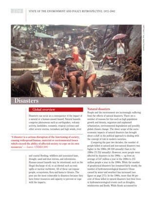
  • 1. Global overview Disasters can occur as a consequence of the impact of a natural or a human-caused hazard. Natural hazards comprise phenomena such as earthquakes, volcanic activity, landslides, tsunamis, tropical cyclones and other severe storms, tornadoes and high winds, river and coastal flooding, wildfires and associated haze, drought, sand and dust storms, and infestations. Human-caused hazards may be intentional, such as the illegal discharge of oil, or accidental such as toxic spills or nuclear meltdown. All of these can expose people, ecosystems, flora and fauna to threats. The poor are the most vulnerable to disasters because they have fewer resources and capacity to prevent or cope with the impacts. Natural disasters People and the environment are increasingly suffering from the effects of natural disasters. There are a number of reasons for this such as high population growth and density, migration and unplanned urbanization, environmental degradation and possibly global climate change. The sheer scope of the socio- economic impacts of natural disasters has brought about a shift in the political approach to dealing with the concept of risk in modern societies. Comparing the past two decades, the number of people killed in natural and non-natural disasters was higher in the 1980s (86 328 annually) than in the 1990s (75 252 annually). However, more people were affected by disasters in the 1990s — up from an average of 147 million a year in the 1980s to 211 million people a year in the 1990s. While the number of geophysical disasters has remained fairly steady, the number of hydrometeorological disasters (those caused by water and weather) has increased (see figure on page 271). In the 1990s, more than 90 per cent of those killed in natural disasters lost their lives in hydrometeorological events such as droughts, windstorms and floods. While floods accounted for 270 STATE OF THE ENVIRONMENT AND POLICY RETROSPECTIVE: 1972–2002 Disasters ‘A disaster is a serious disruption of the functioning of society, causing widespread human, material or environmental losses which exceed the ability of affected society to cope on its own resources.’ — Source: UNDHA 2001 UNEP,EdwinC.Tuyay,TophamPicturepoint
  • 2. more than two-thirds of people affected by natural disasters, they are less deadly than many other types of disaster, accounting for only 15 per cent of deaths (IFRC 2001). The social and economic costs of disasters vary widely and are difficult to estimate on a global basis. Insurance claims tend to be misleading as an estimate of the economic impact of disasters. Considering insured damage claims for the 1999 floods in Austria, Germany and Switzerland, at least 42.5 per cent of damage was covered by disaster insurance. But in Venezuela the same year, only 4 per cent of flood damage was covered (CRED-OFDA 2002). There is a need for reliable and systematic data on disasters to help assess their socio-economic and environmental impacts in both the short and the long term. But although communities in developing countries suffer from numerous local-scale disasters such as wildfires, small floods, droughts and pest infestations, these are often not reflected in disaster statistics. The most expensive disasters in purely financial and economic terms are floods, earthquakes and windstorms but events such as drought and famine can be more devastating in human terms. While earthquakes accounted for 30 per cent of estimated damage, they caused just 9 per cent of all fatalities due to natural disasters. In contrast, famine killed 42 per cent, but accounted for just 4 per cent of damage over the past decade (IFRC 2001). In 1999, global financial losses from natural catastrophic events were estimated to exceed US$100 billion — the second highest figure on record. A total of 707 large events were recorded compared to 530 to 600 events in previous years. It is even more striking that the number of major catastrophic events over the past decade has increased threefold in comparison with the 1960s, while the rate of economic losses has increased by a factor of almost nine over the same period (Munich Re 2001). Between 1995 and 1997, the impacts of natural hazards cost the United States at least US$50 billion a year, or the equivalent of about US$1 billion a week (IDNDR 1999a). The economic losses of the United States because of the 1997-98 El Niño event were estimated at US$1.96 billion or 0.03 per cent of GDP. Ecuador suffered equivalent financial losses but this represented 11.4 per cent of its GDP. The floods in China in 1991, 1994-95 and 1998 caused losses ranging from US$20 to 35 billion (CNC-IDNDR 1999). DISASTERS 271 1950 2000 1955 1960 1965 1970 1975 1980 1985 1990 1995 earthquake flood storm other Numbers of great natural disasters per year, 1950–2001 Graph shows increasing trend in frequency of ‘great’ natural disasters. Catastrophes are classed as great if the ability of the region to help itself is overtaxed, making inter-regional or international assistance necessary, as is usually the case when thousands of people are killed, hundreds of thousands made homeless or when a country suffers substantial economic losses Source: Munich Re 2001 Recent disasters caused by extreme natural events The year 2000 q Mongolian herders had their hardest winter for 30 years — 2.4 million livestock died and 45 per cent of the country’s population was affected. q In February and March, floods killed 650 people and left more than half a million homeless in Mozambique. Heavy rains also affected Botswana, Swaziland and Zimbabwe. q Cyclones Eline (mid-February) and Gloria (early-March) left 184 000 people in need of immediate relief support out of the total of 737 000 affected in Madagascar. In early April, a third cyclone, Hudah, hit the north of the island. q Floods in September and October in Southeast Asia, especially Viet Nam and Thailand, killed approximately 900 people and left 4 million homeless or with insufficient shelter. Losses estimated at US$460 million. q Hurricane Keith in October killed eight and affected 62 000 people in Belize. Direct losses estimated at US$520 million. q In mid-October, heavy rains caused floods in the Italian and Swiss Alps killing 38 people and causing economic losses estimated at US$8.5 billion. q Similar floods killed six people and caused US$1.5 billion loss in the United Kingdom in November. The year 2001 q In mid- to late January, heavy rains over Zambezia Province caused the Licungo River to flood in Mozambique. Nearly 500 000 people were affected by the floods. q In March, floods devastated a wide area of northeastern Hungary, northwestern Romania and western Ukraine. Tens of thousands of people were forced to move. q Flash floods unexpectedly struck parts of Pakistan on 23 July. The cities of Islamabad and Rawalpindi were the worst affected. 132 people were killed. q In mid-November, as many as 576 Vietnamese had been killed by natural disasters, mainly floods and typhoons. Material losses amounted to more than US$200 million. q A persistent multi-year drought in Central and Southwest Asia had affected about 60 million people by November 2001. q After several months of drought, devastating floods tore through the Algerian capital Algiers on 10 November, killing 751 people. Thousands were injured, and about 40 000 people were left homeless. Source: ReliefWeb (2002), Munich Re 2001
  • 3. The annual loss from natural disasters over the period from 1989 to 1996 is estimated to range from 3 to 6 per cent of China's GDP, averaging 3.9 per cent. In December 1999, the Anatol, Lothar and Martin storms generated losses in northern Europe amounting to US$5–6 billion (Munich Re 2001). Less developed countries with limited economic diversity and poor infrastructure must not only rely mostly on external relief if a disaster happens but their economies need more time to recover. In developed economies, governments, communities and individuals have greater capacities to cope with disasters, the economic losses are to some extent absorbed by a diversified economy, and most assets are insured. Among the least developed countries, 24 of the 49 face high levels of disaster risk; at least six of them have been affected by between two and eight major disasters per year in the past 15 years, with long-term consequences for human development (UNDP 2001). Since 1991, more than half of all the disasters reported occurred in countries with medium levels of human development (see ‘Socio-economic background’). However, two-thirds of those killed came from countries with low levels of human development, while just 2 per cent came from highly developed countries. The effect of development on disasters is dramatic: on average, 22.5 people die per reported disaster in highly developed countries, 145 die per disaster in countries with medium human development, and 1 052 people die per disaster in countries with low levels of development (IFRC 2001). A number of experts link the current trend in extreme weather events with an increase of the global mean temperature. Many parts of the world have suffered major heat waves, floods, droughts and other extreme weather events. While individual events, such as El Niño-related phenomena (see box), cannot be directly linked to human-induced climate change, the frequency and magnitude of these types of events are predicted to increase in a warmer world. The changes in the global mean temperature are ‘very likely’ to affect parameters such as precipitation patterns, wind velocities, soil moisture and vegetation cover which appear to influence the occurrence of storms, hurricanes, floods, drought and landslides (IPCC 2001). For example, the extent of damage from storm surges can be directly linked to sea level variations. Climate change and variability alone do not explain the increase in the impacts related to disasters. ‘Natural’ can be a misleading description for disasters such as the droughts, floods and cyclones which afflict much of the developing world. Identifying human- induced root causes, and advocating structural and political changes to combat them, is long overdue (IFRC 2001). For example, destruction of the natural environment because of logging or inappropriate land uses for short-term economic gain is one of the major 272 STATE OF THE ENVIRONMENT AND POLICY RETROSPECTIVE: 1972–2002 The 1997-98 El Niño event affected virtually every region: Eastern Africa suffered drought and unusually high rainfall; Southeast Asia and North America, abnormally warm periods; South Asia, drought; Latin America and the Caribbean, unusually high rainfall and drought; and the Pacific Islands unusually high rainfall. The global socio- economic impacts were varied: q More than 24 000 people died because of high winds, floods or storm tides that occurred during intense storms. q More than 110 million people were affected and more than 6 million people were displaced as community infrastructures, including housing, food storage, transport and communications, were lost during storms. q Direct economic losses exceeded US$34 billion. q Waterlogging of fields reduced agricultural production in many regions; in others, the absence of storms and rain led to prolonged dry spells, loss of crops and reduction in water supplies. q Wildfires were more frequent and widespread during extended dry periods. q Increased incidence of disease followed the prolonged disruption to weather and rainfall patterns that resulted in contamination of water supplies or a more favourable environment for disease-carrying insect vectors. Sources: WMO 1999, UNU 2001 Socio-economic effects of the 1997–98 El Niño 90 45 0 60 1950 2000 1955 1960 1965 1970 1975 1980 1985 1990 1995 15 30 75 >167 Economic costs of great natural disasters (US$billion), 1950–2000 In comparison with the 1960s, economic losses during the 1990s increased by a factor of almost nine Note: chart shows only the cost of ‘great’ natural catastrophes — see figure on page 271 for definition Source: Munich Re 2001
  • 4. factors promoting floods or mudslides such as those that hit Venezuela in December 1999. Similarly, the migration of population to urban and coastal areas increases human vulnerability as population densities increase, infrastructure becomes overloaded, living areas move closer to potentially dangerous industries, and more settlements are built in fragile areas such as floodplains or areas prone to landslides. As a result, natural catastrophes affect more people and economic losses are increased. For example, despite the fact that seismic activity has remained constant over recent years, the effects of earthquakes on the urban population appear to be increasing. Human-induced disasters A number of major accidents involving chemicals and radioactive materials have drawn attention worldwide to the dangers of mismanagement, particularly in the transport, chemical and nuclear power sectors. These events often have impacts that transcend national boundaries; they also emphasize the fact that issues of technological safety concern more than just the developed countries. Some disasters have resulted in the introduction of voluntary or mandatory regulations designed to prevent similar occurrences. Public concern following the explosion in 1976 at a pesticide plant in Seveso, Italy, with the release of 2,3,7,8-tetrachlorodibenzo-p- dioxin (TCDD), led to the introduction in 1982 of a European Directive on the major-accident hazards of certain industrial activities. Similarly, other major accidents, such as the methyl isocyanate leak at Bhopal, India, in 1984 and the Switzerland-Sandoz warehouse fire in Basel in 1989, stimulated legislation in many countries to prevent and control chemical incidents. Influenced by the Bhopal accident, in particular, the International Labour Office developed in 1993 the Convention Concerning the Prevention of Major Industrial Accidents No. 174 and the Prevention of Major Industrial Accidents Recommendation No. 181. These documents call for an international exchange of relevant information, development of policies aimed at addressing the major accident risks, hazards and their consequences, and recognition that a major accident could have serious impacts on human life and the environment. Major nuclear accidents such as those at Three Mile Island in the United States in 1979 and at Chernobyl in 1986 have not only catalysed action to strengthen nuclear safety and emergency preparedness but also forced many countries to DISASTERS 273 On 17 August 1999, an earthquake with a magnitude of 7.4-7.8 on the Richter scale hit the city of Izmit, Turkey, and the surrounding areas. Damage from the earthquake was estimated at more than US$13 billion. More than 15 000 people were killed, 25 000 others were injured and 600 000 people were left homeless. The earthquake was blamed for increasing the national account deficit of some US$3 billion in 1999-2000 (equivalent to about 1.5 per cent of the GNP). A significant part of the damage could have been avoided had local building codes been effectively implemented. Many new buildings had not been properly designed, had not been built on foundations strong enough to resist earthquakes, and had not been sited in areas where the effects of earthquakes would have been diminished. Source: ISDR 1999 The 1999 earthquake in Izmit, Turkey Apartment block split in two by the 1999 earthquake in Izmit, Turkey Source: Alexander Allmann, Munich Re
  • 5. abandon or severely restrict development of the nuclear power sector. Following the Chernobyl accident, two major international treaties were adopted — the Convention on Assistance in the Case of Nuclear Accident or Radiological Emergency and the Convention on the Early Notification of a Nuclear Accident. Most recently, the 1994 Convention on Nuclear Safety, committing parties to a higher level of nuclear safety, and the 1997 joint Convention on the Safety of Spent Fuel Management and on the Safety of Radioactive Waste Management were adopted. The 1989 Exxon Valdez oil spill in Alaska resulted in enormous environmental and economic damages and catalysed the development of the ‘Valdez Principles’ — a voluntary code of conduct for corporate behaviour towards the environment — by the Coalition for Environmentally Responsible Economics (CERES). The ‘Valdez Principles’ guide corporations in the establishment of environmentally sound policies and require the raising of corporate environmental safety standards and the taking of responsibility for environmental harm that may be caused by them (Adams 1994). International policy responses Until the 1970s, the international community considered disasters as exceptional circumstances, when local coping capacities were exhausted and external emergency relief was required. The term disaster management was generally equivalent to disaster response and tended to be within the exclusive competence of organizations such as the Red Cross and Red Crescent Societies or national civil defence institutions. In 1971, the United Nations Disaster Relief Office, now the United Nations Office for the Coordination of Humanitarian Affairs (UNOCHA), was established to mobilize and coordinate relief activities from all sources in times of disaster. The concept of disaster preparedness was developed during the 1970s and 1980s, and included training and some cross-sectoral activities to increase capacity for rescue, relief and rehabilitation during and after a disaster. But even the most pessimistic forecasts could not have foreseen the upward spiral in negative socio-economic consequences of natural disasters in the closing decades of the 20th century. The 1990s was declared the International Decade for Natural Disaster Reduction (IDNDR), one of the principal goals of which was to inculcate a culture of disaster prevention through the wider application of known scientific and technological mechanisms by a better-informed population. In the words of United Nations Secretary-General Kofi Annan, ‘We must, above all, shift from a culture of reaction to a culture of prevention. The humanitarian community does a remarkable job in responding to disasters. But the most important task in the medium and long-term is to strengthen and broaden programmes which reduce the number and cost of disasters in the first place. Prevention is not only more humane than cure, it is also much cheaper’ (IDNDR 1999b). The IDNDR successfully placed risk reduction higher on the political agenda, as well as setting out a number of priorities to be undertaken by countries and regions in the 21st century. An increasing number of governments and international organizations are promoting risk reduction as the only sustainable solution for reducing 274 STATE OF THE ENVIRONMENT AND POLICY RETROSPECTIVE: 1972–2002 The Chinese government is shifting the focus of its disaster policies from improving response capabilities to reducing hazards and risks. During the past ten years, national coordination has been vested in the Chinese National Committee (CNC) for the IDNDR, an inter-ministerial organization composed of representatives from 28 ministries, departments and commissions. Since 1989, CNC has been working on the National Natural Disaster Reduction Plan of the People's Republic of China (1998- 2010). It has also helped to develop and coordinate policies and plans for national and local disaster reduction activities. Motivated by the seriousness of the 1991 floods in China, the Chinese authorities recognized the need ‘to integrate disaster reduction into the comprehensive plan for national economy and social development’. The Chinese National Centre for Natural Disaster Reduction has now been established within the Chinese Academy of Sciences. The centre compiles and analyses data on disasters, and passes the results to the State Council for decision-making responsibilities. China experienced its worst floods in more than 100 years in 1999, which affected more than 300 million people. The floods galvanized more political commitment for the integration of risk and disaster prevention programmes into national social and economic planning. However, China believes that there were fewer losses during the 1999 floods in the Yangtze River Valley, despite higher water levels, because of the US$7.6 billion invested in water conservancy measures since the costly 1998 floods. Source: CNC-IDNDR 1999 China committed to risk reduction
  • 6. the social, economic and environmental impacts of disasters. Risk reduction strategies include: q vulnerability mapping; q identification of areas that are safe for settlement and development; q adoption of building codes based on disaster resilient engineering and on local hazard risk assessments; and q enforcing these plans and codes by economic and other incentives. At the global level, the UN has established an International Strategy for Disaster Reduction (ISDR), a global platform aimed at helping all communities to become resilient to the effects of natural disasters and to proceed from protection against hazards to the management of risk through the integration of risk prevention into sustainable development. The strategy — based on the IDNDR experience and developments such as the 1994 Yokohama Strategy and Plan of Action for a Safer World and the 1999 Strategy ‘A Safer World in the 21st Century: Disaster and Risk Reduction’ — reflects a cross-sectoral and interdisciplinary approach to disaster reduction. Implementation of the strategy, which is based on the establishment of partnerships between governments, non-governmental organizations, UN agencies, the scientific community and other stakeholders in the disaster reduction community, is an integral part of efforts aimed at promoting the overall goal of sustainable development. It is also an indispensable element in the search for solutions designed to counter the increasing threat posed by natural hazards (ISDR 1999). DISASTERS 275 The fundamental goal of the UNEP disaster management programme is to reinforce the centrality of environmental concerns in disaster management. The other cornerstone is the adoption of preventive strategies and practical measures to reduce the potential loss of human lives and property, as well as destruction of the environment. The success of this approach depends on increasing public awareness of the risks that natural, technological and environmental hazards pose to societies, and on educating people about the value of existing approaches for prevention and preparedness. UNEP contributes to this process through its programmes on environmental law, early warning and assessment, and Awareness and Preparedness for Emergencies at Local Level (APELL). UNEP’s APELL programme, developed in conjunction with governments and industry, recognizes that the incidence and effects of environmental disasters can be reduced by prevention and preparedness initiatives at the local level. The APELL concept has been successfully introduced to more than 30 countries and in more than 80 industrial communities worldwide. The UNEP strategy includes the promotion of cleaner production processes and technologies, and helping countries establish cleaner production centres. A major objective of the UNEP early warning and assessment programme is to evaluate the increasing vulnerability of human society due to widespread environmental and climatic change in order to emphasize the need for sound integrated environmental management, and to provide early warning of emerging threats for preparedness and response. Prevention and preparedness to reduce the costs of disasters Adams, J. (1994). Corporate Crime/Our Crime: What citizens have done and can do to curtail corporate ‘crime’. In Context, 38, 45 http://www.context.org/ICLIB/IC38/Adams.htm [Geo-2-329] CNC-IDNDR (1999). Natural Disaster and Disaster Relief in China; the China National Report on International Decade for Natural Disaster Reduction. Beijing, Chinese National Committee IDNDR CRED-OFDA (2002). EM-DAT: The OFDA/CRED International Disaster Database. Centre for Research on the Epidemiology of Disasters http://www.cred.be/emdat [Geo-2-330] IDNDR (1999a). Progress and Challenges in Reducing Losses from Natural Disasters http://www.usgs.gov/themes/sndr/sndr09.html [Geo-2-331] IDNDR (1999b). Despite Dedicated Efforts, Number and Cost of Natural Disasters Continue To Rise. Press Release, United Nations International Strategy for Disaster Reduction http://www.unisdr.org/forum/press3.htm [Geo-2- 332] IFRC (2001). World Disasters Report 2001. International Federation of Red Cross and Red Crescent Societies http://www.ifrc.org/publicat/wdr2001/ [Geo-2-334] IPCC (2001). Climate Change 2001: The Scientific Basis. Contribution of Working Group I to the Third Assessment Report of the Intergovernmental Panel on Climate Change. Cambridge, United Kingdom, and New York, United States, Cambridge University Press ISDR (1999). Les retombées socio-économiques du seisme d’Izmit en Turquie. United Nations International Strategy for Disaster Reduction http://www.unisdr.org/unisdr/izmit.htm ISDR (2001). The Concept of Disaster Reduction Embodied in the ISDR. United Nations International Strategy for Disaster Reduction http://www.unisdr.org/unisdr/aboutisdr.htm [Geo-2- 333] Munich Re (2001). Topics 2000: Natural Catastrophes — The Current Position. Special Millennium Issue. Munich, Munich Re Group ReliefWeb (2002). Natural Disasters. ReliefWeb: Project of the United Nations Office for the Coordination of Humanitarian Affairs http://www.reliefweb.int/w/rwb.nsf UNDHA (2001). United Nations Department of Humanitarian Affairs: Internationally agreed glossary of basic terms related to Disaster Management. United Nations International Strategy for Disaster Reduction http://www.unisdr.org/unisdr/glossaire.htm [Geo-2- 335] UNDP (2001). Disaster Profiles of the Least Developed Countries. Geneva, United Nations Development Programme Emergency Response Division UNU (2001). Once Burned, Twice Shy? Lessons Learned from the 1997-98 El Niño. Tokyo, United Nations University http://www.esig.ucar.edu/un/index.html [Geo-1- 032] WMO (1999). The 1997-1998 El Niño Event: a Scientific and Technical Retrospective. Geneva, World Meteorological Organization References: Chapter 2, disasters, global overview
  • 7. Disasters: Africa Extreme hydrometeorological events such as flooding and drought are common across Africa, while geophysical events such as earthquakes occur predominantly in Northern Africa, along the Atlas mountain range, and in the African Rift Valley, which also experiences volcanic activity. The El Niño Southern Oscillation causes significant climatic disturbances in most parts of Africa, either inducing drought or flooding, or increasing sea temperatures leading to cyclones. These natural events become disasters where large numbers of people or infrastructure are affected, as has occurred over the past 30 years due to high population growth rates, especially in urban centres and drought-prone areas — 34 per cent of Africa’s population lives in arid areas compared to just 2 per cent of Europe’s population (Findlay 1996). Impacts of disasters include loss of lives and livelihoods, damage to infrastructure and communications, interruption of economic activities, and increased risk of disease outbreaks. In many places, these impacts are worsened by poverty and marginalization, and overcrowding. Inadequate, old and deteriorating infrastructure and lack of economic security to provide for times of hardship also compromise people’s coping capacities and therefore magnify the impacts of disasters. There is growing concern that the frequency and severity of disasters are increasing at a time when early warning systems are inadequate and disaster management is weak (DMC 2000). Natural disasters Africa has experienced some of the worst droughts and famines in terms of number of people killed or number affected (see table), with particularly severe droughts in 1972-73 and 1984-85, affecting much of Northern, Southern, Eastern and Sahelian Africa (Gommes and Petrassi 1996). Countries most regularly affected include Botswana, Burkina Faso, Chad, Ethiopia, Kenya, Mauritania and Mozambique (FAO 2001), where the impacts of famine are exacerbated by inadequate transport facilities to receive and distribute food and medical aid (Ehrlich and Ehrlich 1990). There are some indications that droughts are becoming more prolonged and their impacts more severe (DMC 2000, FAO 2000). The risk of damage from heavy rain is greater in drier areas than in those that usually receive higher rainfall because there is less vegetation cover to absorb the water and stabilize soils. Expansion of informal settlements into the flood zone is putting many more people at risk of flooding, as illustrated in South Africa’s Alexandra Township, Johannesburg, during the floods of 2000 when approximately 3 000 families living in shacks below the floodline were subjected to flooding and outbreaks of cholera (Kim 2000, World Bank 2001a). Disasters can have severe economic impacts which are difficult to calculate. The Western Indian Ocean islands typically experience ten cyclones a year, between November and May, which bring strong winds and heavy rainfall. This causes destruction of infrastructure, particularly in low-lying areas and where settlements have encroached into flood-prone areas. Huge costs are incurred due to destruction of income-generation activities, including tourism revenues, and rehabilitation and replacement of damaged infrastructure and crops. Globally, Africa suffers the least damage from disasters in purely financial terms but the significance of such losses may actually be greater in terms of impact on economic development. Africa’s people and economies are heavily dependent on rainfed 276 STATE OF THE ENVIRONMENT AND POLICY RETROSPECTIVE: 1972–2002 number killed number affected 1972 famine Ethiopia 600 000 no data 1973 drought Ethiopia 100 000 no data 1974 drought Ethiopia 200 000 no data 1980 drought Mozambique no data 6 000 000 1982 famine Ghana no data 12 500 000 1983 drought Ethiopia no data 7 000 000 1984 drought Ethiopia 300 000 7 750 000 1984 drought Sudan 150 000 8 400 000 1985 drought Mozambique 100 000 2 466 000 1987 drought Ethiopia no data 7 000 000 1990 drought Ethiopia no data 6 500 000 1991 drought Ethiopia no data 6 160 000 1991 drought Sudan no data 8 600 000 1993 drought Malawi no data 7 000 000 1993 famine Ethiopia no data 6 700 000 1999 famine Ethiopia no data 7 767 594 2000 drought Ethiopia no data 10 500 000 Source: CRED-OFDA 2002 Some of the worst disasters in Africa, 1972–2000
  • 8. agriculture, and are therefore vulnerable to rainfall fluctuations. It is usually the poor who suffer most from flood or drought-induced crop failure, because they often cultivate areas that are climatically marginal for crop production and they cannot accumulate reserves for times of hardship. Both droughts and floods can result in malnutrition and famine, and the associated food imports and dependency on food aid can affect the economic growth potential of affected countries. In Kenya, low reservoir levels resulting from drought and siltation linked to deforestation led to reductions in hydropower generation, necessitating water and power rationing which devastated the country’s economy in 1999 and 2000. Losses from power rationing alone were estimated at US$2 million per day, and the cost of unmet electricity demand was estimated at US$400-630 million, equal to 3.8-6.5 per cent of GDP (World Bank 2000). In Mozambique, the costs of floods in 2000 were estimated at US$273 million in physical damage, US$247 million in lost production, US$48 million in lost exports and US$31 million in increased imports (Mozambique National News Agency 2000). Human-caused disasters Although climatic variability is a natural phenomenon, the increasing frequency and severity of extreme events can be in part attributed to human activities such as deforestation and inappropriate management of land and water resources. For example, clearing of tropical forests in Central and Western Africa has altered the local climate and rainfall patterns, and increased the risk of drought. Clearing of vegetation may also increase run-off and soil erosion. Damming of rivers and draining of wetlands reduces the environment’s natural ability to absorb excess water, enhancing the impacts of floods. For example, countries in Southern Africa experienced devastating floods in 1999 and 2000 which affected more than 150 000 families (Mpofu 2000). Degradation of wetlands such as the Kafue wetlands in Zambia, damming of rivers, deforestation and overgrazing lowered the environment’s ability to absorb excess water and magnified the impact of the floods (Chenje 2000, UNDHA 1994). Over the past three decades, millions of Africans have sought refuge from natural and human-made disasters with both environmental and socio-economic impacts. At the end of 2000, there were 3.6 million refugees in Africa, 56 per cent of whom were under 18 years of age (UNHCR 2001b). Often refugees are settled in fragile ecosystems where they exert considerable pressure on the natural resources, as they have no other means of survival (see box). Refugee populations also sometimes experience further conflicts with neighbouring communities, through competition for resources. Disaster responses There have been no concerted regional efforts to manage disasters, and disaster responses in Africa have tended to focus on national and sub-regional levels. Efforts have also concentrated on responses rather than mitigation through improved environmental management and agricultural practices. The unpredictable nature of extreme events, and the weak economic performance of most African countries, makes preparation for, and relief from, disasters all the more difficult. There have however been some successes in preventing famine resulting from drought, such as the Famine Early Warning System (FEWS) project, the implementation of a new efficient seed distribution system in Niger and promotion of more drought-resistant crop varieties. In Northern Africa, efforts to respond to economic hardship during droughts include financing DISASTERS 277 Environmental rehabilitation of refugee camps in Africa alone could cost as much as US$150 million a year. Visible evidence of environmental degradation is most obvious in long-standing asylum countries such as Kenya and Sudan. Land surrounding the refugee camps has been stripped clean of trees and vegetation. In such situations, refugees may have to walk up to 12 km in search of water and firewood. In the early 1990s, an estimated 20 000 ha of woodlands were cut each year in Malawi to provide firewood and timber for the various camps hosting Mozambican refugees, while in 1994, at the height of the refugee crisis near the Virunga National Park in the Democratic Republic of Congo (formerly Zaire), refugees were removing some 800 tonnes of timber and grass each day from the park — an amount far in excess of a possible sustainable yield. Despite efforts to restrict the impact on the park, almost 113 km2 have been affected, of which more than 71 km2 have been completely deforested. At another site in South Kivu, almost 38 km2 of forest were lost within three weeks of the arrival of refugees. In December 1996, more than 600 000 refugees from Burundi and Rwanda were housed in the Kagera region in northwest Tanzania. More than 1 200 tonnes of firewood were consumed each day — a total of 570 km2 of forest were affected, of which 167 km2 were severely deforested. Source: UNHCR 2001a Environmental impacts of refugees in Africa
  • 9. employment-generating projects to keep farmers from abandoning lands where productivity is declining, while in Eastern Africa afforestation and reforestation projects are being implemented to lessen the impact of future environmental changes, particularly climate change. In Southern Africa, the SADC Regional Early Warning Unit, the Regional Remote Sensing Project, the Drought Monitoring Centre and the FEWS Project advise governments on drought preparedness (see Chapter 3). A drought fund is also in place to mitigate the effects of poor rainfall (UNDHA 1994). In some areas, including parts of West Africa, long- term measures such as urban planning regulations which prohibit developments along watercourses have been promulgated although resource constraints often prevent them from being strictly enforced. Additional responses include the development and implementation of early warning or forecasting mechanisms such as ENSO forecasting, which has been implemented in Southern Africa and the Western Indian Ocean area. While this has the potential to alert relief organizations and evacuate communities ahead of time, it has been limited by poor communications services (Dilley 1997). For example, only 152 of every 1 000 people in Africa had radios by 1997 (World Bank 2000b). With global warming, the incidence of drought is likely to increase in many parts of Africa. The frequency and intensity of cyclones and floods in some areas are also likely to increase, adding to the stresses on water and food security, and possibly contributing to outbreaks of disease (IPCC 2001). For example, Seychelles is currently outside the cyclone zone but sea temperature rise could cause an increase in cyclone intensity and expansion of the cyclone zone to include the islands (UNEP 1999). 278 STATE OF THE ENVIRONMENT AND POLICY RETROSPECTIVE: 1972–2002 Chenje, M. (ed., 2000). State of the Environment Zambezi Basin 2000. Maseru, Lusaka and Harare, SADC, IUCN, ZRA and SARDC Coe, M. and Foley, J. (2001). Human and Natural Impacts on the Water Resources of the Lake Chad Basin. Journal of Geophysical Research 27 February 2001, Vol. 106, No. D4 CRED-OFDA (2002). EM-DAT: The OFDA/CRED International Disaster Database. Centre for Research on the Epidemiology of Disasters http://www.cred.be/emdat [Geo-2-330] Dilley, M. (1997). Warning and intervention: what kind of information does the response community need from the early warning community? Internet Journal of African Studies, Vol. 2. University of Bradford http://www.brad.ac.uk/research/ijas/ijasno2/dilley.ht ml [Geo-2-336] DMC (2000). Ten-Day Bulletin. DEKAD 19 Report (1-10 July, 2000). Nairobi, Drought Monitoring Centre Ehrlich, P. and Ehrlich, A. (1990). The Population Explosion. London, Arrow Books FAO (2000). ACC Inter-Agency Task Force on the UN Response to Long Term Food Security, Agricultural Development and Related Aspects in the Horn of Africa. Rome, Food and Agriculture Organization FAO (2001). 17 Countries are Facing Exceptional Food Emergencies in Sub-Saharan Africa – FAO Concerned About Deteriorating Food Situation in Sudan, Somalia and Zimbabwe. Press Release 01/48. Rome, Food and Agriculture Organization Findlay, A.M. (1996). Population and Environment in Arid Regions. Policy and Research Paper No. 10, Paris, International Union for the Scientific Study of Population Gommes, R. and Petrassi, F. (1996). Rainfall Variability and Drought in Sub-Saharan Africa since 1960. FAO Agrometeorology Working Paper No 9. Rome, Food and Agriculture Organization IPCC (2001). IPCC Third Assessment Report — Climate Change 2001. Working Group II: Impacts, Adaptation and Vulnerability. Geneva, World Meteorological Organization and United Nations Environment Programme Kim, S. (2000). Southern Africa Swamped by Rains. Disaster News Network http://www.disasternews.net/disasters/2-14- 00_africa-swamped.shtml [Geo-2-337] Mozambique National News Agency (2000). Government reports on flood damage and reconstruction. AIM Reports, Issue No. 194, 6 November 2000. Mozambique National News Agency http://www.poptel.org.uk/mozambique- news/newsletter/aim194.html#story1 [Geo-2-338] Mpofu, B. (2000). Assessment of Seed Requirements in Southern African Countries Ravaged by Floods and Drought 1999/2000. SADC Food Security Programme http://www.sadc-fanr.org.zw/sssd/mozcalrep.htm [Geo-2-339] UNDHA (1994). First African Sub-Regional Workshop on Natural Disaster Reduction, Gaborone, 28 November to 2 December 1994. Gaborone, United Nations Department of Humanitarian Affairs UNEP (1999). Western Indian Ocean Environment Outlook. Nairobi, United Nations Environment Programme UNHCR (2001a). Refugees and the Environment — Caring for the Future. Geneva, UNHCR – The UN Refugee Agency UNHCR (2001b). Refugee Children in Africa; Trends and Patterns in the Refugee Population in Africa Below the Age of 18 Years, 2000. Geneva, UNHCR – The UN Refugee Agency World Bank (2000). World Bank Board Approves $72 million for Kenya. World Bank News Release No: 2001/105/AFR. World Bank http://wbln0018.worldbank.org/news/pressrelease.n sf [Geo-2-340] World Bank (2001a). Upgrading Urban Communities, Version 2001. Spotlight on Alexandra, South Africa. Massachusetts Institute of Technology http://web.mit.edu/urbanupgrading/upgrading/case- examples/overview-africa/alexandra-township.html [Geo-2-341] World Bank (2001b). World Development Indicators 2001. Washington DC, World Bank http://www.worldbank.org/data/wdi2001/pdfs/tab3_ 8.pdf [Geo-2-024] References: Chapter 2, disasters, Africa
  • 10. Disasters: Asia and the Pacific About 75 per cent of the world’s major natural catastrophes between 1970 and 1997 occurred in the Asia and the Pacific region, mostly in poverty-ridden developing countries (UNESCAP and ADB 2000). There has been a general upward trend in the number of natural disasters due to hydrometeorological events (such as cyclones and flooding) in the region, while geophysical disasters such as volcanic eruptions, earthquakes and tsunamis have remained fairly steady (see figure). Natural disasters Vulnerability to disasters is closely linked with population density and economic resources. The impact of natural disasters in the region is severe, with more than 1.4 million people killed, almost 4 000 million affected and US$438 million in damage over the past three decades (see table). During 1991-2000 alone, the total number of deaths caused by natural disasters in the region exceeded 550 000 or 83 per cent of the global total (IFRC 2001), the majority of them in Asian countries with low or medium levels of human development. The highest number of deaths occurred in South Asia (the sub-region with the highest population density and the lowest per capita income) and the lowest number in Australia and New Zealand, the sub- region with the lowest population density and a high per capita income (UNPD 2001, World Bank 2001). China experienced more than 300 natural disasters and recorded more than 311 000 deaths during 1971- 2000; India with more than 300 disasters suffered more than 120 000 deaths; the Philippines, with nearly 300 events, lost about 34 000 people; Indonesia experienced about 200 disasters with more than 15 000 lives lost; and Bangladesh experienced 181 events and more than 250 000 people killed. Some areas are more exposed to natural hazards because of location (on the coast, near a volcano or geological fault). Cyclones occur most frequently over the Northwest Pacific, over the southern end of the Bay of Bengal, east of India and south of Bangladesh (UNESCAP and ADB 1995, Ali 1999, Huang 1999, Kelly and Adger 2000). Bangladesh, China and India are the most flood-prone countries of the region (Mirza and Eriksen 1996, Ji and others 1993). Hilly and mountainous areas (China, India, Nepal, Philippines and Thailand) are most prone to landslides, which are aggravated by deforestation and cultivation that destabilizes slopes. Countries along or adjacent to seismic zones (Afghanistan, China, India, Iran, Nepal, Philippines and the Pacific Islands) are more vulnerable to seismic events, while countries along the Pacific Rim are at risk from volcanic eruptions, particularly Indonesia, Japan and the Philippines (UNESCAP and ADB 1995). The El Niño phenomenon has significant impacts over large areas in the region, the most affected being Indonesia (Glantz 1999, Salafsky 1994, 1998). Other disasters Environmental degradation and change are becoming increasingly important in relation to both the occurrence and impact of natural disasters. Deforestation, for example, is now frequently linked to severe flood events and landslides. Overexploitation of DISASTERS 279 hydrometeorological 500 0 300 200 100 400 1971–75 1996–00 1976–80 1981–85 1986–90 1991–95 geophysical Disasters caused by water and weather (hydrometeoro- logical disasters) have become more frequent while the number of geophysical disasters remains fairly constant Source: CRED- OFDA 2002 Trends in disasters (number/year): Asia and the Pacific number killed number affected damage (thousands) (thousands) (US$1 000) South Asia 761 2 164 034 60 881 Southeast Asia 73 284 074 33 570 Northwest Pacific 606 1 447 643 317 174 and East Asia Central Asia 3 4 895 986 Australia and New Zealand 1 15 761 21 900 South Pacific 4 4 061 3 139 total 1 447 3 920 467 437 649 Note: Central Asia figures are for 1992/93–2000 Source: CRED-OFDA 2002 Impact of natural disasters in Asia and the Pacific, 1972–2000
  • 11. water resources has already resulted in sub-regional environmental disasters such as the drying up of the Aral Sea in Central Asia (see box below and feature on page 296). Most of the countries in the Northwest Pacific and East Asia sub-region and the Pacific Island countries will be particularly vulnerable to climate change and associated sea-level rise because so many human settlements and so much industrial infrastructure are located in coastal or lowland areas. For the small island developing states, climate change and extreme weather events may also have dramatic impacts on terrestrial biodiversity, subsistence cropping and forest food sources (IPCC 1998). Rapid population growth, urbanization and weak land-use planning are some of the reasons why poor people move to fragile and high risk areas which are more exposed to natural hazards. Moreover, the rapid growth of industries in urban areas has induced rural–urban migration. This has sometimes led to more people being exposed to technological hazards such as the disaster in Bhopal, India, in 1984, in which escaping methyl isocyanate from an industrial plant killed more than 3 000 and affected more than 200 000 others (Robins 1990). Disaster responses Asian countries are at different stages of institutional development with respect to disaster reduction. Some, such as Japan, have a long-established system of disaster management. Stimulated by the International Decade for Natural Disaster Reduction (IDNDR), other countries (such as Viet Nam, see box page 281) have either strengthened existing frameworks or are formulating new ones (UNESCAP and ADB 1995). Despite some recent achievements, significant 280 STATE OF THE ENVIRONMENT AND POLICY RETROSPECTIVE: 1972–2002 q July 1976: an earthquake in China took 242 000 lives q April 1991: a cyclone in Bangladesh accompanied by a storm surge caused 138 866 deaths q February 1990 and December 1991: cyclones in Samoa caused losses of US$450 million, about four times the country’s GDP q January 1995: an earthquake in Kobe, Japan, became one of the costliest natural disasters in history — 5 502 people were killed and more than 1 800 000 affected, with damage estimated at US$131.5 billion q October 1999: the Super Cyclone in the eastern state of Orissa in India caused more than 10 000 deaths, while 15 million people were rendered homeless, left without food, shelter or water and their livestock population devastated — the cyclone damaged 1.8 million ha of agricultural land and uprooted more than 90 million trees q January 2001: an earthquake of magnitude 7.7 on the Richter scale rocked the state of Gujarat in India, causing more than 20 000 deaths and 167 000 injuries — economic losses estimated at US$2.1 billion Sources: ADPC 2001, CRED-OFDA 2002, DoAC India 2002 Selected natural disasters: Asia and the Pacific The Aral Sea: a human-induced environmental and humanitarian disaster The destruction of the Aral Sea is now a well- known example of unsustainable development. Atlases used to describe the sea as the world’s fourth largest lake, with an area of 66 000 km2 and a volume of more than 1 000 km3. Its waters supplied local fisheries with annual catches of 40 000 tonnes, while the deltas of its tributaries hosted dozens of smaller lakes and biologically rich marshes and wetlands covering 550 000 ha. In the 1960s, planners in the former Soviet Union assigned Central Asia the role of supplier of raw cotton. Irrigation was imperative, and the Aral Sea and its tributaries seemed a limitless source of water. Irrigated land was expanded from about 4.5 million ha in 1960 to almost 7 million ha in 1980. The local population also grew rapidly, from 14 million to about 27 million in the same period, while total water withdrawal almost doubled to an annual 120 km3, more than 90 per cent of it for agriculture. The result was the collapse of the prevailing water balance in the basin. Waterlogging and salinization eventually affected about 40 per cent of irrigated land. Overuse of pesticides and fertilizer polluted surface water and groundwater, and the delta ecosystems simply perished: by 1990, more than 95 per cent of the marshes and wetlands had given way to sand deserts, and more than 50 delta lakes, covering 60 000 ha, had dried up. The surface of the Aral Sea shrank by one-half and its volume by three-quarters. The mineral content of the water has increased fourfold, preventing the survival of most of the sea’s fish and wildlife. Commercial fishing ended in 1982. Former seashore villages and towns are now 70 km from the present shoreline. Communities face appalling health problems. In Karakalpakstan, Uzbekistan, drinking water is saline and polluted, with a high content of metals that causes a range of diseases. Over the past 15 years, there has been a 3 000 per cent increase in chronic bronchitis and in kidney and liver diseases, especially cancer, while arthritic diseases have increased 6 000 per cent. The infant mortality rate is one of the world’s highest. Five newly independent Central Asian states have now established a joint commission for water coordination. Several international organizations and bilateral agencies are providing assistance, and an International Fund for the Aral Sea and the Interstate Council for the Aral Sea Problem have been set up to coordinate initiatives. The Central Asian republics have decided to focus on demand management, aiming to reduce water withdrawal by raising irrigation efficiency. The primary objective is to satisfy crop water requirements. Total water withdrawal in the basin has now stabilized at 110-120 km3/year but environmental degradation continues. Source: FAO 1998
  • 12. measures and actions still remain to be taken at the regional and national levels to reduce risks and losses due to disasters, namely: q the impact of environmental degradation needs to be examined — raising awareness about the dangers of environmental degradation among the governments and people is of utmost importance; q deforestation should be stopped; q mitigation and preparedness measures already undertaken must be strengthened; q actions are needed to reduce poverty levels with a view to maintaining the resource base and protecting biodiversity; and q rural development is a prerequisite for reducing the migration of people to cities and coastal areas. DISASTERS 281 Ali, A. (1999). Climate Change Impacts and Adaptation Assessment in Bangladesh. Climate Research, special 6, 12 (2/3), 109–16 ADPC (2001). Asian Disaster Management News, Vol. 7, No. 1, January-March 2001. Bangkok, Asian Disaster Preparedness Centre, Asian Institute of Technology CRED-OFDA (2002). EM-DAT: The OFDA/CRED International Disaster Database. Centre for Research on the Epidemiology of Disasters http://www.cred.be/emdat [Geo-2-330] DoAC India (2002). Super Cyclone Orissa. Natural Disaster Management, Department of Agriculture and Cooperation, India http://ndmindia.nic.in/cycloneorissa/ [Geo-2-343] FAO (1998). Time to save the Aral Sea? Agriculture 21, 1998 http://www.fao.org/WAICENT/FAOINFO/AGRICULT/ magazine/9809/spot2.htm (26/09/2001) [Geo-2- 342] Glantz, M. H. (1999). Currents of Change: EL Nino’s Impact on Climate and Society. Cambridge, Cambridge University Press Huang, Z.G. (1999). Sea Level Changes in Guangdong and its Impacts. Guangzhou, China, Guangdong Science and Technology Press (in Chinese) IFRC (2001). World Disaster Report 2000. Geneva, International Federation of Red Cross and Red Crescent Societies IPCC (1998). The Regional Impacts of Climate Change: An Assessment of Vulnerability. Cambridge, Cambridge University Press Ji, Z.X., Jiang, Z.X and Zhu, J.W. (1993). Impacts of Sea Level Rise on Coastal Erosion in the Changjiang Delta Northern Jiangsu Coastal Plain. Acta Geographica Sinica, 48 (6), 516–26 (in Chinese with English Abstract) Kelly, P.M. and Adger, W.N. (2000). Theory and Practice in Assessing Vulnerability to Climate Change and Facilitating Adaptation. Climate Change, 47, 325-52 Mirza, M.Q. and Ericksen, N.J. (1996). Impact of Water Control Projects on Fisheries Resources in Bangladesh. Environmental Management, 20(4), 527–39 Robins, J. (1990). The World’s Greatest Disasters. London, Hamlyn Salafsky, N. (1994). Drought in the Rainforest: Effects of the 1991 El Niño Southern Event on a Rural Economy in West Kailimantan, Indonesia. Climate Change, 27, 373–96 Salafsky, N. (1998). Drought in the Rainforest, Part II: an Update Based on the 1994 ENSO Event. Climate Change, 39, 601–3 UNEP (2001). Disasters. Our Planet http://www.ourplanet.com/imgversn/113/ngo.html [Geo-2-344] UNESCAP and ADB (1995). State of the Environment in Asia and the Pacific 1995. United Nations Economic and Social Commission for Asia and the Pacific and the Asian Development Bank, United Nations, New York UNESCAP and ADB (2000). State of the Environment in Asia and Pacific 2000. Economic and Social Commission for Asia and the Pacific and Asian Development Bank. New York, United Nations http://www.unescap.org/enrd/environ/soe.htm [Geo- 2-266] World Bank (2001). World Development Indicators 2001. Washington DC, World Bank http://www.worldbank.org/data/wdi2001/pdfs/tab3_ 8.pdf [Geo-2-024] References: Chapter 2, disasters, Asia and the Pacific Viet Nam has a long tradition of disaster mitigation. When the United Nations General Assembly designated the 1990s as the International Decade for Natural Disaster Reduction, Viet Nam responded by organizing a National Committee and strengthening the role its Central Committee for Flood and Storm Control (CCFSC) plays in disaster mitigation. The CCFSC has developed programmes, plans and measures for disaster reduction in coordination with other relevant organizations, directed the implementation of disaster mitigation activities and coordinated actions with relevant international organizations. In the late 1990s, Viet Nam experienced a number of extreme events, including Typhoon Linda (1997) in the southern coastal area. Although the human and economic losses were tragic, agencies at all levels strengthened their search and rescue capacities, resulting in tens of thousands of evacuations. More than 5 000 people were saved by these efforts. Once the typhoon abated, the government provided assistance to the local fishing communities. As a result of this and other disasters, the government took policy decisions for each part of the country, including improving flood resistance and protecting populated areas, by strengthening the system of dykes and flood diversion structures in northern Viet Nam, policies to prevent and mitigate flood damage in central Viet Nam, and the Mekong River Delta policy which is designed to prepare measures for living with floods and minimizing their damage. In recognition of these achievements, the United Nations awarded Viet Nam the Certificate of Distinction for Disaster Reduction on 11 October 2000, the International Day for Disaster Reduction. Source: UNEP 2001 Being prepared: Viet Nam’s disaster reduction programme
  • 13. Disasters: Europe Disasters resulting from natural and human-caused hazards occur throughout Europe, often leading to significant environmental damage, economic loss, human injuries and premature mortality. The overall consequences depend on both the magnitude of the event and on factors such as population density, disaster prevention, preparedness and response measures and emergency planning. Europe generally suffers less from disasters than many developing countries, due to a higher level of ‘coping capacity’ in terms of government ability to prepare and respond to disasters. Natural disasters In Europe, the most common natural disasters are storms and floods, although earthquakes do occur in some countries. Storms and floods are also the most costly in terms of economic and insured losses. The windstorms Lothar and Martin that occurred in December 1999 caused an estimated €5 billion damage to crops, forests and infrastructure while the cost of flood damage between 1991 and 1995 has been estimated at €99 billion. One of the worst years ever in terms of flood damage was 2000, accounting for almost one-quarter of the total US$10.6 billion insured costs (Swiss Re 2001). In recent years, many European countries have experienced abnormally high precipitation intensity and duration, especially in winter months, which has led to floods in the Czech Republic, France, Germany, Hungary, Italy, Portugal, Switzerland, Ukraine and the United Kingdom. Between 1971 and 1996, 163 major floods occurred in Europe. The main factors that induce or intensify floods and their impacts include climate change, land sealing, changes in the catchment and floodplain land use, population growth, urbanization and increasing settlement, roads and railways and sometimes hydraulic engineering measures (EEA 2001a). Forest fires and droughts are a problem in the southern countries along the rim of the Mediterranean (Croatia, France, Greece, Italy, Slovenia and Spain) and fires are also common in the Siberian region of the Russian Federation where economic recession has caused a severe decline in the response capacity of local authorities and forest fire teams. Each year, hundreds of thousand of hectares of taiga forest are lost due to fires. Around 80 per cent of forest fires are a result of people’s ignorance of fire safety rules. The average annual number of natural disasters appears to be increasing and since the late 1980s there has also been an increase in the impacts of these 282 STATE OF THE ENVIRONMENT AND POLICY RETROSPECTIVE: 1972–2002 In January 1998, the 12th Conference of Rhine Ministers adopted an Action Plan on Flood Defence to be implemented over 20 years. The most important aims of the plan are to reduce damage by up to 10 per cent by the year 2005 and by up to 25 per cent by 2020. Extreme flood levels downstream of the regulated Upper Rhine are to be reduced by up to 30 cm by 2005 and by up to 70 cm by 2020. These ambitious targets are likely to be reached only through an integrated managerial approach at local, national, regional and international levels. Over the past two centuries, the Rhine has lost more than 85 per cent of its natural floodplains to buildings and agriculture. There were severe floods in 1993 and 1995. The assets that could be affected in areas at flood risk may amount to €1 500 billion. Countermeasures, such as the preservation and expansion of floodplains, and improved water storage in the entire catchment area, must aim at the ecological improvement of the Rhine, its valley and catchment area. Source: ICPR 2001 The Rhine Action Plan on Flood Defence Lothar, the first of two severe storms that passed over Western Europe on 26–27 December 1999, caused severe damage. This image shows the storm passing over Europe at 12.00 UTC on 26 December, with the northern African coast outlined below Source: copyright EUMETSAT 2002
  • 14. disasters and their related economic losses — at least in the European Union (EEA 1999). For example, at the French–German border, the floodwaters of the Rhine rose more than 7m above flood level about once every 20 years between 1900 and 1977. Since 1977, that level has been reached on average once every other year (UWIN 1996). Actions and measures are taken at both national and regional level to reduce the impacts of natural disasters (see box left), though there is no targeted policy. Integrated land-use planning can, to some extent, prevent impacts on humans. Emergency response plans have been produced throughout the European Union to react to various natural disasters, but these appear to be ad hoc, generally not tested, and are considered unlikely to work well in practice (EEA 1999). Major human-caused disasters Human-caused disasters cause more human fatalities and economic losses than natural disasters in Europe. Despite overall higher technological and safety levels in Europe, the number of industrial accidents in the European Union continues to rise (EC undated). In 1997, there were 37 major industrial accidents — the highest annual number since records began in 1985 (EEA 1999). In contrast to accidents in fixed installations, major oil spills from marine transport and offshore installation accidents have shown a downward trend (ITOPF 2000) although the total number of oil spills appears to be increasing (EEA 2001b). It is likely that the overall risk from nuclear accidents increased in the 1970s as more plants were commissioned but declined in the 1990s as older plants were taken out of service and the building of new ones either slowed or was completely abandoned due to public pressure. However, quantifying the risk from accidental releases of radionuclides is not possible due to lack of sufficiently detailed, comparable information. A widespread campaign on increasing the safety of new and already functioning civil nuclear reactors, especially in CEE countries, was catalysed by the 1986 nuclear accident at Chernobyl in the former Soviet Union. Significant resources have been allocated to increasing nuclear safety at nuclear processing plants (for example, €838 million was spent by the European Commission between 1991 and 1998 (EC 2001)). However, a complicating factor is the increasing deterioration of the older nuclear power plants in the Russian Federation and Lithuania built to a similar design to the Chernobyl reactor. Analyses of major industrial accidents indicate that component failure and operator error are the two most common immediate causes but the dominant underlying causes identified were poor safety and environmental management (Drogaris 1993, Rasmussen 1996). The age of process plants is a further factor as the probability of ‘wear-out’ failure increases with age (M&M Protection Consultants 1997). Lack of expenditure on safety and environmental management, and operating plants past their design life, are often a result of pressure from DISASTERS 283 At 22:00 on 30 January 2000, a dam wall failed at a mine tailings reclamation facility at Baia Mare in northwestern Romania, spilling 100 000 m3 of wastewater polluted with cyanide into the Tisa river and then the Danube, eventually entering the Black Sea, by which time it had become significantly diluted. The spill devastated large numbers of plant and wildlife species in the river systems. The Baia Mare Task Force, set up to investigate, reported that faults in the design of the operating plant, including inadequate construction of the dams, contributed to the accident. The key problem was believed to be the ineffectiveness of the permitting and enforcement authorities. The permitting process was over-complex and the Task Force concluded that the original environmental impact assessment was flawed. Furthermore, no measures were established to deal with an emergency, and monitoring of the water level in the tailings pond where the dam broke was inadequate. Source: BMTF 2000 Baia Mare: analysis of a mining accident Helicopter sprays water on one of the forest fires that periodically plague southern European countries such as Croatia, France, Greece, Italy, Slovenia and Spain; fires are also common in the Siberian region of the Russian Federation Source: UNEP, Rougier, Topham Picturepoint
  • 15. shareholders wishing to increase profitability, although this may result in major losses in the long run. However, they also reveal gaps in regulation and monitoring. The mining accident at Baia Mare, Romania, in January 2000 served as a rather sobering reminder of the shortcomings in enforcement of environmental regulations in the countries of Eastern Europe (see box on page 283). Policy responses For many technological disasters, holistic approaches are becoming more prevalent, with increasing attention to reducing the risk of long-term environmental impacts as well as reducing acute health and property damage from accidents (EEA 1999). The European Commission’s directive on the control of major-accident disasters involving dangerous substances (often referred to as the ‘Seveso II Directive’), now also incorporated into the legal systems of most CEE countries, is important in this respect. Its Major Accident Reporting System (MARS) database and the Seveso Plants Information Retrieval System database are practical tools helping countries make decisions related to risk management. Information on the extent and location of technological hazards is generally improving. Emergency response plans can now be made for technological accidents but further efforts are still necessary to reduce risks (EEA 1999). Since pollution does not stop at political boundaries, one of the most important multilateral agreements in this respect is the 1992 Helsinki Convention on the Protection and Use of Transboundary Watercourses and International Lakes, which entered into force in 1996. This convention includes requirements to conduct environmental impact analyses (EIAs), to notify downstream states of accidents and it enforces the ‘polluter pays’ principle. The 1991 Convention on Environmental Impact Assessment in the Transboundary Context, which entered into force in 1997, requires parties to notify and consult each other on all major potentially dangerous ongoing projects (ECE 1991). An innovative approach is under consideration with respect to a proposed joint protocol on liability under the Helsinki Convention and the Convention on the Transboundary Effects of Industrial Accidents (REC 2000). Most European countries are parties to these multilateral treaties, and international cooperation under their provisions helps governments improve national policies in respect of human-caused disaster prevention and mitigation. 284 STATE OF THE ENVIRONMENT AND POLICY RETROSPECTIVE: 1972–2002 BMTF (2000). Report of the International Task Force for Assessing the Baia Mare Accident. Brussels, European Commission Drogaris, G. (1993). Learning from major accidents involving dangerous substances. Safety Science, 16, 89-113 EEA (1999). Environment in the European Union at the Turn of the Century. Environmental Assessment Report No. 2. Copenhagen, European Environment Agency EEA (2001a). Sustainable Water Use in Europe. Part 3: Extreme Hydrological Events: Floods and Droughts. Environmental Issues Report No. 21. Copenhagen, European Environment Agency EEA (2001b). Environmental Signals 2001. Environmental Assessment Report No. 8. Copenhagen, European Environment Agency EC (undated). Major Accident Reporting System of the European Commission. MARS http://mahbsrv.jrc.it/mars/Default.html [Geo-2-3??] EC (2001). Nuclear Safety in Central Europe and the New Independent States. Europa http://europa.eu.int/comm/external_relations/nuclear _safety/intro/ [Geo-2-347] ECE (2001). Convention on Environmental Impact Assessment in a Transboundary Context. United Nations Economic Commission for Europe, Environment and Human Settlements Division. http://www.unece.org/env/eia/ [Geo-2-352] EUMETSAT (2002). Winter Storm Lothar over Europe as seen in Meteosat Images http://www.eumetsat.de/en/area5/special/storm_26 121999.html ICPR (2001). Action Plan on Flood Defense. The International Commission for the Protection of the Rhine. http://www.iksr.org/icpr/11uk.htm [Geo-2-348] ITOPF (2000). Historical Data. International Tanker Owners Pollution Federation http://www.itopf.com/stats.html M&M Protection Consultants (1997). Large Property Damage Losses in the Hydrocarbon- Chemical Industries A Thirty-year Review. AcuSafe http://www.acusafe.com/Incidents/Statistics/MarshP etrochemicalLosses0201.pdf [Geo-2-351] Rasmussen, K. (1996). The Experience with the Major Accident Reporting System from 1984 to 1993. CEC, EUR 16341 EN REC (2000). Europe ‘Agreening’: 2000 Report on the Status and Implementation of Multilateral Environmental Agreements in the European Region. Szentendre, Hungary, Regional Environmental Centre for Central and Eastern Europe and United Nations Environment Programme Swiss Re (2001). Property claims service. The Economist, 31 March 2001 UWIN (1996). Worldwide Paper on River and Wetland Development. Carbondale, Universities Water Information Network, Southern Illinois University References: Chapter 2, disasters, Europe
  • 16. Disasters: Latin America and the Caribbean In Latin America and the Caribbean, the main natural hazards are droughts, hurricanes, cyclones, tropical storms, floods, tidal waves, avalanches, landslides and mudslides, earthquakes and volcanoes. Mining and oil spill accidents represent the main human-caused disasters in the region. A total of 65 260 deaths due to natural disasters were reported in the region during the 1990s. The deaths were mainly a result of floods (54 per cent), epidemics (18.4 per cent), storms, cyclones and hurricanes (17.7 per cent), earthquakes (5.2 per cent) and landslides (3.2 per cent) (CRED-OFDA 2002). Considering that floods and landslides are often associated with storms and hurricanes, this means that three-quarters of total human losses due to natural disasters in the region have a hydrometeorological origin. The number of deaths due to disasters declined markedly between 1972 and 1999, coinciding with the global trend. Total fatalities in the 1990s were less than one-third of those in the 1970s while the number of people injured fell by almost one-half (after rising by nearly 30 per cent in the 1980s) (CEPAL 1999). This trend can be explained by fewer severe earthquakes in densely populated or highly vulnerable areas and by the establishment of early warning systems and disaster-preparedness measures in some countries over the past 30 years (PAHO 1998). Economic losses caused by disasters increased by almost 230 per cent between the 1960s and the 1990s (CEPAL 1999), again reflecting a global trend. Hydrometeorological events The best known hydrometeorological event is the El Niño phenomenon, the impacts of which can be severe. For example, after the El Niño of 1983, Peru’s GDP fell by 12 per cent, mostly because of a reduction in agricultural output and fishery. The national economy took a decade to recover. Damage in the Andean Community countries (Bolivia, Colombia, Ecuador, Peru and Venezuela) due to the 1997/98 El Niño was estimated at more than US$7 500 million (CEPAL 1999). Most countries in Central America and the Caribbean are within the hurricane belt, on both the Atlantic and Pacific coasts. Hurricane Mitch, which struck the region in 1998, affecting mostly Honduras and Nicaragua, killed more than 17 000 people and left three million homeless with damage estimated at US$3 000 million. The hurricane also caused fatalities and serious environmental and economic damage in Costa Rica, Dominican Republic, El Salvador and Guatemala (CRED-OFDA 2002). The 1999 floods on the northern coast of Venezuela also had a strong impact, with damage estimated at more than US$ 3 200 million or 3.3 per cent of the country’s GDP (World Bank 2000). In the state of Vargas, the hardest-hit area, more than 230 000 jobs were lost. The state of Miranda was also badly hit: the El Guapo dam collapsed, causing water shortages and 60 per cent of crops were reported lost (MoPD Venezuela 2000). It is estimated that there were 30 000 deaths, 30 000 families left homeless and more than 81 000 dwellings destroyed (IFRC 2002). DISASTERS 285 Cyclical temperature and rainfall variations associated with El Niño are particularly important since they can favour the development and proliferation of vectors of epidemic diseases such as malaria, dengue fever, yellow fever and bubonic plague (WHO 1999). In South America, the most severe outbreaks of malaria generally occur a year after the beginning of an El Niño event, whether associated with an increase in rainfall (as in 1983 in Bolivia, Ecuador and Peru) or with a reduction in rainfall and run-off (as in Colombia and Venezuela). A similar link has been suggested between the warming of superficial oceanic waters by El Niño, the proliferation of marine algae, and the appearance of cholera in South America in 1992. The impact of extremes in precipitation (both too much and too little) is also important in the transmission of water-borne diseases such as cholera, gastrointestinal infections and various types of diarrhoea. There were outbreaks of cholera in 1997–98 in Honduras, Nicaragua and Peru related to the increase in precipitation, associated with El Niño (WHO 1999, PAHO 1998). El Niño and epidemic diseases The series of earthquakes that shook El Salvador in early 2001 began with one of 7.6 on the Richter scale that was initially considered an isolated event. However, it was only part of a series that spanned weeks and demonstrated the complex social and ecological implications of such events. Besides the loss of life and infrastructure during the original series of earthquakes, there has been a long-lasting impact on people and ecosystems. For example, the artisanal fishery lost an essential part of its docking infrastructure as well as service infrastructure for processing fish and transporting it to the market on land. A total of 30 772 farms were damaged and farmers were forced to wait for three months for the rains because they did not have the funds to repair their damaged irrigation systems. The destruction of 20 per cent of the country’s coffee processing plants severely affected the jobs and income of thousands of rural families in a country that was also affected by Hurricane Fifi in 1974, civil conflict between 1978 and 1992, the 1986 earthquake and Hurricane Mitch in 1998. Source: UNICEF 2001 Ecological and social impacts of earthquakes in El Salvador
  • 17. Geological events Seismic and tectonic activities are particularly intense along the Pacific Ocean coast and in the Caribbean basin due to pressures generated between oceanic and continental plates. Such activity creates a relatively high risk of earthquakes, tsunamis and volcanic eruptions which in some areas add to the already high risk of hurricanes and floods. Between 1972 and 1999, extreme geological events killed 65 503 people and affected 4.4 million others (CRED-OFDA 2002). Human-caused disasters Certain disasters such as spills of hazardous chemicals and oil products have a technological origin. In the Orinoco River delta and neighbouring regions of Venezuela, for example, the use of cyanide and mercury for gold extraction has increased by 500 per cent over the past decade with the growth in the exploitation of the mineral. In the Caroni Basin alone, 3 000 kg of mercury have been dumped and a spill of 1.5 million litres of cyanide-polluted waste has been reported in the Omai and Esequibo rivers in neighbouring Guyana (Filártiga and Agüero Wagner 2001, AMIGRANSA 1997). The largest regional oil spill was an underwater oil blow-out of the Ixtoc well in Campeche Bay in 1979, the second largest in world records at more than 500 000 tonnes (Cutter Information Corp 2000). Policy responses Many countries, especially those located on islands, are vulnerable to natural disasters (see table). The major concerns with regard to policy include the following (UNEP 1999): q deficiencies in disaster prevention, including the lack of zoning of vulnerable areas during the development planning process; q weak mitigation mechanisms; q deficiencies and limited use of anti-seismic building measures, as well as inadequate administrative arrangements and human resources for enforcement; q lack of insurance policies for low-income households; and q inadequate support systems for affected communities. Improving management is critical to disaster reduction, especially non-structural mitigation actions using natural mechanisms. For example, wetlands reduce floods, woodlands reduce landslides and mangroves lessen the effect of coastal storms and extreme tides. In general, good land use maintains healthy ecosystems, provides resources and facilitates non-structural mitigation action. This strategy is particularly attractive in countries where risk insurance and structural mitigation come at a high price. Given the enormous economic, social and environmental burden of disasters, considerable attention has been paid during the past decade to disaster preparedness, assessment and mitigation. Many of the actions took place in the context of the International Decade for Natural Disaster Reduction (IDNDR). At the regional level, its mandate for promoting international cooperation in this field was supported by the Inter-American Conference on Natural Disaster Reduction held in Cartagena, in March 1994. 286 STATE OF THE ENVIRONMENT AND POLICY RETROSPECTIVE: 1972–2002 hurricanes earthquakes volcanoes floods drought Antigua q q q q q and Barbuda Bahamas q q q q q Barbados q q q q q Belize q q q q q Cuba q q q q q Dominica q q q q q Dominican q q q q q Republic Granada q q q q q Guyana q q q q q Haiti q q q q q Jamaica q q q q q Saint Kitts q q q q q and Nevis St Lucia q q q q q St Vincent and q q q q q the Grenadines Surinam q q q q q Trinidad and Tobago q q q q q q = high vulnerability q = medium vulnerability q = low vulnerability Vulnerability to natural hazards of Caribbean countries
  • 18. Several countries in the region — such as Brazil, Costa Rica, Cuba, Chile, Colombia, Guatemala, Nicaragua and Panama — have created and strengthened national institutional frameworks in the area of disaster management. These include the Centre for Coordination of the Prevention of Natural Disasters in Central America, established in 1988, and the Caribbean Disaster Emergency Response Agency, established in 1991. Under the auspices of the Organization of American States, the Inter-American Convention to Facilitate Disaster Assistance was adopted in 1991 and entered into force in 1996 (PAHO 1998). Experience has shown the positive effects of planning and building institutional capacities. A fundamental element is to strengthen and standardize data production methods at a regional level, not only to prevent inconsistencies during emergencies but also to assess losses. Also important are efforts to identify the vulnerability of the territories and populations when faced with natural and human-made hazards (see box). The prevailing disaster response is directed towards risk management. It has a growing component of local and community participation, and makes non-centralized use of non-governmental organizations and citizen groups. Within this framework, a new vision is emerging: the development process must reduce risk by lessening populations’ and territories’ social, economic and environmental vulnerability. DISASTERS 287 AMIGRANSA (1997). Posición de AMIGRANSA ante el decreto 1.850 de explotación de los bosques de Imataca. Press Release. Communications for a Sustainable Future, University of Colorado http://csf.colorado.edu/mail/elan/jul97/0068.html [Geo-2-353] CEPAL (1999). América Latina y el Caribe: El Impacto de los Desastres Naturales en el Desarrollo, 1972-1999. Mexico City, Commisión Economica para America Latina y el Caribe, Naciones Unidas CRED-OFDA (2002). EM-DAT: The OFDA/CRED International Disaster Database. Centre for Research on the Epidemiology of Disasters http://www.cred.be/emdat [Geo-2-330] Cutter (2000). Oil Spill Intelligence Report. Cutter Information Corporation http://cutter.com/osir/biglist.htm [Geo-2-354] Filártiga, J. and Agüero Wagner, L. (2001). Fiebre del oro y ecoapocalipsis en Venezuela. Apocalipsis Geo-Ambiental. El Imperialismo Ecológico http://www.quanta.net.py/userweb/apocalipsis/Vene zuela/body_venezuela.html [Geo-2-355] IFRC (2002). Venezuela: Floods. Situation Report No. 9. Geneva, International Federation of Red Cross and Red Crescent Societies MoPD Venezuela (2000). Venezuela Rises Above Destruction. Caracas, Ministry of Planning and Development, Venezuela PAHO (1998). Health in the Americas. 1998 Edition. Scientific Publication No. 569. Washington DC, Pan American Health Organization Segnestam, L., Winograd, M. and Farrow, A. (2000). Developing Indicators: Lessons Learned from Central America. Washington DC, World Bank UNEP (1999). Caribbean Environment Outlook. Mexico City, United Nations Environment Programme, Regional Office for Latin America and the Caribbean UNICEF (2001). El Salvador Earthquakes. United Nations Children’s Fund http://www.unicef.org/emerg/ElSalvador.htm [Geo- 2-356] WHO (1999). El Niño and Health. Geneva, World Health Organization World Bank (2000). In Wake of Floods, Bank Urges Venezuela to Protect Poor …. Press release 7 March 2000 http://wbln0018.worldbank.org/external/lac/lac.nsf/ [Geo-2-357] References: Chapter 2, disasters, Latin America and the Caribbean Vulnerability to natural hazards: a geo-referenced index for Honduras Pre-existing conditions in the environment, demography, social system and infrastructure are among the major factors of vulnerability. The Centro Internacional de Agricultura (CIAT)-UNEP-World Bank rural sustainability indicators have generated a geo-referenced index of vulnerability that combines geographic information from four maps. The environmental vulnerability map highlights areas at risk from landslides and flooding using data on forests, rivers, topography, slopes, soil permeability and vegetation. The population vulnerability map displays the population density per county and the social vulnerability map adds data on incomes and poverty. The infrastructure vulnerability map adds data on electricity lines and roads. These four maps are then combined (see map right) to show the 60 counties of highest priority for disaster prevention and rehabilitation (top 10 in red, next 15 in orange and the other 35 in yellow). The information provided by the maps answers major questions such as why are some counties more vulnerable than others, what can be done about it and where should interventions be focused? Source: Segnestam, Winograd and Farrow 2000
  • 19. 288 STATE OF THE ENVIRONMENT AND POLICY RETROSPECTIVE: 1972–2002 Disasters: North America Natural hazards such as earthquakes, volcanic eruptions, tornadoes, hurricanes, ice storms, droughts, dust storms and other extreme events threaten different parts of North America. Floods and forest fires are also priority concerns. North American governments have put in place many response mechanisms to prevent and alleviate the harm caused by such factors. Despite strong regulations governing the handling of hazardous material, occasionally serious accidents occur, prompting further preventive legislation. Floods and climate change The disruption and intensification of the Earth’s water cycle is believed to be one of the most fundamental effects of climate change (White House 2000). Changes may already be occurring in North America’s hydrological conditions, as demonstrated by the increase in average annual precipitation over the past 30 years (see figure). In the United States, the average amount of moisture in the atmosphere increased by 5 per cent per decade between 1973 and 1993 (Trenberth 1999). Most of the increase has been due to heavier precipitation events resulting in floods and storms (O’Meara 1997, Easterling and others 2000). During the 1960s and 1970s, more than 90 per cent of the natural disasters in the United States were the result of weather or climate extremes (Changnon and Easterling 2000). Flooding is natural and essential to the health of watersheds but floods can also be destructive and cause economic damage (see box right). In response to these events, the United States introduced the National Flood Insurance Act of 1968 and the 1974 Disaster Relief Act. Many of the separate and fragmented responsibilities of parallel state and local level disaster programmes were merged in 1979 under the Federal Emergency Management Agency (FEMA 1999). In 1975, Canada introduced the Flood Damage Reduction Program (FDRP) and, in 1988, it established Emergency Preparedness Canada (EPC) (EC 2000). These programmes provided better flood mitigation, preparation, response and recovery measures. Evidence shows that deaths and damage from floods have increased sharply since the early 1970s (USGRP 2000). More people and their settlements are exposed to floods because of population increase and concentration, and increasing affluence (Easterling and others 2000). A tendency to settle in flood-prone areas is also influenced by a perception that risk has been lowered by protective structures such as dams, dykes and diversions, and because of the availability of disaster relief (Brun and others 1997, Bruce and others 1999). Structures that prevent rivers from flooding often provoke extremely damaging floods when water eventually overflows (see box above). In the 1990s, the United States, which is subject to more frequent and severe weather events than Canada, began to encourage non-structural approaches to flood prevention such as resettlement projects and wetland The 1993 Mississippi flood, which submerged 75 towns and killed 48 people, cost US$10–20 billion, surpassing all previous US floods in terms of economic losses, area, duration and amount of flooding (Dalgish 1998, USGCRP 2000). It was the result of record-breaking spring rains in the midwest, a larger than usual snow cover, and high soil moisture content — but levees and dykes also confined the river to its channel, helping increase the flood crest (Dalgish 1998). In 1996, Canada experienced its most destructive and costly flood in the Saguenay River valley in Quebec. Nearly 126 mm of rain fell in 48 hours, resulting in 10 deaths and about US$750 million in damages (EC 1998b, Francis and Hengeveld 1998, EC 2001). In 1997, the Red River, which flows north from the United States into Canada, experienced its worst flooding in 150 years, incurring costs of almost US$5 billion (IJC 2000). Floods can have significant environmental consequences. The Mississippi flood, for example, damaged much of the midwest’s fertile farmland and altered the natural ecosystems of the region’s rivers and their floodplains (Dalgish 1998). Human modifications over the past century led to the loss of some 85 per cent of the river basin’s wetlands, and changes in riparian and in-stream habitat. Wetlands and temporary lakes act as storage areas for excess water and their loss increases the vulnerability of the watershed to flooding (Searchinger and Tripp 1993). Major floods over the past 30 years 15 -10 10 0 -5 5 1945 1950 1955 1960 1965 1970 1975 1980 1985 1990 2000 1995 Annual average precipitation departures from mean (mm): Canada In Canada (as in the United States), annual precipitation (running mean, solid line) has recently been above the 1951–80 mean Source: EC 1998a
  • 20. DISASTERS 289 restoration. In Canada, settlement in flood-prone areas has been discouraged through mapping and the designation of more than 320 flood risk areas (EC 1998b). Canada established the Office of Critical Infrastructure and Emergency Preparedness (OCIPEP) in 2001 to develop and implement a more comprehensive approach to disaster prevention (OCIPEP 2001). According to some climate change models, the magnitude, frequency and cost of extreme hydrological events in some regions of North America are forecast to increase (USGCRP 2000). Projected effects of climate change include changes in the El Niño. An uncommonly strong El Niño in 1997–98 is believed to account for heavy floods in Florida, California, some midwest states and parts of New England (Trenberth 1999). Where rainstorms intensify and flooding increases, there is greater potential for damage to low- lying settlements and dock and port facilities as well as for problems with water distribution and sewage systems that can have health implications (EC 1999a). The International Joint Commission assists both governments in managing their shared waters. In a report on the 1997 Red River flooding, it cautioned that, given impending increased flooding due to climate change, a comprehensive, binational strategy should be developed and implemented (IJC 2000). Forest fires Forest fires are a natural part of North America’s landscape and play an important role in maintaining and regenerating some types of forests (NIFC 2000). Wild fires ignited by lightning are useful for clearing out old and dead trees which are then quickly replaced by robust new trees (CCFM 2000). Such fires open spaces for new seedlings, help increase diversity, clear debris and increase the availability of nutrients (Jardine 1994). Since the 1970s, the annual area burned by forest fires has grown (see figure). The increase has been due to a number of factors: fuel build-up from past fire protection programmes; changes in policy related to prescribed burning; and increased public access to forests. Climate change has also been implicated. The relative importance of these factors is controversial. The United States has long had an aggressive policy of fire suppression and, by the 1970s, fires were kept to about 2 million ha a year in the lower 48 states compared to the 16 million ha burned every year in the 1930s (Booth 2000, CEQ 2000, H. John Heinz III Center 2001). As a result, species normally eliminated by fire became dominant. Dead trees accumulated during periods of drought, creating excessive fuel loads. Fire suppression prevented natural low-intensity fires from burning this accumulated fuel. The result was increasingly large and disastrous fires (CEQ 2000). The importance of periodic natural fires began to be recognized in the 1970s. US policies of suppressing all fires before they reached 4 ha in size by 10 am the next day ceased in the late 1970s (Gorte 1996). Decisions were taken not to interfere with fires in wilderness areas or national parks unless people or neighbouring land was threatened (COTF 2000, Turner 2001). In addition, prescribed burning and ‘let burn’ policies to reduce built-up fuels and protect settlements and businesses were introduced. Such fires are either purposefully lit or are lightning fires that are allowed to burn. Annually, more than 2 million ha are treated by prescribed fire in the United States (Mutch 1997). These policies have not been without controversy, however. In 1988, parts of Yellowstone — the largest National Park in the United States — were allowed to burn after being struck by lightning. The fires spread quickly because of severe summer drought and high winds. Eventually a decision was made to suppress the fires. At the cost of US$120 million, this was the costliest fire-fighting event in US history (NPS 2000). The challenge of managing wildfires has been exacerbated by population increases close to fire- prone areas. It is estimated that in the 1990s wildfires damaged six times as many homes as in the previous decade (Morrison and others 2000). Wildfires also create smoke hazards and some highways, airports and recreation areas periodically have to close because of 10 0 6 4 2 8 1972 1974 1982 1990 2000 1978 1986 1992 1996 1976 1980 1984 1988 1994 1998 Forest area burnt (million ha/year): North America Since forest authorities decided to let more natural fires burn themselves out, the area of forest burnt each year has been increasing Source: CCFM 2000, CIFCC 2001 and NIFC 2000
  • 21. 290 STATE OF THE ENVIRONMENT AND POLICY RETROSPECTIVE: 1972–2002 reduced visibility. Smoke also constitutes a health hazard, due to the toxic chemicals it contains. Changes in climate that may bring drier conditions and more severe storms may also play a role in changing fire patterns. In 1989, for example, record fires burned in western Canada and the areas east of James Bay. They were caused by unusual weather conditions and an unprecedented heat wave in the Arctic (Jardine 1994, Flannigan and others 2000). The severity of Canada’s 1995 fire season, which burned 6.6 million ha of forestland, was also due in part to extremely dry conditions (EC 1999b). In the future, North America’s annual fire severity rating may well increase due to climate change, which is predicted to increase the number of lightning strikes and the intensity and frequency of windstorms (Jardine 1994). Research into the links between climate and forest change is being intensified. Booth, W. (2000). ‘Natural’ Forestry Plan Fights Fires With Fire. Washington Post, 24 Sep. 2000 Bruce, J.P., Burton, I. and Egener, I.D.M. (1999). Disaster Mitigation and Preparedness in a Changing Climate. Ottawa, Minister of Public Works and Government Services Brun, S.E., Etkin, D., Law, D.G., Wallace, L., and White, R. (1997). Coping with Natural Hazards in Canada http://www.utoronto.ca/env/nh/pt2ch2-3-2.htm [Geo-2-358] CCFM (2000). National Forestry Database Program. Canadian Council of Forest Ministers http://nfdp.ccfm.org/ [Geo-2-389] CEQ (2000). Managing the Impact of Wildfires on Communities and the Environment. A Report to the President In Response to the Wildfires of 2000. Council on Environmental Quality http://clinton4.nara.gov/CEQ/firereport.pdf Changnon, S.A. and Easterling, D.R. (2000). US Policies Pertaining to Weather and Climate Extremes. Science 289, 5487, 2053-5 CIFFC (2001). Canadian Interagency Forest Fire Centre. Hectares by Year http://www.ciffc.ca/graphs/hectares.html [Geo-2- 359] COTF (2000). Exploring the Environment: Yellowstone Fires. Wheeling Jesuit University/NASA Classroom of the Future http://www.cotf.edu/ete/modules/yellowstone/YFfires 1.html [Geo-2-360] Dalgish, A. (1998). The Mississippi Flooding of 1993. http://www.owlnet.rice.edu/~micastio/ann3.html Easterling, D.R., Meehl, G.A., Parmesan, C., Changnon, S.A., Karl, T.R. and Mearns, L.O. (2000). Climate Extremes: Observations, Modelling, and Impacts. Science 289, 5487, 2068-74 EC (1998a). Climate Trends and Variations Bulletin for Canada: Annual 1997 Temperature and Precipitation in Historical Perspective. Environment Canada, Atmospheric Environment Service http://www.msc–smc.ec.gc.ca/ccrm/bulletin/annual 97/ [Geo-2-361] EC (1998b). Canada and Freshwater: Experience and Practices. Ottawa, Environment Canada EC (1999a). The Canada Country Study (CCS), Volume VIII, National Cross-Cutting Issues Volume. Adaptation and Impacts Research Group http://www.ec.gc.ca/climate/ccs/execsum8.htm [Geo-2-362] EC (1999b). Sustaining Canada’s Forests: Timber Harvesting, National Environmental Indicator Series, SOE Bulletin No. 99-4. Ottawa, Environment Canada EC (2000). Environment Canada. Floods http://www.ec.gc.ca/water/en/manage/floodgen/ e_intro.htm [Geo-2-363] EC (2001). Environment Canada. Tracking Key Environmental Issues http://www.ec.gc.ca/tkei/main_e.cfm [Geo-2-364] FEMA (1999). About FEMA: History of the Federal Emergency Management Agency http://www.fema.gov/about/history.htm [Geo-2-365] Flannigan, M.D., Stocks, B.J., and Wotton, B.M. (2000). Climate Change and Forest Fires. The Science of the Total Environment, 262, 221-9 Francis, D. and Hengeveld, H. (1998). Extreme Weather and Climate Change. Downsview, Ontario, Ministry of the Environment http://www.msc-smc.ec.gc.ca/saib/climate/ Climatechange/ccd_9801_e.pdf [Geo-2-366] Gorte, R.W. (1996). Congressional Research Service Report for Congress: Forest Fires and Forest Health. The Committee for the National Institute for the Environment http://cnie.org/NLE/CRSreports/Forests/for-23.cfm [Geo-2-367] H. John Heinz III Center (2001). Designing a Report on the State of the Nation’s Ecosystem: Selected Measurements for Croplands, Forests, and Coasts and Oceans. The H. John Heinz III Center for Science, Economics and the Environment http://www.us-ecosystems.org/forests/index.html [Geo-2-368] IJC (2000). International Joint Commission Cautions that Efforts Must Remain Focused on Protecting Against Flood Damages. International Joint Commission http://www.ijc.org/news/redrelease3e.html [Geo-2- 369] Jardine, K. (1994). The Carbon Bomb: Climate Change and the Fate of the Northern Boreal Forests. Greenpeace International http://www.subtleenergies.com/ormus/boreal.htm [Geo-2-370] Morrison, P.H., Karl, J.W., Swope, L., Harma, K., Allen, T., Becwar, P. and Sabold, B. (2000). Assessment of Summer 2000 Wildfires. Pacific Biodiversity Institute http://www.pacificbio.org/pubs/wildfire2000.pdf [Geo-2-371] Mutch, R.W. (1997). Use Of Fire As A Management Tool On The National Forests: Statement of Robert W. Mutch Before the Committee on Resources, United States House of Representatives Oversight Hearing. Committee on Resources, US House of Representatives http://resourcescommittee.house.gov/105cong/fullc omm/sep30.97/mutch.htm [Geo-2-372] NIFC (2000). National Interagency Fire Center http://www.nifc.gov/ [Geo-2-373] NPS (2000). Wildland Fire. The National Park Service, Yellowstone National Park http://www.nps.gov/yell/nature/fire/wildfire.htm [Geo-2-374] O’Meara, M. (1997). The Risks of Disrupting Climate. World Watch 10, 6, 10-24 OCIPEP (2001). The Office of Critical Infrastructure Protection and Emergency Preparedness http://www.epc-pcc.gc.ca/whoweare/index_e.html [Geo-2-375] Searchinger, T.D. and Tripp, J.T.B. (1993). Planning for Floods: Another Look at Rising Waters. Environmental Defense Fund http://www.edf.org/pubs/EDF–Letter/1993/Nov/ m_floodplan.html Trenberth, K.E. (1999). The Extreme Weather Events of 1997 and 1998. Consequences: Nature and Implications of Environmental Change 5 (1) http://www.gcrio.org/consequences/vol5no1/extreme .html [Geo-2-376] Turner, C. (2001). Fighting Fires: Blazing a Trail. CBC News http://cbc.ca/news/indepth/fightingfires/blazing.html [Geo-2-377] USGCRP (2000). Climate Change Impacts on the United States: The Potential Consequences of Climate Variability and Change. US Global Change Research Program http://sedac.ciesin.org/NationalAssessment/ [Geo-2- 378] White House (2000). Vulnerabilities and Potential Consequences. White House Initiative on Global Climate Change http://clinton4.nara.gov/Initiatives/Climate/vulnerabil ities.html References: Chapter 2, disasters, North America