
Recommended
More Related Content
Similar to Dennis Flood Map Zoning Amendment Discussion
Similar to Dennis Flood Map Zoning Amendment Discussion (20)
More from Town of Dennis, MA
More from Town of Dennis, MA (20)
Recently uploaded
Recently uploaded (19)
Dennis Flood Map Zoning Amendment Discussion
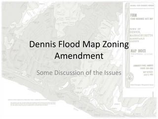
- 1. Dennis Flood Map Zoning Amendment Some Discussion of the Issues
- 2. Some Facts about the Current Maps • Last revised 1992 • Pre-date most electronic mapping capabilities • Do not accurately reflect topography • Provide a false sense of security for home owners
- 3. New Maps • Revision in process since 2009 • Mapping tied to latest GIS mapping capabilities • Topography collected by latest LIDAR technology • Maps better reflect historic flood patterns
- 4. The Changes • Maps extend base flood elevations to appropriate topographical boundaries
- 5. The Changes • Modifies Base Flood Elevation from NGVD29 to NAVD88 a more accurate base elevation • Elevation 0.0 (NAVD88) is about 0.94 ft higher than it was in 1929 (NGVD29). • In most cases old flood elevation 11 (for instance) is now new flood elevation 10. • Old flood elevation 11 that remain 11 equals a 1 foot increase in water levels.
- 6. 90% of Changes are due to extending flood elevations to appropriate contour
- 7. 90% of Changes are due to extending flood elevations to appropriate contour
- 8. 90% of Changes are due to extending flood elevations to appropriate contour
- 9. 90% of Changes are due to extending flood elevations to appropriate contour
- 10. 90% of Changes are due to extending flood elevations to appropriate contour
- 11. 90% of Changes are due to extending flood elevations to appropriate contour
- 12. Ultimately the new flood maps will better reflect hurricane storm surge
- 13. Putting it Into Perspective • In 1944, 238 residences in Dennis were destroyed and an additional 3,898 structures damaged • Only 1,133 structures are currently insured or ¼ of the number damaged in 1944 • The new maps will place about 5,000 structures into the flood zone • Dennis has added 11,000 homes since 1950
- 14. Why We Need to Adopt These Maps • Maintain Dennis Eligibility for National Flood Insurance Program (NFIP) • Loss of NFIP eligibility will eliminate federally backed mortgages within the flood zone. • Over 5,000 properties may be unable to attain conventional financing
- 15. Why We Need to Adopt These Maps • Non-federally backed mortgage companies will still require some form of flood insurance • Private flood insurance will cost more than NFIP backed insurance.
- 16. Why We Need to Adopt These Maps • Town will become ineligible for disaster relief spending such as has gone to Dr. Bottero Road and elsewhere. • Town will become ineligible for pre-disaster relief spending such as is available from time to time to assist in making homes flood zone compliant
- 17. A SIDE NOTE ON NATIONAL FLOOD INSURANCE PROGRAM CHANGES
- 18. “The insurance pool doesn’t just insure that your house can be rebuilt Mary, it helps Mr. Jones and Mr. Smith here too. We all pay into the NFIP to be sure we all have the funds to rebuild later.”
- 19. Flood Insurance in Perspective • 1,133 policies issued in Dennis • $245,632,900 total premium value • $1,312,095 in annual payment to NFIP • Average Premium Value $216,799 • Average Policy Payment $1,158 Source: http://bsa.nfipstat.fema.gov/reports/1011.htm#MAT
- 20. Flood Insurance in Perspective • It would take NFIP minimum of 187 years to recover damages occurring in a 100 year (1%) storm • Since 1976 NFIP has paid out $1,450,308 in damages ($38,166/year) • Annual average payouts extend NFIP risk recovery to 192 years Source: http://bsa.nfipstat.fema.gov/reports/1040.htm#25
- 21. Flood Insurance in Perspective • Congress has adopted guidance calling for an average policy cost cap of 1% of premium value, in Dennis this would mean $2,167 average insurance costs • Guidance would mean a $1,010 average increase phased in over several years • Average annual premium increase would be $208 at the 18% maximum cap ($173 increase at the average recommended increase of 15%)
- 22. Flood Insurance in Perspective • HR 3370 provides properties newly mapped to acquire Preferred Risk Policies prior to July 16 • Preferred Risk Policies can be acquired for $460 for $250,000 coverage for two years. • Policy costs will increase by 18% annually thereafter until full risk
- 23. More information at: HR 3370 Discussion http://dennismaplanningdept.wordpress.com/ Flood Maps Online http://www.mapsonline.net/dennisma/dennisfema2013.html#