
Data, Infrastructures and Geographical Imaginations

ABSTRACT: The central argument of this dissertation is that Canadian reality is conditioned by government data and their related infrastructures. Specifically, that Canadian geographical imaginations are strongly influenced by the Atlas of Canada and the Census of Canada. Both are long standing government institutions that inform government decision-making, and are normally considered to be objective and politically neutral. It is argued that they may also not be entirely politically neutral even though they may not be influenced by partisan politics, because social, technical and scientific institutions nuance objectivity. These institutions or infrastructures recede into the background of government operations, and although invisible, they shape how Canadian geography and society are imagined. Such geographical imaginations, it is argued, are important because they have real material and social effects. In particular, this dissertation empirically examines how the Atlas of Canada and the Census of Canada, as knowledge formation objects and as government representations, affect social and material reality and also normalize subjects. It is also demonstrated that the Ian Hacking dynamic Looping Effect framework of ‘Making Up People’ is not only useful to the human sciences, but is also an effective methodology that geographers can adapt and apply to the study of ‘Making Up Spaces’ and geographical imaginations. His framework was adapted to the study of the six editions of the Atlas of Canada and the Census of Canada between 1871 and 2011. Furthermore, it is shown that the framework also helps structure the critical examination of discourse, in this case, Foucauldian gouvernementalité and the biopower of socio-techno-political systems such as a national atlas and census, which are inextricably embedded in a social, technical and scientific milieu. As objects they both reflect the dominant value system of their society and through daily actions, support the dominance of this value system. While it is people who produce these objects, the infrastructures that operate in the background have technological momentum that also influence actions. Based on the work of Bruno Latour, the Atlas and the Canadian census are proven to be inscriptions that are immutable and mobile, and as such, become actors in other settings. Therefore, the Atlas of Canada and the Census of Canada shape and are shaped by geographical imaginations.

Recommended
Recommended
More Related Content
What's hot
What's hot (20)
Similar to Data, Infrastructures and Geographical Imaginations
Similar to Data, Infrastructures and Geographical Imaginations (20)
More from Communication and Media Studies, Carleton University
More from Communication and Media Studies, Carleton University (20)
Recently uploaded
Recently uploaded (20)
Data, Infrastructures and Geographical Imaginations
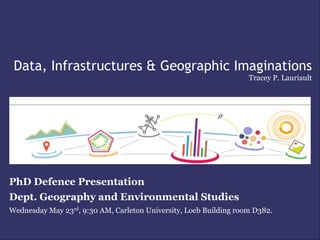
- 1. Data, Infrastructures & Geographic Imaginations Tracey P. Lauriault PhD Defence Presentation Dept. Geography and Environmental Studies Wednesday May 23rd, 9:30 AM, Carleton University, Loeb Building room D382.
- 2. Central Argument Canadian reality is conditioned by government generated data and the related infrastructures that produce them. Data and infrastructures shape and are shaped by geographic imaginations. Geographic imaginations have real material effects as they produce knowledge, spaces and subjects which are acted upon.
- 3. Case Studies • Atlas of Canada • 1906-Present • “ A portrait of Canada ” • Census of Canada • 1871-2011 • “ The stock taking of the people ”
- 4. Lens • Data, maps and infrastructure are socially constructed (Hughes, Hetch & Thad Allen, Marvin & Graham, Star and Ruhleder, Latour) • The Atlas of Canada and census are biopower in action (Foucault) • The Atlas of Canada and the census, and their infrastructures are biopolitical objects which produce subjects to be governed - they are gouvernementale (Foucault)
- 5. Objective Premise: Government manages territory and people, Atlas and census help perform that function by ‘making up spaces and people’ and by doing so constructing geographic imaginations. Empirically assess if the Atlas of Canada and the Census of Canada shape geographical imaginations.
- 6. Methodology • Modify the Ian Hacking framework of dynamically ‘making up people’ • Apply the ‘making up spaces’ modified Hacking framework to the analysis of the Atlas of Canada and the Census of Canada • Critically examine the discourse of data, maps and infrastructure – infrastructural inversion (Bowker)
- 7. Data Data and maps are technological and scientific products, interrogated according to the norms of the scientific messages they convey as well as the social contexts of their emergence, dissemination and use (Pickles, Harley, Latour). • Data and maps are socio-technological objects (Hughes) • Maps & data are knowledge representations, inscriptions and immutable mobiles (Latour) • Maps and data are arrangements of “facts within a specific cultural perspective” (Harley) • Atlas of Canada and Census of Canada are infrastructural work (Curtis)
- 8. Data Infrastructures Technopolitical Regime – grounded in institutions, linked sets of people, engineering and industrial practices, technological artifacts, political programs and institutional ideologies which act together to govern technological development and pursue technopolitics (Hetch) • Story telling system (Kim & Ball-Rokeach) • Implicated in the “cultural construction of space” (Dourish & Bell) • Information ecology (Nardy & O’Day) • Properties of infrastructure – ethnographic view (Star & Ruhleder) • Inscription devices & black box (Latour) • Large technopolitical regimes (Hetch) with momentum (Hughes, Feenberg) exhibiting infrastructural determinism (Lauriault & Lenczner) • Invisible, human built technological fabric of society (Hayes)
- 9. CGDI Is gouvernementale, biopolitical & a socio-technopolitical state formation activity that helps construct geographical imaginations Canadian Geospatial Data Infrastructure (CGDI)
- 10. Geographic Imaginations Joseph Campbell “the society of the Planet” from the Power of the Myth in reference to the Blue Marble Image released by NASA in 1972
- 11. Geographic Imaginations Data as representations/inscriptions of space & infrastructure as spatial practice construct imaginations of space & condition practices in space. “worlds where real elements are arranged and introduced in an interpretable system whereby individuals or collectivities on one side and the earth on the other are harmoniously arranged in a coherent fashion” (Debarbieux) Geography formed an epistemic apparatus of collecting and processing spatial data in the service of the state, theoretical discourse provided the nation with an imaginary identity by interpreting national culture and history as the result of people’s engagement with the singular conditions, structures, and processes of their terrestrial habitats (Tang) Said - Orientalism Wright - Terrae Incognitae Cosgrove - Appollo’s Eye Tang - The Geographic Imagination of Modernity Anderson - Imagined Communities Schulten - The Geographical Imagination in America Lefebvre - The Production of Space 1880-1950 Debarbieux - Imagination et imaginaire géographiques Winichakul - Geo-body
- 12. Hacking – Framework of ‘making up people’ How scientific classification brings into being new kinds of people who conceive and perceive themselves as that kind 1. The category or classification and the category and classification as an object 2. How it came into being 3. How it becomes a convention 4. What is actually being measured 5. And how the thing measured gets put to work
- 13. Hacking ‘Making up People’ Framework 5 Interactive Elements of 7 Engines of Discovery the Looping Effect 3 Derived Engines
- 14. Classification & Material Effects Infirmities Category of Unsound Mind, Schedule 1 Nominal Return of the Living of the 1871 Census, Nova Scotia (CCRI, 2012) Detail of Halifax map extracted from Plate 39, 1st Edition of the Atlas of Canada (1906) showing the location of the Insane and the Poor Asylums
- 15. Resisting a spatial arrangement
- 16. Modified Framework ‘Making up Spaces’ 5 Interactive Elements of 6 Engines of Discovery the Looping Effect 3 Derived Engines
- 17. Examples The World, 2nd Edition Atlas of Canada, Circa 1914
- 18. Atlas of Canada - Case Study
- 19. 1. National Atlas Defined (Harley, Schulten, Ackerman, Monmonier, Salichtchev, Brouillette, IGU, Nicholson, Symons, Taylor, Groot, Edney, Buckley, Vasquez de Maure)
- 20. 2. Atlas of Canada • institutions • scientification • knowledge • normalization • Experts • bureaucratization
- 21. 3. Atlas of Canada Content
- 23. 4 Map Topics Examining the particularities of classifying to assess if spaces were made up, specifically these aspects of the Hacking framework: • counting • quantifying • norms • correlation • taking action and • scientification • 3 derived engines & the 5 elements
- 24. 4. a) Relief 1st Edition 2nd Edition 3rd Edition 6th Edition 4th Edition 5th Edition
- 25. Fremlin’s Relief Profiles, 4th edition
- 26. 4. b) Forest 1st Edition 2nd Edition 3rd Edition 6th Edition 4th Edition 5th Edition
- 27. 4. c) Communication Infrastructure 1st Edition 2nd Edition 3rd Edition 4th Edition 5th Edition
- 28. 4. d) Territorial Evolution 3rd Edition 2nd Edition 1st Edition 4th Edition 5th Edition 6th Edition
- 29. 5 th Edition Treaties Map 5th Edition
- 30. Census of Canada - Case Study
- 31. 1. Census History and Definition
- 32. 2. Census of Canada
- 33. 3. Census of Canada Question
- 34. 4. 2 Topics • Examined 2 classifications across time • All elements & engines of the Hacking’s framework
- 35. 4. a) Citizenship & Immigration
- 36. 4. a) Citizenship & Immigration cntd.
- 37. 4. b) Official Languages
- 38. 4. b) Language cndt.
- 39. Conclusion • Atlas of Canada and ‘making up spaces’ • Census of Canada and ‘making up spaces’ • Socio-Technopolitics, Gouvernementalité and Biopower • Hacking’s Framework and Geography • Contributions to Geography • Conclusion