Aerial Photography Mapping Patrick Coyle, P.E. – Belize Open Source This session will demonstrate Simple Aerial Photography Mapping with Balloons or Kites. Aerial photomaps can be very useful for EWB teams for their projects and the communities they work with. Example applications include: community planning, site planning, land boundary adjudication, agricultural planning, ecological evaluations, and documenting changes such as cutting of rain forest, clearing of land, etc. Weather permitting, we’ll meet outside and discuss how to do the mapping, covering what’s needed to take the photos and use software to stitch them together into a single georegistered photomap. We’ll fly kites or balloons to take pictures and afterwards make and share the map. We’ll briefly discuss advanced topics including integration of gps data, dual-camera based multispectral imagery, 3-D Digital Elevation Models, UAVs and automated image processing. Participants are making map from photos taken during session.
Come Join the Humanitarian OpenStreetMap TeamKate Chapman
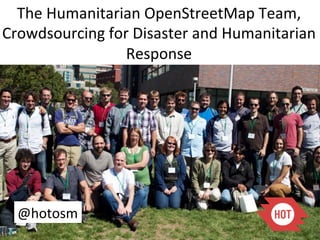
The Humanitarian OpenStreetMap Team uses open source and open data techniques to provide free geographic data in times of crisis and in disaster risk reduction programs.
Local Outreach, Local Communities, World MapKate Chapman
Communities have different personalities and ways to communicating. Spreading interest in OpenStreetMap around the world takes different approaches for different groups. This talk is a look at characteristics of certain existing OSM communities and why some of those approaches won't work elsewhere.
Using OpenStreetMap and QGIS for Community MappingKate Chapman
Over the past year in Indonesia the Humanitarian OpenStreetMap Team has been working with partners from AusAID to teach community mapping utilizing OpenStreetMap and QGIS.
Aerial Photography Mapping Patrick Coyle, P.E. – Belize Open Source This session will demonstrate Simple Aerial Photography Mapping with Balloons or Kites. Aerial photomaps can be very useful for EWB teams for their projects and the communities they work with. Example applications include: community planning, site planning, land boundary adjudication, agricultural planning, ecological evaluations, and documenting changes such as cutting of rain forest, clearing of land, etc. Weather permitting, we’ll meet outside and discuss how to do the mapping, covering what’s needed to take the photos and use software to stitch them together into a single georegistered photomap. We’ll fly kites or balloons to take pictures and afterwards make and share the map. We’ll briefly discuss advanced topics including integration of gps data, dual-camera based multispectral imagery, 3-D Digital Elevation Models, UAVs and automated image processing. Participants are making map from photos taken during session.
Come Join the Humanitarian OpenStreetMap TeamKate Chapman
The Humanitarian OpenStreetMap Team uses open source and open data techniques to provide free geographic data in times of crisis and in disaster risk reduction programs.
Local Outreach, Local Communities, World MapKate Chapman
Communities have different personalities and ways to communicating. Spreading interest in OpenStreetMap around the world takes different approaches for different groups. This talk is a look at characteristics of certain existing OSM communities and why some of those approaches won't work elsewhere.
Using OpenStreetMap and QGIS for Community MappingKate Chapman
Over the past year in Indonesia the Humanitarian OpenStreetMap Team has been working with partners from AusAID to teach community mapping utilizing OpenStreetMap and QGIS.
The User-participated Geospatial Web as Open PlatformChanny Yun
It's presentation of speaking in GIS International Seminar in Korea. You can refer to my full document in http://channy.creation.net/blog/data/channy/gis-seminar-2007.pdf
OGC Update for State of Geospatial Tech at T-RexGeorge Percivall
An update on OGC activities in three time horizons: Now, Next and After Next. Finishing with how to keep updated on OGC activities.
Now
Recently approved OGC standards
Implementation of approved standards
Next
Standards Program
Innovation Program
After Next
Tech Forecast
How to keep in touch
Volunteered Geographic Information and OpenStreetMapchippy
Short introduction to the subject of Volunteered Geographic Information and outlining some of the characteristics, issues themes of VGI
and then a comprehensive talk about the OpenStreetMap Project.
By Tim Waters, at AGI Northern Group (SIG), April 2009, Manchester University
Encry-Pixel: A Novel Approach Towards Locational Privacy Enhancement in ImagesSoumyaShaw4
We attempt to mystify the metadata that includes the location coordinates to address the privacy concern. We put forward an algorithm that performs randomized location hopping to compromise the algorithms targeted to extract sensitive data. The idea is to hide sensitive information that might be used otherwise without user knowledge.
Presented by Stanley Wood (IFPRI/HarvestChoice) at the CGIAR-CSI Annual Meeting 2009: Mapping Our Future. March 31 - April 4, 2009, ILRI Campus, Nairobi, Kenya
A Visualization Application On AppEngine (Google Cloud)surprisedcloud
This presentation walks you through the possibilities of creating a visualization application on top of AppEngine (Google PaaS).This also demonstrates the technologies that are used during the making of this application called InnovatorWatcher.The next series of slides would walk you through the InnovatorWatcher application.For details visit www.surprisedcloud.com
From the time when digital maps was not mainstream and around 1918 when the WWII had
employed pigeons to capture the aerial pictures, the evolution of gathering aerial photos of
the earth has gone many technical advancements.
So we must believe there would be major uses of the earth imagery and hence we would
explore why it is important for enterprises. Additionally, why and what those technical
advancements are and take a dive deep for enterprise users to help make a decision.
Building a Community: Humanitarian OpenStreetMap Team in IndonesiaKate Chapman
Three years ago the Humanitarian OpenStreetMap Team began work in Indonesia to support the new community there. This presentation reviews what they learned and what is happening going forward.
OpenStreetMap for Resilience, Response and RecoveryKate Chapman
OpenStreetMap for Resilience, Response and Recovery presentation given at the World Bank in Manila as part of a workshop entitled: Participatory Mapping with OpenStreetMap for Disaster Resilience , and Community based Recovery and Reconstruction Planning
Community Mapping using OpenStreetMap in Indonesia -Feb UpdateKate Chapman
Update on the progress of community mapping for exposure in Indonesia. Includes the software created, communities worked with as well as preliminary results of the academic evaluation o the data.
Enabling Collaborative Analytics for Faster Answers in CrisisKate Chapman
The value of crowd-sourcing for data collection has been well-proven. What about enabling the crowd to perform analysis? This allows more data to be analyzed and faster results to be obtained.
Essentials of Automations: The Art of Triggers and Actions in FMESafe Software
In this second installment of our Essentials of Automations webinar series, we’ll explore the landscape of triggers and actions, guiding you through the nuances of authoring and adapting workspaces for seamless automations. Gain an understanding of the full spectrum of triggers and actions available in FME, empowering you to enhance your workspaces for efficient automation.
We’ll kick things off by showcasing the most commonly used event-based triggers, introducing you to various automation workflows like manual triggers, schedules, directory watchers, and more. Plus, see how these elements play out in real scenarios.
Whether you’re tweaking your current setup or building from the ground up, this session will arm you with the tools and insights needed to transform your FME usage into a powerhouse of productivity. Join us to discover effective strategies that simplify complex processes, enhancing your productivity and transforming your data management practices with FME. Let’s turn complexity into clarity and make your workspaces work wonders!
Dr. Sean Tan, Head of Data Science, Changi Airport Group
Discover how Changi Airport Group (CAG) leverages graph technologies and generative AI to revolutionize their search capabilities. This session delves into the unique search needs of CAG’s diverse passengers and customers, showcasing how graph data structures enhance the accuracy and relevance of AI-generated search results, mitigating the risk of “hallucinations” and improving the overall customer journey.
Observability Concepts EVERY Developer Should Know -- DeveloperWeek Europe.pdfPaige Cruz
Monitoring and observability aren’t traditionally found in software curriculums and many of us cobble this knowledge together from whatever vendor or ecosystem we were first introduced to and whatever is a part of your current company’s observability stack.
While the dev and ops silo continues to crumble….many organizations still relegate monitoring & observability as the purview of ops, infra and SRE teams. This is a mistake - achieving a highly observable system requires collaboration up and down the stack.
I, a former op, would like to extend an invitation to all application developers to join the observability party will share these foundational concepts to build on:
In his public lecture, Christian Timmerer provides insights into the fascinating history of video streaming, starting from its humble beginnings before YouTube to the groundbreaking technologies that now dominate platforms like Netflix and ORF ON. Timmerer also presents provocative contributions of his own that have significantly influenced the industry. He concludes by looking at future challenges and invites the audience to join in a discussion.
State of ICS and IoT Cyber Threat Landscape Report 2024 previewPrayukth K V
The IoT and OT threat landscape report has been prepared by the Threat Research Team at Sectrio using data from Sectrio, cyber threat intelligence farming facilities spread across over 85 cities around the world. In addition, Sectrio also runs AI-based advanced threat and payload engagement facilities that serve as sinks to attract and engage sophisticated threat actors, and newer malware including new variants and latent threats that are at an earlier stage of development.
The latest edition of the OT/ICS and IoT security Threat Landscape Report 2024 also covers:
State of global ICS asset and network exposure
Sectoral targets and attacks as well as the cost of ransom
Global APT activity, AI usage, actor and tactic profiles, and implications
Rise in volumes of AI-powered cyberattacks
Major cyber events in 2024
Malware and malicious payload trends
Cyberattack types and targets
Vulnerability exploit attempts on CVEs
Attacks on counties – USA
Expansion of bot farms – how, where, and why
In-depth analysis of the cyber threat landscape across North America, South America, Europe, APAC, and the Middle East
Why are attacks on smart factories rising?
Cyber risk predictions
Axis of attacks – Europe
Systemic attacks in the Middle East
Download the full report from here:
https://sectrio.com/resources/ot-threat-landscape-reports/sectrio-releases-ot-ics-and-iot-security-threat-landscape-report-2024/
The Art of the Pitch: WordPress Relationships and SalesLaura Byrne
Clients don’t know what they don’t know. What web solutions are right for them? How does WordPress come into the picture? How do you make sure you understand scope and timeline? What do you do if sometime changes?
All these questions and more will be explored as we talk about matching clients’ needs with what your agency offers without pulling teeth or pulling your hair out. Practical tips, and strategies for successful relationship building that leads to closing the deal.
LF Energy Webinar: Electrical Grid Modelling and Simulation Through PowSyBl -...DanBrown980551
Do you want to learn how to model and simulate an electrical network from scratch in under an hour?
Then welcome to this PowSyBl workshop, hosted by Rte, the French Transmission System Operator (TSO)!
During the webinar, you will discover the PowSyBl ecosystem as well as handle and study an electrical network through an interactive Python notebook.
PowSyBl is an open source project hosted by LF Energy, which offers a comprehensive set of features for electrical grid modelling and simulation. Among other advanced features, PowSyBl provides:
- A fully editable and extendable library for grid component modelling;
- Visualization tools to display your network;
- Grid simulation tools, such as power flows, security analyses (with or without remedial actions) and sensitivity analyses;
The framework is mostly written in Java, with a Python binding so that Python developers can access PowSyBl functionalities as well.
What you will learn during the webinar:
- For beginners: discover PowSyBl's functionalities through a quick general presentation and the notebook, without needing any expert coding skills;
- For advanced developers: master the skills to efficiently apply PowSyBl functionalities to your real-world scenarios.
Securing your Kubernetes cluster_ a step-by-step guide to success !KatiaHIMEUR1
Today, after several years of existence, an extremely active community and an ultra-dynamic ecosystem, Kubernetes has established itself as the de facto standard in container orchestration. Thanks to a wide range of managed services, it has never been so easy to set up a ready-to-use Kubernetes cluster.
However, this ease of use means that the subject of security in Kubernetes is often left for later, or even neglected. This exposes companies to significant risks.
In this talk, I'll show you step-by-step how to secure your Kubernetes cluster for greater peace of mind and reliability.
A tale of scale & speed: How the US Navy is enabling software delivery from l...sonjaschweigert1
Rapid and secure feature delivery is a goal across every application team and every branch of the DoD. The Navy’s DevSecOps platform, Party Barge, has achieved:
- Reduction in onboarding time from 5 weeks to 1 day
- Improved developer experience and productivity through actionable findings and reduction of false positives
- Maintenance of superior security standards and inherent policy enforcement with Authorization to Operate (ATO)
Development teams can ship efficiently and ensure applications are cyber ready for Navy Authorizing Officials (AOs). In this webinar, Sigma Defense and Anchore will give attendees a look behind the scenes and demo secure pipeline automation and security artifacts that speed up application ATO and time to production.
We will cover:
- How to remove silos in DevSecOps
- How to build efficient development pipeline roles and component templates
- How to deliver security artifacts that matter for ATO’s (SBOMs, vulnerability reports, and policy evidence)
- How to streamline operations with automated policy checks on container images
PHP Frameworks: I want to break free (IPC Berlin 2024)Ralf Eggert
In this presentation, we examine the challenges and limitations of relying too heavily on PHP frameworks in web development. We discuss the history of PHP and its frameworks to understand how this dependence has evolved. The focus will be on providing concrete tips and strategies to reduce reliance on these frameworks, based on real-world examples and practical considerations. The goal is to equip developers with the skills and knowledge to create more flexible and future-proof web applications. We'll explore the importance of maintaining autonomy in a rapidly changing tech landscape and how to make informed decisions in PHP development.
This talk is aimed at encouraging a more independent approach to using PHP frameworks, moving towards a more flexible and future-proof approach to PHP development.
Pushing the limits of ePRTC: 100ns holdover for 100 daysAdtran
At WSTS 2024, Alon Stern explored the topic of parametric holdover and explained how recent research findings can be implemented in real-world PNT networks to achieve 100 nanoseconds of accuracy for up to 100 days.
GraphSummit Singapore | The Future of Agility: Supercharging Digital Transfor...Neo4j
Leonard Jayamohan, Partner & Generative AI Lead, Deloitte
This keynote will reveal how Deloitte leverages Neo4j’s graph power for groundbreaking digital twin solutions, achieving a staggering 100x performance boost. Discover the essential role knowledge graphs play in successful generative AI implementations. Plus, get an exclusive look at an innovative Neo4j + Generative AI solution Deloitte is developing in-house.
3. History
*
Founded
in
the
United
Kingdom
in
2004
by
Steve
Coast
*
Ordnance
Survey
Data
was
Expensive
to
Use
*
July
2005
the
First
Mapping
Party
Takes
Place
5. Why
do
we
need
a
Humanitarian
OpenStreetMap
Team?
6. What is the Humanitarian OpenStreetMap Team?
An organization working to promote the
use of open data and volunteered
geographic information within the
humanitarian and development contexts
7. OSM and Crisis Response in Haiti
Port-au-Prince
Before
28 Days Later
http://vimeo.com/
9182869
8.
9. High level imagery timely released under an
“attribution only” license
Google//GeoEye
DigitalGlobe
World
Bank
(ImageCAT
GFDRR),
SpotImage
CIA
Raw imagery processed into tiles to be made available in OSM editors (potlatch,
merkator & josm)
Hundreds traced 24/7 over base map features, humanitarian features (camps) & also
damages
Incentive for sharing restricted vector data sets
Foster quality of field collection activities
10. Database import compatible with OSM license
(CC-SA. OdbL).
PREPAREDNESS : only public domain data from UNJLC/LogCluster
deployment Sept/Oct 2008 Cyclone Response-
Haiti REPONSE: Base map layers (MINUSTAH/ CNIGS), Health Facility
(PAHO), Haiti damage assessment: ITHACA & UNOSAT….
11. Community
640 mappers
24/7
month
Capacity building
to other VCT
through crisis
camp;
marginal
47. Na^onal
Disaster
Management
Agency
(BNPB)
Regional
Disaster
Management
Agency
(BPBD)
United
Na^ons
Office
for
Coordina^on
of
Humanitarian
Affairs
World
Bank
AusAID
–
Australia-‐Indonesia
Facility
for
Disaster
Reduc^on
Humanitarian
OpenStreetMap
Team
University
of
Indonesia
48. 267
Villages
3
Maps
for
Each
Village
Lots
and
lots
of
prinCng…
Lots
and
lots
of
students
62. Draft Workflow for
Satellite Imagery and OSM Data
Draft Imagery Release Process from USG Lead Federal Agencies to VTCs under the NEXTVIEW License !
EQ 8.4 in Sumatra @ 1336 GMT!
USG requests satellite
vendors for imagery VTC!Request!Schema!
under NextView or! 1. Supported!Operation!
license! 2. Geographic!Bounds!
3. Temporal!Bounds!
Humanitarian 4. Reason!for!Use. What
LFA requests that OpenStreetMap
HOT create vectors for analytical problem needs to
Team (HOT)
DG and GeoEye post-EQ imagery and be solved?!
requests imagery
collect imagery of damage, IDs key AOIs ! 5. License!for!derived!
from Broker! remand!
affected AOI ! works. Will the data be a
public or orivste good?!
6. Partners. Who will
Broker ensures benefit?!
request is valid ! 7. Objective: how will the
data be used to do what!
remand!
Broker forwards
NGA receives imagery request to LFA!
VTC!Request!Evaluation!
from DG and/or Criteria!
GeoEye! 1. Goverment Interest. Is the
request in the interest of the
LFA evaluates
USG?!
requests against VTC
2. Gap. What information
criteria!
gap will be filled?!
3. Trust. Does the USG trust
this VTC with data?!
LFA forwards request remand! 4. Host nation. Does the
to NGA! host nation have issues with