Download to read offline
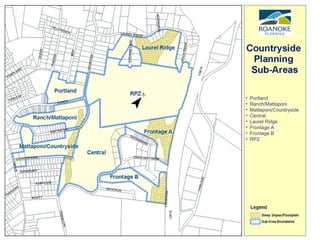
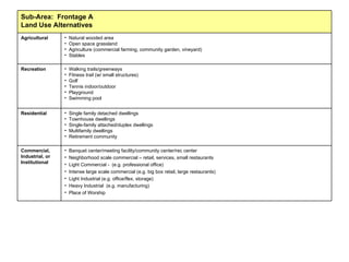
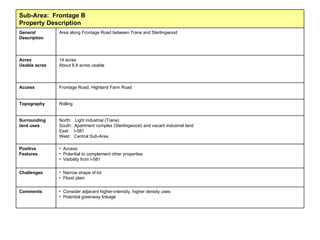
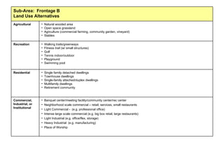
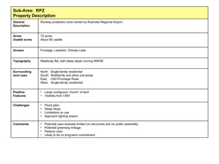
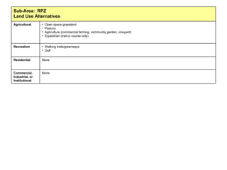
![Countryside Planning Sub-area Review As an initial step in planning, we identified eight sub-areas and reviewed information about each area. Land use alternatives are also listed for each sub-area. The last two slides depict Land Use Appropriateness . Here, we listed potential uses identified through public and stakeholder input sessions, then indicate if the land use is appropriate in each Sub-area. Note that the feasibility of the uses has not yet been considered. Contents of this presentation Sub-area Map Tables: Information about each sub-area Tables: Land Use Appropriateness The contents of this presentation are for public review. We welcome your comments and questions. Chris Chittum, AICP Planning Administrator [email_address] (540) 853-2356](https://image.slidesharecdn.com/countrysidesubareareview-100823135145-phpapp02/85/Countryside-Planning-Presentation-1-320.jpg)
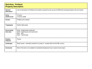
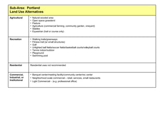
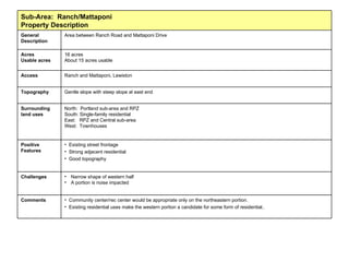
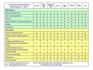
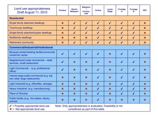

The document outlines a review of eight sub-areas for countryside planning, detailing potential land uses and their appropriateness based on public and stakeholder input. It discusses challenges and positive features for each area while emphasizing that feasibility has not yet been assessed. Each sub-area's characteristics, including suitability for residential, commercial, agricultural, and recreational uses, are included for public review and feedback.


