Cosit2015
•Download as PPTX, PDF•
0 likes•29 views

This document discusses teaching students about the complexities of map boundaries and categories. It notes that while political boundaries may seem straightforward, defining plant communities and ecoregions requires considering factors like structure, floristics, and geomorphology. The document also mentions using landscape metrics to analyze classified land and testing hypotheses about map categories versus other possibilities.
Report
Share
Report
Share

Recommended
The characterisation of “living” landscapes: the role of mixed descriptors an...
The characterisation of “living” landscapes: the role of mixed descriptors and volunteering geographic information
Ernesto Marcheggiani, Hubert Gulinck - Katholieke Universiteit Leuven
Andrea Galli - Polytechnic University of Marche
Enhancing Student Interaction Using Packback© AI Tools:
An Online World Regio...
This document describes how the Packback AI tool enhances student interaction and moderates online discussions. The AI provides real-time feedback to help students improve their writing. If a post is moderated, the student receives coaching and is prompted to revise. The AI also suggests top student posts for instructors to feature and provides weekly insight reports on the discussion community's health.
Transitioning to a Geographically Literate Society
This document discusses the importance of geographic literacy in society. It notes that geography broadens intellectual outlook and appreciation of the world. It then provides examples of how a lack of geographic knowledge can cause problems, such as with understanding climate change issues or locating places. The document also explains how organizations like National Geographic, the National Council for Geographic Education, and ESRI are working to improve geographic education through initiatives like GIS curriculum and professional development courses. The overall summary is that geography education is important but needs more support to transition society to being more geographically literate.
Innovations and Adaptations in Online Geography Education
This document discusses using online and experiential learning tools to teach geography. It covers learning styles, Kolb's experiential learning theory, and using virtual worlds like Second Life for hands-on learning. It proposes using quest-based learning and an AI system to provide feedback on student posts. The AI would score posts for "curiosity", flag low-quality posts, and suggest high-scoring posts for instructors to feature. Weekly reports would provide insights to instructors on discussion participation, post quality, and recommendations. Student reactions were mixed - they liked features for curiosity and interactions but disliked paying separately and lack of LMS integration.
Aag 2017
The document summarizes topics from the 2017 AAG Annual Meeting in Boston, including:
1. Exploring abandoned GIS research to augment applied geography education.
2. Comparing groundwater DRASTIC maps and clarifying that polygon numbers refer to ID codes, not DRASTIC ratings.
3. How a retrospective approach can yield new ways to add to GIS technology, data, knowledge, applications, and research methods.
Geographers and the OSS
Richard Hartshorne, a professor at the University of Wisconsin-Madison, was appointed to head the Geography Division of the newly created Branch of Research and Analysis in the Office of Strategic Services (OSS). Geographers in the OSS developed unique map production systems and analyzed over 2 million maps, 300,000 photos, and hundreds of thousands of documents to support intelligence and mission planning efforts. After the war, many OSS geographers returned to academia, applying the skills they developed to research and teaching.
DeMers FOP_2019
This short document discusses geographic research and provides contact information for Prof. Michael DeMers. It asks what the professor is currently working on and invites any questions from the reader.
AAG 2019
The document discusses a quest-based GIS course taken by pre-service teacher candidates. It found that students engaged in quest-based learning where they had choice in curricular interactions. A key finding was that students remained persistent in their learning even after earning an "A" grade in the course.
Ncge igu 2018
The Teachers Teaching Teachers Institute (T3G) provided GIS professional development to educators from 2009-2018. The purpose was to assess the impact on educator practice. The program equipped educators to teach GIS concepts, create GIS curricula, and promote GIS use. A survey found it successfully enabled educators across levels and institutions to teach with GIS. While the program evolved, it generally achieved its goals and suggested best practices for future GIS professional development.
T3g pd gis_presentation_aag2018_final
This document summarizes a multi-year professional development institute (T3G) for educators in GIS. The T3G aimed to teach educators how to teach GIS to other educators and apply it in their classrooms. A survey of T3G participants found that it helped educators learn GIS skills and concepts to incorporate into their teaching. While the T3G evolved over time, the survey showed it successfully enabled educators across disciplines and levels to teach with GIS. The study concludes by calling for more research on the effectiveness of GIS professional development programs.
Ncge 2017
A study examined student ratings of a quest-based learning (QBL) GIS course to evaluate learner motivation and effectiveness. Students were asked to complete an upcoming survey about how they managed their time, chose quests, approached scores/leaderboards/badges, reacted to feedback, and their overall reactions to the QBL course structure. The survey also asked students to rate how much they learned compared to other online classes, their views on the effort required for quest points, and their overall experience in the QBL course. Finally, students were asked if they would be willing to participate in an interview about the course.
Ncge2016 final(complete)
This document introduces using virtual reality in geography classrooms. It discusses how virtual reality can provide situated cognition, active learning, and social interaction. It provides details on virtual reality hardware like Google Cardboard and apps that are available. The advantages of virtual reality for education include being highly motivating and engaging for students, allowing active participation and learning at their own pace. Potential disadvantages include costs, availability of equipment, and concerns about health, safety, and educator reluctance.
Ncge 2015
This document discusses using a quest-based learning approach for K-12 GIS professional development. It notes that quest-based learning uses leaderboards and points to motivate students, grading their performance on a scale from 0-100% rather than with traditional letter grades. The goal is to encourage life-long learning beyond formal schooling.
Agc 2015
Applied geography became less emphasized in U.S. academia following World War II, especially at Ivy League schools that focused more on theory over practice. To legitimize applied geography, the author argues geography must re-emphasize the complement of theory and application through testing, reinvigorate place-based studies, engage more in applied work instead of just discussing it, and reengage with the scientific method rather than just social theory.
Aag 2017
The document summarizes topics from the AAG Annual Meeting in Boston from April 5-9, 2017. It discusses exploring abandoned GIS research to augment applied geography education. It provides examples of comparing ground water DRASTIC maps and what can be derived from a retrospective approach to GIS technology. It also outlines topical GIS research areas and how GIS technology and GIScience can be used, including through integrated terrain units, biophysical units, and land use allocation models. Finally, it raises the question of how to teach these topics.
Auto carto
This document discusses using fuzzy set membership and support logic to perform areal differentiation. Fuzzy set membership allows for partial membership in sets rather than binary membership. Support logic is then used to determine the degree to which data supports or refutes hypotheses about spatial patterns and relationships. Together, fuzzy set membership and support logic provide a way to analyze geographic data and identify spatial patterns and relationships in a more nuanced way than traditional binary methods.
NCGE 2016
This document discusses introducing virtual reality in geography classrooms. It notes that virtual reality involves immersing users in simulated environments using technology that engages multiple senses. It lists advantages like being highly motivating and engaging for students, allowing for active participation and discovery at their own pace. Disadvantages mentioned include the affordability, availability, and ease of use of virtual reality technology, as well as potential questions around its appropriate and safe use and educator reluctance.
NMGIC fall 2017
Rapid mapping techniques were used to classify ecoregions in arid lands. Michael DeMers of New Mexico State University's Department of Geography presented on this topic at the New Mexico Geographic Information Council's fall meeting on October 27, 2017 in Albuquerque, New Mexico. The presentation provided an overview of using rapid mapping to classify ecoregions in arid environments.
Learner Motivation and Effectiveness of a Quest-Based Learning GIS Course
Through review of individual questions (assignments) in a Quest-Based GIS course, I will ascertain the degree to which each provides a "satisfactory" learning experience as viewed by the learners. A final survey will evaluate learner overall satisfaction. I will also monitor time-on-task, pacing, and timing of quests, selection of optional quests, textual analysis of answers, and other course-related statistics and correlate them to final grades.
Exploring Abandoned GIS Research to Augment Applied Geography Education
Applied geography has enjoyed a resurgence since the increased availabilty of geospatial software and the advancement of an ever-increasing sophistication of these analytical tools designed to solve complex geospatial problems. These advancements have quickly been translated into coursework at colleges and universities – often adopted wholesale into complete applied geography programs throughout academia. One unintended consequence of this adoption is that much of the conceptual content responsible for the development of these tools is not covered in the applied geography coursework. In many cases the conceptual frameworks were chosen more out of expediency rather than geographical foundations, thus leaving the applied geography student with the misconception that the fundamental geographic underpinnings upon which the software is based, are thoroughly understood and extensively tested. A direct result of this is that students in applied geography programs often employ the tools with little or no understanding of their limitations for modeling real geographic processes. I propose that one aspect of an applied geography curriculum must include the study of the underlying principles upon which the software is based, and perhaps more importantly, the study of concepts that were abandoned in the early days of tool development. While this is obvious for programs that emphasize the more theoretical aspects of geography, I argue that it is equally important for those who use the tools so they are aware of the fundamental limitations of the results derived from analysis.
NMFWA ArcHydro: An Introduction
A general description of the tools and the NMSU geography educational resources available to New Mexico Flood Waters Association personnel.
Areal Differentiation Using Fuzzy Set Membership and Support Logic
This document discusses using fuzzy set membership and support logic to perform areal differentiation. Fuzzy set membership allows for partial membership in sets rather than binary membership. Support logic uses fuzzy set membership to determine the degree to which data supports hypotheses about spatial patterns or relationships. This approach provides a way to systematically analyze areal units and identify differentiated spaces using fuzzy set theory.
Teaching the Complexities of Map Boundaries
This document discusses teaching students about the complexities of map boundaries and categories. It notes that while political boundaries may seem straightforward, defining plant communities and ecoregions requires considering factors like structure, floristics, and geomorphology. The document also mentions using landscape metrics to analyze classified land and testing hypotheses about map categories versus other possibilities.
Categorical Boundary Analysis: Sorting Out Terminology and Methodologies
This document discusses different methodologies for analyzing categorical boundaries in land classification. It introduces key terminology used in categorical boundary analysis, such as plant communities, ecoregions, and geomorphology-based vegetation classes. The document also mentions using landscape metrics to analyze classified land and testing hypotheses about map categories.
Gamifying a University Level GIS Course
A university level GIS course was gamified by incorporating elements like points, levels, badges, leaderboards, and quests to motivate students. Students were awarded points for completing assignments, with more points leading to higher grades from A to F. Quests provided structured learning paths while leaderboards and ranks created friendly competition. This gamified approach aimed to make the course content more engaging and encourage life-long learning beyond just grades.
Quest-Based Professional Development
This document discusses using a quest-based learning approach for K-12 GIS professional development. It notes that a quest-based model uses leaderboards and points to motivate learning, assessing progress on a scale from 0% to 100% rather than traditional grades. The goal is to encourage life-long learning beyond the traditional school setting.
Introducing Virtual Reality in Your Geography Classroom
This document introduces using virtual reality in geography classrooms. It discusses how virtual reality can provide situated cognition, active learning, and social interaction. It provides details on virtual reality hardware like Google Cardboard and apps that are available. The advantages of virtual reality for education include being highly motivating and engaging for students, allowing active participation and learning at their own pace. Potential disadvantages include costs, availability of equipment, and concerns about health, safety, and educator reluctance.
Immersive Virtual Body of Knowledge
A presentation of research regarding developing an immersive environment to deliver the UCGIS Body of Knowledge
How to Add Chatter in the odoo 17 ERP Module
In Odoo, the chatter is like a chat tool that helps you work together on records. You can leave notes and track things, making it easier to talk with your team and partners. Inside chatter, all communication history, activity, and changes will be displayed.
Pengantar Penggunaan Flutter - Dart programming language1.pptx
Pengantar Penggunaan Flutter - Dart programming language1.pptx
More Related Content
More from Michael DeMers
Ncge igu 2018
The Teachers Teaching Teachers Institute (T3G) provided GIS professional development to educators from 2009-2018. The purpose was to assess the impact on educator practice. The program equipped educators to teach GIS concepts, create GIS curricula, and promote GIS use. A survey found it successfully enabled educators across levels and institutions to teach with GIS. While the program evolved, it generally achieved its goals and suggested best practices for future GIS professional development.
T3g pd gis_presentation_aag2018_final
This document summarizes a multi-year professional development institute (T3G) for educators in GIS. The T3G aimed to teach educators how to teach GIS to other educators and apply it in their classrooms. A survey of T3G participants found that it helped educators learn GIS skills and concepts to incorporate into their teaching. While the T3G evolved over time, the survey showed it successfully enabled educators across disciplines and levels to teach with GIS. The study concludes by calling for more research on the effectiveness of GIS professional development programs.
Ncge 2017
A study examined student ratings of a quest-based learning (QBL) GIS course to evaluate learner motivation and effectiveness. Students were asked to complete an upcoming survey about how they managed their time, chose quests, approached scores/leaderboards/badges, reacted to feedback, and their overall reactions to the QBL course structure. The survey also asked students to rate how much they learned compared to other online classes, their views on the effort required for quest points, and their overall experience in the QBL course. Finally, students were asked if they would be willing to participate in an interview about the course.
Ncge2016 final(complete)
This document introduces using virtual reality in geography classrooms. It discusses how virtual reality can provide situated cognition, active learning, and social interaction. It provides details on virtual reality hardware like Google Cardboard and apps that are available. The advantages of virtual reality for education include being highly motivating and engaging for students, allowing active participation and learning at their own pace. Potential disadvantages include costs, availability of equipment, and concerns about health, safety, and educator reluctance.
Ncge 2015
This document discusses using a quest-based learning approach for K-12 GIS professional development. It notes that quest-based learning uses leaderboards and points to motivate students, grading their performance on a scale from 0-100% rather than with traditional letter grades. The goal is to encourage life-long learning beyond formal schooling.
Agc 2015
Applied geography became less emphasized in U.S. academia following World War II, especially at Ivy League schools that focused more on theory over practice. To legitimize applied geography, the author argues geography must re-emphasize the complement of theory and application through testing, reinvigorate place-based studies, engage more in applied work instead of just discussing it, and reengage with the scientific method rather than just social theory.
Aag 2017
The document summarizes topics from the AAG Annual Meeting in Boston from April 5-9, 2017. It discusses exploring abandoned GIS research to augment applied geography education. It provides examples of comparing ground water DRASTIC maps and what can be derived from a retrospective approach to GIS technology. It also outlines topical GIS research areas and how GIS technology and GIScience can be used, including through integrated terrain units, biophysical units, and land use allocation models. Finally, it raises the question of how to teach these topics.
Auto carto
This document discusses using fuzzy set membership and support logic to perform areal differentiation. Fuzzy set membership allows for partial membership in sets rather than binary membership. Support logic is then used to determine the degree to which data supports or refutes hypotheses about spatial patterns and relationships. Together, fuzzy set membership and support logic provide a way to analyze geographic data and identify spatial patterns and relationships in a more nuanced way than traditional binary methods.
NCGE 2016
This document discusses introducing virtual reality in geography classrooms. It notes that virtual reality involves immersing users in simulated environments using technology that engages multiple senses. It lists advantages like being highly motivating and engaging for students, allowing for active participation and discovery at their own pace. Disadvantages mentioned include the affordability, availability, and ease of use of virtual reality technology, as well as potential questions around its appropriate and safe use and educator reluctance.
NMGIC fall 2017
Rapid mapping techniques were used to classify ecoregions in arid lands. Michael DeMers of New Mexico State University's Department of Geography presented on this topic at the New Mexico Geographic Information Council's fall meeting on October 27, 2017 in Albuquerque, New Mexico. The presentation provided an overview of using rapid mapping to classify ecoregions in arid environments.
Learner Motivation and Effectiveness of a Quest-Based Learning GIS Course
Through review of individual questions (assignments) in a Quest-Based GIS course, I will ascertain the degree to which each provides a "satisfactory" learning experience as viewed by the learners. A final survey will evaluate learner overall satisfaction. I will also monitor time-on-task, pacing, and timing of quests, selection of optional quests, textual analysis of answers, and other course-related statistics and correlate them to final grades.
Exploring Abandoned GIS Research to Augment Applied Geography Education
Applied geography has enjoyed a resurgence since the increased availabilty of geospatial software and the advancement of an ever-increasing sophistication of these analytical tools designed to solve complex geospatial problems. These advancements have quickly been translated into coursework at colleges and universities – often adopted wholesale into complete applied geography programs throughout academia. One unintended consequence of this adoption is that much of the conceptual content responsible for the development of these tools is not covered in the applied geography coursework. In many cases the conceptual frameworks were chosen more out of expediency rather than geographical foundations, thus leaving the applied geography student with the misconception that the fundamental geographic underpinnings upon which the software is based, are thoroughly understood and extensively tested. A direct result of this is that students in applied geography programs often employ the tools with little or no understanding of their limitations for modeling real geographic processes. I propose that one aspect of an applied geography curriculum must include the study of the underlying principles upon which the software is based, and perhaps more importantly, the study of concepts that were abandoned in the early days of tool development. While this is obvious for programs that emphasize the more theoretical aspects of geography, I argue that it is equally important for those who use the tools so they are aware of the fundamental limitations of the results derived from analysis.
NMFWA ArcHydro: An Introduction
A general description of the tools and the NMSU geography educational resources available to New Mexico Flood Waters Association personnel.
Areal Differentiation Using Fuzzy Set Membership and Support Logic
This document discusses using fuzzy set membership and support logic to perform areal differentiation. Fuzzy set membership allows for partial membership in sets rather than binary membership. Support logic uses fuzzy set membership to determine the degree to which data supports hypotheses about spatial patterns or relationships. This approach provides a way to systematically analyze areal units and identify differentiated spaces using fuzzy set theory.
Teaching the Complexities of Map Boundaries
This document discusses teaching students about the complexities of map boundaries and categories. It notes that while political boundaries may seem straightforward, defining plant communities and ecoregions requires considering factors like structure, floristics, and geomorphology. The document also mentions using landscape metrics to analyze classified land and testing hypotheses about map categories versus other possibilities.
Categorical Boundary Analysis: Sorting Out Terminology and Methodologies
This document discusses different methodologies for analyzing categorical boundaries in land classification. It introduces key terminology used in categorical boundary analysis, such as plant communities, ecoregions, and geomorphology-based vegetation classes. The document also mentions using landscape metrics to analyze classified land and testing hypotheses about map categories.
Gamifying a University Level GIS Course
A university level GIS course was gamified by incorporating elements like points, levels, badges, leaderboards, and quests to motivate students. Students were awarded points for completing assignments, with more points leading to higher grades from A to F. Quests provided structured learning paths while leaderboards and ranks created friendly competition. This gamified approach aimed to make the course content more engaging and encourage life-long learning beyond just grades.
Quest-Based Professional Development
This document discusses using a quest-based learning approach for K-12 GIS professional development. It notes that a quest-based model uses leaderboards and points to motivate learning, assessing progress on a scale from 0% to 100% rather than traditional grades. The goal is to encourage life-long learning beyond the traditional school setting.
Introducing Virtual Reality in Your Geography Classroom
This document introduces using virtual reality in geography classrooms. It discusses how virtual reality can provide situated cognition, active learning, and social interaction. It provides details on virtual reality hardware like Google Cardboard and apps that are available. The advantages of virtual reality for education include being highly motivating and engaging for students, allowing active participation and learning at their own pace. Potential disadvantages include costs, availability of equipment, and concerns about health, safety, and educator reluctance.
Immersive Virtual Body of Knowledge
A presentation of research regarding developing an immersive environment to deliver the UCGIS Body of Knowledge
More from Michael DeMers (20)
Learner Motivation and Effectiveness of a Quest-Based Learning GIS Course
Learner Motivation and Effectiveness of a Quest-Based Learning GIS Course
Exploring Abandoned GIS Research to Augment Applied Geography Education
Exploring Abandoned GIS Research to Augment Applied Geography Education
Areal Differentiation Using Fuzzy Set Membership and Support Logic
Areal Differentiation Using Fuzzy Set Membership and Support Logic
Categorical Boundary Analysis: Sorting Out Terminology and Methodologies
Categorical Boundary Analysis: Sorting Out Terminology and Methodologies
Introducing Virtual Reality in Your Geography Classroom
Introducing Virtual Reality in Your Geography Classroom
Recently uploaded
How to Add Chatter in the odoo 17 ERP Module
In Odoo, the chatter is like a chat tool that helps you work together on records. You can leave notes and track things, making it easier to talk with your team and partners. Inside chatter, all communication history, activity, and changes will be displayed.
Pengantar Penggunaan Flutter - Dart programming language1.pptx
Pengantar Penggunaan Flutter - Dart programming language1.pptx
ISO/IEC 27001, ISO/IEC 42001, and GDPR: Best Practices for Implementation and...
Denis is a dynamic and results-driven Chief Information Officer (CIO) with a distinguished career spanning information systems analysis and technical project management. With a proven track record of spearheading the design and delivery of cutting-edge Information Management solutions, he has consistently elevated business operations, streamlined reporting functions, and maximized process efficiency.
Certified as an ISO/IEC 27001: Information Security Management Systems (ISMS) Lead Implementer, Data Protection Officer, and Cyber Risks Analyst, Denis brings a heightened focus on data security, privacy, and cyber resilience to every endeavor.
His expertise extends across a diverse spectrum of reporting, database, and web development applications, underpinned by an exceptional grasp of data storage and virtualization technologies. His proficiency in application testing, database administration, and data cleansing ensures seamless execution of complex projects.
What sets Denis apart is his comprehensive understanding of Business and Systems Analysis technologies, honed through involvement in all phases of the Software Development Lifecycle (SDLC). From meticulous requirements gathering to precise analysis, innovative design, rigorous development, thorough testing, and successful implementation, he has consistently delivered exceptional results.
Throughout his career, he has taken on multifaceted roles, from leading technical project management teams to owning solutions that drive operational excellence. His conscientious and proactive approach is unwavering, whether he is working independently or collaboratively within a team. His ability to connect with colleagues on a personal level underscores his commitment to fostering a harmonious and productive workplace environment.
Date: May 29, 2024
Tags: Information Security, ISO/IEC 27001, ISO/IEC 42001, Artificial Intelligence, GDPR
-------------------------------------------------------------------------------
Find out more about ISO training and certification services
Training: ISO/IEC 27001 Information Security Management System - EN | PECB
ISO/IEC 42001 Artificial Intelligence Management System - EN | PECB
General Data Protection Regulation (GDPR) - Training Courses - EN | PECB
Webinars: https://pecb.com/webinars
Article: https://pecb.com/article
-------------------------------------------------------------------------------
For more information about PECB:
Website: https://pecb.com/
LinkedIn: https://www.linkedin.com/company/pecb/
Facebook: https://www.facebook.com/PECBInternational/
Slideshare: http://www.slideshare.net/PECBCERTIFICATION
How to Build a Module in Odoo 17 Using the Scaffold Method
Odoo provides an option for creating a module by using a single line command. By using this command the user can make a whole structure of a module. It is very easy for a beginner to make a module. There is no need to make each file manually. This slide will show how to create a module using the scaffold method.
Pollock and Snow "DEIA in the Scholarly Landscape, Session One: Setting Expec...
Pollock and Snow "DEIA in the Scholarly Landscape, Session One: Setting Expec...National Information Standards Organization (NISO)
This presentation was provided by Steph Pollock of The American Psychological Association’s Journals Program, and Damita Snow, of The American Society of Civil Engineers (ASCE), for the initial session of NISO's 2024 Training Series "DEIA in the Scholarly Landscape." Session One: 'Setting Expectations: a DEIA Primer,' was held June 6, 2024.DRUGS AND ITS classification slide share
Any substance (other than food) that is used to prevent, diagnose, treat, or relieve symptoms of a
disease or abnormal condition
Executive Directors Chat Leveraging AI for Diversity, Equity, and Inclusion
Let’s explore the intersection of technology and equity in the final session of our DEI series. Discover how AI tools, like ChatGPT, can be used to support and enhance your nonprofit's DEI initiatives. Participants will gain insights into practical AI applications and get tips for leveraging technology to advance their DEI goals.
Exploiting Artificial Intelligence for Empowering Researchers and Faculty, In...
Exploiting Artificial Intelligence for Empowering Researchers and Faculty, In...Dr. Vinod Kumar Kanvaria
Exploiting Artificial Intelligence for Empowering Researchers and Faculty,
International FDP on Fundamentals of Research in Social Sciences
at Integral University, Lucknow, 06.06.2024
By Dr. Vinod Kumar KanvariaHow to Make a Field Mandatory in Odoo 17
In Odoo, making a field required can be done through both Python code and XML views. When you set the required attribute to True in Python code, it makes the field required across all views where it's used. Conversely, when you set the required attribute in XML views, it makes the field required only in the context of that particular view.
Natural birth techniques - Mrs.Akanksha Trivedi Rama University
Natural birth techniques - Mrs.Akanksha Trivedi Rama UniversityAkanksha trivedi rama nursing college kanpur.
Natural birth techniques are various type such as/ water birth , alexender method, hypnosis, bradley method, lamaze method etcChapter 4 - Islamic Financial Institutions in Malaysia.pptx
Chapter 4 - Islamic Financial Institutions in Malaysia.pptxMohd Adib Abd Muin, Senior Lecturer at Universiti Utara Malaysia
This slide is special for master students (MIBS & MIFB) in UUM. Also useful for readers who are interested in the topic of contemporary Islamic banking.
The History of Stoke Newington Street Names
Presented at the Stoke Newington Literary Festival on 9th June 2024
www.StokeNewingtonHistory.com
Hindi varnamala | hindi alphabet PPT.pdf
हिंदी वर्णमाला पीपीटी, hindi alphabet PPT presentation, hindi varnamala PPT, Hindi Varnamala pdf, हिंदी स्वर, हिंदी व्यंजन, sikhiye hindi varnmala, dr. mulla adam ali, hindi language and literature, hindi alphabet with drawing, hindi alphabet pdf, hindi varnamala for childrens, hindi language, hindi varnamala practice for kids, https://www.drmullaadamali.com
The Diamonds of 2023-2024 in the IGRA collection
A review of the growth of the Israel Genealogy Research Association Database Collection for the last 12 months. Our collection is now passed the 3 million mark and still growing. See which archives have contributed the most. See the different types of records we have, and which years have had records added. You can also see what we have for the future.
Recently uploaded (20)
Pengantar Penggunaan Flutter - Dart programming language1.pptx
Pengantar Penggunaan Flutter - Dart programming language1.pptx
Digital Artefact 1 - Tiny Home Environmental Design
Digital Artefact 1 - Tiny Home Environmental Design
ISO/IEC 27001, ISO/IEC 42001, and GDPR: Best Practices for Implementation and...
ISO/IEC 27001, ISO/IEC 42001, and GDPR: Best Practices for Implementation and...
How to Build a Module in Odoo 17 Using the Scaffold Method
How to Build a Module in Odoo 17 Using the Scaffold Method
Pollock and Snow "DEIA in the Scholarly Landscape, Session One: Setting Expec...
Pollock and Snow "DEIA in the Scholarly Landscape, Session One: Setting Expec...
Executive Directors Chat Leveraging AI for Diversity, Equity, and Inclusion
Executive Directors Chat Leveraging AI for Diversity, Equity, and Inclusion
Exploiting Artificial Intelligence for Empowering Researchers and Faculty, In...
Exploiting Artificial Intelligence for Empowering Researchers and Faculty, In...
Natural birth techniques - Mrs.Akanksha Trivedi Rama University
Natural birth techniques - Mrs.Akanksha Trivedi Rama University
Chapter 4 - Islamic Financial Institutions in Malaysia.pptx
Chapter 4 - Islamic Financial Institutions in Malaysia.pptx
Pride Month Slides 2024 David Douglas School District
Pride Month Slides 2024 David Douglas School District
Cosit2015
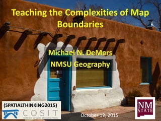
- 1. Teaching the Complexities of Map Boundaries Michael N. DeMers NMSU Geography (SPATIALTHINKING2015) October 12, 2015
- 4. I GET IT! CATEGORY LINES JUST SEPARATE DIFFERENT POLITICAL AREAS. PRETTY STRAIGHT FORWARD.
- 5. What do these mean? What criteria are used? What are plant communities anyway? What are ecoregions? Would you use structure, floristics, or both?
- 22. Analysis of Classified Land (landscape metrics)