Download to read offline

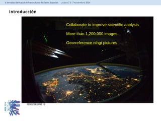
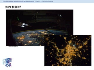
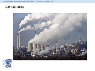
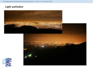
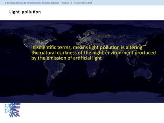
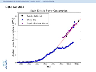
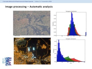
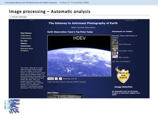
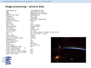
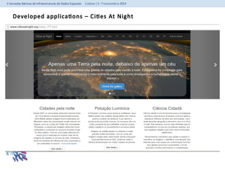
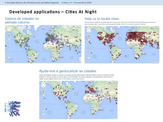
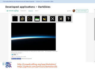
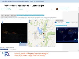
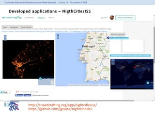
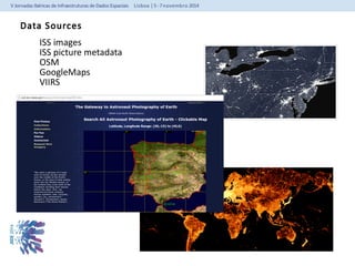
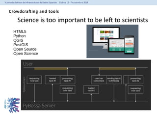
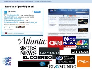
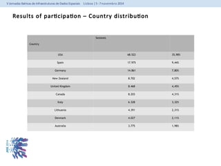
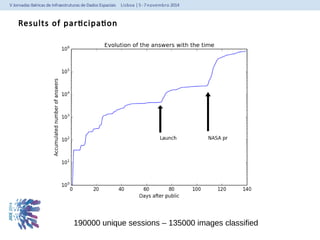
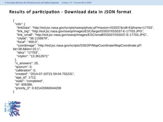
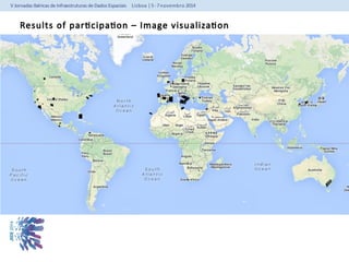
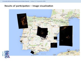
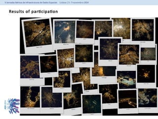
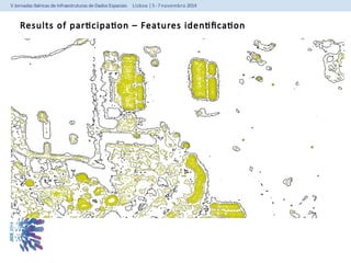
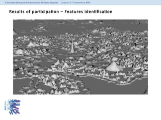
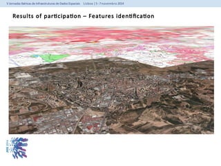

This document summarizes a project that used crowdsourcing to analyze images taken from the International Space Station (ISS) at night in order to study light pollution and energy consumption. Volunteers were able to georeference and classify over 135,000 ISS night images through web applications. The project found high levels of participation from the US, Spain, Germany and other countries. Analysis of the image data provided information on light pollution levels and identified light sources. The project demonstrates the potential of open collaboration to advance scientific analysis.


![Photo_Introd[1]week1 of remote-sense1.ppt](https://cdn.slidesharecdn.com/ss_thumbnails/photointrod1week1remote1-241026120408-8129f013-thumbnail.jpg?width=640&height=640&fit=bounds)


![1200 cash[2]](https://cdn.slidesharecdn.com/ss_thumbnails/enxkjvufqc6h4ffmmmnz-signature-fabe374f978bfb273f92443e2c8243d3e294d623a7c677008fe136d7284f57a9-poli-140825181532-phpapp01-thumbnail.jpg?width=640&height=640&fit=bounds)


![谷歌留痕技术 [ 𝙩𝙤𝙥 𝟮𝟯𝟯. 𝙘 𝙤𝙢 ]](https://cdn.slidesharecdn.com/ss_thumbnails/top233-260130174328-3833018c-thumbnail.jpg?width=640&height=640&fit=bounds)


