Download free for 30 days
Sign in
Upload
Language (EN)
Support
Business
Mobile
Social Media
Marketing
Technology
Art & Photos
Career
Design
Education
Presentations & Public Speaking
Government & Nonprofit
Healthcare
Internet
Law
Leadership & Management
Automotive
Engineering
Software
Recruiting & HR
Retail
Sales
Services
Science
Small Business & Entrepreneurship
Food
Environment
Economy & Finance
Data & Analytics
Investor Relations
Sports
Spiritual
News & Politics
Travel
Self Improvement
Real Estate
Entertainment & Humor
Health & Medicine
Devices & Hardware
Lifestyle
Change Language
Language
English
Español
Português
Français
Deutsche
Cancel
Save
Submit search
EN
Uploaded by
Toru Takahashi
PPTX, PDF
633 views
Code4Libカンファレンス2014ライトニングトーク
2014年9月に鯖江で行われたCode4Libカンファレンス2014ライトニングトーク資料。自身のOpenGLAMに関わる取組みと、第100回図書館大会公募分科会でのワークショップイベントの紹介。
Social Media
◦
Read more
1
Save
Share
Embed
Embed presentation
Download
Download to read offline
1
/ 26
2
/ 26
3
/ 26
4
/ 26
5
/ 26
6
/ 26
7
/ 26
8
/ 26
9
/ 26
10
/ 26
11
/ 26
12
/ 26
13
/ 26
14
/ 26
15
/ 26
16
/ 26
17
/ 26
18
/ 26
19
/ 26
20
/ 26
21
/ 26
22
/ 26
23
/ 26
24
/ 26
25
/ 26
26
/ 26
More Related Content
PDF
フィールドミュージアム構築における 代替現実ゲーム「Ingress」の活用
by
Akihiko Shirai
PDF
「スマ歩さがみはら」相模原市協働事業 平成26年度 公開中間ヒアリング
by
Akihiko Shirai
PDF
博物館ネットワーク事業: Ingressを用いた フィールドミュージアムの開発
by
Akihiko Shirai
PDF
みんなでつくる相模原「知的探求散策アルバム」 (通称:スマ歩さがみはら)事業終了報告
by
Akihiko Shirai
PDF
プレゼンテーション×地図 StoryMapJSを使ってみよう
by
Kaz Furukawa
PPT
古地図を歩く ちずぶらり
by
Kohei Otsuka
PPTX
横浜市の文化財公開アプリの提案0117
by
拓也 岸本
PPTX
金沢市の文化財公開アプリの提案
by
拓也 岸本
フィールドミュージアム構築における 代替現実ゲーム「Ingress」の活用
by
Akihiko Shirai
「スマ歩さがみはら」相模原市協働事業 平成26年度 公開中間ヒアリング
by
Akihiko Shirai
博物館ネットワーク事業: Ingressを用いた フィールドミュージアムの開発
by
Akihiko Shirai
みんなでつくる相模原「知的探求散策アルバム」 (通称:スマ歩さがみはら)事業終了報告
by
Akihiko Shirai
プレゼンテーション×地図 StoryMapJSを使ってみよう
by
Kaz Furukawa
古地図を歩く ちずぶらり
by
Kohei Otsuka
横浜市の文化財公開アプリの提案0117
by
拓也 岸本
金沢市の文化財公開アプリの提案
by
拓也 岸本
Similar to Code4Libカンファレンス2014ライトニングトーク
PDF
登米市民大学院大学キックオフ講座
by
Toru Takahashi
PDF
Code4Lib 2010報告会・発表ダイジェスト
by
Masao Takaku
PPTX
関博研トーク20140714
by
Toru Takahashi
PDF
「Linked dataとLinked Open Data」アート・ドキュメンテーション学会
by
KAMURA
PPTX
体験/メディアのIAデザインに関する
by
Toru Takahashi
PPTX
オープンデータと博物館
by
Toru Takahashi
PDF
Code4Lib 2013参加報告
by
Masao Takaku
PDF
3rd_DA4PL(20120224)
by
真 岡本
PDF
ウイキペディアタウン in 岐阜
by
和人 青木
PDF
10 steps for developing school digital archives
by
Nanako Takahashi
PDF
20171002 takaku lab-intro
by
Masao Takaku
PDF
Makerムーブメントの時代におけるdesign、学び、産業
by
Shigeru Kobayashi
PPTX
オープンデータと「つながる社会」@オープンデータ京都勉強会(2013.04.20)
by
Ikki Ohmukai
PPTX
図書館とLinked Open Data@大学図書館問題研究会全国大会(2014.8.24)
by
Ikki Ohmukai
PPTX
20140917 yahooall
by
Nobuyuki Otomori
PPTX
MLA連携の国際的最前線を探る:国際図書館連盟(IFLA)2014年サテライト会議(トリノ)をベースに(古賀崇)
by
Takashi Koga
PDF
第9回 北関東3県工業高校生徒研究発表大会
by
Masaki Kobayashi
PDF
研究室紹介
by
Masao Takaku
PDF
Code4lib2023_practice_of_generativeAI
by
Nanako Takahashi
PDF
Lifoツアー with alis mulu報告_tokoi
by
alis_lib
登米市民大学院大学キックオフ講座
by
Toru Takahashi
Code4Lib 2010報告会・発表ダイジェスト
by
Masao Takaku
関博研トーク20140714
by
Toru Takahashi
「Linked dataとLinked Open Data」アート・ドキュメンテーション学会
by
KAMURA
体験/メディアのIAデザインに関する
by
Toru Takahashi
オープンデータと博物館
by
Toru Takahashi
Code4Lib 2013参加報告
by
Masao Takaku
3rd_DA4PL(20120224)
by
真 岡本
ウイキペディアタウン in 岐阜
by
和人 青木
10 steps for developing school digital archives
by
Nanako Takahashi
20171002 takaku lab-intro
by
Masao Takaku
Makerムーブメントの時代におけるdesign、学び、産業
by
Shigeru Kobayashi
オープンデータと「つながる社会」@オープンデータ京都勉強会(2013.04.20)
by
Ikki Ohmukai
図書館とLinked Open Data@大学図書館問題研究会全国大会(2014.8.24)
by
Ikki Ohmukai
20140917 yahooall
by
Nobuyuki Otomori
MLA連携の国際的最前線を探る:国際図書館連盟(IFLA)2014年サテライト会議(トリノ)をベースに(古賀崇)
by
Takashi Koga
第9回 北関東3県工業高校生徒研究発表大会
by
Masaki Kobayashi
研究室紹介
by
Masao Takaku
Code4lib2023_practice_of_generativeAI
by
Nanako Takahashi
Lifoツアー with alis mulu報告_tokoi
by
alis_lib
More from Toru Takahashi
PPTX
Strolyによる古地図やイラスト地図を使ったまち歩きや、Wikipedia記事との連携の方法
by
Toru Takahashi
PDF
地域情報のデジタル化と“オープン”であることの意義 〜文化資料やWikipediaの活用と地域協働〜
by
Toru Takahashi
PPTX
Interactive Designed and Curated Maps of Cities with Stroly
by
Toru Takahashi
PPTX
なぜ5つ星オープンデータなのか ー リンクトオープンデータとオープンガバメント
by
Toru Takahashi
PPTX
21th知的生産シンポジウム(キックオフ)2share
by
Toru Takahashi
PPTX
Review of International Open Data Day 2014 in Kyoto - OKFJ Open Data Talk 9
by
Toru Takahashi
PPTX
ちずぶらり@京大未踏イベント
by
Toru Takahashi
Strolyによる古地図やイラスト地図を使ったまち歩きや、Wikipedia記事との連携の方法
by
Toru Takahashi
地域情報のデジタル化と“オープン”であることの意義 〜文化資料やWikipediaの活用と地域協働〜
by
Toru Takahashi
Interactive Designed and Curated Maps of Cities with Stroly
by
Toru Takahashi
なぜ5つ星オープンデータなのか ー リンクトオープンデータとオープンガバメント
by
Toru Takahashi
21th知的生産シンポジウム(キックオフ)2share
by
Toru Takahashi
Review of International Open Data Day 2014 in Kyoto - OKFJ Open Data Talk 9
by
Toru Takahashi
ちずぶらり@京大未踏イベント
by
Toru Takahashi
Code4Libカンファレンス2014ライトニングトーク
1.
図書館ぶらり部ワークショップ @第100回図書館大会 Code4Libカンファレンス2014ライトニングトーク
2.
高橋徹 Linked Open
Data Initiative 関西支部代表 ATR 知能ロボティクス研究所研究員 (株)ATR Creative チーフプロデューサ
3.
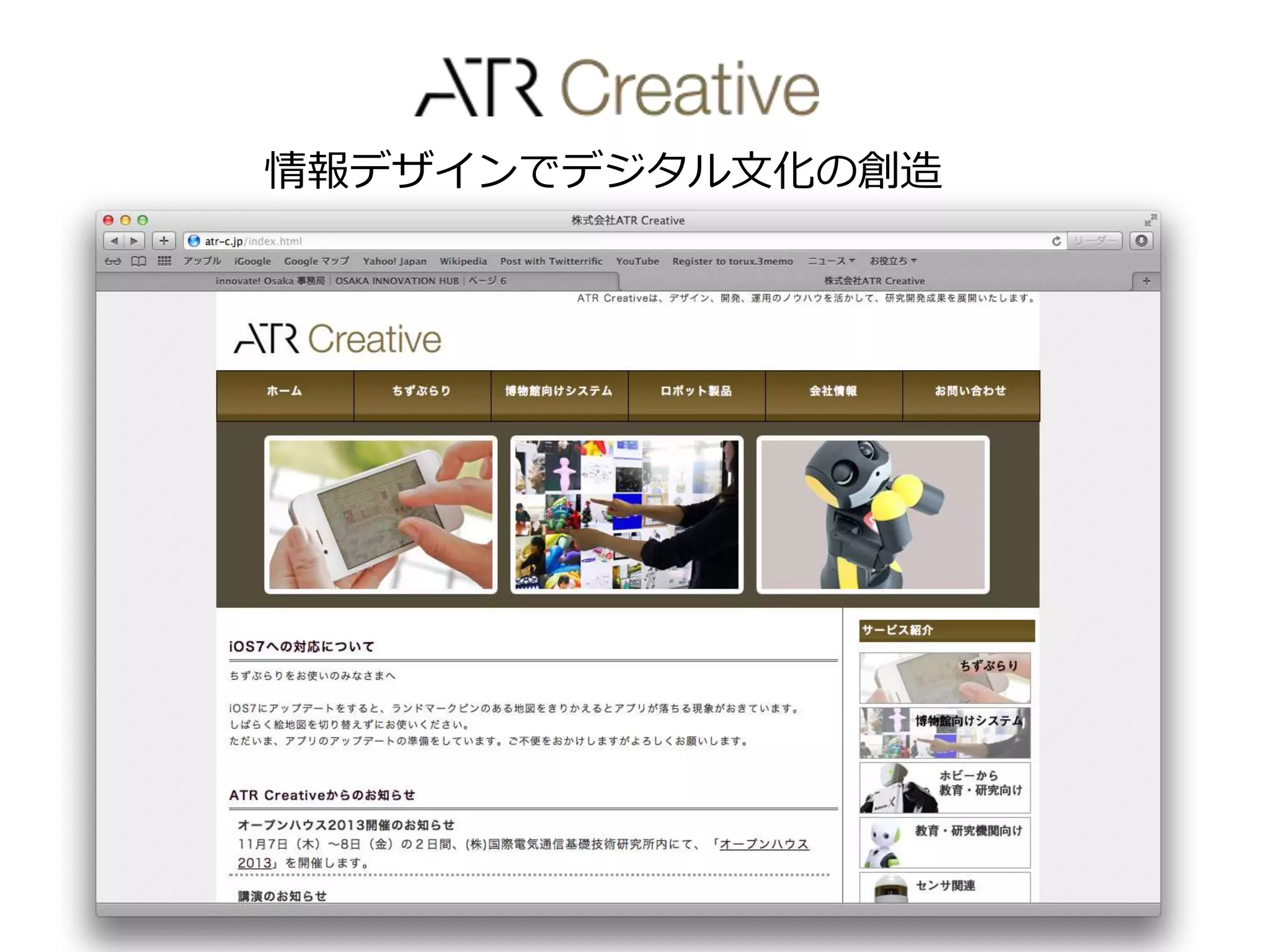
ATR Creative 情報デザインでデジタル文化の創造
4.
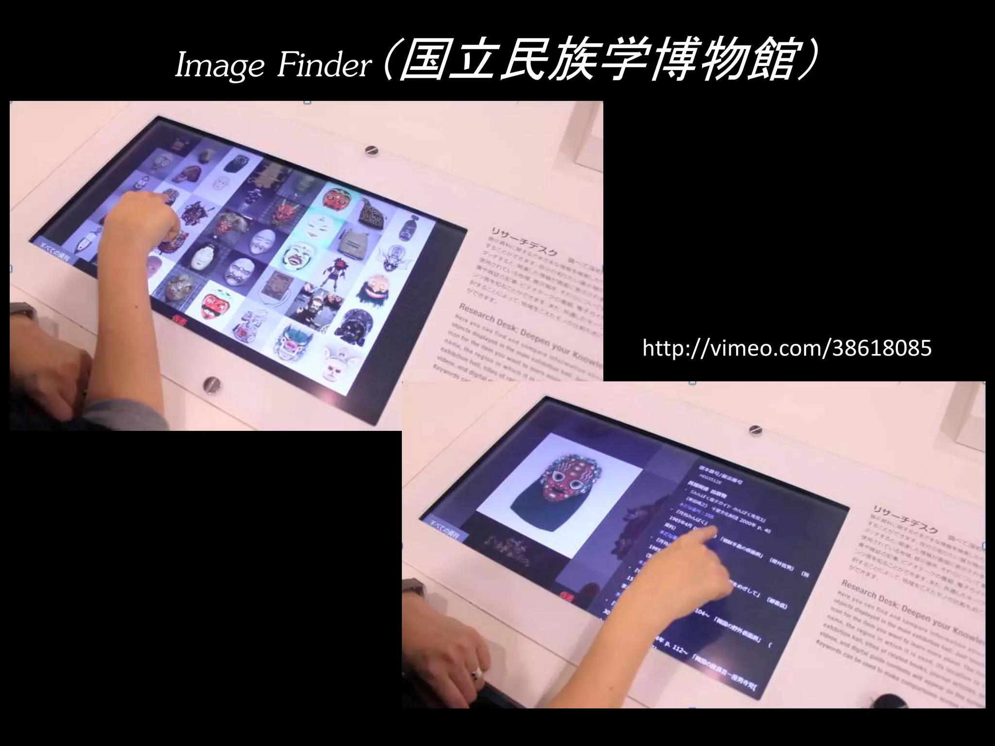
Image Finder(国立民族学博物館) http://vimeo.com/38618085
5.
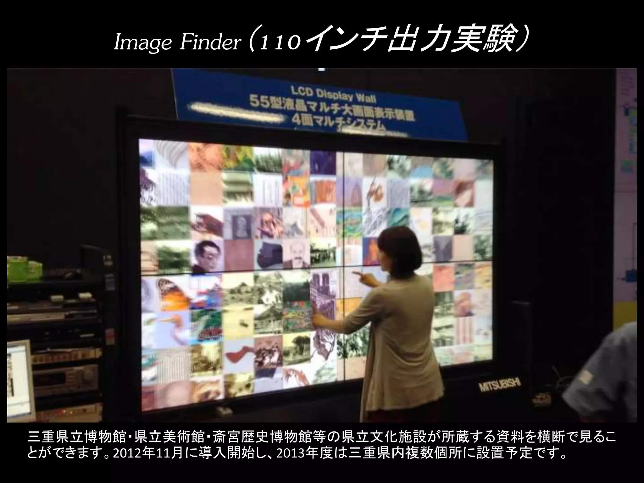
Image Finder(110インチ出力実験) 三重県立博物館・県立美術館・斎宮歴史博物館等の県立文化施設が所蔵する資料を横断で見るこ
とができます。2012年11月に導入開始し、2013年度は三重県内複数個所に設置予定です。
6.
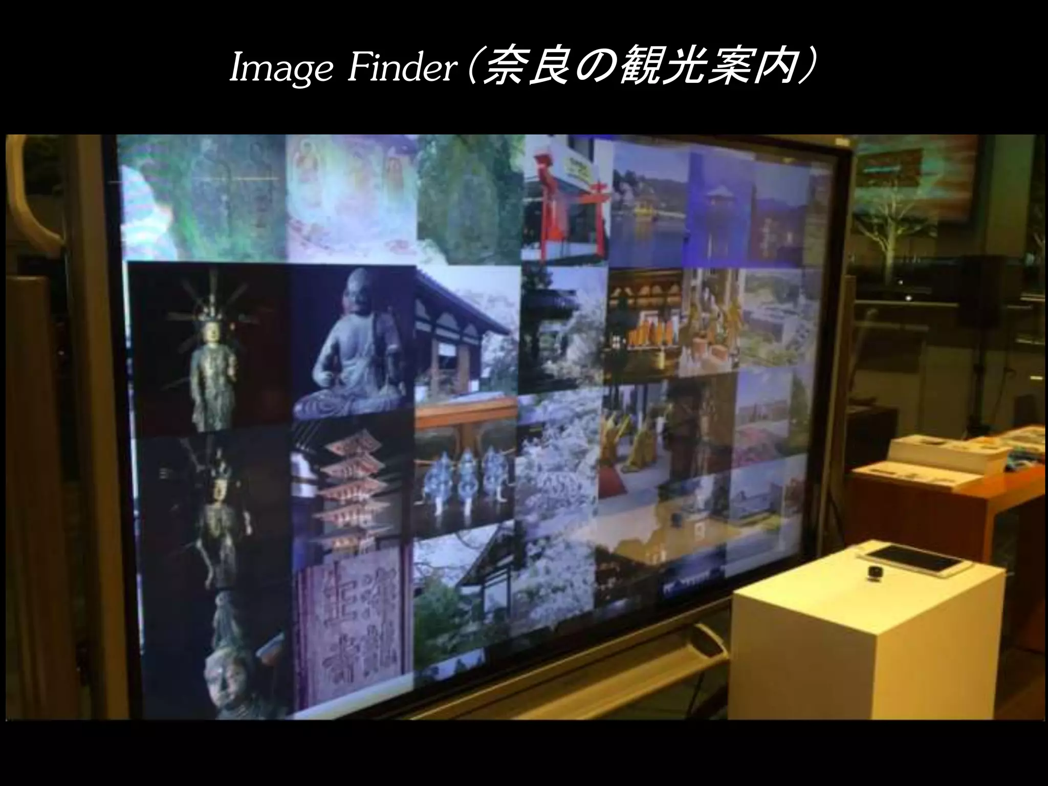
Image Finder(奈良の観光案内)
7.
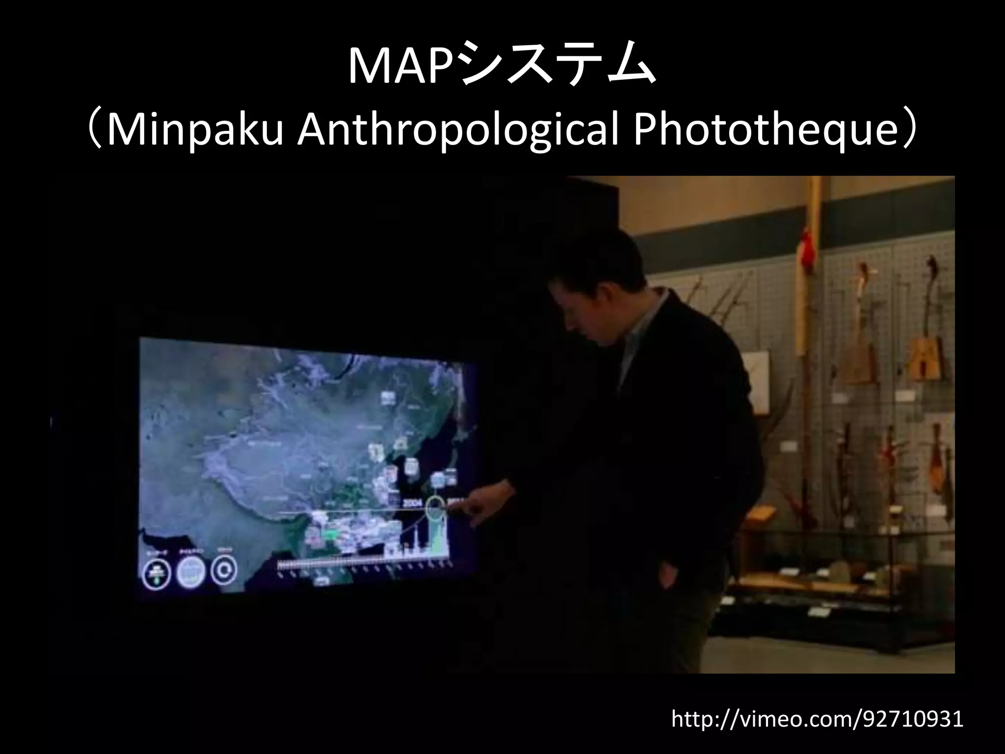
MAPシステム (Minpaku Anthropological
Phototheque) http://vimeo.com/92710931
8.
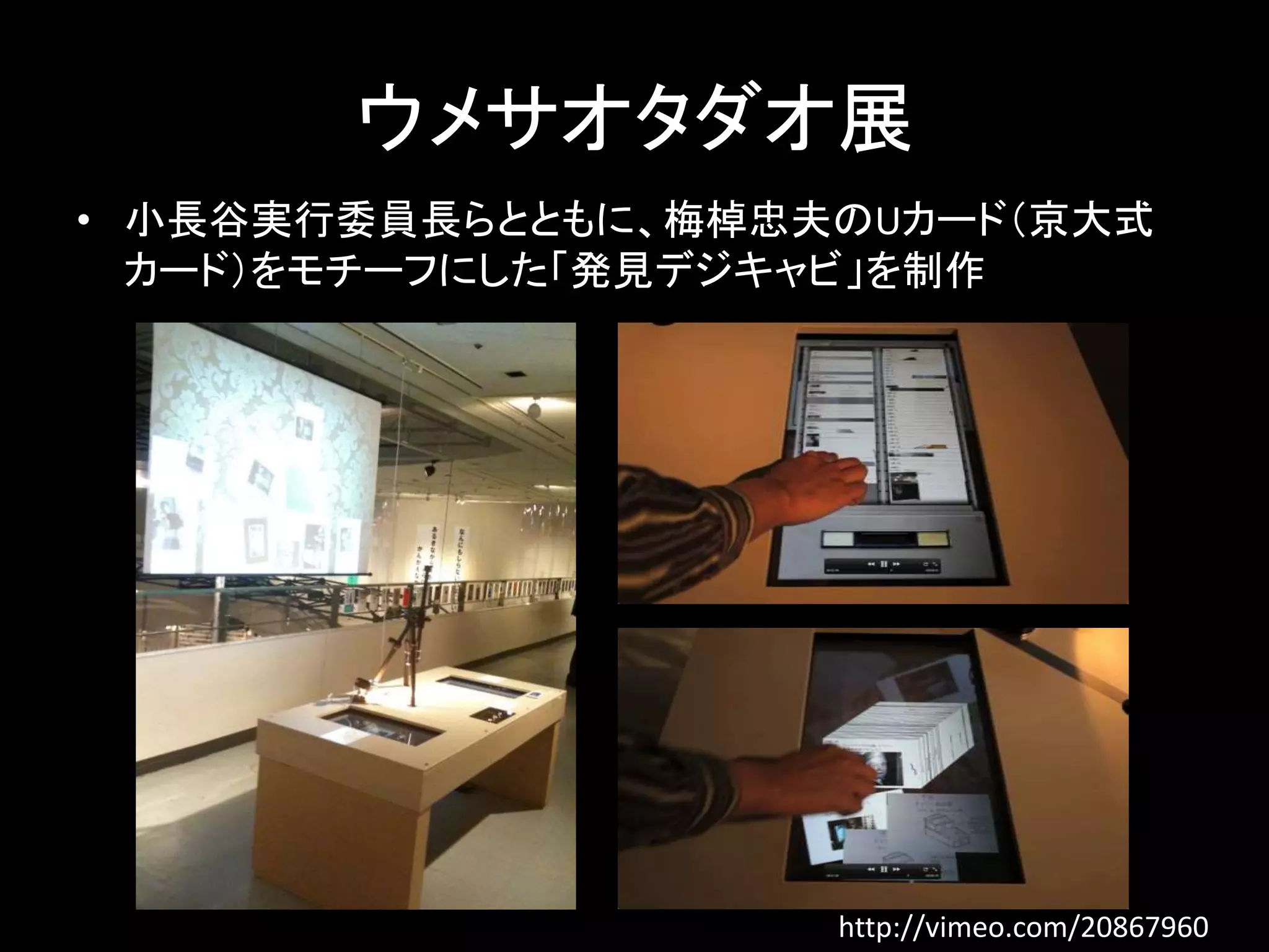
ウメサオタダオ展 • 小長谷実行委員長らとともに、梅棹忠夫のUカード(京大式
カード)をモチーフにした「発見デジキャビ」を制作 http://vimeo.com/20867960
9.
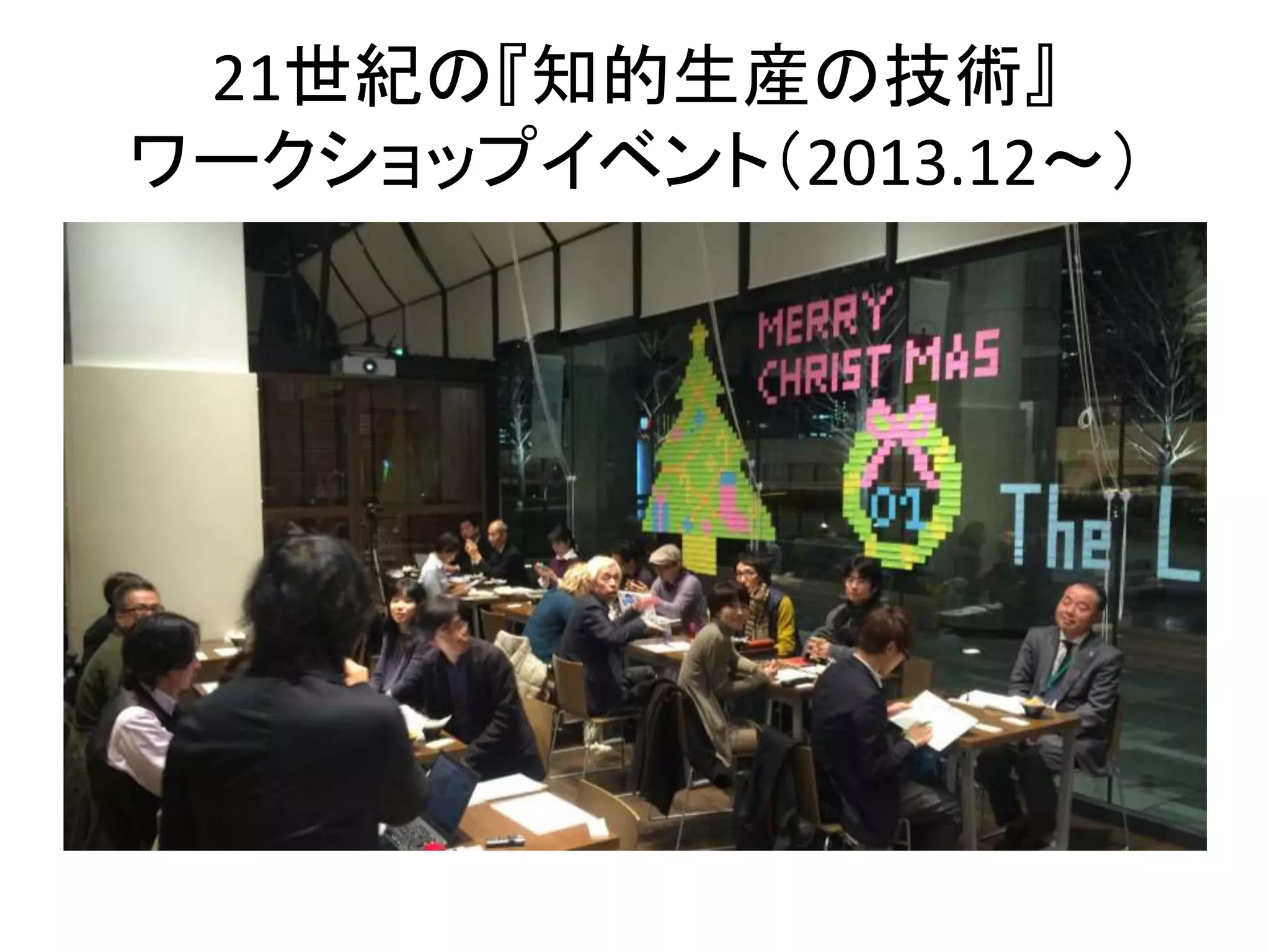
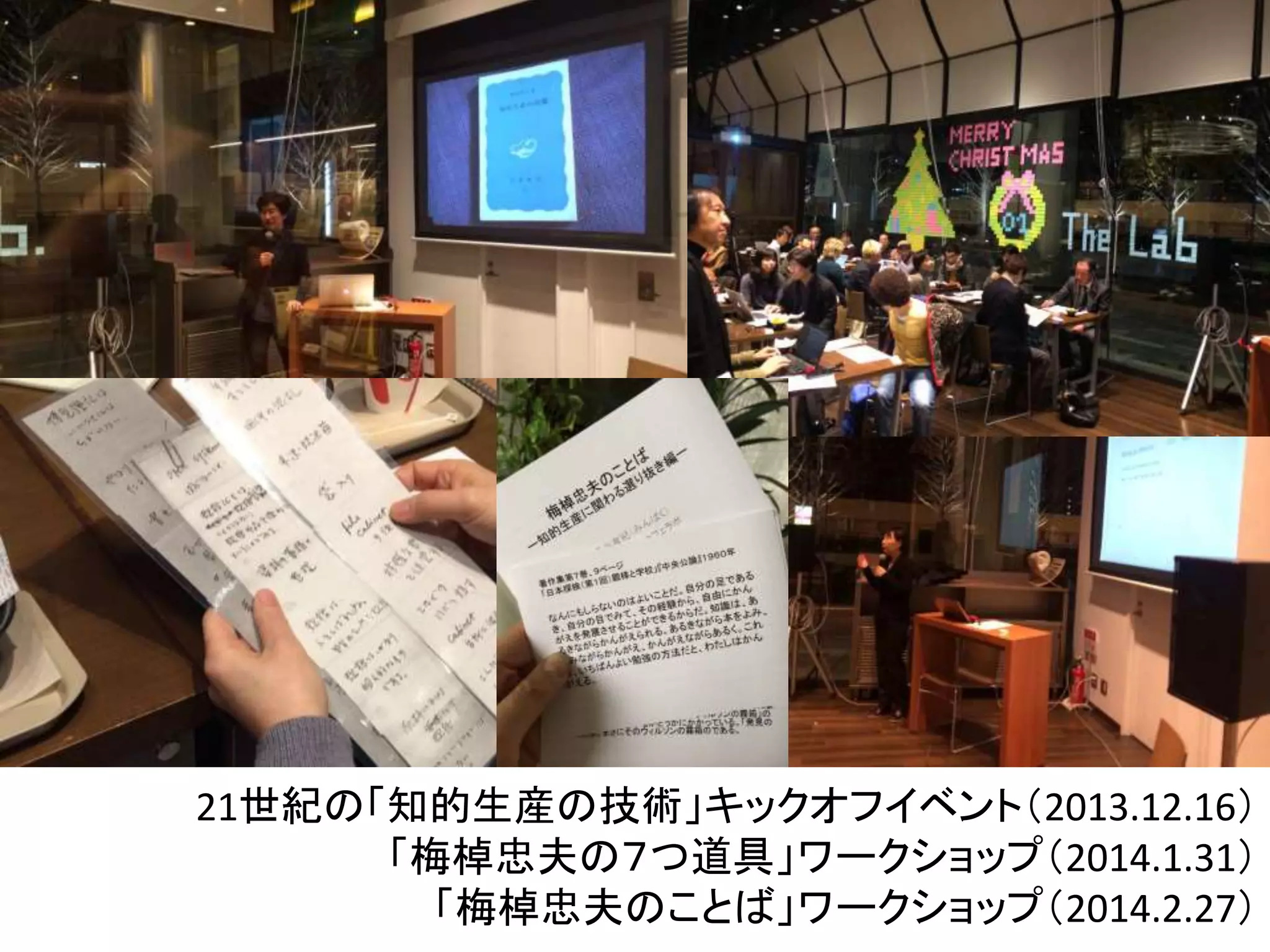
21世紀の『知的生産の技術』 ワークショップイベント(2013.12〜)
10.
21世紀の「知的生産の技術」キックオフイベント(2013.12.16) 「梅棹忠夫の7つ道具」ワークショップ(2014.1.31) 「梅棹忠夫のことば」ワークショップ(2014.2.27)
11.
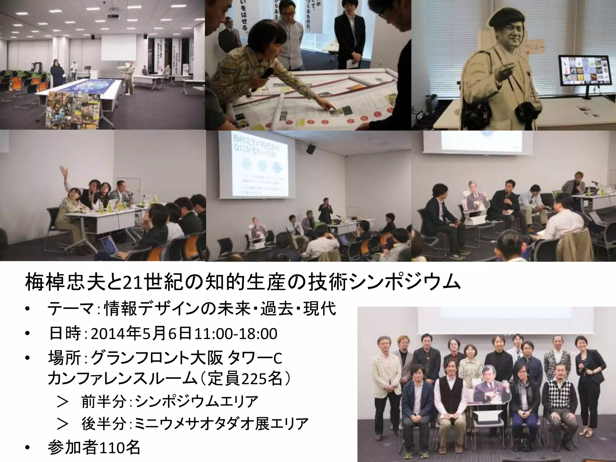
梅棹忠夫と21世紀の知的生産の技術シンポジウム • テーマ:情報デザインの未来・過去・現代
• 日時:2014年5月6日11:00-18:00 • 場所:グランフロント大阪タワーC カンファレンスルーム(定員225名) > 前半分:シンポジウムエリア > 後半分:ミニウメサオタダオ展エリア • 参加者110名
12.
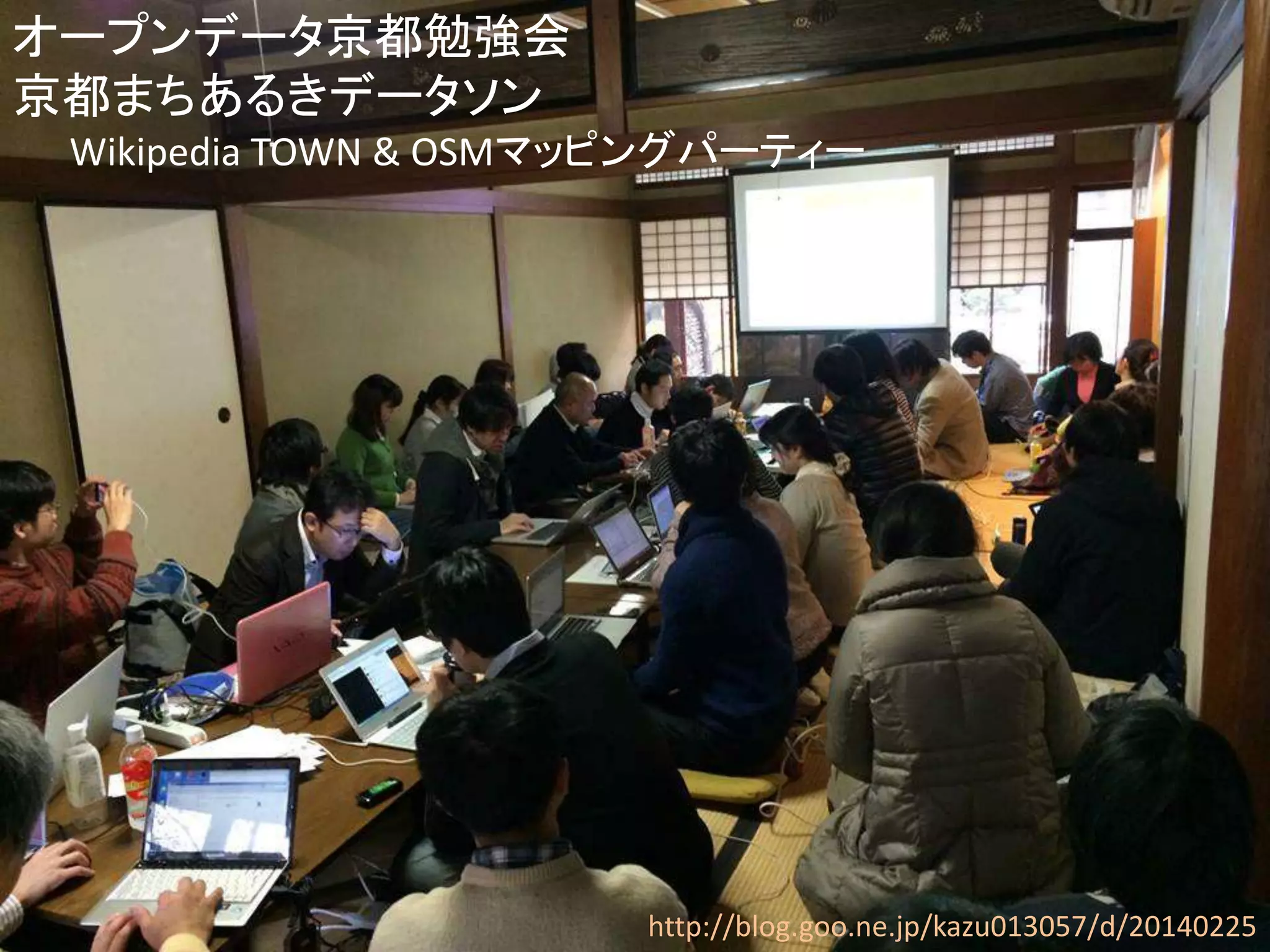
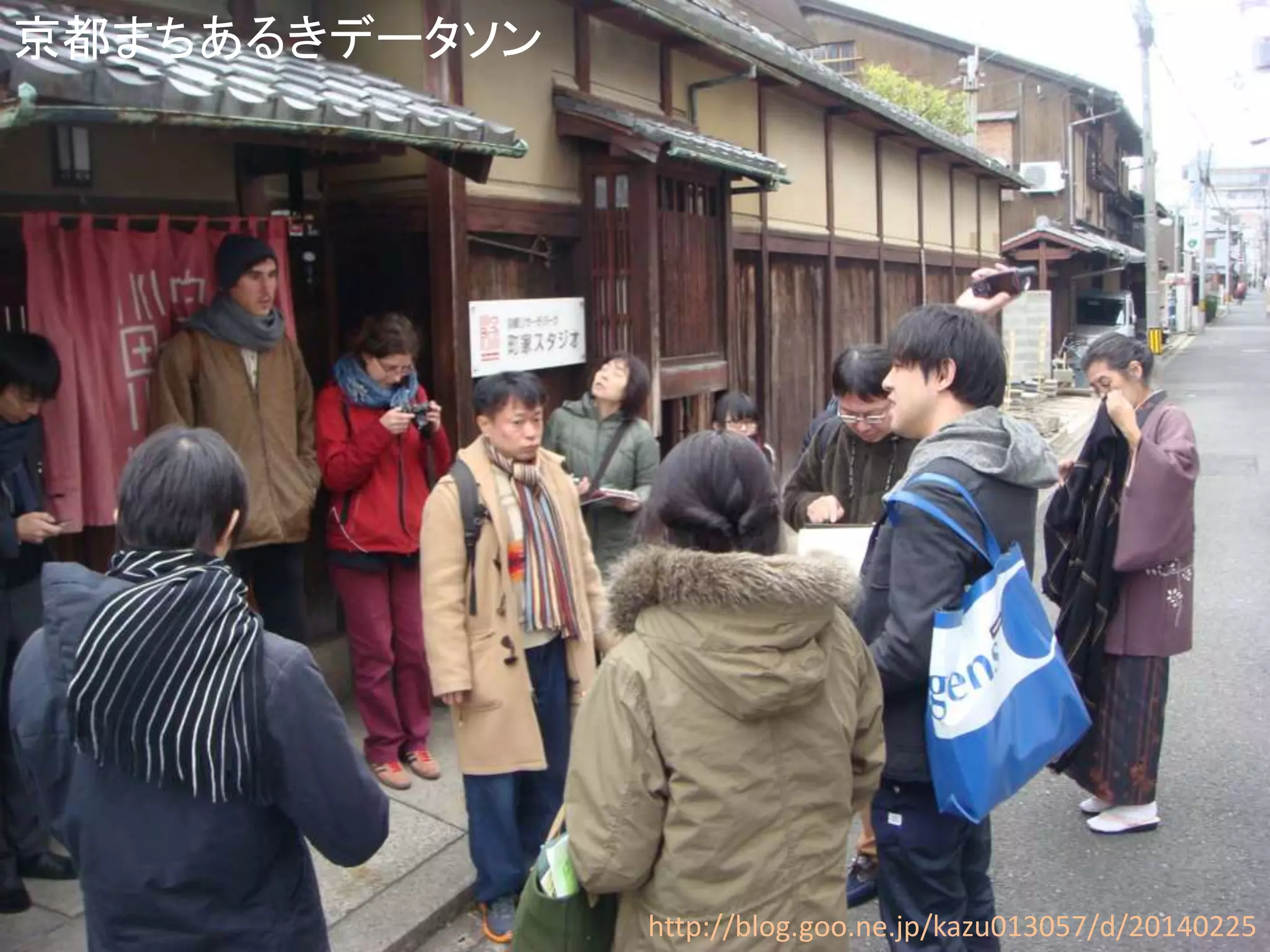
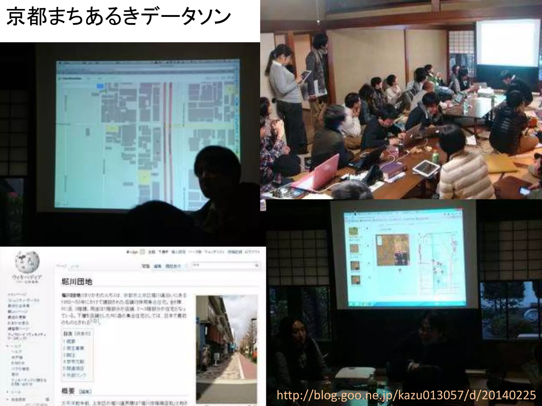
http://blog.goo.ne.jp/kazu013057/d/20140225 オープンデータ京都勉強会 京都まちあるきデータソン
Wikipedia TOWN & OSMマッピングパーティー
13.
http://blog.goo.ne.jp/kazu013057/d/20140225 京都まちあるきデータソン
14.
http://blog.goo.ne.jp/kazu013057/d/20140225 京都まちあるきデータソン
15.
OpenGLAM
16.
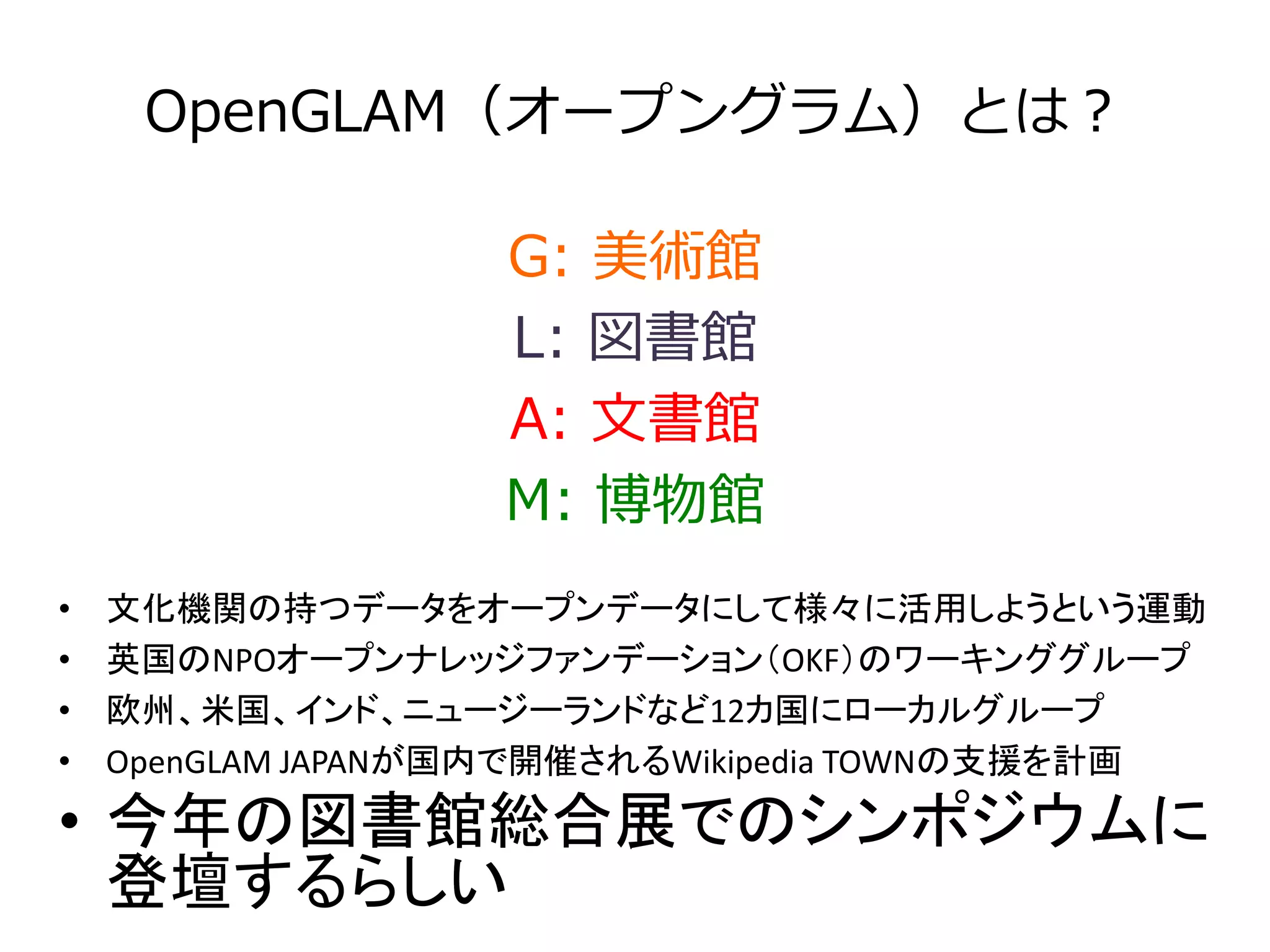
OpenGLAM(オープングラム)とは? G: 美術館
L: 図書館 A: 文書館 M: 博物館 • 文化機関の持つデータをオープンデータにして様々に活用しようという運動 • 英国のNPOオープンナレッジファンデーション(OKF)のワーキンググループ • 欧州、米国、インド、ニュージーランドなど12カ国にローカルグループ • OpenGLAM JAPANが国内で開催されるWikipedia TOWNの支援を計画 • 今年の図書館総合展でのシンポジウムに 登壇するらしい
17.
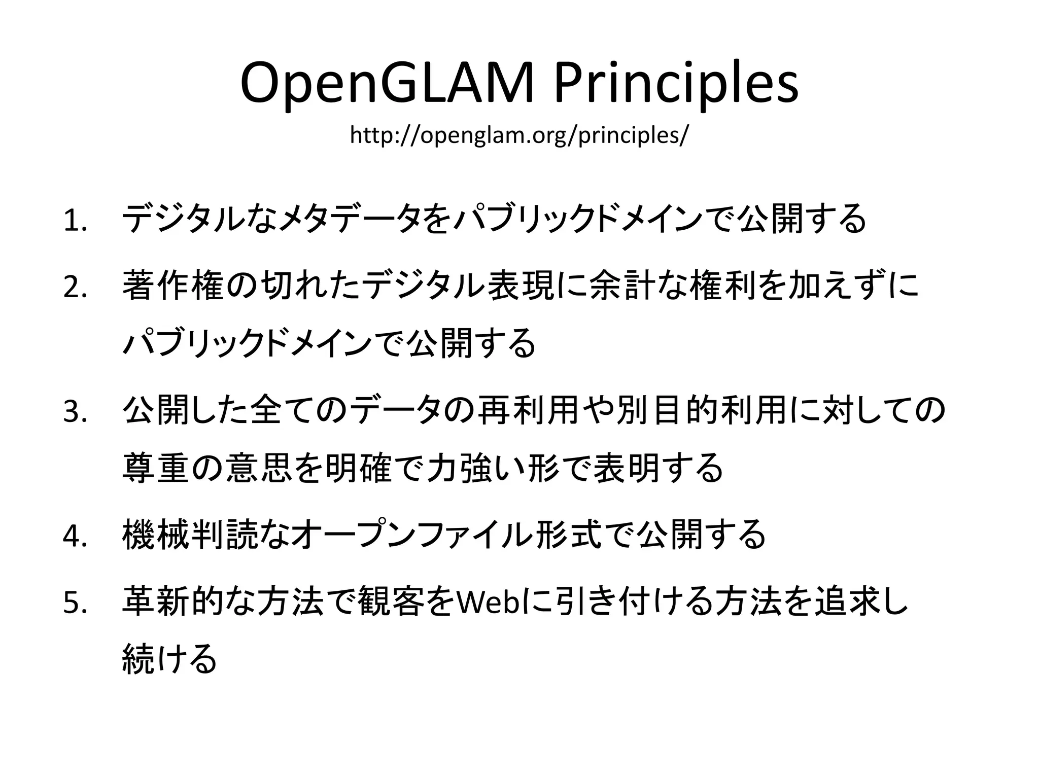
OpenGLAM Principles http://openglam.org/principles/
1. デジタルなメタデータをパブリックドメインで公開する 2. 著作権の切れたデジタル表現に余計な権利を加えずに パブリックドメインで公開する 3. 公開した全てのデータの再利用や別目的利用に対しての 尊重の意思を明確で力強い形で表明する 4. 機械判読なオープンファイル形式で公開する 5. 革新的な方法で観客をWebに引き付ける方法を追求し 続ける
18.
ちずぶらり
19.
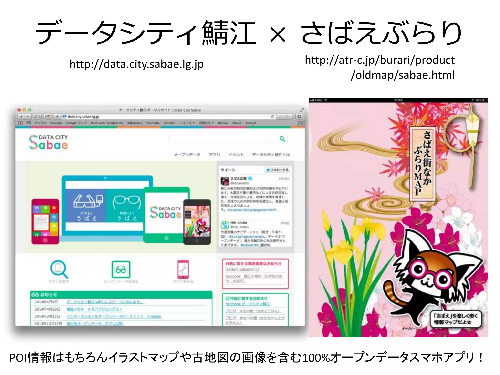
データシティ鯖江× さばえぶらり http://data.city.sabae.lg.jp
http://atr-c.jp/burari/product /oldmap/sabae.html POI情報はもちろんイラストマップや古地図の画像を含む100%オープンデータスマホアプリ!
20.
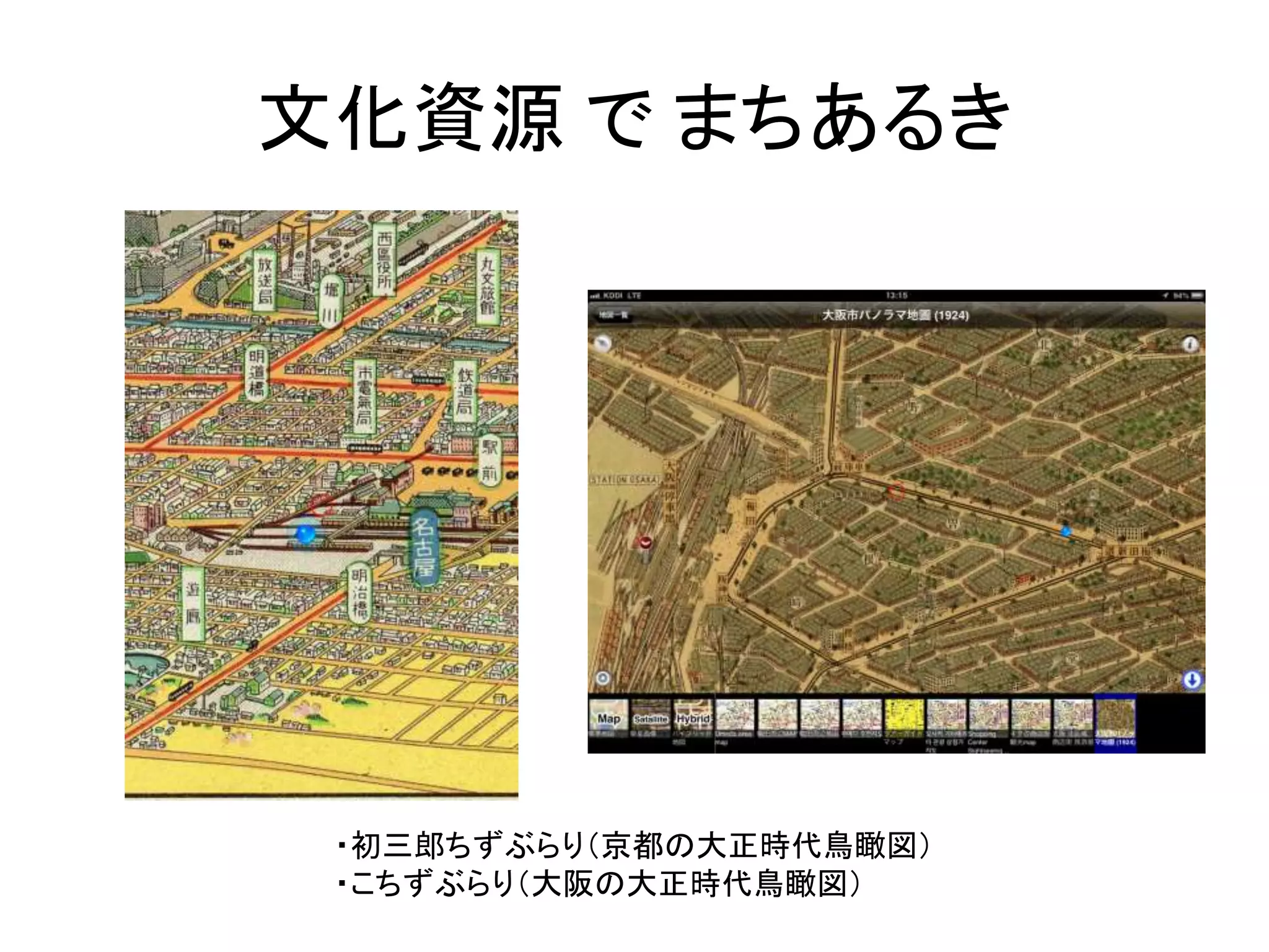
文化資源でまちあるき ・初三郎ちずぶらり(京都の大正時代鳥瞰図) ・こちずぶらり(大阪の大正時代鳥瞰図)
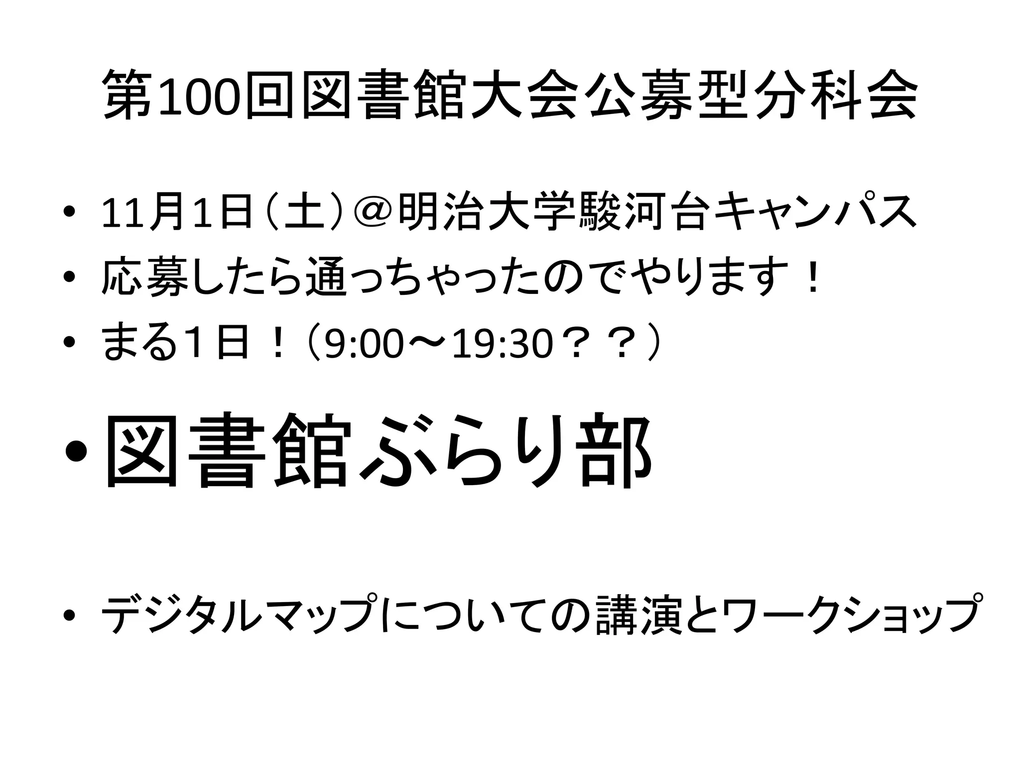
21.
第100回図書館大会公募型分科会
22.
第100回図書館大会公募型分科会 • 11月1日(土)@明治大学駿河台キャンパス
• 応募したら通っちゃったのでやります! • まる1日!(9:00〜19:30??) •図書館ぶらり部 • デジタルマップについての講演とワークショップ
23.
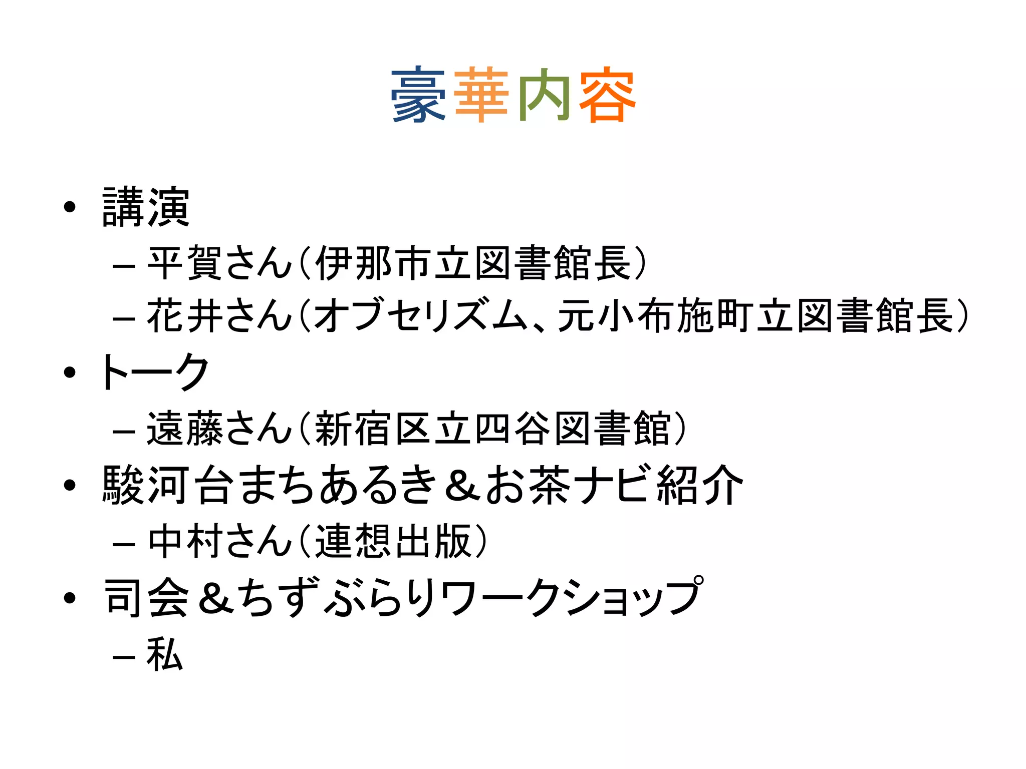
豪華内容 • 講演
– 平賀さん(伊那市立図書館長) – 花井さん(オブセリズム、元小布施町立図書館長) • トーク – 遠藤さん(新宿区立四谷図書館) • 駿河台まちあるき&お茶ナビ紹介 – 中村さん(連想出版) • 司会&ちずぶらりワークショップ – 私
24.
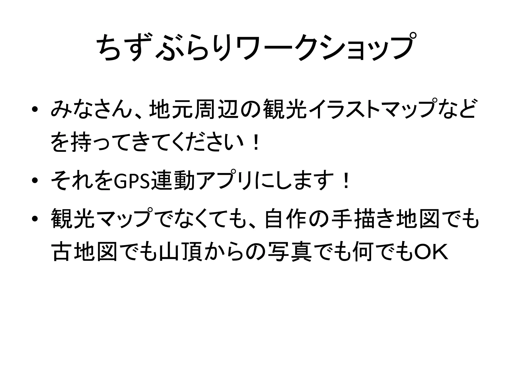
ちずぶらりワークショップ • みなさん、地元周辺の観光イラストマップなど
を持ってきてください! • それをGPS連動アプリにします! • 観光マップでなくても、自作の手描き地図でも 古地図でも山頂からの写真でも何でもOK
25.
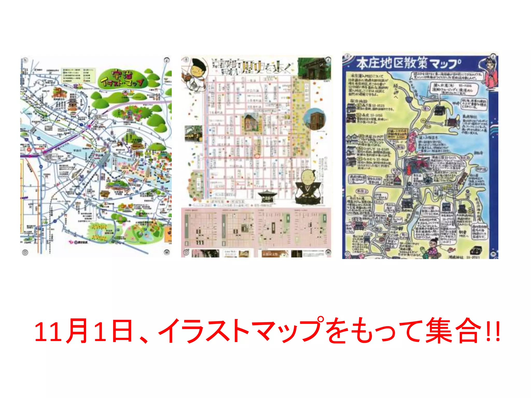
11月1日、イラストマップをもって集合!!
26.
ご清聴ありがとうございました。
Download