This document discusses trends shaping the future of zoning. It summarizes key points from a presentation by Neal LaMontagne at the CIP Infuse 2013 conference in Vancouver. The presentation outlines 8 trends that will influence the future of zoning: 1) zoning will focus more on performance metrics; 2) zoning will aim to increase public value through amenities; 3) zoning will better integrate private and public realms; 4) zoning will become more social and participatory; 5) zoning will allow development to "jump the curb" and coordinate public and private spaces; 6) zoning will be adaptive and responsive to changing conditions; 7) zoning will be based more on principles than rigid rules; and 8) new technologies will enable more flexible and
This document summarizes a steering committee meeting for a planning project in Uptown Pittsburgh. It includes:
1. An agenda for the meeting covering an analysis update, community survey results, an open house discussion, and preliminary web design.
2. An overview of over 40 interviews conducted with local community partners, institutions, neighbors, city and county entities, and outside organizations to inform the planning process.
3. A discussion of transportation patterns, environmental conditions, and current land use in Uptown based on the project analysis to date.
4. An update on outreach efforts including the project website, community survey, and an upcoming open house on February 25th. The committee is asked to provide
Decoding Connectivity: Thriving and Leading in the Internet of Everything WorldCisco Canada
Carlos Dominguez is the SVP of the Office of the Chairman & CEO at Cisco. He gave a presentation titled "Decoding Connectivity" about how connectivity is changing everything in the new, connected world. The presentation discussed how the Internet of Everything will connect people, processes, data and things. It also explained how exponential technologies are driving major changes and disruptions across all industries. Finally, it argued that to be successful in this new environment, companies must adapt, prioritize innovation, and establish a culture open to change.
A presentation of an original idea for a self-sustainable youth-devised and youth-run youth center that aims to stop the marginalization of kids from underprivileged, and single parent families.
The document provides information about community centers, including their functions, history, and case studies. Community centers are public locations where community members gather for activities and social support. They can host celebrations, meetings, and family events. Historically, the first community centers were established in the 1940s-50s in Singapore and the 1960s-70s in Australia to foster community development. The case studies describe the Firstenburg Community Center in Vancouver, which incorporates recreational, community, and library spaces, and the Agha Khani community's use of jammat khannas as gathering places.
Promoting urban comfort in a compact futureSilvia Tavares
This document summarizes a study analyzing urban comfort in Christchurch, New Zealand before and after earthquakes damaged the city center. It assessed indicators of urban living, social/retreat spaces, local identity, recreation/gardening, and adaptation at three points: pre-earthquake, during temporary sites post-earthquake, and under the current blueprint/landscape. While some indicators like connection to outdoors were maintained, others like various space types and microclimate consideration are unclear. The document concludes that subtle shifts in public space control, social character and building heights were not fully considered, and recommends improvements like more small, wind-protected spaces and regulating north-facing building heights.
The document discusses the importance of walkability and how development regulations and design standards can promote it. It notes that many trips are short distances that could be walked or biked, but current infrastructure often requires automobile use. The Planning Commission is working on a Bicycle/Pedestrian Plan to identify needs and gather input on standards to make the community more accessible to all. Walkable, connected places can address challenges like health, the economy, and sense of place.
Read about the first ever virtual open data hack where developers turn open data into novel and useful citizen applications, and how you can get involved!
Infill or Greenfield? Can we do Greenfield better? Learn the six universal truths about planned communities of the future, and the four locational variables that vary between regions.
This document is Peter Winch's urban planning portfolio from 2017. It includes summaries and diagrams from several of his past projects in locations such as Abu Dhabi, Detroit, Turlock, San Diego, Palmdale, Pacifica, Venice, Chicago, Portland, Mumbai, and New England. The portfolio shows his work in areas like public realm implementation strategies, station area planning, general plan updates, transit-oriented development frameworks, and rethinking transportation infrastructure. It provides examples of his approach to shaping places by analyzing resources, patterns, and guiding development in a sustainable, beautiful, and humane way.
Innovative changes to urban areas are occuring rapidly, spurred by social media connectivity that has launched "livability" initiatives that are adding parks, green plants, bike lanes, and other transportation and environmental enhancements to cities. The goal is both to enhance their own living area while also attracting residents back to urban cities. Much of the change, when you think about it, is actually a suburbanization of cities. People living in the suburbs already have green all around them, whether it is their own yards or the big park down the street and along their drive to work or in their school playgrounds. Urbanists want that sense of fresh air and ability to connect and meet with neighbors more easily. Hence, the suburbanization of urban areas, creating meeting areas and bringing more green to the city.
This document discusses smart, creative placemaking and provides examples of projects that incorporate digital technologies into public spaces. It begins with a brief history of placemaking and defines creative placemaking as strategically shaping public spaces through arts and cultural activities. Examples are given of projects like interactive light installations, sensor-triggered sidewalk lights, and a subway platform "musical instrument." The document aims to explore how smart technologies can enhance placemaking and public experiences in cities.
This document contains Emily Pietrantone's resume. It includes her contact information, education history, work experience, skills, and involvement. For her education, she attends the University of Cincinnati where she is studying Urban Planning with minors in Real Estate and Professional Communication. She has experience as a Resident Advisor, cashier, and server. Her skills include AutoCAD, ArcMAP, Revit, and Microsoft Office programs. She has also been involved with organizations at her university and high school.
During the opening plenary of the 2016 National Regional Transportation Conference, several presenters offered information about the regional planning work being conducted that ties transportation to community and economic development visions. Speakers included:
Gena McCullough, Bi-State Regional Commission (IL/IA); Jennifer Tinsley, Lower Savannah Council of Governments (SC); Elijah Sharp, New River Valley Regional Commission (VA); Mari Brunner, Southwest Regional Planning Commission (NH); Julio Portillo, River Valley Regional Commission (GA); Robby Cantrell, North Central Alabama Regional Council of Governments.
The document is an overview of the upcoming NACTO Urban Street Design Guide, which will provide principles and best practices for designing urban streets. It outlines that the guide will discuss designing streets for multiple purposes, including as public spaces, for business activity, and for safety. It emphasizes that streets can be changed and redesigned through low-cost temporary improvements to test designs. The guide will categorize street design based on street width rather than conventional functional classifications.
This document outlines a course on strategies for connecting transit and active transportation. It discusses challenges in implementing such projects, including public opposition and perceptions. Examples of successful projects from New York City, Auckland, Vancouver, and Edmonton are provided. The presenter emphasizes building a strong business case by thoroughly analyzing potential traffic impacts, considering constructability, and planning for ongoing operations and maintenance. New resources for project evaluation like NACTO guidelines are also presented. The overall message is that proponents must address common concerns while challenging conventional engineering approaches.
Presentation by Rick Hall, PE at Great Streets-Healthy Communities program hosted by ULI Memphis and the University of Memphis Partnership for Active Community Environments in Memphis, TN on April 21, 2010.
Chris Mullins presented an analysis of the optimal location for a new transmission line between Manatee and Sarasota counties in Florida. The analysis found: (1) the proposed corridor avoids conservation lands and wetlands, impacting less than 1% of wetlands in the study area; (2) the corridor impacts approximately 34 homes directly and 49 homes within 400 feet but avoids populated areas; (3) there are no schools or daycares within a quarter mile of the corridor. The presentation concluded the proposed corridor would have minimal environmental and community impacts and increase energy availability at a reasonable cost.
Public Sector GIS: Transit-Oriented DevelopmentNancy Cole
The document analyzes suitability for transit-oriented development (TOD) in St. Louis County, MO using geospatial analysis. It identifies 1,836 potential TOD sites across 263,010 acres based on 10 criteria including transit access, community features, and land use. Six high-scoring example sites are described in detail. The document recommends public policies to encourage TOD, such as coordinating agencies, modifying zoning, and creating development incentives near transit.
the Community Access Project sings out the concerns of people with physical and sensory disabilities in these Public Comments to MassDOT. Three recommendations, with photos, are included.
The document outlines a presentation for a neighborhood plan on Broadway Avenue in Saskatoon, Saskatchewan. It includes an introduction to the study and process, key outcomes from a community summit, observations from experts on the area, and existing conditions. Challenges to address include defining the area's character, appropriate new development forms, enhancing pedestrian experiences, transitions to adjacent neighborhoods, parking issues, and traffic strategies.
This document contains Emily Pietrantone's resume. It outlines her education at the University of Cincinnati where she is studying Urban Planning with a minor in Real Estate and a certificate in Professional Communication. She expects to graduate in May 2023. It also lists her relevant work experience as a Resident Advisor, cashier, and server. Additionally, it provides details about her involvement in organizations, awards received, and skills. The resume demonstrates Emily's qualifications for positions related to urban planning through her relevant coursework, projects, work history, and extracurricular activities.
The agenda/presentation slide deck shown during the March 3, 2021 Citizens' Transportation Advisory Committee (CTAC) virtual meeting. The meeting video can be viewed at https://youtu.be/IIbCHS3pV0w
Prepare for cold weather rafting with proper gear: layering for warmth, insulated headgear, gloves, waterproof footwear, and essential accessories like sunglasses and sunscreen. Prioritize safety with a life jacket and maintain gear for optimal performance. Stay warm, dry, and ready for adventure on the rapids!
jaipur metro: stations, timings and latest newsnarinav14
Jaipur Metro, a significant development in the realm of urban transportation, has transformed the way residents and visitors navigate the Pink City. Inaugurated in 2015, the metro system has steadily expanded, providing a fast, efficient, and eco-friendly mode of transport
Sicily's Coastal Charms: Discovering the Top 5 Beaches on the IslandTime for Sicily
Nestled in the azure embrace of the Mediterranean, Sicily boasts a coastline dotted with breathtaking beaches. From secluded coves to lively shores, each offers a unique slice of paradise. Among the island's gems, Mondello Beach entices with its golden sands and crystal-clear waters, while San Vito Lo Capo enchants visitors with its powdery shores framed by rugged cliffs. For a taste of history and natural beauty, Scala dei Turchi beckons with its striking white cliffs, while Isola Bella captivates with its picturesque islet setting. Sicily's coastal charms await exploration, promising unforgettable seaside adventures. For more information, visit the website https://timeforsicily.com/the-top-5-beaches-in-sicily-for-this-summer/
JourneyPalette is an innovative SaaS platform for seamless adventure discovery and booking, offering personalized recommendations, organized curated adventure styles for easy exploration, and a strong focus on sustainability and cultural preservation.
Our Bahrain Visa PowerPoint Presentation offers a detailed and comprehensive guide to the Bahrain visa application process. It is designed to assist travelers, travel agents, and businesses in navigating the various visa types, including tourist, business, work, student, and family visas. Each section provides an in-depth look at eligibility criteria, required documents, and step-by-step application procedures. Additionally, the presentation includes valuable tips for avoiding common application mistakes, an overview of processing times, and details on fees and payment methods. This presentation aims to ensure a smooth and successful visa application experience, making travel to Bahrain as seamless as possible.
A list of budget-friendly things that families can do in San Antonio! Dive into its rich history and vibrant culture at iconic landmarks like the Alamo. Explore colorful Market Square and stroll along the scenic River Walk. Enjoy family-friendly fun at Brackenridge Park and capture breathtaking views at the Tower of the Americas—all without breaking the bank!
You can easily change/correct a name on your flight ticket under the American Airlines name change policy. The airline provides multiple online and offline modes to place a name change request. To learn more about how to change a name on American Airlines ticket, you can directly approach the airline’s customer support. Moreover, you can connect with a flight expert at +1-866-738-0741 for quick assistance.
What Outdoor Adventures Await Young Adults in Montreal's Surrounding NatureSpade & Palacio Tours
Experience Montreal's vibrant culture and thrilling outdoor adventures. From hiking scenic trails at Mont-Saint-Bruno to kayaking the Saint Lawrence River, there's something for every adventurous young adult. Explore street art, camp under the stars, and immerse yourself in nature's beauty just beyond the city's bustling streets.
The Inca Trail to Machu Picchu is an unforgettable adventure, blending stunning natural beauty with rich history. Over four days, trekkers traverse diverse landscapes, from lush cloud forests to high mountain passes, encountering ancient Inca ruins along the way. Each step brings you closer to the awe-inspiring sight of Machu Picchu, revealed at sunrise from the Sun Gate. The journey is challenging but incredibly rewarding, offering a profound sense of accomplishment. With its combination of breathtaking scenery and cultural significance, the Inca Trail to Machu Picchu is a must-do for those seeking an extraordinary adventure in Peru.
Explore Architectural Wonders and Vibrant Culture With Naples ToursNaples Tours
Discover the historical gems and vivid culture of Naples with our guided tours. From the vivid narrow streets of Spaccanapoli to the ancient ruins of Pompeii, the city offers a mixed bag of adventurous experiences. Book your tickets today https://www.naples.tours/ and experience the best of Naples!
Experience the magic of bioluminescence at Puerto Rico's Bioluminescent Bay with our guide to optimal viewing. Plan your visit during the new moon phase for vibrant displays, and consider dry season from December to April. Book a guided tour, choose calm nights, and respect the environment for an unforgettable adventure.
Ibiza, situated in the Balearic Islands, stands out as a destination that encompasses everything: stunning landscapes, hidden gems to explore, a vibrant social scene, rich cultural life, and exceptional gastronomy. Opting for ‘Ibiza Rent A Boat’ to experience an unforgettable vacation on the White Island is certainly worthwhile, prompting a deeper exploration of the unique and fascinating aspects of Ibiza.
Traveling with Frontier Airlines through Boston Logan International Airport offers a budget-friendly and efficient experience. With the modern facilities at Terminal C, extensive services, and amenities provided by Frontier, passengers can enjoy a comfortable journey. Whether you're a frequent flyer or a first-time traveler, this guide aims to help you navigate BOS with ease and make the most of your trip.
Frontier Airlines at Boston Logan International Airport (BOS) Comprehensive G...
CIP future of zoning nlamontagne
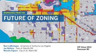
1. Neal LaMontagne - University of California Los Angeles
Joe Nethery - Town of Oakville ON
Marcelo Figuera - City of St. Albert AB
DISPATCHES FROM THE
FUTURE OF ZONING
CIP Infuse 2013
Vancouver BC
2. Introduction: Future of Zoning
Prediction is difficult,
especially about the future
- Niels Bohr
The Future of Zoning
Infuse 2013
Vancouver BC
02/62
Neal LaMontagne
University of California Los Angeles
3. Zoning matters
- shapes our cities and resolves spatial conflicts
- generative software for urbanism
- design at the scale of cities
- implements our visions and values in physical space
The Future of Zoning
Infuse 2013
Vancouver BC
03/62
Neal LaMontagne
University of California Los Angeles
4. Zoning is seen as
- too rigid / inflexible
- too indiscriminate
- not responsive to complex conditions
- top down / teleocratic
- not delivering the cities we aspire to
SO WHERE DO WE GO NEXT?
The Future of Zoning
Infuse 2013
Vancouver BC
04/62
Neal LaMontagne
University of California Los Angeles
5. Major ‘meta’-trends shaping the Future of Zoning
- ubiquitous data / technological advancement
- increasingly complex urban environments
- generational shift
- empowered (and networked) communities
- demand for high-performance urbanism
The Future of Zoning
Infuse 2013
Vancouver BC
05/62
Neal LaMontagne
University of California Los Angeles
6. The Future of Zoning
8 TRENDS
The Future of Zoning
Infuse 2013
Vancouver BC
06/62
Neal LaMontagne
University of California Los Angeles
7. 01: The Future of Zoning is
PERFORMANCE
The Future of Zoning
Infuse 2013
Vancouver BC
07/62
Neal LaMontagne
University of California Los Angeles
8. 01 PERFORMANCE
Key Drivers
- Desire for Higher-Performance Development
- Availability of Ubiquitous Data
- Demand for Nexus between Policy and Regulation
- Opportunity to Enable Design Innovation
The Future of Zoning
Infuse 2013
Vancouver BC
08/62
Neal LaMontagne
University of California Los Angeles
15. 01 PERFORMANCE
Key Questions
- What are the relevant metrics?
- Must maintain a qualitative spirit (not all that counts...)
- What are the skills/tools needed to manage data +
- Do your zoning requirements consider performance?
The Future of Zoning
Infuse 2013
Vancouver BC
15/62
Neal LaMontagne
University of California Los Angeles
16. 02 The Future of Zoning is
PUBLIC VALUE
The Future of Zoning
Infuse 2013
Vancouver BC
16/62
Neal LaMontagne
University of California Los Angeles
17. 02 PUBLIC VALUE
Key Drivers
- Increased pressure on public budgets
- Higher density development requires a higher level of public
amenity (Density Done Well)
- Development approval is effective + targeted lever for
balancing public + private value
The Future of Zoning
Infuse 2013
Vancouver BC
17/62
Neal LaMontagne
University of California Los Angeles
20. 39
49
22
22
49
22
23
39
22
26
23
39
19
23
16
39
26
11
51
23
39
11
23
11
16
51
39
11
South St
HollisSt
BarringtonSt
QueenSt
Sackville St
Morris St
SouthParkSt
U
pper W
ater S
t
Spring Garden Rd
GranvilleSt
Bell Rd
ArgyleSt
BrunswickSt
Prince St
GraftonSt
Duke St
G
ottingen
S
t
AhernAve
College St
DresdenRow
Kent St
Salter St
Tobin St
SummerSt
MarginalRd
Victoria Rd
M
aitland
St
Fenwick St
Green St
BirminghamSt
BrentonSt
C
ornw
allis
St
MartelloSt
AlbemarleSt
Harvey St
TowerRd
C
reighton
S
t
Blowers St
ChurchSt
Falkland St
Portland
Pl
LucknowSt
Smith St
M
aynard
St
Tower Terr
Doyle St
WellingtonSt
Carmichael St
University Ave
CarltonSt
Bauer S
t
Wright Ave
Brenton Pl
BlandSt
Scotian
Rd
Map 4
Maximum
Pre-Bonus Heights
±0 100 200
metres
Effective: Note: Effective date does not indicate date of data creation.
Downtown Halifax
Land Use By-Law
(in metres)
28
22
22
22
22
49
28
49
49
23
19
31
23
49
34
22
16
49
28
11
66
23
11
34
11
16
31
28
66
49
11
!
22
South St
HollisSt
BarringtonSt
QueenSt
Sackville St
Morris St
SouthParkSt
LowerWaterSt
U
pper W
ater S
t
Spring Garden Rd
GranvilleSt
Bell Rd
ArgyleSt
BrunswickSt
Prince St
GraftonSt
G
ottingen
S
t
AhernAve
College St
DresdenRow
Kent St
Salter St
Tobin St
SummerSt
MarginalRd
Victoria Rd
M
aitland
St
Fenwick St
Green St
BirminghamSt
BrentonSt
C
ornw
allis
St
MartelloSt
AlbemarleSt
Harvey St
TowerRd
C
reighton
S
t
Blowers St
ChurchSt
Falkland St
Portland
Pl
LucknowSt
Smith St
M
aynard
St
Tower Terr
Doyle St
WellingtonSt
Carmichael St
University Ave
CarltonSt
Bauer S
t
Wright Ave
Brenton Pl
BlandSt
Scotian
Rd
Map 5
Maximum
Post-Bonus Heights
±
0 100 200
metres
Effective: Note: Effective date does not indicate date of data creation.
Downtown Halifax
Land Use By-Law
Post-Bonus Height Area
Rampart Maximum
(in metres)
Pre+Post-Bonus Height Regulations Halifax by Design Downtown Plan
21.
22. 02 PUBLIC VALUE
Key Questions
- How to manage legal uncertainty
- How to ensure legislative + planning discipline
- Transparency and public involvement
The Future of Zoning
Infuse 2013
Vancouver BC
22/62
Neal LaMontagne
University of California Los Angeles
23. 03 The Future of Zoning is
‘JUMPING THE CURB’
The Future of Zoning
Infuse 2013
Vancouver BC
23/62
Neal LaMontagne
University of California Los Angeles
24. 03 JUMPING THE CURB
Key Drivers
- Need to connect public and private realm decision making
- Recognize the relationship between street and building
- Key aspect of urban performance is linking movement and
land use
The Future of Zoning
Infuse 2013
Vancouver BC
24/62
Neal LaMontagne
University of California Los Angeles
25. How can LA Streets be More Livable Huma Husain UCLA MURP 2012
28. 03 JUMPING THE CURB
Key Questions
- How to coordinate between departments?
- Is zoning the right tool? (the hammer problem)
- How can we localize decision-making?
The Future of Zoning
Infuse 2013
Vancouver BC
28/62
Neal LaMontagne
University of California Los Angeles
29. 04 The Future of Zoning is
SOCIAL
The Future of Zoning
Infuse 2013
Vancouver BC
29/62
Neal LaMontagne
University of California Los Angeles
30. 04 SOCIAL
Key Drivers
- Public demand to participate in development decision-making
- New networking technologies + cultures changing engagement
- Need for codes that are reflective of and responsive to
complex public interests
The Future of Zoning
Infuse 2013
Vancouver BC
30/62
Neal LaMontagne
University of California Los Angeles
31.
32. Talk Green to Us City of Vancouver Crowdsourcing/Public Engagement site
726 distinct ideas
3,100 users
2,100 comments
28,000 votes
21,500 visits
35. PARTICIPATING SCHOOLS (VANCOUVER)
General GordonHenry Hudson Bayview Kitsilano High
371
YOUTH PARTICIPANTS
Age 6 – 10
Age 11–13
Age 14–17
92
171
108
GRADE BREAKDOWN
WORKSHOPS
X X
AVG # OF
STUDENTS
AVG # OF
MINUTES
WORKSHOP COMMITTMENTS
Sample Size
Total Student
Enrollment
371 / 2392 = 15.5%
of total current enrollment
PARTICIPANT MAKE UP
371
2392
Making Point Grey / Cornwall Fun, Safe & Easy for Youth.^
more
QUESTIONS
How do you have fun in your neighbourhood?
What stops you from having fun?
How can we make it safer and easier to have
fun in your neighbourhood?
FUN SAFE EASY
INTERSECTIONS 33%
TRAFFIC
CALMING
29%
LIGHTING
20%
GREENING 30%
PERMITTING
21%
PLAY 20%
PLAY
14%
GREENING
16% PERMITTING
15%
OVERALL PROJECT RECOMMENDATIONS & PRIORITIES
The Green Streets Game enables participants to examine and collaboratively
redesign their streets into fun, safe, and easy public spaces. This report is a summary
of youth recommendations for the Point Grey-Cornwall Active Transportation project.
Fun Examples:
Trees / Rezoning / Playground
Safe Examples:
Painted Crossing / Speed bumps / Street lights
Easy Examples:
Waste Bins / Rezoning / Playground
1. Neighbourhood food carts
2. WiFi trees
3. Retractable covered sidewalks
4. Mid-block street crossings
5. Creek and stream daylighting
6. Street closures
CROSSING MAIN STREET CROSSING BIKE ROUTE
PED. BRIDGE
10%
PED. BRIDGE
7%
TUNNEL
6%
ACCESSIBILITY
RAMPS 13%
MID BLOCK
CROSSING 6%
MID BLOCK
CROSSING 7%
PAINTING
CROSSING
37%
PAINTING
CROSSING
38%
TRAFFIC
LIGHT 26%
TRAFFIC
LIGHT 26%
INTERSECTION RECOMMENDATIONS
COOL DESIGN RECOMMENDATIONS
PREFERRED ACTIVE TRANSPORTATION IMPROVEMENTS
GREENING 25%
INTERSECTIONS 13%
PERMITTING 13%
PLAY 11%
WEATHER
PROOFING
8%
LIGHTING
7%
BIKE
INFRA.
9%
TRAFFIC
CALMING 10%
AMENITY 2%
ART 1%
SITTING 2%
Julien Thomas // julienfthomas@gmail.com
Adam Kebede // adam.kebede@gmail.com
June 2013
For more information on the project and/or to see the full report please follow the link or contact:
http://vancouver.ca/streets-transportation/point-grey-cornwall
Green Streets Game Youth Engagement for City of Vancouver
36.
37. 04 SOCIAL
Key Questions
- Need to ensure equity in decision-making
- How to engage diverse (and distracted) communities
- How to communicate implications
- How to balance the ‘tyranny of the established’
The Future of Zoning
Infuse 2013
Vancouver BC
37/62
Neal LaMontagne
University of California Los Angeles
38. 05 The Future of Zoning is
ADAPTIVE
The Future of Zoning
Infuse 2013
Vancouver BC
38/62
Neal LaMontagne
University of California Los Angeles
39. 05 ADAPTIVE
Key Drivers
- Cities are problems of ‘organized complexity’
- Smart cities are ‘learning cities’
- Public interests are evolving
- Any zoning code must be a living document
- Influence of “Tactical Urbanism”
- We already do so, but in an ad-hoc way (variance, rezoning)
The Future of Zoning
Infuse 2013
Vancouver BC
39/62
Neal LaMontagne
University of California Los Angeles
43. 05 ADAPTIVE
Key Questions
- How to balance flexibility with predictability?
- What is the value of stability in an accelerated culture?
- How do we staff the zoning counter of the future?
- How do we build ‘feedback loops’ into our processes?
- Is your zoning code future-proof?
The Future of Zoning
Infuse 2013
Vancouver BC
43/62
Neal LaMontagne
University of California Los Angeles
44. 06 The Future of Zoning is
ITERATIVE
The Future of Zoning
Infuse 2013
Vancouver BC
44/62
Neal LaMontagne
University of California Los Angeles
45. 06 ITERATIVE
Key Drivers
- Zoning cannot keep pace with demand for change
- Difficult to generate support for ‘big changes’
- Iterative models more compatible to how cities evolve
The Future of Zoning
Infuse 2013
Vancouver BC
45/62
Neal LaMontagne
University of California Los Angeles
49. 05 ITERATIVE
Key Questions
- Can we democratize zoning revisions?
- Is iteration a conservative principle?
- How do we incorporation evolution into zoning codes?
The Future of Zoning
Infuse 2013
Vancouver BC
49/62
Neal LaMontagne
University of California Los Angeles
50. 07 The Future of Zoning is
DESIGN DIVERSITY
The Future of Zoning
Infuse 2013
Vancouver BC
50/62
Neal LaMontagne
University of California Los Angeles
51. 06 DESIGN DIVERSITY
Key Drivers
- Design is a growth-industry in zoning
- Design innovation does not bloom under design control
- People seek ‘signs of life’ in cities + neighbourhoods
- Design community seeks opportunities for expression
- Allowing for design flexibility = an important feedback loop
The Future of Zoning
Infuse 2013
Vancouver BC
51/62
Neal LaMontagne
University of California Los Angeles
54. http://www.fastcoexist.com/1681959/joi-ito-s-plan-for-urban-innovation-let-a-thousand-weirdos-bloom
Joi Ito’s Plan For Urban
Innovation: “Let A
Thousand Weirdos Bloom”
Instead of planning for an urban renewal, the head of MIT’s Media Lab says
cities should just get out of the way and make it easier for young and
interesting people to do what they do best: innovate.
Ever since Richard Florida published The Rise of the Creative Class, back in 2002, urban
planners have been hot to find the secret key to unleashing innovation (and its
attendant jobs) in their cities.
Is it all about attracting gays (perhaps Florida’s most newsworthy prescription at the
time. What a difference a decade makes!)? Artists? Techies? And, more importantly, if a
city doesn’t already have a home-base of such “creatives," what can city fathers do to
attract it?
Joi Ito, the director of MIT’s famed Media Lab, has a different idea: Find what talent
already exists in your city, the more iconoclastic the better, and then nurture it without
284 295
Find your own weirdos, and figure out
how to amplify them.
“”
Co.DESIGN Co.CREATE Co.LABS SUBSCRIBE EXIST DAILY
‘Misregistered’ Zoning Code ZAGO Architecture - MOMA Foreclosed
55. 06 DESIGN DIVERSITY
Key Questions
- What is role of design review
- How to champion creativity and design at the small scale
- How to define creativity or design excellence
The Future of Zoning
Infuse 2013
Vancouver BC
55/62
Neal LaMontagne
University of California Los Angeles
56. 08 The Future of Zoning is
FRIENDLY
The Future of Zoning
Infuse 2013
Vancouver BC
56/62
Neal LaMontagne
University of California Los Angeles
57. Building Intensity and Density
1.0 Maximum Floor Area Ratio: 3.0
2.0 Minimum Floor Area Ratio: 2.0
3.0 Maximum Residential Density: 212 units per hectare (86 units per acre)
4.0 Minimum Open Space Requirements: 10%
Building Function
1.0 Use Mix: Does not apply to Non-Residential Areas
Building Typology
1
Employment-Related Uses include office, retail, commercial, lodging
or industrial (subject to use restrictions).
Lot Size Minimum Percentage of Use Type
Employment Related Uses1
Residential
2500sq m or more 30% 60%
2500sq m or less 80% —
Development Phasing
Development projects may
develop one use type
before another provided
that:
a) The use type does not
exceed the maximum
percentage of the overall
site FAR, and;
b) Future development of
the remainder can be
accommodated without
excessive disruption to
existing tenants/residents.
1
Residential is not permitted in Non-Residential Areas.
Thoroughfares
& Major Streets
Minor Streets
& Lanes
At Grade Above Grade At Grade Above
Grade
Residential1
Entries only Permitted Permitted Permitted
Retail Permitted Permitted Permitted Permitted
Office Permitted Permitted Permitted Permitted
Lodging Permitted Permitted Permitted Permitted
Live/Work Permitted Permitted Permitted Permitted
Industrial Entries only Permitted Entries only Permitted
Building Type Street Type
Thorough-
fares
Major
Streets
Minor Streets Lanes
Signature
High-Rise
Restricted Restricted Restricted Restricted
High-Rise Permitted Permitted Restricted Restricted
Mid-Rise
(High)
Permitted Permitted Permitted Permitted
Mid-Rise
(Low)
Permitted Permitted Permitted Permitted
Ground-
Oriented
Restricted Permitted Permitted Permitted
Min St: 10.6m
L: 7.6m
30m tower
Building Envelope
1.0 Height1
2.0 Placement (Build-to-Lines)
Mid-Rise (Low)/Ground-OrientedHigh-Rise Mid-Rise (High)
45m tower
High-Rise/Mid-Rise (High)
A B
Mid-Rise (Low)/Ground-Oriented
A
Building Type Street Type
Thorough-
fares
Major
Streets
Minor
Streets
Lanes
Signature
High-Rise
Podium
Tower
—
—
—
—
—
—
—
—
High-Rise Podium 15m 10.6m — —
Tower 45m 45m — —
Mid-Rise
(High)
Podium
Tower
15m
30m
10.6m
30m
10.6m
30m
7.6m
30m
Mid-Rise
(Low)
— 15m 10.6m 10.6m 7.6m
Ground-
Oriented
— 15m 10.6m 10.6m 7.6m
1
All building heights subject to Transport Canada regulations.
Building Type Street Type
Thorough-
fares
Major
Streets
Minor
Streets
Lanes
Signature
High-Rise
Podium — — — —
Tower — — — —
High-Rise Podium 5.8m min
7.6m max
5.4m min
7.6m max
— —
Tower 7.6m min 7.6m min — —
Mid-Rise
(High)
Podium 5.8m min
7.6m max
5.4m min
7.6m max
5.4m min
12.6m max
5.4m min
12.6m max
Tower 7.6m min 7.6m min 7.6m min 7.6m min
Mid-Rise
(Low)
— 5.8m min
3m max
5.4m min
1m max
5.4m min
10.6m max
5.4m min
10.6m max
Ground-
Oriented
— — — 5.4m min
10.6m max
5.4m min
10.6m max
A
Th: 5.8m min–7.6m max
Maj St: 5.4m min–7.6m max
Min St: 5.4m min–12.6m max
L: 5.4m min–12.6m max
B
Th: 7.6m min
Maj St: 7.6m min
Min St: 7.6m min
L: 7.6m min
A
Th: 5.8m min–3m max
Maj St: 5.4m min–1m max
Min St: 5.4m min–10.6m max
L: 5.4m min–10.6m max
2.0 Use Location
Th: 15m
Maj/Min St: 10.6m
T: 15m
Maj/Min St: 10.6m
L: 7.6m
Proposed Form-Based Code IBI Group for Richmond BC