Car-Free living is the lifestyle choice for city-dwellers worldwide. But what happens when you want get out of the city? For generations city dwellers have been spent their summers along the Maine Coast, but without a car most people just give up and say-
"You can't get theyah from Heyah..."
CarFree Maine is making sure that this saying has no more use than a plastic lobster! This Elevator Pitch outlines our proposal for a CarFree-Travel planning application in Maine.
The document proposes a suite of location-based networking tools called CarFree Maine that is designed to enhance non-automotive transportation connections throughout the state by building on local partnerships and marketing to young adults in the Boston and New York City metro areas in order to get them to visit Maine without having to rely on a personal vehicle. The tools would utilize mobile and web applications to map transportation routes involving multiple transit networks and allow users to share information to help plan car-free trips throughout Maine.
This document discusses technologies that can encourage greater public transportation use. It summarizes that location-tracking mobile apps increase passengers' confidence by providing real-time transit information. On-demand transportation services can increase route efficiency. Smart cards and contactless payments alleviate issues with cash and provide user data to help transit agencies. Future technologies like bike sharing, driverless vehicles, and personal rapid transit could further transform public transportation.
How can the stigma of public transport as the 'poor man's vehicle' be overcom...Nuno Quental
The document contains opinions from several experts on how to overcome the stigma of public transport being seen as only for the poor. Some key points made:
- Public transport is seen as undesirable due to poor conditions, but cities like Paris show it can be clean, safe, and reliable. Subsidies are needed to make prices competitive with private vehicles.
- Public transport must improve speed, reliability and integration to compete directly with private cars. Measures like coordinated schedules and regional tickets could attract more riders.
- The stigma comes from some public transport users having no choice but to use it. Walking and cycling conditions also impact perceptions if they are unsafe.
- Efficiency, high quality infrastructure, campaigns
Growing An Active Transportation SystemCynthia Hoyle
This document summarizes a presentation on growing active transportation systems. It notes that fewer children now walk or bike to school due to unintended consequences of community design changes. Solutions discussed include investing in bicycle and pedestrian infrastructure, traffic calming, and safe routes to school programs. Case studies show how road diets, complete streets redesigns, and retrofitting neighborhoods can encourage mode shift toward active transportation. Public engagement, long-range planning, and partnerships across organizations are keys to successful implementation.
A basic template for quickly presenting your mobile app to your audience.
This template has been developed in the context of the Mobile Applications Development course at the Computer Science Department of the University of L'Aquila (Italy).
http://www.di.univaq.it/malavolta
Startup Pitch Deck - Sample Presentation Design by MK Tantum - TuneBash Music...MK (Mary Kathryn) Tantum
TuneBash will create the world's first open music ecosystem, connecting fans to free streaming music while giving artists access to listening data and a way to share music directly with fans. The service aims to solve problems for both users in countries without affordable music services and artists who lack royalty payments, promotion, and user insights. TuneBash plans to acquire users through social media integration, artist partnerships, and targeting free music searches, and will generate revenue through music/ticket/merch sales commissions.
1) The document discusses how lower-income residents displaced from inner cities by gentrification often relocate to suburbs that lack robust public transit, creating barriers to employment opportunities and social services.
2) It proposes pilot programs using shared mobility services like Uber and Lyft to provide "first-mile last-mile" connections from suburbs to public transit stations and job centers to improve access for these residents.
3) Looking to the future, it argues transit agencies should evolve from fixed-route providers to "mobility managers" leveraging new technologies like shared, autonomous, and electric vehicles to better serve community needs.
The document summarizes presentations from an urban mobility summit hosted by Uber. It discusses partnerships between Uber and public transit agencies to provide first/last mile transportation. Examples highlighted partnerships in Dallas, Atlanta, Boston, and other cities where Uber provides subsidies or discounts for trips to/from transit stations. The document also discusses how the launch of London's Night Tube service provided an opportunity to study the relationship between Uber and public transit ridership. Finally, the document outlines Uber's approaches to safety and the future of urban transportation as private car ownership declines and ridesharing increases.
futuristic urban transit system for small cities_the dissertationMridul Bhandari
This document discusses strategies for developing a futuristic urban transportation system for small cities. It begins by defining transportation systems and their components. It then outlines the aims and objectives of understanding challenges and opportunities for transportation in small urban areas and concepts for new transit systems. The rest of the document discusses specific challenges and opportunities related to community location, form, demographics, culture, health, and resources that must be considered when developing transportation strategies for small cities.
Ericsson ConsumerLab - Commuters expect moreEricsson
Today, commuters are taking advantage of greater connectivity and apps to simplify their daily commute. However, the public transport industry is perceived as lagging behind.
Multimodal Impact Fees - Using Advanced Modeling ToolsJonathan Slason
This document discusses transportation impact fees and how to account for multimodal capacity. It notes that comprehensive transportation master planning now incorporates multimodal travel beyond single modes. Land use changes have led to more urban development patterns that support non-auto travel. Transportation impact fees are used to fund necessary mobility infrastructure for new development but traditionally focused on roads; there are now challenges in properly accounting for and assessing multimodal demand and capacity. The document discusses using both top-down data from travel demand models and bottom-up site-specific data to bridge this gap and set multimodal transportation impact fees.
The presentation covered transit oriented development (TOD), its benefits, and its role in the Wollaston area. TOD integrates housing, offices, retail, and amenities within a half mile of quality public transit. Benefits include decreased transportation costs, economic opportunity, and environmental gains. The presentation analyzed Wollaston's transit options, demographics of area residents, and development characteristics to understand opportunities for improving transit access and integrating new housing and businesses. Attendees then discussed values, development sites, businesses, and connectivity improvements to enhance Wollaston Center.
The document proposes a partnership between the MTA and employers in New York City's outer boroughs to improve bus routes for low- and moderate-income workers. The MTA would work with anchor institutions to analyze employee commute data and allow employers to bid on prospective bus routes serving their areas. This would help the MTA design more effective routes while giving employers access to a larger labor pool. If implemented, the partnership could reduce commute times for low-income workers from over an hour to under 45 minutes, supporting economic growth in the outer boroughs.
Rennes Métropole is working to promote soft mobility solutions to reduce reliance on personal vehicles. Key issues include reducing traffic congestion caused by single-occupancy vehicles, improving communication about existing transportation options, and increasing accessibility for all users. New mobility options being explored include electric scooters, electric bikes, and improved integration between transportation modes like public transit, carpooling services, and micro-mobility services. Data sharing and user experience are also important considerations for developing an effective and equitable soft mobility network.
This document discusses the economic merits of public transportation systems, specifically subways. It begins by outlining the various modes of public transportation, including buses, light rail, subways, and more. It then focuses on subways, explaining that they provide fast transportation for large groups of people while avoiding collisions. The document lists several economic benefits of subways, such as generating jobs, increasing property values and business revenues. It also notes that subways are safer and can save households money compared to automobile use. In conclusion, while public transportation provides economic and environmental benefits, it also has some disadvantages such as lack of late night service in some areas.
A national survey of 800 registered voters was conducted in February-March 2010 regarding transportation issues. The key findings were:
1) There was strong support for the idea that both the US and individual communities would benefit from expanded and improved public transportation like rail and buses.
2) While most voters felt they had no choice but to drive, a majority would prefer less time in cars and more transportation options.
3) Availability, not cost, was cited as the main barrier for those not using public transportation.
4) Rail was seen as the type of transportation most neglected in federal priorities.
5) Improving public transportation was preferred over building more roads to reduce congestion.
6
Public transportation provides several benefits. It eases traffic congestion by providing transportation alternatives to driving. For every $10 million invested in public transit, more than $15 million is saved in transportation costs. Public transit also helps promote cleaner air by reducing automobile use and the associated air pollution. However, some drawbacks of public transportation include lack of privacy and personal space as travelers are crowded together. It also may not be convenient if it does not directly match someone's travel needs due to its fixed schedules. There are also sometimes concerns about lack of space for luggage or strollers. Overall, public transportation can help reduce traffic and pollution but may not be as convenient as personal vehicles for some travelers.
The document discusses how mobile technologies are transforming passenger transportation systems to make cities more livable. It reports on a survey of 116 transportation executives on how they are using mobile devices and data. Key findings include that public transit operators see benefits like increased ridership and satisfaction, while private operators and government agencies cite improved efficiency and safety. Looking ahead, respondents aim to use more real-time mobile data in the next 5 years to address issues like delays and emergencies, helping to reduce costs and pollution. Currently, mobile is primarily used to provide travel information, tickets, and route planning to passengers.
The document outlines a marketing campaign created by the Valenti Group for METRO, Houston's primary public transportation provider. The campaign aims to increase awareness, ridership, and consideration of METRO services among millennials at the University of Houston. The campaign was informed by secondary research on successful transit marketing and millennials' attitudes toward transportation. Primary research found that millennials have low familiarity with and negative perceptions of METRO. The campaign's big idea positions METRO's Q Card as providing freedom of choice in transportation. The campaign's three phases are to initially generate awareness ("Excite"), hold an educational event ("Experience"), and continue engagement ("Extend"). The goal is to change millennials' perception of METRO from something
This document proposes a mobile app called "UWE-TAXI TOGETHER" to connect UWE students needing taxis to campus. It aims to reduce costs by sharing rides, decrease traffic by filling taxis, and lower emissions. The app would allow students to specify their campus, passenger numbers, and location to match with others. Drivers would see available fares with passenger counts and destinations to service. By optimizing taxi utilization, the app offers social, economic and environmental benefits to students, drivers and the local community.
This document summarizes a study on cellular phone users in the San Francisco Bay Area. A survey was conducted of 35,000 GTE Mobilnet customers to assess the impact of cellular communication on driver behavior and travel patterns. Key findings include:
1) The primary transportation effect of cellular phones is on trip scheduling and frequency, with over 60% of respondents reporting it affected their travel.
2) Only 15% of respondents obtained traffic information when expecting congestion, due to the lack of real-time traffic info in the Bay Area.
3) Cellular phones likely alter trip patterns as people adapt activities, but may not significantly affect total trip generation on their own. Route guidance could have a greater impact
"Living without a car in a city is one thing, but "CarFree" in Maine? Thats impossible!"
This collection of info-graphics demonstrate not only how car-free (or car-lite) travel can work in Maine, but also argues that it has few other alternatives!
The document proposes The Transit Hub, a collaborative user interface for public transit. It would use digital surfaces like phones, tablets, computers, and displays to provide real-time transit information. This includes schedules, arrival times, routes, trip planning, and ticketing. The system would be open source, allowing civic entrepreneurs and users to develop applications and share data. It aims to make transit information more accessible, usable, and integrated across different modes of transportation like buses, trains, bikes, and cars.
More Related Content
Similar to CarFree Maine Social Transportation, Elevator Pitch
The document summarizes presentations from an urban mobility summit hosted by Uber. It discusses partnerships between Uber and public transit agencies to provide first/last mile transportation. Examples highlighted partnerships in Dallas, Atlanta, Boston, and other cities where Uber provides subsidies or discounts for trips to/from transit stations. The document also discusses how the launch of London's Night Tube service provided an opportunity to study the relationship between Uber and public transit ridership. Finally, the document outlines Uber's approaches to safety and the future of urban transportation as private car ownership declines and ridesharing increases.
futuristic urban transit system for small cities_the dissertationMridul Bhandari
This document discusses strategies for developing a futuristic urban transportation system for small cities. It begins by defining transportation systems and their components. It then outlines the aims and objectives of understanding challenges and opportunities for transportation in small urban areas and concepts for new transit systems. The rest of the document discusses specific challenges and opportunities related to community location, form, demographics, culture, health, and resources that must be considered when developing transportation strategies for small cities.
Ericsson ConsumerLab - Commuters expect moreEricsson
Today, commuters are taking advantage of greater connectivity and apps to simplify their daily commute. However, the public transport industry is perceived as lagging behind.
Multimodal Impact Fees - Using Advanced Modeling ToolsJonathan Slason
This document discusses transportation impact fees and how to account for multimodal capacity. It notes that comprehensive transportation master planning now incorporates multimodal travel beyond single modes. Land use changes have led to more urban development patterns that support non-auto travel. Transportation impact fees are used to fund necessary mobility infrastructure for new development but traditionally focused on roads; there are now challenges in properly accounting for and assessing multimodal demand and capacity. The document discusses using both top-down data from travel demand models and bottom-up site-specific data to bridge this gap and set multimodal transportation impact fees.
The presentation covered transit oriented development (TOD), its benefits, and its role in the Wollaston area. TOD integrates housing, offices, retail, and amenities within a half mile of quality public transit. Benefits include decreased transportation costs, economic opportunity, and environmental gains. The presentation analyzed Wollaston's transit options, demographics of area residents, and development characteristics to understand opportunities for improving transit access and integrating new housing and businesses. Attendees then discussed values, development sites, businesses, and connectivity improvements to enhance Wollaston Center.
The document proposes a partnership between the MTA and employers in New York City's outer boroughs to improve bus routes for low- and moderate-income workers. The MTA would work with anchor institutions to analyze employee commute data and allow employers to bid on prospective bus routes serving their areas. This would help the MTA design more effective routes while giving employers access to a larger labor pool. If implemented, the partnership could reduce commute times for low-income workers from over an hour to under 45 minutes, supporting economic growth in the outer boroughs.
Rennes Métropole is working to promote soft mobility solutions to reduce reliance on personal vehicles. Key issues include reducing traffic congestion caused by single-occupancy vehicles, improving communication about existing transportation options, and increasing accessibility for all users. New mobility options being explored include electric scooters, electric bikes, and improved integration between transportation modes like public transit, carpooling services, and micro-mobility services. Data sharing and user experience are also important considerations for developing an effective and equitable soft mobility network.
This document discusses the economic merits of public transportation systems, specifically subways. It begins by outlining the various modes of public transportation, including buses, light rail, subways, and more. It then focuses on subways, explaining that they provide fast transportation for large groups of people while avoiding collisions. The document lists several economic benefits of subways, such as generating jobs, increasing property values and business revenues. It also notes that subways are safer and can save households money compared to automobile use. In conclusion, while public transportation provides economic and environmental benefits, it also has some disadvantages such as lack of late night service in some areas.
A national survey of 800 registered voters was conducted in February-March 2010 regarding transportation issues. The key findings were:
1) There was strong support for the idea that both the US and individual communities would benefit from expanded and improved public transportation like rail and buses.
2) While most voters felt they had no choice but to drive, a majority would prefer less time in cars and more transportation options.
3) Availability, not cost, was cited as the main barrier for those not using public transportation.
4) Rail was seen as the type of transportation most neglected in federal priorities.
5) Improving public transportation was preferred over building more roads to reduce congestion.
6
A national survey of 800 registered voters was conducted in February-March 2010 regarding transportation issues. The key findings were:
1) There was strong support for the idea that both the US and individual communities would benefit from expanded and improved public transportation like rail and buses.
2) While most voters felt they had no choice but to drive, a majority would prefer less time in cars and more transportation options.
3) Availability, not cost, was cited as the main barrier for those not using public transportation.
4) Rail was seen as the type of transportation most neglected in federal priorities.
5) Improving public transportation was preferred over building more roads to reduce congestion.
6
Public transportation provides several benefits. It eases traffic congestion by providing transportation alternatives to driving. For every $10 million invested in public transit, more than $15 million is saved in transportation costs. Public transit also helps promote cleaner air by reducing automobile use and the associated air pollution. However, some drawbacks of public transportation include lack of privacy and personal space as travelers are crowded together. It also may not be convenient if it does not directly match someone's travel needs due to its fixed schedules. There are also sometimes concerns about lack of space for luggage or strollers. Overall, public transportation can help reduce traffic and pollution but may not be as convenient as personal vehicles for some travelers.
The document discusses how mobile technologies are transforming passenger transportation systems to make cities more livable. It reports on a survey of 116 transportation executives on how they are using mobile devices and data. Key findings include that public transit operators see benefits like increased ridership and satisfaction, while private operators and government agencies cite improved efficiency and safety. Looking ahead, respondents aim to use more real-time mobile data in the next 5 years to address issues like delays and emergencies, helping to reduce costs and pollution. Currently, mobile is primarily used to provide travel information, tickets, and route planning to passengers.
The document outlines a marketing campaign created by the Valenti Group for METRO, Houston's primary public transportation provider. The campaign aims to increase awareness, ridership, and consideration of METRO services among millennials at the University of Houston. The campaign was informed by secondary research on successful transit marketing and millennials' attitudes toward transportation. Primary research found that millennials have low familiarity with and negative perceptions of METRO. The campaign's big idea positions METRO's Q Card as providing freedom of choice in transportation. The campaign's three phases are to initially generate awareness ("Excite"), hold an educational event ("Experience"), and continue engagement ("Extend"). The goal is to change millennials' perception of METRO from something
This document proposes a mobile app called "UWE-TAXI TOGETHER" to connect UWE students needing taxis to campus. It aims to reduce costs by sharing rides, decrease traffic by filling taxis, and lower emissions. The app would allow students to specify their campus, passenger numbers, and location to match with others. Drivers would see available fares with passenger counts and destinations to service. By optimizing taxi utilization, the app offers social, economic and environmental benefits to students, drivers and the local community.
This document summarizes a study on cellular phone users in the San Francisco Bay Area. A survey was conducted of 35,000 GTE Mobilnet customers to assess the impact of cellular communication on driver behavior and travel patterns. Key findings include:
1) The primary transportation effect of cellular phones is on trip scheduling and frequency, with over 60% of respondents reporting it affected their travel.
2) Only 15% of respondents obtained traffic information when expecting congestion, due to the lack of real-time traffic info in the Bay Area.
3) Cellular phones likely alter trip patterns as people adapt activities, but may not significantly affect total trip generation on their own. Route guidance could have a greater impact
"Living without a car in a city is one thing, but "CarFree" in Maine? Thats impossible!"
This collection of info-graphics demonstrate not only how car-free (or car-lite) travel can work in Maine, but also argues that it has few other alternatives!
Similar to CarFree Maine Social Transportation, Elevator Pitch (20)
The document proposes The Transit Hub, a collaborative user interface for public transit. It would use digital surfaces like phones, tablets, computers, and displays to provide real-time transit information. This includes schedules, arrival times, routes, trip planning, and ticketing. The system would be open source, allowing civic entrepreneurs and users to develop applications and share data. It aims to make transit information more accessible, usable, and integrated across different modes of transportation like buses, trains, bikes, and cars.
Open data and crowdsourcing in public transit can save money and improve operations. Making schedule and real-time location data publicly available in a standardized format allows developers to create mobile apps that have transformed public transit by making it more convenient. While initially successful in large cities, these practices could also benefit smaller transit systems if agencies provide open data.
This was originally intended to serve as a proposal for the "Community Challenge" grants program of the Partnership for Livable Communities (HUD/EPA/USDOT).
I have revised it to demonstrate that community engagement starts at the grassroots level.
Supplementary visuals to CarFree Maine presentation given (briefly) at the Maine Alliance for Sustainable Transportation meeting at Peloton Labs, Portland Maine October 25 2011.
This document provides a comparison of the transportation histories of Portland, Maine and Portland, Oregon. It discusses the growth of both cities' populations from 1880 to 2000. In the late 19th/early 20th century, both cities boomed due to their ports and connections to national railroad networks. Passenger rail peaked in the early-mid 20th century, with over 90 trains serving Portland, OR daily. However, the rise of automobiles and suburbs in the postwar period led to declines in rail and inner cities in both Portlands. Urban renewal projects in the 1960s-70s reconfigured the cities' street grids and displaced residents to accommodate cars.
The document outlines short and long term challenges facing the midcoast region, including an aging population, high housing costs, and the effects of economic recession. It then discusses opportunities for community challenge grants to fund master planning, affordable housing development, energy strategies, and civic engagement tools. The recommendations focus on developing affordable housing near job centers and transportation, as well as implementing community energy and climate adaptation plans while deepening civic participation.
CarFree Maine Social Transportation, Elevator Pitch
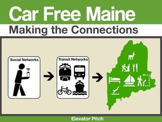
1. Car Free Maine
Making the Connections
Social Networks Transit Networks 4
1C
Wpu
5
Elevator Pitch
2. CarFree Maine
2
Suite of Location-Based Networking Tools designed to
enhance non-automotive transportation connections
throughout the State of Maine.
Local outreach effort builds on local partnerships and
forges strong connections between transportation
providers, government agencies, local tourism bureaus,
chambers of commerce, NGOs and local businesses
Marketing effort focuses on young adults in NY and
Boston Metros between the age’s of 18-30 and 30-40 years
old
3. Emerging generations are moving into
downtowns, driving less, walking
more, living in smaller homes[...], preferring local
businesses, [...] prioritizing health, going green and
valuing community and social networking like
never before.-Neil Takemoto www.cooltownstudios.com
Farmers Market Cafe'
4. “Young people aren't simply
swapping cars for buses or bikes;
they are choosing to own and use
other technology instead, such as
smartphones and tablet
computers.” -www.shareable.com
“Carmakers' next problem:
"Previous generations found freedom and
Generation Y
flexibility through the car. But Generation People in their teens and twenties are more
Ys find their freedom and flexibility by interested in gadgets than cars”
staying connected to their friends, family
and workplaces through the various http://www.msnbc.msn.com/id/39970363/ns/business-autos/
information devices - like their laptops, or
iphones.
"They can stay connected on a bus or a
“
train. They can bring the office with them.
They can bring their study with them.
They can bring their friends with them.
They can't if they're driving." ”
-- Peter Newman, Curtin University, Perth, Australia,
quoted in the West Australian, www.humantransit.org
Article: http://adage.com/digital/article?article_id=144155
5. • In the City of Boston (not Boston Metro Region Commuters
including Cambridge, Newton
etc...) almost 92,000 people do
not own a vehicle. 41 %
• Almost 300,000 people 50%
commute to work via Public
Transportation Regionwide 10%
• More than half of all Transit
Users are in the 24-44yr/old Car, truck, or van -- drove alone
Car, truck, or van -- carpooled
Age Group Public transportation (excluding taxicab)
• 1/3 of users Commute via Public Transportation
(100,000) use 5%5%5%
14%
Mobile Transit 14%
Apps*
58%
Statistics from, 2005-2009 American Community Survey 5-Year Estimates
16 to 19 years 20 to 24 years
25 to 44 years 45 to 54 years
*Joshua Robin, Director of Innovation and Special Projects at the MBTA, http://transportationnation.org/ 55 to 59 years 60 years and over
2011/05/13/boston-upwards-of-13-of-ridersM-use-transit-app-tools/)
6. What if you want to get
out of the city every
once in awhile? Where
can you go without a
car?
7. You can take the train to Maine!
Nearly 500,000 people a
year ride the Amtrak
Downeaster between
Boston and Portland
Maine with an extension
to Freeport and
Brunswick scheduled for
operation in Fall of 2012. 7
8. Welcome to Maine 20 Miles
Downtown, Shops, Beaches, Hotels Attractions, Mountains?
“You can’t get there from here”
? ?!!!
We’ve arrived in Maine...
8
Now what?
Getting from the train station to hotels, beaches, trails, restaurants etc...
can be confusing for the uninitiated. Without convenient connections
many potential riders see no other option than to rent or drive their own
vehicle instead. Which means spending a third of their budget on gas,
and a third of their time sitting in traffic.
9. Out of the 12 stops between Boston
and Brunswick only Freeport lacks a
fixed-route local transit system.
Other connections include Intercity
busses, an extensive island ferry
system and the Maine Eastern
Railroad to Rockland. However, 9
keeping track of these connections
can seem impossible.
10. Solution CarFree Maine
After researching and planning the trip on
the CarFree Maine web page, the user
finds the local transit connection via the
GPS-enabled Mobile app 10
11. 11
■ Simple interface allows personalized travel
choices involving multiple transportation
networks, modes, schedules and wayfinding
systems. Brunswick
■ Utilizes collaborative mapping/Geo-
networking technology
■ Promotes Sustainable Transportation by Ride Stay Book
connecting riders to underutilized portions of
transit networks
■ Interface will be optimized for user-generated
Eat Bike Walk
content on both web and mobile platforms
■ Allows users to post reviews via Find Map Position
OpenStreetMap portal, video logs and social
networking profiles (Integration w/Facebook,
TripAdvisor, Yelp, Gowalla, Foursquare, Twitter,
Wikitude...)
12. Brunswick Brunswick
Transportation
Ride Stay Reserve
Rail Bus Tickets
Eat Bike Walk
CarShare Bike Trails
See Learn Map
Closest Schedules Maps
12
13. Browser Window
http://www.carfreemaine.org/ Search x
CarFreeMaine
Routes Local Map Connect Book Media Blog
Mobile App
Express see all
Local see all
Map your route, make
suggestions, share
waypoints, photos and
videos, get group
CarFree Maine discounts and more!
Transportation Resources Along the Maine Destinations, Events, Activities
Coast
Connect With
13
15. Further
Information
15
Presentations- Presentations can be found at
Extended Pitch Deck-
www.carfreemaine.org, or
Extended pitch presentation including concept and
development plan http://www.slideshare.net/newmediatransit
The CarFree Corridor- email-ajawitz@newmediatransit.com
Detailed presentation outlining existing and Twitter-@carfreemaine
potential locations where CarFree travel is
possible in Maine
Why CarFree?-
Market research outlining the social/economic
impact of automobile dependency on rural
areas and why Generation Y is overwhelmingly
rejecting the Car.
Why Maine?-
Outlines specific strategies for the implementation
of regionally-appropriate transit technologies.
Argues that public transportation can be a viable
option in rural areas