Download to read offline

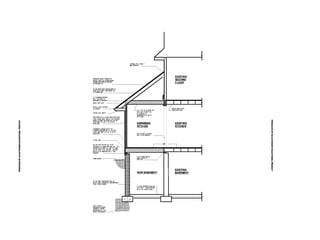


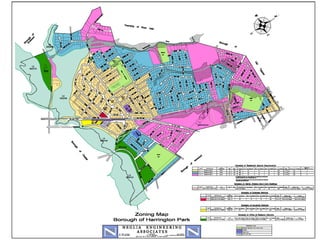
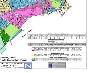
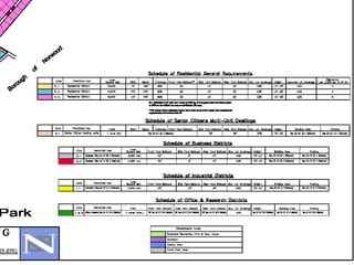
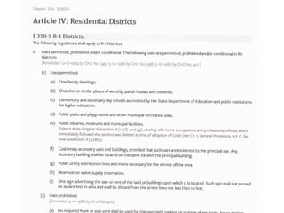

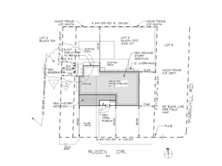
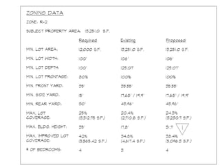
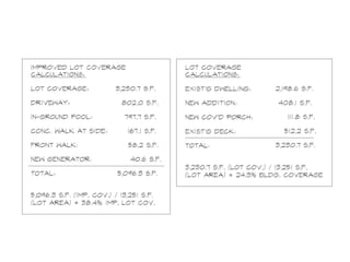
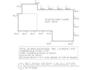
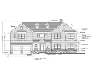


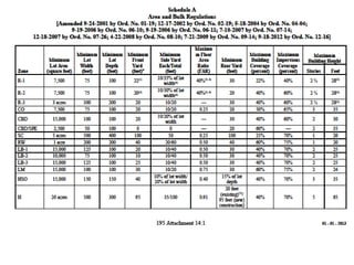

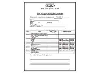
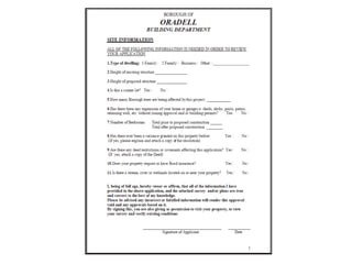
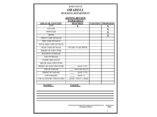

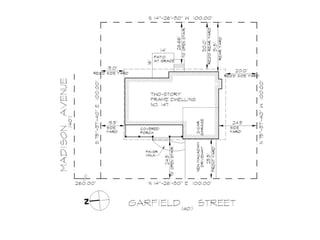
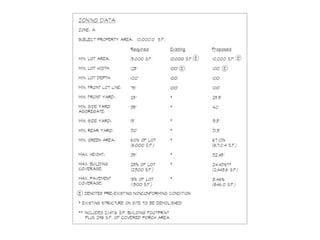

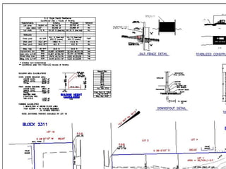

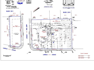


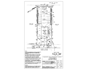


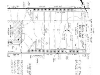


The document contains information about surveys, site plans, and topography for zoning board and planning applications. A survey provides a scaled drawing of property lines, structures, and man-made improvements. A site plan is a scaled engineering drawing showing all existing and proposed structures as well as site improvements. Topography lines indicate ground elevation levels relative to a fixed datum.


